12 California Places Built Around One Very Specific Industry
Some California towns do not just have a local industry. They orbit it.
The crop, mine, mill, cemetery, oil field, or wind corridor is not background trivia. It shapes the streets.
It gives the museum something to explain. It decides what the roadside signs brag about and what visitors notice before they even find lunch.
A place like that can feel oddly fascinating because the story is so specific.
A state this big was never going to survive on beaches and movie clichés alone.
These California communities prove how strange, practical, and deeply local the map can get.
One town smells like garlic with complete confidence. Another built its name around artichokes.
There’s fun in following one industry into a town’s identity. The trip becomes more than a stop.
It turns into a look at what people grew, dug up, built, celebrated, and depended on for generations.
Suddenly, the most specific places become the ones worth remembering.
1. Boron, Borax Mining
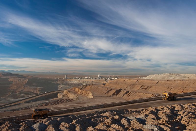
Few towns in the American West have a story quite as mineral-rich as Boron, a small community sitting in the heart of the Mojave Desert where the ground itself became the economy.
The open-pit borax mine here is one of the largest of its kind on the planet, stretching wide and deep enough to be visible from considerable distance.
It has been in continuous operation since the early 20th century and remains a working mine today.
The Borax Visitor Center offers free admission and gives a clear, close-up view of the massive pit below.
Inside, exhibits explain how borates are extracted, refined, and used in everyday products ranging from laundry detergent to fiberglass.
An authentic Twenty Mule Team wagon sits outside, a nod to the 1880s method of hauling borax across the desert before modern transport existed.
Just down the road, the Twenty Mule Team Museum covers Boron’s broader local history, including its surprising aerospace connections.
The town sits near Edwards Air Force Base, adding another layer to its industrial identity.
Visiting on a weekday tends to offer a quieter experience at the visitor center, with staff available to answer questions about the mining process in detail.
2. Taft, Oil
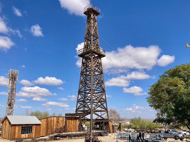
Taft sits at the edge of two of California’s most historically productive oil fields – the Midway and the Sunset – and the town has never tried to be anything other than what it is: an oil town, proud of it.
The scent of petroleum is faint but real on certain days, and the skyline beyond the city limits still holds working pump jacks moving in their slow, rhythmic way. This is a place where the industry never left.
The West Kern Oil Museum at 1168 Wood Street preserves what an early 20th-century oil camp actually looked like, spread across eight volunteer-maintained acres.
A 1917-era wooden derrick stands over its original well, one of the few surviving examples of its kind still in its original location.
Nearby structures include a vintage cookhouse, firehouse, and tool sheds, all restored to reflect the working conditions of early oil workers.
Inside the main exhibit building, scale models, vintage tools, and historical photographs trace the area from its Native American roots through the dramatic Lakeview Gusher of 1910.
The grounds are mostly flat and accessible. Every five years in October, the town hosts Oildorado Days, a multi-day festival with parades and historical tours that draws visitors from across the region.
3. Castroville, Artichokes
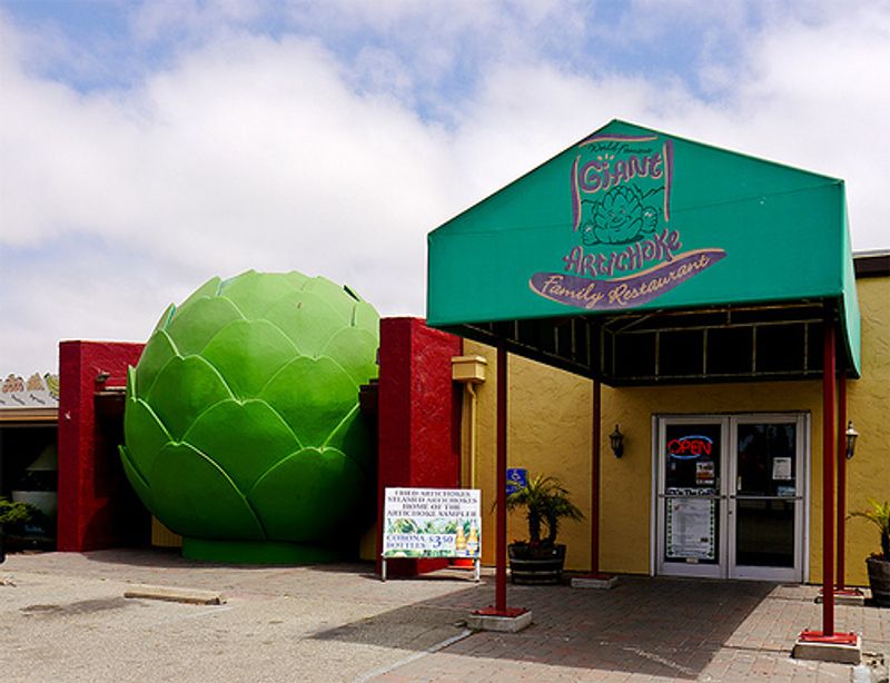
Cool mornings, marine fog, and sandy loam soil created the perfect accidental recipe for an artichoke empire just a few miles inland from Monterey Bay.
Castroville earned the title of Artichoke Capital of the World not as a marketing slogan but as a straightforward description of reality.
The surrounding fields produce the majority of California’s commercial artichoke crop, and the harvest has been ongoing since the early 1900s.
The Giant Artichoke Restaurant at 11261 Merritt Street is the town’s most recognizable landmark, marked by a large concrete artichoke sculpture out front that has become a roadside photo staple.
The menu centers on locally grown artichokes prepared in multiple ways, with fried artichokes served with ranch dressing being the most talked-about item.
A produce market adjacent to the restaurant sells fresh artichokes at prices that tend to be lower than what grocery stores charge.
Pezzini Farms is another stop worth making, offering artichoke-themed baked goods alongside fresh produce, and occasionally hosting farm visits on select days.
During harvest season, workers move through the fields hand-cutting each bud individually, a process that has remained largely unchanged for generations.
The annual Artichoke Festival celebrates the crop with cooking demonstrations, live entertainment, and farm-themed activities for all ages.
4. Gilroy, Garlic
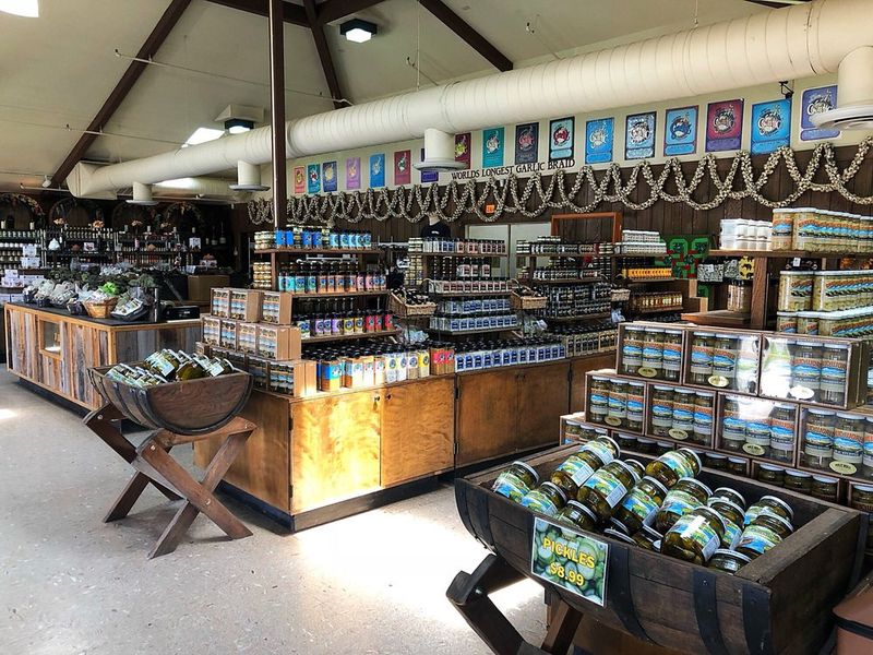
The smell hits before the city limits sign does.
Gilroy carries the reputation of Garlic Capital of the World with genuine agricultural backing – the Santa Clara Valley’s warm days and dry summers create growing conditions that have supported large-scale garlic farming for over a century.
Local fields once produced a significant share of the nation’s garlic supply, and the crop still defines the town’s character even as the surrounding landscape shifts.
The Gilroy Garlic Festival is the centerpiece event, typically held over a summer weekend and drawing large crowds from across the state.
Food stalls at the festival serve garlic-loaded dishes ranging from garlic bread and garlic fries to more adventurous preparations like garlic ice cream.
Live music, cooking competitions, and agricultural demonstrations round out the program, making it a full-day outing for families and food enthusiasts alike.
Outside of festival season, local restaurants throughout Gilroy incorporate garlic prominently into their menus, and specialty shops carry garlic braids, garlic-infused oils, and related products year-round.
The surrounding farmland is visible from many of the main roads through the area, giving visitors a sense of the agricultural scale that built the town’s identity.
5. Salinas, Leafy Greens
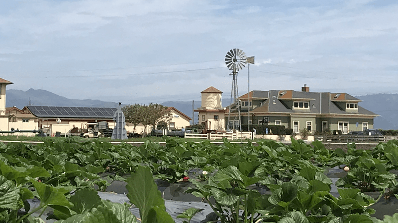
Called the Salad Bowl of the World for good reason, the Salinas Valley produces a staggering share of the leafy greens consumed across the United States.
The combination of rich alluvial soil, cool coastal air, and reliable irrigation has made Monterey County one of the most productive agricultural regions on the continent.
Driving through the valley on almost any day of the year, the fields are active – crews harvesting lettuce, broccoli, strawberries, or cauliflower depending on the season.
Ag Venture Tours offers guided outings that take participants directly into working fields, covering more than 40 different vegetable and fruit crops.
Tours are educational and hands-on, giving a realistic picture of commercial-scale vegetable production that goes well beyond what a roadside view can offer.
The California Welcome Center Salinas, housed in the historic Southern Pacific Freight Depot downtown, provides regional information and serves as a useful starting point for planning a visit.
Throughout Salinas, public art installations pay tribute to the agricultural workforce that sustains the valley.
Artist John Cerney’s 18-foot plywood figures of farmworkers stand at various points across the landscape, visible from the road.
The Farm, an organic education center on the outskirts of town, welcomes visitors to walk among growing rows and connect directly with the people who tend them.
6. Selma, Raisins
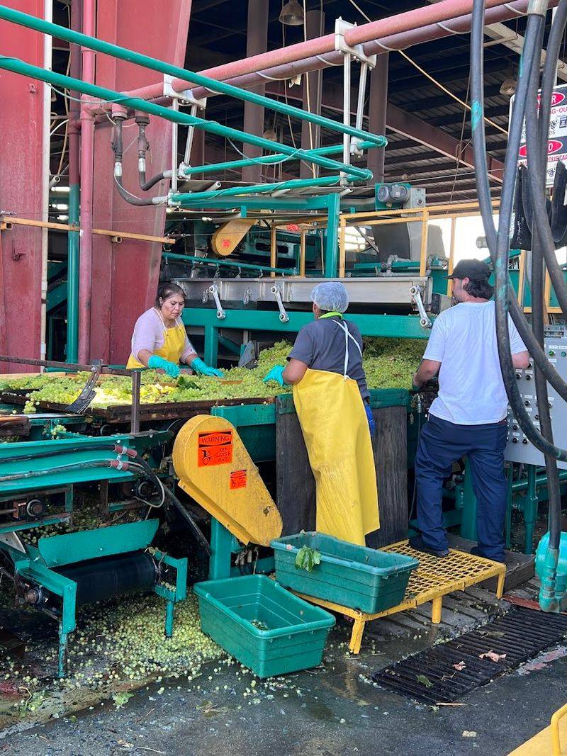
In the heart of the San Joaquin Valley, Selma built its agricultural identity around one of the most sun-dependent processes in food production – drying grapes into raisins.
The valley’s intense summer heat, combined with virtually no rainfall during harvest months, creates natural drying conditions that are difficult to replicate anywhere else.
Selma has been part of California’s raisin-producing heartland for well over a century, and the vineyards that surround the city remain a defining feature of the landscape.
Driving the roads around Selma during late summer and early fall reveals the traditional drying process in action, with harvested grapes laid out on paper trays between vine rows to dry under the open sky.
This method, known as sun-drying, has been used in the region for generations and produces the soft, sweet raisins associated with the San Joaquin Valley.
The sheer scale of the vineyards in this area gives a clear sense of how central raisin production is to the local economy.
Local agricultural stands and markets in the area carry a variety of grape and raisin products, especially during and after the harvest season.
The Selma Historical Museum holds exhibits and materials that trace the town’s development through its farming roots, offering context about how raisin production shaped its growth.
7. Lompoc, Flower Seeds
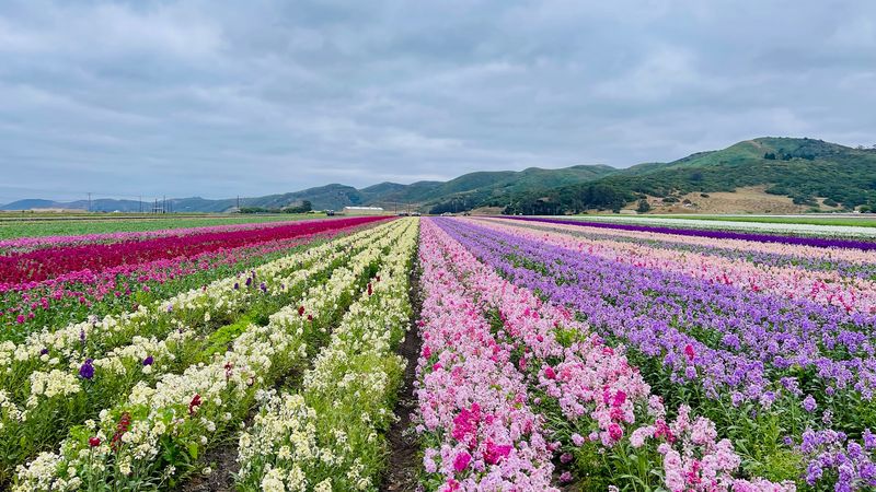
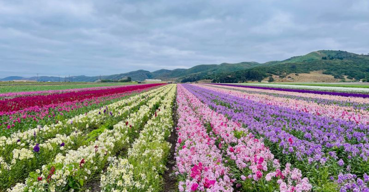
When the Lompoc Valley blooms in late spring and early summer, the effect is genuinely striking.
Wide, flat fields fill with dense rows of color – orange, yellow, purple, and white – as commercial flower seed crops reach peak bloom.
Lompoc has carried the title City of Arts and Flowers for decades, and the floral half of that name is backed by real agricultural production that supplies seed companies with varieties grown for gardens across the country.
The valley’s microclimate plays a central role in making this possible.
Cool mornings tempered by marine air from the Pacific, combined with warm and sunny afternoons, create conditions that favor strong flower development and high-quality seed production.
Many of the fields are privately owned and not open for walking, but the scenic drives along the valley roads offer unobstructed views of the blooms from late May through July depending on the year and crop rotation.
Some farms offer U-pick opportunities or roadside flower stands during peak season, giving visitors a chance to take fresh-cut stems home.
The Lompoc Valley Flower Festival, held annually, celebrates the industry with a parade, art exhibits, and community events that bring the agricultural tradition into public view.
Local shops carry flower seeds and pressed flower products as souvenirs that connect directly to the valley’s working fields.
8. McCloud, Lumber
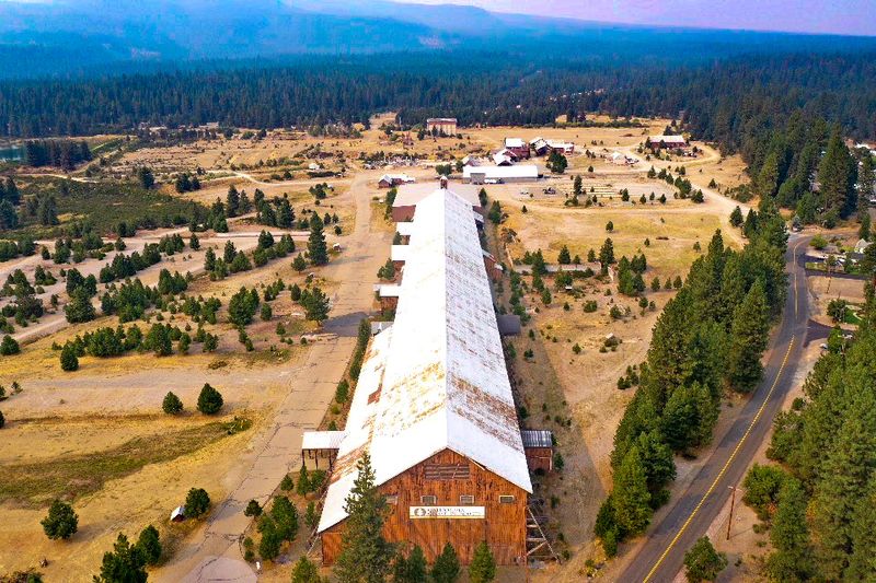
Perched on the southern slope of Mount Shasta in the Shasta Cascade region, McCloud has the quiet, unhurried feel of a town that remembers exactly what it once was.
For much of the 20th century, it functioned as a full company town built and operated by the McCloud River Lumber Company, which owned the homes, the stores, and the mill that kept the whole community running.
The surrounding forests of Douglas fir and pine made the location ideal for large-scale timber operations.
Much of the town’s historic architecture survives and reflects that company-town origin – orderly streets, modest worker cottages, and a few larger structures that once served administrative purposes.
Walking through downtown McCloud is a low-key but genuinely interesting experience for anyone drawn to industrial history and early 20th-century planning.
The McCloud Heritage Junction Museum holds photographs, documents, and artifacts that tell the story of the mill and the people who worked it.
The McCloud River Loop Trail offers a scenic hike through the surrounding forest and along the river, providing natural context for understanding the scale of the timber resources that built the town.
Though large-scale milling operations have long since wound down, the forested landscape and well-preserved built environment give McCloud a distinct character that is hard to find elsewhere in Northern California.
9. Scotia, Redwood Lumber Company Town
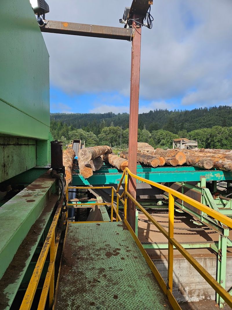
Scotia is one of the last true company towns in California, built from the ground up by the Pacific Lumber Company in the 1880s to house the workers who processed old-growth redwood along the Eel River in Humboldt County.
The town’s streets, buildings, and civic spaces were all constructed and owned by the company for most of its history, giving Scotia a remarkably cohesive architectural character that still defines it today.
The Humboldt Redwood Company continues to operate a sawmill there, keeping the industrial thread alive.
The Scotia Museum documents the town’s unique history through vintage logging equipment, historical photographs, and artifacts from the PALCO era, though it has periodically closed for renovations.
Outside the museum, a small park displays historic trains that visitors can explore up close, offering a tactile connection to the rail systems that once moved timber through the region.
Historic plaques and interpretive signs are scattered throughout town, filling in the story for self-guided walkers.
On Main Street, the Humboldt Redwood Company Fishery Exhibit features freshwater aquariums holding Chinook salmon and steelhead trout, open weekdays year-round and considered the largest freshwater aquarium on the North Coast.
Fireman’s Park and Scotia Ballpark sit near the Eel River, offering quiet spots to rest and take in the surroundings after exploring the town’s industrial past.
10. Bodie, Gold Mining
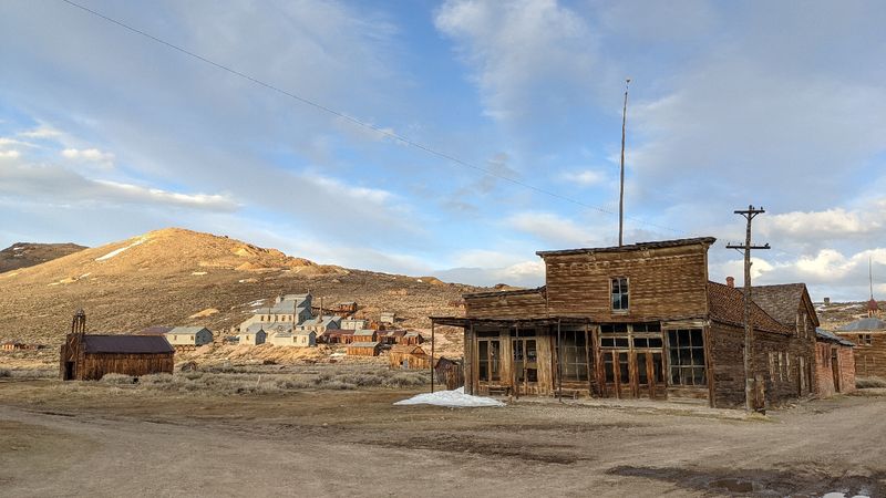
At 8,375 feet above sea level in the Eastern Sierra, Bodie sits frozen in a state the park service calls arrested decay – meaning nothing is restored, nothing is rebuilt, and everything is left exactly as it was found.
Nearly 200 wooden structures remain standing, their weathered boards slowly graying under the high-altitude sun.
At its peak in the late 1870s, the town held close to 10,000 residents and produced millions of dollars worth of gold and silver.
Bodie State Historic Park is open year-round, though winter access requires skis, snowshoes, or snowmobiles due to the heavy snow that closes the access road.
Summer hours run from 9 AM to 6 PM between May 1 and Labor Day, with winter hours from 9 AM to 4 PM. Entry fees are $8 for adults and $5 for children ages 4 to 17, with a self-guided tour booklet available for $3 at the museum.
Walking the deserted streets past the church, schoolhouse, and old saloon – where glasses and bottles still sit on shelves – creates a quiet, almost eerie atmosphere that photographs rarely capture fully.
Guided Stamp Mill tours run seasonally and provide a detailed look at how gold ore was processed on-site.
11. Colma, Cemeteries And Monument Businesses
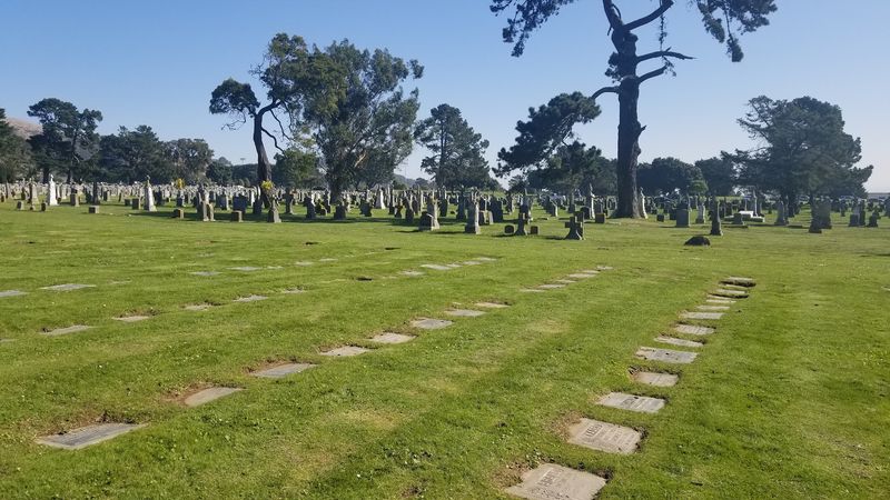
Colma holds a distinction found nowhere else in California – the living are outnumbered by the gone by a ratio of roughly 1,000 to one.
The town’s unusual identity took shape in the early 1900s when San Francisco banned new burials within city limits and began relocating existing cemeteries to the peninsula south of the city.
Colma absorbed that history and built an entire civic economy around it, with memorial parks, monument makers, florists, and related businesses forming the backbone of local commerce.
More than a dozen cemeteries operate within Colma’s small boundaries, each with its own character and cultural identity.
Some feature elaborate Victorian-era mausoleums and carved stone monuments, while others reflect more recent traditions and architectural styles.
Walking the grounds of these memorial parks is a quietly absorbing experience, offering a kind of open-air museum of funerary art and cultural history that spans over a century.
The town itself is compact and easy to navigate, with most of the cemeteries accessible by foot or a short drive from one another.
Monument businesses and florists line the commercial streets, providing practical services that have sustained the local economy for generations.
Visiting on a weekday tends to offer more stillness and space for reflection, as weekends can bring larger numbers of families visiting grave sites.
12. Tehachapi, Wind Power
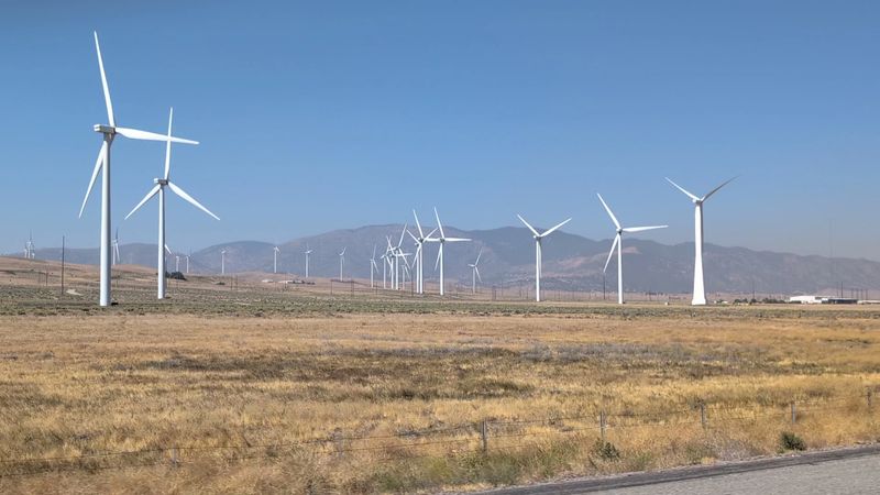
Standing at the edge of Tehachapi Pass on a clear day, the scale of what has been built here is genuinely hard to process.
Thousands of wind turbines cover the surrounding ridgelines and slopes, ranging from older, smaller models installed in the early 1980s to modern giants that stretch 400 to 500 feet into the sky.
The Tehachapi Pass Wind Farm is one of California’s largest wind resource areas, generating enough electricity to power hundreds of thousands of homes across the state.
Wind development here began in earnest in the early 1980s, driven by the pass’s consistent winds that average between 14 and 20 miles per hour.
Driving along State Route 58 or Tehachapi-Willow Springs Road puts visitors in direct proximity to the turbines, with some standing close enough to the roadside that the slow rotation of the blades is visible and almost hypnotic.
No formal visitor center exists for the wind farm itself, but the roads through the area provide ample opportunity for viewing and photography.
Sections of the Pacific Crest Trail pass through the region near Cameron Road, offering a hiking option that puts walkers among the turbines in a more immersive way.
Roadside pullouts provide safe stopping points for photos, though parking on highway shoulders should be avoided.
The visual contrast between the wind-swept terrain and the engineered turbines creates one of the more unusual landscapes in Southern California.