Drop Everything For This 138-Mile North Carolina Coastal Drive With Ferries, Wild Beaches, And Tiny Island Villages
Some coastal drives feel too big to rush.
This one keeps stretching farther than a normal beach trip should, pulling travelers toward quiet edges, wide skies, and places that feel slightly removed from everything familiar.
The road does not hand over its best moments all at once.
It makes people slow down first.
Salt air slips through the windows, the scenery turns wilder, and the schedule starts feeling less important with every mile.
At some point, the drive stops feeling like a simple route and starts feeling like an escape with better timing.
Even the quiet stretches seem to know they are part of the adventure.
By the time the coast has fully taken over, turning back feels like the dullest idea on the map.
This is the kind of North Carolina road trip that makes a regular drive feel like the start of something much bigger.
Ferry Rides Make This Drive Feel Like A Real Escape
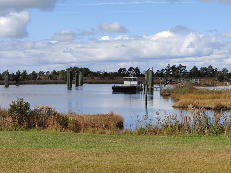
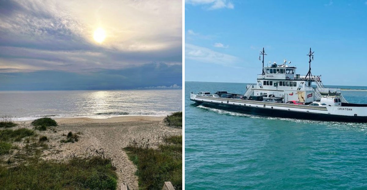
Rolling onto a ferry changes the whole mood of the Outer Banks National Scenic Byway because the road does not just continue; it floats.
The Hatteras Ferry Terminal sits at 59063 NC-12 in Hatteras, while Cedar Island Ferry Terminal waits at 3619 Cedar Island Road in Cedar Island, giving travelers clear points to plug into the route.
Swan Quarter Ferry Terminal at 748 Oyster Creek Road adds another longer route option for reaching Ocracoke from the mainland.
Current ferry guidance lists Hatteras to Ocracoke as a free crossing of about 60 minutes, while Ocracoke to Cedar Island and Ocracoke to Swan Quarter each take about 2.5 hours and require more planning.
Snacks, reservations for longer routes, and schedule checks matter here. Still, the wait becomes part of the fun when gulls move overhead and Pamlico Sound opens around the boat.
By the time the dock slips behind you, North Carolina already feels quieter, farther out, and far more interesting than a regular highway trip.
Tiny Island Stops Give The Route Its Slow Magic
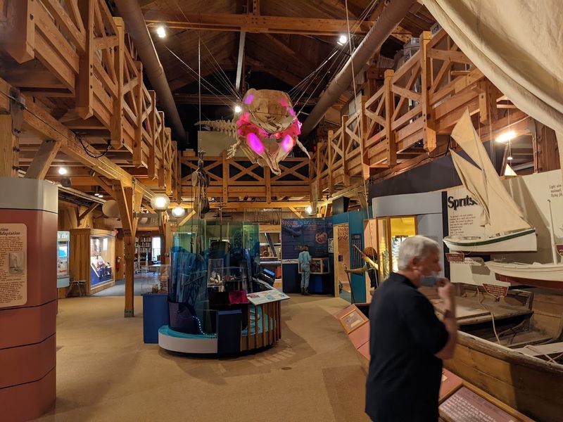
Small coastal communities give this byway its real personality, especially once the drive moves beyond the better-known Outer Banks names and into quieter villages shaped by boats, weather, and family history.
Official byway information describes 21 coastal villages along the route, which explains why the trip feels less like one road and more like a chain of lived-in places.
Harkers Island is a strong stop, anchored by the Core Sound Waterfowl Museum & Heritage Center at 1785 Island Road. The museum preserves waterfowl, decoy, fishing, and maritime traditions tied to Core Sound.
Farther along the Down East route, Atlantic, Sea Level, Davis, and nearby communities add docks, marsh views, local seafood signs, and a slower coastal rhythm.
Portsmouth Village can also be reached by boat for travelers who want a preserved island community with a quieter, more reflective feel. Rushing through these stops misses the point.
Park the car, walk a little, listen more than you talk, and let each village add its own small chapter to the drive.
Ocracoke Turns The Road Trip Into Something Stranger
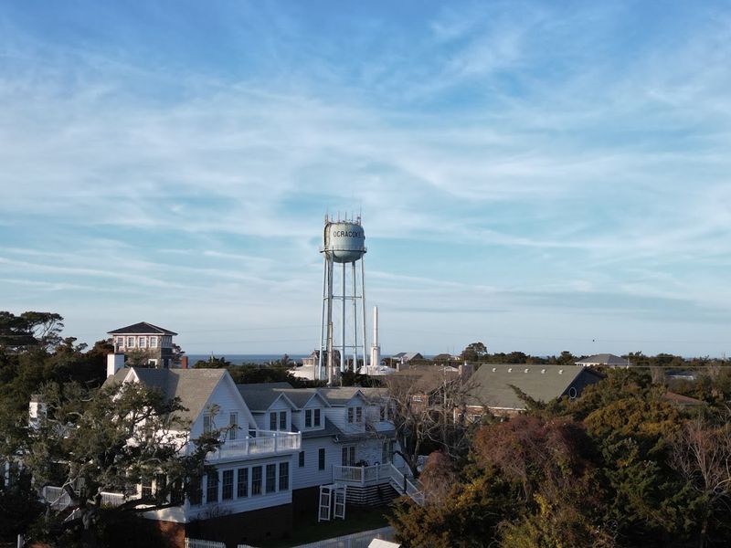
Ocracoke gives the byway its most wonderfully offbeat pause because nobody reaches the island by bridge. A practical address for orientation is the Ocracoke Island Visitor Center at 38 Irvin Garrish Highway, where travelers can get their bearings near the village and ferry activity.
Silver Lake Harbor anchors the village with boats, small shops, restaurants, bikes, golf carts, and a pace that feels wonderfully separate from mainland routines.
Ocracoke Lighthouse, at 360 Lighthouse Road, was built in 1823 and remains one of North Carolina’s most treasured coastal landmarks.
Pirate-era stories still linger around the island, but the better reason to slow down is the everyday atmosphere: narrow lanes, salt air, harbor light, and the feeling that time has softened around the edges.
Wild Banker Ponies once roamed freely before being protected in a managed area, adding another memorable layer to the island’s identity.
Ocracoke is not just a stop between ferries. It is the place where the road trip starts feeling strange, historic, and deeply worth the extra planning.
Wild Beaches Stretch Out Before The Villages Return
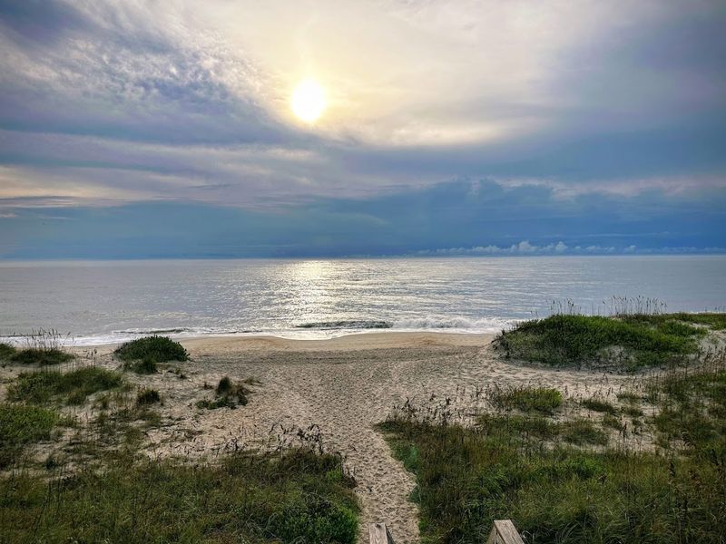
Open beaches along the Outer Banks National Scenic Byway give the trip its biggest breathing room. Cape Hatteras National Seashore begins near the US-64 and NC-12 junction in Nags Head and protects long stretches of barrier-island shoreline.
Coquina Beach Access is located off NC-12 between Nags Head and Oregon Inlet. It sits across from the Bodie Island Lighthouse access road, making it an easy coastal stop along the northern stretch of the drive.
Farther south, the Hatteras Island Visitor Center at 46375 Lighthouse Road in Buxton gives travelers another useful landmark near Cape Hatteras beaches and lighthouse views.
These shorelines are not about high-rise beachfront energy. Dunes, sea oats, wind, surf, and long Atlantic views do most of the work.
Soundside areas offer a gentler contrast with calmer water and wide Pamlico Sound scenery. Pack sunscreen, check beach access rules, and give yourself time.
These wild stretches make every village feel even more special once the road returns to porches, docks, and small-town signs.
Pamlico Sound Keeps Showing Up Beside The Highway
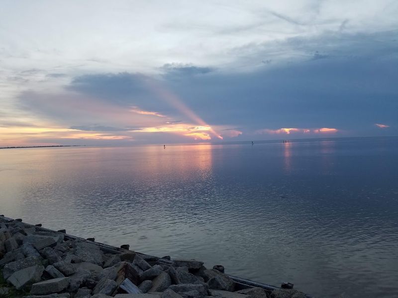
Pamlico Sound is not just scenery on this route; it keeps returning beside the highway, the ferries, the villages, and nearly every part of the trip’s identity.
Official byway information names Pamlico Sound as part of the landscape threaded by the 138 driving miles and 25 ferry-riding miles.
For a clear soundside stop, Salvo Day Use Area sits just south of Salvo on Hatteras Island, with public access to Pamlico Sound, picnic areas, restrooms, showers, and space for water-sport activity.
Milepost 44 is a useful marker for South Salvo Sound Access, especially for travelers trying to break up the drive without guessing where to pull over.
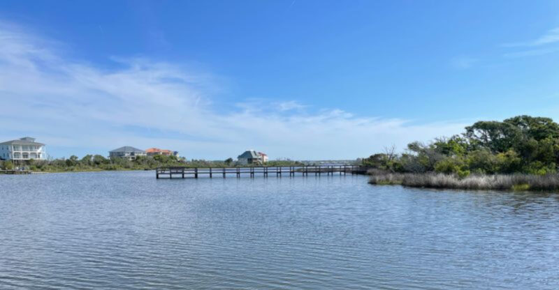
Here, the coast feels different from the Atlantic side. Instead of crashing surf, you get broad water, marsh edges, kite sails, fishing boats, calmer views, and sunsets that seem to stretch across the whole horizon.
Hatteras Island communities such as Avon, Buxton, Frisco, and Hatteras all feel shaped by this quieter water. The sound keeps reminding travelers that this byway belongs as much to estuary life as ocean drama.
Lighthouses Add Classic Outer Banks Drama Along The Way
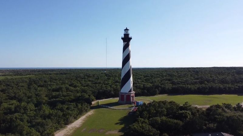
Lighthouses give the Outer Banks National Scenic Byway its most recognizable landmarks, and each one adds a different reason to stop. Bodie Island Light Station stands at 8210 Bodie Island Lighthouse Road in Nags Head, near the northern end of Cape Hatteras National Seashore.
Farther south, Cape Hatteras Lighthouse rises near the Hatteras Island Visitor Center area at 46375 Lighthouse Road in Buxton, one of the most famous lighthouse stops in North Carolina.
Ocracoke Lighthouse, at 360 Lighthouse Road in Ocracoke, brings a quieter whitewashed landmark to the island’s village setting.
National Park Service guidance notes that Bodie Island Lighthouse offers seasonal self-guided climbs. Cape Hatteras Lighthouse will not be open for climbing in 2026 due to restoration work, while Ocracoke Lighthouse is not open for climbing, though its base may be open at times.
Even without climbing every tower, these beacons add height, history, and classic coastal character.
They break up the drive beautifully and give travelers clear places to pause before the road bends toward another village.
The Coastal Villages Make Rushing Feel Almost Impossible
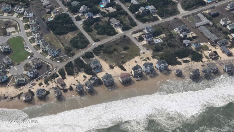
Coastal villages along the byway quietly argue against hurry, and most of them win. Official descriptions emphasize 21 villages along the route, which is why the drive feels so different from a simple shoreline highway.
Nags Head starts the journey near Whalebone Junction, where US-64, US-158, and NC-12 come together before the route heads south.
Rodanthe, Waves, Salvo, Avon, Buxton, Frisco, and Hatteras carry barrier-island energy shaped by surf, wind, seafood, ferries, and weather.
Ocracoke slows the route even more with harbor streets and ferry-only access. Down East communities in Carteret County bring working-water character, marshland, small churches, seafood markets, and deep local roots.
Useful anchors include Core Sound Waterfowl Museum at 1785 Island Road in Harkers Island and Cedar Island Ferry Terminal at 3619 Cedar Island Road in Cedar Island. Overplanning can flatten the whole trip.
Choose a few stops, leave room for detours, and let quiet lanes, docks, and water views do what they do best.
By The Final Ferry, North Carolina Feels Farther From Everything
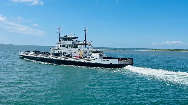
Final ferry stretches make the byway feel less like a drive and more like a gradual departure from ordinary North Carolina. Ocracoke to Cedar Island takes about 2.5 hours by current Outer Banks ferry guidance, while Ocracoke to Swan Quarter offers another long toll route across open water.
Those crossings are not quick errands, so reservations and schedule checks matter. Still, the length is exactly what gives them power.
Water replaces roadside clutter. Engine noise settles into the background.
Marshes, birds, low horizons, and distant shorelines make the mainland feel temporarily optional. Cedar Island and the Down East route beyond it bring quieter coastal landscapes where wildlife refuges, fishing communities, and wide views stretch the trip’s final mood.
By then, the Outer Banks National Scenic Byway has already done its work. Ferries, lighthouses, wild beaches, Pamlico Sound, Ocracoke, and tiny villages have slowed the day into something harder to measure by miles.
North Carolina has easier scenic drives, but few feel this removed, this salt-weathered, or this dependent on water letting you continue.