13 Easy Northern California Hikes You Can Tackle In 2026 For Surprisingly Stunning Views
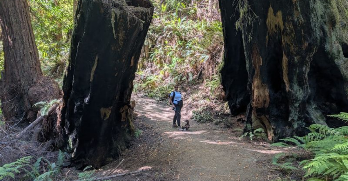
A great view should not always require trembling knees or a backpack filled like someone is relocating permanently.
These hikes keep the effort manageable.
Trails may follow coastal bluffs, circle quiet lakes, wander beneath tall trees, or climb just enough to reveal a lookout that feels wildly generous.
Distances and terrain vary, but each route offers a realistic outing for anyone who prefers enjoying the scenery without turning the day into an endurance test.
Northern California makes “easy” look suspiciously impressive when ocean cliffs, waterfalls, and mountain panoramas appear on relatively approachable paths.
Carry water, leave room in the schedule, and expect frequent pauses that have nothing to do with being tired.
The biggest challenge may be convincing everyone that stopping for another photo does not technically count as delaying the hike.
1. Fern Canyon Loop Trail, Prairie Creek Redwoods State Park
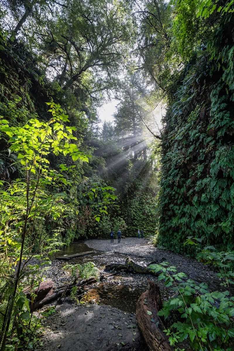
Fern Canyon has the feeling of stepping back in time by about 65 million years.
The walls on both sides rise between 50 and 80 feet and are almost entirely covered in a dense, layered tapestry of five-finger ferns, sword ferns, and lady ferns.
Home Creek winds through the canyon floor, and crossing it is part of the experience, so waterproof footwear is a genuinely practical choice rather than just a suggestion.
The loop covers approximately 1.1 miles and sits within the larger Redwood National and State Parks system, a designated UNESCO World Heritage Site.
The cool, damp air and the soft sound of moving water give the canyon a calm, almost hushed quality that feels rare.
From May 15 through September 15, a free day-use permit is required to access the Gold Bluffs Beach Day-Use Area where the trailhead is located.
Parking can fill quickly during summer weekends, and a high-clearance vehicle is recommended for Davison Road, the unpaved access road that crosses two streams.
Arriving early on a weekday morning tends to offer the most peaceful experience and the best light filtering through the fern walls above.
2. Lady Bird Johnson Grove Trail, Redwood National Park
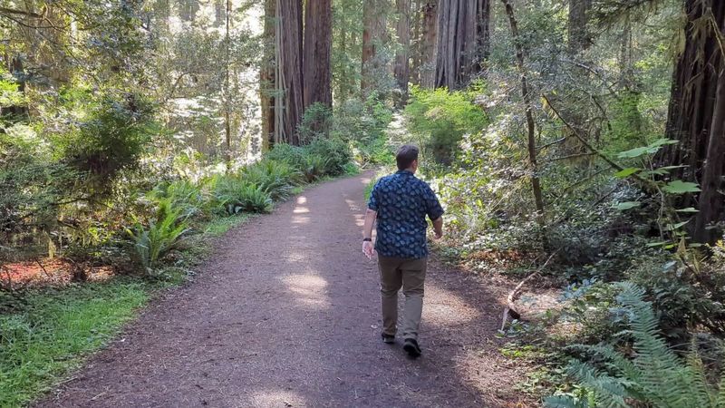
There is something quietly moving about walking through a grove of trees that were already ancient when the first European explorers arrived on the Pacific Coast.
The Lady Bird Johnson Grove Trail offers an easy 1.0 to 1.5-mile loop through old-growth redwoods, Douglas-firs, and tanoaks, set at a ridge-top elevation of over 1,000 feet above sea level.
That higher position means the sky is often visible above the canopy in a way that lower grove trails do not always allow.
The trail is mostly level, making it a comfortable choice for families with younger children or anyone who prefers a relaxed pace.
Interpretive plaques placed along the route provide context about the park’s conservation history and the ecology of the surrounding forest, adding an educational layer to the walk.
The trailhead is located approximately three miles up Bald Hills Road from the Highway 101 turnoff.
Parking is available at the trailhead, though the road is not recommended for RVs or vehicles towing trailers due to its narrow width and limited turnaround space.
A sloped footbridge on the trail means the route is not officially wheelchair-accessible for all mobility equipment types, so it is worth checking current conditions before visiting.
3. Simpson-Reed Trail, Jedediah Smith Redwoods State Park
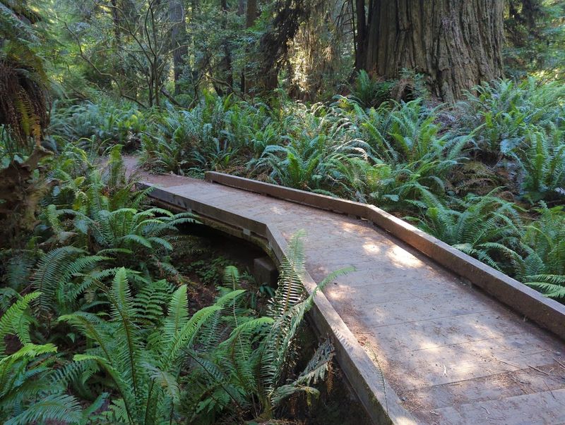
Not every redwood trail looks the same, and the Simpson-Reed Trail makes that point clearly within the first few steps.
The forest here has a distinctly jungle-like quality, with mosses and lichens draped over hemlock trees and huckleberry shrubs filling the spaces between the towering redwood trunks.
The 0.8 to 0.93-mile loop follows a compacted gravel surface that makes it accessible for wheelchairs and a variety of mobility aids.
Interpretive panels placed at intervals along the trail explain the ecology of the old-growth forest, covering topics like the role of decomposing logs and the relationship between the tree species present.
Tranquil creeks run nearby, and the combination of filtered light and layered greenery creates a sense of being completely enclosed in a living, breathing ecosystem.
The trailhead is located off Walker Road, where accessible parking and non-flush restrooms are available.
Although the trail runs near Highway 199, road noise fades quickly once inside the forest, and the experience feels genuinely removed from the surrounding world.
Spring and early summer tend to bring the most vibrant green tones to the understory, while fall visits offer a quieter, more atmospheric mood with fewer visitors on the path.
4. Yurok Loop Trail, Redwood National and State Parks
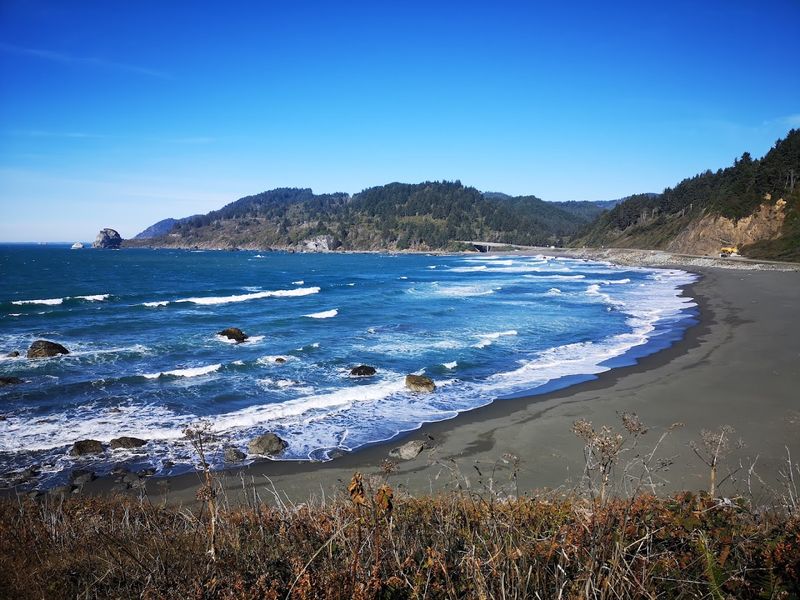
Few easy trails manage to deliver both dense coastal forest and open ocean views within a single short loop, but the Yurok Loop Trail pulls it off with quiet confidence.
The 1.1 to 1.15-mile circuit begins in a vibrant mix of cypress, alders, and Sitka spruce before gradually opening up to reveal the rugged coastline and the striking offshore formation known as False Klamath Rock.
On a clear day, the contrast between the dark forest and the wide blue ocean is genuinely striking.
The loop takes most walkers between 30 minutes and an hour to complete, making it an ideal stop during a longer coastal drive.
Seabirds are frequently spotted resting and nesting on the offshore rocks, and marine mammals such as harbor seals can sometimes be seen in the water below the bluffs.
The trailhead is located at the Lagoon Creek Picnic Area, which offers free parking and restroom facilities.
Layering up before starting is a practical idea since coastal fog and steady wind are common even during summer months.
The trail is family-friendly and moves at a comfortable pace throughout, with enough variety in the scenery to keep younger walkers engaged from start to finish.
5. Vista Point Trail, Castle Crags State Park
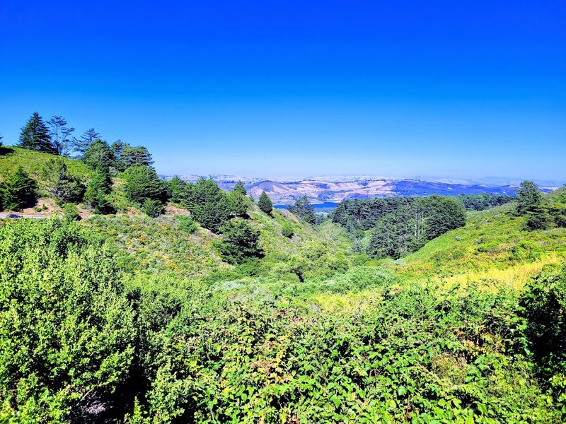
The payoff at the end of the Vista Point Trail is the kind of panoramic scene that tends to stop people mid-step.
From the overlook, the jagged granite spires of the Castle Crags rise dramatically in the foreground while the snow-capped summit of Mount Shasta dominates the distant skyline.
The evergreen formations of the Gray Rocks add additional texture to a view that feels almost too grand for such a short walk.
The trail covers between 0.5 and 1.7 miles round trip depending on the starting point chosen and is wheelchair-friendly along its primary route, making it one of the more accessible viewpoints in the region.
Picnic tables and a mounted viewing scope are available at the vista point, encouraging visitors to slow down and spend time absorbing the scenery rather than rushing back to the parking area.
Dogs and bicycles are not permitted on any trails within Castle Crags State Park, so it is worth planning accordingly before arriving.
Morning visits often bring the clearest air and the most dramatic light on the granite formations, while afternoon haze can sometimes soften the distant views of Mount Shasta considerably.
6. Crystal Creek Falls Trail, Whiskeytown National Recreation Area
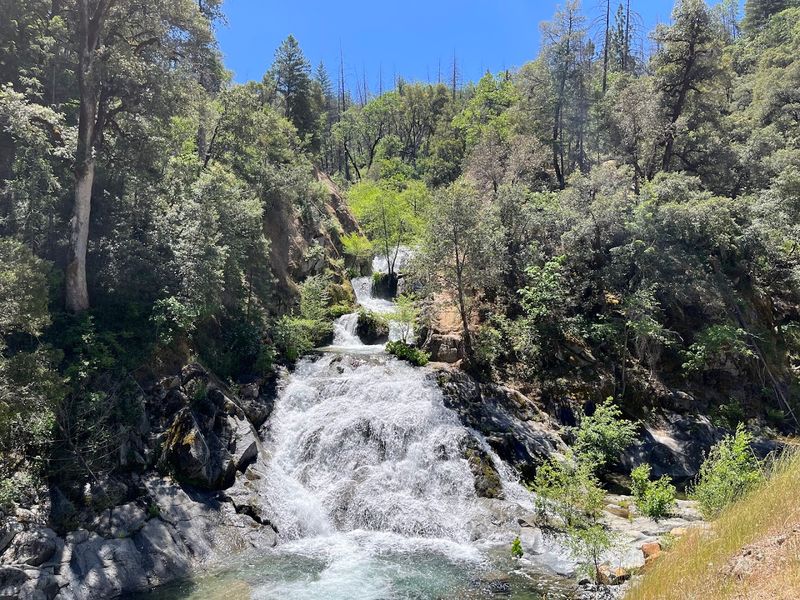
Paved, flat, and shaded, the Crystal Creek Falls Trail is the kind of accessible route that tends to surprise people with just how rewarding it can be.
The path covers 0.5 to 0.8 miles one way through a coniferous forest, offering consistent shade that makes it comfortable even during warm summer afternoons.
At the end of the trail, a picturesque waterfall drops into a natural pool, and during hot weather, the mist and cool air near the falls provide a welcome contrast to the heat outside the forest.
Picnic tables with BBQ grills are available near the falls, making the area a practical spot for a longer midday break.
For those who want more, an informal steep dirt path leads down to the base of the falls and a natural pool, though this section requires caution and is not part of the maintained trail.
A separate unmaintained path leads to upper falls and demands additional care.
The trailhead and parking lot are located off Crystal Creek Road, about two miles from Highway 299, and a vault toilet is available at the lot.
The paved surface makes this trail genuinely wheelchair-accessible, and the short distance means it works well as a quick stop or a longer outing depending on the pace chosen.
7. Manzanita Lake Loop, Lassen Volcanic National Park
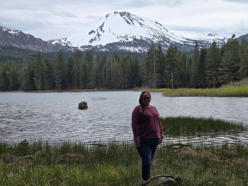
Watching Lassen Peak reflect perfectly in the still surface of Manzanita Lake at sunrise is one of those experiences that tends to linger in memory long after the drive home.
The loop covers 1.1 to 1.7 miles on a primarily firm dirt surface with some tree roots and exposed rocks that keep the walk interesting without making it difficult.
Jeffrey pines and willows line much of the path, providing shade and framing views of the volcanic peaks across the water.
Wildlife sightings are common along this route, with various bird species, deer, and occasionally black bears moving through the forest near the shoreline.
The uneven terrain means strollers and wheelchairs are not well-suited to this particular loop, despite the overall low difficulty level.
Sunrise and sunset are especially popular times to visit since the shifting light creates vivid color on the surrounding peaks and their reflections in the lake.
Parking and restrooms are available at the Loomis Plaza and Museum area as well as the Manzanita Lake Day Use Area, both of which serve as convenient starting points.
The trail is generally accessible from late May through October depending on snowpack, and checking current road and trail conditions before visiting is always a practical step.
8. Reflection Lake Loop, Lassen Volcanic National Park

Compact and rewarding, the Reflection Lake Loop delivers a level of visual impact that feels disproportionate to its modest 0.5 to 0.7-mile length.
The circuit wraps around Reflection Lake, a small but exceptionally photogenic body of water that mirrors Lassen Peak and the craggy ridgeline of Chaos Crags on calm mornings.
The dirt surface includes some tree roots and exposed rocks, so paying attention to footing is worthwhile even though the overall grade remains flat throughout.
Canada geese and mallard ducks are frequent visitors to the lake, and the surrounding forest provides habitat for a variety of songbirds that add consistent background sound to the walk.
Swimming, fishing, and boating are not permitted on Reflection Lake due to the presence of sensitive aquatic vegetation and submerged obstacles near the shoreline.
The trail is typically snow-free and open between May and October, though exact dates can shift depending on the season’s snowpack.
Parking is available across the highway at the Loomis Plaza or the Manzanita Lake Day Use Area, with a short connecting section of the Manzanita Lake Trail linking the two areas.
For families with young children or anyone looking for a brief but genuinely beautiful walk, this loop consistently delivers without requiring much time or physical effort.
9. Verna Dunshee Trail, Mount Tamalpais State Park
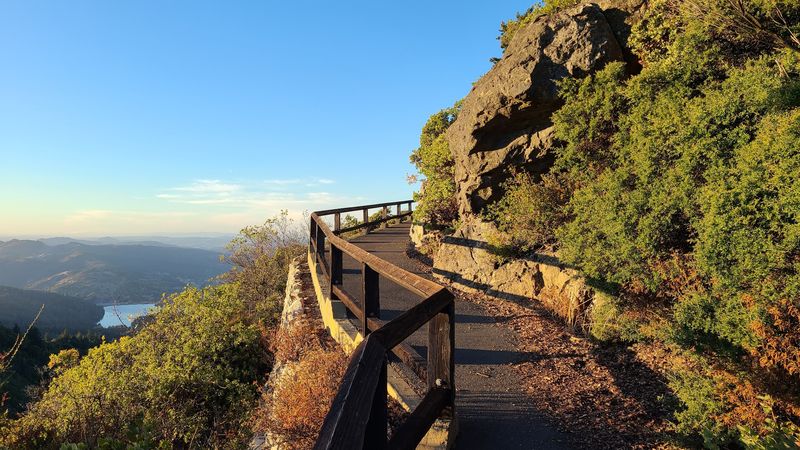
Standing at the East Peak of Mount Tamalpais and turning slowly in a full circle is one of the most geographically rich experiences available on an easy trail anywhere in the Bay Area.
The Verna Dunshee Trail is a 0.75 to 1.5-mile loop, much of which is paved and ADA-accessible, circling the summit and presenting views that span the entire San Francisco Bay.
Benches placed at strategic intervals make it easy to stop and take in each direction without rushing.
Picnic tables are available at the welcome area near the trailhead, and the combination of views and seating makes the summit a natural spot for a longer midday break.
Parking at East Peak carries a fee and can become crowded during peak times, particularly in the late afternoon when cloud inversions below the summit create a dramatic, almost otherworldly atmosphere.
Arriving earlier in the day tends to offer more available parking and calmer conditions on the trail itself.
The trail is open daily from 7 a.m. until sunset, and the paved surface makes it one of the more genuinely accessible summit experiences in Northern California.
Fog is common in summer mornings, so late morning or midday visits often yield the clearest panoramic views.
10. Mendocino Headlands Trail, Mendocino Headlands State Park
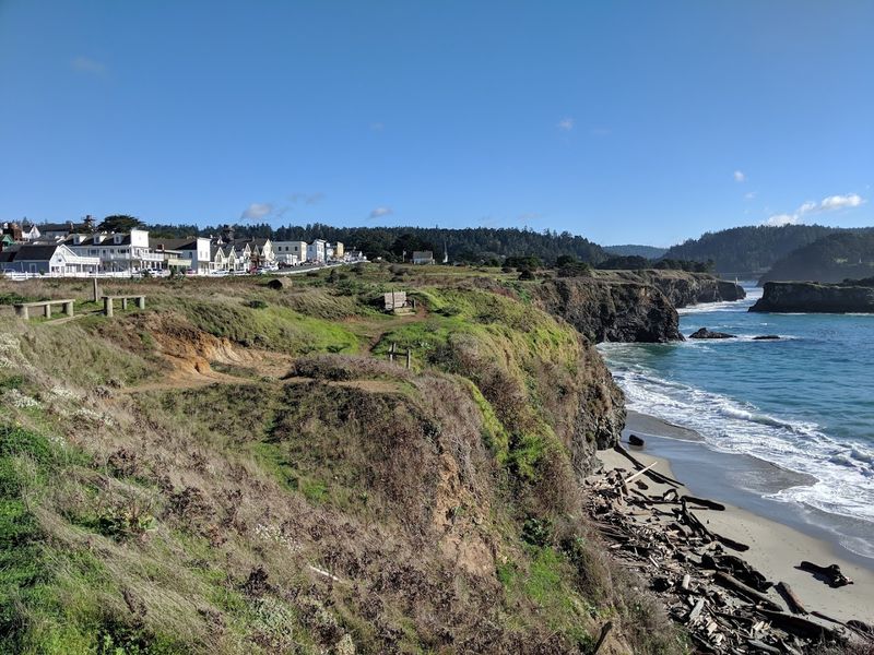
The Mendocino Headlands Trail moves along one of the more dramatically sculpted stretches of the Northern California coast.
Covering between 1.1 and 3 miles depending on the route chosen, the trail winds through coastal prairie on sandy singletrack paths past impressive natural sea arches and wind-shaped cypress trees.
The combination of open sky, salt air, and the constant presence of the ocean gives the walk a freeing, unhurried quality.
Spring brings vibrant wildflowers to the headlands, adding bursts of color along the clifftops that contrast beautifully with the deep blue water below.
Gray whales can sometimes be spotted during migration season, and the area sits along the Pacific Flyway, making it a productive birdwatching location throughout the year.
Dogs on leashes are welcome on the trail, which makes it a practical option for visitors traveling with pets.
Access is available from multiple points within the village of Mendocino, where street parking is generally available without a fee.
The trail does not have a single formal trailhead, so exploring from the town center and following the headland edge is the most natural approach for first-time visitors to the area.
11. Headlands Trail, Russian Gulch State Park
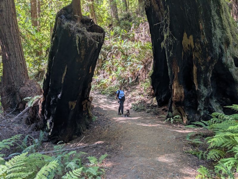
Two geological features make the Headlands Trail at Russian Gulch State Park stand out from other short coastal walks in the region.
The first is the Devil’s Punchbowl, a collapsed sea cave where water surges and churns through a circular opening in the rock with a force that can be heard before it is seen.
The second is the Panhorst Bridge, a historic arch structure visible from the bluff that frames the rocky coastline in a way that makes it a natural focal point for photographs.
The trail runs less than a mile to 1.5 miles round trip along coastal bluffs, offering open Pacific Ocean views throughout and a relatively flat, manageable surface underfoot.
Dogs on leashes are permitted on the trail, and the short distance makes it a good option for a quick stop during a longer drive along the Mendocino Coast.
Sunset visits are particularly popular since the western-facing bluffs provide a clear view of the sun dropping toward the water.
A fee is required at the park entrance, and parking is available at the headlands area near the trailhead.
The trail is open year-round, though winter visits may bring stronger winds and occasional coastal storms that add drama to the scenery while requiring a bit more preparation in terms of layering.
12. Fern Canyon Trail, Van Damme State Park
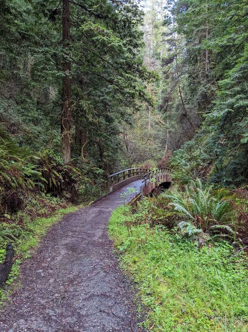
A steady canopy of redwoods, the sound of the Little River moving alongside the path, and a series of small wooden bridge crossings.
They give the Fern Canyon Trail at Van Damme State Park a storybook quality that is easy to appreciate at any walking pace.
The initial 2.5 miles, formally called the Fern Canyon Scenic Trail, follow a largely flat route along the river through abundant ferns and second-growth redwoods.
This section is generally suitable for strollers and bicycles, making it one of the more family-accessible forest trails on the Mendocino Coast.
The overall trail can extend up to a 9-mile round trip when combined with the Pygmy Forest Loop, at which point the terrain becomes more moderate with steeper sections and potentially muddy conditions after rain.
Even during drier summer months, the canyon retains its lush green character thanks to the river and the dense tree cover overhead.
The trail is accessible year-round, and the greenery remains impressive even when surrounding areas feel dry and brown.
Parking is available at the Van Damme State Park parking area located at the end of the campground.
Standard state park fees apply, and checking current trail conditions before a visit is helpful during winter and early spring when river crossings can be higher than usual.
13. Mary Bowerman Interpretive Trail, Mount Diablo State Park
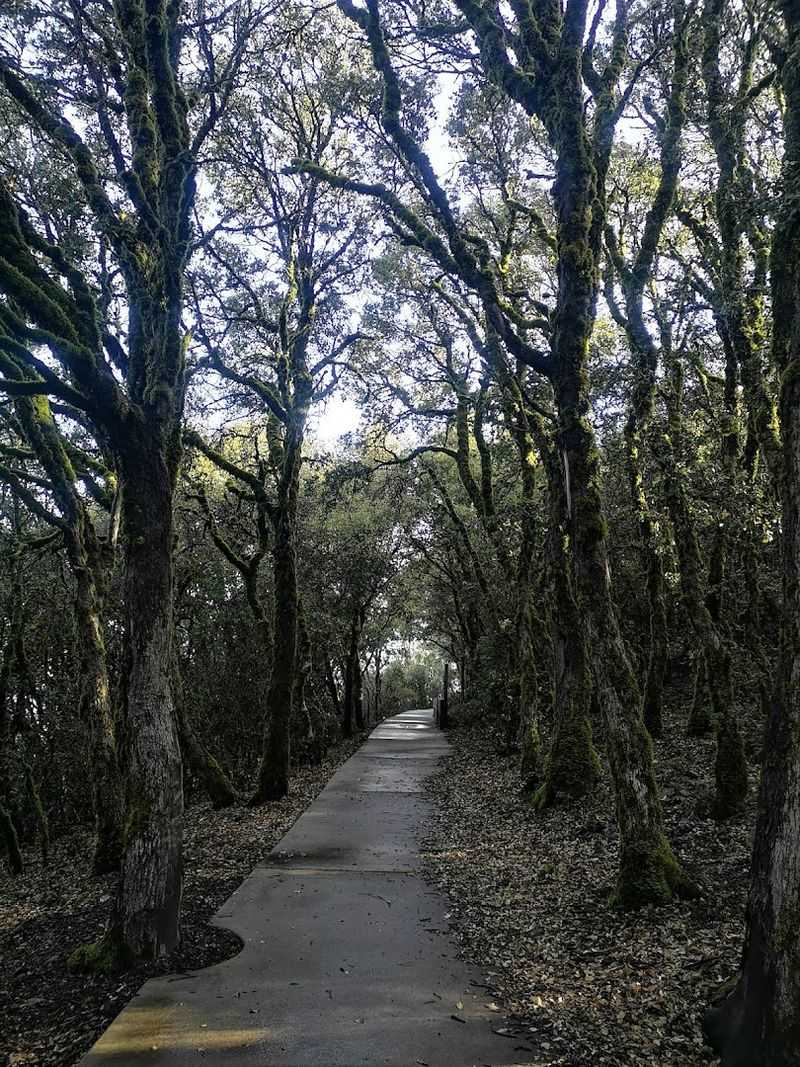
On an exceptionally clear day, the view from the summit area of Mount Diablo is said to be one of the most geographically expansive in the contiguous United States.
The Mary Bowerman Interpretive Trail, formerly called the Fire Interpretive Trail, is a 0.7-mile loop or a 0.2-mile accessible out-and-back path that puts those views within easy reach.
Landmarks visible on clear days can include Lassen Peak to the north and portions of the Sierra Nevada to the east, making the summit area feel like a genuine geographic crossroads.
Roughly half of the trail surface is paved and wheelchair-accessible, ending at the Ransome Point overlook where the views are particularly broad and unobstructed.
Interpretive stops along the route cover the mountain’s geology, native plant communities, and the diverse wildlife that inhabits the park across different elevations.
The information panels are detailed enough to add meaningful context to what might otherwise feel like a simple walk.
A $10 vehicle entrance fee is required, and the park is open from 8:00 a.m. until sunset.
Dogs are not permitted on trails within Mount Diablo State Park, so it is important to plan accordingly before arriving with pets. Spring visits often bring the clearest air and the most expansive distant views.