This 32-Mile Northern California Bike Trail Follows An Old Railroad Through Six Parks And Five Downtowns
Some trails feel less like a workout and more like an invitation to keep going.
The route slips past neighborhoods, open spaces, and busy town centers without ever losing its easy rhythm.
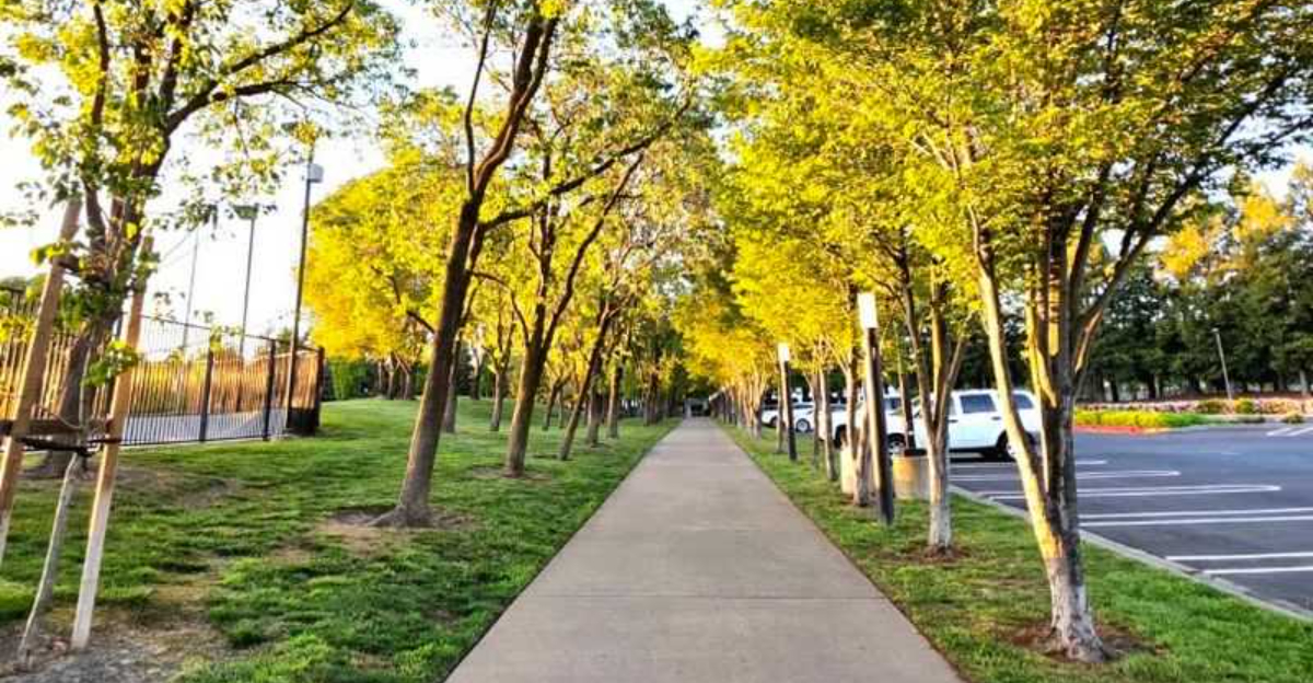
One stretch feels quiet and tree-lined. The next brings coffee shops, parks, and a reason to pause before pedaling on.
Across Northern California, few bike paths connect so many different settings in one continuous ride.
The old railroad corridor gives the journey a natural sense of direction, but there is no pressure to cover all 32 miles at once.
Riders can choose a short section, plan a longer day, or simply follow the path until curiosity says it is time to turn around.
How often can one trail carry you through six parks and five downtowns without making the trip feel repetitive? That variety is the real draw.
The Trail Covers 32 Mostly Paved Miles
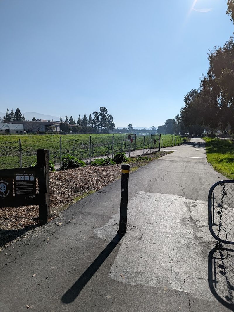
Stretching a full 32 miles from Concord to Pleasanton, the Iron Horse Regional Trail ranks among the longest rail-trails in California.
Most of the surface is paved, which makes for a smooth and predictable ride regardless of the season.
Packed gravel sections exist in certain stretches, so checking current trail conditions before heading out is always a smart move.
The consistent pavement is a big part of what makes this trail so welcoming to so many different types of users.
Road cyclists, mountain bikers, joggers, dog walkers, and stroller-pushing parents all share the corridor comfortably.
The width of the path is generous enough that passing feels easy and relaxed rather than stressful.
Planning a full out-and-back trip covers 64 miles total, so many riders choose a point-to-point route using BART for the return leg.
Parking is available at multiple trailheads along the route, giving riders flexibility in where to start and end.
Restrooms and water fountains appear at several parks along the way, making longer rides far more manageable.
An Abandoned Railroad Created The Route
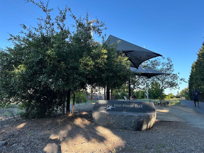
Railroad corridors have a special quality that most trails simply cannot replicate.
Built for heavy freight trains that could not handle steep climbs, these old rights-of-way cut through the landscape in long, sweeping, nearly flat lines that happen to be perfect for cyclists and walkers decades later.
The Iron Horse Trail exists because the Southern Pacific Railroad once ran a line through the San Ramon Valley, connecting communities that were far more rural and isolated in the late 1800s than they are today.
When freight service ended and the tracks were pulled up, the corridor became available for repurposing rather than development.
East Bay Regional Park District and local agencies worked together to transform the old railbed into the recreational and commuter pathway riders enjoy today.
Walking or riding along a former railroad always carries a quiet sense of place.
The straight sightlines, the gentle curves, and the way the trail slips between backyards and businesses all hint at its industrial past.
Interpretive signs at certain points along the route acknowledge the railroad history, giving curious visitors a richer understanding of why the trail looks and feels the way it does.
The Tracks Date Back To The 1890s
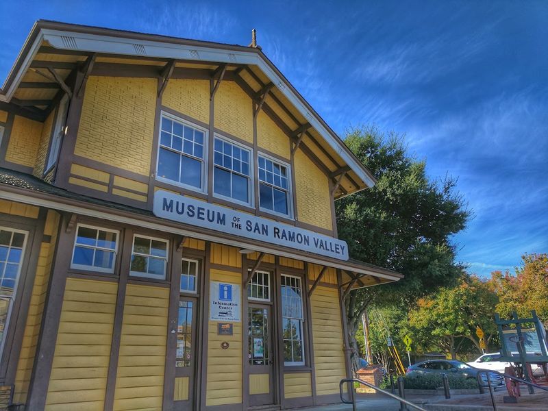
The Southern Pacific Railroad established its line through the San Ramon Valley in 1891, a time when the valley was primarily agricultural and the train was the fastest way to move goods and people.
Grain, livestock, and produce moved north toward Oakland and beyond, while settlers and supplies traveled south into communities that were still finding their footing.
For nearly nine decades the railroad shaped the rhythm of life in towns like Danville, San Ramon, and Dublin.
Then, as road transportation became dominant and freight patterns shifted, the line lost its economic purpose.
Service wound down and the tracks were officially abandoned in the late 1970s, leaving behind a long, flat corridor through the heart of one of the Bay Area’s fastest-growing regions.
A beautifully preserved reminder of that era still stands in Danville.
The Museum of the San Ramon Valley is housed in the original Southern Pacific Depot, built in 1891 and carefully restored.
The museum sits right alongside the trail, making it an easy and genuinely rewarding stop for anyone curious about what life in the valley looked like more than a century ago.
Nine East Bay Communities Share The Trail
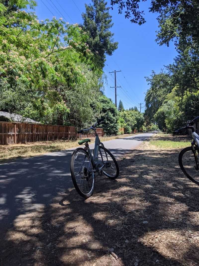
One of the most appealing qualities of the Iron Horse Regional Trail is how many distinct communities it threads together.
Starting in Concord and ending in Pleasanton, the route passes through Pleasant Hill, Walnut Creek, Alamo, Danville, San Ramon, and Dublin along the way.
Each town has its own personality, architecture, and pace, and riding through all of them in a single day offers a genuinely varied experience.
Concord feels urban and energetic near the northern trailhead, with busy streets and commercial corridors visible from the path.
As the trail moves south through Walnut Creek, the scenery shifts toward a more polished suburban character with well-maintained parks and civic spaces.
Further south, Alamo and Danville carry a quieter, more residential tone, with mature trees arching over the path and open space feeling noticeably more generous.
By the time the trail reaches San Ramon and Dublin, the landscape opens up again with newer development and expansive parks.
Pleasanton at the southern end has a charming historic downtown that feels like a natural finishing point for the journey.
Moving through all nine communities in sequence gives riders a sense of how the East Bay has grown and changed over the decades.
Walnut Creek’s Civic Park Sits Along The Route
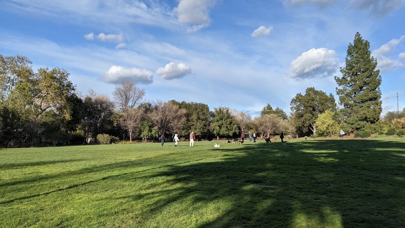
Civic Park in Walnut Creek occupies a stretch of the trail corridor that feels genuinely open and airy compared to the more enclosed sections further north.
The park sits directly alongside the Iron Horse Trail, meaning riders do not need to leave the path to enjoy the green space.
Benches, shade trees, and open lawn areas make it an easy place to pause and recover before continuing south.
Walnut Creek as a whole brings a lively urban energy to the trail experience.
The city has a well-developed downtown with a mix of shops, restaurants, and cultural venues, and the trail skirts close enough to the center that a short detour is all it takes to explore.
The Lesher Center for the Arts is nearby for those interested in the city’s cultural side, though most trail riders simply appreciate the access to food and water that Walnut Creek provides.
The park itself is calm and clean, with a surface that transitions smoothly from the trail.
On weekday mornings the area tends to be quiet, while weekend afternoons bring out families and dog walkers in larger numbers.
Stopping here mid-ride offers a chance to stretch, refill water bottles, and take in a bit of the East Bay’s pleasant suburban parkland character before heading further south.
San Ramon Central Park Breaks Up The Ride
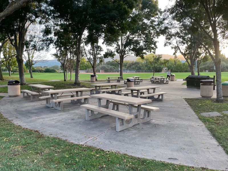
Central Park in San Ramon is one of the most practical and comfortable stopping points along the entire Iron Horse Trail.
The park offers restrooms, water fountains, picnic areas, and wide open lawns that invite riders to fully stop and reset rather than just slow down briefly.
It is a well-maintained community park that sees regular use from both trail visitors and local residents.
The park’s size makes it feel genuinely spacious rather than just a narrow strip of green wedged between development.
Children’s play areas and sports fields fill the surrounding grounds, giving families with younger riders a natural destination to aim for.
Arriving at Central Park from the north feels like a milestone, roughly marking the southern third of the full trail distance.
Timing a stop at Central Park for midday works well on most days since the shade trees provide relief during warmer months.
The park connects smoothly back to the Iron Horse Trail corridor, so getting back on the route after a break requires no navigation or guesswork.
San Ramon’s newer suburban character gives this section of the trail a different feel from the older, more established neighborhoods found further north near Walnut Creek and Danville.
Several Pedestrian Bridges Cross Local Creeks
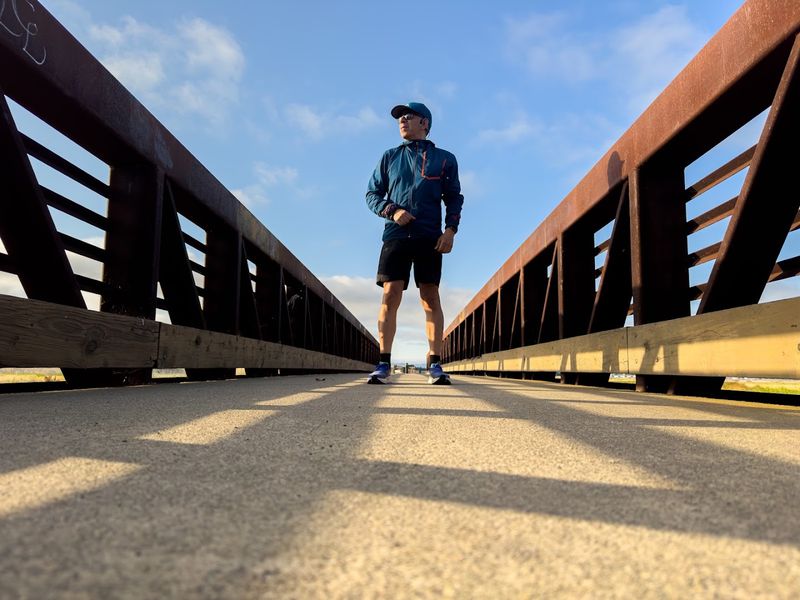
Bridges are some of the most satisfying moments on any long trail ride.
Along the Iron Horse Trail, several pedestrian and cyclist bridges span local creeks and busy roadways, keeping the path continuous and safe without requiring riders to navigate intersections or wait for traffic signals.
These crossings are engineered to handle the steady flow of cyclists, joggers, and strollers that move through on busy weekend mornings.
The creek crossings in particular offer brief but beautiful pauses in the urban scenery.
Looking down from a bridge at a marshy streambed lined with willows and cattails provides a surprising sense of nature within what is otherwise a heavily developed corridor.
Birds are common near these wet areas, and the sound of water moving below the bridge adds a pleasant acoustic texture to the ride.
Major road crossings over thoroughfares like Treat Boulevard, Ygnacio Valley Road, Bollinger Canyon Road, and Dublin Boulevard are handled with dedicated bridges or underpasses that keep trail users completely separated from vehicle traffic.
This level of infrastructure reflects how seriously the trail was designed as a true transportation corridor rather than just a recreational afterthought.
Riders who might feel nervous about road crossings on other trails will find the Iron Horse Trail refreshingly well-engineered in this regard.
Parks And Greenbelts Soften The Urban Scenery
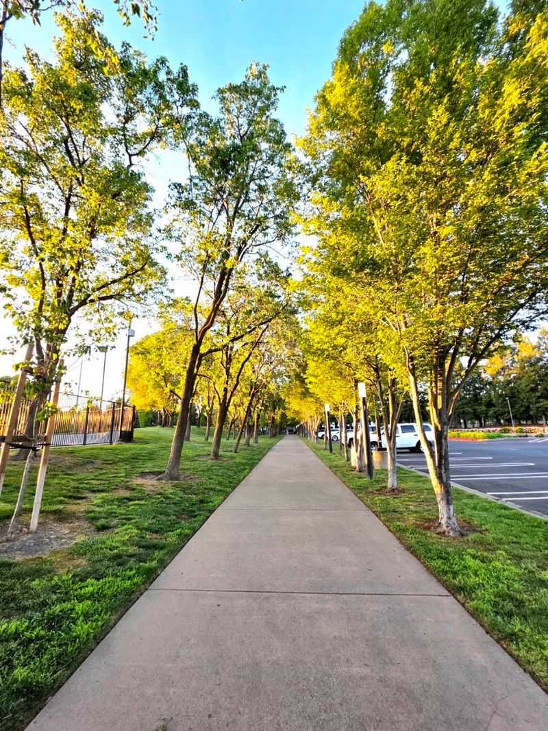
Long paved trails through suburban areas can sometimes feel relentlessly urban, with fences, parking lots, and back walls of commercial buildings dominating the view.
The Iron Horse Trail manages this challenge better than most, thanks to a series of parks, greenbelts, and natural buffers that break up the developed landscape at regular intervals.
Walden Park and Hemme Station Park in the Walnut Creek and Alamo areas both contribute to this softer character.
The greenbelts along the route vary in size and character.
Some are narrow strips of grass and native plantings that simply provide visual relief between neighborhoods, while others open into broader natural areas.
The combination keeps the ride feeling fresh and varied rather than monotonous, even during sections where the surrounding development is dense.
Toward the southern end of the trail near Dublin and Pleasanton, the landscape shifts again as the path approaches the edge of the Tri-Valley’s open space network.
Shadow Cliffs Regional Recreation Area is accessible from the southern portion of the route, offering a scenic backdrop of rolling hills and a reservoir that feels quite removed from the suburban character.
Cyclists Can Connect With Other Regional Trails
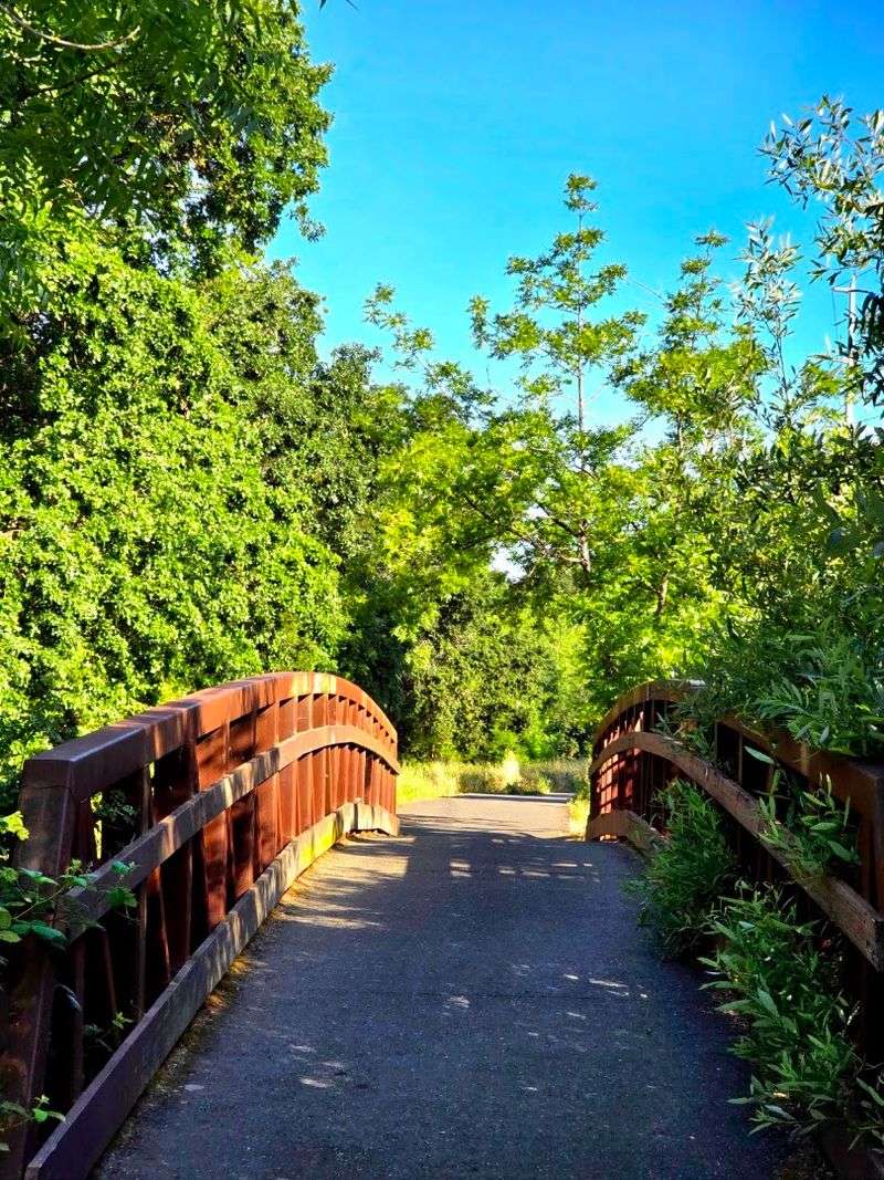
Thirty-two miles is already a satisfying distance, but the Iron Horse Trail’s real power comes from how it plugs into a broader network of regional paths.
Riders who want to extend their journey have several options for branching off and exploring beyond the main corridor.
The Contra Costa Canal Regional Trail connects from the Walnut Creek area, offering a different landscape and a quieter character than the Iron Horse itself.
Further south, the Arroyo Mocho Trail in Pleasanton picks up near the southern terminus and heads in a different direction, allowing adventurous riders to continue well beyond the official Iron Horse endpoint.
The Centennial Trail and the Alamo Canal Trail near Dublin and Pleasanton add additional options for those who enjoy planning longer multi-trail loops or point-to-point adventures across multiple jurisdictions.
For riders drawn to the hills rather than the flatlands, connections to the Briones to Mt. Diablo Trail and the Las Trampas to Mt.
Diablo Trail are accessible from various points along the Iron Horse corridor.
These connections transform the trail from a standalone route into a gateway for exploring a much larger regional trail system.
Carrying a printed or downloaded map of the East Bay trail network helps riders take full advantage of these junctions without missing a turn.