12 Northern California Mountain Towns Where Summer Heat Rarely Gets The Upper Hand
Summer does not always mean chasing shade or planning every outing around the hottest part of the day.
Higher elevations, forested roads, and cooler evening air give certain communities a welcome break from the season’s intensity.
Mornings can start crisp and nights may call for a light jacket even when lower elevations are sweltering.
Northern California makes room for a very different kind of summer escape.
These mountain towns offer the chance to slow down without feeling trapped indoors. Main streets stay walkable while the cooler climate makes spontaneous plans much easier to enjoy.
Would you trade triple-digit heat for pine-scented air and open windows? These 12 destinations make that choice remarkably easy.
1. Truckee, Nevada County
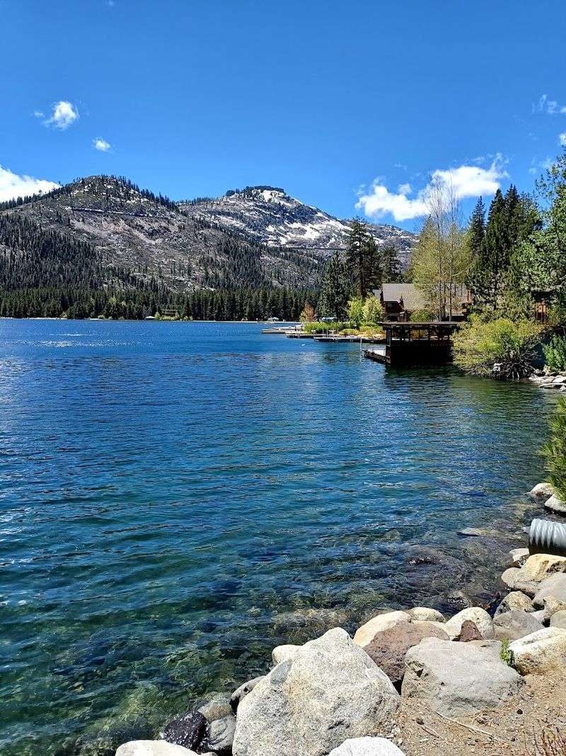
Sitting at roughly 5,800 feet above sea level, Truckee earns its reputation as one of the Sierra Nevada’s most reliably cool summer destinations.
The air carries a noticeable crispness even on the warmest afternoons, and the surrounding pine forest adds a layer of shade that keeps temperatures comfortable throughout the day.
Over 600 miles of trails wind through the surrounding landscape, offering options for hikers of every skill level.
Donner Lake sits just west of the historic downtown area and provides calm, swimmable water during summer months, along with paddleboarding and kayaking access.
The Truckee River Legacy Trail, a paved and family-friendly path, follows the river and connects to scenic viewpoints and green spaces.
Downtown Truckee along Donner Pass Road features locally owned shops, galleries, and buildings that reflect the town’s Old West roots.
The park grounds include picnic areas, beaches, and more than eight miles of maintained trails. Visiting on a weekday tends to mean fewer crowds and easier parking near the trailheads.
2. Tahoe City, Placer County
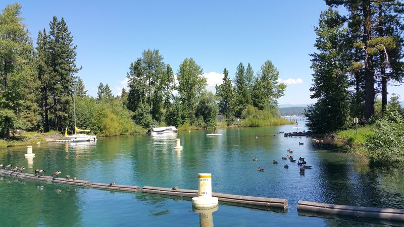
Perched right on the western shore of Lake Tahoe, Tahoe City offers a summer experience shaped entirely by water and altitude.
The lake acts as a natural temperature regulator, keeping the surrounding air noticeably cooler than inland areas at similar elevations.
Commons Beach is a local favorite for swimming, picnicking, and watching the light shift across the lake’s famously clear surface.
The compact downtown layout makes it easy to move between the lakefront and the shops and eateries along the main streets without needing a car.
Kayak and paddleboard rentals are available near the water, and the lake’s western shore offers calmer paddling conditions during morning hours.
The surrounding area also connects to a network of mountain biking and hiking trails that climb into the forest above the lake.
The Gatekeeper’s Museum, housed in a replica log cabin features exhibits on early local residents alongside the Marion Steinbach Basket Gallery.
The gallery holds one of the most significant collections of Native American woven baskets in the region.
Arriving in the morning helps avoid the midday crowds that tend to gather along the lakefront during peak summer weekends.
3. Kings Beach, Placer County
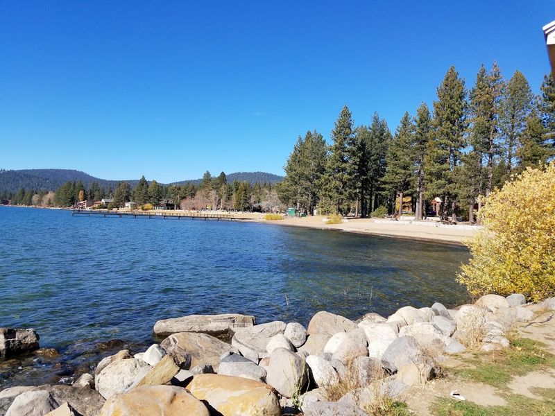
The northernmost stretch of Lake Tahoe opens up at Kings Beach, where a wide sandy shore meets some of the clearest water in the state.
Despite sitting at over 6,200 feet in elevation, the beach sees generous sunshine during summer, but the altitude keeps the heat from becoming oppressive.
The combination of sun, cool air, and cold water creates a genuinely refreshing outdoor setting that draws visitors from across the region.
Kings Beach State Recreation Area is the central hub for summer activity here, offering swimming, sunbathing, and easy water access for kayakers and paddleboarders.
Rental equipment is available nearby, making it straightforward to get on the water without bringing gear. The beach area can fill up quickly on summer weekends, so arriving before 10 AM tends to make a noticeable difference in finding good parking and open space.
The recreation area provides accessible amenities including restrooms and picnic facilities along the waterfront.
The surrounding North Lake Tahoe corridor also offers hiking trails and forested roads that lead away from the beach toward quieter viewpoints.
A weekday visit reveals a more relaxed pace with room to settle in and enjoy the scenery without the weekend rush.
4. Graeagle, Plumas County
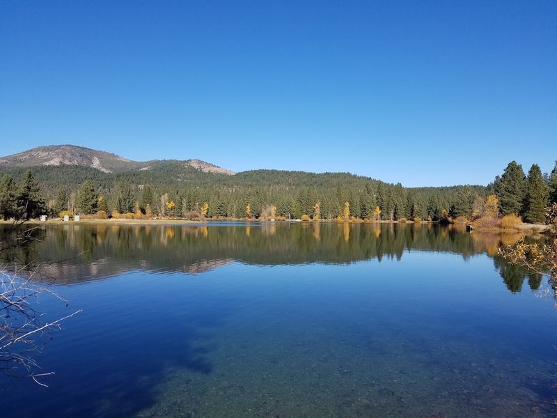
Known affectionately as part of the Lost Sierra, Graeagle sits in a wide mountain meadow at around 4,400 feet and carries the kind of quietude that feels increasingly rare.
Plumas National Forest wraps around the community on all sides, filling the air with the scent of conifers and the sound of moving water.
Summer temperatures here tend to stay mild, rarely climbing into uncomfortable territory, which makes the outdoors feel inviting at almost any hour.
The Middle Fork of the Feather River and nearby Graeagle Creek offer fly fishing opportunities within easy reach of the town center.
Several scenic golf courses take advantage of the open meadow terrain, and the surrounding forest trails range from flat, easy walks to more demanding ridge routes with broad mountain views.
Clio, a neighboring community just minutes away, adds additional access to river swimming spots and forested picnic areas.
The overall pace of life in Graeagle leans toward the unhurried, with small local shops and a general store anchoring the modest town center.
Bucks Lake and Lake Davis, both located within a short drive, expand the options for boating and fishing considerably.
Visitors who prefer a mountain escape without large crowds tend to find Graeagle particularly well-suited to that kind of experience throughout the summer season.
5. Sierra City, Sierra County
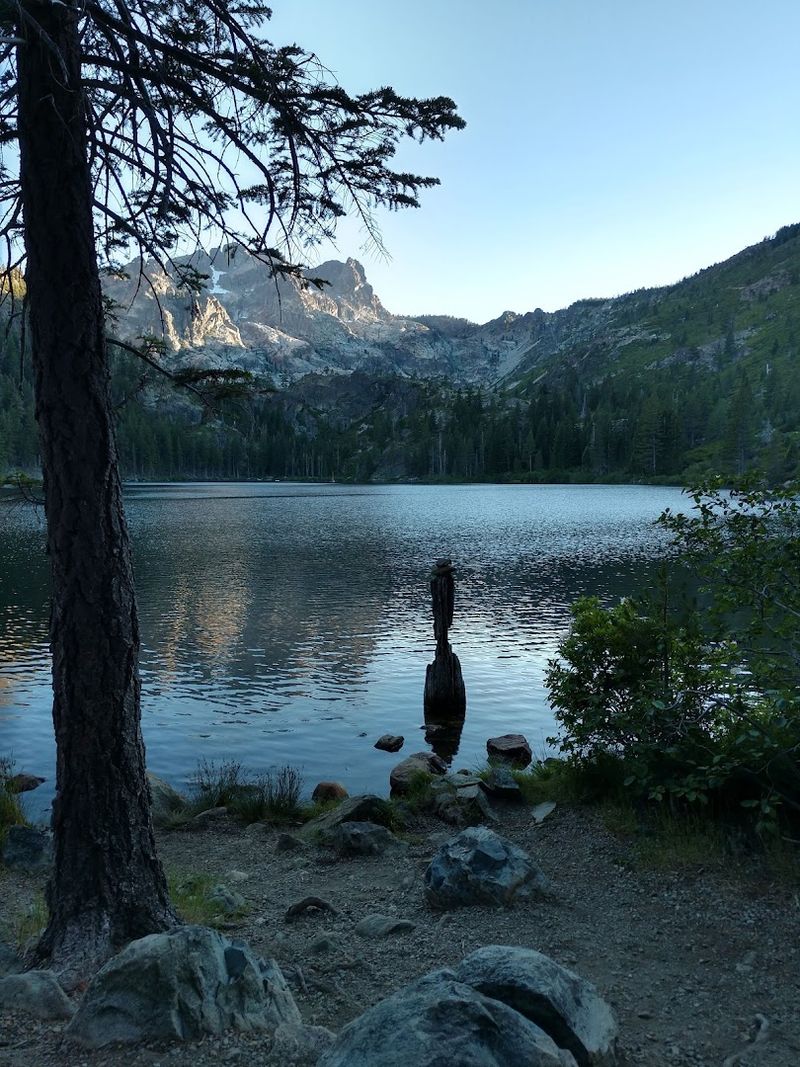
Beneath the dramatic granite ridgeline of the Sierra Buttes, Sierra City sits at about 4,200 feet and delivers a summer climate shaped by elevation, forest cover, and the cold waters of the North Yuba River running nearby.
The town itself is small and unhurried, with a character deeply rooted in the California Gold Rush era.
Those steep, rocky peaks visible from nearly every angle in town serve as a constant reminder of just how high and wild this part of the Sierra Nevada truly is.
The Kentucky Mine Museum offers a grounded look at the region’s mining past through an authentic stamp mill, mine entrance tours, and a broad collection of artifacts.
The museum typically operates from Memorial Day weekend through Labor Day, with guided tours of both the mine and the mill offered twice daily.
Exploring the site provides a sensory connection to the era, from the weight of old tools to the scale of the machinery.
The Pacific Crest Trail passes near Sierra City, drawing long-distance hikers who stop to resupply and rest.
The North Yuba River corridor provides swimming holes and streamside trails that stay cool even during the warmest weeks of summer.
Early arrivals on weekday mornings tend to have the best access to the quietest spots along the river.
6. Downieville, Sierra County
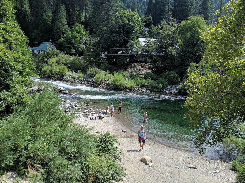
At the meeting point of the North Yuba and Downie rivers, Downieville carries the kind of lived-in mountain character that takes decades to develop.
The stone and brick buildings along Main Street date back to the Gold Rush period, and the narrow canyon setting keeps the town shaded and cool for much of the summer day.
River sounds are a near-constant backdrop here, which adds to the sense of being genuinely removed from the pace of everyday life.
Mountain biking has become one of Downieville’s most recognized draws, with the Downieville Downhill trail system attracting riders who want technical descents through old-growth forest.
Downieville Outfitters provides shuttle services and gear support for those looking to tackle the trails without the uphill effort.
The rivers themselves offer excellent swimming holes and fishing access throughout the summer months.
The Downieville Museum occupies a well-preserved 1852 stone building with original iron doors and shutters.
Inside, exhibits trace the town’s arc from gold camp to mountain community through photographs, artifacts, and a detailed scale model of the historic business district.
The museum generally operates from Memorial Day through Labor Day, making summer the ideal time to pair a river day with a look at local history.
7. Chester, Plumas County
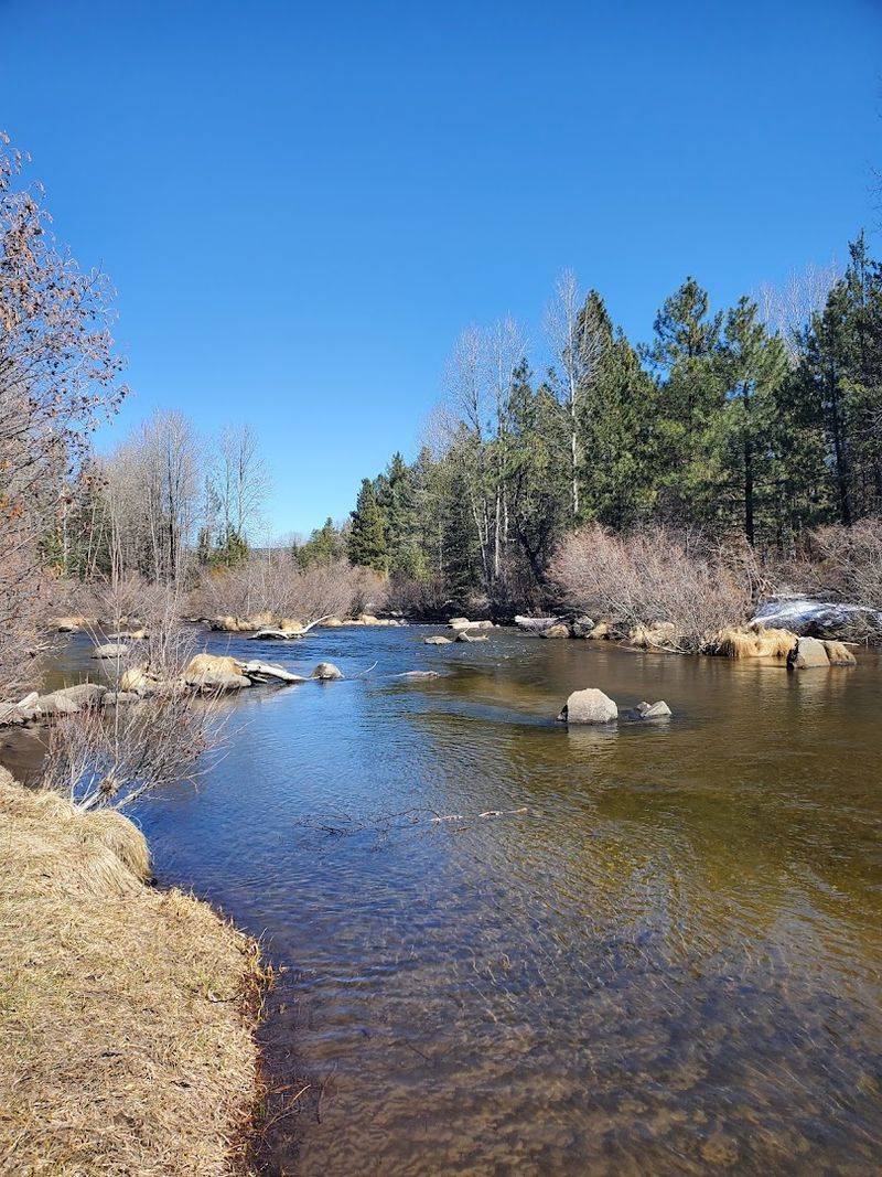
Anchored by the broad, calm surface of Lake Almanor, Chester sits at around 4,500 feet and benefits from both its elevation and its proximity to a large body of water that moderates summer temperatures.
The lake stretches across roughly 13,000 acres and provides an expansive setting for boating, fishing, and shoreline exploration.
On clear mornings, the reflection of Mount Lassen on the lake’s surface creates one of the more quietly spectacular views in Northern California.
The town itself serves as a practical and friendly base for visiting Lassen Volcanic National Park, which lies just a short drive to the west.
Local outfitters and shops along the main commercial strip offer gear, supplies, and information for park-bound visitors.
The roads between Chester and the park pass through dense conifer forest, with several pullouts that reward those who stop with views of the broader volcanic landscape.
Fishing on Lake Almanor draws a loyal following, particularly for brown trout and salmon, and the lake’s size means there is usually room to find a quiet cove even during busy summer weekends.
The Hamilton Branch area on the lake’s eastern shore is a less-visited section that tends to stay calm and uncrowded.
Chester’s overall character is low-key and welcoming, making it a practical and comfortable stop for extended mountain exploration.
8. Mineral, Tehama County
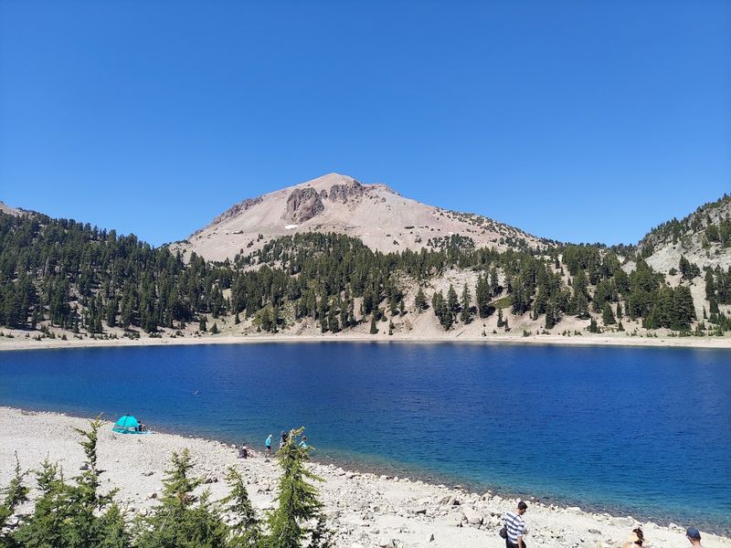
Sitting at the doorstep of one of the most geologically active landscapes in the continental United States, Mineral serves as the quiet gateway to Lassen Volcanic National Park.
At around 4,850 feet, the surrounding area stays noticeably cool throughout summer, and the forest that blankets the hillsides keeps the light filtered and the air fresh.
The volcanic terrain just up the road offers a dramatic contrast to the calm, wooded character of the community itself.
Lassen Volcanic National Park encompasses boiling mud pots, steaming fumaroles, hydrothermal lakes, and a dormant volcano that last erupted in the early twentieth century.
Trails within the park range from short interpretive walks near active thermal areas to full-day ridge routes with sweeping panoramic views.
The diversity of landscapes within a single park visit is genuinely hard to match anywhere else in Northern California.
The Loomis Museum sits near the park’s Southwest Entrance and presents exhibits covering both the natural history and the cultural heritage of the region.
It serves as a practical first stop for understanding the park’s geology before heading out on the trails.
Summer weekday mornings tend to offer the best combination of open trails, available parking, and unhurried access to the park’s most popular hydrothermal features.
9. Mount Shasta, Siskiyou County
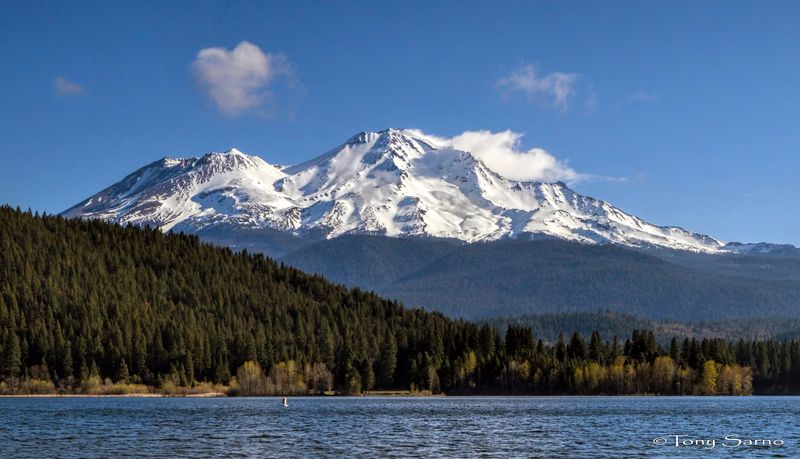
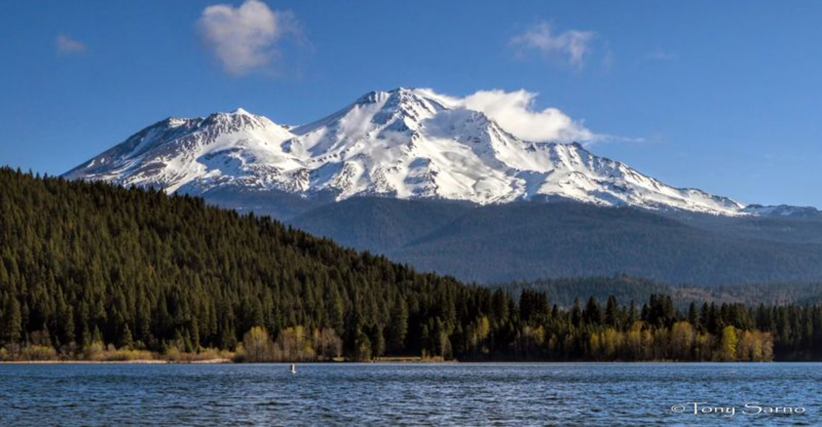
Few mountain towns in Northern California announce themselves as boldly as Mount Shasta does, with the 14,179-foot volcano looming over every street and storefront.
The town sits at about 3,500 feet, which keeps summer temperatures moderate and the air genuinely refreshing compared to the Sacramento Valley below.
The mountain itself draws hikers, climbers, and those simply seeking the kind of stillness that open sky and volcanic terrain can provide.
Trails around the mountain vary considerably in difficulty, from accessible forest walks near the town boundary to demanding summit routes that require technical preparation and permits.
Castle Lake, located a short drive from downtown, offers cold, clear swimming water and a forested picnic area with views of the mountain reflected on the lake surface.
The surrounding Shasta-Trinity National Forest expands the range of outdoor options well beyond what the mountain alone provides.
The Mount Shasta Sisson Museum shares its grounds with a state fish hatchery and features exhibits on local history, Native American basketry, mountaineering, and the lenticular clouds that frequently form above the summit.
The museum provides an engaging and informative complement to a day spent outdoors.
Downtown Mount Shasta also holds a walkable cluster of independent shops and eateries that reflect the town’s distinctive blend of outdoor culture and community character.
10. McCloud, Siskiyou County
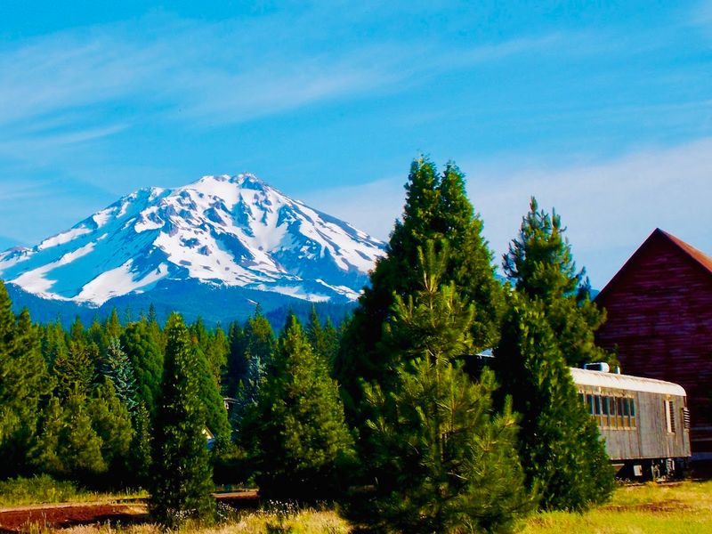
Built originally as a company town for a large lumber operation, McCloud retains the tidy, planned layout and historic architecture that set it apart from other mountain communities in the region.
The town sits on the southern flank of Mount Shasta at around 3,200 feet, and summer temperatures here tend to be mild and comfortable, often cooled by afternoon breezes coming off the mountain.
The historic district designation reflects the care that has gone into preserving the town’s original character.
The McCloud River Falls Trail is one of the area’s most popular routes, leading visitors through forest to three separate waterfalls, each with its own distinct character and swimming access.
The McCloud Reservoir provides a broader outdoor setting for paddling, boating, and fishing during the warmer months.
After dark, the limited light pollution around McCloud makes for exceptional stargazing conditions that surprise many first-time visitors.
The McCloud River Mercantile Company anchors the historic downtown with a general store atmosphere and vintage product lines housed within a carefully preserved building.
The space also connects to the McCloud River Mercantile Hotel, which offers historically themed accommodations within the same structure.
Visiting on a weekday morning allows for a more relaxed experience of both the town and the nearby waterfall trail before afternoon visitors arrive.
11. Dunsmuir, Siskiyou County
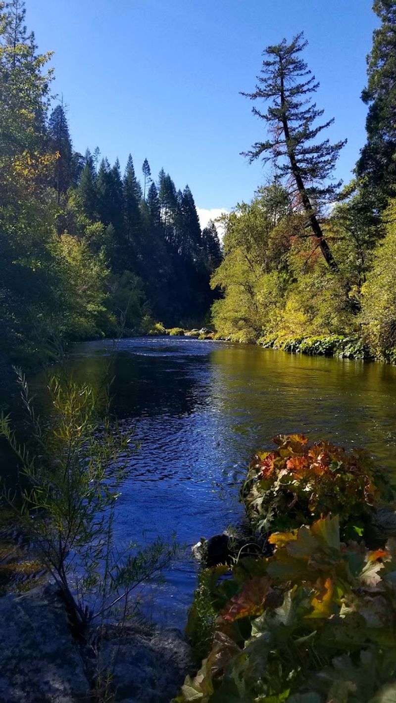
Carved into the walls of the Sacramento River Canyon, Dunsmuir holds a reputation for exceptionally clean water and a mountain climate that stays genuinely cool even at its relatively modest elevation of around 2,300 feet.
The canyon walls and dense riparian vegetation create a sheltered microclimate that keeps temperatures comfortable throughout the summer.
The Sacramento River running through town is considered one of the finest wild trout fisheries in the state, drawing fly fishing enthusiasts from across the country.
Hedge Creek Falls sits within a short walk of the town and features a trail that curves behind the waterfall itself, offering an unusual and memorable perspective on the cascade.
Mossbrae Falls, accessible via a trail along the river, presents a broad curtain of water spilling over a mossy cliff face into the Sacramento River below.
Castle Crags State Park, just minutes south of town, adds dramatic granite spires and additional hiking routes to the available options.
Admission is free, and the gardens generally remain open from sunrise to sundown throughout the year.
The combination of river access, waterfalls, and free green space makes Dunsmuir an unusually complete mountain stop for a town of its size.
12. Burney, Shasta County
Positioned on the Modoc Plateau at around 3,100 feet, Burney benefits from a high-desert mountain climate that keeps summer days noticeably cooler than the surrounding lowlands.
The town itself is modest and functional, but its proximity to one of California’s most celebrated natural landmarks gives it a draw that far exceeds its size.
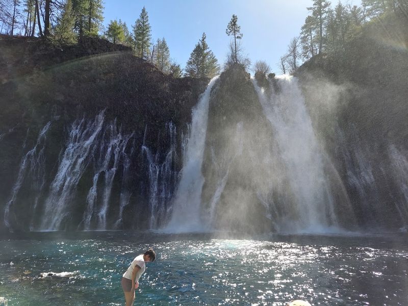
McArthur-Burney Falls Memorial State Park lies just a short drive north of town and anchors the entire region’s appeal for summer visitors.
Burney Falls drops 129 feet over a basalt cliff face, with additional water seeping directly from the porous rock walls on either side of the main cascade, creating a wide and misty spectacle that stays visually striking throughout the day.
The pool at the base of the falls maintains a cold, clear quality fed by underground springs that flow at a consistent rate regardless of seasonal rainfall.
Trails within the park lead to various viewpoints of the falls and continue through old-growth forest along the creek corridor below.
The park also offers camping facilities and a visitor center with interpretive displays covering the park’s geology and ecology.
Arriving early in the morning provides the best light for viewing the falls and reduces the likelihood of crowded conditions at the main overlook.
The surrounding Shasta-Trinity region adds additional hiking and lake access for those staying multiple days in the Burney area.