These 9 Idaho Mining Towns Have Stories Hidden Behind Their Empty Buildings
Silence feels different when an entire town once stood where the weeds are growing.
Across Idaho, abandoned settlements still cling to mountain slopes and remote valleys. Empty cabins lean with age, old storefronts fade beneath the weather, and forgotten roads lead toward places that once felt full of possibility.
Miners and merchants arrived hoping to build better lives. For a while, new communities rose quickly around valuable discoveries.
Then the work slowed, people moved on, and nature began taking back what remained.
Today, these places feel quiet without feeling empty. Every broken wall and rusted object hints at the routines, ambitions, and difficult choices that shaped life there.
Reaching some of them takes patience. Rough roads and isolated terrain often stand between visitors and the first weathered building.
That only makes the discovery more rewarding.
These nine former mining communities offer a rare look at Idaho’s past. Just do not expect the silence to stop feeling slightly strange.
1. Bayhorse – Near Challis
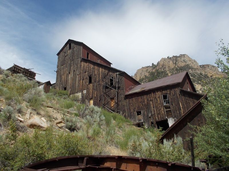
Climbing beside Bayhorse Creek brings visitors into one of Idaho’s clearest surviving nineteenth-century mining landscapes. Lead and silver development accelerated after the Ramshorn discovery in 1877, and production expanded through the following decade.
Cabins, shops, mills, stone structures, mining equipment, and charcoal kilns still show how work moved from the surrounding slopes into a compact industrial settlement.
Bayhorse reached roughly 400 residents before a federal ruling affecting imported silver-lead ore disrupted the local economy in 1889 and temporarily eliminated hundreds of jobs.
Later mining returned, but the community never regained its earlier size. Today, the site belongs to Land of the Yankee Fork State Park, which protects the buildings and guides visitors along established routes.
Fences are not invitations to step closer. They help keep people away from unstable walls, steep ground, and fragile equipment.
Seasonal access generally depends on weather, road conditions, and park operations, so confirm the current status before leaving Challis. Nothing needs to be entered or handled for the place to make sense.
Looking uphill from the creek reveals cabins, processing areas, and transportation routes arranged around the same demanding terrain that once determined where people lived and worked. Summer visits reveal the layout most clearly.
2. Custer – Near Stanley, Idaho
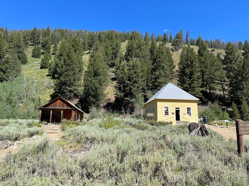
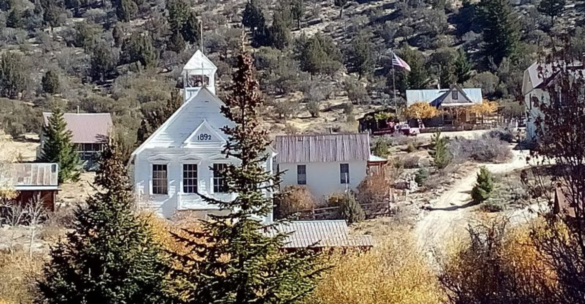
Stabilized buildings give Custer enough shape that visitors can follow its rise without pretending the town survived untouched. Prospectors organized the community during the late 1870s, and nearby operations such as the General Custer, Lucky Boy, and Black mines supported rapid growth.
By the 1890s, around 600 people lived here, with a school, post office, businesses, community buildings, and homes spread beside the Yankee Fork. Economic life remained tied closely to mining.
As production weakened after the turn of the century, families and merchants gradually left, and Custer became a ghost town by 1911. Preservation has since given several structures a careful second life.
The former schoolhouse operates as a museum during the seasonal visiting period, while cabins and interpretive displays help explain daily routines beyond the mines.
Land of the Yankee Fork State Park offers both guided and self-guided opportunities when staffing and weather permit.
Roads into the district can remain affected by snow well into the year, making summer the most dependable season. Stay on marked routes and avoid entering closed structures.
Custer feels unusually complete because restoration supports the story without turning the town into a modern recreation of something that no longer exists without theatrical effects.
3. Bonanza – Near Custer
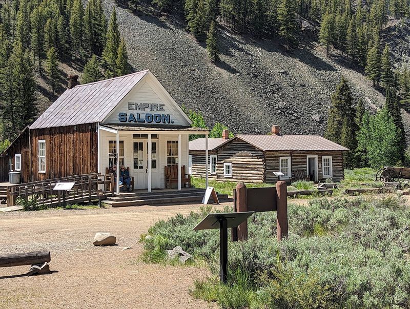
Only a few miles separate Bonanza from Custer, yet their remaining landscapes look noticeably different. Founded during the late 1870s, Bonanza first became the Yankee Fork district’s commercial and social center.
Supplies, mail, transportation, and services gathered here while nearby mines drew workers into the valley. Two major fires, in 1889 and 1897, changed that advantage.
Businesses that rebuilt often moved toward Custer, where mining activity and community institutions were becoming stronger. Bonanza never recovered its earlier position, even though the surrounding ground continued attracting investment.
Large-scale dredging later reshaped portions of the valley from 1940 through 1953, leaving long rows of tailings that add a twentieth-century industrial layer to the older townsite.
Visitors now find fewer maintained buildings than at Custer, but cabins, foundations, historic markers, and altered ground still explain the settlement’s shifting fortunes.
Land of the Yankee Fork State Park includes Bonanza among its historic destinations, and nearby camping can make the area easier to explore without rushing. Current roads, seasonal conditions, and private boundaries still matter.
Follow signs rather than wandering toward every visible remnant. Bonanza’s quieter appearance shows how fire, relocation, and new machinery could redirect an entire district without moving very far, even today.
4. Silver City – Owyhee County, Idaho
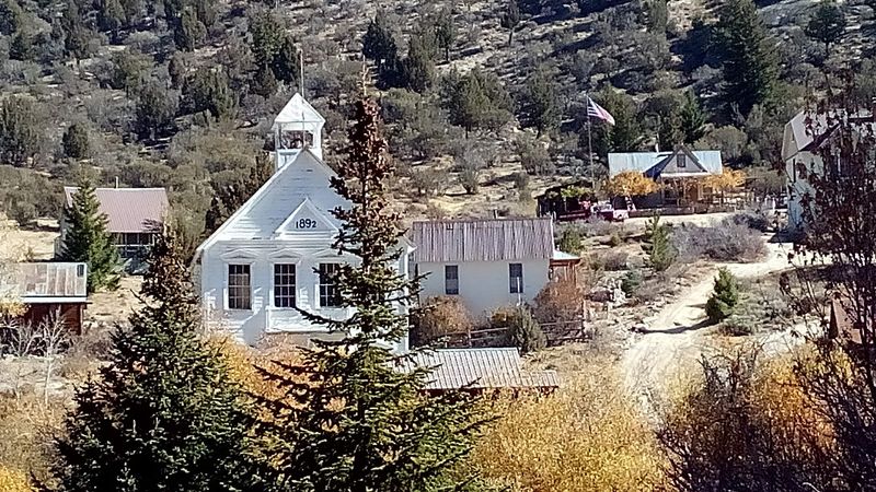
Seasonal life still moves through Silver City, making “completely abandoned” the wrong description for this Owyhee Mountains community.
Rich gold and silver discoveries during the 1860s created a substantial town with residences, stores, civic buildings, hotels, and mining businesses.
Telegraph service arrived in 1875, and the Owyhee Avalanche became Idaho’s earliest daily newspaper soon afterward.
Production later shifted toward lower-grade ore on Florida Mountain, while improved transportation supported a longer working life than the first rush might suggest.
Major companies closed by 1912, but Silver City remained the Owyhee County seat until 1934. Roughly 75 historic structures still shape its streets, including privately owned residences, a church, a school, lodge buildings, and the Idaho Hotel.
Visitors may admire them from public roads, but porches, yards, and interiors are not automatically open. Current access requires extra care.
BLM posted a temporary closure for a broad part of southern Owyhee County beginning July 28, 2026, with an anticipated end on August 14, because of wildfire response activity. Check the latest closure map and county road conditions before traveling.
When access is permitted, Silver City rewards respectful walking rather than treating private property as an open-air exhibit. Public access can change again quickly.
5. Burke – Northeast Of Wallace
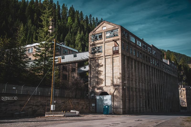
Narrow canyon walls explain Burke before any interpretive plaque can. Lead and silver discoveries beginning in 1884 drew mines, mills, workers, businesses, a railroad, and a roadway into a corridor with almost no level ground.
Buildings crowded beside Canyon Creek and climbed the slopes wherever construction remained possible. The best-known example was the Tiger Hotel, built across the confined transportation route rather than comfortably beside it.
Railroad tracks and the canyon road passed through the structure, creating an arrangement that photographs still make difficult to believe.
Fire damaged the original hotel, and a larger 1923 fire changed much of the settlement before rebuilding followed.
Mining continued longer here than in many short-lived camps, so Burke declined gradually instead of disappearing after one brief boom. Today, scattered buildings, mine features, foundations, and industrial remains line the route northeast of Wallace.
This is not a restored museum with a controlled walking circuit. Private property, unstable structures, traffic, and active industrial areas require attention.
Remain on public roads and signed spaces, and never enter old workings. Even without stepping inside anything, the canyon demonstrates how geography forced residents to compress homes, transportation, and industry into one unusually narrow strip of land, even now.
6. Gilmore – Near Leadore, Idaho
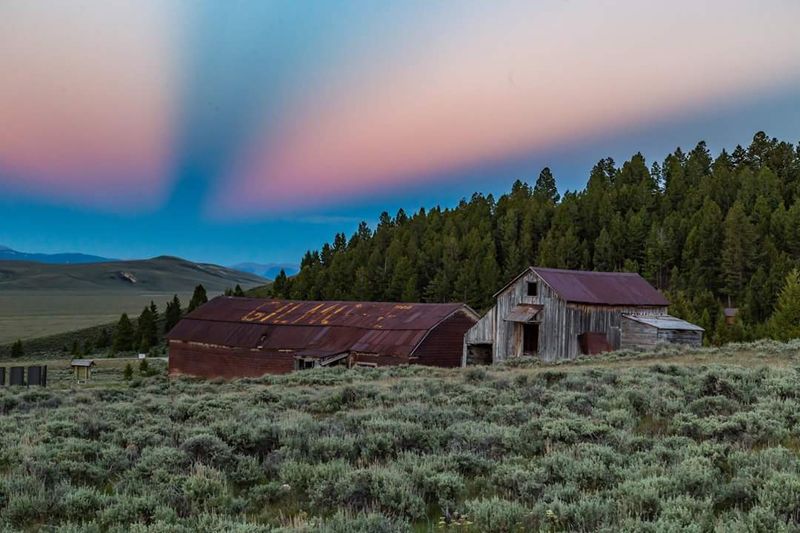
Vacant houses in the Lemhi Range mark a community supported by Idaho’s leading lead-silver operation outside the Coeur d’Alene region. Gilmore developed as outside capital expanded older claims, built processing facilities, and connected the remote district to markets by rail.
Around 500 residents lived there during its strongest period, while roughly 20,000 feet of tunnels and shafts extended beneath the surrounding slopes.
Production remained relatively steady until weaker demand and lower prices became widespread after 1919.
Operations recovered during the 1920s, but a 1929 power plant accident stopped major work. Restarting became impractical during the Great Depression, leaving the district with production exceeding $11 million.
Surviving homes and industrial remains still outline the former settlement, yet current safety information matters more than romantic descriptions of an empty town. The Forest Service and Idaho Department of Environmental Quality warn that soil and dust at and near Gilmore contain high levels of lead and arsenic.
Visitors should not dig, disturb soil, enter buildings, or allow children and pets to play on the ground. Pick up a current map from the Leadore Ranger Station and follow posted guidance.
Gilmore’s story remains visible, but responsible viewing means minimizing contact with the site itself.
7. Rocky Bar – Northeast Of Mountain Home
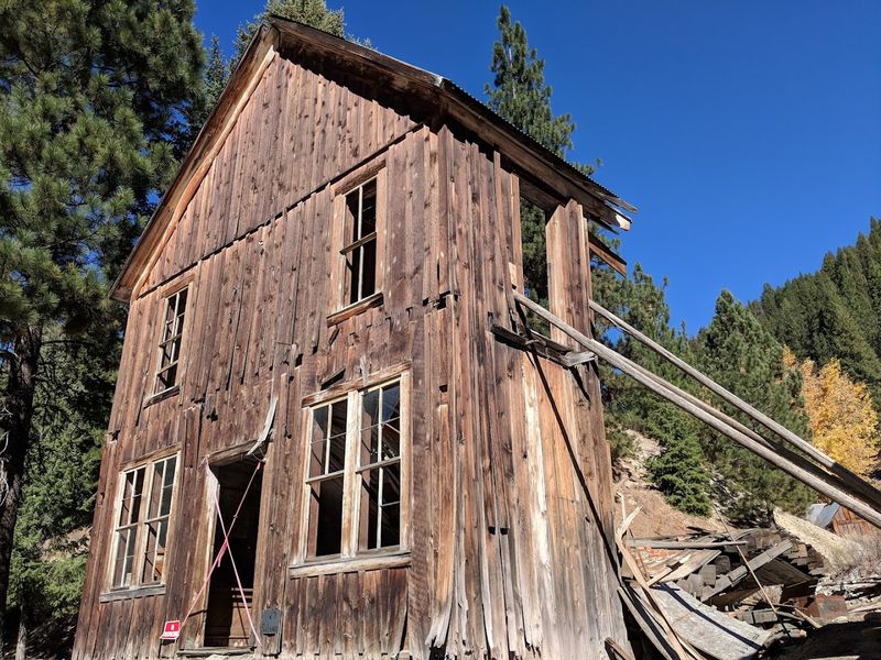
Mountain roads lead toward a settlement that competed with Boise for influence in southern Idaho. Rocky Bar formed after gold discoveries in 1863 and became a center for placer work, underground mining, trade, and government.
Local accounts placed the population near 1,000 during the strongest years, while stores, mills, homes, and offices filled the Boise River country.
The community served as the Alturas County seat from 1864 until 1882 and became Elmore County’s first seat after that county formed in 1889.
Declining production weakened the town, and a fire in 1892 removed much of its built environment. Structures were rebuilt, but Rocky Bar never returned to that scale.
One especially recognizable survivor is the building called the Masonic Hall and General Store, which later served several community purposes.
Remaining buildings and foundations are scattered rather than arranged as a polished attraction, and some properties may still be privately controlled or seasonally used.
Access roads can be rough, muddy, or blocked by snow, so local conditions should be checked from Mountain Home before departure. Stay outside closed structures and old mine openings.
Rocky Bar’s modest remains become more striking once you understand the population and political importance they once supported.
8. Florence – West Of Riggins, Idaho
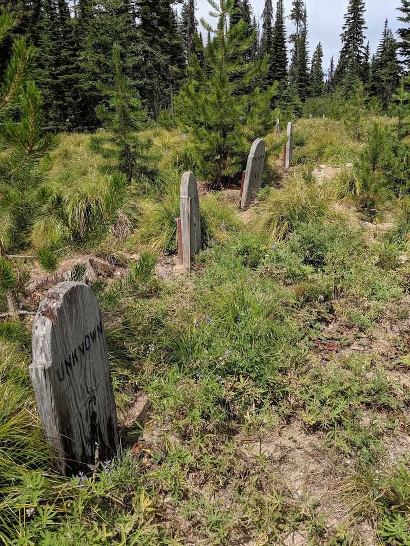
Forest growth has nearly erased the scale of Florence, where one of Idaho’s fastest mining booms unfolded after gold was discovered in August 1861.
Thousands reached the high basin within months, despite difficult trails, deep snow, and limited supplies.
Estimates place the population near 9,000 during the peak, while placer operations produced substantial gold before the richest accessible ground diminished. Many prospectors left quickly when claims failed to support them.
Chinese miners and a smaller remaining community continued working areas abandoned by earlier arrivals, extending the district’s productive life.
Quartz mining produced another period of activity during the 1890s, and lumber from older Florence buildings was reused in the later settlement often called New Florence.
That recycling helps explain why visitors now see cemeteries, foundations, shallow depressions, interpretive signs, and only limited structural remains. Nez Perce-Clearwater National Forest provides a self-guided historical brochure and a kiosk near the cemetery.
Roads beyond that point are narrow, unpaved, and unsuitable for recreational vehicles or low-clearance cars. Snow can persist until mid-June, while weather changes quickly at elevation.
Follow the mapped route, leave cemetery features untouched, and avoid crossing into the neighboring Gospel-Hump Wilderness with motorized or mechanized equipment during every visit.
9. White Knob – Near Mackay, Idaho
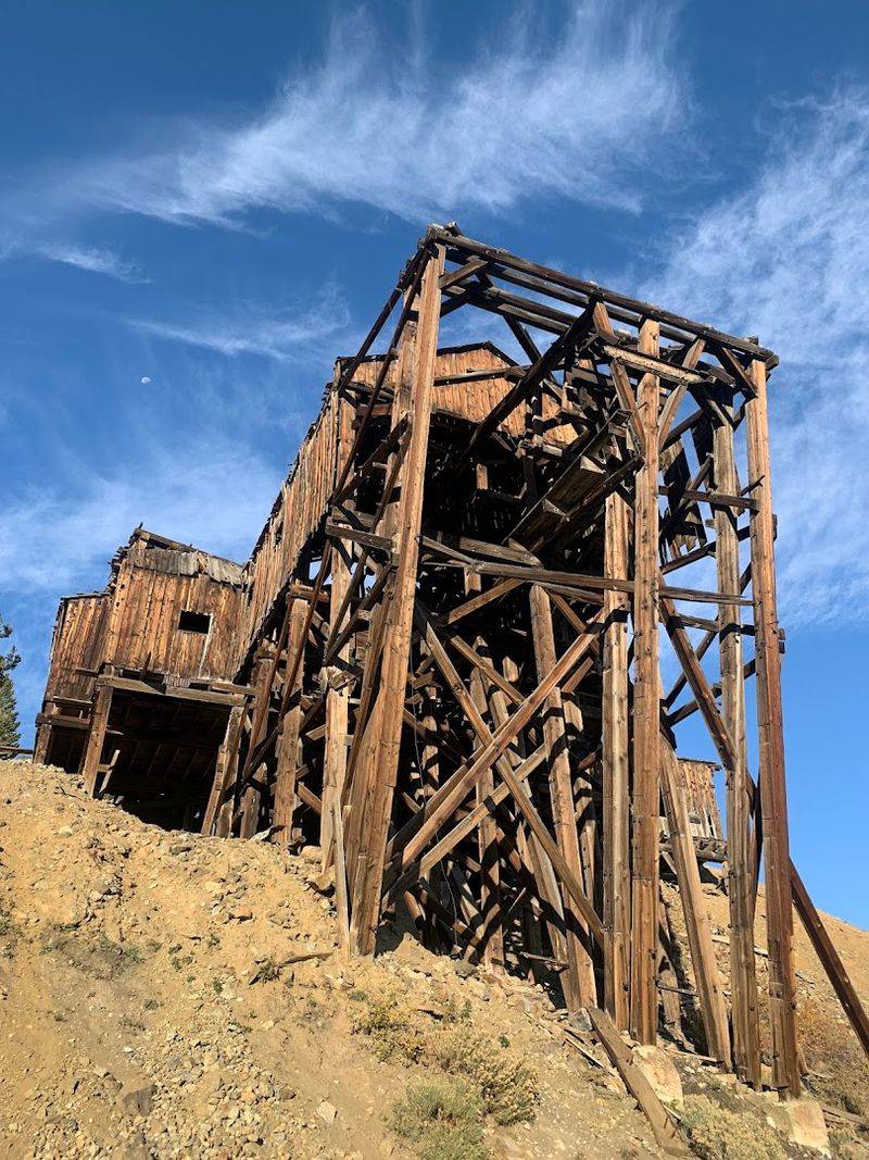
Rusting tramway towers above Mackay trace an industrial system that moved copper ore from White Knob toward processing and rail connections below.
Mining developed after discoveries in the Alder Creek district during the late nineteenth century, while the arrival of the Oregon Short Line branch in 1901 strengthened the operation.
Workers and families lived near the mines in a community that included homes, a school, stores, a post office, a movie house, and telephone service.
Population estimates reached nearly 1,000 before mining changes and Mackay’s growing importance drew residents downhill.
White Knob was abandoned by the mid-1930s. Today, its remains form part of the Mackay Mine Hill Tour, a self-guided route with interpretive stops covering the townsite, tramway headhouse, mine buildings, cabins, smelter areas, and reconstructed Shay railroad trestle.
Access varies by route and vehicle. BLM’s map notes that ongoing mining has removed some former stops from public access, while gates and temporary closures may alter others.
Motor homes, trailers, and street motorcycles are unsuitable for the tour. Pick up an updated map in Mackay, obey every gate, and remain on designated roads.
White Knob tells its story across an engineered mountainside rather than through one cluster of buildings.