These Wild California Trails Climb From Black-Sand Beaches To A 4,088-Foot Peak Along The Lost Coast
Start on the sand and keep looking uphill.
That dark shoreline may feel like the dramatic part, but the real surprise comes when the trail starts climbing away from the Pacific and refuses to stop.
One stretch keeps you close to the surf. Another pulls you into steep ridges where the ocean suddenly looks impossibly far below.
California hiking rarely feels this raw.
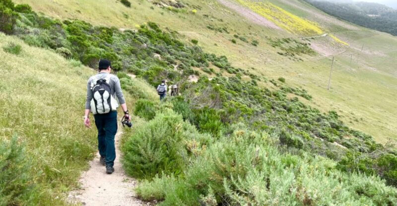
You will need to earn some of these views, so choose your route carefully. Tighten the laces. Check the weather. Bring more water than you think you need.
Black-sand beaches give way to forested slopes and high country that can carry you toward a 4,088-foot summit.
Pause when the coast opens up behind you. Turn around. That view is your reminder that you really did climb all the way from down there.
Hike The Famous Lost Coast Trail
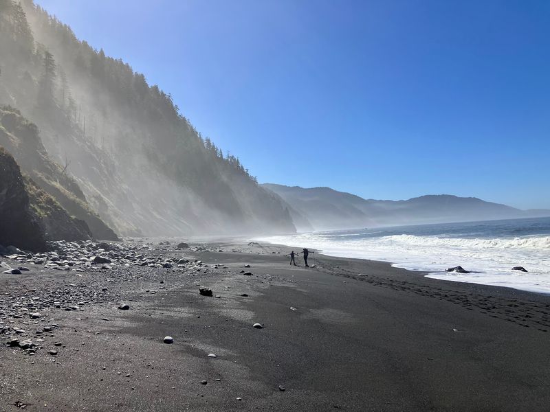
Stretching roughly 24.6 miles along one of the most isolated shorelines in California, the northern section of the Lost Coast Trail runs between Mattole Beach and Black Sands Beach.
Most hikers complete it in three days or more, and the terrain earns every bit of that time. Soft sand, bowling-ball-sized rocks, stream crossings, and occasional bushwhacking all show up along the route.
The trail stays close to the water for much of the journey, which means the scenery constantly shifts between crashing waves, steep bluffs, and open sky.
There are no paved roads nearby and no services along the way, so everything needed for the trip must come in on a hiker’s back.
Planning ahead matters enormously here. Wilderness permits are required for overnight use, and bear canisters are mandatory on the northern section due to active black bear presence.
The Bureau of Land Management manages the area and provides current condition reports that are well worth reading before any trip begins.
Climb Toward 4,088-Foot King Peak
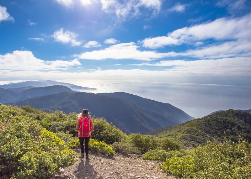
King Peak sits at 4,088 feet above sea level while being only about three miles from the Pacific Ocean, making its vertical rise one of the steepest coastal gradients found anywhere in the contiguous United States.
That dramatic compression of elevation into such a short horizontal distance gives the King Range its defining character and makes summit views genuinely striking.
Two primary routes lead toward the top. The Lightning Trail takes a steady grade through old-growth Douglas fir before opening into chaparral near the upper slopes.
The King Crest Trail offers a more gradual climb with panoramic ridge views along the way.
Snow can fall on King Peak a couple of times per year above approximately 3,281 feet, so checking seasonal conditions before choosing a summit date is a smart move.
The effort required to reach the top tends to reward hikers with sweeping views of the ocean and surrounding wilderness that are genuinely difficult to find anywhere else in the state.
Walk Across Black-Sand Beaches
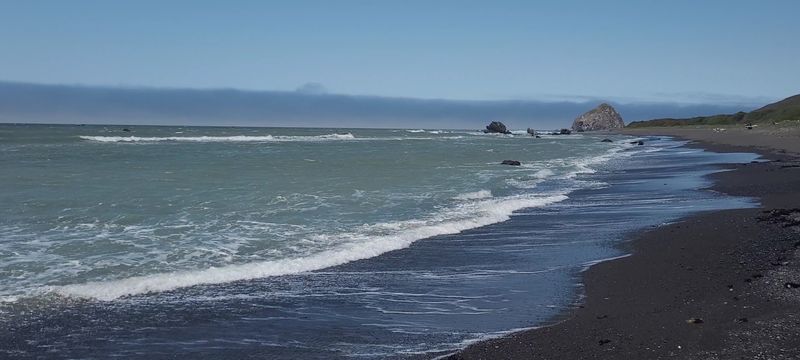
Black Sands Beach near Shelter Cove is one of the most visually distinct stretches of shoreline on the entire California coast.
The dark sand is actually a mix of fine gravel and eroded rock, giving the beach a texture that feels rougher and more raw than typical coastal sand.
Windswept Douglas fir trees crowd close to the waterline, framing the scene in a way that feels almost cinematic.
Sections of the Lost Coast Trail route hikers directly across this shoreline, meaning the trail surface shifts from gravel to sand to wave-battered coastal terrain without much warning.
Footing can be slow and tiring, especially over longer stretches where the ground gives underfoot with every step.
The dune systems in the King Range Wilderness also stand out for a specific ecological reason.
Unlike most coastal dunes north of San Francisco, the aggressive invasive European dune grass has not taken over here, leaving the natural dune landscape relatively intact.
That makes the beach environment noticeably different from many other Northern California coastal spots.
Follow Trails Where Highway 1 Could Not Go
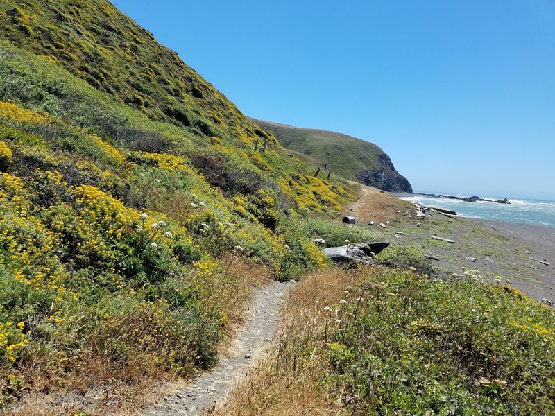
The terrain of the King Range proved too steep and unstable for highway construction, which forced both State Highway 1 and U.S. 101 to be routed far inland.
That engineering detour had a lasting consequence that turned out to be a gift for anyone who loves wild places. The coastline was left largely untouched by development, earning it the name the Lost Coast.
Today the Lost Coast is recognized as the longest undeveloped stretch of coastline in the lower 48 states.
The absence of a highway corridor means the only real way to experience this section of shoreline is on foot, which filters out casual traffic and keeps the trail system feeling genuinely remote.
Hikers who make the effort to reach these trails often describe a noticeable shift in atmosphere once the road noise fades away.
The combination of rugged mountains, open beach, and total absence of roadside infrastructure creates a trail experience that feels qualitatively different from most of coastal California.
Explore The Upland Wilderness Trails
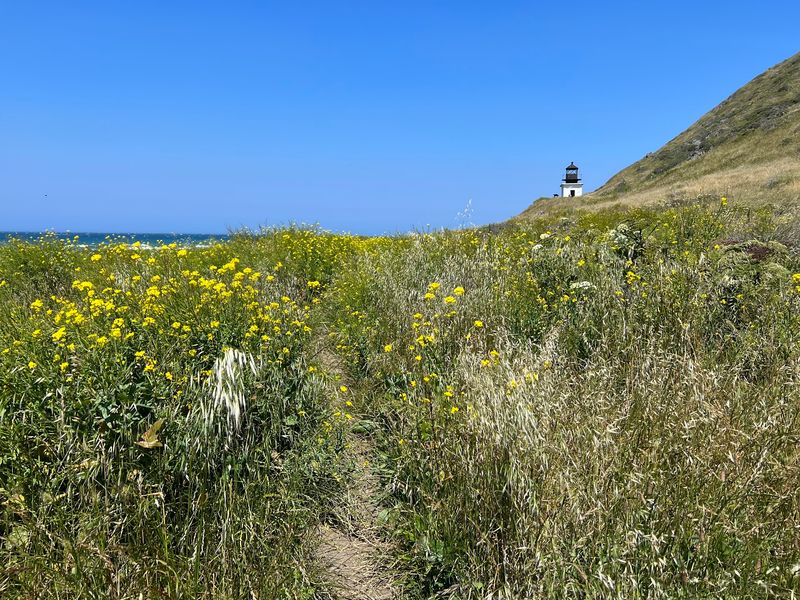
The shoreline gets most of the attention, but the King Range contains over 70 miles of hiking trails that extend well beyond the beach and into serious mountain terrain.
Upland routes climb through dense Douglas fir forests, cross drainages, and follow ridgelines with sweeping views of both the ocean and the interior mountains.
Most of these trails are strenuous.
Elevation changes in the King Range happen quickly, and the combination of steep grades and rough footing means that mileage alone does not tell the full story of how long a route will take.
Hikers comfortable on developed state park trails may find the adjustment to this kind of backcountry significant.
The Bureau of Land Management maintains the King Range as a wilderness setting, which means facilities are minimal and trail signing is sparse.
Carrying a detailed map and checking current condition reports before heading into the uplands is genuinely important here rather than just a precaution.
The King Crest Trail is one of the more accessible upland options and offers strong views as a reward for the climb.
Venture Onto Cooskie Creek Trail
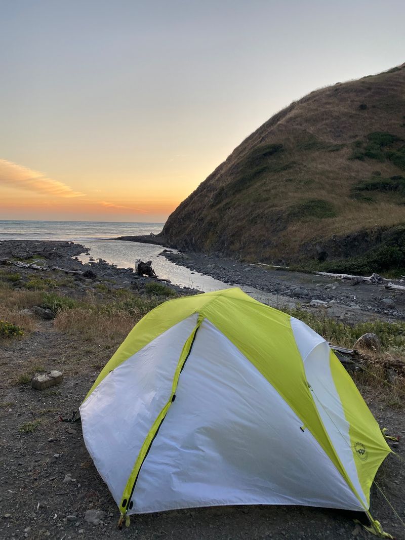
Cooskie Creek sits about 6.8 miles from the Mattole trailhead along the Lost Coast and serves as both a campsite and a junction point for one of the less-traveled upland routes in the King Range.
The full Cooskie Creek Trail connecting Punta Gorda to the Spanish Ridge Trailhead runs 12.8 miles and climbs roughly 2,400 feet while descending around 2,300 feet.
That elevation profile is not gentle, and the trail condition adds to the challenge.
The BLM lists Cooskie Creek among the routes where hikers should expect minimal signing and potentially difficult navigation.
Storm damage, downed trees, and landslides can complicate progress after heavy rain, and conditions along upland trails are not always updated quickly.
Choosing this route requires a different mindset than hiking a well-marked state park trail.
The roughness is part of what defines the experience here, and hikers who come in with solid navigation skills and realistic expectations tend to find it genuinely rewarding.
For those looking to get away from even the modest crowds of the Lost Coast shoreline, Cooskie Creek offers a step further into true wilderness.
Connect Trails Into Bigger Backcountry Loops
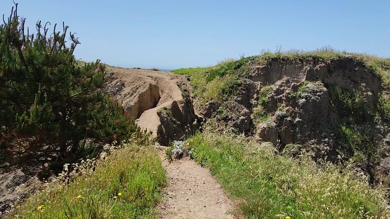
One of the underappreciated strengths of the King Range trail system is how well the individual routes connect into longer loop itineraries.
Connector trails make it possible to link the upland network with the coastal route, opening up multi-day trips that cover dramatically different terrain within a single wilderness area.
A popular loop of about 20.9 miles combines the King Crest, Rattlesnake Ridge, Lost Coast, and Buck Creek Trails while including a summit of King Peak.
For hikers looking for something even more ambitious, a 41-mile loop that joins Lost Coast and King Range trails climbs over 7,000 feet of total elevation gain across its full length.
Putting together these kinds of routes requires more planning than a simple out-and-back trip. Shuttle logistics, water sources, permit requirements, and tide windows all need to align before the first step.
But for hikers who enjoy the planning process as much as the hiking itself, the King Range offers enough variety to build genuinely custom wilderness experiences that feel nothing like a standard trail.
Watch Wildlife Along The Coast
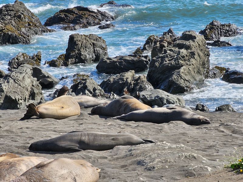
The Lost Coast Trail passes through habitat that supports a genuinely broad range of wildlife.
Sea lions and elephant seals haul out on rocky sections of the shoreline, while river otters, bobcats, black bears, deer, and peregrine falcons all use different parts of the King Range ecosystem.
Ravens are a constant presence along the coast.
Gray whales migrate along this section of shoreline from December through May, and spotting one from the beach requires nothing more than patience and a good vantage point on the bluffs.
Tide pools along the route hold anemones, hermit crabs, barnacles, and other marine life that reward a slow pace and a close look.
Spring brings wildflowers across the hillsides and bluffs, adding color to a landscape that can feel stark and grey during the wet season.
Because bears are active throughout the King Range, bear canisters are required for all overnight backpackers on the northern section of the Lost Coast Trail.
Keeping food stored correctly is not optional and helps protect both hikers and the wildlife that shares the area.
Reach Punta Gorda And Its Remote Lighthouse
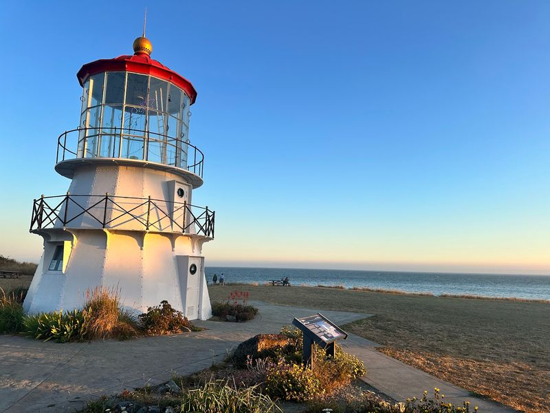
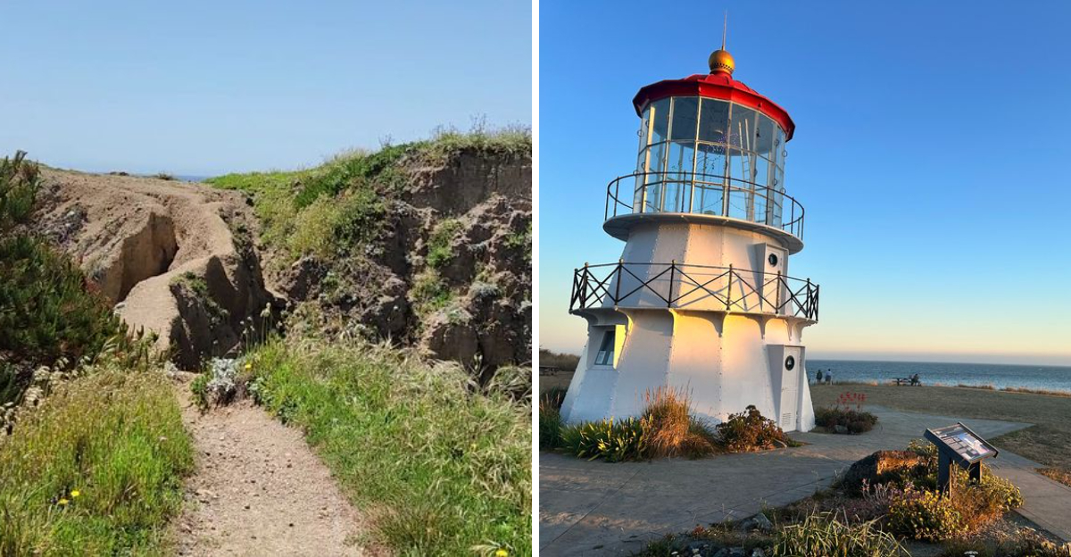
Built in 1912 and decommissioned in 1951, the Punta Gorda Lighthouse earned the nickname the Alcatraz of Lighthouses because of how difficult it was to supply and staff during its years of operation.
Reaching it today still requires effort: the lighthouse sits about four miles from the Mattole River Beach parking area, accessible only by walking along the beach.
The northern Lost Coast route passes through the Punta Gorda area, making the lighthouse a natural landmark along the way for backpackers heading south from Mattole.
For day hikers, the round trip from the parking area to the lighthouse and back covers roughly eight miles of coastal terrain and gives a solid taste of what the Lost Coast feels like without requiring an overnight permit.
Standing next to the old lighthouse on a stretch of coast with no road access in any direction tends to sharpen the sense of just how remote this place really is.
The structure itself is a weathered reminder of how difficult life along this coastline was for the people who once tried to maintain a permanent presence here before the wilderness eventually won.
Make The Journey To One Of California’s Most Remote Trail Systems
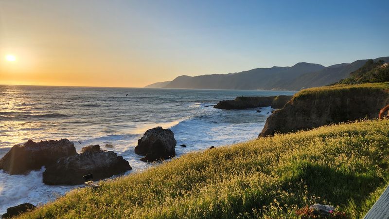
Getting to the King Range National Conservation Area is part of the experience.
Located about 230 miles north of San Francisco, the area is reached via narrow, steep, and winding roads that demand full attention from any driver.
The BLM office at 768 Shelter Cove Rd, Whitethorn, CA 95589 serves as a practical first stop for maps, permit information, and current road conditions before heading deeper into the range.
Some primitive roads like Smith-Etter Road and King Range Road require high clearance and four-wheel drive, and certain routes close seasonally due to slide risk during winter months.
Road access conditions should be confirmed before any trip, especially for shoulder-season visits when conditions can change fast.
The Lost Coast also holds the distinction of being one of the wettest sections of California coastline, with average annual rainfall around 100 inches.
That rainfall feeds the dense forests and keeps the rivers running, but it also means that late fall and winter visits require serious rain gear and a flexible attitude toward conditions.
The payoff for making the journey is a trail network where ocean, forest, and mountain terrain meet with almost no development between them.