2026 Nebraska Bucket List Hikes With Stunning Views And No Hiking Permit Required
Pick a trail, lace up, and go.
No special hiking permit. No complicated approval process. Just a good pair of shoes, enough water, and a willingness to see a side of Nebraska that does not always make the postcards.
That is where these hikes come in.
You may find yourself climbing wooded bluffs, crossing open prairie, following river valleys, or stopping at an overlook that makes the state feel much bigger than expected.
Some routes are easy enough for a relaxed morning. Others ask a little more from your legs before handing over the view.
Do not rush the good sections. Stop when the landscape opens up. Take the photo. Sit for a minute. Let the wind do whatever it wants with your hair.
These 2026 bucket list hikes are about getting outside without turning the whole experience into a logistical project.
Choose the trail that fits your mood, then see where your feet take you.
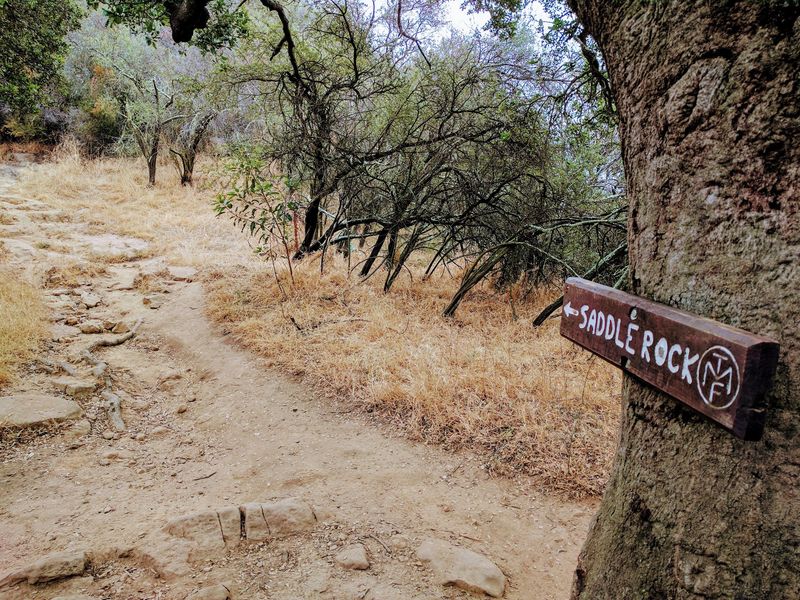
1. Saddle Rock Trail, Scotts Bluff National Monument, Gering
Standing at the base of Scotts Bluff and looking upward, the scale of the landscape becomes immediately clear.
The monument is located at 190276 Old Oregon Trail, Gering, NE 69341, and entry is free with no reservation or park pass required.
The Saddle Rock Trail is roughly 4.1 miles long and gains about 435 feet in elevation as it winds through the heart of the bluff country.
Hikers pass Scotts Spring early on the route before moving through a tunnel carved into the rock, which adds a genuinely memorable moment to the climb.
From there, the trail continues via switchbacks toward the summit, where wide views open across the North Platte Valley. On clear days the visibility stretches for miles, making the effort feel well worth it.
Some sections of the trail have softer, crumbly rock underfoot, so staying on the marked path matters for both safety and trail preservation.
The trail includes a mix of paved and unpaved surfaces, which keeps the terrain varied throughout the hike.
The monument is open daily from sunrise to sunset year-round, giving visitors plenty of flexibility to plan around weather and daylight.
2. South Bluff Backcountry Hike, Scotts Bluff National Monument, Gering
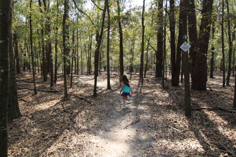
Not every hiker wants a well-marked trail with gentle grades, and the South Bluff Backcountry Hike at Scotts Bluff National Monument exists for exactly that reason.
The monument grounds at 190276 Old Oregon Trail, Gering, NE 69341 are open daily from sunrise to sunset, and no activity fee or reservation is required for this backcountry option.
With roughly 3,000 acres of terrain to explore, the South Bluff area offers a noticeably wilder experience than the main Saddle Rock corridor.
Expect steep inclines, loose rock underfoot, and terrain that demands real attention with every step.
The reward for navigating those conditions is a set of elevated views that feel genuinely earned, with broad panoramas visible from the South Overlook at the summit.
The surrounding badlands stretch out in textured layers of tan, gray, and rust-colored rock that shift in appearance depending on the light.
Visitors interested in tackling this route are encouraged to check in at the visitor center beforehand for current trail conditions and any specific guidance about the South Bluff area.
Proper footwear with ankle support is strongly recommended given the loose and uneven surface. The backcountry experience here suits hikers comfortable with route-finding and uneven terrain.
3. Cowboy Trail at Valentine, Valentine
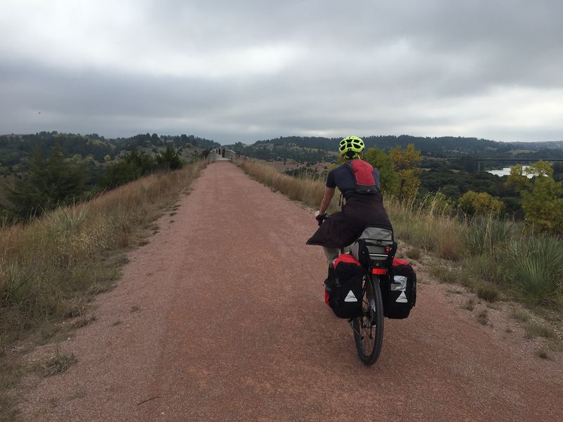
The stretch of the Cowboy Trail near Valentine carries a distinct sense of history, tracing the path of a former railroad line through some of the most scenic terrain in northern Nebraska.
Access to this segment is free for day use, with the trail open from half an hour before sunrise to half an hour after sunset.
No permit is needed to walk this section, and parking is available near 109 East 1st Street in Valentine, NE.
The undeniable highlight here is the towering former railroad bridge spanning the Niobrara River.
The structure rises approximately 148 to 150 feet above the water and stretches for roughly a quarter-mile, creating a crossing that feels genuinely dramatic when standing on it.
The Niobrara River holds National Scenic River designation, which speaks to the quality of the landscape visible from the bridge.
Much of the trail surface in this area consists of crushed limestone, which provides a firm and walkable path through the countryside. Sections passing through town may transition to concrete.
The surrounding terrain includes cedar-covered hills and open grassland, giving the hike a layered visual experience beyond just the bridge itself. Early morning visits tend to offer quieter conditions and softer light across the valley.
4. Cowboy Trail at Long Pine, Long Pine
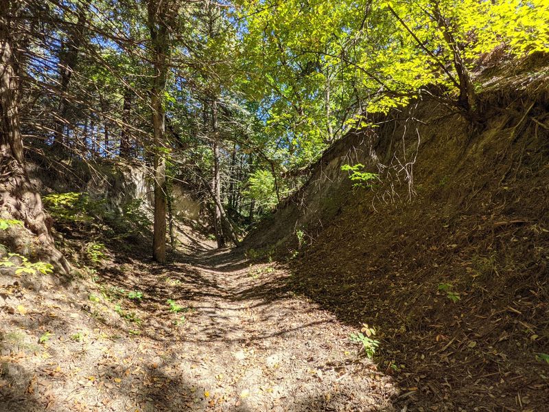
A bridge crossing 595 feet long and standing roughly 145 feet above Long Pine Creek is not something most people expect to find in Nebraska, but the Cowboy Trail near Long Pine delivers exactly that.
The trail is open daily from half an hour before sunrise to half an hour after sunset, and no permit or fee is required for day use.
The creek canyon below the bridge adds real depth to the crossing, with the water cutting through rock and vegetation far below the trail surface.
Surrounding terrain includes the gently rolling grass-covered dunes of the Nebraska Sandhills, a landscape that has a quiet, almost meditative quality to it.
The combination of canyon views directly below and open prairie stretching in every direction creates a contrast that makes this section memorable.
The Long Pine State Recreation Area, located about one mile north and one mile west of U.S. Highway 20 in Long Pine, offers nearby access to additional natural features in the area.
Hikers who want to extend their time outdoors can combine the trail crossing with a visit to the recreation area.
The pacing here tends to be relaxed, making it a good fit for hikers of varying experience levels.
5. Cowboy Trail at O’Neill, O’Neill
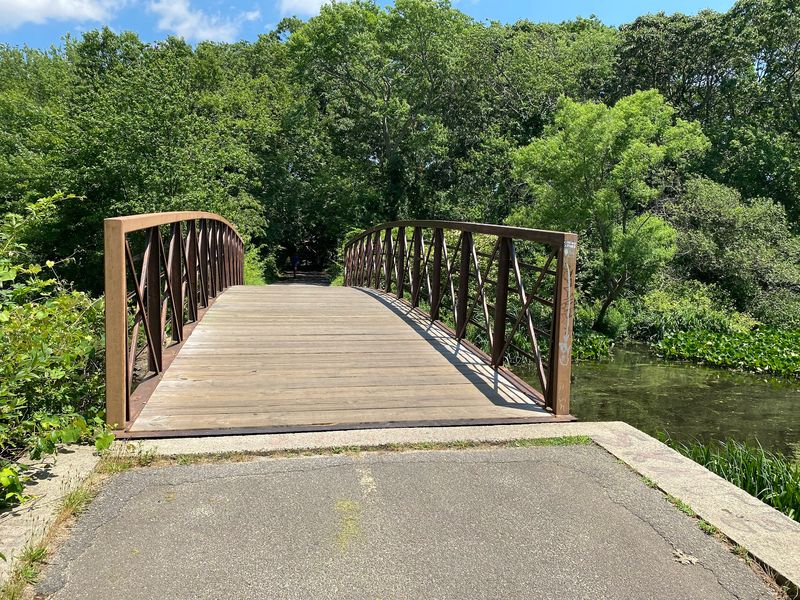
Rolling into O’Neill, the Cowboy Trail shifts in character, offering a smooth and easy-access section that works well for hikers who want a straightforward outing without technical terrain.
Day use is free and no permit is required, with the trail open from half an hour before sunrise to half an hour after sunset.
A trailhead is conveniently located near the Old Historic Railroad Depot in O’Neill, and parking is available at 330 East Hancock Street, O’Neill, NE.
The surface through town is concrete, giving walkers a clean and even path as they move through the community.
Once past the town limits heading west, the trail transitions to crushed limestone, which is the standard surface across the rural stretches of this 195-mile-plus rail-trail.
The scenery shifts accordingly, with ranchland, hay fields, and patches of native prairie opening up on either side.
This segment sits near mile marker 75 on the Cowboy Trail, placing it in the middle of the route’s broader journey across northern Nebraska.
The flat terrain and accessible surface make this section approachable for families and casual hikers.
Traveling through here on a weekday tends to be quieter, with fewer other trail users and a more relaxed pace to the experience.
6. Lied Platte River Bridge Trail, South Bend
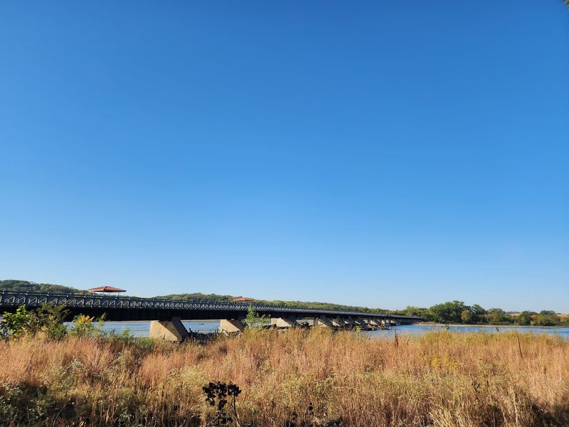
Converted from a former railroad crossing into a public recreational trail, the Lied Platte River Bridge near South Bend offers a genuinely open-air walk above one of Nebraska’s most iconic rivers.
The bridge spans 1,714 feet and has been updated with a 14-foot-wide concrete trail surface, complete with railings and designated viewing platforms along the way.
No permit is required to access the trail, and the crossing is free for public use.
The views from the bridge stretch across the wide, shallow expanse of the Platte River and into the surrounding wetland and grassland landscape.
The area is known for wildlife activity, and the elevated vantage point from the bridge can offer sightings of birds and other animals moving through the river corridor below.
Fishing is also a draw for visitors who want to spend extra time near the water after completing the crossing.
The trail connects shorter paths on both sides of the river, creating about 1.5 miles of accessible pathway between the north and south parking areas.
Parking on the south side is available at the trailhead on 328th Street, roughly half a mile south of South Bend, NE, with additional parking off Highway 66 to the south and Highway 31 to the north.
Morning light across the river tends to be especially clear and calm.
7. Toadstool Geologic Park Trail, Near Crawford
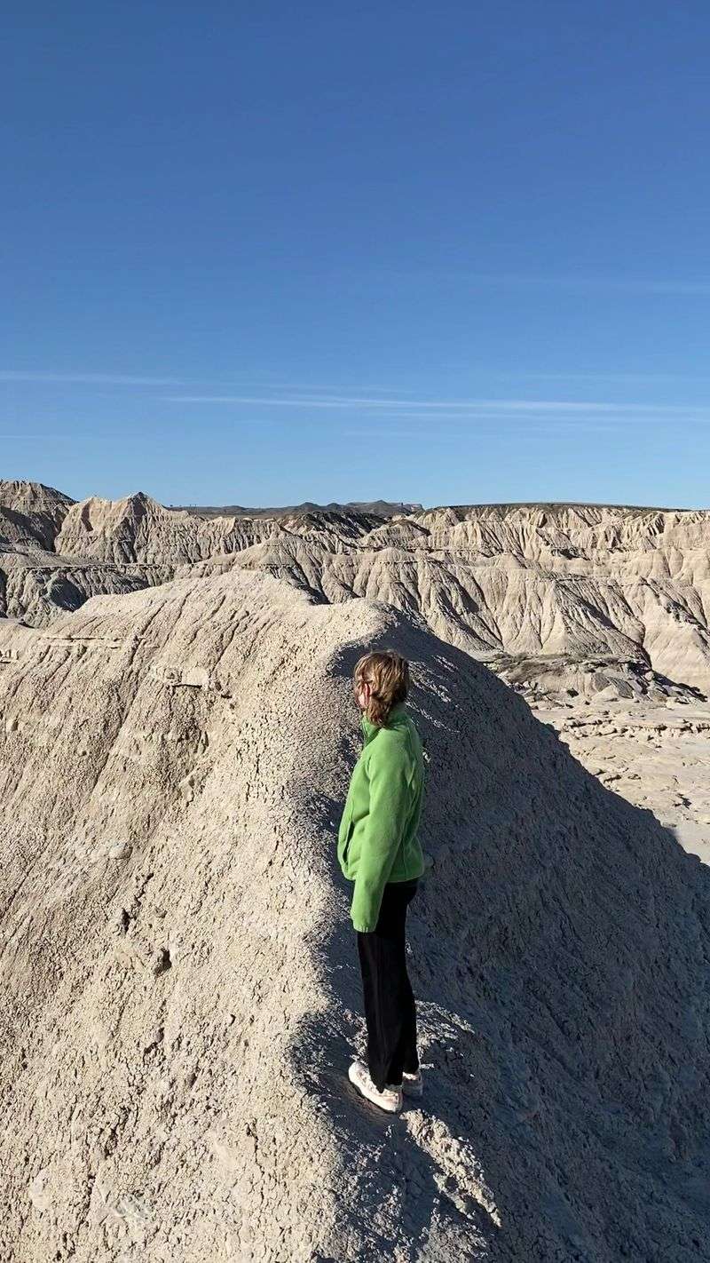
Nowhere else in Nebraska looks quite like Toadstool Geologic Park, where the landscape has been slowly carved by erosion into a series of strange and striking formations that feel genuinely out of place on the Great Plains.
Entry to the park is free, no permit is required, and the area is generally open year-round for visitors to explore at their own pace.
The park is managed by the Oglala National Grassland and sits in the northwestern corner of the state near Crawford.
The signature formations are the mushroom-shaped rock pedestals, created when harder capstone layers protect softer sediment beneath from erosion, leaving elevated columns topped with wider rock caps.
Walking among them gives a strong sense of geological time, especially knowing the terrain is also rich with fossils from ancient ecosystems that existed millions of years ago.
The pale, chalky soil and layered rock walls create a color palette unlike anything found on the surrounding grasslands.
A one-mile loop trail guides hikers through the most visually striking features of the park, making the experience accessible without requiring a full day of effort.
The compact size of the trail also makes it easy to slow down, look closely at the formations, and take in details that a longer hike might rush past.
Visiting during late afternoon can bring out warm tones in the rock that shift the whole mood of the landscape.
8. Roberts Loop Trail, Pine Ridge National Recreation Area, Near Chadron
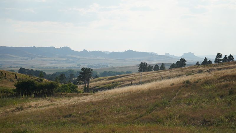
Nebraska suddenly looks much more mountainous around the Pine Ridge National Recreation Area, where ponderosa pines, rocky ridges, and deep canyons replace the flatter scenery many travelers expect.
The Roberts Loop Trail offers an approachable way to experience this landscape without committing to an especially long hike.
The 2.5-mile loop begins at the Roberts Tract Campground and Trailhead southwest of Chadron and provides direct access to the larger Pine Ridge Trail system. No hiking permit is required to explore the route.
The landscape changes noticeably along the way. Open grassland gives way to pine-covered slopes, while higher stretches provide broader views across the rugged Pine Ridge country.
The surrounding trail system also passes creek bottoms, canyons, and open ridges with views toward nearby buttes.
Hikers who want a longer outing can continue onto the Pine Ridge Trail rather than completing only the loop.
The trail system is open to hikers, mountain bikers, and horseback riders, while motorized vehicles are prohibited on the Pine Ridge Trail itself.
Facilities are limited once you leave the trailhead area, so carrying plenty of water is important.
The relatively short loop makes this a strong final addition to the list, delivering scenery that feels surprisingly wild for Nebraska.