This Maryland Battlefield Preserves The Story Of A Major Civil War Battle
History clicked differently for me once I realized how much a battlefield landscape can explain without saying anything.
Western Maryland preserves one especially important place where September 1862 becomes easier to understand simply by walking the ground.
The fields remain open, historic landmarks anchor the story, and a driving route connects major points across the battlefield.
Trails let you slow things down even further. That is how I would see it.
Park the car occasionally, walk, read, then look back across the terrain you just learned about. An observation tower adds another perspective.
Give this place more than a quick stop, and those familiar Civil War names and dates start connecting to real distances.
Where History Meets Farmland
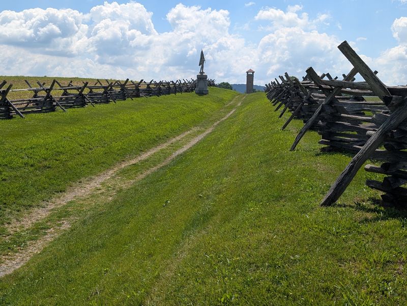
My first look came from the hill behind the visitor center, and the view stopped me mid-sentence. Fields roll out in long green waves, broken by split-rail fences and rows of silent cannons.
Very little modern clutter interrupts the scene, which is exactly the point. The National Park Service and partner groups have worked for decades to keep this land close to its 1862 appearance.
Roughly 3,000 acres of Maryland countryside sit open and accessible here. Antietam Creek still curls through the property, shaded by trees and crossed by old stone arches.
Because the terrain survived, you can actually read the battle in the land itself. Ridges, hollows, and cornfields explain why soldiers moved the way they did.
Photographers love the early light, when mist hangs low over the creek bottom. Birders love it too, since blue jays, cardinals, and orioles are frequent company.
The visitor center that anchors the whole experience sits at 302 E Main St, Sharpsburg.
One Day That Changed Everything
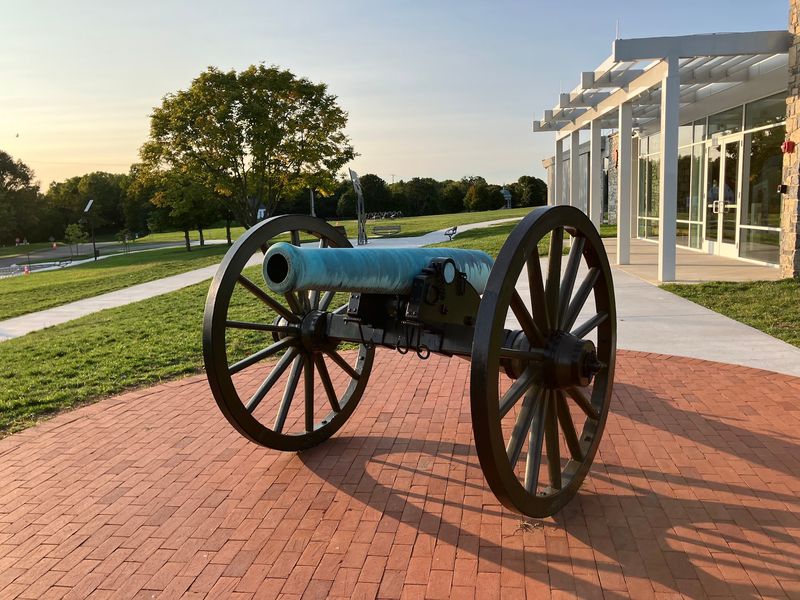
Twelve hours of fighting on September 17, 1862 turned these quiet farms into the most costly single day in American military history. Roughly 23,000 soldiers were counted as killed, wounded, or missing when the sun finally set.
Confederate General Robert E. Lee had pushed north for the first time, and the Union Army of the Potomac under General George B. McClellan met him near Sharpsburg.
Neither side won a clean tactical victory on the field.
Strategically, though, the outcome mattered enormously. Lee’s advance was halted and his army withdrew back across the Potomac.
President Abraham Lincoln used that moment to issue the preliminary Emancipation Proclamation. With one document, the war’s purpose expanded beyond preserving the Union to ending slavery.
Great Britain and France, both weighing recognition of the Confederacy, backed away from intervening. That diplomatic ripple reached far past these Maryland fields.
Locals also call it the Battle of Sharpsburg, a reminder that Southern accounts often named battles after towns. Union reports usually chose the nearest waterway instead.
Starting Inside The Visitor Center
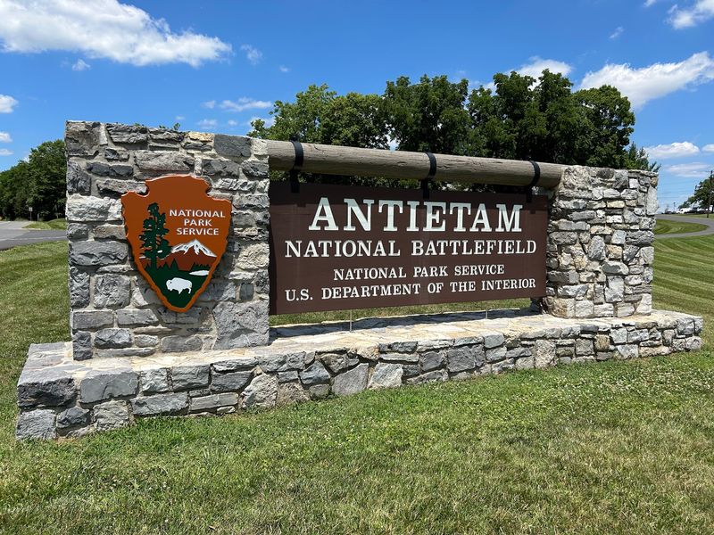
Skip the visitor center and you will spend the day guessing. I walked in, grabbed a free map, and watched the introductory film before touching a single trail.
The movie runs about 25 to 30 minutes and lays out the day’s fighting in plain, clear order. By the end I could name the cornfield, the sunken road, and the bridge without hesitating.
Two exhibit rooms hold maps, artifacts, and displays that explain troop movements. Some items have rotated out of view during building repairs, so check ahead if a specific exhibit matters to you.
Upstairs there is an observation room with wide windows facing the fields. That vantage point made an excellent first orientation, and the photos came out great.
Rangers behind the desk answer questions with real depth, and volunteers are equally generous with their time. I asked about a single regiment and got a five-minute answer.
Doors open at 9 AM and close at 5 PM daily, while the grounds stay open until shortly after sunset. Restrooms, the bookstore, and passport stamps are all inside.
Antietam National Battlefield rewards visitors who begin here rather than wandering in cold.
Driving The Eleven Stops
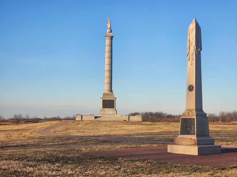
Eight and a half miles does not sound like much until you stop at every marker. The self-guided auto tour loops through the park with eleven numbered stops, each one covering a specific piece of the fighting.
Interpretive signs and audio segments explain what happened on that exact patch of ground. I kept the park map on my lap and traced the route as I went.
Traffic moves slowly, roads are easy to follow, and parking areas sit right beside each stop. Crowds stayed light even on a pleasant weekend afternoon.
My favorite trick was pairing driving with short walks. Park, stroll two hundred yards, read a marker, then continue.
The observation tower along the route closes at 5 PM, so hit it before then. Climbing those stairs gave me the clearest overhead sense of the whole field.
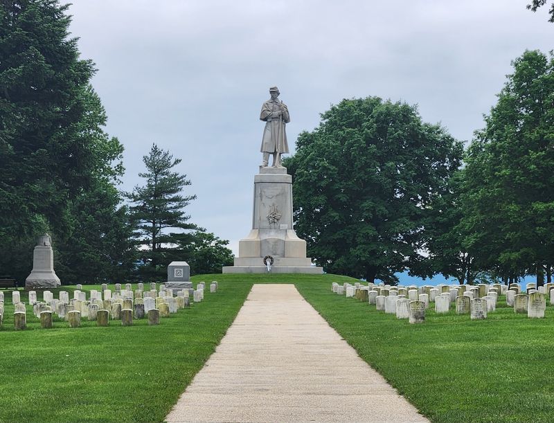
The national cemetery serves as the final stop, and it is a fitting, quiet finish. Rows of headstones stretch under old shade trees.
Casual visitors can finish in about three hours. History enthusiasts should plan on a full day, or honestly, two.
Bloody Lane And Dunker Church
A plain white building with dark shutters became one of the most important landmarks on the field. Dunker Church sat at the center of the morning’s brutal fighting in the northern sector.
Both armies used it as a reference point while battle lines surged back and forth. Rebuilt on its original foundation, it still stops visitors in their tracks.
Around the back of the church, sharp eyes can find a hand-carved message on original window glass. Small details like that thrilled me more than any grand monument.
Farther south runs the Sunken Road, later called Bloody Lane. Confederate troops held this natural trench for hours while Union soldiers pressed forward again and again.
More than 5,000 men fell along that short stretch of farm path. Walking it slowly, with the tower rising ahead, was the most sobering part of my visit.
Nearby, the cornfield saw fighting so intense the stalks were cut down to stubble. Signs mark the shifting lines across that infamous acreage. Treat these spots as places for reflection rather than photo ops.
Burnside Bridge Stone Arches
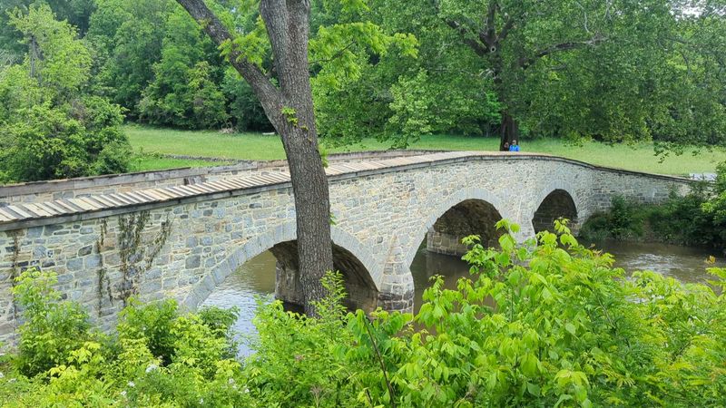
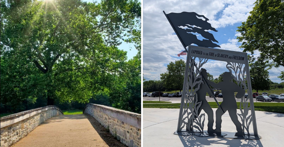
Photographers save their memory cards for this one. Burnside Bridge crosses Antietam Creek with three graceful stone arches, framed by enormous old sycamores.
Confederate riflemen on the wooded bluff above held off Union General Ambrose Burnside’s troops for hours. A narrow crossing became one of the day’s hardest objectives.
Standing on the bridge, I looked up at that slope and understood the problem immediately. Attackers had nowhere to hide.
The setting is peaceful now, with water sliding over rocks and birds chattering overhead. Benches and shaded paths make it a pleasant place to linger.
Snavely Ford Trail begins nearby and runs close to two miles along the creek. It was the prettiest walk I took all day, quiet and mostly level.
Bring bug spray in warm months, since the creek bottom attracts mosquitoes. Water and sturdy shoes are smart additions too.
Regimental and state monuments dot the surrounding fields, most placed by Union veterans and their states. Each one records a unit’s part in the fight.
Trails, Birds And Fresh Air
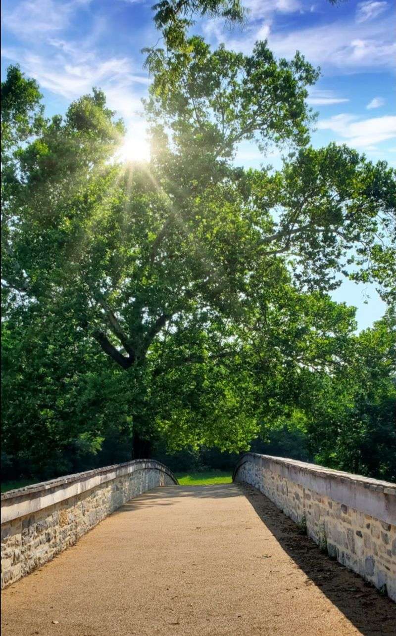
Runners and cyclists have quietly claimed these roads, and I understand why. Long views, low traffic, and gentle grades make the park a joy on foot or two wheels.
Several marked trails branch off the main route. A one-mile family loop shares stories of the farms that stood here, with signs written for younger visitors.
Kids can pick up Junior Ranger materials at the desk and work through activities as they explore. My advice is to let them lead one trail themselves.
Wildlife shows up constantly. Groundhogs bolt through the grass, deer graze at dusk, and hawks circle above the ridges.
Here is a fun bit of trivia. Volunteers from the Maryland Ornithological Society have monitored bluebird nest boxes here since the 1970s, forming one of the longest bluebird trails around.
Cardinals, blue jays, and the occasional Baltimore Oriole flash through the fence lines. I kept binoculars in my daypack and never regretted it.
A small shop just outside the park sells snacks, which makes picnicking easy. Plenty of shaded spots invite a slow lunch.
Practical Tips Before You Go
A little planning turns a decent visit into an excellent one. Entrance passes are sold at the front desk, and an America the Beautiful pass covers admission if you already own one.
Grounds stay open until about ten minutes after sunset, while the visitor center runs 9 AM to 5 PM every day of the week. Arriving by early afternoon leaves room for the film, the museum, and the full driving loop. Occasional staffing or maintenance issues can affect building access.
Pack water, snacks, sunscreen, and insect repellent, especially between May and September. Shade is limited across the open fields.
Comfortable shoes matter more than anything else you bring. Grass paths and gravel lanes cover a lot of ground.
Cell coverage works in most spots, though I recommend the paper map anyway. Signs use compass directions, which are easier to follow with a map in hand.
Nearby Hagerstown and Sharpsburg offer lodging and meals within a short drive across western Maryland. Give yourself time, stay respectful, and this place will reward every hour you spend.