Here’s What We Found After Exploring This Idaho Rail Trail
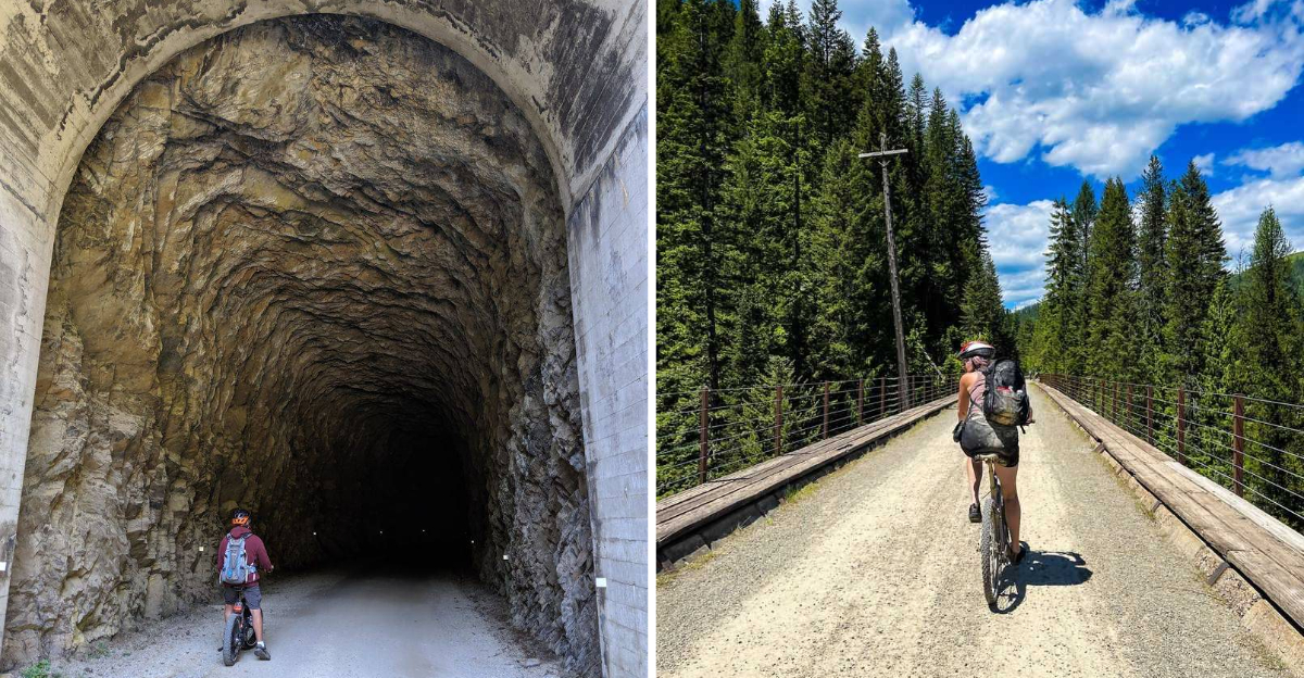
Would you believe me if I told you the most exciting part of this bike ride happens underground?
Idaho has a rail trail where riders coast through long tunnels, cross towering trestles, and barely notice how many miles are disappearing.
The route follows an old railroad grade, so history keeps popping up between stretches of mountain scenery. Then comes the tunnel experience, complete with darkness, headlights, and one seriously memorable exit back into daylight.
The mostly downhill ride adds to the appeal, especially for groups with different experience levels.
By the time the shuttle enters the picture, this feels less like exercise and more like a full afternoon adventure on two wheels.
Where The Adventure Actually Begins
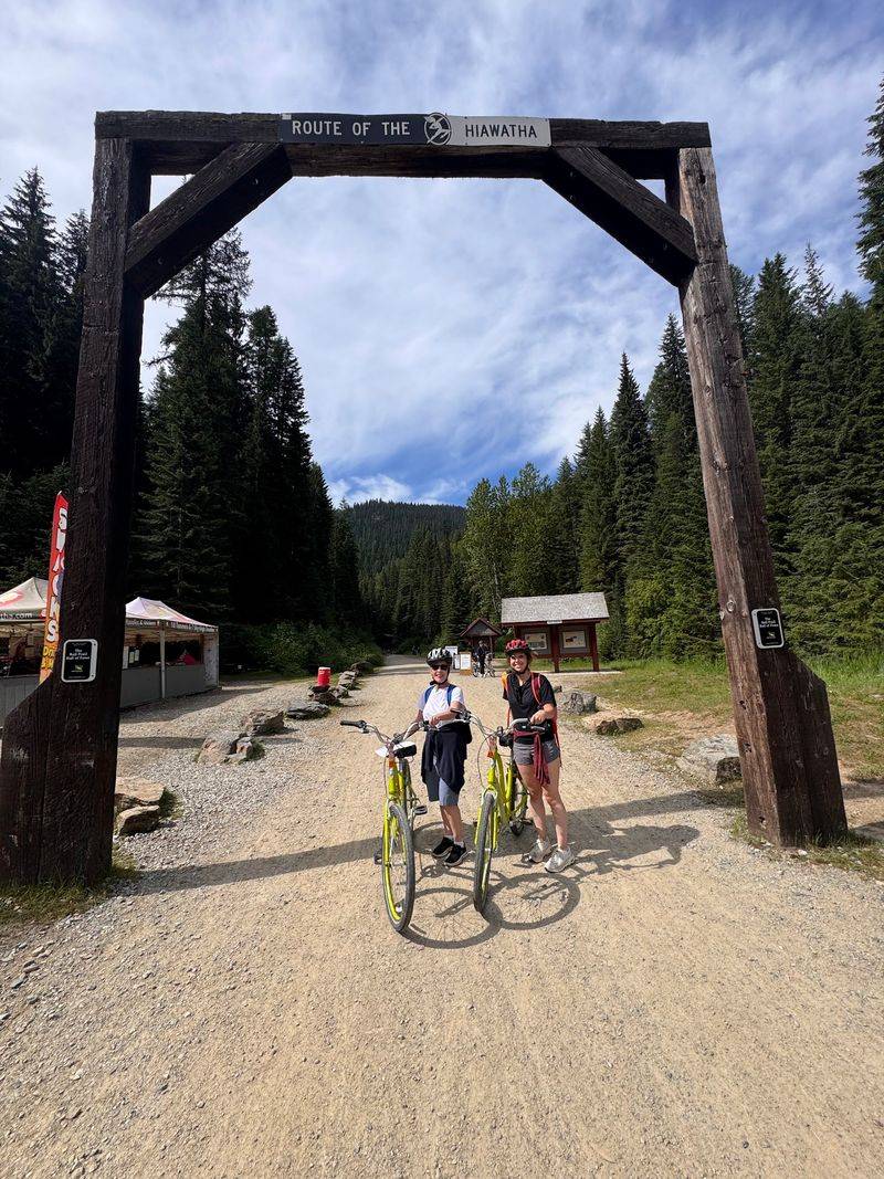
My morning started at Lookout Pass Ski Area, not at the trail itself. That is where passes, rentals, helmets and lights get sorted before anyone touches a pedal.
Staff handed over a map and explained the layout in about four minutes. Most riders then drive to the East Portal, where the famous long tunnel swallows the path.
Parking felt busy by mid-morning, so arriving early made everything smoother. Volunteers directed cars, which helped on a day with heavy traffic.
The Hiawatha Mountain Bike Trail sits inside the Idaho Panhandle National Forests, tucked in the Silver Valley. Cell service disappears quickly, so download directions before leaving town.
Restrooms exist at the start and near the halfway point, though they are basic. Plan accordingly and carry hand sanitizer.
Booking online at least a day ahead saved money and time. Walk-up availability during peak weekends can vanish fast. Bikes with wider tires handled the packed gravel best. Road tires would fight the surface the entire way.
You will find the trail listed at 1-90 I-90, Mullan, ID 83846, though check-in happens at Lookout Pass first.
Riding Through The Taft Tunnel
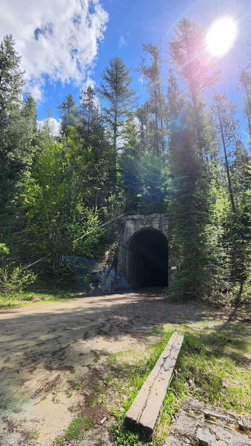
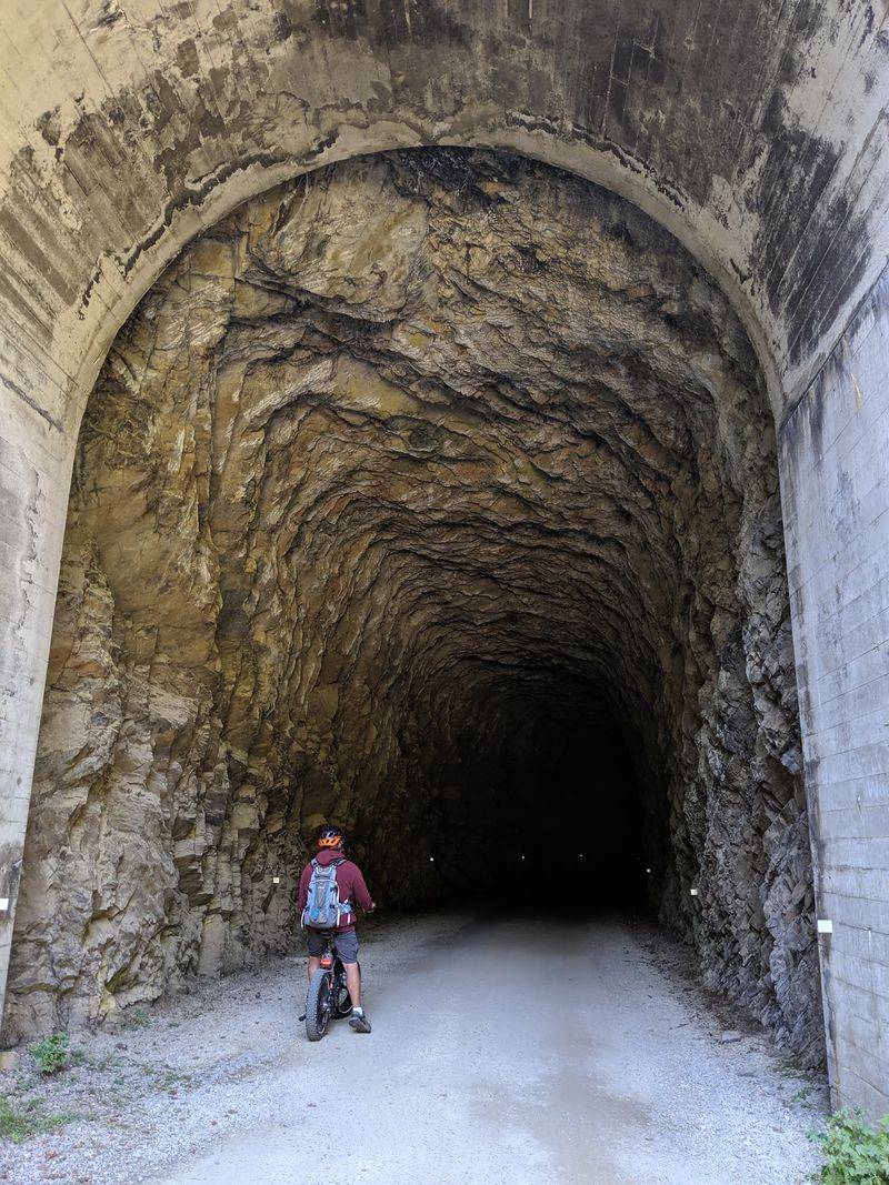
Nothing prepares you for the first hundred yards inside the St. Paul Pass Tunnel. Daylight vanishes, the temperature drops, and your headlight becomes your best friend.
Locals call it the Taft Tunnel. It runs 1.66 miles beneath the Idaho and Montana state line.
Inside, the average temperature hovers near 47 degrees Fahrenheit all summer. My arms had goosebumps within seconds.
Water drips from the ceiling and puddles sit across the gravel floor. Riding fast means a mud stripe up your back, which I earned proudly.
Bring a second light. The rental lights work, but a brighter headlamp turns nervous pedaling into confident cruising.
Sound behaves strangely in there. Voices bounce, tires hum, and kids shriek with delight at the echoes. Rain ponchos are a clever trick some riders use. They keep clothes cleaner without adding bulk.
Nine of the ten tunnels along the route are open to riders. Each one has its own personality, though none match the drama of the first.
Seven Trestles Above The Canyons
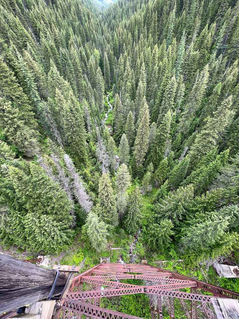
Standing on a trestle taller than the treetops rearranges your sense of scale. I stopped on three of them just to stare.
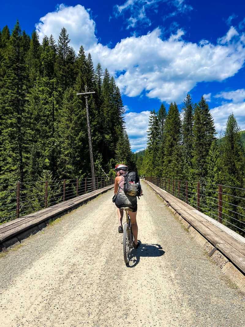
Seven trestle bridges span the canyons along this fifteen-mile route. Some rise as high as 230 feet above the ground.
Loop Creek Trestle stands out as the showstopper. The curve of the steel against the green canyon walls made for my favorite photo of the day.
Guardrails line every bridge, but they are not built for leaning. Keep children close and hands on handlebars.
Wind picks up in the open spans, which feels refreshing after the chilly tunnels. Warm sun on damp sleeves is a fine reward.
Riders naturally slow down here, creating little traffic clusters. Pull to the side if you want a longer look.
The alternating rhythm of dark tunnel, bright trestle, forest corridor keeps the miles from blurring together. Boredom never got a chance.
Below the bridges, creeks tumble over rocks and waterfalls appear without warning. One sits near the west portal of the big tunnel.
The Downhill That Barely Needs Pedaling
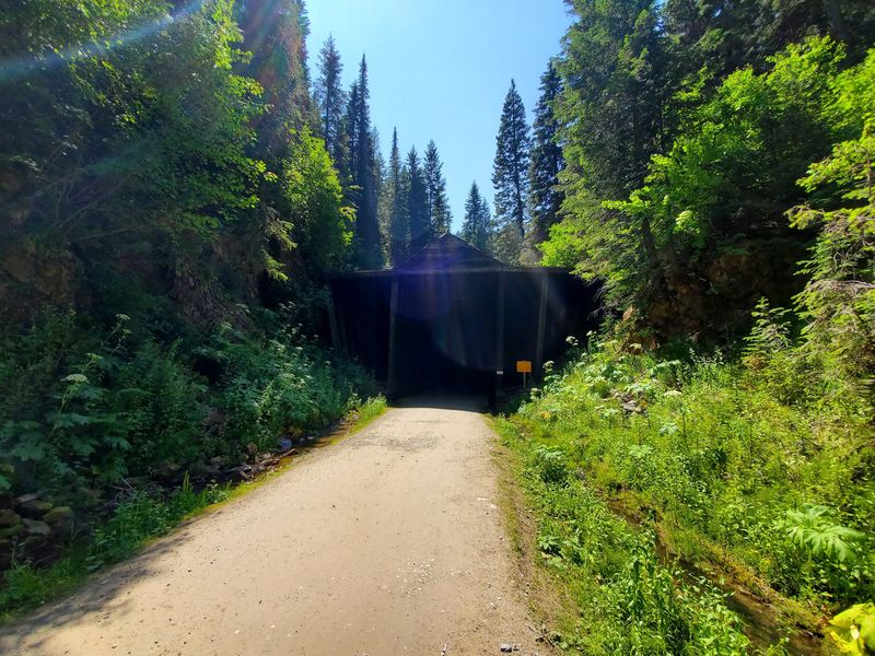
My legs did surprisingly little work. The grade averages between 1.6 and 2 percent, all in your favor.
Across fifteen miles, riders drop roughly 1,000 feet. Gravity handles most of the effort while you steer and stare.
Curves are wide and gentle because trains once rolled through here. Sharp switchbacks simply do not exist.
I watched an eight-year-old and a woman celebrating her seventy-fifth birthday enjoy the same stretch. Trikes are available for anyone uneasy on two wheels.
Brakes matter more than gears. Check them before rolling out, especially on rental bikes.
Some riders skip the shuttle and pedal back uphill for a thirty-mile round trip. The climb is shallow enough that e-bike users barely notice.
Loose gravel appears in patches, so keep speed reasonable. Skidding into a corner ruins a good afternoon.
Total ride time for most groups runs three to four hours with photo stops. Rushing defeats the purpose. Coasting through Idaho forest with almost no effort remains the strangest luxury I have found on a bike.
Stories Written Along The Route
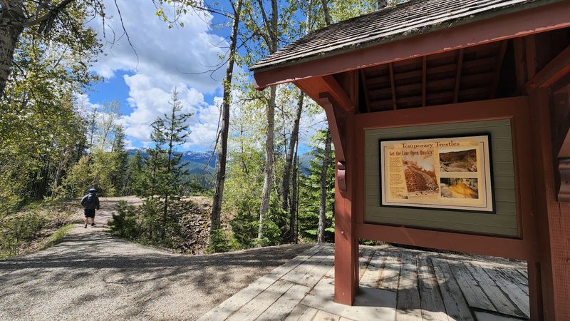
Between 47 and 50 interpretive signs line the corridor, and I read far more than I planned. Each one turns a rest stop into a history lesson.
The Milwaukee Road built this Pacific extension between 1906 and 1911. Nearly 9,000 workers carved the route through the Bitterroot Mountains.
It became the last transcontinental railway completed in the United States, linking Chicago to the Pacific Northwest.
The Great Fire of 1910 tore through this region and pushed the railroad toward electrifying its trains. Signs explain how crews sheltered inside the tunnels.
Commercial trains stopped running in 1980. The rail bed sat quiet until the first trail section opened to the public in 1998.
The long St. Paul Pass Tunnel reopened for riders in 2001, completing the route we ride today. The Rail-to-Trail Conservancy inducted it into the Rail-Trail Hall of Fame, an honor only a handful of trails hold.
Old photographs on the panels show snow sheds, work camps and locomotives. Comparing them to the view in front of you is oddly moving.
How The Shuttle Ride Works
At Pearson, the bottom of the trail, a bus and bike trailer wait to carry everyone back up. Skipping the uphill is worth every minute.
Crews load bikes onto trailers while riders board the bus. E-bikes cost extra to haul because of their weight.
The road climbs a narrow one-lane mountain route with big drop-offs. Drivers narrate history and crack jokes the whole way, which settles nerves.
Buses drop you near the east portal, meaning you ride the long tunnel one final time. Knowing what to expect made the second pass much faster.
Timing matters. Most groups finish around the same hour, so lines can stretch past an hour during peak season.
Going early on a weekday cut my wait dramatically. Late starters face the longest queues. Snacks and drinks are sold near the finish, which helps while you wait. Bring your own too.
Make sure rental lights still have charge before that return tunnel. Mine faded, and I regretted not packing a backup headlamp. Reserving shuttle tickets online alongside your trail pass keeps the process simple.
Wildlife Watching Between The Tunnels
Two moose were splashing in a creek when I rolled past, and the entire group froze in place. Moments like that are not rare here.
Deer wander near the trail regularly, especially in early morning hours. Elk calls sometimes echo through the timber.
Black bears live throughout the Idaho Panhandle National Forests. Making noise around blind corners keeps encounters from turning into surprises.
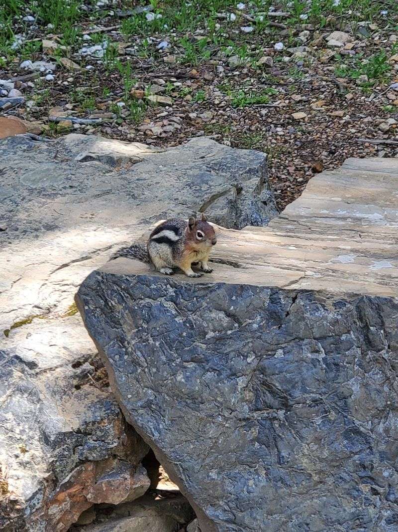
Golden-mantled squirrels are the most reliable performers, darting across gravel constantly. Birds of prey circle above the canyons.
Mountain lions exist in the area, though sightings are extremely uncommon. Riding in groups is always smart.
Pets are not allowed on the trail, with trained service animals being the exception. Wildlife protection drives that rule.
Bees showed real interest in my snack break. Eat quickly and pack wrappers out. Cell service is essentially nonexistent along the route. Tell someone your plans before heading out.
Streams, alpine meadows and thick cedar forest create habitat that feels genuinely wild. You are a guest passing through.
Best Timing And Nearby Detours
Season length is short, so mark your calendar. The route generally runs from late May through mid-September.
Daily hours sit around 8:30 AM to 5:00 PM Pacific time. Starting early beats both crowds and afternoon heat.
Weekdays felt noticeably calmer than Saturdays. Weekend afternoons can get packed at the shuttle line.
June brings fuller waterfalls and greener canyons. Late August offers drier tunnels and warmer air. Special moonlight rides occasionally happen, adding a whole new mood to the darkness.
Once finished, drive about twelve miles east of Lookout Pass to Wallace, a historic mining town in Idaho. Brick storefronts and mining museums make an easy follow-up.
Lookout Pass itself straddles the Idaho and Montana border, which means you cross state lines simply by riding.
Give yourself a full day rather than squeezing the trip into a morning. Rushing this route wastes it. Reservations for passes, rentals and shuttles should be locked in ahead of peak weekends.
After all fifteen miles, the tunnels, the trestles and the history, I understood why the Hiawatha Mountain Bike Trail keeps pulling people back to this quiet corner of Idaho year after year.