11 Northern California Places Even Lifelong Locals May Have Never Seen
Living somewhere for years can create an illusion: that you already know what is there.
Then a road bends toward a strange landscape you have never heard anyone mention. A quiet natural area sits close enough to visit, yet somehow never made it onto your radar.
Northern California has plenty of places capable of surprising people who thought they had seen most of it.
That is what makes this list worth exploring.
These are not necessarily the biggest attractions or the places plastered across every travel guide. They are easy-to-miss destinations that remind you how much can hide between familiar cities.
Pick the one that sounds least familiar. That may be the best place to start.
1. Ahjumawi Lava Springs State Park, McArthur
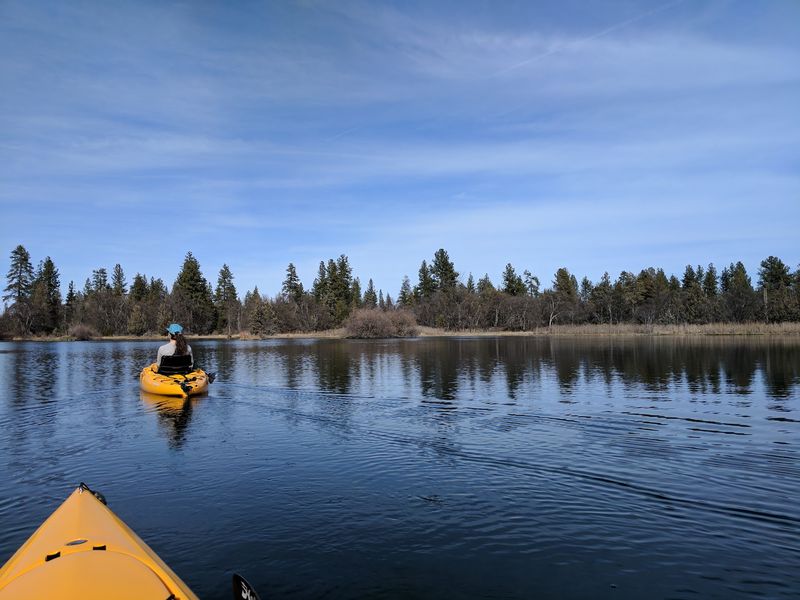
Getting here requires a paddle, which explains why so few Californians have set foot on these shores. Boat access is the only way in, making it the rare state park where a canoe or kayak counts as the entry ticket.
More than two-thirds of the park’s 5,930 acres sit under jagged black basalt from flows that happened within the last two to five thousand years.
Freshwater springs bubble up through the rock and feed the surrounding waterways, and the contrast between dark stone and clear water is the main draw.
Launching happens at a public ramp known locally as Rat Farm.
Reaching it means turning off Highway 299 onto Main Street north of McArthur, passing the Intermountain Fairgrounds, crossing a canal, and following a graded dirt road north for roughly three miles.
From the ramp, expect about a 2.5-mile paddle across Big Lake to reach the park itself. Shallow access points make larger power boats impractical, so smaller human-powered craft work best.
Over twenty miles of trails wind through the park, though the backcountry stays extremely rugged with sharp lava rock underfoot. Sturdy boots matter more here than in most parks.
Day use and primitive boat-in camping are both allowed, and solitude comes standard. Anyone heading off the marked trails should carry proper gear and leave an itinerary with someone before setting out.
2. Lava Beds National Monument, Tulelake
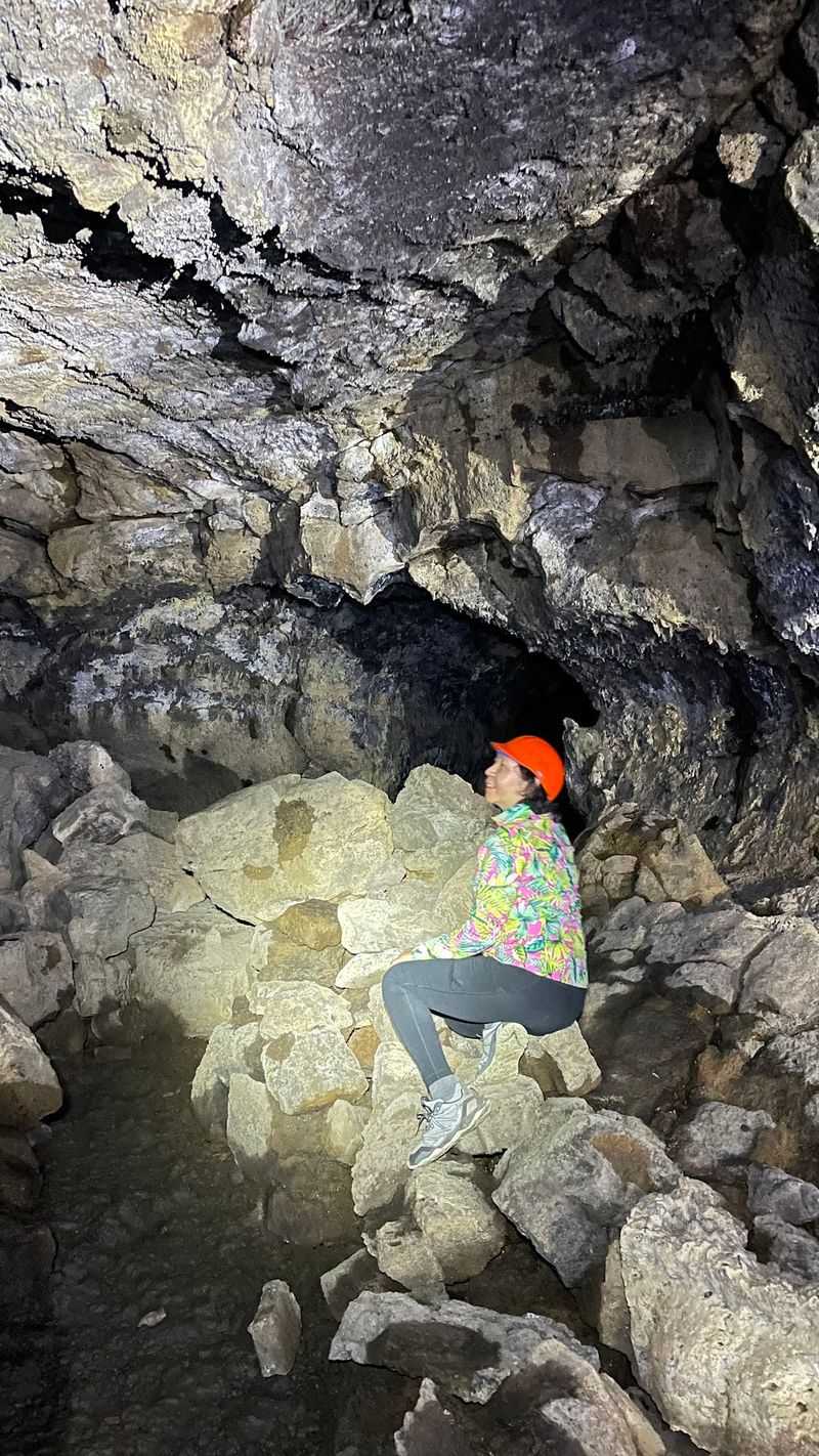
More than 800 caves riddle the ground across this volcanic monument in the far northeast corner of the state.
Many are lava tubes, hollow tunnels left behind when molten rock drained away and the outer shell cooled into stone.
Trip planning starts at the visitor center, located at 28950 Lava Beds Rd, Tulelake, CA 96134. Staff there share current conditions, cave access details, and any permits needed before heading underground.
Some caves close seasonally, often to protect bats during sensitive periods. Checking ahead saves disappointment, especially for anyone driving a long way with a specific tube in mind.
A visit usually involves driving between cave entrances and trailheads, with parking available at each site.
Pacing is flexible, since a few caves take only minutes to explore while deeper tubes turn into longer, more demanding treks.
Temperatures underground stay cool no matter how hot the surface gets, so layers are worth packing.
A reliable flashlight or headlamp with backup batteries also belongs in the daypack, along with something to protect the head from low ceilings.
Above ground, the landscape reads as high desert, all sagebrush and open sky. The quiet is noticeable, and on weekdays outside summer the roads can feel nearly empty.
Footing inside the tubes ranges from smooth to broken and uneven, so slow, deliberate steps make the experience far more comfortable.
3. Cinder Cone And The Painted Dunes, Lassen Volcanic National Park
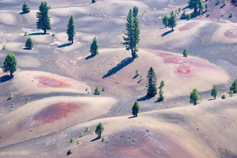
Few views in the state reward a four-mile hike quite like the one from the top of this volcanic cone.
Below the rim, the Painted Dunes spread out in bands of rust, tan, and orange, with the dark Fantastic Lava Beds sprawling beyond them.
Color in the dunes comes from volcanic ash that fell onto lava still hot enough to oxidize it. The result looks almost painted on, which is exactly how the name came about.
Snow limits access for much of the year, and the trail generally works best from late spring through early fall.
Checking the national park’s official website for current trail status and weather before driving out is a smart move.
Elevation gain is moderate but the surface is loose cinder, which makes the climb feel harder than the numbers suggest. Steady pacing and a pair of shoes that keep grit out will help considerably.
Parking sits at the trailhead and can fill during busy stretches, so an early start pays off on weekends. There are no restrooms or visitor facilities at the cone itself, so plan accordingly at the last developed stop.
Carry more water than seems necessary, since shade is scarce across the open volcanic ground. Sun protection matters here too, especially at this elevation during midday.
4. Deadfall Lakes And Mount Eddy, Near Mount Shasta
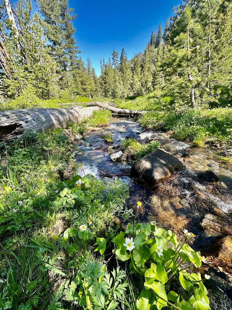
Everybody looks at Mount Shasta, and almost nobody looks west at the peak staring back at it.
Mount Eddy stands as the highest point in the Eddy Mountains, and the Deadfall Lakes sit quietly below it inside Klamath National Forest.
Warm months are the practical window, since snow lingers on these trails well into early summer. Checking current conditions before driving up saves a wasted trip.
Hiking is the only way to reach the lakes, with routes passing through forested stretches and open slopes before opening onto still alpine water. The air feels thinner and cleaner up here, and sound carries differently.
From higher ground on Eddy, views stretch across the surrounding wilderness and include distant looks at Shasta itself. Seeing that famous volcano from an unfamiliar angle is part of the appeal.
Trailheads sit along forest service roads with parking available at designated spots. Road surfaces vary, so a slow, careful drive is wise.
No developed facilities exist at the lakes, meaning water, food, and a way to handle waste all need to come along. Layered clothing helps, since mountain weather shifts quickly even in July.
Solitude tends to be generous here, particularly on weekdays. Anyone hoping for a quiet lunch beside still water without a crowd nearby will likely find it.
5. Castle Crags State Park, Castella
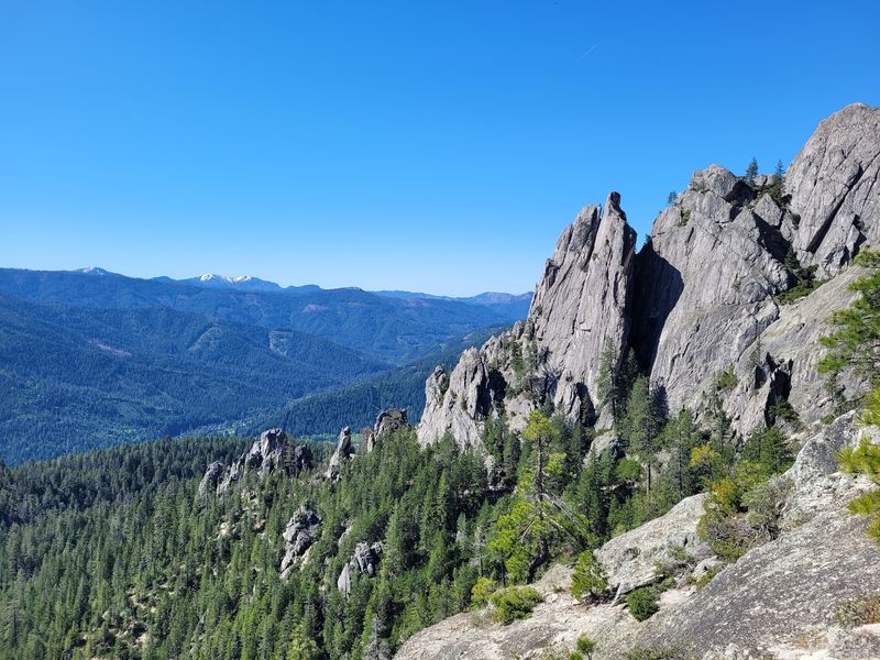
Drivers on Interstate 5 crane their necks at these granite spires and keep going, which is a shame.
The formations rise to roughly 6,000 feet and are over 170 million years old, giving the area one of the most dramatic skylines in the northern part of the state.
Park entrance and visitor services are found at 20022 Castle Creek Rd, Castella, CA 96017. Day use runs year round from 8 AM until sunset, though severe winter weather can force temporary closures.
Camping operates on a first-come, first-served basis, so arriving earlier in the day improves the odds during busy stretches. Picnicking and fishing round out the options.
Twenty-eight miles of hiking trails cover a wide range of ability levels.
The Vista Point Trail and the gentle Root Creek Trail sit at the easier end, while the Crags Trail climbs all the way to the base of Castle Dome for those wanting a real workout.
A section of the Pacific Crest Trail also passes through, which means through-hikers occasionally appear looking road-worn and cheerful.
Dogs are welcome in parking lots, on paved roadways, and in campgrounds, but not on hiking trails or in day-use areas. Planning ahead matters for anyone traveling with a pet.
The Sacramento River runs through the park with several access points for fishing and easy riverside walking.
6. Cheatham Grove, Grizzly Creek Redwoods State Park
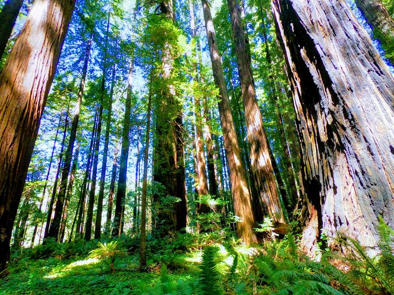
Highway 101 gets the redwood traffic, and this small grove sits far enough off that route to stay peaceful.
California State Parks describes the area as being off the beaten tourist track, which is unusually candid for official park literature.
Sunlight filters down through a high canopy, and the forest floor stays soft and shaded. Sound drops away almost immediately after stepping in from the parking area.
Walking here is easy, with trails winding among trunks wide enough to make a person stop mid-sentence. Nothing about the terrain demands serious fitness, so a slow wander suits the place perfectly.
Pacing is the real gift. Without a crowd moving through, there is room to stand still, look up, and actually take in the scale of old-growth redwoods.
Parking is available at the park entrance and the visit requires little more than a drive and comfortable shoes. Weekdays tend to be quietest.
Fog and rain are common in this part of the coast range, so a waterproof layer is a reasonable thing to keep in the car. Damp days actually deepen the colors of the moss and ferns underfoot.
7. Tolowa Dunes State Park, Near Crescent City
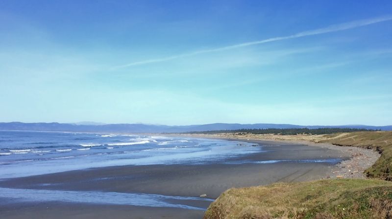
Birdwatchers know about this one, and almost nobody else does.
Roughly 4,000 acres of ocean beach, ancient dunes, wetlands, and wooded ridges sit just a couple of miles north of Crescent City along the Pacific Flyway. Hours run sunrise to sunset, year round.
Thousands of migrating ducks, geese, and swans use the wetlands as a stopover, which makes certain seasons genuinely spectacular for anyone with binoculars.
Reaching the park means taking Northcrest Drive north off Highway 101, then following access roads including Old Mill Road and Lake Earl Drive. Signage is limited, so a downloaded map helps.
Over 27 miles of trails and shoreline are available, with most routes rated easy to moderate. Hiking, birdwatching, and fishing are the main activities, and the variety of habitats within a short walk is unusual.
Leashed dogs are allowed on the waveslope up to the high tide mark, though restrictions apply elsewhere.
Spring and summer bring milder temperatures between 60 and 70 degrees along with wildflowers across the dunes. Winter runs cooler and wetter, with most rain falling between November and May.
Wind off the ocean can be steady, so a windbreaker is worth having even on sunny afternoons.
8. Montgomery Woods State Natural Reserve, Near Ukiah
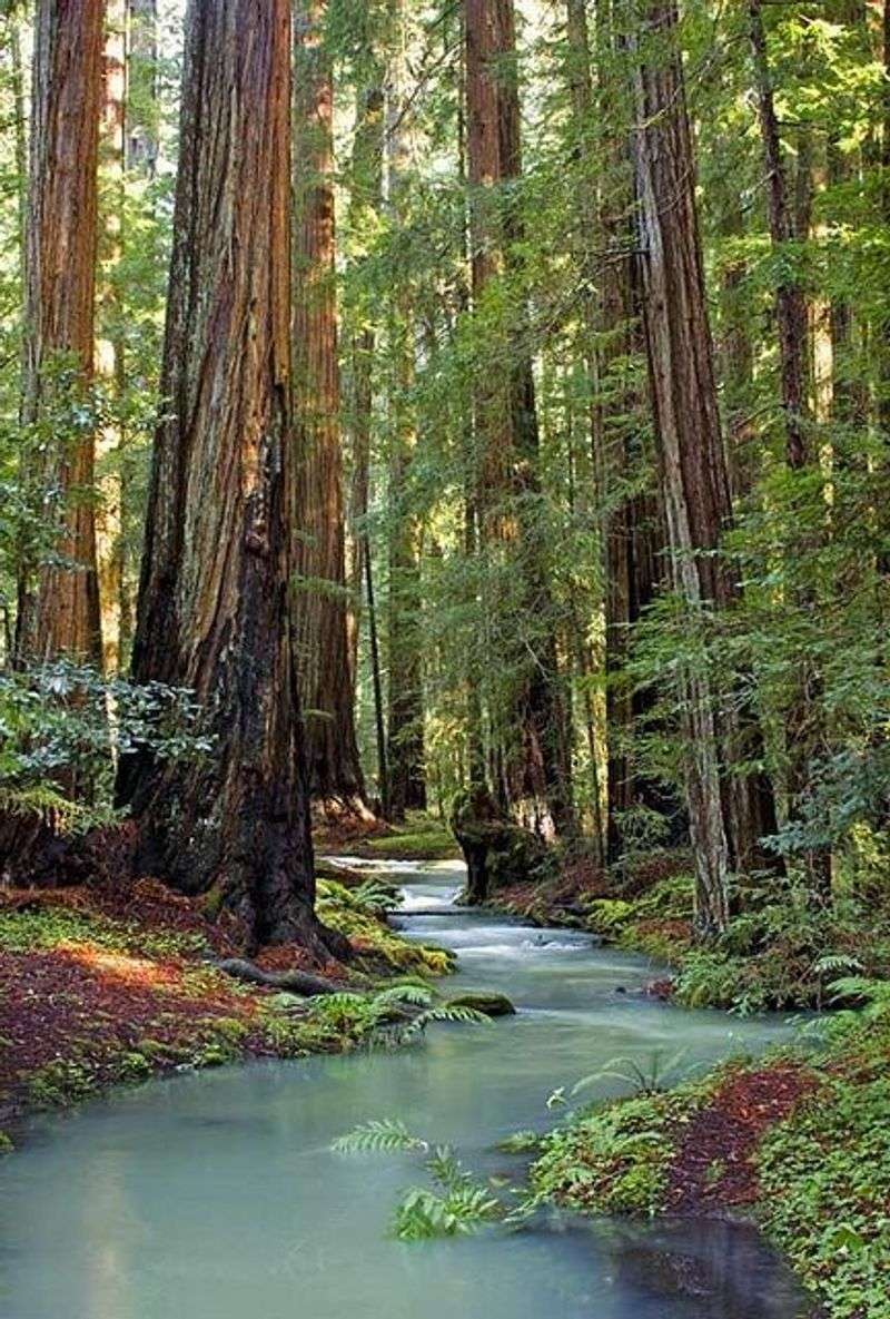
A tree in this canyon once held the title of tallest in the world, though taller specimens have since been measured elsewhere.
The reserve still shelters eleven coast redwood groves and some genuinely enormous trunks.
Silence is the first thing most visitors notice, since the location sits about 13 miles west of Ukiah along twisty Orr Springs Road and far from traffic noise.
The trail runs roughly two miles as a loop and opens with a steep climb of about 0.3 miles, gaining around 200 feet before leveling out. Older knees may want a slow start.
Wet weather can leave sections muddy or flooded, so waterproof footwear helps during the rainy months.
Dogs are not allowed on the trail or in the reserve, with service animals the only exception. Planning around that restriction avoids a frustrating arrival.
Picnic sites sit near the parking area and along the trail, giving a quiet place to eat under the canopy. Mosquitoes can show up in marshy spots during summer, so repellent earns its space in the pack.
Reaching the reserve takes patience on a narrow winding road, and driving it slowly is genuinely the safest approach.
9. Bowling Ball Beach, Point Arena
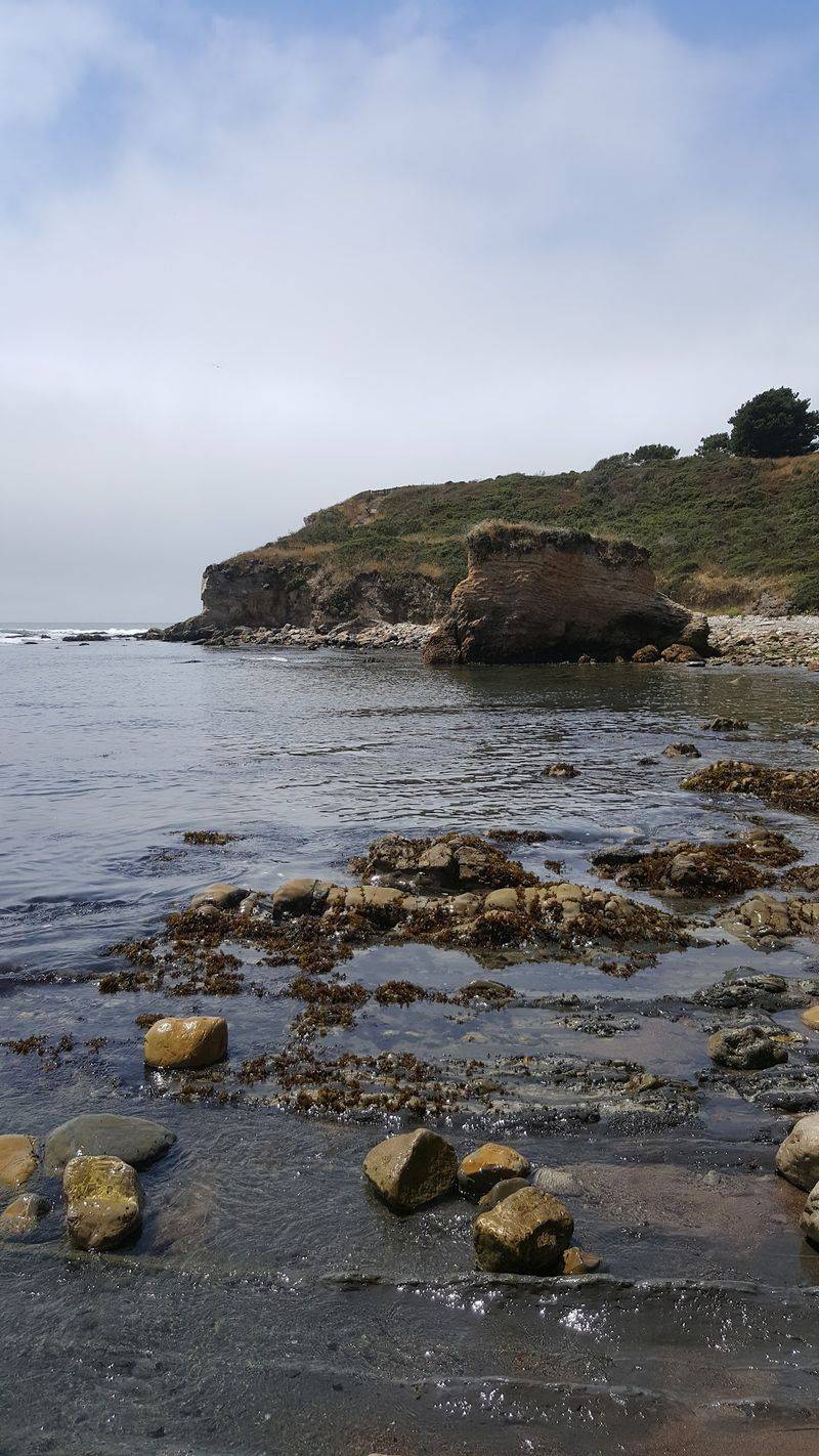
Rows of nearly spherical boulders lined up across a rock shelf look staged, but geology did all the work.
Concretion formed these sandstone spheres, which range from about 2 to 5 feet across and occasionally reach 12 feet. Access comes through the northern end of Schooner Gulch State Beach.
From the pull-off, a northern trail drops down the bluff toward the sand. The path can be steep and slippery when wet, so non-slip footwear is strongly recommended.
Timing decides everything on this trip. At high tide the concretions sit underwater and invisible, so a visit needs to line up with low tide and ideally a minus tide.
Checking a tide chart in advance is not optional here. Arriving an hour or so before the lowest point gives room to explore without racing the incoming water.
Leashed dogs are permitted at the beach.
Water conditions along this shore are frequently dangerous and swimming is unsafe, so the visit is strictly a looking-and-walking affair. Late afternoon light tends to make the rounded shapes stand out beautifully.
10. The Pygmy Forest At Van Damme State Park, Little River
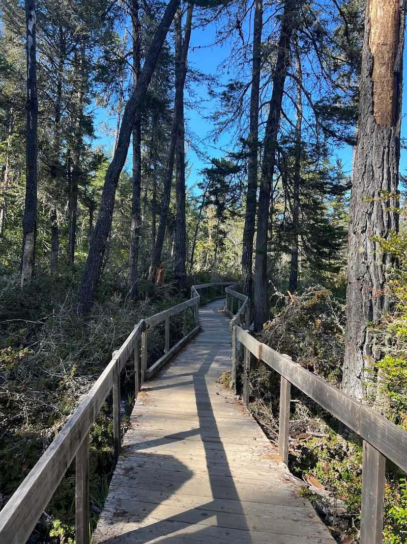
Trees older than a century standing shorter than a garden fence sound like fiction, yet that is exactly what grows on this bluff.
Mature cypress and pine here range from six inches to eight feet tall despite being fully developed.
Blame the soil. Low nutrients and high aluminum levels keep root systems from supporting normal growth, and the ground itself may be between 500,000 and 1,000,000 years old.
Because natural erosion never brings fresh soil in, the conditions stay locked in place and the dwarfism continues generation after generation.
A self-guided nature boardwalk of roughly a quarter mile loops through the forest, keeping feet off the fragile ground while allowing close looks at the miniature canopy.
The boardwalk is generally accessible, though accessible restrooms are not available at this particular trailhead. Planning a stop elsewhere beforehand is wise.
Dogs are not permitted in the pygmy forest area.
Staying on the designated path protects delicate lichen and the surrounding environment, which recovers extremely slowly if trampled.
The whole visit takes under an hour, making it an easy addition to a day already spent along the Mendocino Coast.
11. Sinkyone Wilderness State Park, Lost Coast
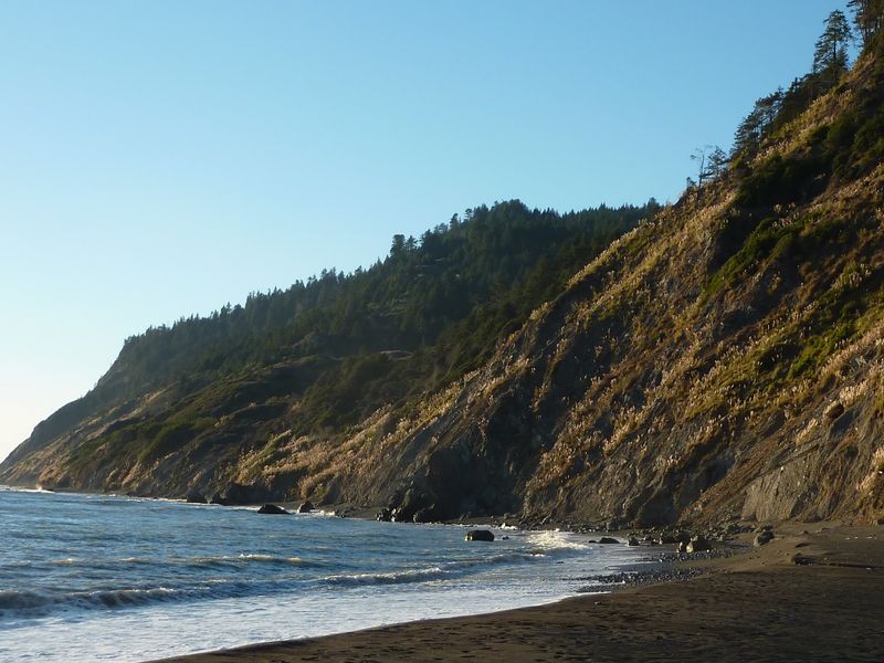
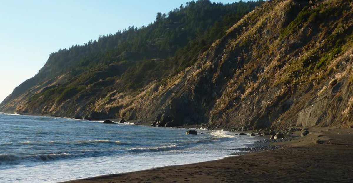
Roosevelt elk grazing on grassland above a black-sand beach is not a common California scene, but it happens regularly along this southern stretch of the Lost Coast.
Sea lions and harbor seals turn up in the rocky coves below.
Wildness here is the whole point, and the access roads make sure of it. Unpaved routes run steep and narrow, and wet weather can render them impassable.
High-clearance vehicles are recommended, while trailers and RVs are generally not advised. Anyone unsure about their vehicle should reconsider the trip.
Two main entry points exist. Usal Beach Campground anchors the southern end, reached by Usal Road off Highway 1 at milepost 90.88, and Needle Rock sits at the northern end via Briceland Road out of Redway.
Services are limited and cell coverage is unreliable or absent throughout, so telling someone the plan before leaving is a sensible habit.
Hiking trails follow rugged coastal terrain with numerous stream crossings that often lack bridges. Wading is part of the deal, and quick-drying footwear helps.
Weather shifts fast along this coastline, moving from fog to sun and back within an hour.
What visitors get in return is a stretch of shoreline with almost nothing built on it, which is increasingly rare anywhere in the state.