This Strange Idaho Roadcut Reveals Nearly 6-Million-Year-Old Volcanic Formations
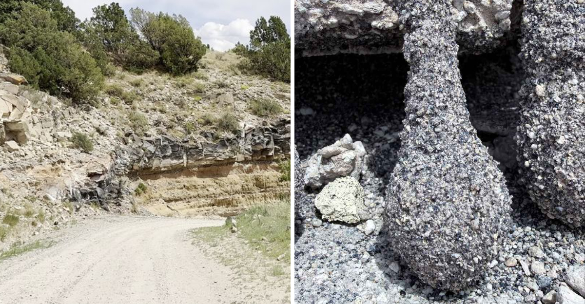
The roadside looks like somebody left a tiny ruined city in the lava.
Dark little towers poke from pale volcanic rock, with shapes that resemble chimneys and crooked arches. A few look so oddly deliberate that the first instinct is to blame humans.
Humans had nothing to do with it.
These strange formations began taking shape about 5.59 million years ago, when hot volcanic material linked to the Yellowstone hotspot settled across eastern Idaho.
Gas moved through the cooling deposits, harder sections formed, and millions of years of weathering eventually stripped softer material away.
What survived is the weird part.
Small dark structures now stick out from the roadcut like geological punctuation marks, turning an otherwise ordinary drive near Ririe into a serious double-take.
No ancient builders were involved.
Just volcanic ash, escaping gas, absurd amounts of time, and nature apparently experimenting with architecture long before Idaho had roads.
The Weird Little Cones Are The First Thing You Notice
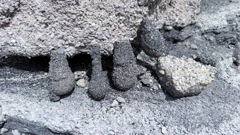
A close look at the exposed wall reveals the detail that makes Meadow Creek Dugout far more interesting than an ordinary gravel-road cut.
Dark gray projections rise from softer material in stubby pillars and tapered forms, while neighboring sections have eroded into little openings beneath the harder rock.
Their irregular shapes can resemble miniature chimneys or tiny shelters when seen up close. They are not pieces of concrete or objects placed against the wall.
The surrounding rock is volcanic tuff, material created from ash and other debris produced during explosive eruptions.
Geological studies near Ririe Reservoir have documented unusual vertical and flame-shaped formations within the Wolverine Creek Tuff. In some areas, fine ash was removed while coarser crystals and fragments remained.
Those structures become increasingly noticeable as erosion works on the surrounding softer deposit. The forms in the roadcut are small compared with the enormous eruptions that produced the surrounding material, yet their size is exactly what makes them so easy to overlook.
A person could drive past the exposed bank without realizing that some of its strangest details record movement inside volcanic debris laid down millions of years ago.
The Rock Around Them Dates Back About 5.6 Million Years
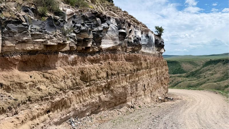
The number attached to this material is difficult to grasp on a human timescale. The Wolverine Creek Tuff exposed in the Meadow Creek area has been dated to approximately 5.59 million years ago, placing its formation during the late Miocene.
The Idaho Geological Survey describes the unit as gray to gray-brown volcanic material that can contain abundant obsidian fragments, with exposures ranging from nonwelded to partially welded tuff.
That age puts the unusual formations visible at Meadow Creek Dugout within the nearly six-million-year range promised by the title.
The eruption happened during activity associated with the Heise volcanic field, an older volcanic center along the track eventually leading toward modern Yellowstone.
Geological field guides identify the Wolverine Creek deposit as part of a stack of major volcanic units preserved near Ririe Reservoir.
The small shapes visible in the cut therefore belong to material created during a chapter of Idaho history when huge explosive eruptions repeatedly reshaped this part of the Snake River Plain.
What now fits into a close-up photograph once formed inside deposits spread across a much larger landscape.
Those Shapes Formed As Gas Moved Through Volcanic Debris
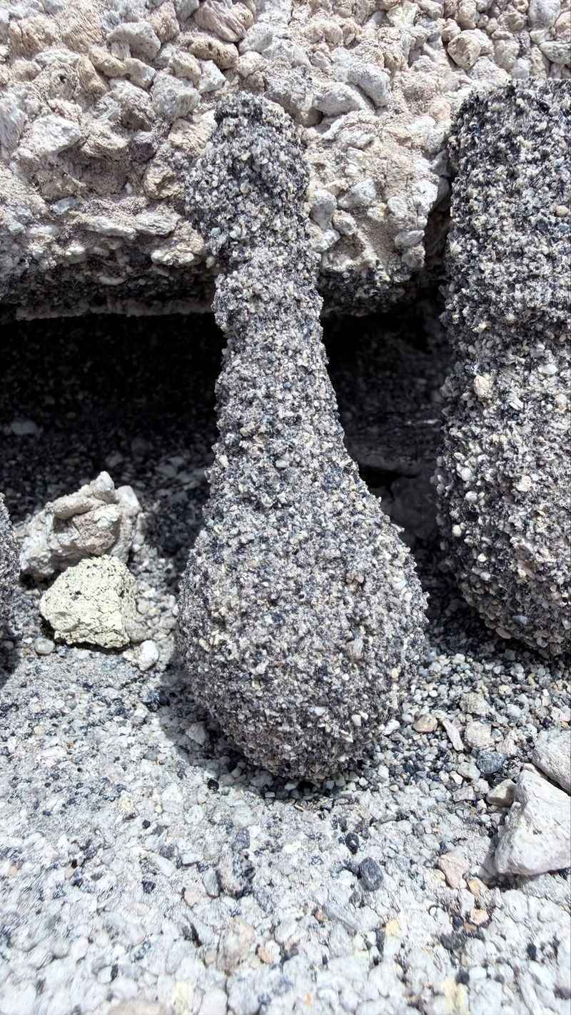
The story begins while freshly deposited volcanic material was still settling into place. Pyroclastic deposits can hold enormous amounts of gas between ash, pumice, crystals, and pieces of older rock.
As that gas moves upward through the deposit, it can carry away the finest ash while leaving larger particles behind. Geologists call the resulting vertical features elutriation pipes, and older terminology sometimes describes them as gas-escape or fluid-escape structures.
They tend to be coarser and more resistant than the fine-grained material surrounding them. Geological descriptions from the Ririe Reservoir area specifically record fines-depleted elutriation pipes and flame-like fluid-escape structures within the Wolverine Creek Tuff.
Once millions of years of erosion begin stripping away the softer ash, those differently textured zones can emerge as protruding shapes rather than remaining hidden inside a solid-looking deposit.
That helps explain why the small structures at Meadow Creek Dugout look so different from the material around them.
Their strange appearance is a remnant of movement that happened inside a volcanic deposit long before eastern Idaho took on its present landscape.
Obsidian Fragments Help Give The Tuff Its Speckled Look
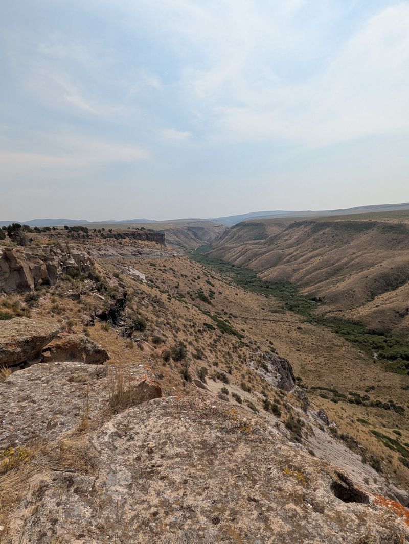
Tiny dark pieces scattered through the volcanic material provide another clue to what happened here. The Wolverine Creek Tuff is notably rich in obsidian fragments, pieces of volcanic glass produced when silica-rich material cooled without developing a normal crystalline structure.
Field descriptions call the unit gray and obsidian-rich, with pyroclastic fall, surge, and flow deposits represented within the sequence.
Earlier geological work around Ririe Reservoir also identified crystal- and obsidian-rich material inside the fines-depleted pipes associated with this tuff.
Those coarser grains help explain the rough, peppered texture visible across portions of the rock at Meadow Creek Dugout. The wall does not resemble the smooth lava people often picture when they hear the word volcanic.
This material came from explosive activity capable of breaking magma and older rocks into fragments, moving them rapidly across the landscape, and depositing them as thick accumulations of ash and debris.
The contrast between fine pale material and darker, tougher concentrations makes the unusual formations easier to pick out.
Instead of one uniform rock face, the exposure contains countless small changes in grain size and composition that become visible only after erosion opens the deposit.
The Roadcut Preserves Volcanic Ash That Once Moved Across The Landscape
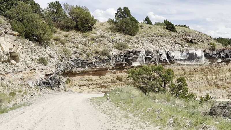
Nothing about the original deposit required a quiet lava flow creeping downhill. The Wolverine Creek Tuff includes evidence of much more energetic processes.
Geologists have identified pyroclastic fall, surge, and flow deposits within the unit, showing that volcanic debris reached the area in several ways.
Pyroclastic density currents can carry hot ash and rock fragments rapidly across the ground, while fallout drops material from an eruption cloud above.
Surge deposits tend to produce recognizable bedding created as fast-moving, turbulent clouds sweep across the surface.
Older field studies in the Ririe Reservoir area describe cross-stratified surge beds resting above portions of the Wolverine Creek Tuff, with soft-sediment deformation and fluid-escape structures preserved within the volcanic material below.
At Meadow Creek Dugout, that larger history gives the little dark projections in the photograph much more context. They are not isolated oddities sitting in random dirt.
They occur within a landscape built from explosive volcanic deposits that were later buried, altered, exposed, and weathered. The road simply created an unusually convenient cross-section through material that otherwise would remain hidden beneath the surface.
Younger Volcanic Layers Sit Above This Much Older Material
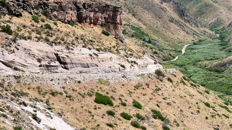
Wolverine Creek was not the final volcanic chapter preserved beside Meadow Creek Road. Higher in the sequence, geologists have identified the Kilgore Tuff, dated to roughly 4.5 million years ago, followed much later by the Huckleberry Ridge Tuff from the Yellowstone Plateau volcanic field at about 2.06 million years old.
That means the landscape around Meadow Creek Dugout preserves material from volcanic events separated by millions of years.
The Kilgore deposit can change sharply in thickness because it flowed across an already uneven landscape, while the younger Huckleberry Ridge material eventually draped over the older rocks from a volcanic source far to the northeast.
These later units matter because they show how much history accumulated after the Wolverine Creek material and its strange structures had already formed.
The little formations visible near the base of an exposure represent one moment inside a much longer story rather than the entire site.
Each younger layer records another major change overhead while erosion and sedimentation continued between eruptions. Reading upward through the rocks is therefore a bit like moving forward through several million years of eastern Idaho history.
Meadow Creek Dugout Sits Along A Route Geologists Have Studied For Decades
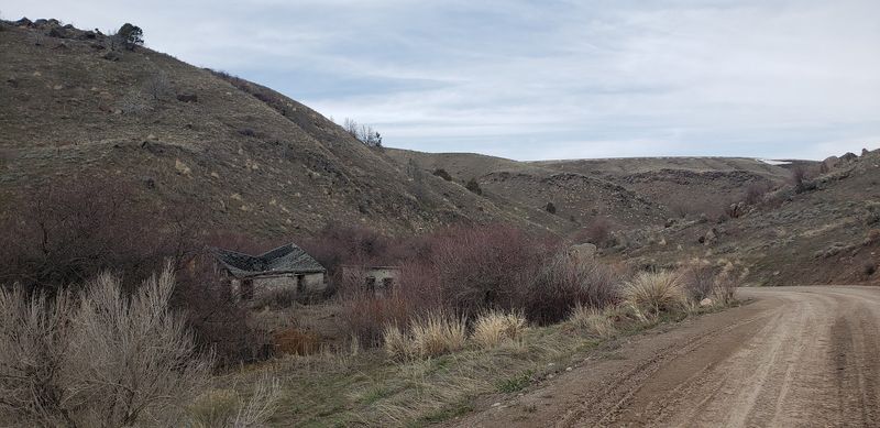
A gravel road provided researchers with one of the easiest windows into the volcanic sequence around Ririe Reservoir. Meadow Creek Dugout is mapped near Ririe, while geological field guides refer to the area as the Meadow Creek Dugway and direct visitors south from Highway 26 along Meadow Creek Road.
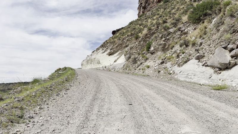
The route eventually changes from pavement to gravel before descending into the exposed volcanic terrain.
Researchers have been bringing field groups into this area for decades because erosion and road construction expose units that would otherwise require much more work to examine.
The walls reveal the Wolverine Creek Tuff alongside younger Heise and Yellowstone-related volcanic deposits, making a relatively short stretch of road useful for studying several major stages of regional volcanism.
This is not a developed attraction with exhibits explaining every layer, so the geology is easiest to appreciate after knowing what to look for.
The small dark forms in the photograph are a good starting point because they force the eye away from the overall cliff and toward details only a few inches across.
Road conditions can change seasonally, making careful driving appropriate whenever visiting the gravel sections around the dugout.
Those Tiny Formations Tell A Much Bigger Yellowstone Hotspot Story
A few weathered shapes sticking from a wall would be easy to dismiss if the surrounding rocks did not carry such enormous history. Meadow Creek Dugout lies along the volcanic track that records movement of the North American Plate over the Yellowstone hotspot.
Older volcanic centers stretch southwest from present-day Yellowstone across the Snake River Plain, with the Heise volcanic field representing one major stage before activity shifted farther northeast.
Wolverine Creek Tuff formed about 5.59 million years ago during that older Heise chapter.
Kilgore followed roughly a million years later, while Huckleberry Ridge material from the Yellowstone Plateau arrived more than two million years after that.
The strange pipe-like forms in the older volcanic debris preserve something much smaller and more immediate: gas moving through ash after an eruption and separating fine material from coarser grains.
Millions of years of erosion then made those internal structures visible from the outside. That combination is what gives this Idaho roadcut its appeal.
The broad cliff records eruptions large enough to transform a region, while the odd little formations in the photograph preserve what was happening inside the deposit itself.