12 Stunning Waterfalls Near Brevard That Prove Why This North Carolina Town Is Called The Land Of Waterfalls
Brevard does not simply sit among waterfalls.
It seems to breathe through them.
Water slips from the mountains in silver ribbons, gathers speed beneath the trees, then breaks into white spray against ancient rock. Around each bend, another cascade seems to be waiting with its own voice and rhythm.
More than 250 waterfalls shape this part of North Carolina, earning the region its name as the Land of Waterfalls.
Some thunder close to the road. Others reveal themselves only after the forest has had time to quiet everything else.
That is part of the spell. No two falls seem to move the same way, and no trail delivers quite the same feeling twice.
Here, water is not just scenery.
It is the pulse running through the mountains.
12. Looking Glass Falls, Pisgah National Forest
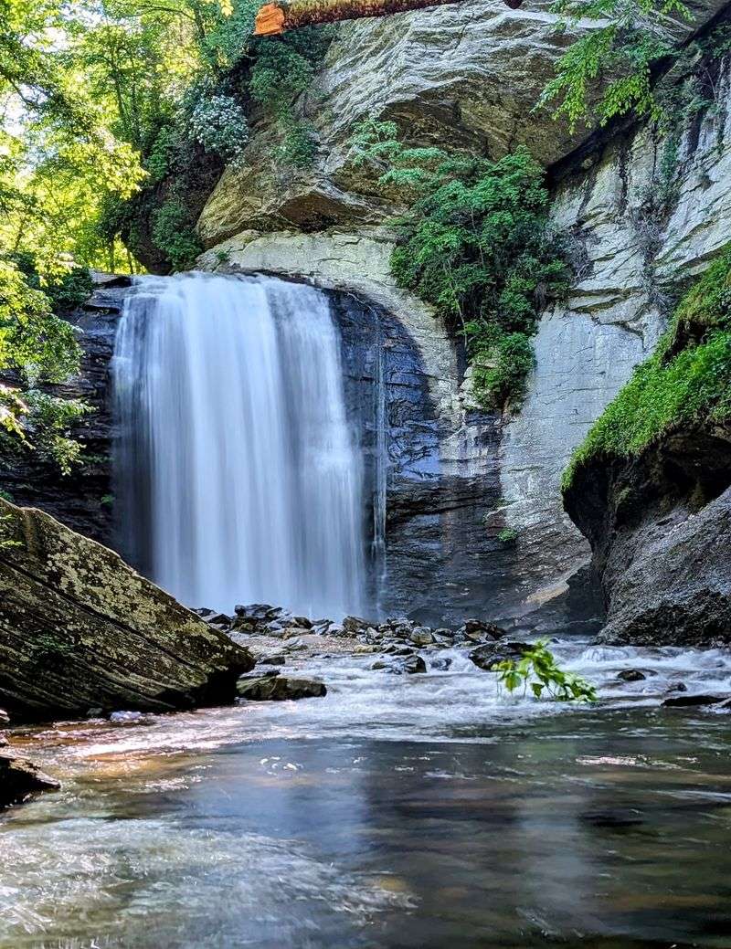
Roadside waterfalls rarely deliver this much drama with so little effort. Looking Glass Falls drops more than 60 feet over a rock cliff beside US-276, only a short drive north of the Pisgah Ranger District visitor center.
Parking lines the highway near the overlook, and the upper viewing area makes the waterfall one of the easiest major cascades around Brevard to see without a hike.
Steps continue toward the lower viewing area and creek, giving visitors a closer angle when conditions allow.
The broad curtain is roughly 30 feet wide, and heavier rain can make the entire face look considerably more powerful than it does during a dry spell. Looking Glass Falls gets its name from nearby Looking Glass Rock, whose exposed surface can shine when winter ice catches the light.
Crowds are the bigger challenge here, not distance, so arriving earlier in the morning usually makes the stop easier.
The Forest Service consistently warns visitors to stay off wet rocks and away from waterfall edges, which is especially important at a place where convenient access can make the terrain seem safer than it really is.
11. Moore Cove Falls, Pisgah National Forest
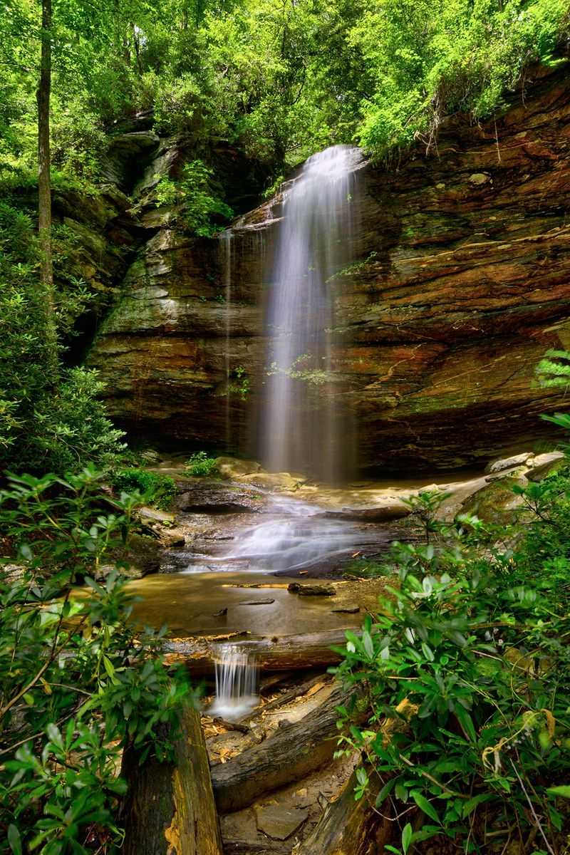
A cave-like rock overhang gives Moore Cove Falls a completely different personality from the heavy curtain down the road.
Water drops about 50 feet from the ledge, leaving an open recess behind the falling stream that the Forest Service currently allows visitors to enter while cautioning everyone to watch their footing on damp surfaces.
Reaching it requires an easy 0.7-mile hike each way from the trailhead on US-276, about a mile beyond Looking Glass Falls. The path crosses the creek on several footbridges and passes through a classic cove forest filled with yellow poplars and seasonal wildflowers.
Rain makes an enormous difference here because Moore Cove Falls can look delicate during dry stretches and much fuller after wet weather.
The official trail ends at the waterfall, and hikers are specifically told not to climb toward the top or continue upstream, where erosion and dangerous footing become serious concerns.
Another detail worth remembering is the nighttime restriction: the area within a quarter mile of Moore Cove Falls is closed from sunset to sunrise. For daytime visitors, the short woodland approach and unusual overhang make this one of the most distinctive easy hikes near Brevard.
10. Slick Rock Falls, Pisgah National Forest
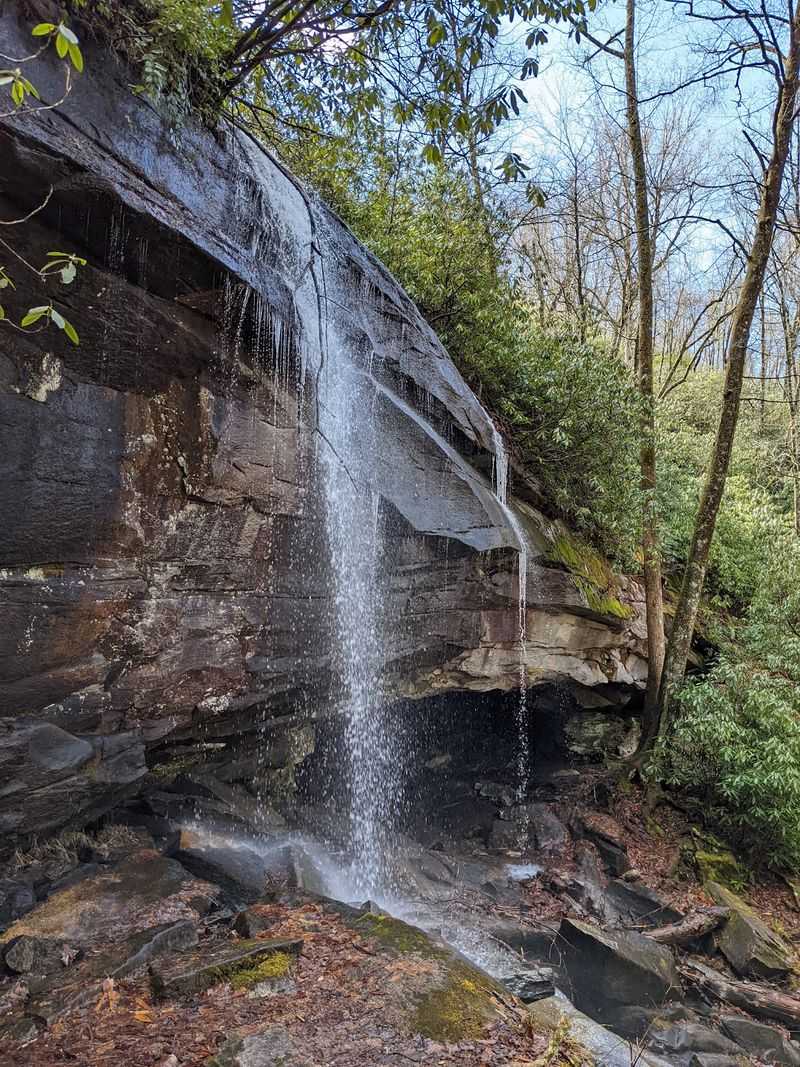
Only a short walk separates the forest road from this overhanging cascade. Slick Rock Falls drops roughly 30 to 35 feet from a cliff in Pisgah National Forest, with Explore Brevard currently using the 35-foot figure and Forest Service materials describing it at about 30 feet.
Either way, the attraction is not enormous height but easy access and the way the water spills cleanly from the rock above.
Slick Rock Falls itself sits only a short walk from the Slick Rock Falls Trail, reached from the FS 475B corridor.
Because forest-road access can change after storms or maintenance work, check current road conditions before assuming you can drive directly to the usual pull-off. Flow varies substantially, so rainy periods bring a much more impressive curtain than dry summer weather.
The name also functions as a useful warning. Wet stone around the waterfall can be exceptionally slippery, and current Forest Service safety guidance urges visitors to remain away from the tops of waterfalls and avoid slick rock surfaces.
Because the stop sits near several other Pisgah attractions, Slick Rock Falls works well as part of a larger waterfall day rather than requiring an outing of its own.
A brief approach, forested cliff and changing flow give this North Carolina waterfall plenty of character despite its smaller size.
9. Hooker Falls, DuPont State Recreational Forest
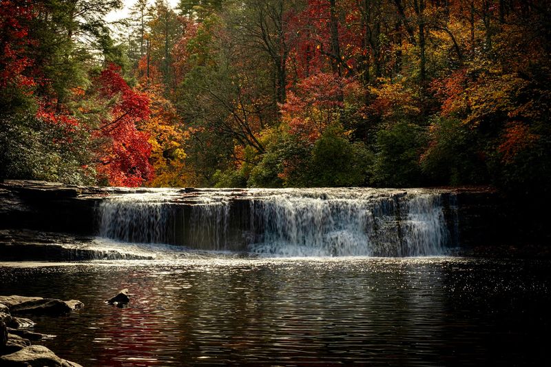
Width matters more than height when the Little River reaches Hooker Falls. The drop measures only about 12 feet, yet the broad sheet of water spilling into the pool below creates one of DuPont State Recreational Forest’s most approachable waterfall scenes.
A short trail begins at the Hooker Falls Access Area, where visitors also have access to restrooms and changing rooms.
The pool below has long been a popular warm-weather swimming area, although Friends of DuPont Forest stresses that natural water remains unpredictable and non-swimmers should use extreme caution.
The Forest Service also prohibits wading within 300 feet upstream of waterfalls and bans jumping, diving or sliding from any falls in the forest. History adds another layer to the stop.
Hooker Falls was once known as Mill Shoals Falls and took its current name from Edmund Hooker, who operated a mill downstream in the late 1800s. It also appeared in The Last of the Mohicans.
Parking can become extremely difficult during summer, so current 2026 guidance recommends arriving before the main morning rush or later in the afternoon when spaces begin opening again.
8. Triple Falls, DuPont State Recreational Forest
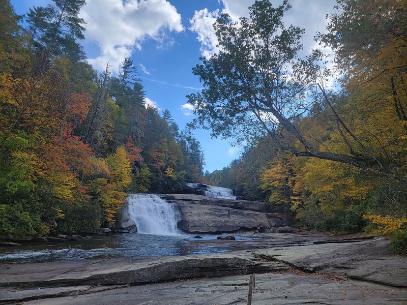
Three separate cascades give this Little River landmark the scale promised by its name.
Triple Falls drops about 120 feet in total and can be reached from either the Hooker Falls or High Falls access areas, with the route from Hooker including a noticeably steep section.
The main overlook remains open in 2026, but one important piece of older advice is now outdated: the Triple Falls stairs that once led to a closer viewing area are still closed because of damage from Tropical Storm Helene in 2024.
Current forest alerts continued to list that closure in August 2026, so visitors should stay with the available overlook and respect barricades rather than trying to recreate photographs taken from the old staircase.
Triple Falls is also one of the DuPont waterfalls associated with major film productions, including The Last of the Mohicans and The Hunger Games. That cinematic history is easy to understand once all three levels come into view through the forest.
DuPont prohibits climbing on waterfalls and jumping, diving, or sliding from them. Swimming and wading are also prohibited within 300 feet upstream of a waterfall, and visitors should remain behind all posted barriers.
7. High Falls, DuPont State Recreational Forest
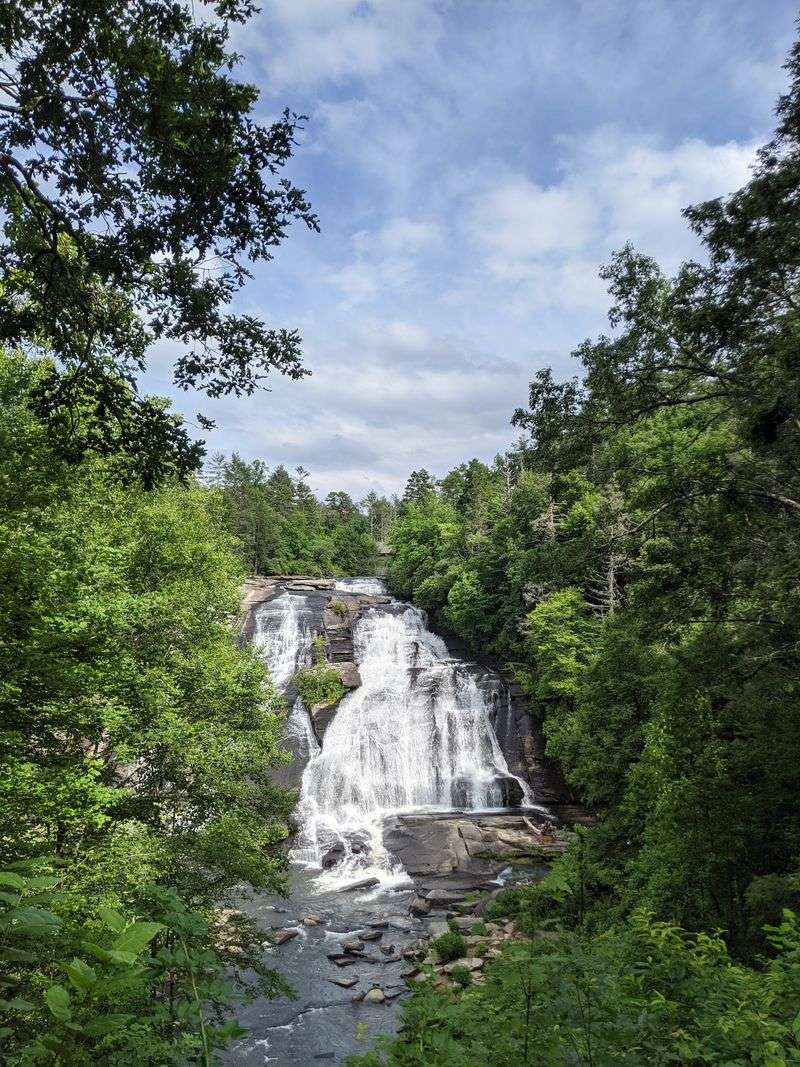
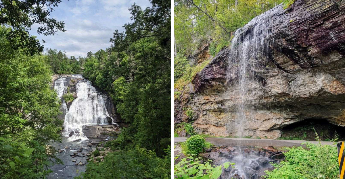
An enormous plane of exposed granite carries the Little River downward for about 120 feet at High Falls, the largest waterfall in DuPont State Recreational Forest. Better still, seeing it does not require one of the forest’s longer expeditions.
Friends of DuPont Forest places the main overlook about half a mile from the Visitor Center at the High Falls Access Area, and a spur trail leads toward the base for another perspective.
The covered bridge upstream gives the area a second recognizable landmark, while the High Falls shelter provides a convenient place to pause above the waterfall.
Access is currently open in 2026, even as a handful of unrelated DuPont trails and the Triple Falls stairs remain closed. The biggest challenge during busy periods is parking.
Current Forest Service guidance notes that summer lots can be completely full by about 9:30 a.m., with arrivals before 9 or after 5 offering better odds. Once on the trail, waterfall rules are strict: no climbing on the falls, no jumping or sliding, and no wading within 300 feet upstream.
High Falls hardly needs a risky close-up anyway. The overlook shows just how much water can spread across one giant sweep of mountain rock.
6. Bridal Veil Falls, DuPont State Recreational Forest
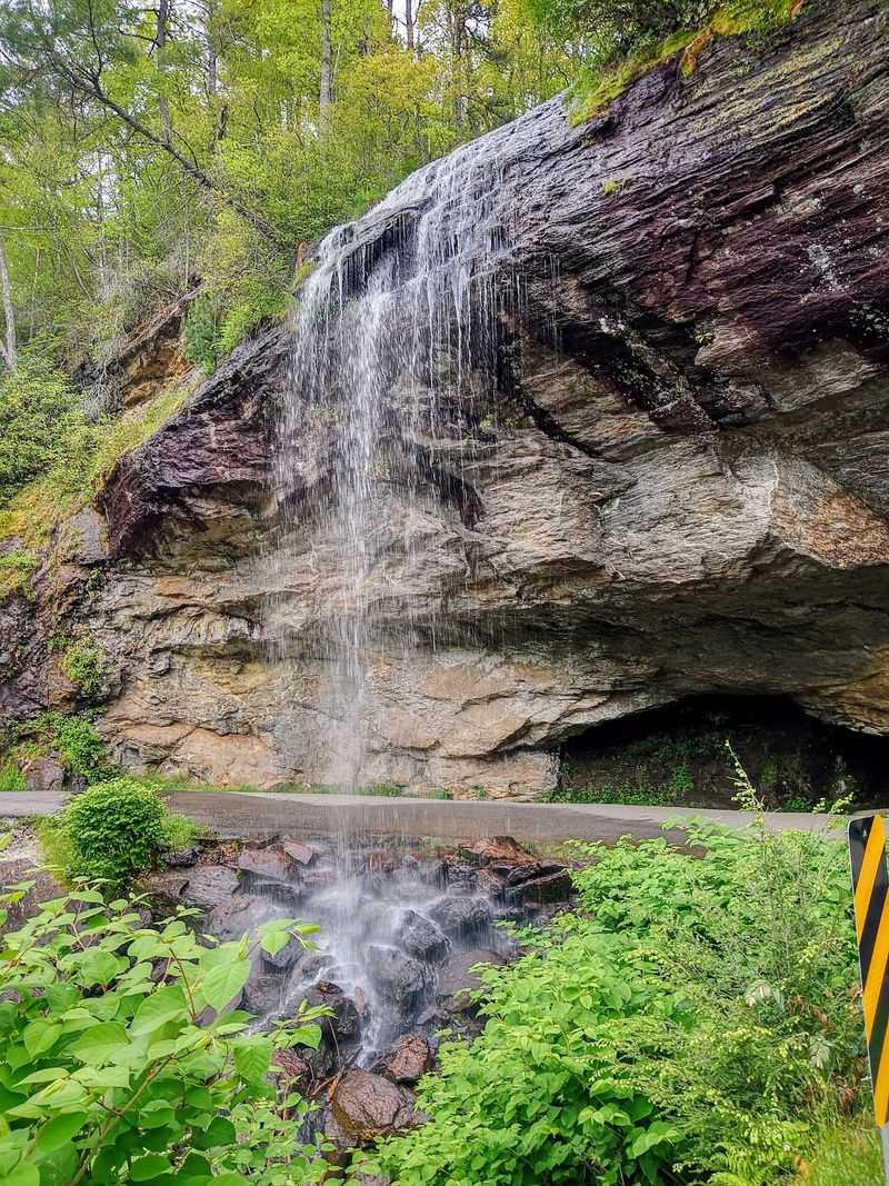
Water takes a long, unusual route down the granite here. Bridal Veil Falls begins by dropping from an overhanging ledge before spreading across an inclined rock face and continuing toward the pool below.
That first overhang appeared in The Last of the Mohicans, giving the waterfall one of DuPont’s best-known film connections.
Current access is available from the High Falls, Fawn Lake and Corn Mill Shoals areas, though reaching Bridal Veil requires more walking than stopping at High Falls or Hooker Falls.
One older route does need to be removed from current plans: Bridal Overlook Trail is now permanently closed and no longer appears on new DuPont maps.
Visitors can still reach the waterfall by established forest roads and trails, but current barriers and route information should take priority over old online directions.
The temptation to climb onto the broad granite has also led to much stricter safety rules. DuPont prohibits climbing on waterfall rocks, sliding from waterfalls and wading above them, so this is now very much a look-from-safe-ground destination.
Bridal Veil Falls remains worth the longer approach because its shape is so different from the compact plunges and stacked cascades elsewhere in the forest.
5. Rainbow Falls, Gorges State Park Area
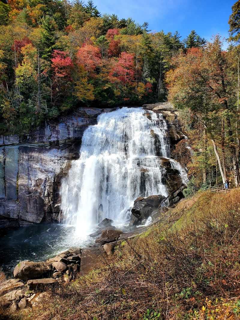
Mist gives Rainbow Falls its name, but reaching that mist requires considerably more work than pulling off a highway. The waterfall itself is in Pisgah National Forest, while the most popular access begins inside Gorges State Park at the Grassy Ridge area.
The official Rainbow Falls Trail runs 1.5 miles one way and is rated strenuous, making the standard outing about three miles round trip before adding the short continuation toward Turtleback Falls.
Rainbow Falls drops roughly 150 feet on the Horsepasture River, producing enough spray for rainbows to appear when sunlight reaches it at the right angle.
The forest around the river lies within an exceptionally wet section of the Blue Ridge Escarpment, which helps explain the lush vegetation surrounding the gorge.
Save some energy for the return because the hike out requires regaining elevation lost on the approach.
The park’s current September 2026 notice concerns temporary tent-camping restrictions related to bear activity, not closure of the Rainbow Falls Trail itself. Safety around the river remains the bigger concern for day hikers.
Staying on developed trails and designated viewing areas is the right way to enjoy one of the tallest and most powerful waterfalls on this list.
4. Turtleback Falls, Gorges State Park Area
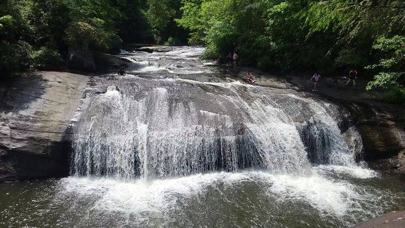
Continue roughly another quarter mile beyond Rainbow Falls and the Horsepasture River rolls across a rounded rock formation that explains the name Turtleback.
The two waterfalls are generally treated as one strenuous outing from the Grassy Ridge access at Gorges State Park, with Explore Brevard listing the combined trip at about 3.5 miles round trip.
Like Rainbow Falls, Turtleback itself lies beyond the state-park boundary in Pisgah National Forest. Older travel guides sometimes promoted the rounded cascade as a natural waterslide, but that is not useful advice for a current safety-focused visit.
The Horsepasture River can carry powerful currents, and official waterfall guidance throughout the region emphasizes staying away from dangerous edges and avoiding slick rock surfaces.
The better reason to continue upstream is simply to see how dramatically the river changes character within such a short distance.
Rainbow Falls is a sheer 150-foot plunge filled with spray, while Turtleback spreads across curved stone in a much lower, broader shape.
The extension still requires a long climb back toward the Grassy Ridge parking area. It is best suited to hikers comfortable with the strenuous Rainbow Falls route and prepared for the longer return.
3. Schoolhouse Falls, Panthertown Valley
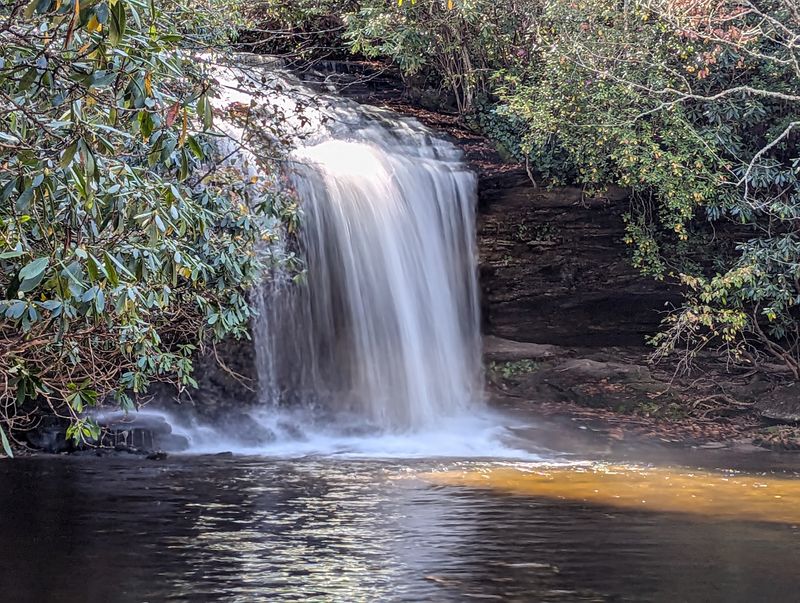
Remote surroundings make this 20-foot waterfall feel much farther from civilization than its height might suggest. Schoolhouse Falls sits on Greenland Creek in Panthertown Valley, a 6,311-acre backcountry area of Nantahala National Forest west of Brevard.
The most direct route from the Cold Mountain Gap side is roughly 2.5 miles round trip, using Panthertown Valley Trail and Little Green Trail.
A broad pool and rock beach sit below the falls, while the overhanging cliff supports a sensitive spray-cliff plant community that deserves extra care.
The area has also been receiving restoration work. A Forest Service project calls for removing the old direct steps toward the pool, redirecting visitors along a more sustainable path and rehabilitating eroded streambank around Schoolhouse Falls.
That makes following current signs especially important rather than relying on an older trail description. The name reaches back to the valley’s logging era, when a schoolhouse was constructed nearby but apparently never operated as a school before later serving as a residence.
Panthertown’s larger trail network can be confusing, so Friends of Panthertown strongly recommends planning carefully and carrying reliable navigation.
Schoolhouse Falls rewards the extra preparation with one of the area’s quieter backcountry waterfall settings.
2. Connestee Falls, Brevard
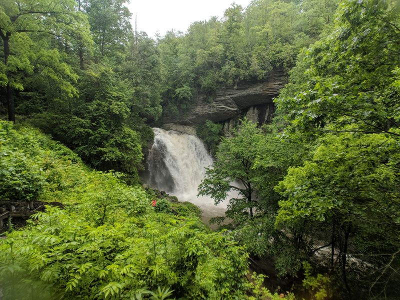
Accessibility is the standout feature at this roadside waterfall pairing south of Brevard. Connestee Falls drops about 85 feet, while Batson Creek Falls descends on the opposite side of the ravine, allowing both to be viewed from the same public overlook.
A roughly 50-foot boardwalk leads from the parking area to the viewing deck near the entrance of Connestee Falls, making the stop dramatically easier than the forest hikes elsewhere on this list.
Explore Brevard specifically includes Connestee Falls among the county’s accessible outdoor experiences, and a conservation easement protects both waterfalls and the surrounding woods.
Connestee Falls Park is publicly owned by Transylvania County, but the boardwalk and viewing deck are the designated public access points, and visitors should not attempt to descend toward the base or enter neighboring private areas.
After heavy rain, both streams become more prominent and the twin-waterfall effect is easier to appreciate.
The short approach also makes this an especially useful stop for travelers mixing waterfall sightseeing with other activities around Brevard rather than dedicating half a day to one hike.
Connestee Falls proves that the Land of Waterfalls nickname is not reserved only for people willing to tackle steep trails.
Some of the area’s most interesting water views are surprisingly easy to reach.
1. Toxaway Falls, Lake Toxaway
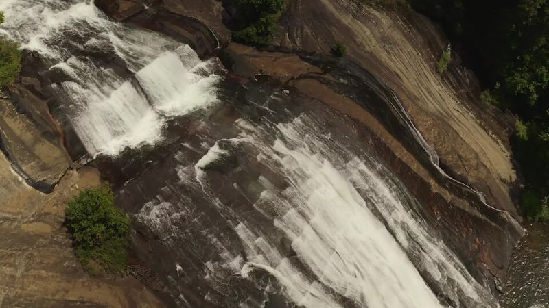
Drivers on US-64 pass directly over the top of this long cascade, making Toxaway Falls another reminder that impressive waterfalls around Brevard do not always require hiking boots.
Current Explore Brevard information lists the waterfall at about 150 feet, correcting the much larger 250-foot figure sometimes repeated in older descriptions.
Water pours from Lake Toxaway and spreads across a broad slope of exposed bedrock immediately below the highway bridge.
There are no designated waterfall parking spaces, so Explore Brevard currently recommends viewing the scene from the roadside area around nearby businesses rather than treating the highway shoulder like a formal trailhead.
The stripped rock face has a dramatic piece of history behind it. In 1916, the original Lake Toxaway dam failed after extreme rainfall, sending water down the slope and scouring away soil that had covered much of the bedrock.
The lake was eventually rebuilt decades later, but the exposed stone below the present dam remains part of the waterfall’s appearance today.
Toxaway Falls works particularly well as a stop while traveling between Brevard and the Gorges State Park area, adding a large roadside cascade to a day that might otherwise be filled with longer hikes.