This Tiny North Carolina Mountain Town Sits Beneath Some Of The State’s Most Dramatic Peaks
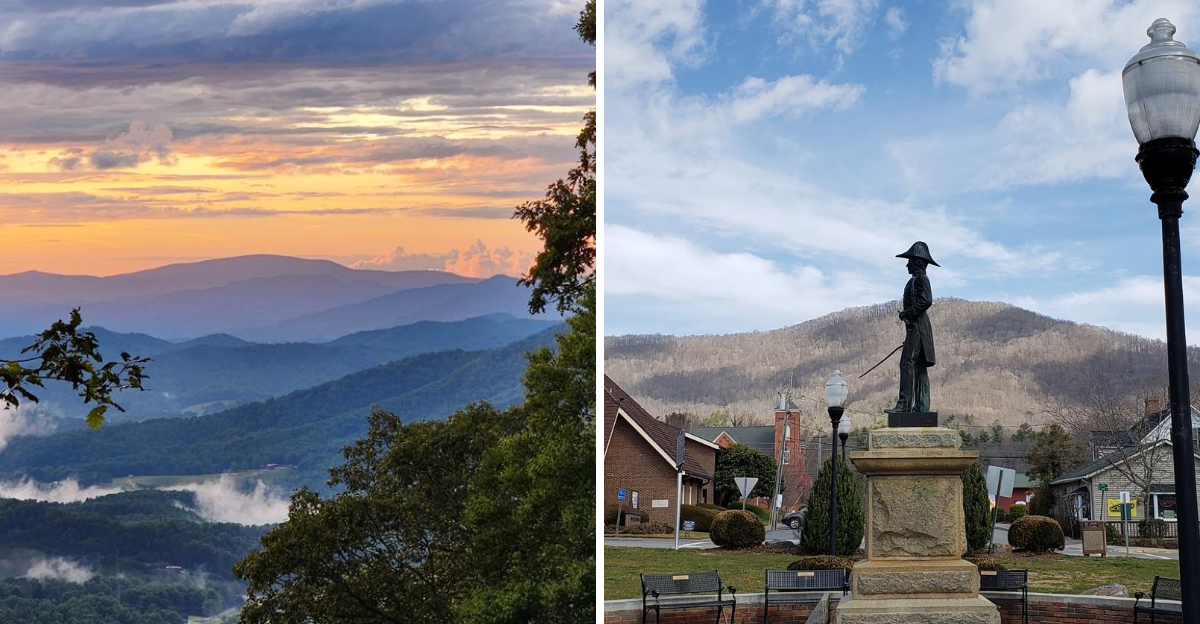
The skyline seems wildly overqualified for a town this small.
In one quiet corner of North Carolina, a community of roughly 1,600 people sits beneath mountains that refuse to be background scenery. The Black Mountains rise almost immediately beyond town, with some of the highest summits in the eastern United States dominating the horizon.
Down below, life moves at a completely different scale.
Brick sidewalks lead through a compact downtown where the pace feels calm enough to notice just how enormous everything looks beyond the rooftops. The contrast gives the place its personality.
You can be standing near the center of town with coffee in hand while some of North Carolina’s most dramatic peaks loom just beyond the streets.
For such a small dot on the map, the view is doing an astonishing amount of heavy lifting.
Stand In The Shadow Of Mount Mitchell
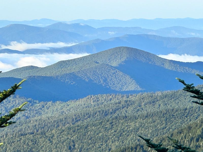
Mount Mitchell rises just southeast of Burnsville, but reaching the park by car currently requires a longer approach from the Asheville side of the Blue Ridge Parkway because the section north of the park remains closed.
Air sharpens as the elevation builds. Summit temperatures often run 10 to 15 degrees cooler than the valley floor, so a jacket belongs in the car even in July.
From the upper parking area inside Mount Mitchell State Park, a paved path of about 0.4 miles leads to the observation deck. Ridges roll outward in blue layers, folding into one another until they blur at the horizon.
Spruce and fir crowd the trailside, their resin scent closer to Canada than to the southern foothills. Frost can settle here in early fall, and clouds sometimes drift straight through the parking lot.
Plan for changeable weather, pack water, and give yourself time near the top; standing above every other peak in the East is a quiet thrill that visitors to Burnsville remember long after the trip. Sunrise visits reward early risers with soft light across the ranges.
Look Up At A Skyline Packed With 6,000-Foot Peaks
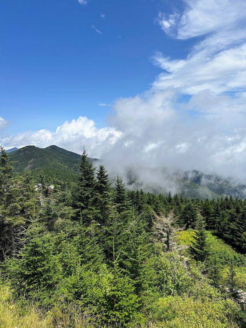
Eighteen named summits above 6,000 feet crowd the Black Mountains, which makes this stretch of the Appalachians the loftiest range in the eastern United States.
Standing on a quiet street in Burnsville and tilting your head back, you can trace a jagged skyline that changes character by the hour. Morning haze softens the ridgeline, midday sun sharpens every notch, and evening turns the whole wall of rock and forest deep violet.
Mount Craig, at 6,647 feet, ranks second only to its famous neighbor, and names like Celo Knob, Gibbs Mountain, Winter Star Mountain, and Big Butt fill in the rest of that skyline.
Locals sometimes point out peaks the way other towns point out landmarks. Photographers favor the fields along the edge of town at first light, when mist pools in the hollows below.
Clear winter days deliver the sharpest definition, with bare branches and snow-dusted crowns visible from the valley.
Few small communities in North Carolina can claim a horizon like the one framing Burnsville, and it never quite stops surprising first-time visitors.
Explore The Black Mountains Just Beyond Downtown
Just past the last stoplight, pavement gives way to gravel, gravel gives way to forest, and the ancient bulk of these mountains takes over.
Much of the terrain falls within Pisgah National Forest, where slopes drop steeply into shaded coves and creeks run cold year-round.
The range earned its name from dense stands of red spruce and Fraser fir that cover the upper elevations, giving the ridges a dark, almost inky look from a distance. Walk beneath them and the light dims, the ground goes spongy with needles, and sound softens to birdcalls and moving water.
Ecologically, this is unusual country. Cool, damp conditions support plants and animals more common far to the north, including mosses, ferns, and salamanders that thrive in the mist.
Wildflowers appear along lower trails in spring, while blueberries ripen on sunnier slopes in late summer.
Roads climb quickly, so allow extra driving time and watch for fog. A short outing from Burnsville can feel like a genuine wilderness day, which is part of why so many travelers make Burnsville their starting point.
Follow Trails That Climb Into The Highest Country In The East
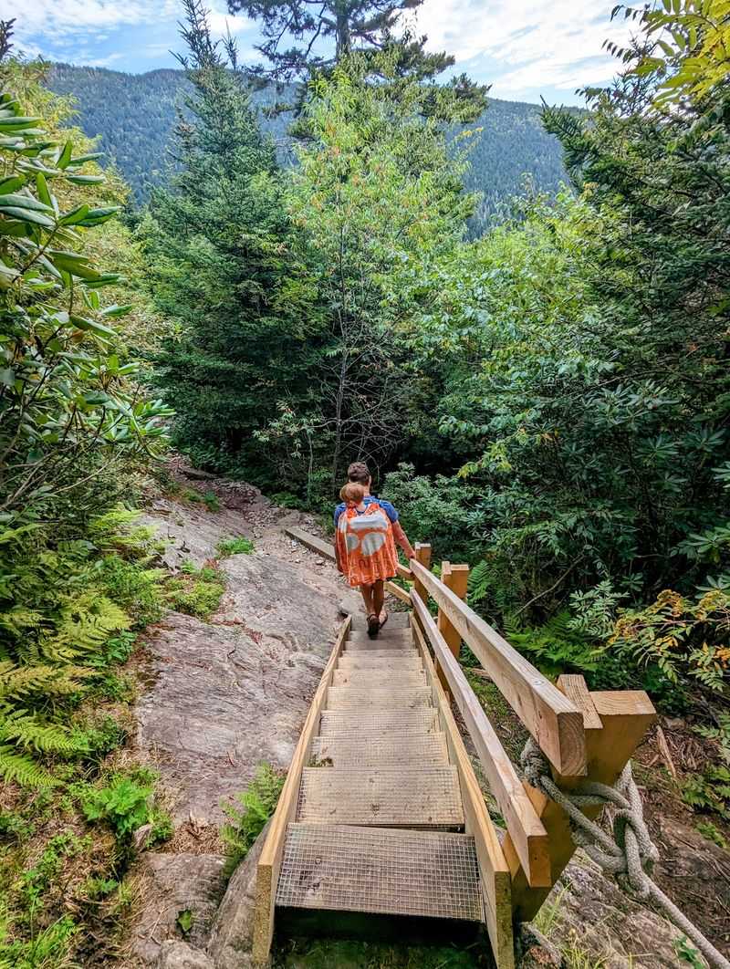
Serious hikers know the Mount Mitchell Trail by reputation: 5.6 miles one way from Black Mountain Campground, with roughly 3,600 feet of climbing. Legs burn, switchbacks stack up, and the payoff arrives as the forest thins near the top.
The Black Mountain Crest Trail runs even tougher, crossing or skirting ten of the range’s highest summits, Mount Craig among them. Its nickname among local hikers hints at relentless ups and downs rather than a steady climb.
Prefer something shorter but still steep? Woody Ridge Trail is only about 2.2 miles one way but climbs roughly 3,000 feet, making it one of the steepest approaches into the Black Mountains.
Gentler feet have options too. The Balsam Nature Trail, an easy 0.75-mile loop at Mount Mitchell State Park, winds through high-elevation forest with spruce, fir, and mossy boulders along the way.
Start early, carry layers and snacks, and check trail conditions before leaving Burnsville, since weather up high rarely matches what you see in town. More than 100 miles of public trail thread the county, so repeat visits never run out of routes.
Take In Long-Range Views From The Blue Ridge Parkway
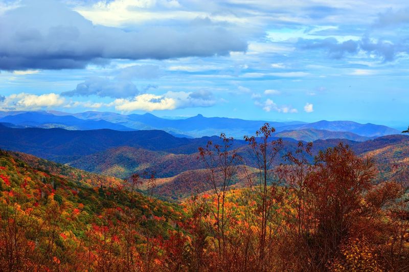
America’s Favorite Drive earned that title honestly, unspooling for 469 miles across ridge crests with almost no traffic lights to break the spell.
The Blue Ridge Parkway remains one of western North Carolina’s signature scenic roads, but Burnsville visitors need to plan carefully in 2026.
The stretch between NC 80 and Mount Mitchell remains closed, which means Green Knob Overlook near milepost 350.5 is currently inaccessible from the Parkway.
Mount Mitchell State Park is open, but drivers must approach from the Asheville side of the Parkway. Current NPS road status should be checked before building a scenic drive around the park.
Pack a picnic before heading up. Shaded pullouts make fine spots to spread a blanket, and cool breezes at elevation keep midsummer comfortable.
Drivers should watch for cyclists, fog banks, and seasonal closures after ice storms. Few scenic roads in North Carolina reward slow travel as generously, and Burnsville makes a convenient place to return to at the end of the day.
Return Downtown To A Classic Mountain Town Square
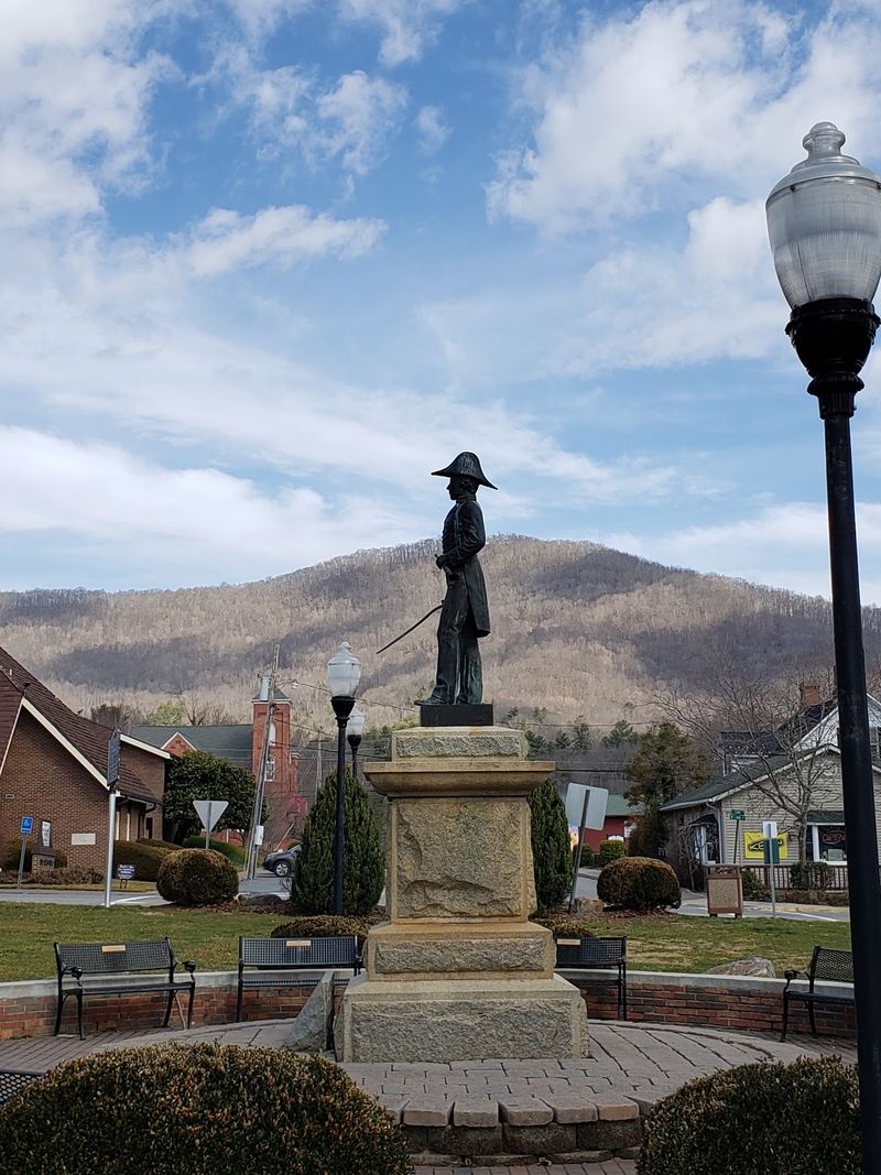
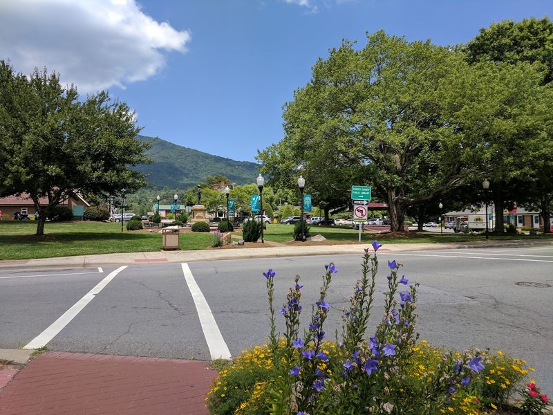
Brick walkways, shade trees, and benches surround a village green at the center of town, and after a day on the ridges the pace here feels wonderfully unhurried.
A statue of Captain Otway Burns, the naval hero of the War of 1812 who gave the town its name, stands at the middle of the green. Burnsville Town Hall, housed in the former Yancey County Courthouse, can be found at 2 Town Square, Burnsville, NC 28714.
The historic Nu Wray Inn, dating to 1833, anchors another side of the square with its long porch and white columns.
Shopfronts nearby sell coffee, baked goods, books, and mountain-made gifts, so a quick loop on foot turns into an hour without much effort. The smell of fresh cinnamon rolls drifts out of doorways on cool mornings.
Summer evenings bring music to the green, with families spreading quilts on the grass and children chasing fireflies at dusk. Farmers bring tomatoes, honey, and apples to market days.
Grab a bench, watch the light fade behind the peaks, and you will understand why the square remains the heart of Burnsville.
Browse Galleries Shaped By A Strong Local Arts Scene
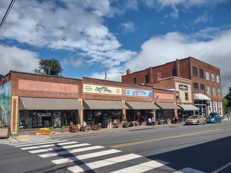
Few towns of roughly 1,600 residents support a creative community this large. Yancey County counts more than 400 full-time artists and around 200 part-time makers, one of the highest concentrations per person anywhere in the country.
Burnsville and the surrounding Toe River Valley support one of western North Carolina’s strongest craft communities. Toe River Arts organizes gallery exhibitions and twice-yearly studio tours across Yancey and Mitchell counties, with its current tours featuring roughly 85 to 100 participating artists.
Its former Burnsville gallery is in the process of moving, while the organization’s Spruce Pine gallery remains open.
The historic Micaville building at 573 Micaville Loop, formerly home to OOAK Art Gallery, is also still being repaired until its reopening is confirmed.
Nearby Penland School of Craft has trained makers for generations, feeding talent into the studios around Burnsville.
Ask a gallery attendant about open studio weekends; many artists welcome visitors, and watching a potter center clay is a memory that outlasts any souvenir from western North Carolina.
Use The Town As A Base For Waterfalls And High-Elevation Hikes
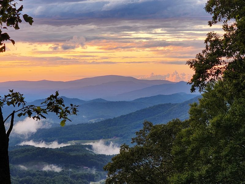
Water is the other headline attraction around here, and it takes only a short drive to find it falling.
Roaring Fork Falls rewards an easy 1.4-mile round trip with a 100-foot cascade sliding down bare rock at the base of Mount Mitchell.
Crabtree Falls asks more of you: a moderate to difficult 2.5-mile round trip near milepost 339.5 on the Blue Ridge Parkway leads to a 60-feet curtain of water and a wooden footbridge at its base.
Mist drifts across the trail on warm days, and the roar reaches you before the view does.
With more than 100 miles of public trails in the surrounding area, mornings can go toward a summit and afternoons toward a quiet creek walk beneath old hemlocks. Sturdy shoes and a dry bag for the camera handle most conditions.
Lodging, groceries, and hot breakfasts sit close to the square, which makes logistics simple. For travelers building a mountain itinerary in North Carolina, Burnsville works as a practical, friendly home base, and every road out of Burnsville leads somewhere worth seeing.