8 Idaho Hiking Trails Perfect For September’s Cooler Temperatures
September is when hiking finally stops feeling like a negotiation with the sun.
Across Idaho, cooler mornings and softer afternoon light make trails far more inviting than they felt a few weeks earlier.
Even familiar landscapes start changing character.
Aspens flash yellow, rivers run clear, and open ridges suddenly sound much more appealing without peak-summer heat.
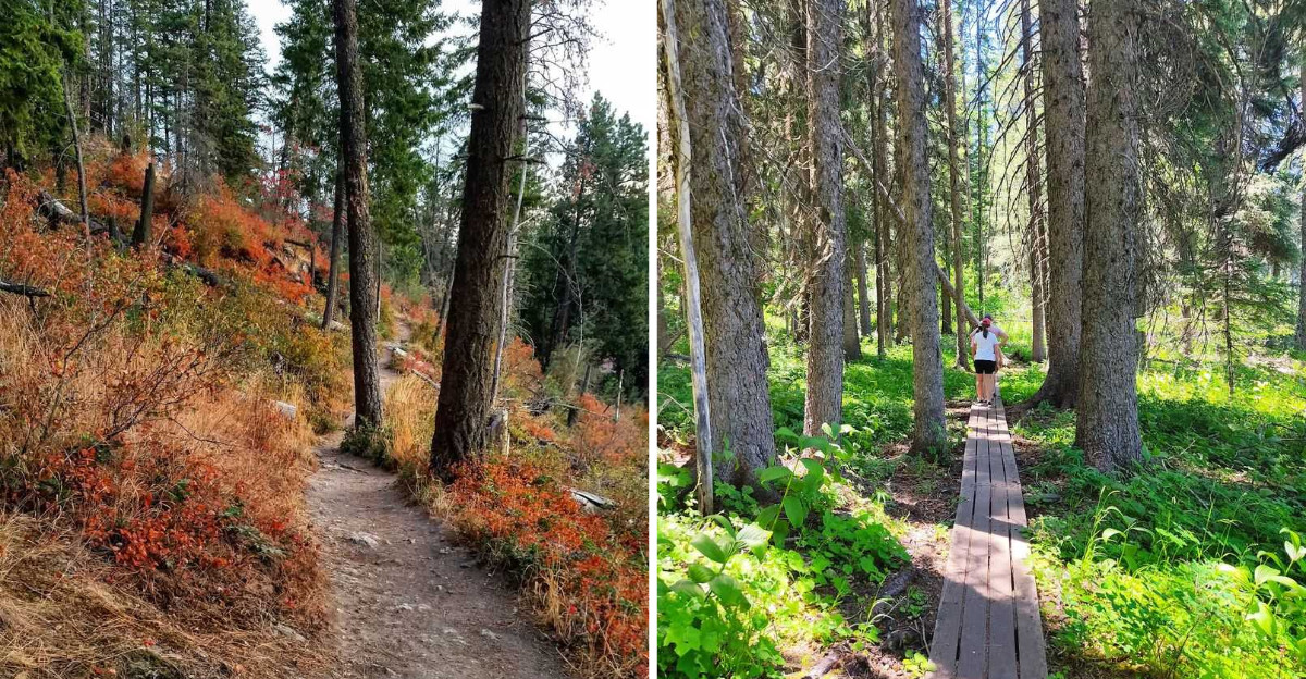
Boardwalks, lakeside loops, old rail corridors, dunes, and steeper climbs all come back into play.
Now lace up! This is the month for lingering at viewpoints instead of racing toward shade.
Bring a light layer, start early, and give yourself time to enjoy the scenery. Autumn arrives quietly here, but hikers notice first.
1. Table Rock Trail, Boise
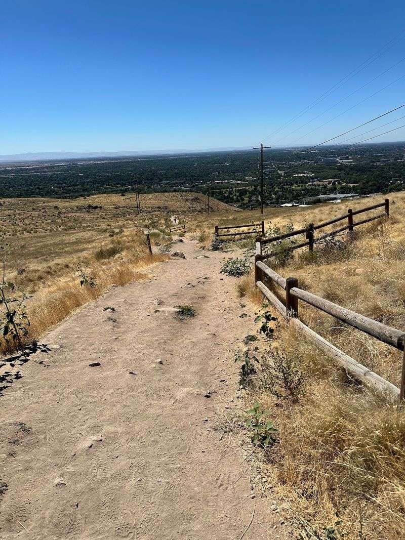
Have you given any thought to what the whole Treasure Valley looks like from above? A steady climb through open sagebrush answers that question in about an hour.
Table Rock Trail rises straight out of the Boise foothills and delivers big. The route runs roughly 3.7 to 3.8 miles round trip with close to 900 feet of elevation gain.
Most hikers finish in two to two and a half hours. There is almost no shade along the way, which is exactly why September works so well here.
At the summit sits a 60-foot illuminated white cross, visible from much of the city below. Nearby you will find the historic Table Rock Quarry, source of the sandstone used in many early Boise buildings.
Long before modern recreation brought hikers here, Table Rock and the surrounding mesa held cultural significance for Native peoples. The Idaho State Historical Society describes the area as sacred to several Native American tribes.
Views from the top stretch toward the Owyhee Mountains and across the foothills. Autumn colors ripple through the valley neighborhoods below, and the light around sunset turns everything amber.
Leashed dogs are welcome, so your four-legged hiking buddy can tag along. Access runs daily from sunrise to sunset for foot traffic.
Bring more water than you think you need, since the sun still has bite at midday. Sturdy shoes help on the loose, rocky sections near the upper switchbacks.
Table Rock is one of the busiest trails in the Ridge to Rivers system, especially on weekends, so visitors should plan accordingly. Parking for the hike is available at 2421 Old Penitentiary Rd in Boise.
Few climbs this close to a downtown pay off with scenery this generous.
2. River Trail At Harriman State Park, Island Park
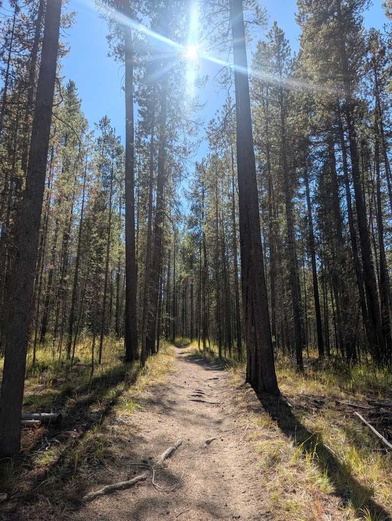
Let’s be real for a second, quiet wildlife encounters are getting harder to find. Out here, they still happen on an easy one-mile stroll.
The River Trail at Harriman State Park traces the famous Henry’s Fork of the Snake River near Island Park. Flat, gentle, and endlessly scenic, it suits every pair of legs.
Anglers know this stretch as one of the finest fly-fishing streams in the country. Even if you never cast a line, the clear water is mesmerizing.
Keep your eyes moving as you walk. Harriman lies within an 11,700-acre wildlife refuge where moose, elk, trumpeter swans, and many other wildlife species can be seen.
On clear days the Teton Mountains rise in the distance, adding another layer to the river views. Binoculars are useful for spotting wildlife across the river, meadows, and surrounding refuge.
The one-mile River Trail connects with a much larger network, with 22 miles of hiking, biking, and horseback-riding trails available throughout Harriman. September’s cooler air can make longer outings through the park more comfortable.
Wildlife protection comes first here, so certain nesting areas close seasonally. The River Trail is normally open by September, but a quick check before heading out never hurts.
Mornings often start near freezing, so pack layers you can shed by lunchtime. A thermos and a sandwich turn this into a slow, unhurried outing.
Early light can be especially attractive along the Henrys Fork, though mist depends on current conditions. The park’s official address is 3489 Green Canyon Rd in Island Park.
Some trails impress with difficulty; this one wins you over with pure calm.
3. Crown Point Trail, Cascade
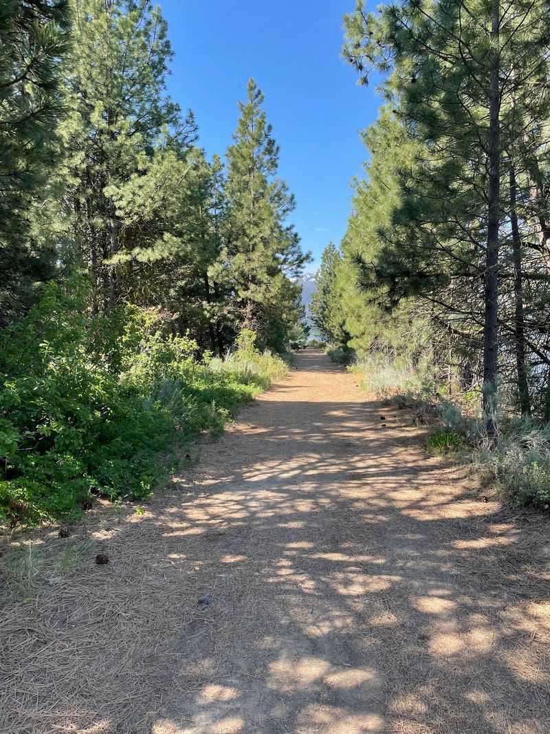
I find the way Lake Cascade repeatedly appears between the trees one of the best features of this easy shoreline route.
Crown Point Trail follows the southeast shoreline of Cascade Reservoir near the town of Cascade. Flat and welcoming, it charms families and casual walkers alike.
Here is a fun detail: the path is a rail-trail built on an old railroad bed. Watch closely and you can still spot remnants of railroad ties along the route.
The state park’s current map marks 2.7 miles of Crown Point Trail along the former railroad bed, while shorter out-and-back walks can easily be tailored from the trailhead.
Secluded beaches hide along the way, tucked between clusters of trees. Those sandy coves make excellent picnic stops or quiet reading nooks.
September daytime temperatures often land between 55 and 80 degrees. That range is close to perfect for a lakeside ramble without breaking a sweat.
Towering pines throw welcome patches of shade across the path. Between them, the lake flashes into view again and again.
Birdwatchers do well here, especially in the early hours when the water sits glassy. Osprey and waterfowl are regular sights above the reservoir.
Pack a light windbreaker, since breezes off the water pick up in the afternoon. Sunglasses help too, because glare off the surface is strong.
Sunset can bring warm color to the shoreline, so lingering is easy to justify. Crown Point Trail access is near the Crown Point unit and campground by Cascade Dam, while 100 Kelly’s Parkway is the Lake Cascade State Park headquarters.
Easy miles, big views, and a history lesson underfoot make for a satisfying afternoon.
4. Creekside Towers Trail At City Of Rocks, Almo
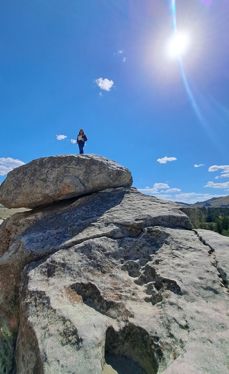
Trust me when I tell you that Idaho geology gets seriously weird here. Granite pinnacles jut skyward like something from another planet.
Creekside Towers Trail sits inside City of Rocks National Reserve near Almo. The 1.2-mile out-and-back has a gentle grade and is specifically recommended by the National Park Service as a family-friendly hike.
The route gains only about 122 feet overall, although the National Park Service notes that portions farther along become rougher and more uneven.
Look up and around constantly, because the small details steal the show. Hidden arches and honeycomb-textured rock faces appear when you least expect them.
A creek accompanies portions of the route, and spring or early summer can bring a small cascading waterfall beside the trail. Water flow later in the season varies with current conditions.
Fall foliage is the real September bonus here. Aspen, chokecherry, and willow light up gold and red against pale granite.
That contrast between colorful leaves and ancient stone is worth the drive alone. Photographers should plan for late afternoon when the rock warms to honey tones.
Rock climbers work the nearby towers, so you may watch a few ascents from the trail. Give them space and enjoy the free show.
Bring water, because the high desert dries you out quickly. A hat and sunscreen round out the packing list.
Cell service is spotty, so download maps before arriving. Short in distance yet enormous in scenery, this out-and-back hike punches far above its weight class.
5. Highpoint Trail At Farragut State Park, Athol
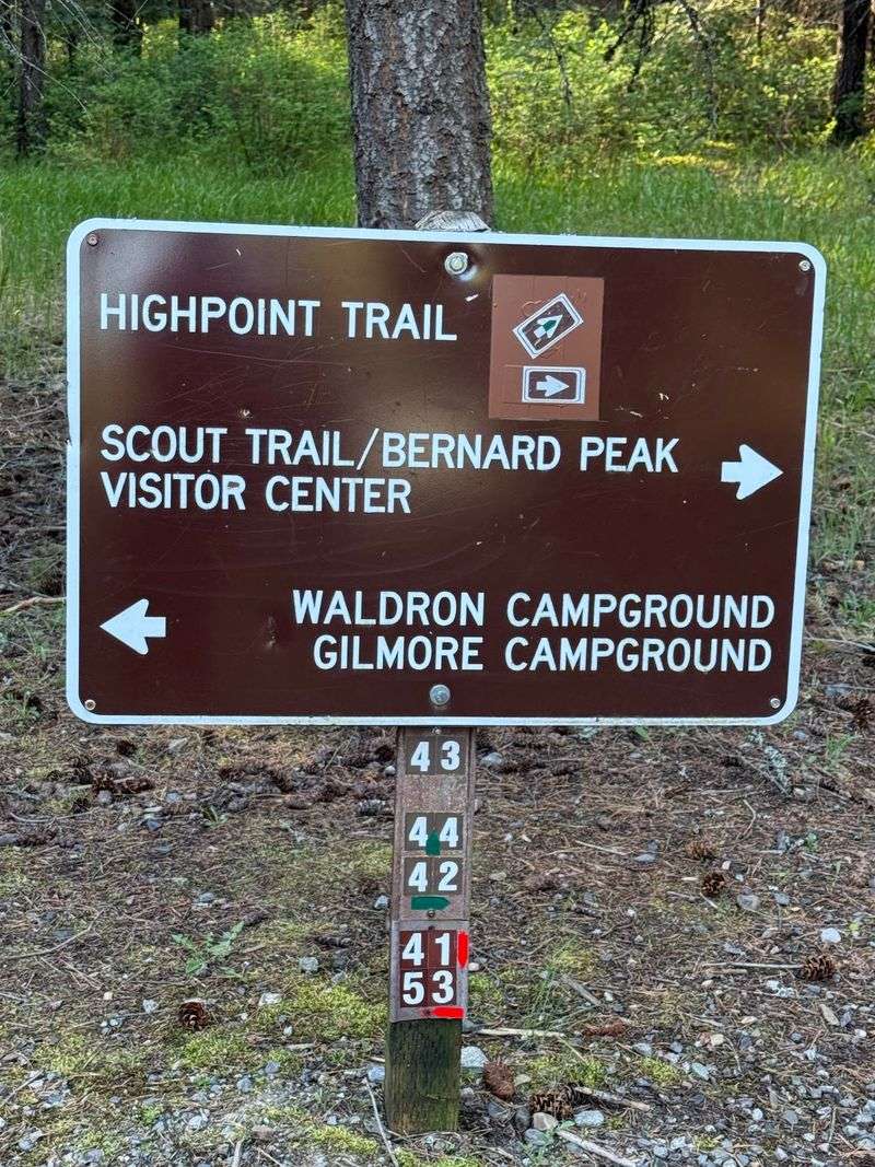
I’m still wrapping my head around how much elevation hides inside this park. Most trails hug the water, but one climbs away from it entirely.
Highpoint Trail at Farragut State Park in Athol heads inland and upward. It ascends a rock ridge, leaving Lake Pend Oreille behind and below.
Starting near the visitor center, Highpoint Trail heads into forested ridge terrain before becoming rockier as the climb gains elevation.
Expect rocky, loose footing in places. Trekking poles or grippy shoes make the climb noticeably smoother.
Views from Highpoint can be partly screened by forest, with glimpses toward Buttonhook Bay. Hikers looking for broader Lake Pend Oreille views can continue onto Scout Trail toward Bernard Peak.
History runs deep in this ground. Farragut Naval Training Station operated here during World War II and became the second-largest naval training center in the world.
Its name honors David Farragut, the first admiral of the U.S. Navy. Interpretive displays near the visitor center fill in the story nicely.
Farragut stays open year-round, and September’s cooler temperatures can make the rocky climb more comfortable than during hotter summer weather. Trail conditions still depend on recent rain and weather.
Wildlife sightings include deer and the occasional wild turkey. Move quietly and your odds improve.
Pack a snack for the top, since the climb earns a proper break. Trade the shoreline for the skyline once, and you may never go back.
6. Tubbs Hill Loop, Coeur D’Alene
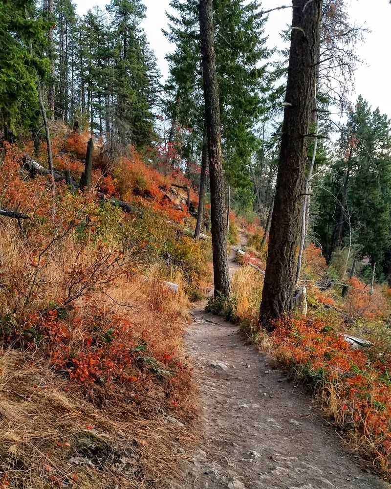
Are you seeing what I’m seeing? A genuine forest walk starting steps from a downtown street.
Tubbs Hill wraps around a scenic peninsula in Coeur d’Alene, with Lake Coeur d’Alene bordering it on three sides. The city’s official perimeter interpretive trail measures 2.2 miles.
Lake Coeur d’Alene borders the hill to the west, south, and east. That means views appear around nearly every bend.
Ponderosa pine and Douglas fir shade much of the path. The forest floor smells like warm bark on sunny September afternoons.
Scenic overlooks and quiet coves dot the shoreline below. Several short spur paths drop down to rocky beaches if you want a closer look.
The mileage looks short, but rocky and steep sections can slow the walk. City guidance has recommended allowing about two hours for the full interpretive loop.
September can bring comfortable hiking temperatures to Tubbs Hill, though weather and visitor levels vary from day to day.
Leashed dogs are welcome, and plenty of them patrol the trail daily. Bring water for them, since shade does not equal cool on warm days.
Footing includes roots and rocky steps in a few spots. Regular sneakers work, but sandals are a rough idea.
The trailhead sits right beside McEuen Park in the heart of town. Wild scenery this accessible is rare, and it makes an ordinary weekday feel like a small escape.
7. Bruneau Dunes Hiking Trails, Mountain Home
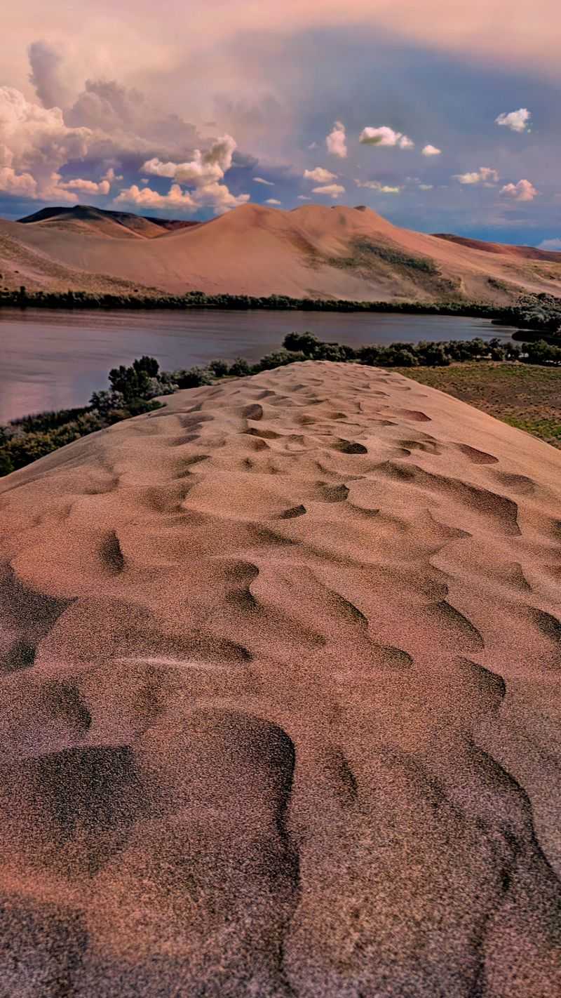
North America’s tallest single-structured sand dune sits in Idaho. That fact surprises almost everyone who hears it.
Bruneau Dunes State Park near Mountain Home protects an unusual desert dune landscape shaped by long-term wind patterns. Its tallest single-structured dune rises 470 feet above the surrounding desert floor.
Visitors can climb directly toward Big Dune for a shorter outing, while the established longer hiking route covers roughly six miles through the dune and lake landscape.
Prefer distance over steepness? A six-mile interpretive loop circles the dune field and surrounding terrain.
Hiking through sand rates as moderately strenuous no matter which option you pick. September’s cooler temperatures make the effort far more reasonable than a summer attempt.
From the top, panoramic desert views stretch in every direction. Sliding or sandboarding back down is the fun part.
Two lakes sit at the base of the dunes, adding an unexpected splash of blue. Waterfowl gather there, especially during fall migration.
Nighttime here is legendary for stargazing, with an observatory on site. Clear autumn skies show the Milky Way with startling clarity.
Wear shoes you do not mind emptying repeatedly, or go barefoot once the sand cools. Gaiters help if you have them.
Carry plenty of water, since there is zero shade on the dune. Wind can whip sand around, so sunglasses are practical rather than stylish. Climb it once and you will understand why people return with sleeping bags.
8. Lily Marsh Trail At Ponderosa State Park, McCall
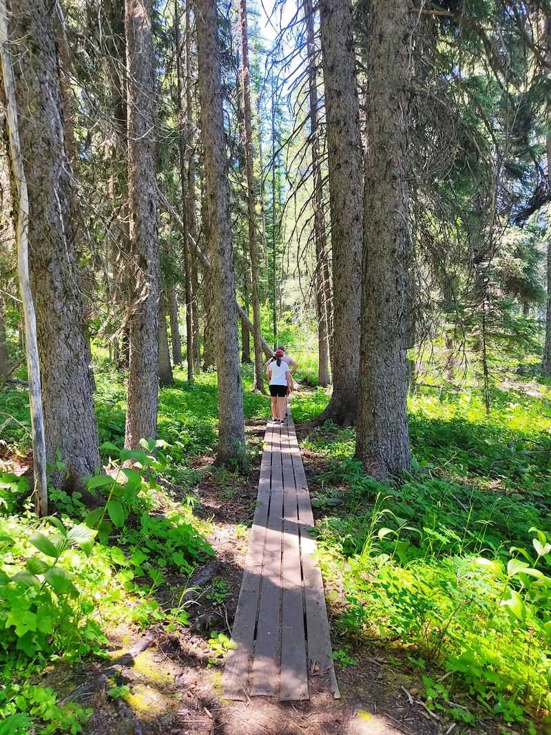
A marsh surrounded by towering ponderosa pines gives this section of the park a completely different character from the open shoreline nearby.
Lily Marsh Trail sits within Ponderosa State Park’s connected summer trail network. Popular mapped outings of roughly 2.3 miles combine Lily Marsh with adjoining trail segments rather than forming one official 2.4-mile Lily Marsh loop.
Elevation changes remain relatively gentle through the Lily Marsh area, with bridges and developed trail sections helping hikers cross wetter portions of the landscape.
Payette Lake makes appearances along the way, flashing blue between tree trunks. Benches along the route invite unhurried breaks.
Wetland, forest, and lakeshore habitat make the Lily Marsh area a useful place to watch for birds and other wildlife, though sightings naturally vary.
Dawn and dusk deliver the most activity, so time your walk accordingly. Move slowly and keep voices low for the best odds.
September can bring the first hints of fall color, while the timing of western larch and aspen color varies and the strongest larch display often develops later in the season.
Dogs are permitted in Ponderosa State Park but must currently remain on a leash no longer than six feet. The park does not list a May-through-November restriction specifically for Lily Marsh Trail.
The boardwalk sections can be slick after overnight frost. Watch your footing during those chilly early starts.
Bring a camera with a zoom lens if wildlife is your goal. Bug pressure drops noticeably by September, another point in autumn’s favor.
Between the marsh reflections and the pine-scented air, this loop leaves you unhurried and thoroughly recharged.