This North Carolina Mining Town Is Surrounded By Bridges, Rivers And Endless Greenery
Most towns do not have a geological résumé.
This one absolutely does.
Beneath the mountains of western North Carolina sits quartz so pure that the rest of the world has very serious uses for it, which is a strange amount of responsibility for a place this small.
Above ground, things are considerably more relaxed.
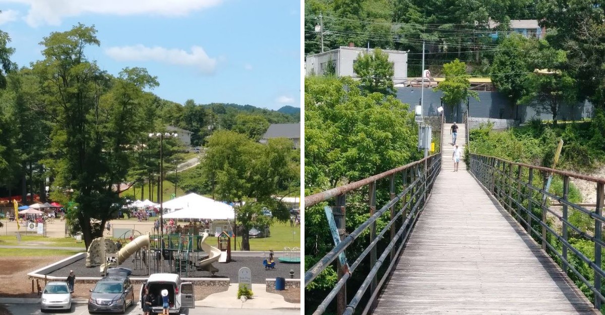
A river slips past downtown while an old footbridge makes crossing it feel much more interesting than necessary.
The surrounding ridges do a good job of hiding just how much is happening nearby.
You can arrive expecting a quiet mountain stop and accidentally end up reading about minerals like you have an exam on Monday.
That is part of the charm.
The scenery gets your attention first.
Then the ground beneath your feet starts showing off.
The North Toe River Runs Right Along The Edge Of Downtown
Water sets the pace here. The North Toe slides past the edge of the business district, and its sound carries up the streets on quiet mornings.
Sunlight catches the riffles while herons stalk the shallows.
A two-mile section of the North Toe through Spruce Pine is designated Mountain Heritage Trout Water and managed under delayed-harvest trout regulations.
Riverside Park sits across the North Toe from downtown, although the Town of Spruce Pine currently lists the park as under construction.
Benches face the current, so you can sit and watch the river do its work.
Spring brings high, quick water; late summer slows everything to a green, glassy drift. Families spread blankets on the grass while kids hunt for smooth stones along the bank.
Anglers often wade in below the bridge pilings, casting into shaded pockets where fish hold.
Bring a light jacket even in warm months, because river air stays cooler than the streets above. Birdwatchers should arrive early, when kingfishers and warblers are most active.
For a first look at Spruce Pine, this riverside edge is the friendliest introduction you can find.
A Historic Footbridge Connects The Business District With Riverside Park
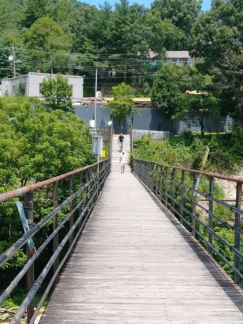
Built in 1940, the 403-foot pedestrian bridge is notable for its unusual riveted bowstring deck-truss design. Its steel arches frame the water below like a series of windows.
Handrails and wooden decking make the crossing easy for strollers and small children.
Walking it takes only a couple of minutes, though most people stop halfway. From that vantage point you can see the North Toe River sliding underneath, the green sweep of the parkland, the working railroad line, and the rooftops of downtown Spruce Pine.
Trains occasionally rumble past, and the whole structure hums faintly beneath your shoes.
The 1940 bridge remains a distinctive historic landmark, with its original builder unidentified in available bridge records. Photographers love it at dusk, when lamplight glitters on the current.
Cross early and you may share the span with joggers and dog walkers heading to the park. Cross late and you get the river to yourself.
Either way, this walkway remains one of the simplest pleasures in Spruce Pine, linking shops and cafes with picnic tables and open lawn in under five minutes.
Forested Mountains Rise Around Town In Nearly Every Direction
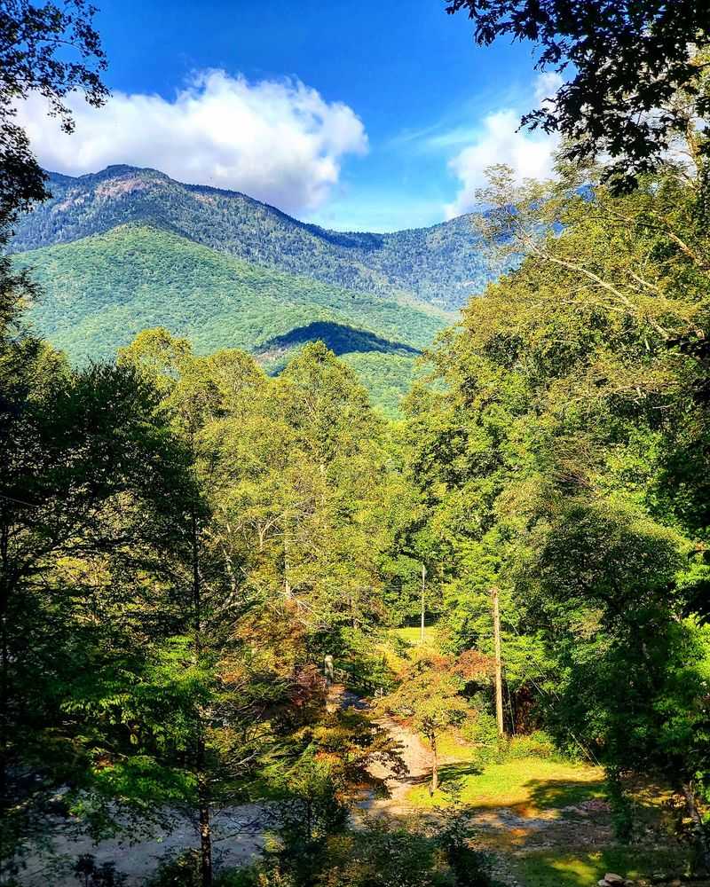
Look up from almost any street corner and a wooded ridge answers back. Slopes covered in oak, maple, and hemlock climb on all sides, part of the ancient Blue Ridge range that shapes weather, light, and mood throughout the year.
Morning fog settles in the valley and burns off slowly, leaving the peaks sharp against the sky. By October the hillsides turn scarlet and gold, and the whole bowl around Spruce Pine glows.
Elevation gives the town cool summer evenings, so pack a sweater even in July. Rhododendron thickets bloom pink and white along shaded trails in June, and wild blueberries ripen higher up later in the season.
Hikers can pick short walks near town or longer routes toward higher ground, including trails that lead to bald summits with wide, uninterrupted views. Roan Mountain and Mount Mitchell both sit within an easy drive.
Bring sturdy shoes, since mountain paths stay slick well after a storm passes.
What makes the setting special is the sense of enclosure. Ridges wrap around Spruce Pine like cupped hands, muffling traffic noise and holding in the smell of damp leaves and pine needles after rain.
Mining Helped Shape The Community Long Before Tourism Took Center Stage
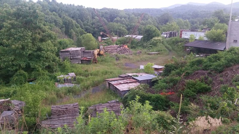
Pickaxes came before postcards. Long before visitors arrived for scenery, families here made their living pulling minerals out of the ground, and that work built the streets, the rail connections, and much of the local identity.
Indigenous peoples worked mica deposits in the Spruce Pine district long before European settlement, digging shallow pits and tunnels in search of sheet muscovite. Later, commercial operations expanded rapidly.
The Bon Ami Mine, established in 1924, extracted feldspar used in household cleaning products and turned Spruce Pine into a genuine industrial center.
Locals sometimes call the region the Mineral City of the World, and rockhounds treat it as a treasure hunt. You can still sift buckets of gravel at nearby gem mines and find garnet, amethyst, or flecks of mica that shine like tiny mirrors.
Kids especially love the moment a wet stone reveals a bright, glassy face.
Museums and shops around western North Carolina display specimens from the district, and old mine roads still thread through the woods. Understanding that history changes how the landscape looks: every glittering roadside cut is a reminder that Spruce Pine grew from what lies beneath it.
Quartz Feldspar And Mica Put This Small Mountain Town On The Map
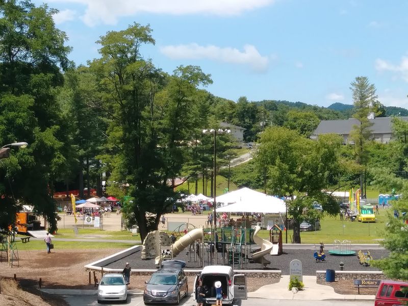
Here is a fact that surprises almost everyone: the purest quartz on Earth comes from the mining district surrounding this small mountain community.
Recent technical literature estimates that the Spruce Pine deposit supplies about 70 percent of the world’s high-purity quartz, a critical material used in fused-quartz components for semiconductor and solar manufacturing.
Feldspar and mica built the earlier chapters of that story. A chemical separation method called froth flotation, adopted in the 1940s, transformed how these minerals were processed and boosted output dramatically.
Golf fans may recognize a curious connection. For more than forty years, the bright white sand in the bunkers at the Masters tournament has been described as Spruce Pine sand, a byproduct of high-purity quartz processing here.
Walk the sidewalks and you notice mica flecks winking in the pavement and in the gravel along driveways. Local shops sell polished specimens, raw crystals, and handmade jewelry that carry a piece of the district home with you.
Few towns of roughly two thousand residents can claim such global reach, which is part of what makes Spruce Pine feel bigger than its footprint suggests.
River Access Makes Fishing Paddling And Tubing Part Of Everyday Recreation
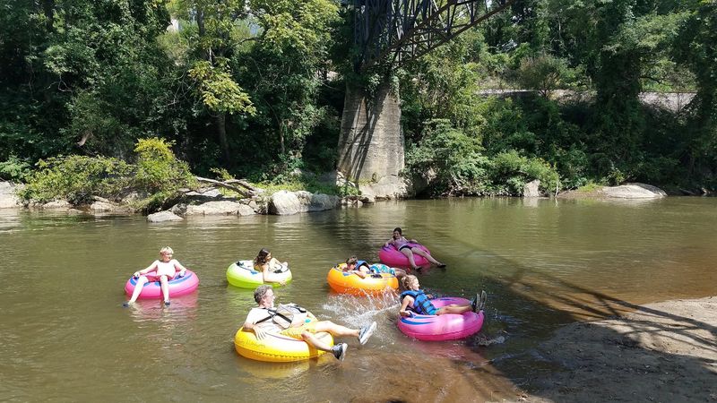
Summer afternoons here often end with wet sneakers. Because the water sits so close to homes and shops, paddling, casting, and floating feel less like planned excursions and more like ordinary weekday habits.
Fly anglers have a real prize downtown: a delayed harvest section of the North Toe River designated as Mountain Heritage Trout Water, stocked heavily so fishing stays productive across the seasons.
Anglers should check current state licensing requirements, seasonal harvest rules, and lure restrictions before fishing this section.
Kayakers and canoeists follow miles of scenic current past rocky outcrops, shaded banks, and quiet pools where turtles sun themselves. Rapids appear in stretches, then settle back into slow green water.
Paddlers passing Spruce Pine often spot kingfishers, herons, and deer stepping down to drink.
Tubing suits lazier days. Drift with the current, trail your fingers in the cold water, and watch the ridgelines slide by overhead.
Check flow levels before heading out, since mountain rivers rise quickly after heavy rain. Water shoes protect feet from slick stones, and a dry bag keeps phones safe.
Local outfitters near Spruce Pine rent gear and arrange shuttles, which saves the hassle of parking two vehicles.
The Blue Ridge Parkway Is Only Minutes From Downtown
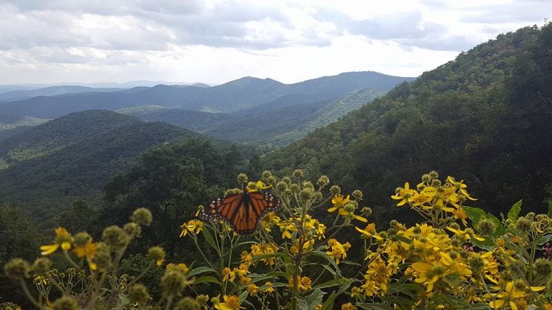
A few turns of the steering wheel separate the town center from one of the most photographed roads in America. Access sits near Milepost 331, close enough that you can grab breakfast, drive up, and be watching layered ridges fade into blue haze before your coffee cools.
Speed limits stay low, which is the point. The Parkway rewards unhurried driving, with overlooks appearing every few miles and picnic areas shaded by hardwoods.
Protected corridors along the route shelter wildflowers, songbirds, black bears, and hundreds of tree species. Spring brings flame azalea and mountain laurel; autumn draws crowds for color that peaks in mid-October.
Because of that proximity, Spruce Pine markets itself as a basecamp to the Blue Ridge, and the label fits. Several Parkway destinations remain accessible, but routes should be checked individually because nearby road closures continue in 2026.
Sections of the Parkway close during winter ice and snow, so check conditions before setting out. Fill the fuel tank in town, since services along the road are limited.
Few places in North Carolina put a national scenic byway this close to a downtown sidewalk, and Spruce Pine makes the most of it.
Old Rail Lines Waterways And Mountain Slopes Give The Town Layers Of Scenery
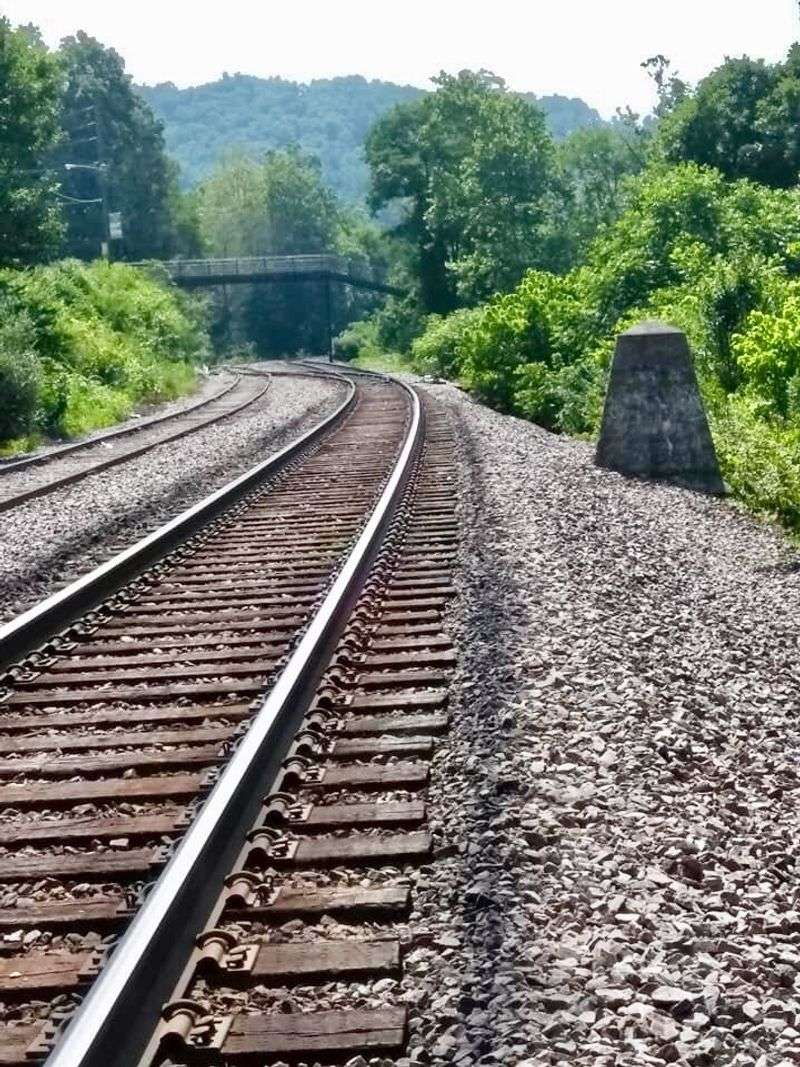
Scenery here stacks up like pages in a book. Rails run beside the historic downtown district, a reminder of the years when freight cars carried minerals out to distant factories.
South of Spruce Pine, the historic Clinchfield Loops use horseshoe curves, tunnels, bridges, cuts, and fills to carry the railroad across the steep Blue Ridge terrain. Watching a locomotive thread that puzzle is a memorable sight.
On the water, the Toe River Canoe Trail runs 37 miles along the North Toe, threading past rapids, farm valleys, and steep wooded banks where wildlife moves quietly at the edges. Each mile reveals a different combination of rock, water, and forest.
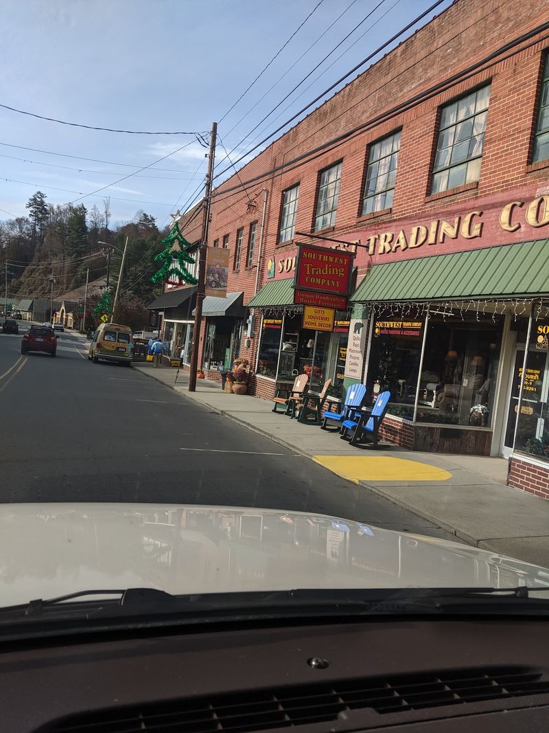
Downtown blocks in Spruce Pine climb a hillside, so streets sit at different levels and rooftops become viewpoints. Brick storefronts, murals, and small galleries fill the upper street, while the lower street opens toward the river.
Industry, rivers, and ridges layered together create a place that rewards slow exploration. Give yourself a full day, wander both street levels, and you will understand why this corner of North Carolina keeps drawing travelers back to Spruce Pine.