This Georgia Waterfall Hike Winds Through A Shaded Forest To Multiple Cascades
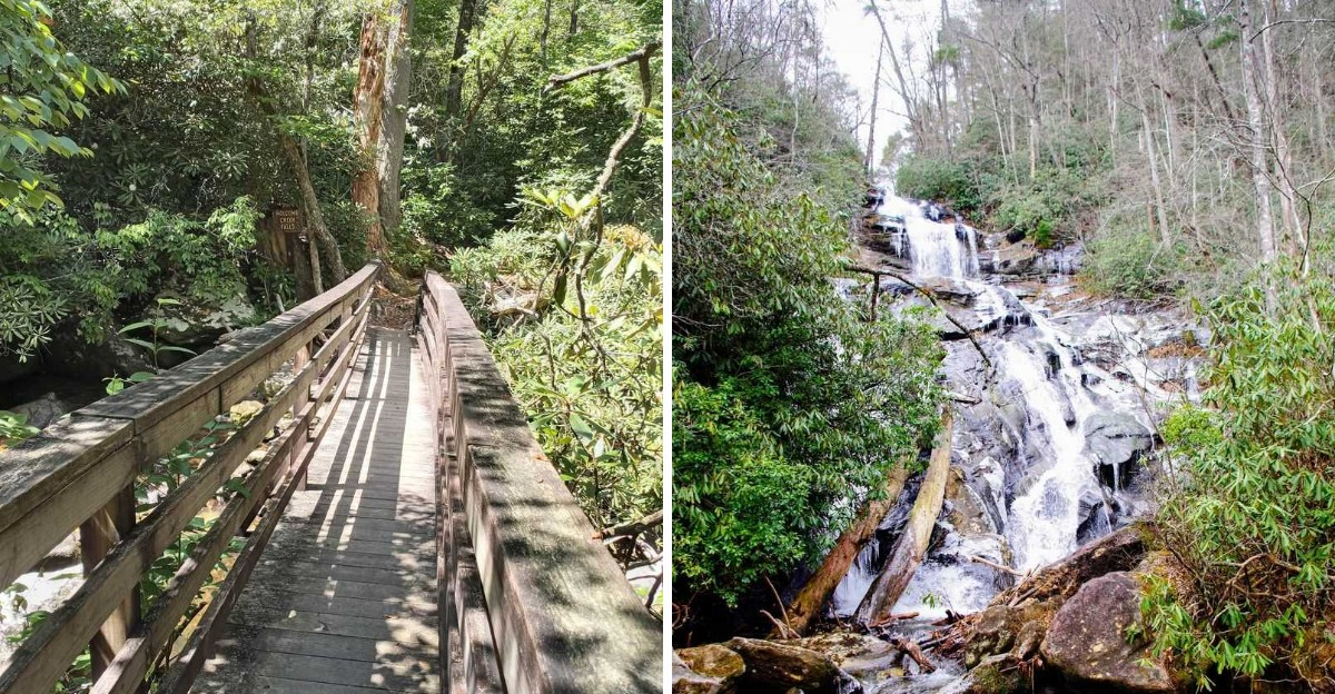
The sound reached me before the trail even curved. A steady rush of water somewhere ahead, promising more than one waterfall.
I had packed for a short walk and ended up chasing that sound for almost two miles. Tall trees blocked most of the sun, keeping the whole path cool even on a warm day.
Moss covered every rock along the creek like a soft green carpet. Each turn revealed another cascade, then another, until I lost count.
This kind of trail rarely makes it onto the popular lists, yet it delivers more than plenty of famous ones. Somewhere in the mountains of Georgia, water still finds its way over stone the same way it has for centuries.
By the final waterfall, my legs were tired but my mood was better than when I started. Georgia keeps hiding surprises like this in plain sight.
The Gravel Road That Guards The Trailhead
Getting here feels like a test before the reward. The last few miles run on gravel forest roads, and they can be rough, narrow, and washboard bumpy.
Passenger cars have made the trip on dry days. Still, a vehicle with higher clearance handles the ruts far more comfortably.
Rain and winter change the math completely. Washed out sections show up fast, and drivers with all wheel drive tend to relax more on those stretches.
The turn matters too. From town, Warwoman Road runs east roughly ten miles before Hale Ridge Road, also marked FS 7, branches left.
Follow that road for several miles until it meets Overflow Road, listed as FS 86. That intersection is your landmark, and the parking is simply a wide spot along the roadside.
Space is tight, with room for only a handful of cars. Arriving early in the day gives you the best shot at an easy spot.
Cell service disappears out here, so download your map ahead of time. Tell someone your plan before you leave the pavement behind.
The trailhead sits at Hale Ridge Road in Clayton, Georgia, part of the Chattahoochee-Oconee National Forest, and it is called Holcomb Creek Falls Trail Head.
Finding The Unmarked Start Behind A Blue Blazed Tree
Your GPS will say you have arrived while you stare at nothing but woods. That moment confuses almost everyone on their first visit.
The clue is a large oak tree wearing a stripe of blue spray paint. The actual trail sign sits a few feet behind it, easy to miss from a moving car.
Look on the left side of the road as you approach the intersection. A big rock nearby gives you a second reference point.
There is a smart trick worth knowing. Two access points exist along the road, roughly ten minutes apart on foot.
Start at the far point and the loop finishes downhill toward your car. Start at the closer one and you climb almost the entire way back.
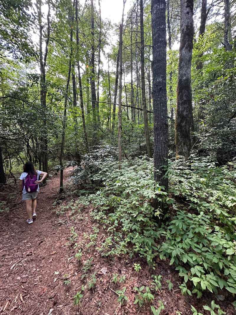
Once you step in, the path itself becomes obvious. The tread is clear and well worn, even when autumn leaves blanket the ground.
Take a photo of your parking spot before you go. Hikers who complete the loop sometimes pop out on the road unsure which direction leads back.
No facilities exist here, so handle that before the gravel road begins. Pack out everything you carry in.
A Loop Under A Roof Of Green Leaves
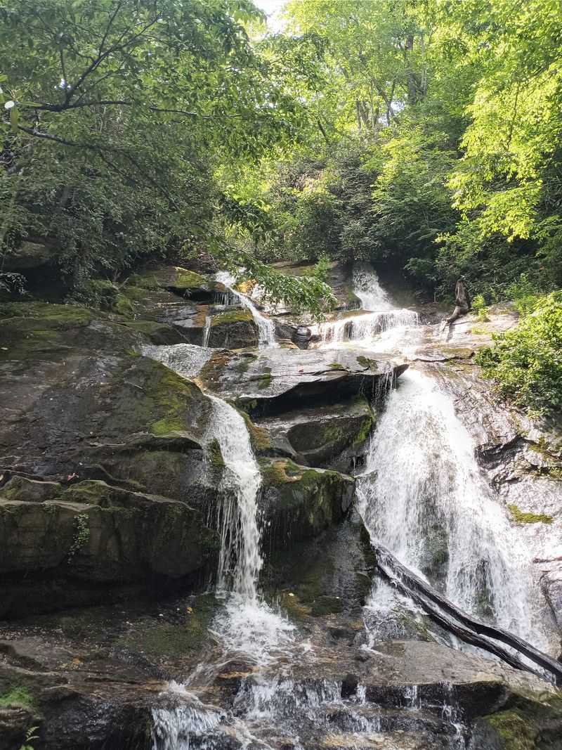
Shade wraps around you within the first fifty steps. Tall hardwoods knit together overhead and turn the sunlight into soft green patches.
The whole loop measures roughly 1.3 to 1.8 miles depending on your route. Add the short road walk and most people finish under two miles.
Moss covers tree trunks and old logs in thick velvet layers. The dampness here feeds a strange, beautiful mix of mountain plants.
Rhododendron thickets crowd the creek banks and bloom in warmer months. Ghostly white Indian Pipe sometimes pushes up through the leaf litter, pale as candle wax.
Butterflies drift along the corridor in summer. Wildflowers show up in surprising numbers for such a shady place.
The temperature drops noticeably as you descend toward the water. That cool pocket of air is one of the best parts on a humid Georgia afternoon.
Sound plays a role too. Rushing water builds slowly until it fills the whole cove.
Holcomb Creek Falls Drops About One Hundred Twenty Feet
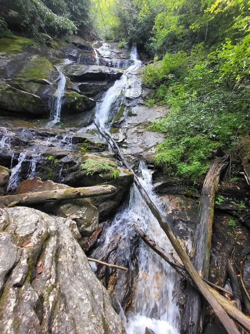
The main event arrives about half a mile in, and it is loud. Water plunges roughly 120 feet in a multi tiered rush down dark rock.
The upper portion free falls through open air. The lower section turns into a steep, sliding sheet across the stone face.
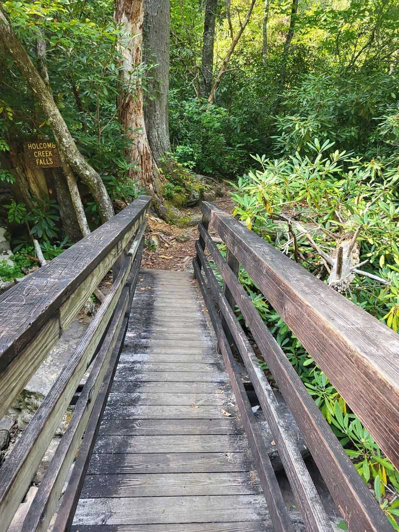
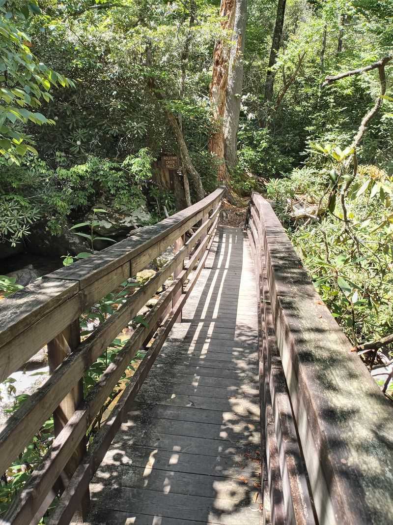
A wooden bridge crosses the creek near the base. From there you can pick your way up a bit for a closer angle.
Boulders sit scattered around the pool below. Several are flat enough to serve as a lunch table with a front row view.
Footing gets tricky on wet rock, so slow down near the edges. Trekking poles or a sturdy stick help more than you would expect.
Flow depends heavily on recent weather. After steady rain or spring melt, the falls thunder and throw mist across the trail.
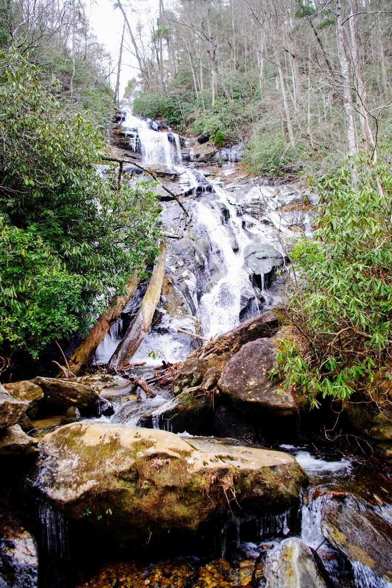
Winter brings something rarer. Cold air settles in this shaded cove, and portions of the cascade can freeze into pale ice sculptures.
Photographers love the low light here. The canopy keeps harsh sun off the water almost all day.
The Smaller Cascades Along Holcomb Creek
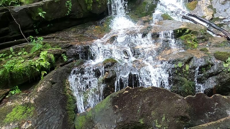
“Holcomb Creek has more to offer beyond the two best-known waterfalls. Smaller cascades appear along the creek as the trail continues through the forest.
A short side path drops down to the creek just before the trail rejoins the road. Miss the turn and you never know it exists.
Size is not the point here. The little cascade sits in a pretty, quiet pocket with almost no foot traffic.
Beyond these three, the creek keeps performing. Water tumbles over shoals and small drops for hundreds of feet along the corridor.
You get partial glimpses of the big falls from higher on the trail. Side paths lead to several smaller chutes if you want to explore.
That constant motion is what makes the hike feel longer than its mileage. There is almost always water in view or in earshot.
Keep an eye out for salamanders on damp rocks. This kind of cool, wet habitat suits them perfectly.
Slow walkers get the best of this place. Rushing the loop means missing half the show.
The Climb Back Up Has Its Own Rewards
Gravity does you a favor on the way in. Most of the walk to the first falls runs downhill, which feels wonderful at the time.
Then comes the return. The climb after the bridge makes up the bulk of the effort and gets hearts pounding fast.
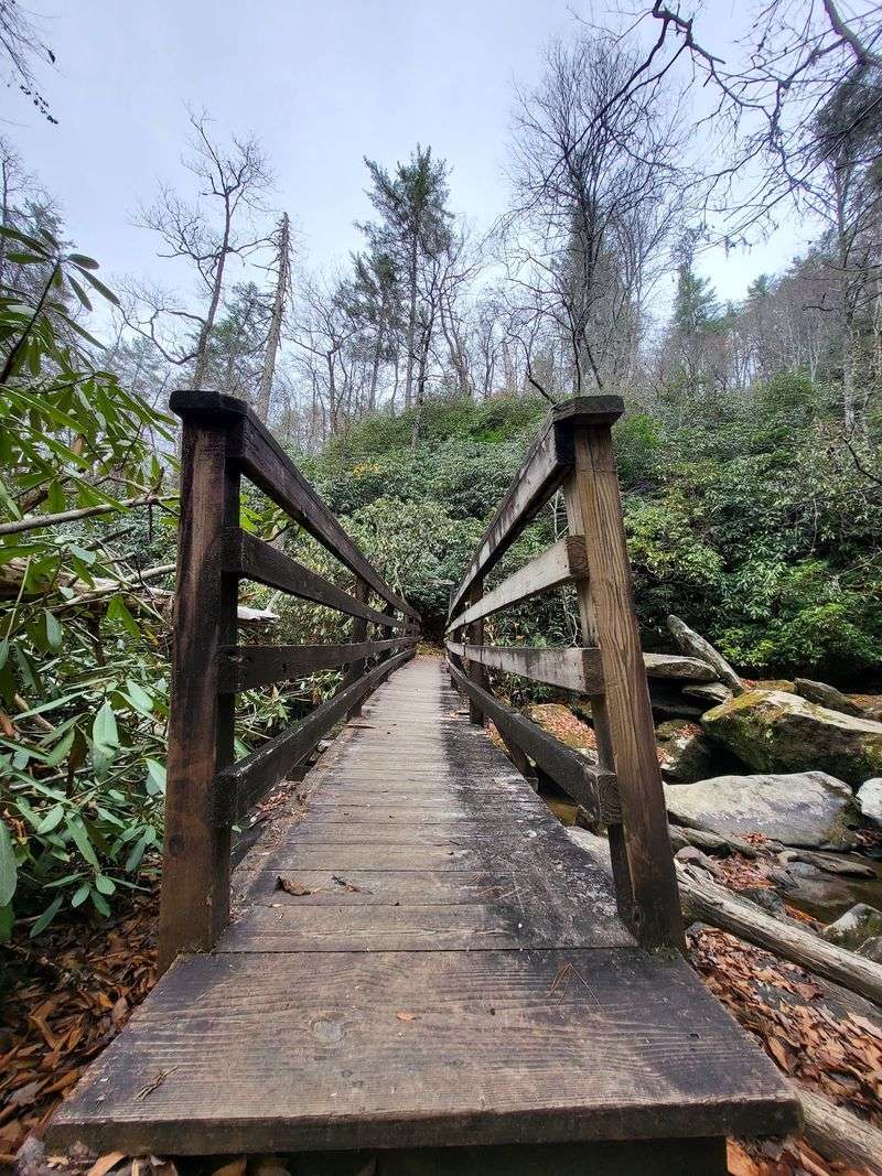
Wooden stairs and walkways help on the steepest pitches. Bridges carry you across the creek at key crossings.
Structures out here need repair from time to time. Fallen trees have blocked sections in the past, so flexibility helps.
The tread is uneven with rocks and roots throughout. Fallen leaves in autumn hide those obstacles surprisingly well.
Good hiking shoes with real grip are the single best piece of gear. Slick rock near the water demands attention.
Pace yourself and pause when needed. Stopping to catch your breath is completely normal on the uphill stretch.
Rate the difficulty as moderate to moderately strenuous. Fit beginners handle it fine with water and patience.
Ammons Falls And Its Sliding Forty Foot Ribbon
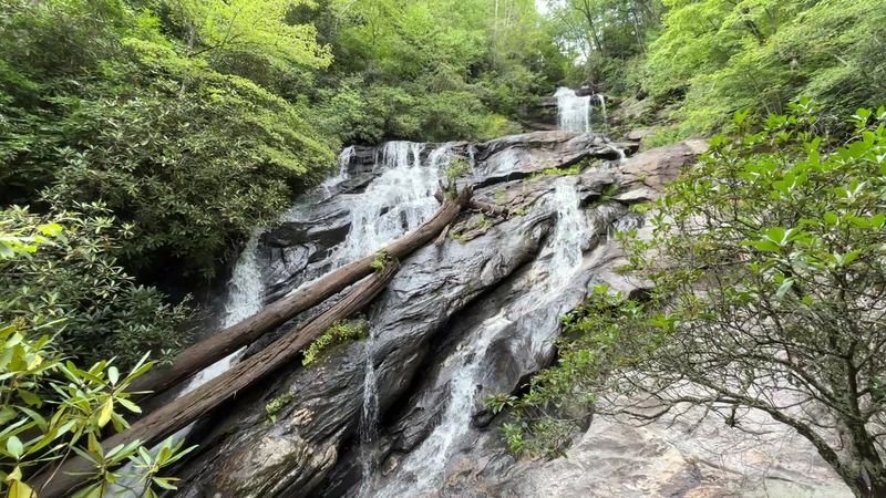
A second waterfall waits a short distance beyond the first. Ammons Falls slides about forty feet down angled rock rather than dropping straight.
The effect looks like a natural waterslide. Water spreads thin across the stone and shimmers in the filtered light.
Cross the creek at the bridge and the trail continues on the far side. At the split, staying right leads you toward this cascade.
An observation deck was built to give hikers a clear view. Storms have damaged it in past years, and repairs have followed.
Because conditions change, checking with the Chattahoochee-Oconee National Forest before a trip is smart. Bridges and platforms out here take a beating from weather.
Reaching the second falls takes about twenty extra minutes from the first. Many hikers agree the pairing is what makes the route special.
Timing Your Visit For The Best Water Show
Waterfalls run on a schedule set by the sky. Spring melt and heavy rain turn these cascades into roaring, mist throwing giants.
Late summer dry spells thin the flow. The falls stay pretty, just gentler and easier to scramble around.
Autumn brings color overhead and leaf covered footing below. Watch your step, because those leaves hide rocks and roots.
Winter offers the rarest scene. The shaded cove traps cold air, and ice builds along the rock faces into glassy formations.
Access is the tradeoff in cold months. Snow and ice make the gravel approach much harder without four wheel drive.
Weekday mornings deliver solitude. Plenty of visitors have walked the entire loop without meeting another person.
Published visitor information lists daily hours from 7 a.m. to 9 p.m., though checking current conditions before visiting is wise.
Check recent rainfall before you commit. A wet week beforehand usually means a spectacular afternoon.
Packing Smart For A Remote Mountain Cove
Remote means genuinely remote here. There is no cell reception, no restroom, and no water fountain waiting at the parking area.
Carry more water than you think you need. The uphill return dries you out faster than the short mileage suggests.
Sturdy shoes top the list. A walking stick or trekking pole steadies you on slick rock and loose leaves.
Bug spray earns its place in warmer months. Yellow jackets can be protective of their turf in late summer.
Bring a paper map or a downloaded offline version. Signal drops long before you reach the gravel section.
Dogs do well on this route and many families bring them along. Keep them leashed near the steep drops.
Snacks make the boulders near the big falls a fine picnic spot. Pack out every wrapper and crumb.
Tell someone your route and expected return time. Simple planning turns a rugged little hike into a smooth, memorable morning.