The Nebraska Town That Vanished Under a Reservoir and Resurfaces Whenever Drought Pulls the Water Back
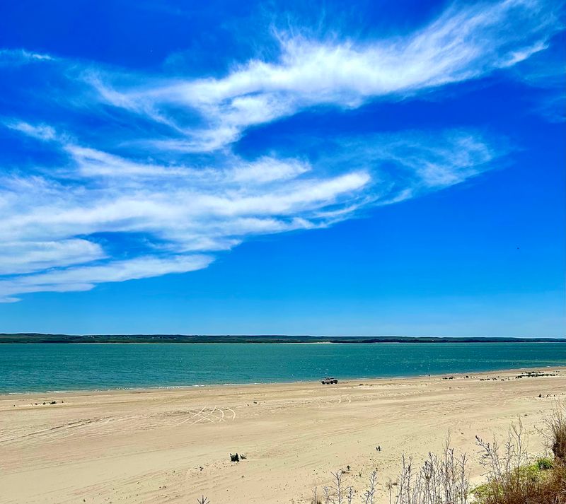
Most people pull off Highway 61 in western Nebraska expecting sand, sunburn, and a cooler full of sandwiches. What they don’t expect is that the pale beach under their bare feet used to be a valley with a hotel, a bank, and a schoolhouse in it.
When the water drops far enough, foundations and a stone root cellar come back into daylight like someone lifted a lid. It is one of the strangest things you can stumble onto in this state, and it happens more often than you’d think.
A Ninety-Thousand-Acre Reservoir With a Sand Beach Rim
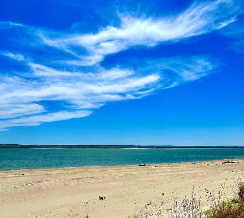
Sand squeaks underfoot here, pale and fine enough that people compare the shoreline to a coast rather than a prairie lake. Lake McConaughy stretches across Keith County in western Nebraska, roughly twenty miles long, held back by an enormous earthen dam at its eastern end.
Locals shorten the name to Lake Mac, and the state recreation area wrapped around it covers beaches, campgrounds, boat ramps, and a wildlife management area that spills onto the flats where the North Platte River feeds in.
The reservoir is the largest in Nebraska, which means it can hold an astonishing amount of water and also lose an astonishing amount of it. That second half is the part that matters for this story.
Below the dam sits smaller, colder Lake Ogallala, a separate world of trout water and winter eagles. Above it, the big lake swings between full pool and long stretches of exposed lakebed depending on snowpack in Wyoming and how thirsty the irrigation season gets.
When the level drops far enough, the lake stops being just a lake and becomes an archaeological site.
Lemoyne Before the Flood
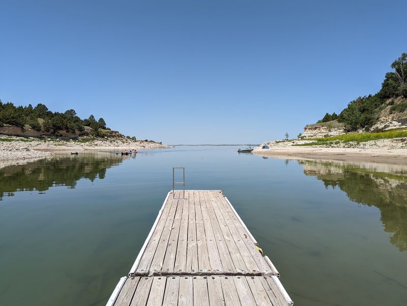
Picture a stockyard, a general store, a hotel, a barbershop, a school, and a bank all sharing one short street in the North Platte Valley. That was Lemoyne, established in the early 1880s and named for its founder, Lemoyne Jacobs.
The valley bottom was good ground. Grass grew, cattle fattened, and the community organized itself well enough to campaign successfully for a railroad connection, which is what turned a settlement into a working town.
Rail access meant shipping cattle out and freight in. It meant a reason for the hotel to have guests and for the bank to keep its doors open.
For roughly half a century, Lemoyne did what small Nebraska county towns did, quietly and without expecting an ending.
What made the place prosper was exactly what doomed it. A broad, flat river valley with high ground on either side is the textbook shape engineers look for when they need somewhere to store several years of water.
Nobody in 1885 was thinking about that. By the late 1930s, everybody was.
Kingsley Dam and the Decision to Fill the Valley
Irrigation drove everything. Farmers across the Platte valley needed a reliable supply of water through dry summers, and hydropower was the bonus that helped pay for the project.
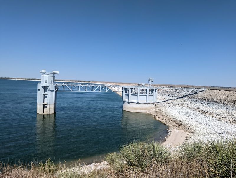
Construction of Kingsley Dam started in the 1930s, an earthen structure of remarkable size for its era, with a hydraulic fill design and an intake tower that still stands out on the skyline. The federal government began the process of clearing the valley in the late 1930s.
Families were bought out. Buildings were moved, dismantled, or left.
A new Lemoyne was reestablished on higher ground north of the water, which is where the name lives on today, so the town technically never disappeared from the map even though its original site did.
By 1941 the dam was finished and the reservoir began to fill. Fields, roads, the old street grid, and whatever foundations remained went under.
Drive across the dam now and there’s nothing to hint at it. Just water on the left, a road, and the drop to Lake Ogallala on the right.
What Comes Back When the Level Drops
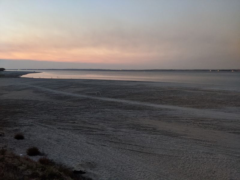
Drought does something no history book can. It moves the shoreline out by hundreds of yards and leaves behind a floor of cracked mud, packed sand, and shapes that are unmistakably not natural.
The near-record dry stretch of 2004 pulled the lake down enough to expose remnants of the original townsite. Low water in 2022 did it again, spreading mud flats where boats normally float, and more recent dry conditions have kept the phenomenon in the conversation.
Concrete and stone survive best. Wood frames and softer materials eroded away across decades of wave action, but a foundation set into the ground has nowhere to go.
Beverly Harris described watching her grandparents’ old root cellar surface, a stone chamber that had been under the lake her entire adult life. That’s the emotional weight of the whole thing in one image.
What you’re looking at is not a ghost town in the postcard sense. It’s a floor plan, a scattering of hard edges in the sand, and a very direct reminder that this valley had a different life first.
Reading the Lakebed Without Digging It Up
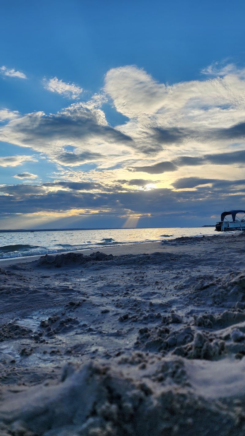
Rusted metal, squared-off slabs, and lines of stone that run too straight to be geology are the giveaways. Once you know what to look for, the exposed flats stop reading as empty and start reading as a map.
Anything you find out there belongs to the site and to the state. Artifacts on public land are protected, and taking them removes the context that makes them meaningful in the first place.
Photograph instead. A picture of a foundation with your shadow across it tells a better story than a rusty bolt in a junk drawer ever will.
Footing on drawn-down lakebed can be deceptive, too. What looks like firm sand can hold water underneath, and soft mud will pull a shoe off before you understand what happened.
Vehicles get stuck out there regularly, even on beaches that look solid. Walk it rather than drive it when the surface is questionable, and keep an eye on how far you’ve wandered from the parking area.
The lake also comes back up. Sometimes fast.
The Sand That Makes Lake Mac Feel Coastal
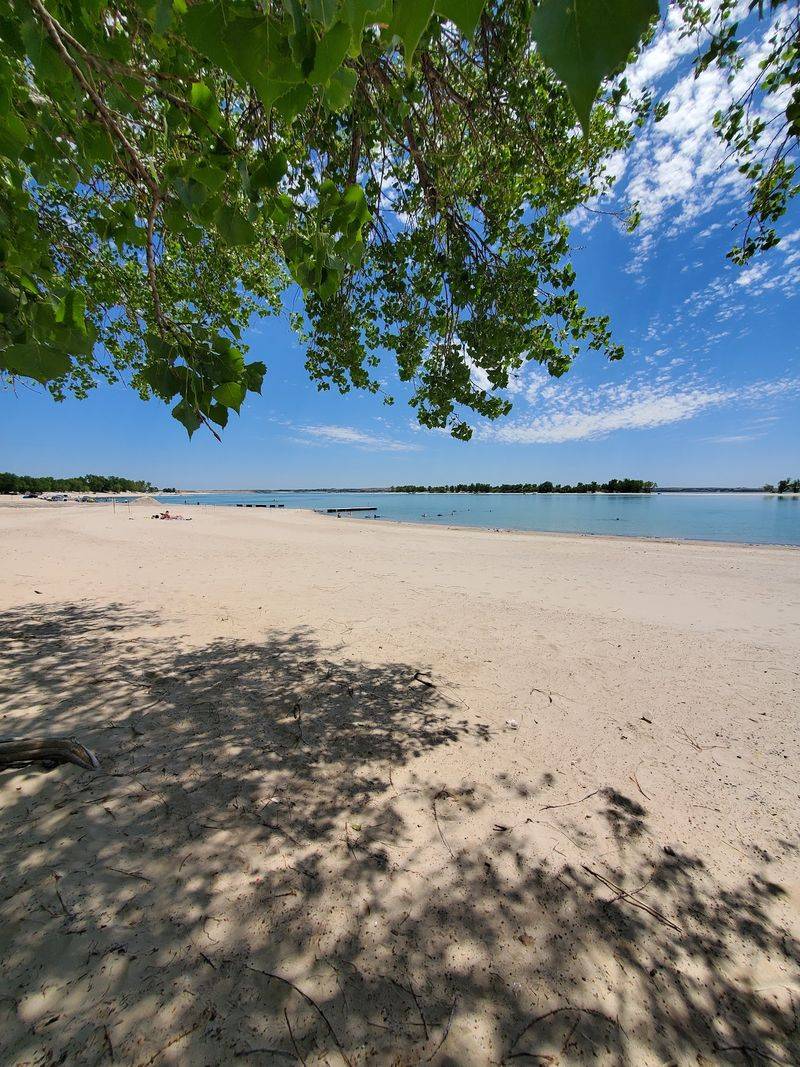
Soft, granular, and almost white, the sand around this lake is the single detail people bring up most. It gets into coolers, tents, sandwiches, and the floor mats of every vehicle that parks near the water.
The slope into the lake is gradual in most beach areas, so you can wade a long way before it deepens. Water warms up considerably by midsummer, which is not what most people expect from a reservoir on the western Nebraska plains.
Roughly eighteen designated beach areas ring the shoreline, and reserving a primitive spot in one of them gives you room to pick your own patch, whether that’s directly on the water or back in the trees.
Sites tend to be spaced out rather than stacked side by side, so the crowding you get at smaller lakes is less of an issue.
One trade-off comes with all that fine sand: it drifts. Loose blow sand can swallow a tire, and campers occasionally need a tractor to get pulled free.
Deflate a little, drive slow, and don’t stop on soft ground.
Camping Right Where the Water Meets the Sand
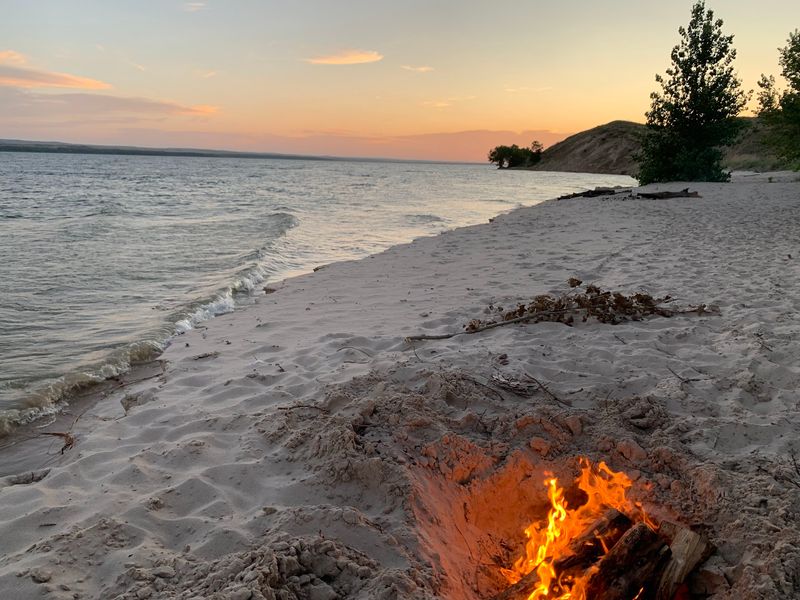
Very few places in the country let you park a camper on the beach and fall asleep with the water twenty steps away. Here you can drive down onto the sand, pick a spot, and stay for an afternoon or a full week.
Developed campgrounds exist too, with electric and water hookups, maintained sites, and trails that run straight down to the lake. Sandy Beach Campground comes up often among people planning a stay.
Shower houses operate on a token system, so bring change or find the machine before you need it. Restroom access varies wildly by area, and some of the primitive beach spots have nothing close by at all, which is the main thing to plan around.
Campfires are allowed in the beach areas, and the space between sites means you’re not listening to your neighbors’ conversation.
Toads and frogs come out at dusk in remarkable numbers, and kids will chase them until somebody makes them stop. One family counted more than a hundred in a single evening.
Reserve ahead in summer.
Fishing, Boating, and the Water Sports Season
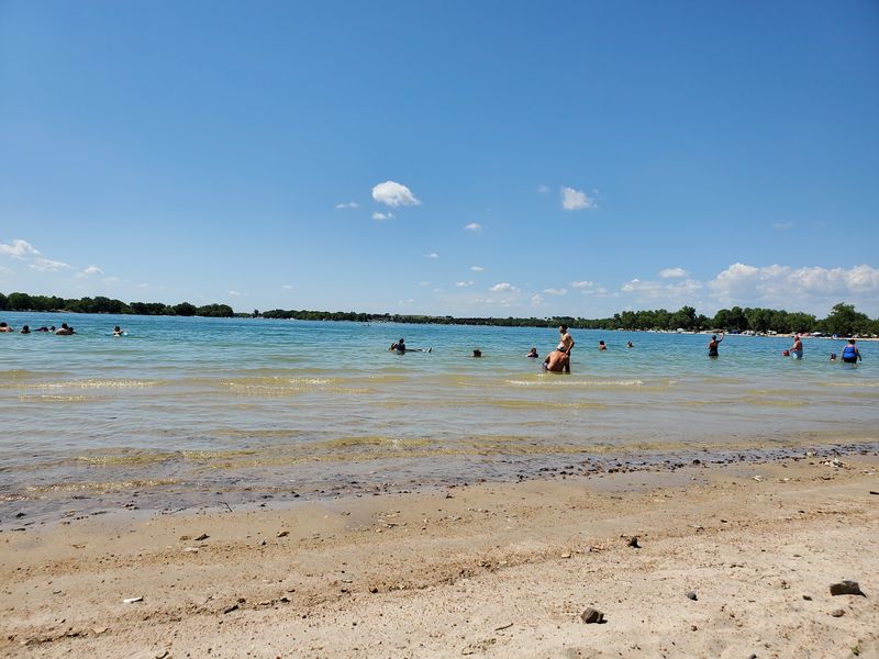
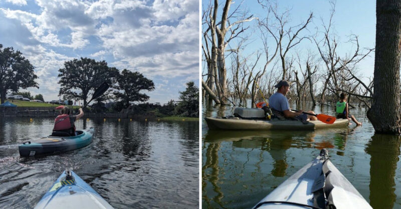
Big water means big boats. Jet skis, ski boats, and pontoons work the open reservoir all summer, while anglers spread out along the shoreline and the coves.
Fishing is a serious draw, and the lake supports a mix of species that changes with the season and the water level. Below the dam, Lake Ogallala runs cold and clear, a different fishing experience entirely and a favorite for early mornings.
Swimming areas and boat traffic share the same shoreline, so keep an eye out. Watercraft come closer to swimmers than they should, especially on busy holiday weekends when the beaches fill up.
Wind is the other constant. Afternoon and evening gusts build on a lake this size, and storms can roll through with little notice, which is worth knowing before you pitch a tent on open sand.
Low-water years change the boating picture too. Ramps that work at full pool can end well short of the water when the lake draws down, so check conditions rather than assuming.
The sunsets over the big water are the reliable part.
Birds, Bighorns, and the Wildlife Management Area
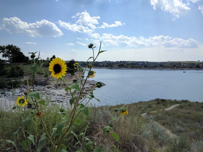
West of the main beaches, where the North Platte River enters the reservoir, the terrain turns to shallow flats, sandbars, and stands of cottonwood. That’s the wildlife management area, and it operates on entirely different rules than the swimming beaches.
Shorebirds work the mudflats during migration, and the exposed ground during low-water years actually creates more feeding habitat, not less. Bald eagles gather below the dam in winter, drawn to the open water at Lake Ogallala when everything else has iced over.
Nesting seasons bring closures on certain stretches of shoreline to protect vulnerable species, so posted signs are not suggestions.
Cattle graze the neighboring fields, which is a small thing that somehow makes the whole scene feel more like Nebraska and less like a resort.
The wildlife side rewards patience and a pair of binoculars more than it rewards a beach towel. Early morning is best, before wind and boat noise pick up.
Dogs are welcome across much of the recreation area, though the wildlife sections deserve extra care during nesting months.
The Visitor Center and the Story It Tells
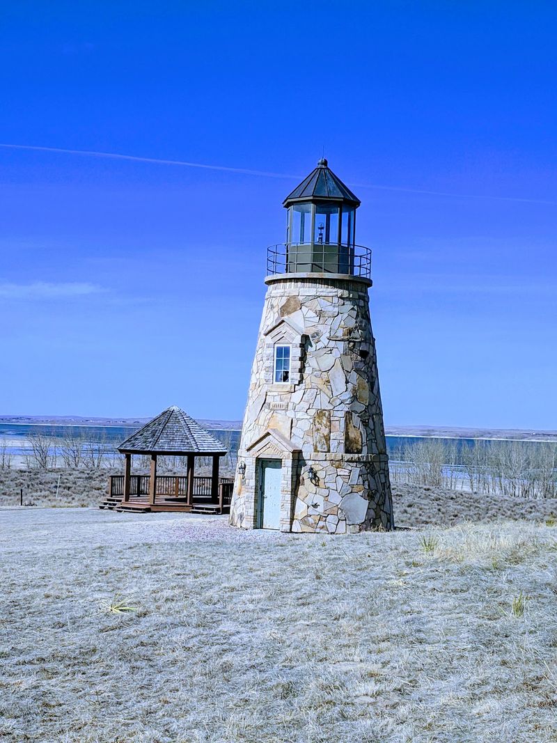
Air conditioning, exhibits, and a place to ask an actual person a question, which is more useful than it sounds when you’re standing on twenty miles of shoreline trying to figure out where to go.
The visitor center near the dam covers how the reservoir was built, what lives in and around it, and the history of the valley underneath. It’s the one indoor stop in a place that is otherwise entirely outdoors.
Staff there can tell you current water conditions, which beach areas are open, and where the sand is firm enough to drive on that week. Those answers change constantly.
Anyone curious about the submerged town should start here rather than wandering the flats hoping to get lucky. Water level determines everything about whether the old site is visible.
Facilities across the recreation area range from well kept to weathered, and pit toilets are common in the outlying beach areas. The visitor center is the polished end of that spectrum.
Give it fifteen minutes. It reframes the entire lake.
Seasons on a Nebraska Reservoir
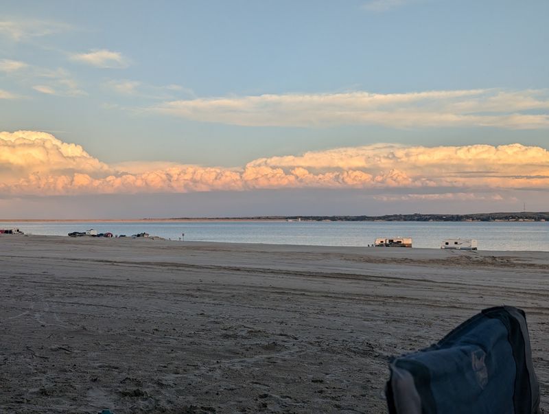
Summer is the obvious season. Beaches fill, boats launch, the water warms, and the sand gets crowded around the Fourth of July stretch in particular.
Fall thins everything out. Fees drop off outside the busy season, the light goes gold across the water, and you can have a stretch of shoreline to yourself on a weekday afternoon.
Winter surprises people. The park stays open year round, crews plow the main areas, and a snowed-in campsite here turns into something quietly memorable.
Eagle watching below the dam peaks in the cold months.
Spring brings migration through the flats and rising water from mountain snowmelt, which is exactly when any exposed foundations start disappearing again.
Low-water years and the chance of glimpsing the old townsite tend to land in late summer and fall, after a long irrigation season has drawn the reservoir down. Drought conditions stretch that window further.
Biting flies can be brutal in certain summer stretches, bad enough to change plans. Wind is nearly guaranteed most evenings, whatever the month.
Check conditions before loading the car.
Getting There From Ogallala and Points Beyond
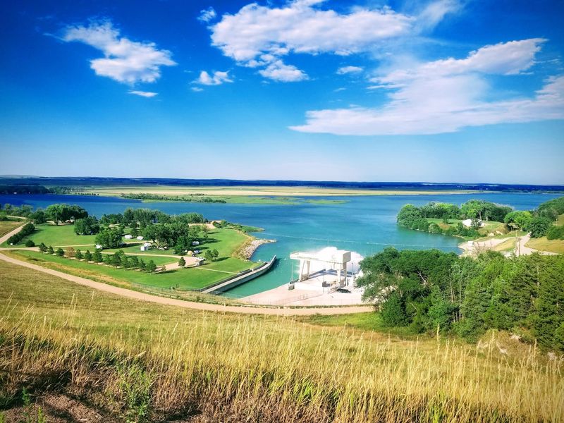
Interstate 80 does most of the work. Exit at Ogallala in Keith County, head north on Highway 61, and the lake shows up within about ten minutes of driving.
The recreation area headquarters sits at 1475 NE-61, Ogallala, NE 69153, right along that route, and it’s the easiest anchor point for a first visit.
Here’s the catch worth knowing: the shoreline is enormous, and the north side and south side are a long way apart by road. Plenty of people map to the lake generally, then discover their reserved spot is on the opposite shore.
Confirm which beach area you booked before you rely on GPS.
From Denver it’s a manageable half-day drive, which is why Colorado plates fill so many campsites. From Omaha or Lincoln it’s a genuine cross-state haul, better as a long weekend than a day trip.
Kearney, North Platte, and Sidney all put you within reasonable striking distance for a day out.
Gates open in the morning and the park closes in the evening, with a park entry permit required for vehicles.
Who Gets the Most Out of a Trip Here
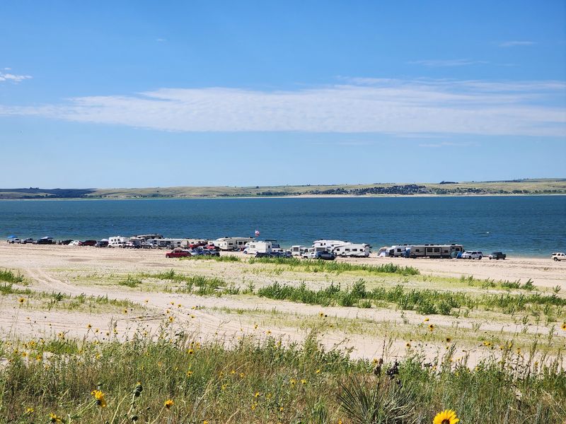
Families with kids who want sand and shallow water will do fine, provided you plan restroom logistics before you commit to a primitive beach spot.
Campers with trailers and RVs get the best of the place, because the ability to park beside the water is the whole appeal. Just come prepared for loose sand and know that a tow may be part of the adventure.
Anglers, boaters, and anyone who likes a lot of space between themselves and the next group will find room here that smaller Nebraska lakes can’t offer.
History-minded travelers get something extra, especially in a drawdown year. Standing on ground that spent eighty years underwater is not an ordinary afternoon.
Tent campers should think twice on exposed sand when wind is forecast, and anyone expecting resort-grade facilities will find the outlying areas rough around the edges.
Dog owners do well across most of the recreation area. Beach access from some campsites involves steep, unmaintained footpaths, so strollers and wagons can be a struggle.
Pack more water than you think you need.
Standing on Ground That Used to Be a Town
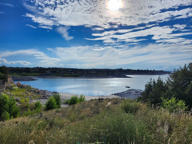
Two things happen at once here, and that’s what makes the place stick with you. On the surface it’s a wide, bright, sandy lake built for swimming and boat motors and burnt shoulders.
Underneath it’s a valley that held a school, a bank, a hotel, and families who had to leave. The water covers all of it until it doesn’t.
Most visits will be the first kind. Show up in July and you’ll get soft sand, warm water, and a sunset that spreads clear across the reservoir with nothing to interrupt it.
Come in a dry year, though, and the lake hands you the second version. Foundations in the mud.
A root cellar wall. Straight lines where straight lines shouldn’t be.
Nothing about it is dramatic from a distance. You have to walk out and look.
For a state that gets described as flat and empty by people who have never stopped, Lake Mac makes an unusually strong argument otherwise. Bring a camera, check the water level, and give yourself more than an afternoon.