One Of The World’s Largest Flat-Topped Mountains Makes An Incredible Colorado Road Trip
I know flat-topped mountains do not sound especially exciting at first, but this one can change that opinion quickly.
In Colorado, a scenic drive climbs high enough to reach cool forests, broad views, and more than 300 lakes scattered across the summit.
That combination alone makes me want to keep driving instead of turning back early.
The appeal is not one dramatic lookout; it is how often the route gives you another reason to stop.
A road like this can turn an ordinary afternoon into a full adventure without requiring a complicated plan. Honestly, that is my favorite kind of road trip.
Where The Climb Begins
The drive can rise from dry canyon country into much cooler high-elevation forest in a relatively short distance.
That whiplash of scenery is exactly why the Grand Mesa Scenic Byway keeps drawing people back.
The route follows CO-65 for 63 miles and climbs through roughly 6,000 vertical feet while crossing four ecological zones.
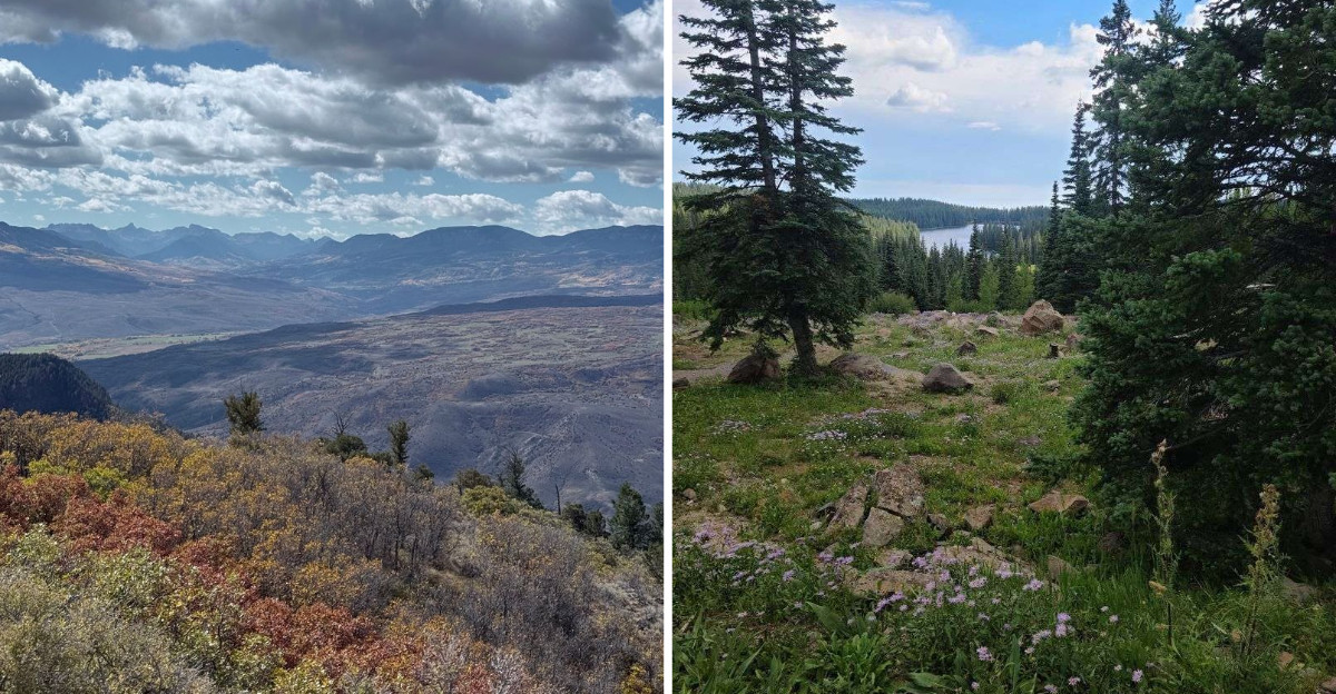
Sagebrush and sandstone give way to ponderosa pine, then aspen groves, then open subalpine meadows.
I recommend driving it from south to north, or north to south, depending on where you are sleeping. Either direction works well, and neither one disappoints.
CDOT lists about two hours of driving time without extended stops, so allowing three hours or more makes sense when adding photographs and short walks. Taking extra time makes it easier to use the overlooks, trails, and lake stops along the route.
If you want to begin near the southern gateway town, aim your navigation toward CO-65, Cedaredge, and let the climb do the rest.
Lava Capped A Vanished Valley
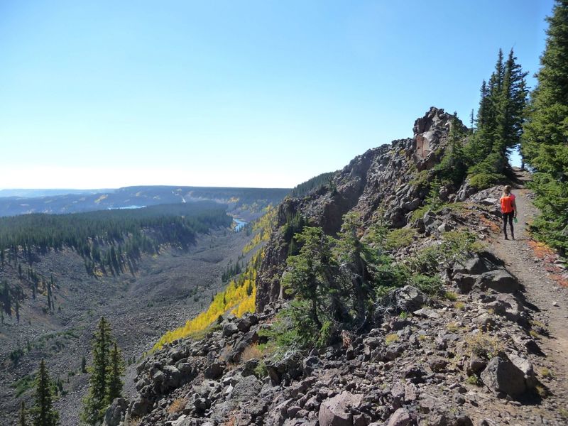
Grand Mesa is a striking example of topographic inversion: land that once occupied a valley now stands high above the surrounding landscape.
Roughly 9.5 to 11 million years ago, repeated basalt flows filled an ancient low area that later became the resistant cap of Grand Mesa. The surviving basalt sequence ranges from roughly 200 to more than 600 feet thick in parts of western Grand Mesa.
Surrounding sedimentary rocks eroded more readily than the resistant basalt cap as the Colorado River system cut deeper into the region.
Geologists call that switcheroo topographic inversion, and it is the reason this landform is so famously flat. The mesa covers about 500 square miles of tabletop terrain.
You can see the evidence without any training at all. Look at the sheer sides where dark columns of rock sit above pale crumbly slopes.
Roadside exposures and overlooks can reveal the darker basalt cap above lighter sedimentary layers.
Landslides and other forms of mass movement continue to affect Grand Mesa, so travelers should check current road conditions before using side roads.
Three Hundred Lakes Up Top
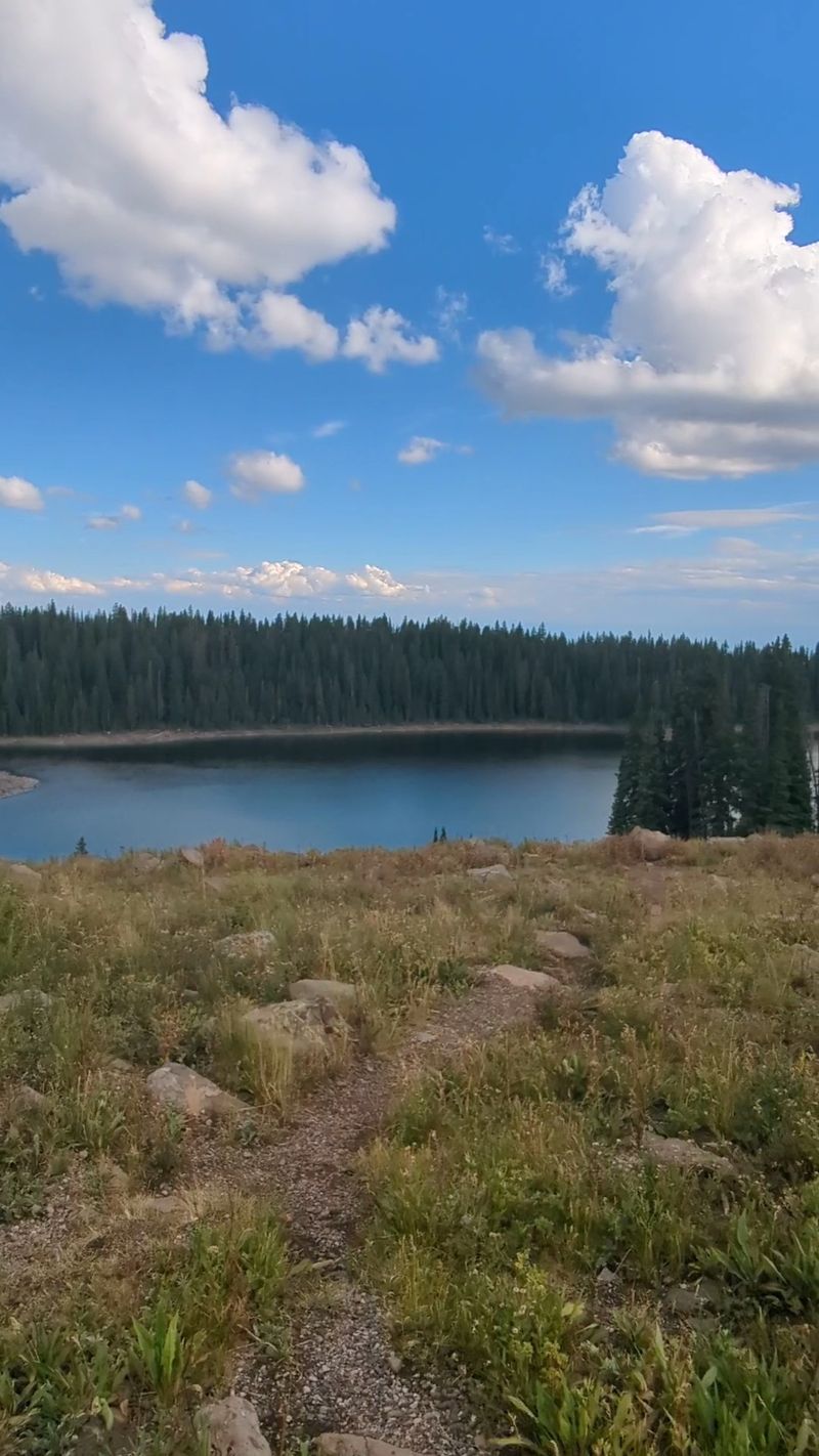
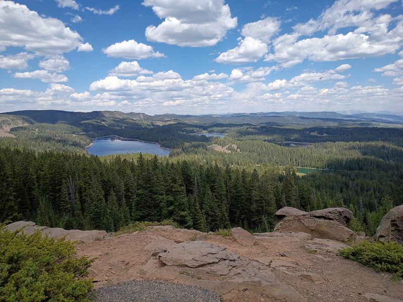
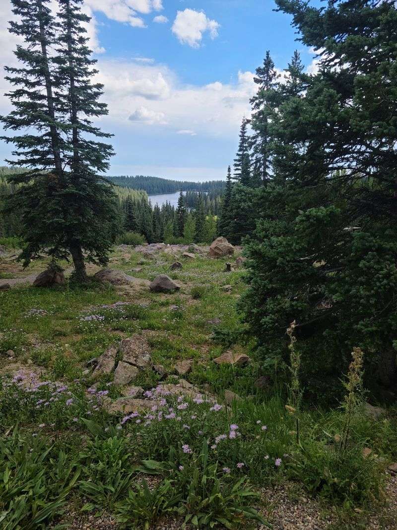
Counting lakes up here is a losing game. More than 300 of them sit scattered across the summit, tucked between spruce stands and grassy shelves.
Land O Lakes Overlook takes its name from the lake-filled landscape visible across this part of Grand Mesa.
Island Lake is the largest lake on Grand Mesa National Forest and has developed access that includes a boat launch and nearby recreation facilities.
Baron Lake, Deep Ward Lake, and Alexander Lake are among the many named waters spread across this part of Grand Mesa.
Many Grand Mesa waters support rainbow, cutthroat, and brook trout, and anglers age 16 and older generally need a valid Colorado fishing license.
Boating rules vary by lake, with some waters restricting motorized use or allowing only electric motors, so regulations should be checked for the specific lake.
These reservoirs are not just for fun, either. They feed the orchards, farms, vineyards, and ranches down in the valleys below.
Early mornings can bring calmer water, though fishing conditions vary with lake, weather, and season. Bring layers, because water and altitude team up to make afternoons surprisingly chilly.
Moose, Marmots And Meadows
Open-range cattle can appear on some Grand Mesa roads during summer, so drivers should slow down and be prepared to stop.
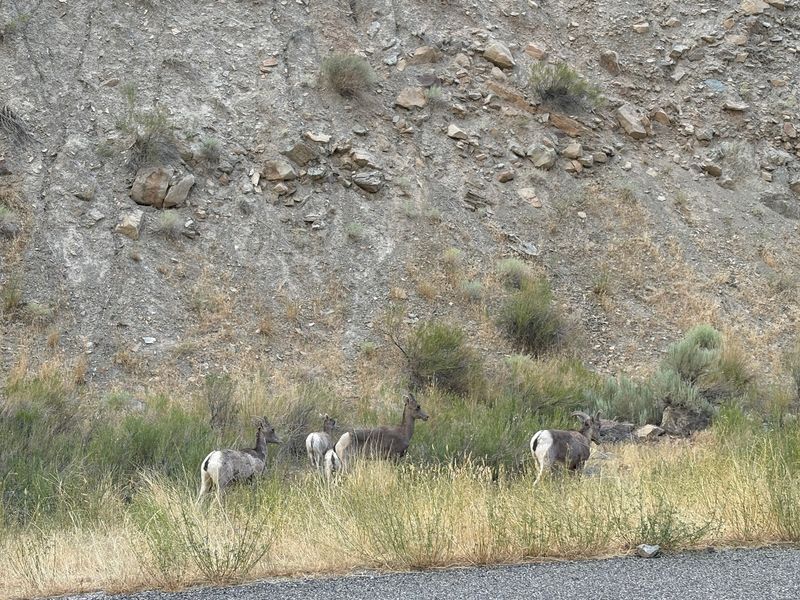
Wild residents are far more thrilling. Moose were reintroduced to Grand Mesa beginning in 2005, and Colorado Parks and Wildlife now identifies the mesa as one of the areas where moose are most abundant in the state.
Elk and mule deer are also found across Grand Mesa and may be seen around its forests and meadows.
Birders can look for bald eagles, three-toed woodpeckers, and noisy jays working the conifers. Marmots sunbathe on boulders like they own them.
Coyotes, red foxes, and mountain lions share the forest too, though they rarely show themselves. Black bears also inhabit Colorado’s Western Slope, so visitors should follow current wildlife and food-storage guidance while exploring the forest.
Keep a long lens handy and a generous distance at all times. Moose are unpredictable, and giving them space protects everybody.
Grand Mesa Moose Day is an annual Colorado Parks and Wildlife event. In 2026, the 16th edition took place on July 25 and focused on moose viewing, safety, reintroduction, and wildlife research.
Trails For Every Ambition
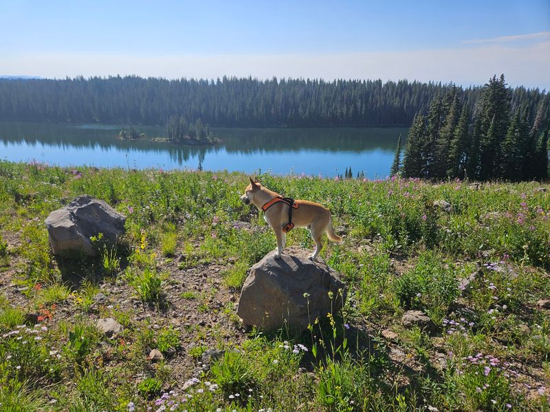
Boots earn their keep on this plateau. More than 400 miles of trail thread across the summit, ranging from flat lakeside strolls to airy ridge walks.
Crag Crest Trail is the headliner, running along a narrow spine with drops on both sides. Crag Crest National Recreation Trail forms a roughly 10.3-mile route, with its crest section following a narrow volcanic ridge.
Mesa Lakes has several shorter trails, including the 1.5-mile Mesa Lake Shoreline Trail, with routes ranging from easy to moderate.
Mountain bikers and horseback riders have their own routes, and many trails connect to quiet backcountry basins. Several trailheads can be reached from or near CO-65, but carrying a current Forest Service map is useful for finding specific routes.
Altitude is the real challenge, since the top sits above 10,000 feet. Drink more water than feels necessary and pace yourself early.
Ticks can appear in brushy sections, so long pants and a quick body check are smart habits. Afternoon thunderstorms build fast in July and August.
Exposed hikes such as Crag Crest are best started early while visitors monitor the forecast for fast-developing afternoon thunderstorms.
Winter Turns Up The Volume
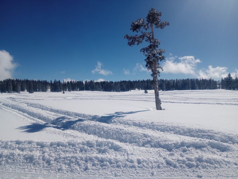
Snow does not end the season here. It simply changes the equipment.
Powderhorn Mountain Resort sits on the north slope and offers downhill skiing and snowboarding with views across the Grand Valley. The runs face outward, which makes the scenery part of the ride.
Cross-country skiers head for the Skyway Nordic Area, where groomed tracks wind through snow-loaded spruce. The County Line Ski System adds more trails for those chasing quiet.
Cross-country skiers can use groomed trail systems at Skyway and County Line, while designated routes elsewhere on Grand Mesa support snowshoeing and other winter recreation.
Snow can remain deep at high elevations well into spring, and Lands End Road is seasonally closed during winter.
The Grand Mesa Visitor Center operates seasonally, currently from Memorial Day weekend through the last Sunday of September.
Check road conditions before heading up, since weather flips quickly at this elevation in Colorado. Carry blankets, snacks, and a full tank.
Check COtrip before heading up because CDOT can activate passenger-vehicle traction or chain requirements on state highways when conditions warrant. Plows work hard, but the byway still demands respect in January.
Thunder Mountain And Old Roads
Ute people used this high country long before modern roads, traveling through and living across the broader Grand Mesa region.
They traveled up in warm months to hunt and gather, then returned to lower valleys when snow arrived.
In 1776, the Domínguez-Escalante expedition crossed Grand Mesa with assistance from Ute guides, providing one of the earliest documented European accounts of the area.
Road building came much later and was anything but easy. Historical accounts credit convict labor with road improvements in the Grand Mesa area in 1911.
The Civilian Conservation Corps worked on the road now known as Lands End Road beginning in the 1930s. Driving it today still feels like a throwback, with washboard sections and sweeping curves.
Pioneer Town Museum in Cedaredge also serves as a Grand Mesa Scenic Byway Welcome Center, with a multi-building campus covering local history.
Its exhibits add context to the human history of Cedaredge, Surface Creek Valley, and the broader Grand Mesa area.
History is stitched into the shoulders of this Colorado route, waiting for anyone curious enough to look.
Overlooks Worth The Detour
Pull-offs on this route are not decoration. They are the whole point.
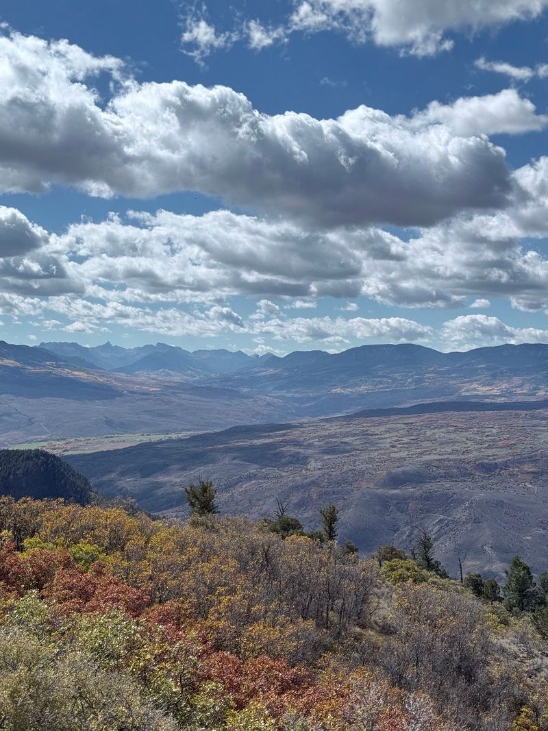
Land’s End Overlook is the most dramatic, perched where the plateau drops roughly 6,000 feet toward the Grand Valley. On clear days the view stretches to the Sneffels Range and the La Sal Mountains in Utah.
From CO-65, the Lands End Observatory spur is about 12 miles and includes both paved and gravel sections. The drive can be rough in places, but the viewpoint at the end overlooks the Grand Valley from the western rim of the mesa.
A historic stone observatory stands at the viewpoint. The building itself has been closed to visitors since 2014, but the overlook remains accessible when the road is open. Small ground squirrels scurry around the parking area, curious and bold.
Land O Lakes Overlook is easier to access from the byway and can reveal about 13 lakes across the surrounding forested mesa.
Late-day light can add warmer color to the landscape, though visibility and conditions depend on the weather. Storm clouds moving across the valley create a show of their own.