15 Abandoned Idaho Places With Stories Creepier Than Any Haunted House
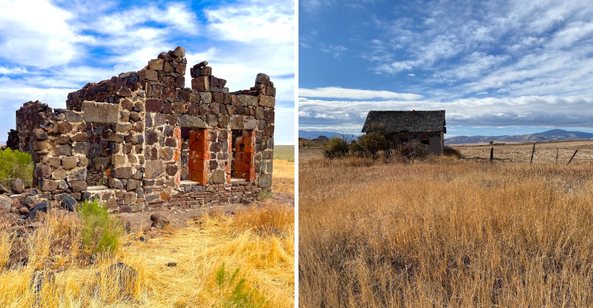
Some places feel abandoned.
Others feel like they are waiting for someone to come back.
Idaho has plenty of the second kind.
Old mining camps and forgotten settlements sit with doors hanging crooked, windows gone dark, and silence that starts feeling a little too personal. No fake cobwebs needed.
A weathered cabin can look harmless at noon and completely suspicious by late afternoon. That is the fun.
Every stop leaves just enough behind for your imagination to finish the story, which is usually where things get creepy.
Bring sturdy shoes, a full tank, and maybe a friend who claims they are not scared.
15. Burke Ghost Town, Near Wallace
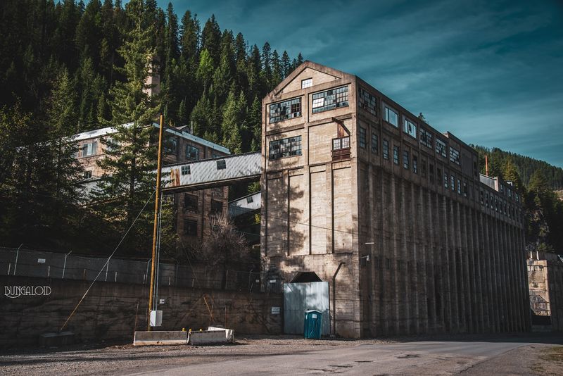
Builders here faced a canyon barely 300 feet wide at its tightest pinch, so they raised structures right against the rails and sometimes straight over them.
The Tiger Hotel was built in 1896 over Canyon Creek, and a railroad track was routed through the building in 1906 as Burke’s narrow corridor grew more crowded.
That unusual arrangement reflected how tightly homes, businesses, roads, rail lines, and the creek had to share a canyon only about 300 feet wide.
Silver, lead, and zinc built Burke after rich strikes began in 1884, and the settlement took shape in 1887 at 3,700 feet in the Coeur d’Alene Mountains.
Labor tensions boiled over during a strike in July 1892, and the final mine closed for good in 1991.
Look for the site in Shoshone County, Idaho, along Burke-Canyon Creek Road, also signed as State Highway 4, northeast of Wallace.
Sunlight reaches the canyon floor late and slips away early, so the ruins stay cool and damp for most of the day.
Interpretive markers explain the old mine works, and the crowded layout still hints at stubborn ingenuity. Wear boots with grip, since loose rock and aged planks line the creek bank.
14. Gilmore Ghost Town, Near Leadore
A clerk’s slip of the pen gave this mining camp its name.
The 1902 post office honored John T. Jack Gilmer, but the paperwork came back misspelled, and the error stuck permanently.
Lead and silver pulled in more than 600 residents, and the Gilmore and Pittsburgh Railroad arrived in 1910 to haul ore toward market. An explosion at the power plant late in the 1920s, followed by the Great Depression and falling silver prices, emptied Gilmore within a decade.
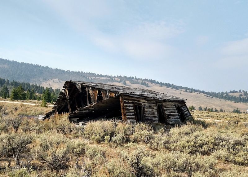
Trains quit running by 1940, the post office closed in 1957, and roughly 40 log and frame buildings still lean into the wind.
Find the townsite about 65 miles south of Salmon, just off Highway 28.
Behind those gray walls, the Lemhi Range throws up peaks above 11,000 feet, which makes the empty street feel smaller than it is.
Idaho DEQ has confirmed dangerously elevated lead and arsenic levels in parts of the townsite, so avoid disturbing soil or dust and follow current health guidance.
State police reported a strange, never-explained incident at a building on the edge of town in 2009.
13. Leesburg Ghost Town, Near Salmon
Gold turned up along Napias Creek in 1866, found by Frank Barney Sharkey and his partners.
The creek’s name means money in the Shoshoni language, and a tribal leader reportedly warned prospectors to look no further.
Thousands ignored the advice, swelling the camp to a population counted anywhere from 2,000 to well over 7,000. Civil War veterans among the residents named Leesburg for Confederate General Robert E.
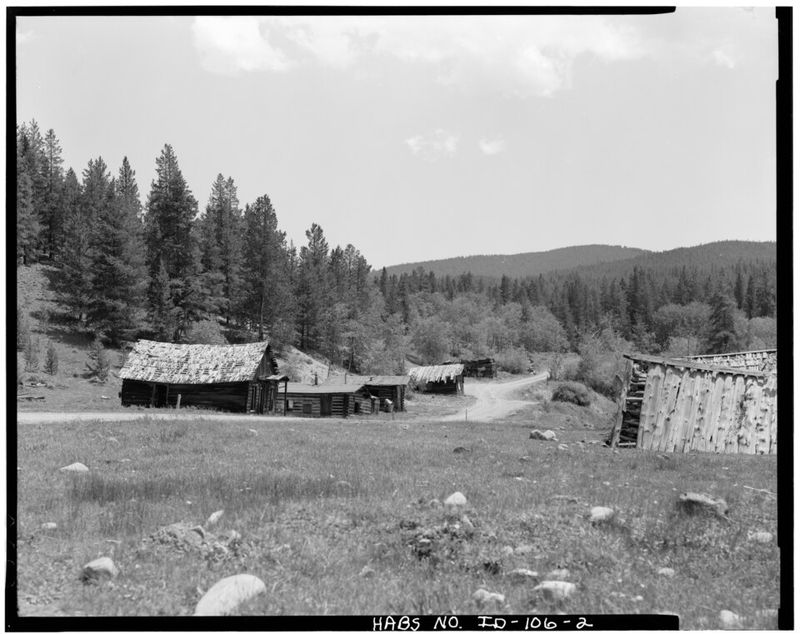
Lee, and a mile-long main street of log buildings followed.
The rush faded by 1870, small hydraulic operations limped along into the 1930s, and the camp sat nearly empty by the close of World War II, earning a National Register listing in 1975.
The ruins rest in Lemhi County, in the mountains below the North Fork of the Salmon River inside the Salmon-Challis National Forest.
Only a handful of sagging cabins and scattered debris survive beneath thick pines. Interpretive signs describe daily life, while unmarked graves nearby keep the mood hushed.
Warm sap smell, birdsong, and dust underfoot are about all that break the stillness.
12. Bayhorse Ghost Town, Near Challis
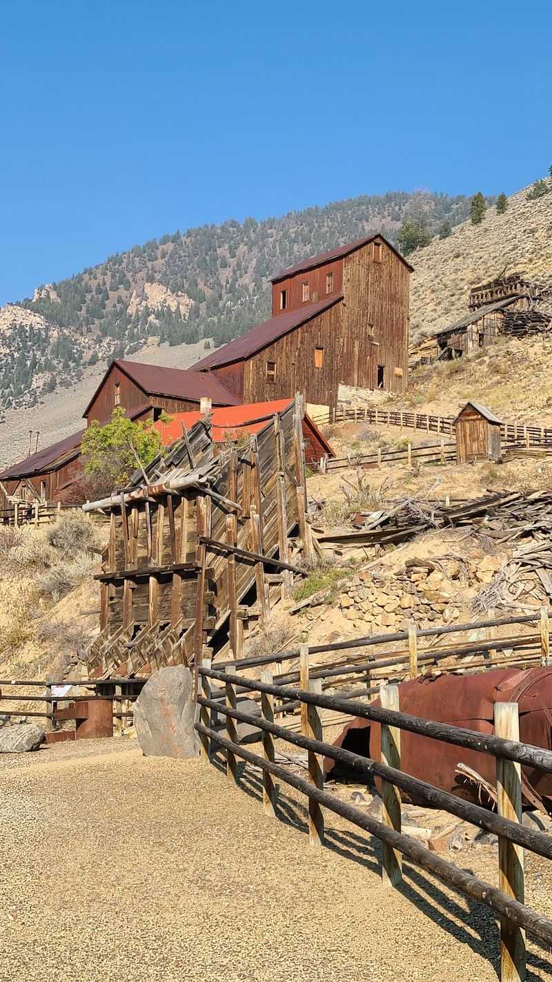
Two stories explain the odd name: a horse that tumbled into the creek, or a prospector who arrived leading a pair of bay horses.
Small gold finds started things in 1864, but richer silver and lead ore around 1877 to 1879 turned the gulch into a working town. Between 300 and 500 people lived here in the 1880s and 1890s, supported by general stores, boarding houses, a smelter, and charcoal kilns.
Fire tore through Bayhorse in 1889, and sinking silver prices plus steep shipping costs finished the job by 1915.
The camp joined the National Register in 1976 and became part of Land of the Yankee Fork State Park in 2009.
It sits above 6,000 feet in central Idaho’s Custer County, reached from Challis by State Highway 75 and then Bayhorse Creek Road.
A loop trail of nearly a mile passes 14 standing structures, among them an 1882 stamp mill, a stone Wells Fargo building, and intact beehive kilns.
Low fences protect fragile walls. Two cemeteries wait on the slopes above.
11. Custer Ghost Town, Near Stanley
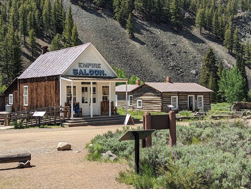
The mine came first, then the name. Prospectors struck the General Custer Mine in 1876, the year the general died, and gold in the Yankee Fork River followed in 1877.
Founded in 1879, Custer eventually reached a peak population of about 600 as nearby mines supported the growing settlement.
Thick evergreens press against Custer’s single street, with the Pioneer and Sawtooth ranges framing the view in every direction.
Ore ran thin and the place stood mostly empty by 1910, then earned National Register status in 1981.
Today it is cared for in Custer County, between Challis and Stanley, inside Land of the Yankee Fork State Park.
Step into the old schoolhouse museum, now the starting point for tours, where artifacts include a remarkable bison fur coat. The Empire building serves as a gift shop pouring old-fashioned sodas, and a battered poker table inside recalls a long-ago argument nobody ever explained.
Docents, signs, a jail, a cemetery, and the enormous Yankee Fork Gold Dredge fill out a full afternoon.
10. Bonanza Ghost Town, Near Sunbeam
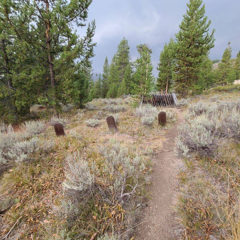
Wide streets shaded by planted trees, two-story storefronts with boardwalks, a community well, and a water system built to fight fire: the first real town of the Yankee Fork country had genuine ambition.
Founded in 1877 after the General Custer Mine discovery the year before, it passed 600 residents by 1881.
Gentle hills wrap the clearing, which makes the emptiness feel oddly peaceful rather than harsh.
Fire in 1889 convinced many families to pack up and move to neighboring Custer, and by 1910 idle mines left Bonanza to the weather.
The Forest Service and the Friends of Custer Society now work to stabilize what survives. The site sits in Custer County within Land of the Yankee Fork State Park, a short drive from Custer City.
A marked walking route points out the few standing buildings and the vanished ones, block by block.
Two burial grounds add weight to the visit, including a lonely Boot Hill holding just three marked graves.
The Yankee Fork Gold Dredge nearby opens seasonally for tours.
9. White Knob Townsite, Near Mackay
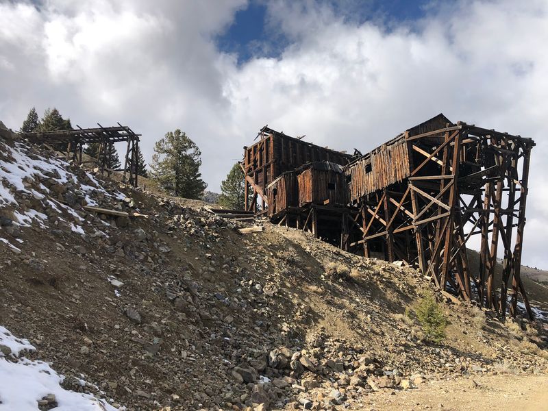
Copper made this hillside community possible.
Discoveries in the White Knob Mountains were recorded as early as 1879, with Wayne Darlington adding claims in 1901 as part of the Alder Creek Mining District.
An electric railway and an aerial cable tramway carried ore down Mine Hill to the smelter in the valley. Families at White Knob had a school, a general store, a post office, a boarding house, and even a theatre for entertainment on long winter nights.
The mine shut down in 1928, the school followed in 1932, and the Mackay Historical Preservation Committee has been protecting the remains since 1999.
The site clings to Mine Hill in Custer County, east of Mackay in the White Knob Mountains.
Old road beds, a restored trestle, stabilized and crumbling cabins, mill and smelter sites, tram towers, and the headhouse still spread across the slope, along with scattered grave sites.
Access depends on the route: some sections use rough maintained gravel roads, while steeper portions are limited to higher-clearance vehicles, ATVs, bikes, horses, or hikers.
8. Vienna Ghost Town, Near Smiley Creek
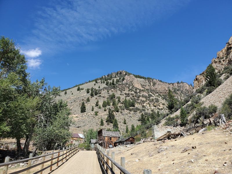
Levi Smiley’s 1878 gold find on Smiley Creek started it, and an even richer lode nearby in 1879 sealed the deal.
Within a few years more than 800 people lived here, served by three stores, two meat markets, six restaurants, two livery stables, a bank, a hotel, a sawmill, and a newspaper of its own.
For a remote silver and lead camp, that was a remarkable amount of town.
A lawsuit in 1885 tangled up the mining operations, and Vienna unraveled fast; by the early 1900s more than 200 buildings had simply disappeared. Nobody has fully explained where all that lumber, or all those people, ended up.
Look for the clearing in Blaine County, high in the Sawtooth Mountains roughly 8 miles north of Sawtooth City, near State Highway 75 and Smiley Creek.
A Forest Service sign marks the general spot, and the rough approach road keeps crowds away.
What remains is rubble, rusted tin, old trash piles, and a leaning outhouse or two.
Faint rectangles in the grass show where homes once stood.
7. Old Sawtooth City Townsite, Sawtooth Valley
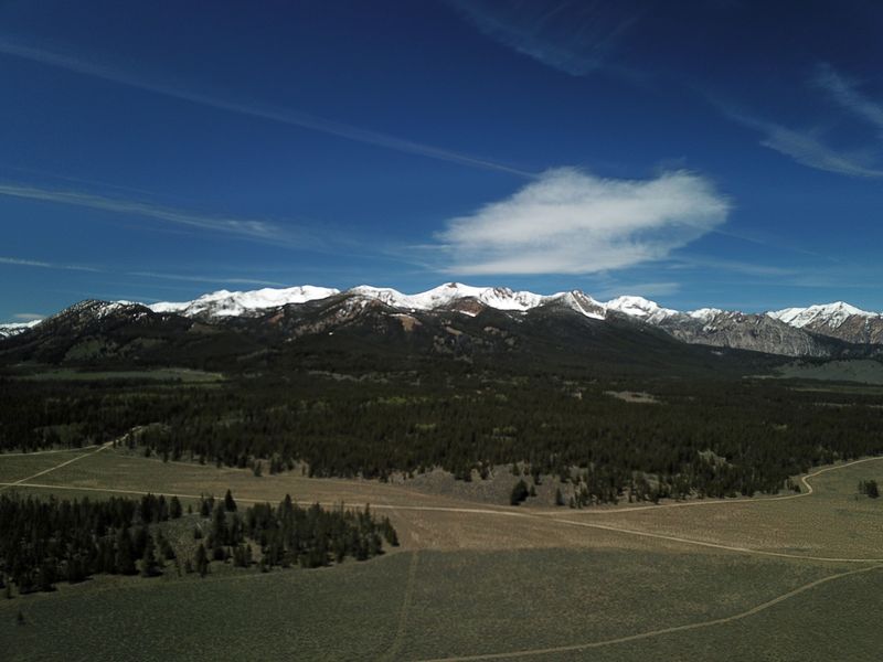
Gold brought hundreds of hopeful workers to this valley floor after Levi Smiley’s 1878 discovery, and the camp organized itself formally in 1879.
At its busiest, roughly 600 people lived here, building homes, stores, and the milling works that kept the operation running.
Freight wagons, mill noise, and woodsmoke would have filled the meadow air. Bad luck arrived in layers.
Accidents, setbacks, and shaky finances halted mining, and Sawtooth City stood deserted by 1888, reduced to a true ghost town within the following decade.
The remains rest in the Sawtooth Valley, along the same high corridor that connects Smiley Creek with Stanley. Very little survives, which is exactly what makes the stop unsettling.
A stone mill foundation traces a rectangle in the grass, and one battered cabin still holds its shape against the weather.
Wildflowers push up between the rocks in July, while the serrated peaks above look completely unbothered by the whole enterprise.
Bring water, watch for old nails in the grass, and give yourself a quiet half hour to take it in.
6. Rocky Bar Ghost Town, Near Featherville
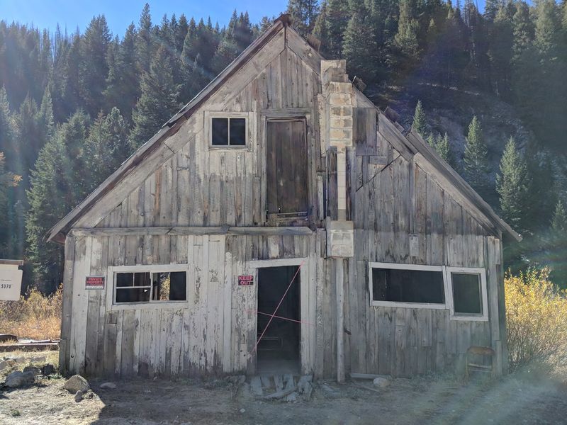
Hard to believe now, but this mountain settlement once rivaled Boise.
Founded in late 1863 by H.T.P.
Comstock, whose name is attached to Nevada’s famous lode, it grew after gold showed up in the Feather River and nearby creeks.
More than 2,500 people lived here at its height, and the town served as first county seat for both Alturas and Elmore counties. Distance did most of the damage.
Isolation, shifting ore prices, and a destructive fire in 1892 whittled Rocky Bar down until only a few buildings were left standing.
The remnants sit in Elmore County, deep in the mountains near Featherville, reached by a slow, winding road best driven in summer.
Historic photographs show tall wooden fronts with second-floor balconies, freight wagons in the street, and hand-stacked rock walls holding back the hillside. A few of those structures survive, silvered by a century of snow.
Stand in the road, listen to the wind in the pines, and the contrast between 2,500 neighbors and total silence lands hard.
5. Silver City, Near Murphy
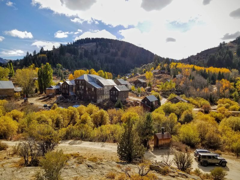
Most boomtowns burned or were bulldozed.
This one simply emptied out, which is why about 70 to 75 original buildings still line its dusty streets.
Growth began in 1863 and 1864 after gold and silver appeared on War Eagle Mountain, and by the 1880s some 2,500 residents supported 75 businesses.
Silver City served as county seat from 1866 to 1934 and led the territory in technology, with the first telegraph and first daily newspaper arriving in 1874, plus early electric and telephone service.
About 75 historic structures still stand at the 6,200-foot townsite, many of them privately owned, and Silver City remains seasonally active rather than completely abandoned.
Find it in Owyhee County, in the Owyhee Mountains southwest of Boise, with Murphy the nearest town on the map.
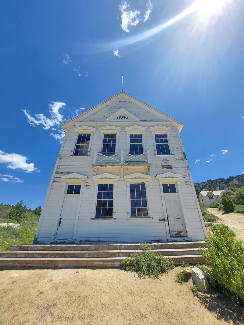
Walk to the fully restored white schoolhouse, the Church of Our Lady of Tears that still holds seasonal mass, and the remains of Chinatown, where the old laundry building stands. The cemetery, heavy with children’s graves and unknown markers, stays with you.
The 1863 Idaho Hotel offers seasonal rooms and meals.
4. De Lamar Ghost Town, Owyhee County
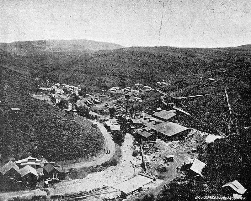
A former sea captain turned mining investor put his own name on this canyon.
Joseph R. DeLamar bought claims in Jordan Canyon in 1888, and the mine quickly became a prolific producer of silver and gold. Output slid sharply after 1890, and the community shrank almost as fast as it had grown.
Life at De Lamar stretched along Jordan Creek at 5,463 feet, with a rough district known as Tough Town holding the livery barns.
A summer-only post office ran from 1917 to 1930, the site joined the National Register in 1976, and the mine itself operated again from 1977 to 2000.
Look for the remains in Owyhee County, in the remote Owyhee Mountains about 6 miles west of Silver City.
By 1976 only four buildings were solid enough to count toward the historic district, so expect stone foundations, mine debris, and bare hillsides.
Today, the surrounding DeLamar district is again attracting mining interest, with the Bureau of Land Management reviewing a proposed gold-and-silver mine project in 2026. That federal environmental review is still underway, with a final decision currently expected in 2027.
3. Ruby City Ghost Town, Owyhee County
Some ghost towns lose their people. This one lost its actual buildings.
Established in November 1863 after strikes on War Eagle Mountain, it served as the very first county seat of Owyhee County from 1863 to 1867, and the county’s first newspaper, the Owyhee Avalanche, rolled off the press here in 1865.
Ruby City sat on a wooded slope running down to Jordan Creek, described in 1865 as a disorderly collection of structures.
Supplies had to be hauled up to 6,200 feet, making everything expensive, and once the post office and county seat shifted to Silver City, neighbors hauled the better buildings there too, including the 1863 hotel moved in 1866.
The site lies in Owyhee County along Jordan Creek, roughly one mile below Silver City.
Almost nothing marks it today.
A handful of small white stone markers in the old cemetery show on a ridge framed by junipers, and you have to look carefully to spot them.
Standing there, with wind and sagebrush and no walls at all, impermanence feels very close.
2. Wickahoney Stage Station, Near Bruneau
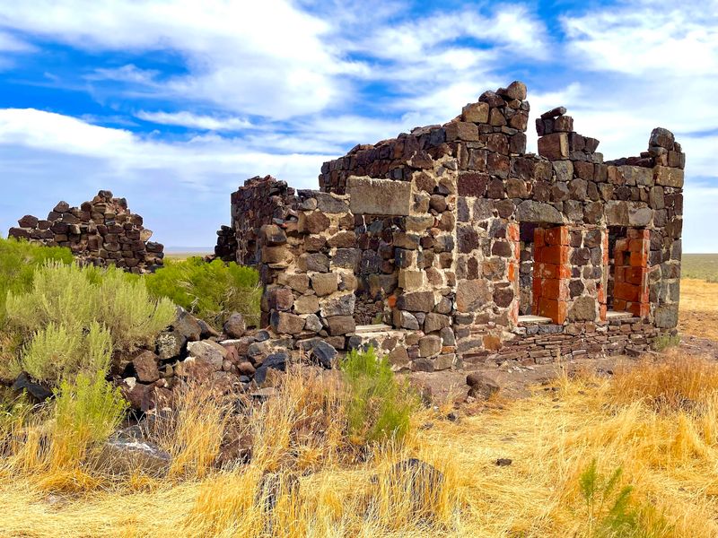
The name likely comes from an Indigenous word for beaver, a clue that dependable water sat nearby in an otherwise dry country.
Homesteader Dow Dunning constructed the local stone buildings and served as postmaster while Wickahoney operated as a post office and stage stop from 1895 to 1911.
Stagecoaches stopped here while running between Mountain Home and Mountain City, Nevada, and the Duck Valley Indian Reservation.
Traffic dried up once a competing route through Elko took the business, and Wickahoney slowly faded until the last resident departed around 1942.
National Register recognition followed in 1982. The station stands in southern Owyhee County, reached by a rough offroad route heading south from Bruneau.
Walls of hand-hewn basalt block still rise square and stubborn, though the wooden porch and seven-gabled shingled roof gave up long ago.
Historic documentation records a concrete oven, stone outbuildings, and a corral around the station, but access should respect current property boundaries and restrictions.
Plan on a high-clearance 4×4, since jagged lava rock, deep ruts, and seasonal water crossings guard the way. No cell service reaches here, which makes the silence absolute.
1. Chesterfield Historic Townsite, Near Bancroft
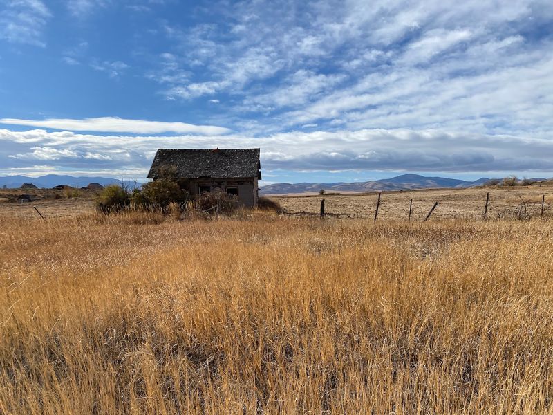
Chester Call and Christian Nelson established a ranch in the area in 1879, families followed in the early 1880s, and church leaders later laid out the organized Chesterfield townsite.
Growth came haphazardly at first, then church leaders reorganized the streets into a tidy grid in 1883.
Peak population passed 400 in town, with nearly 700 in the surrounding countryside by 1920.
Chesterfield thrived into the mid-1920s until a new railroad line bypassed it through Bancroft in 1898, and hard winters, droughts, and farm troubles pushed families out for good.
The school closed before 1941 and the general store in 1958, followed by National Register listing in 1980.
The townsite rests in the foothills of the Portneuf Valley in Caribou County, Idaho, about 11 miles north of Bancroft between Lava Hot Springs and Soda Springs.
Brick homes built between 1884 and 1904 have been carefully restored, and guided tours open the meetinghouse museum stocked with Oregon Trail artifacts, plus the amusement hall, tithing office, and granary.
Founder Chester Call once slipped past federal agents using a decoy after a church service.