This Idaho Trail Leads To A 1920s Logging Machine Still Rusting Deep In The Forest
Someone left a steam-powered monster in the Idaho woods, and somehow it is still there a century later. That is the kind of trail surprise no hiking app prepares you for.
The walk starts quietly beneath tall cedar trees, then old cables and logging remnants begin showing up like clues.
By the time the machinery appears, the forest suddenly feels less empty and more interesting.
It is weird seeing something so massive rusting where crews once worked.
You can photograph the artifacts without wandering off the path, which makes the whole experience easy to explore.
Come for the short hike, stay for the strange history, and try not to wonder who decided leaving that machine behind was a good idea.
Hike Into The Forest To Find A Steam Donkey Left Behind By Loggers
Cedar shade swallows you within the first few minutes, and the noise of the world drops away.
The path slips downhill toward the Marble Creek valley, soft with needles and shaded by trunks that have watched a century pass.
Somewhere below, a machine waits that once did the work of dozens of men.
Trail #254, better known as Hobo Historical Trail, carries hikers into that history within the St. Joe Ranger District of Idaho Panhandle National Forests.
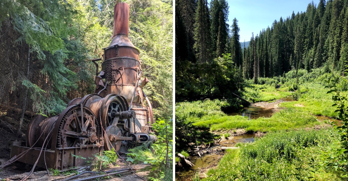
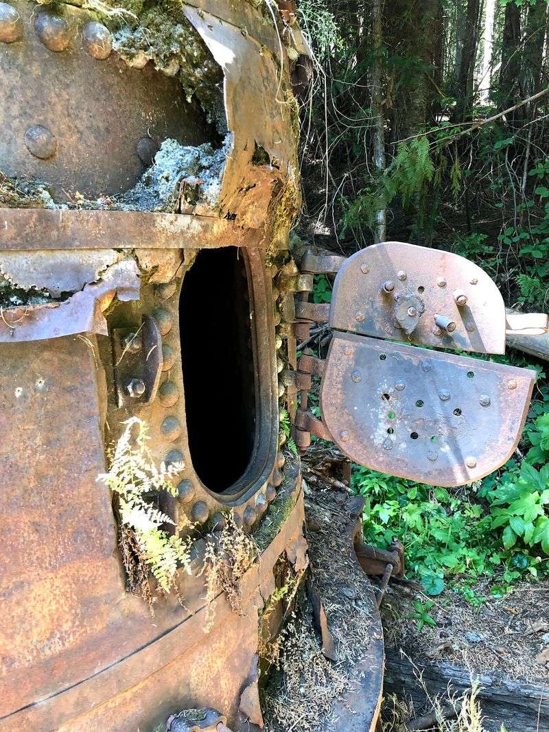
The prize is a steam donkey from the 1920s, a wood or oil fired engine that spun huge drums to reel in steel cable and haul felled logs across rugged ground. Moss climbs the frame now, and ferns crowd the base where crews once shouted over the hiss of steam.
Bring a camera, since morning light filters through the canopy and lands on the metal in soft stripes.
Give yourself time to stand still and listen to the creek running below. The descent feels easy on the way in, which is worth remembering before you turn around.
Snacks, water, and sturdy shoes make the whole loop more pleasant, especially in late summer heat.
Access comes from Marble Creek Road 321, with the signed Hobo Historic Trail about 18 miles south of the St. Joe River Road junction.
See The Rusting Machine That Once Dragged Massive Logs Through The Woods
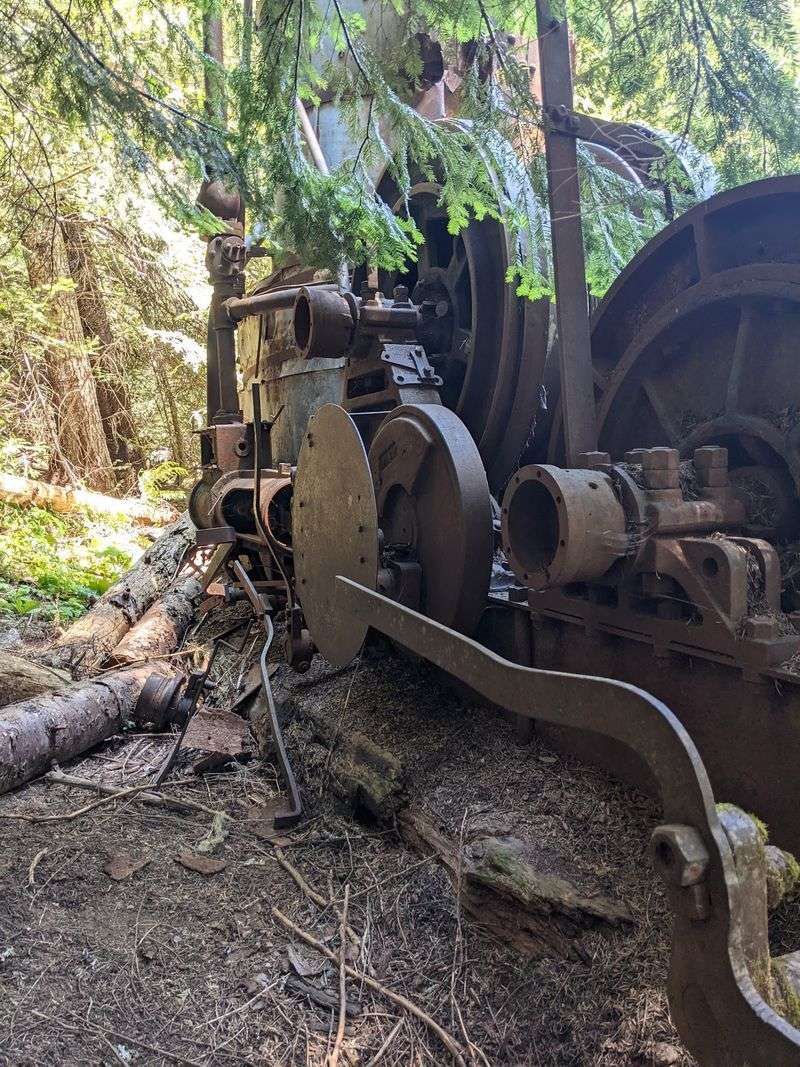
Iron this big does not look small even when it is standing still.
Gears the size of dinner plates, a heavy riveted frame, and drums wrapped in weathered cable give the steam donkey the look of a sleeping animal.
Rust has turned the metal a deep orange, and green moss fills every seam.
Picture the racket that once filled this canyon: hissing steam, groaning cable, and sharp whistle signals bouncing off the rock walls.
Every blast meant something specific to the crew, telling them when to pull, stop, or stand clear.
Quiet is the only sound now, broken by birdsong and moving water.
Few of these engines survived in the drainage, which makes this one unusual.
Another was hauled out and put on display in the town of St. Maries, so the forest version is a rare chance to see one resting where it actually worked. Look but resist climbing.
The metal edges are sharp, the footing uneven, and the artifact belongs to everyone who hikes here after you. Photograph it, sketch it, then leave it exactly as you found it.
Interpretive panels nearby fill in details the rust cannot explain on its own.
Late afternoon light suits the old engine best.
Follow The Trail Into A Forgotten 1920s Logging Camp
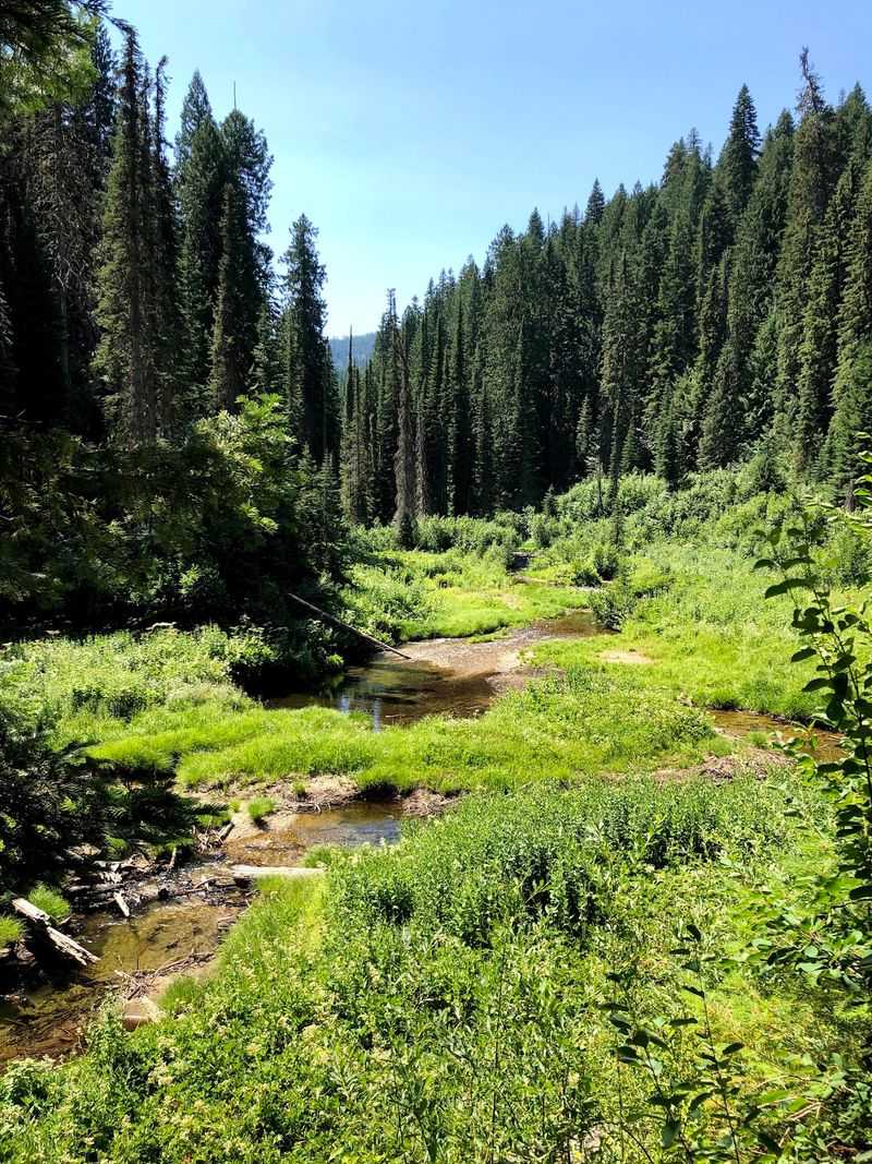
In 1923 the Rutledge Lumber Company ran fifteen camps across the Marble Creek drainage, and this pocket of forest held one of them. Crews slept, ate, and worked here through long seasons far from any town.
Most of what they built has melted back into soil.
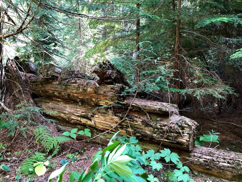
Watch for straight lines of moss-covered logs that mark old foundations, square notches at the corners, and bits of rusted metal poking through ferns.
A few weathered structures still lean under the cedars.
Daily life here revolved around housing crews, maintaining equipment, preparing meals, and moving timber through the Marble Creek drainage.
Today, scattered camp remains offer only fragments of the much larger logging operation that occupied this stretch of Marble Creek. Walk slowly through this stretch and the ground reveals more than a quick pass would show.
Keep to the path where you can, since the soft forest floor hides fragile remains.
Artifacts stay where they lie so the next visitor finds the same quiet surprise.
Camp remnants reward a slower look because many of the surviving outlines blend easily into the forest floor.
Ask children to count the log outlines and the walk turns into a treasure hunt.
Look For Remains Of The Old Splash Dam Along Marble Creek
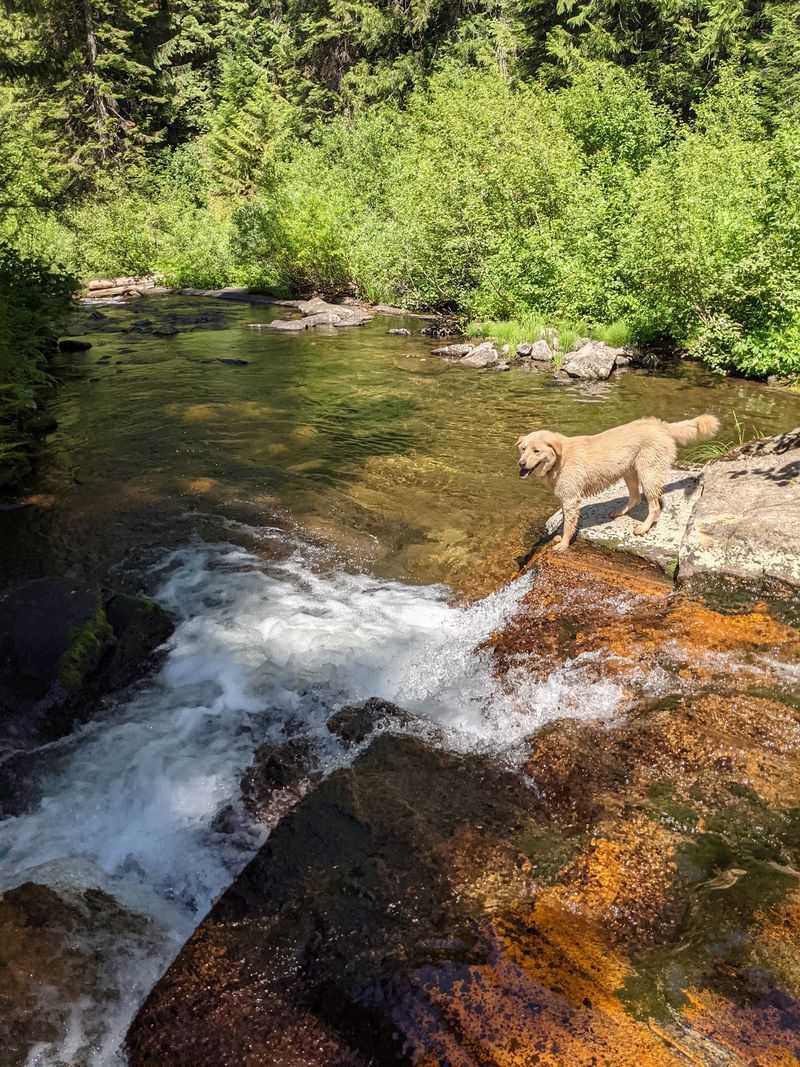
Rivers did the hauling before trucks and roads reached this country.
From 1915 to 1931, splash dams along Marble Creek stored water behind timber walls until crews were ready to move logs. The Rutledge Lumber Company built one here in 1923.
When the gates opened, a sudden flood carried stacked logs down narrow channels toward bigger rivers and, eventually, the sawmills waiting downstream.
Today only fragments remain: weathered timbers, notched beams, and stone-filled cribbing pressed into the bank.
A short spur from the main loop leads toward the remaining traces of the historic dam. Stand near the remnants and the scale becomes clear.
Water in this corner of Idaho did work no machine could match, and it did it in one roaring surge.
The creek runs gently now, clear over rounded cobbles, with cedar roots gripping the banks. Footing along the shoreline can be slick.
Wet rocks and mossy logs deserve caution, especially with young hikers along.
A walking stick helps more than you might expect.
Interpretive information near the crossing explains how log drives worked, and the details stick with you for the rest of the hike.
Reading it before you step down toward the bank makes the scattered timbers far easier to recognize.
Discover Why Thousands Of Feet Of Steel Cable Still Lie In The Forest
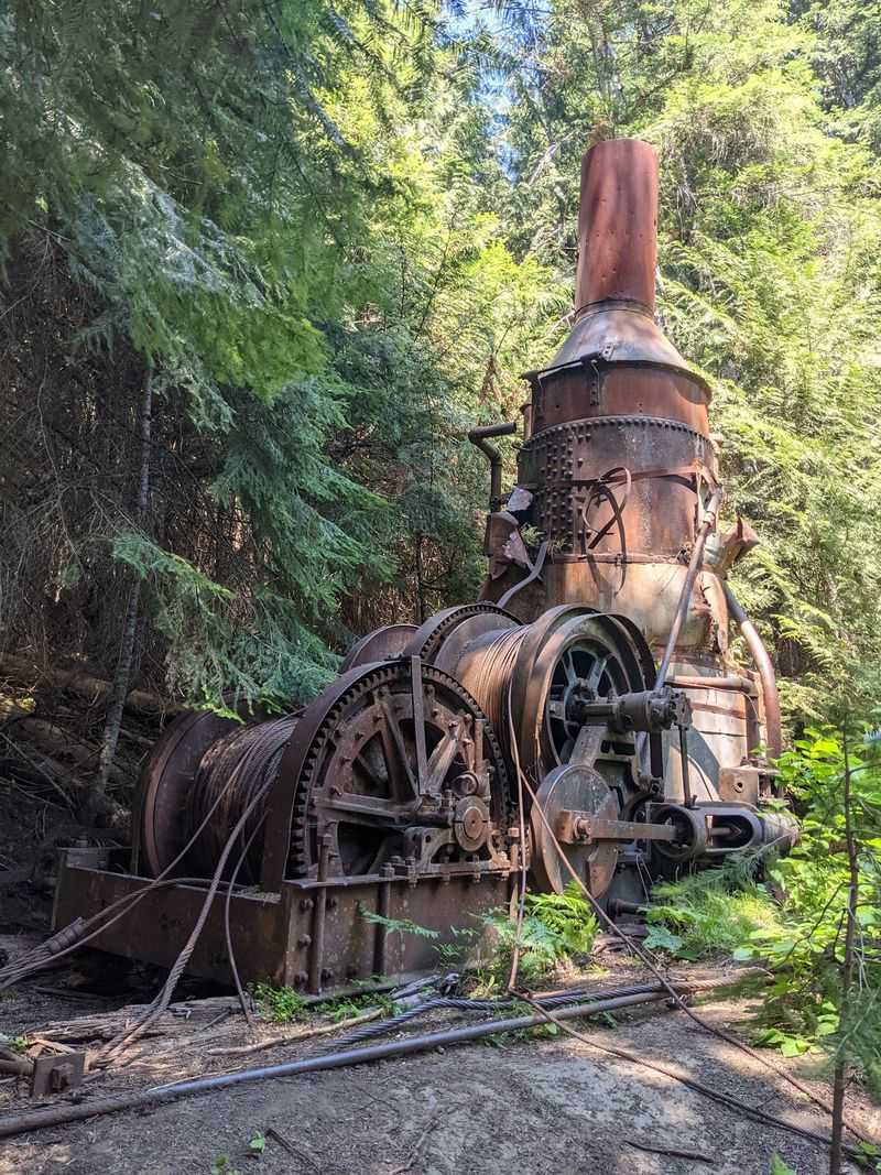
Roughly 5,000 feet of one-inch steel cable still sprawls across this hillside, thick as a child’s wrist and far too heavy to lift.
It loops through brush, disappears under forest litter, and reappears yards away like a frozen river of metal. Crews treated it as a lifeline.
The steam donkey worked as a giant winch, reeling cable in to drag heavy logs uphill toward chutes and landings.
Job titles from that era sound almost invented.
A choker wrapped the cable around felled trees, a whistle punk relayed signals, and the donkey puncher ran the engine itself.
One mistake anywhere in that chain could snap the line. Why leave so much valuable steel behind?
Much of the cable was ultimately left behind with the equipment and remains visible along the historic site today.
Abandonment was simply the practical choice. Run your eyes, not your hands, along the strands.
Frayed steel wire can cut skin quickly, and gloves are no guarantee.
Seeing the cable spread out gives the whole operation a sense of scale that photographs rarely capture.
Thousands of feet of steel, one wood-fired engine, and a hillside of enormous trees add up to a story of stubborn effort.
Read The Trail Signs That Bring North Idaho’s Logging Era Back To Life
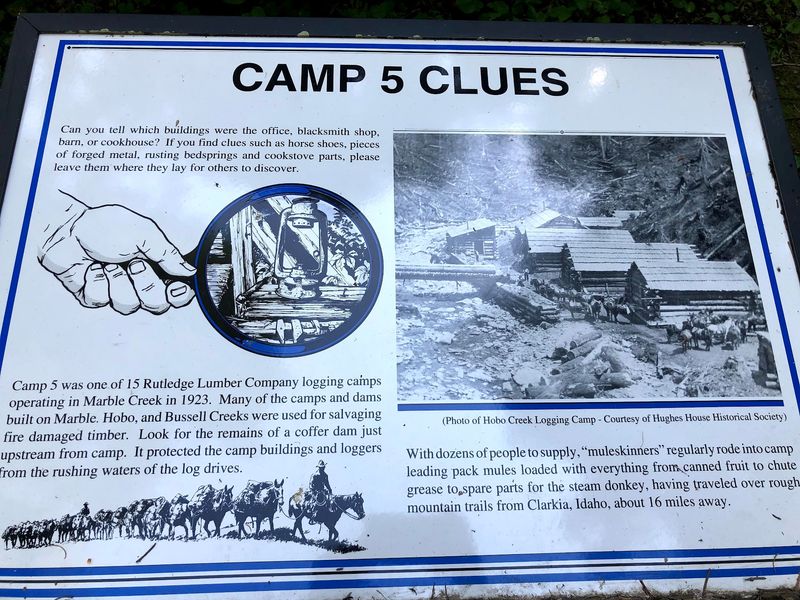
Interpretive panels turn a quiet walk into a guided lesson.
Each one pairs plain explanations with historical photographs of crews, engines, and hillsides stripped to stumps. One sign explains the odd rectangular notches cut into ancient stumps.
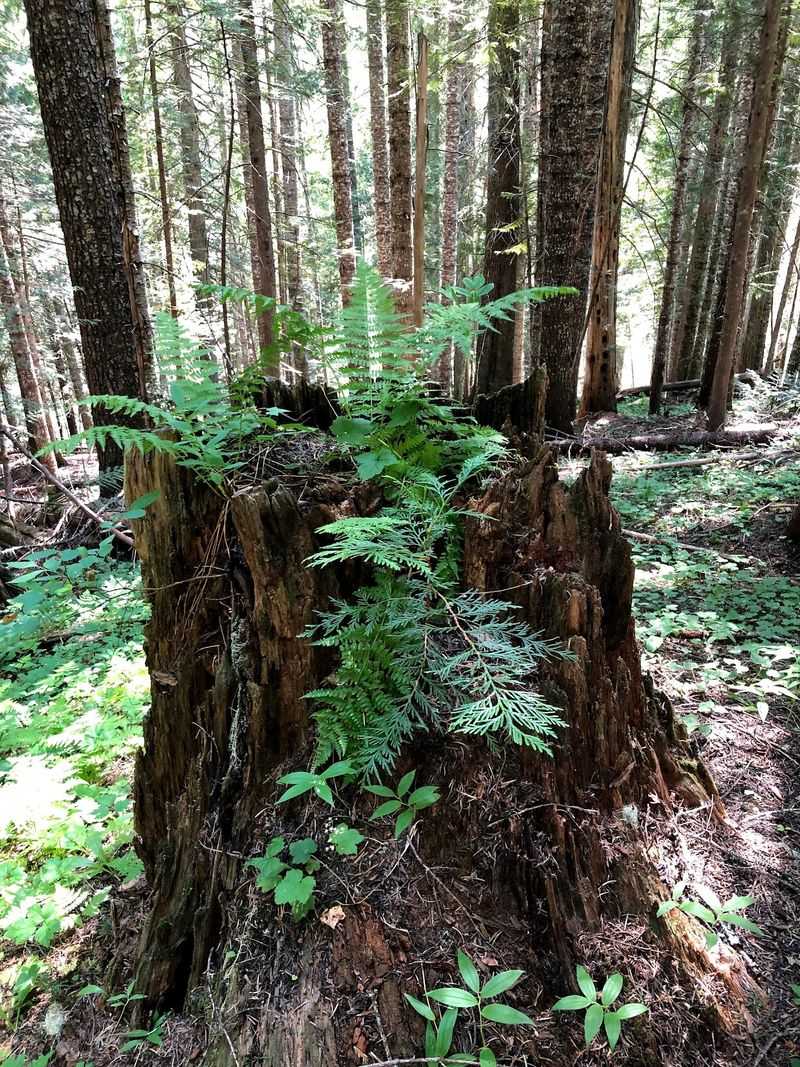
Fallers wedged springboards into those slots, then stood on the planks to saw above the wide, pitchy base of a cedar.
After reading that, every old stump along the route starts to look like evidence.
Other displays cover the lumber industry’s reach, from camp routines to the mills that turned these logs into houses and barns.
Dates and numbers give shape to what the forest alone cannot say. Read them in order if you can.
The story builds from the falling of the trees to the water that carried them away, and the machines make far more sense in that sequence.
Photographs beside the text often show the very ground you are standing on.
Comparing a bare 1920s hillside to today’s shaded canopy ranks among the most striking moments of the entire loop.
Pack a small notebook if your family likes details, because the signs hold more information than most people remember afterward.
Older children can read sections aloud while everyone catches a breath in the shade.
Prepare For A Short Hike With A Surprisingly Steep Climb Back
Distance rarely tells the whole story on a downhill-first trail.
Expect roughly 1.5 to 2 miles of hiking, with a sustained descent toward Marble Creek followed by an uphill return to the trailhead.
A historical Forest Service marker gives 1.5 miles, while one GPS-based trail guide records 2.1 miles. Going in feels effortless.
The path drops steadily through cedar shade toward the creek, and it is tempting to keep wandering past the machinery.
Coming out is where legs get honest.
That same slope now points uphill, and the climb arrives at the end of the walk rather than the beginning.
Short breaks in the shade keep it manageable for most families.
Sturdy shoes with real grip matter more than anything else in your pack here in Idaho, since roots, loose soil, and damp needles turn slick fast.
Carry water even on a cool morning, and add insect repellent in early summer. Plan on one to two hours, longer if you stop at every sign.
Finishing with a snack at the trailhead feels genuinely earned.
Hikers who prefer an easier day can walk partway down, visit the steam donkey, and return on the same grade.
Turning around early trims the mileage without missing the main attraction, and it leaves more time for the drive out.
Know How To Reach This Remote Historic Trail Before You Go
Getting there is half the adventure, and the route deserves attention before you leave pavement.
From St. Maries, follow the St. Joe River Road roughly 35 miles to the Marble Creek Road 321 junction.
Turn right onto Marble Creek Road, also signed as Forest Road 321. Gravel takes over from here, winding beside water through steep, green country.
Continue roughly 18 miles on Marble Creek Road 321 to the signed Hobo Historic Trail access.
Restrooms and background displays make it a useful first pause.
Snow, high water, and fallen trees can keep the road closed well into June, so check current conditions with the local ranger district or the Forest Service website before driving out.
Mid-summer through fall is the dependable window. Cell service disappears quickly.
Download maps ahead of time, top off fuel in town, and pack lunch, since no stores or cafes wait along the gravel.
A high-clearance vehicle is not required, though the washboard sections reward slow, patient driving.
Allow well over an hour from town, and plan to be back on the main road before dark.