10 Little-Known New Mexico Towns That Are Surprisingly Fascinating
Forget the famous plazas for a moment.
New Mexico becomes especially intriguing when the highway bends toward somewhere smaller and less predictable.
One community may have mining history. Another may surprise you with hot springs, art, unusual museums, or stories that sound almost invented.
That uncertainty is the fun part. Nothing has to feel polished or heavily marketed.
Sometimes one strange landmark or fascinating local story is enough to justify the detour.
Would you believe the quietest main street could hold the trip’s biggest surprise?
These are the places that reward travelers who keep driving after the obvious attractions disappear.
1. Hillsboro, Sierra County
I was fascinated when I found gold-rush history hiding in the Black Range Mountains. Cottonwoods shade the road, and the pace here slows way down.
By 1884, Hillsboro had become the Sierra County seat, and gold and silver mining drove the community’s early growth.
By 1884 the settlement had become the Sierra County seat. Mines here eventually produced more than six million dollars in gold and silver.
Today artists, writers, and ranchers keep the village alive. The Black Range Museum holds relics from those wild mining years.
The historic Union Church still stands near the main road. Crumbling walls of the old courthouse hint at busier days.
Stop by the Hillsboro General Store Cafe for a bite. That 1879 building once worked as a telegraph office and stagecoach stop.
Christmas in the Foothills draws neighbors together each December. Monthly music nights fill the street with local talent.
Small galleries and studios add art to a village still shaped by ranching, writing, and its mining-era history.
The nearby Gila National Forest opens up hiking and camping options. The surrounding Black Range and nearby public lands add hiking, camping, and wildlife-viewing opportunities to a Hillsboro visit.
Spring and fall bring the most comfortable temperatures for exploring. Bring water, since services stay limited out here.
2. Pie Town, Catron County
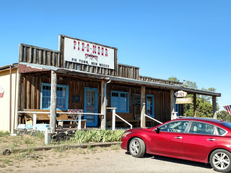
A whole town named after dessert? Amazing! The signs along the highway are not joking even slightly.
Pie Town sits in Catron County on U.S. Highway 60. Wide skies and grassland stretch in every direction.
The most widely repeated origin story credits Clyde Norman, who settled in the area in the early 1920s and began selling dried-apple pies to travelers.
The pie-selling story became closely tied to the community’s unusual name, and baking remains central to Pie Town’s identity today.
Ancient history runs deep in this region too. Archaeological evidence, including pottery associated with earlier Indigenous communities, reflects a much longer human history in the surrounding region.
The Annual Pie Festival lands on the second Saturday of September. Baking contests, games, and music fill the day.
Hikers know the town well for another reason. Pie Town is an important Continental Divide Trail resupply community, although the official route around town includes road walks and an unfinished trail gap.
Cyclists and horseback riders use the route as well. The Toaster House provides by-donation lodging for Continental Divide Trail travelers.
Surrounding country includes parts of the Gila National Forest. Trails and campsites sit within easy driving range.
The Very Large Array sits roughly 30 to 35 miles east of Pie Town along U.S. 60. Those giant white dishes scanning the sky are unforgettable.
Call ahead before arriving, since cafe hours shift with the seasons. Cash comes in handy out here as well.
3. Cerrillos, Santa Fe County
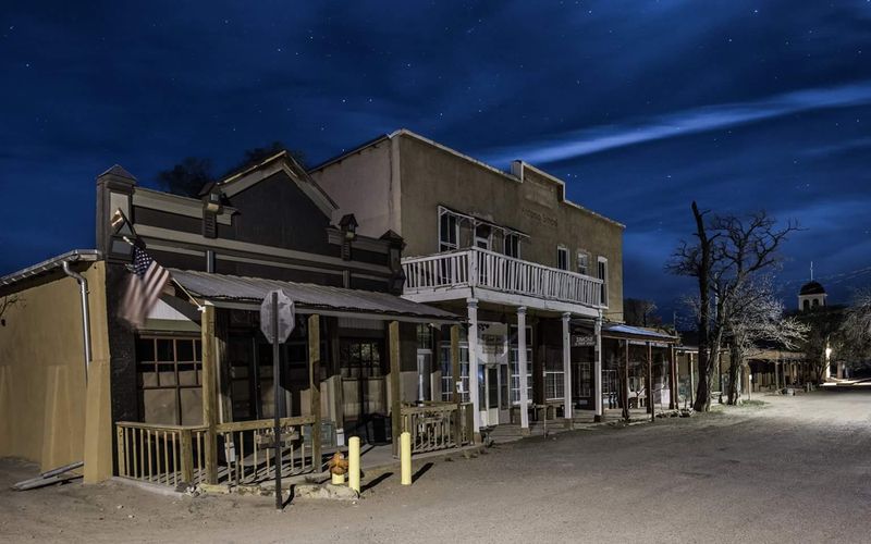
My jaw dropped at the sight of dirt streets that look untouched by the last century. Old wooden storefronts lean into the sun.
Cerrillos sits along State Highway 14, better known as the Turquoise Trail. Santa Fe County holds this pocket of Old West atmosphere.
Native peoples mined turquoise in the Cerrillos Hills for more than a thousand years, giving the area one of North America’s longest documented mining histories.
New gold and especially silver-lead discoveries in 1879 helped ignite Cerrillos’ mining boom. For a short while the town was floated as a possible state capital.
During the boom years, Cerrillos may have grown to about 2,000 residents, with hotels, saloons, stores, and mining-related businesses filling the town.
Cerrillos Hills State Park now protects five miles of trails. Paths wind past historic mine openings and open overlooks.
Hikers, bikers, and horseback riders share those routes. Mornings bring the best light for photos.
Brown’s Casa Grande Trading Post ranks high on any itinerary. Inside sit a mining museum and a vintage coffee can collection.
A small petting zoo there keeps llamas and goats. Kids usually refuse to leave.
St Joseph Church, built of adobe, anchors the community. Film crews have used these streets for several motion pictures.
Nearby Box Studio Sculpture Garden displays monumental metal works inspired by origami, created by artist Kevin Box and collaborators.
4. Jemez Springs, Sandoval County
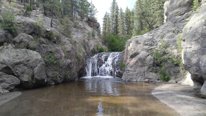
Red rock cliffs and steaming water share the same valley. Pine forest fills in the gaps between them.
Jemez Springs rests in Sandoval County along the Jemez Mountain Trail National Scenic Byway. Cell service fades, which is part of the appeal.
People have lived in this valley for roughly 4,500 years. Findings near Soda Dam confirm that ancient presence.
A Spanish expedition reached the Jemez Valley in 1541, while colonial settlement and Catholic mission activity followed later alongside established Pueblo communities.
Jemez Historic Site protects the remains of Gíusewa Pueblo, established around the 15th century, alongside the ruins of San José de los Jémez Mission, built beginning around 1621.
Natural hot springs made the village famous. Commercial bathhouses and primitive pools both draw soakers.
Spence Hot Springs requires a short uphill walk. McCauley Warm Spring rewards hikers with mellow, shallow pools.
Jemez Falls ranks as the tallest waterfall in these mountains. The overlook sits close to the parking area.
Fishing, wildlife watching, and forest trails fill out the day. Elk live throughout the surrounding Jemez Mountains, although sightings on any particular visit are never guaranteed.
Walatowa Visitor Center at Jemez Pueblo shares cultural history. Nearby sit Fenton Lake, the Gilman Tunnels, and Valles Caldera National Preserve.
Kasha-Katuwe Tent Rocks National Monument showcases its famous cone-shaped formations, but 2026 visits require advance reservations and both federal and Cochiti Pueblo access authorization.
5. Chimayo, Santa Fe County
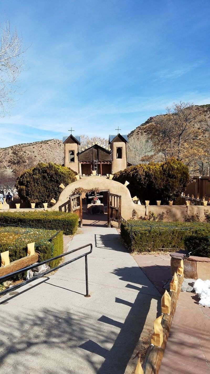
I am still wrapping my head around how one small chapel draws thousands on foot. Something about this valley feels hushed and heavy with meaning.
Chimayo sits in Santa Fe County, tucked into the Sangre de Cristo Mountains. The drive takes about 40 minutes along the High Road to Taos Scenic Byway.
Tewa people lived here from the 12th century and called the area Tsi-Mayoh.
Spanish colonization resumed in the region after 1693, and Chimayó’s history today reflects longstanding Tewa and Hispano traditions as well as the complicated history of colonization.
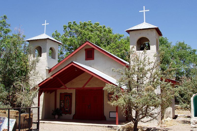
El Santuario de Chimayó anchors the village. The current adobe shrine was completed in 1816 and is now a National Historic Landmark.
Inside sits el pocito, a small pit of holy dirt. Many believe the soil carries healing power.
Pilgrims walk here during Holy Week in huge numbers. Some travel dozens of miles on foot.
Weaving forms the other half of the town’s fame. The Ortega and Trujillo families have kept looms running for generations.
Ortega’s Weaving Shop displays wool rugs and blankets. Centinela Traditional Weaving Arts shows intricate patterns and handbags.
The Chimayó Museum was established in an ancestral Ortega family home on Plaza del Cerro, with collections devoted to the community’s history and traditions.
Northern New Mexican cooking rounds out a trip. Local red chile has a deserved reputation for heat and flavor.
Holy Week and other major pilgrimage periods can bring especially heavy visitation, so allow extra time and check current conditions before arriving.
6. Carrizozo, Lincoln County
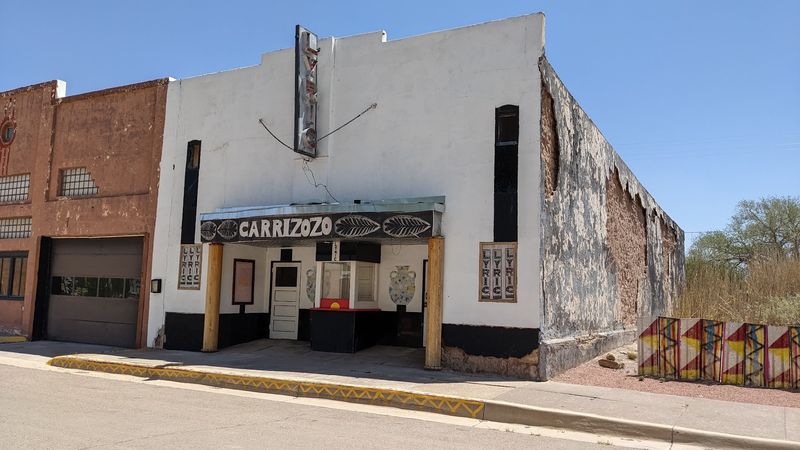
Black lava, neon signs, and painted burros in one small town: the mix should not work, yet it absolutely does!
Carrizozo sits in Lincoln County where U.S. Routes 54 and 380 cross. The name comes from the Spanish word carrizo, meaning reed grass.
Adding zo emphasized just how much of that grass once grew here. Ranchers still remember the story.
The town appeared in 1899 when the railroad arrived. Families moved over from the mining settlement of White Oaks.
By 1909 it had become the Lincoln County seat. Railroad buildings still dot the older blocks.
Valley of Fires Recreation Area showcases the roughly 44-mile-long Carrizozo lava flow, which erupted about 5,000 years ago.
An interpretive nature trail gives visitors a close look at portions of the lava flow and the plants growing across it. Cactus and wildflowers grow right out of the crevices.
South of town, Three Rivers Petroglyph Site protects more than 21,000 images, many created by Jornada Mogollon people between roughly A.D. 500 and 1450.
Carrizozo’s arts scene includes galleries, public art, and the Malkerson Gallery 408 sculpture garden.
Outdoor sculpture and the town’s colorful painted-burro project add public art to the streetscape.
Local historical collections and community projects preserve Carrizozo’s railroad, ranching, and town history. Painted burro statues pose around the streets for photos.
7. Tularosa, Otero County
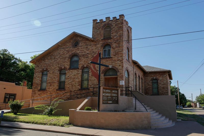
Just imagine for a second a green, shady oasis surrounded by pale desert. Water arrives here the same way it has since the 1860s.
Tularosa lies in Otero County, and its name refers to red or rose-colored reeds along the Rio Tularosa. Those reeds gave the settlement its identity.
Hispanic farmers put down roots in 1862. The village was formally mapped the following year.
An original acequia, a ditch irrigation system, still functions. Those channels feed towering cottonwoods and backyard gardens.
The Tularosa Original Townsite District covers 49 blocks. Historic adobe and brick buildings line Granado Street. Small shops sell handcrafted jewelry, vintage finds, and Southwestern art.
St Francis De Paula Church, founded in 1865, remains a community landmark. Its white walls stand out against the mountains.
The Red Brick Schoolhouse dates to 1917. Architect Henry Charles Trost designed the building.
Inside the Old Tularosa Bank sits a century-old iron vault. A pressed tin ceiling completes the throwback look.
Three Rivers Petroglyph Site waits a short drive north with more than 21,000 images, many created by Jornada Mogollon people between roughly A.D. 500 and 1450.
Pecan and pistachio growers operate in and around Tularosa, with local businesses selling packaged nuts and other regional products.
8. Columbus, Luna County
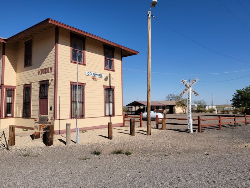
Let’s be real for a second: few tiny border towns carry this much national history. The desert quiet hides a dramatic past.
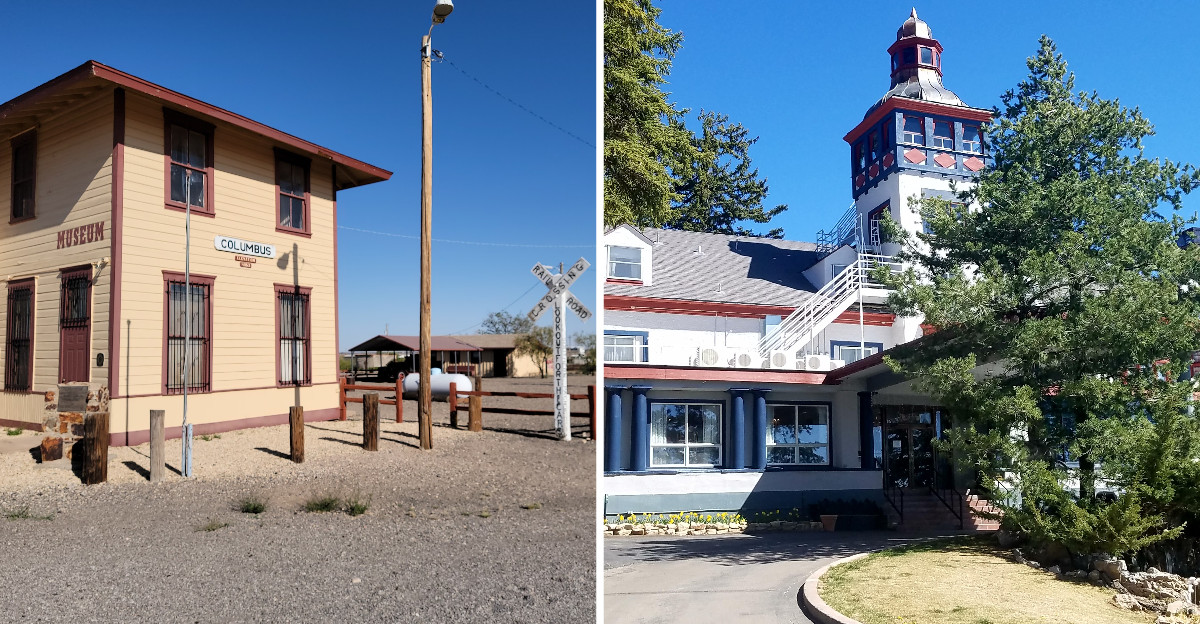
Columbus is a village in Luna County, resting three miles north of the Mexican border. The Chihuahuan Desert spreads out on all sides.
Fame arrived in 1916 with Pancho Villa’s raid. The March 1916 raid prompted the U.S. Punitive Expedition into Mexico, with roughly 10,000 troops eventually serving under Gen.John J. Pershing.
General Blackjack Pershing commanded that Mexican Expedition. Military history buffs still trace those movements today.
Pancho Villa State Park now covers the old Camp Furlong grounds. Original structures from the camp remain standing.
The 1902 U.S. Customs House survives within Pancho Villa State Park, alongside visitor facilities and exhibits interpreting the raid and Camp Furlong.
Columbus Historical Museum adds more artifacts and photographs. A self-guided walking tour connects the key sites.
Across the border in Puerto Palomas, Mexico, The Pink Store combines a restaurant with Mexican art, jewelry, pottery, and gifts.
Mountain scenery frames the valley beautifully. The Florida and Tres Hermanas ranges rise on the horizon.
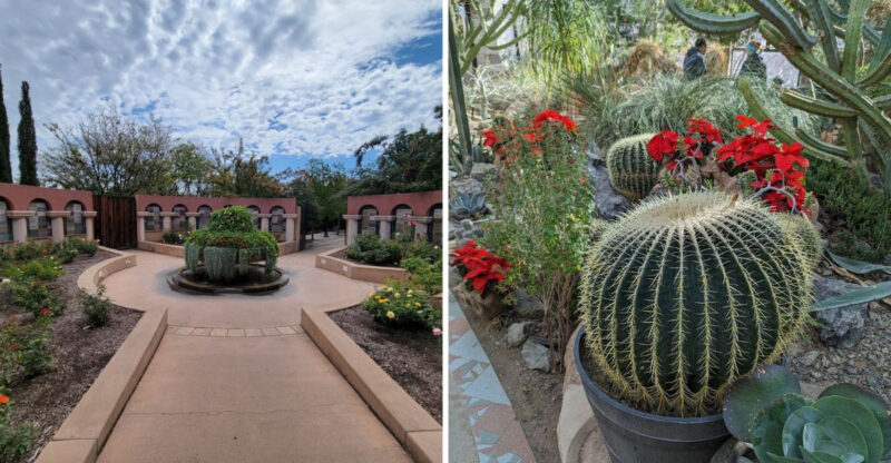
Desert plants and hummingbirds thrive in the park gardens. Spring blooms make the cactus sections especially colorful.
Puerto Palomas lies just across the international border south of Columbus, but travelers should check current entry and re-entry requirements and carry the required documents before crossing.
9. Fort Sumner, De Baca County
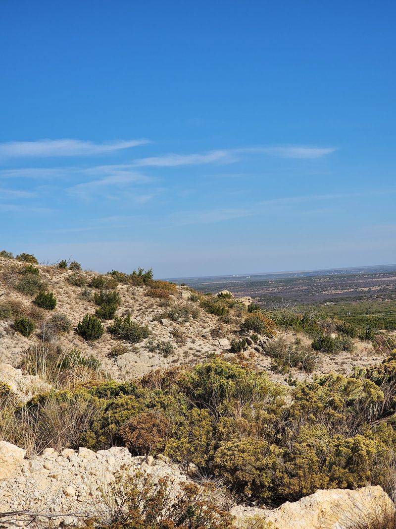
Two very different stories share one stretch of the Pecos River plains. One is somber, the other pure Old West legend.
Fort Sumner sits in De Baca County and takes its name from Col. Edwin Vose Sumner. The military post was established in 1862.
Between 1863 and 1868, the U.S. government forcibly interned thousands of Navajo and Mescalero Apache people at Bosque Redondo; the forced removal of Navajo people there is remembered as the Long Walk.
The Bosque Redondo Memorial interprets those years with care. An audio tour and interpretive trail guide the experience.
After the military abandoned Fort Sumner, rancher Lucien Maxwell acquired the former fort property and buildings during the 1870s.
Maxwell rebuilt one of the former officers’ quarters into a large residence, and Sheriff Pat Garrett killed Billy the Kid there on July 14, 1881.
The outlaw rests in the old military cemetery. His marked gravesite draws steady traffic.
The Billy the Kid Museum holds a huge collection. Antique wagons, frontier tools, and firearms fill the halls.
Lake Sumner State Park handles the outdoor side of things. Fishing, camping, and water sports keep families busy.
Inside the De Baca County Courthouse, murals painted by Vernon Hunter in 1934 depict episodes from the county’s history.
10. Cloudcroft, Otero County
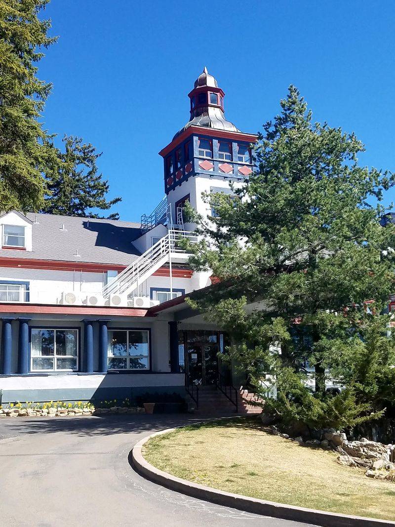
Are you seeing what I am seeing: pine forest and snow in southern New Mexico? The temperature drop on the drive up is startling.
Cloudcroft perches at nearly 9,000 feet in the Sacramento Mountains of Otero County. Desert heat vanishes somewhere along the switchbacks.
Developers with the El Paso and Northeastern Railroad founded the village in the late 1890s. Logging and mountain vacations drove the early economy.
The Mexican Canyon Trestle went up in 1899. That curved wooden rail bridge still stands as a photo favorite.
The Lodge, a historic hotel, hosted notable figures over the decades. Its architecture remains a local landmark.
Cloudcroft’s high elevation makes it a popular summer mountain escape as well as a winter destination.
Hiking, biking, and golf fill the warmer months. Summer and early fall bring forest hiking, mountain scenery, and seasonal wildflowers to the surrounding Sacramento Mountains.
Winter can bring skiing and tubing at Ski Cloudcroft, which lists 25 trails including eight beginner runs, but operations depend heavily on snowfall and weather.
Sacramento Mountains Museum and Pioneer Village preserves restored historic buildings. Old cabins show how settlers lived.
Trestle Recreation Area frames the best trestle views. Overlooks also reveal the vast Tularosa Basin below.
Burro Avenue holds shops, galleries, and bakeries. Seasonal festivals celebrate music, crafts, and local food.
The historic Lodge at Cloudcroft remains open, offering lodging, dining, golf, and mountain views from its landmark property.