You Won’t Believe These 10 Incredible Natural Wonders Are Hiding In Michigan
Wait, this is Michigan?!
That reaction makes sense once colorful cliffs, enormous dunes, deep forests, and water stretching toward the horizon start appearing on the same trip.
The state has a talent for changing scenery so dramatically that one destination barely resembles the last. That keeps every drive interesting.
A trail can open onto a massive view without much warning. A quiet forest can suddenly feel almost prehistoric.
Then the shoreline shows up and steals everything again.
Nature is showing off here, and apparently subtlety was never part of the plan. The hardest part is deciding which landscape deserves the biggest wow.
1. Sleeping Bear Dunes National Lakeshore, Empire
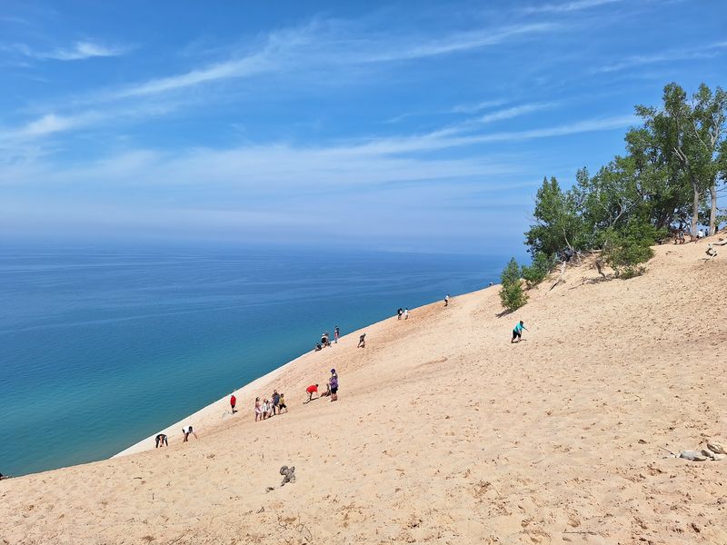
Here is a fun test for your legs. The climb looks short until your feet sink into sand.
Sleeping Bear Dunes National Lakeshore near Empire protects a dramatic mix of dunes, beaches, forests, and inland lakes along Lake Michigan.
The Dune Climb is one of its best-known stops, but reaching the top is only the beginning for anyone continuing toward the lakeshore.
The full Dunes Trail to Lake Michigan covers about 3.5 miles round trip and can take two to four hours.
Steep, loose sand makes the route far more demanding than the distance suggests, so water, sun protection, and sturdy footwear matter. The top of the initial Dune Climb overlooks Glen Lake rather than Lake Michigan.
For broad views without that much effort, Pierce Stocking Scenic Drive offers a 7.4-mile seasonal loop with twelve stops.
The Lake Overlook rises roughly 450 feet above the shore. Going down the bluff is strongly discouraged because the return climb is extremely strenuous and contributes to erosion.
Quieter options include woodland trails, beach walks, and sections of the Sleeping Bear Heritage Trail. Current 2026 conditions list the Dune Climb, scenic drive, and lakeshore trails as open.
The visitor center at 9922 Front Street in Empire is the best starting point for maps, passes, and updated conditions before heading into the dunes.
2. Porcupine Mountains Wilderness State Park, Ontonagon
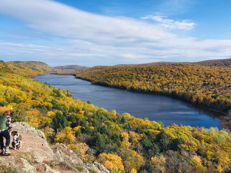
Some overlooks make conversation stop. I understood why after the trees opened onto a forested valley.
Porcupine Mountains Wilderness State Park near Ontonagon covers about 60,000 acres, making it the state’s largest state park.
Its ridges, rivers, waterfalls, Lake Superior shoreline, and vast old-growth forest create one of the most rugged landscapes in the Upper Peninsula.
Lake of the Clouds is the best-known view. An accessible walkway and observation platform make the overlook reachable without a long hike, while the surrounding trail network leads into rougher country.
The park contains about 90 miles of hiking trails, including sections of the North Country Trail and Iron Belle Trail.
The protected wilderness includes roughly 35,000 acres of primary northern hardwood and hemlock forest, an unusually large surviving tract of old-growth woodland.
Fallen logs, towering trunks, and uneven ground are part of the ecosystem rather than signs of neglect.
Other major stops include the Presque Isle River corridor and Summit Peak observation tower. Longer routes require preparation because cell coverage can be limited and weather near Lake Superior can shift quickly.
Summer suits hiking and waterfall trips, while autumn transforms the ridges with color. Winter brings a completely different set of conditions and travel demands.
The visitor center at 33303 Headquarters Road is open seasonally and provides maps, trail updates, exhibits, and current backcountry information.
3. Silver Lake State Park, Mears
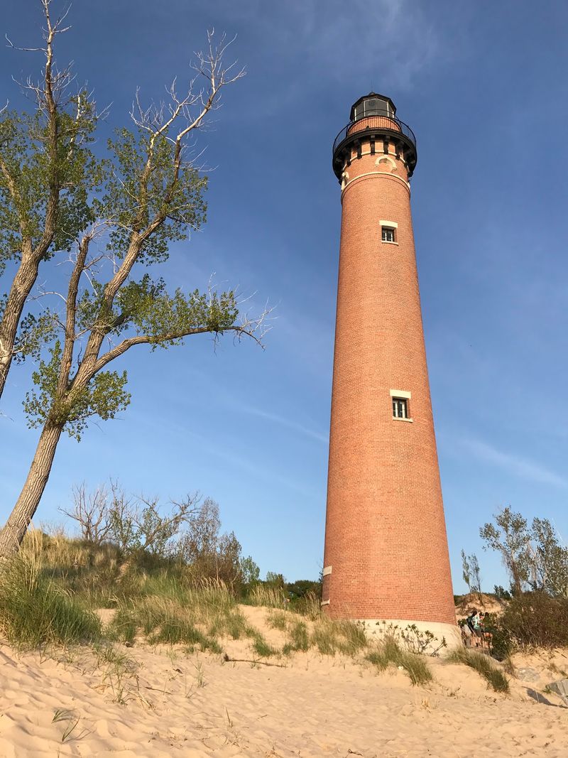
Sand can turn a simple outing into a busy day. I wanted to see both sides of these dunes.
Silver Lake State Park near Mears combines nearly three miles of Lake Michigan shoreline with about 2,000 acres of dunes, an inland lake, and one of the state’s most unusual recreation areas.
The landscape supports both quiet beach time and high-energy motorized riding.
The 450-acre Silver Lake ORV Area is the only motorized sand-dune riding area east of the Mississippi River.
Drivers must follow current equipment, permit, safety, and parking-voucher rules before entering. Visitors without their own machine can use local rentals or guided options.
Nonmotorized visitors have plenty of space too. Hiking, beach walks, swimming, photography, and seasonal horseback riding all use different parts of the park.
Interpretive dune rides operate during summer for anyone who wants the experience without driving.
Little Sable Point Lighthouse adds a historic stop along Lake Michigan. Seasonal tours allow visitors to climb the tower, while the surrounding shoreline works well even when the lighthouse is closed.
Wind can change dune surfaces quickly, and hot sand becomes uncomfortable during bright summer weather. Staying within designated areas also protects vegetation stabilizing the dunes.
Use 9679 W State Park Road in Mears for navigation. Drivers entering the state park need the state’s Recreation Passport.
4. Ludington State Park
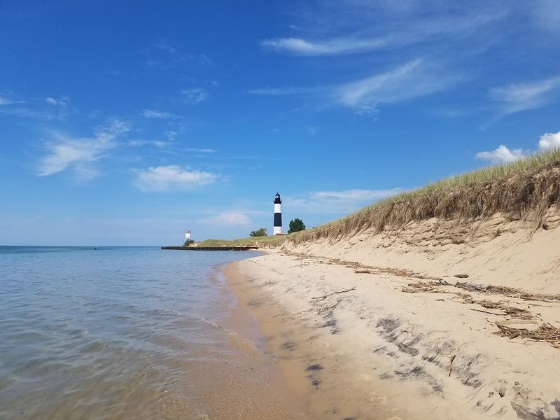
One trail can change the whole plan. I started near the water and kept following the dunes.
Ludington State Park brings together Lake Michigan, 5,000-acre Hamlin Lake, the Big Sable River, forests, wetlands, and extensive freshwater dunes.
The park currently offers 21 miles of marked trails, creating plenty of choices beyond a simple beach visit.
Big Sable Point Lighthouse is one of the signature destinations.
Reaching it requires a 1.8-mile walk or bike ride each way on a mostly unshaded sand-and-gravel path, so water and sun protection are important. The lighthouse is generally open for seasonal tours from May through October.
Paddling and fishing are popular on Hamlin Lake and the Big Sable River, while Lake Michigan provides broad beaches and powerful open-water scenery.
Marked trails move through dunes, woods, wetlands, and river corridors, giving each route a different feel.
One current change matters for 2026 visitors. The Skyline Trail, intersecting paths, and park amphitheater are closing in September for a reconstruction project expected to continue into mid-2027.
Other trails remain available, but checking the latest map before setting out is worthwhile.
The main park entrance is reached by following M-116 to its end. For trip planning, the education-program address is 8800 W M-116 in Ludington.
5. Tawas Point State Park, East Tawas
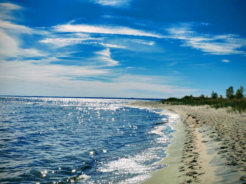
Bring binoculars, even if you cannot name every bird. I found the shoreline entertaining before identifying a single feather.
Tawas Point State Park near East Tawas occupies a narrow sand spit forming one side of Tawas Bay on Lake Huron.
Its position makes the park an important stopover for migrating birds, especially during spring and fall.
The current park footprint covers 183 acres and includes a nature trail, campground, picnic areas, beach access, and broad views across both the protected bay and open lake.
Patient birdwatchers can scan shoreline, shrubs, trees, and water for different species without covering long distances.
Tawas Point Lighthouse adds another layer to the visit. Built in 1876, the Victorian-era station remains a major historic feature, with seasonal guided tours and tower climbs.
Even when interior access is unavailable, visitors can explore the surrounding grounds and related structures.
The bay’s shallow, relatively warm water supports swimming during suitable conditions, while steady winds have also made the area popular for sailing. Weather can differ noticeably between the sheltered bay and the exposed Lake Huron side.
Migration periods reward patience more than speed. Keeping distance from resting birds helps them conserve energy during long seasonal journeys. The park entrance is at 686 Tawas Beach Road in East Tawas.
6. Warren Dunes State Park, Sawyer
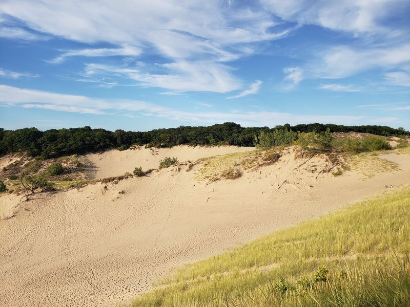
That uphill stretch earned my attention fast. The sand kept sliding beneath my feet, which made every step count.
Warren Dunes State Park near Sawyer protects 1,500 acres along Lake Michigan, including three miles of shoreline, forested dunes, open sand, wetlands, and six miles of hiking trails.
The terrain can change quickly from shaded woodland to exposed slopes.
The park’s largest dune formation rises about 260 feet above the lake, creating wide views for visitors willing to climb.
Loose sand makes steep routes more tiring than their mileage suggests, so water and a realistic turnaround point matter on warm days.
Beach time offers a much simpler alternative. Lake Michigan conditions can change quickly, and posted swimming guidance deserves attention even when the shoreline looks calm. Sun protection is useful because open sand provides limited shade.
Wooded trails offer a cooler change of pace and pass through habitat used by migrating birds. Staying on marked routes helps protect dune grasses and other plants that stabilize the shifting landscape.
Warren Dunes is also known for permitted hang gliding from designated areas, adding an unusual activity to the park’s recreation mix. The entrance is at 12032 Red Arrow Highway in Sawyer.
7. Hartwick Pines State Park, Grayling
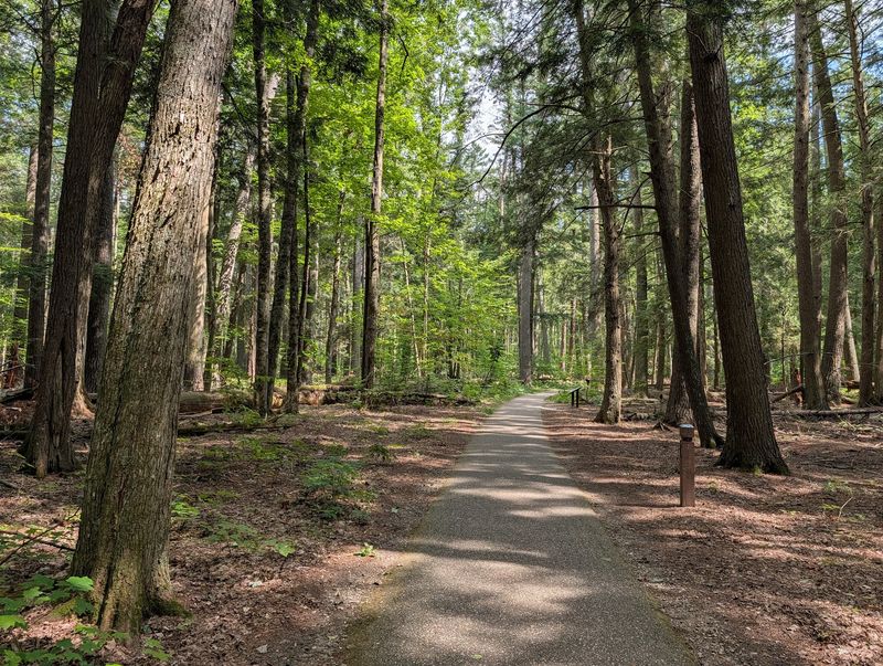
Look up before looking at the trail map. I did, and the tall pines held my attention.
Hartwick Pines State Park near Grayling is best known for 49 acres of old-growth pine forest, one of Michigan’s remaining examples of the towering trees that once dominated parts of the region.
The broader park covers more than 9,000 acres and contains 21 miles of trails.
The paved 1.25-mile Old Growth Forest Trail is the easiest introduction. It passes through the preserved pine stand and links major features including the visitor center, logging museum, chapel, and memorial building.
The route is paved, although two steep grades can affect accessibility.
The Hartwick Pines Logging Museum explains the 19th-century timber industry that transformed Michigan’s forests.
Exhibits and seasonal demonstrations make the surviving old-growth stand more meaningful by showing what disappeared across much of the state.
Visitors wanting more distance can choose additional forest routes, but one current restriction deserves attention.
A section of the Au Sable River Trail is closed indefinitely because several footbridges need work, so completing that route currently requires an out-and-back adjustment.
The park also contains spring-fed lakes, birding areas, and opportunities for paddling and mountain biking.
Use 3612 State Park Drive in Grayling for navigation. Checking the current park map before starting helps avoid the closed trail section and keeps route choices clear.
8. Wilderness State Park, Carp Lake
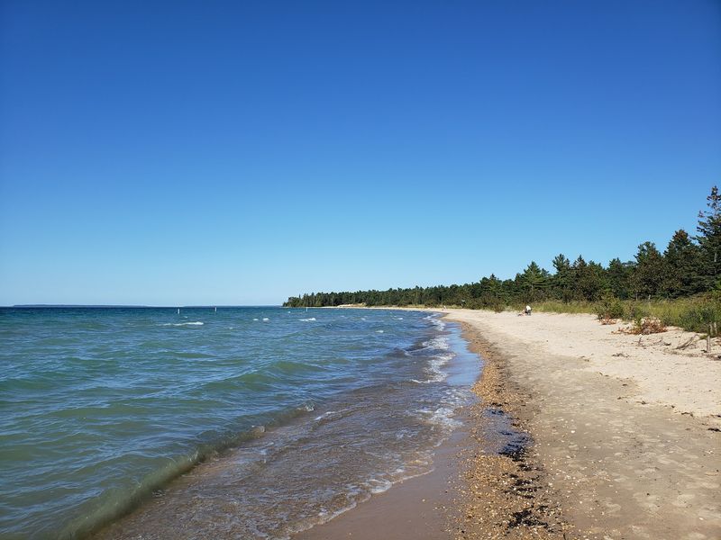
Wait for the sky to grow dark. I nearly packed up before the stars began to show.
Wilderness State Park near Carp Lake protects 26 miles of Lake Michigan shoreline and more than 20 miles of trails just west of Mackinaw City.
Dense conifer forest, mature hardwoods, meadows, ponds, and wetlands give the park far more variety than its name alone suggests.
The park is also a designated dark sky preserve, making clear nights a major attraction. From some areas, visitors can look west toward historic Waugoshance Lighthouse or east toward the Mackinac Bridge before the stars take over.
Daylight offers plenty to do first. Hiking trails cross forest and wetland environments, while beaches, paddling access, fishing areas, and a buoyed swimming zone provide options along the water.
Staying on marked routes is important because the trail system covers a large, wooded landscape.
For stargazing, choose an open approved area, keep bright white lights to a minimum, and bring warmer layers than the daytime forecast might suggest. A red-light flashlight helps preserve night vision without disturbing other visitors.
Wildlife habitat here includes sensitive shoreline areas, including important piping plover habitat, so giving animals and protected areas space matters.
The park entrance is at 903 Wilderness Park Drive in Carp Lake.
9. Pictured Rocks National Lakeshore, Munising
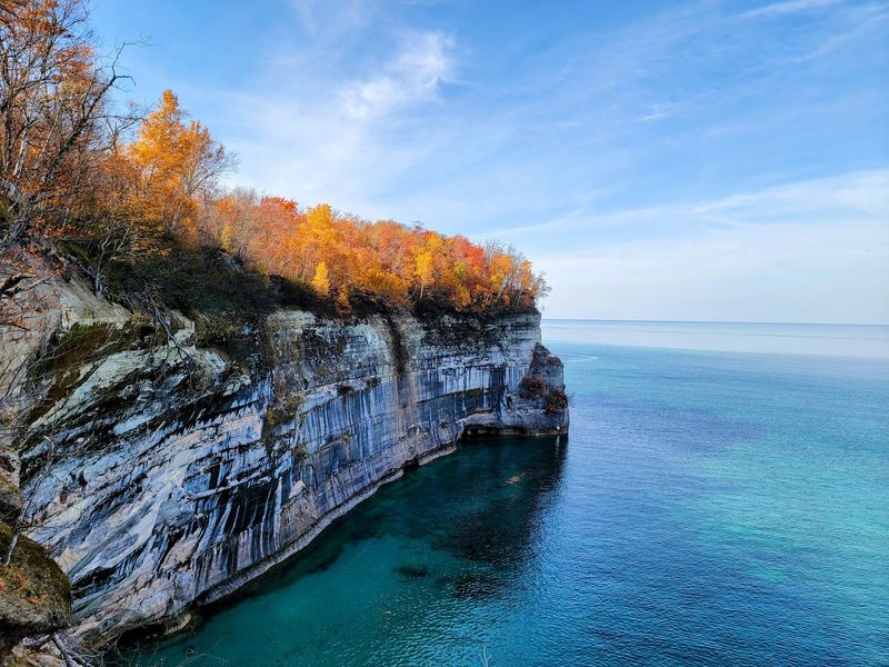
Wait until the shoreline changes color. I nearly missed the first streak while watching waves roll past.
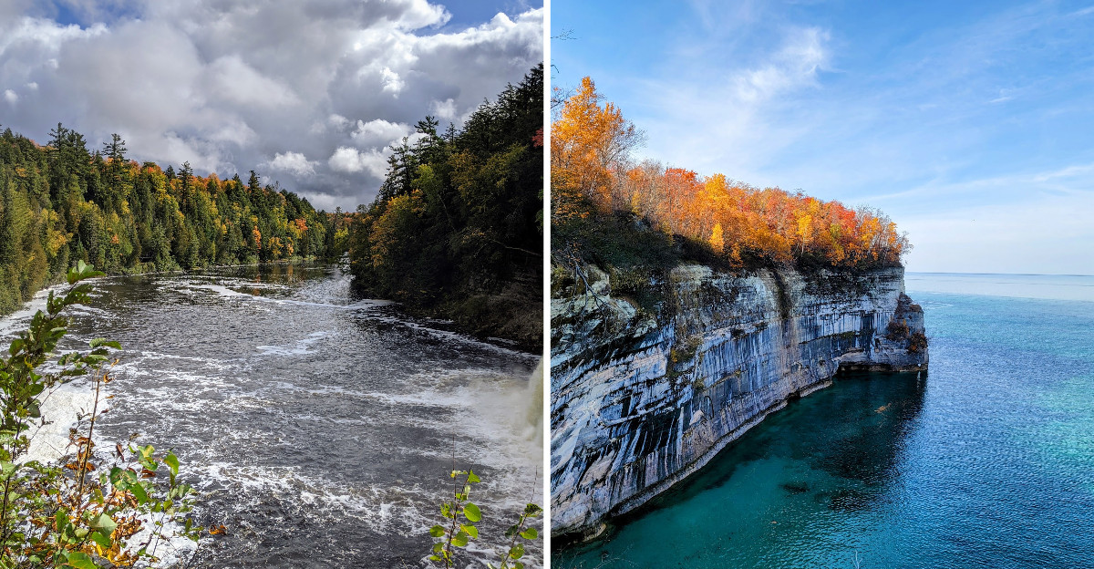
At Pictured Rocks National Lakeshore near Munising, mineral-streaked sandstone cliffs rise 50 to 200 feet above Lake Superior for about 15 miles.
Iron creates red and orange tones, copper adds blue and green, manganese darkens the rock, and limonite contributes white.
Waves, ice, and weather have carved caves, arches, spires, and other formations into the shoreline.
A boat tour gives the broadest look at the cliffs, while guided sea-kayak trips bring experienced paddlers closer to the rock.
Lake Superior can change quickly, so recreational kayaks and canoes do not belong on this exposed water. Visitors without big-water paddling skills should stay with an authorized guide.
Land routes offer plenty too. Nearly 100 miles of trails cross the lakeshore, connecting beaches, waterfalls, forests, and overlooks.
Miners Castle is the only cliff area accessible by vehicle, making it one of the easiest places to see the formations from land.
Summer brings the widest tour schedule, autumn adds bright forest color, and winter reshapes the shore with snow and ice. The Munising Falls Visitor Center at 1505 Sand Point Road is a useful starting point for maps and current conditions.
10. Tahquamenon Falls State Park, Paradise
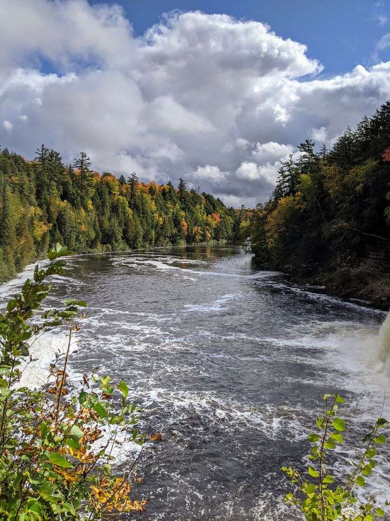
Tahquamenon Falls State Park near Paradise protects nearly 50,000 acres and more than 35 miles of trails in Michigan’s Upper Peninsula.
The amber color of the Tahquamenon River comes from tannins released by surrounding wetlands, giving the water its familiar warm brown tone without indicating pollution.
The Upper Falls stretches more than 200 feet across and ranks among the largest waterfalls in the eastern United States.
A new 1,100-foot accessible boardwalk now leads through old-growth forest toward the brink, with benches and interpretive stops along the way.
About four miles downstream, the Lower Falls break into a series of smaller cascades around an island. Visitors can view them from the riverbank, cross the pedestrian island bridge, or use seasonal rowboat rentals when available.
A 16-mile portion of the North Country Trail runs through the park, including a route linking the Upper and Lower Falls. Shorter walks offer easier ways to experience the river without committing to a full-day hike.
Wildlife ranges from deer and otters to black bears, bald eagles, and occasional moose in wetter areas. Conditions shift sharply with the seasons, so current access information matters.
For navigation, the park headquarters is at 41382 W M-123 in Paradise.