Pioneer Wagons Left Ruts You Still See Today Carved Into This Stretch Of Nebraska Prairie
The sign by the road looked small, and the hill behind it looked like every other grassy rise in western Nebraska. Then a short walk uphill turned a quick leg stretch into the best part of the whole drive.
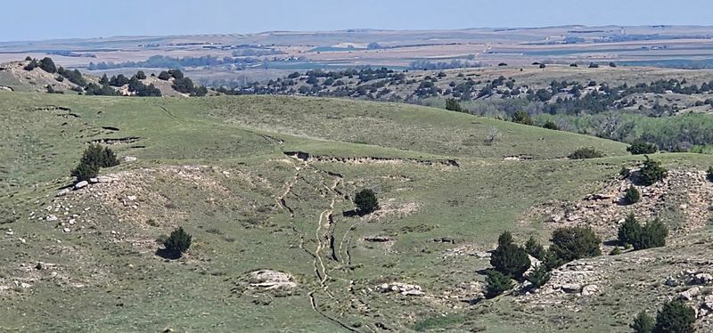
Pressed into that slope are grooves left by wagon wheels more than a century and a half ago. You can stand right beside them and trace the path thousands of families took on their way west.
A Grassy Hillside Near Oshkosh With a Long Memory
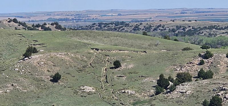
Out in the Nebraska Panhandle, not far from the town of Oshkosh, sits a historical landmark simply labeled Oregon Trail. No visitor center stands on this exact spot, and no gift shop waits at the end of the path.
What you get instead is a hillside, a paved trail, and marks in the ground that pioneers left behind.
The site traces part of the historic Oregon and California trails. Those routes carried hundreds of thousands of emigrants across the plains in covered wagons, mostly following the Platte River valley through the heart of the state.
Where the land forced wagons onto narrow or steep paths, the wheels cut deep.
That’s what makes a stop here special. The ruts aren’t a reconstruction or a painted line on a map.
They’re the real pressure of iron-rimmed wheels, hooves, and boots, repeated season after season until the prairie itself kept the record.
Picture it as an outdoor history lesson you can walk through in well under an hour. For anyone driving the western half of Nebraska, it offers a rare chance to touch the actual trail rather than simply read about it on a roadside plaque.
The Great Migration That Rolled Through the Platte Valley
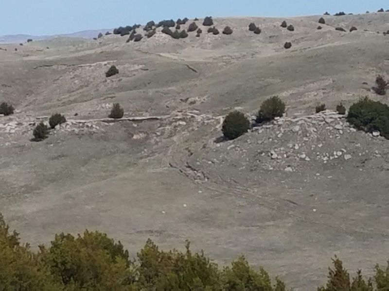
Imagine the creak of wooden wheels and the steady plod of oxen stretching to the horizon. During the middle 1800s, that sound filled the Platte River valley as families headed for Oregon, California, and Utah.
Nebraska was the long opening chapter of nearly every one of those journeys.
Emigrants followed the river because it offered water, grass, and a fairly level road west. The Oregon, California, and Mormon trails all funneled through this corridor.
Modern travelers on Interstate 80 still drive close to many of the same lines.
Why do ruts survive in some places and not others? Farming and development erased most of the trail over time.
The best surviving stretches sit on steep ground, long-kept pasture, or protected historical land, where plows never reached.
The hills around Oshkosh and nearby Lewellen fall into that lucky category. Rough terrain made wagon travel hard back then, and it also kept the evidence intact.
When you look at these grooves, you’re seeing the combined effort of countless travelers squeezed into one narrow passage, pressed deeper with every passing outfit.
Wheel Prints Pressed Into the Slope
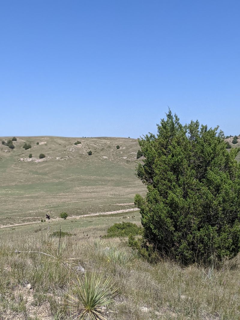
Shadows give the ruts away first. Early or late in the day, low sunlight fills the grooves with darkness, and suddenly the hillside shows its lines clearly.
At midday they look softer, more like gentle dips in the grass.
From the bottom of the trail, look to the right. A sign marks the spot, and the wagon wheel marks are visible climbing the hillside from there.
Once your eyes catch the pattern, it becomes hard to unsee.
Steep slopes like this one were brutal for wagons. Pioneers often rough-locked their wheels on descents so the wagons would slide rather than roll out of control.
That dragging friction tore into the soil, and rain washed through the scars afterward, carving them even deeper over the decades.
Nearby Windlass Hill shows at least five distinct rut scars along its side, a sign of how many teams picked slightly different lines down the grade. Each groove represents a choice made by a tired driver trying to get a heavy load safely to the bottom.
Seen that way, the hillside reads almost like handwriting.
Windlass Hill Next Door
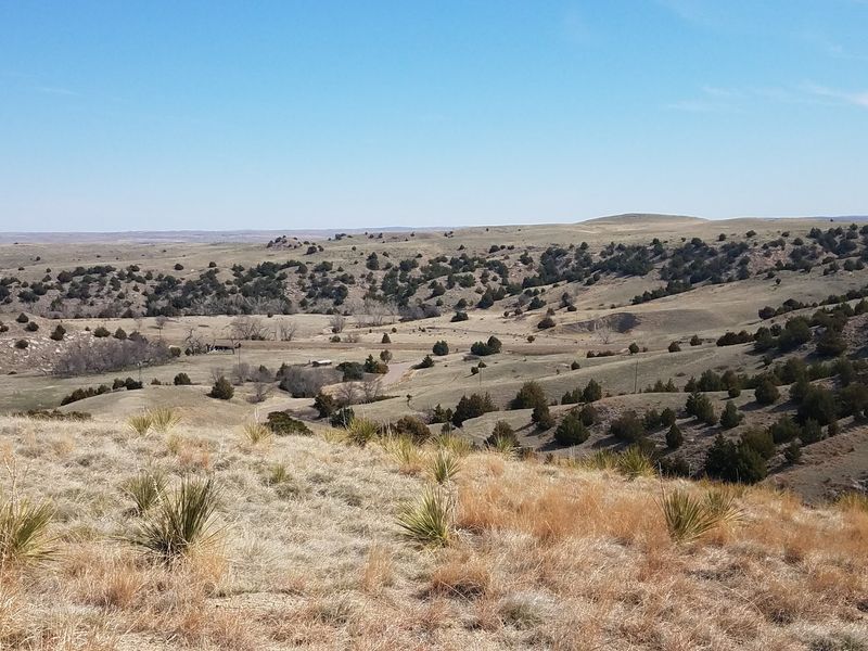
Right beside this landmark sits Windlass Hill, part of Ash Hollow State Historical Park near Lewellen. If the trail marker gives you the raw ruts, Windlass Hill gives you the backstory that makes sense of them.
The two pair naturally into one outing.
Windlass Hill was among the toughest descents on the entire route. The slope runs roughly 25 degrees and stretches about 300 feet, steep enough that wagons had to be slowed with locked wheels and plenty of muscle.
Some accounts suggest early travelers used ropes, which may explain the name, though historians still debate the details.
Interpretive information at the park explains how the descent worked and why emigrants risked it. The reward was waiting at the bottom: Ash Hollow, a sheltered spot with good water, firewood, and grass for livestock.
Plan on visiting both places together. Read up at Windlass Hill, then walk the trail with fresh eyes.
A groove in the dirt means far more once you know a family once inched their entire life’s belongings down that same grade, one locked wheel at a time.
Ash Hollow, the Pioneer Rest Stop
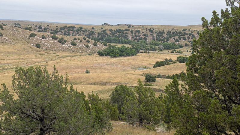
After days of dusty, treeless travel, Ash Hollow must have felt like a gift. Shade trees grew in the canyon.
A sweet water spring flowed, and grass covered the ground thick enough to feed tired oxen and horses.
That combination was rare on the western Nebraska plains. Firewood alone made the stop memorable, since emigrants often relied on dried buffalo chips for cooking fires along open stretches.
Here they could rest, repair wagons, and refill water barrels before pressing on toward the North Platte.
Contrast that relief with the hill they had just come down. The steep descent and the welcome hollow sat side by side, a hard moment followed by a gentle one.
Diaries from the trail years frequently mention the spot with obvious gratitude.
Today the hollow still carries that sense of shelter. Trees and bluffs frame the area, and the land feels different from the open grassland above.
Spending a few minutes there after looking at the ruts helps complete the picture: the struggle up top, then the reward below, all within a short distance of each other.
Roughly Three-Tenths of a Mile Uphill
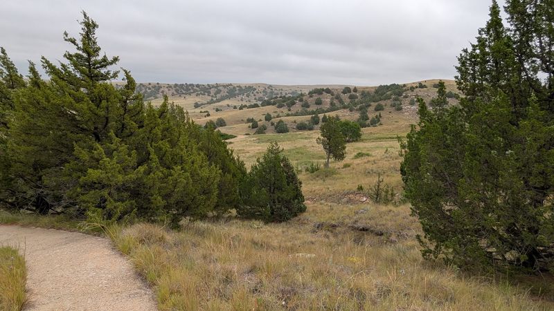
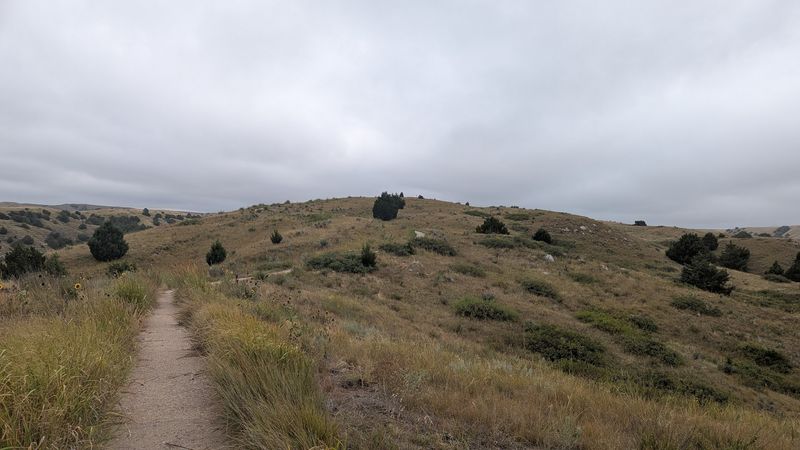
About three-tenths of a mile separates the bottom of the trail from the top. That sounds easy, and for many people it is.
The catch is the grade, which turns steep in a few places and gets the heart pumping.
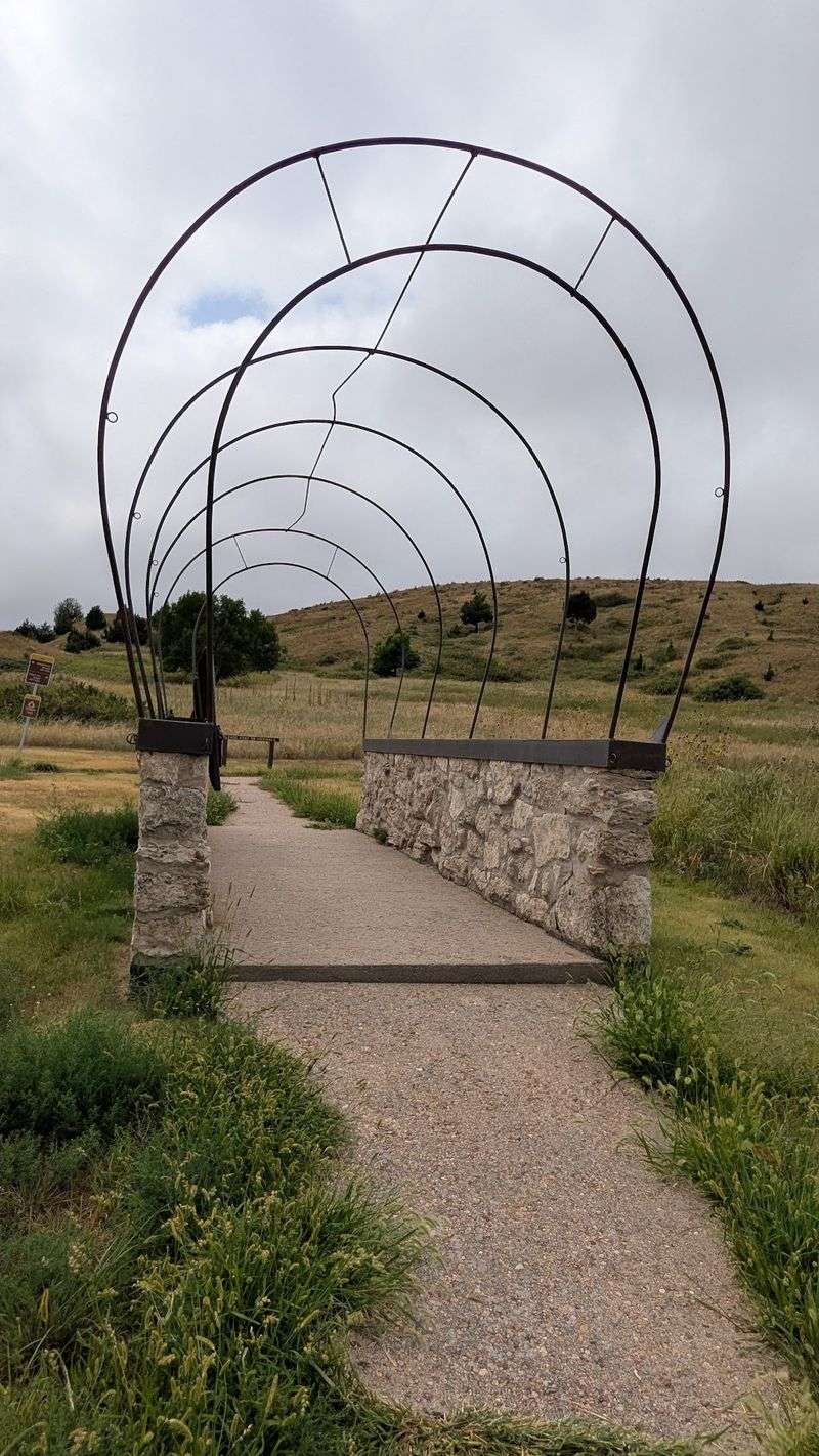
The path is paved the whole way, so you won’t be scrambling over loose rock. Sturdy walking shoes still help, and bringing water on a warm afternoon is smart, since shade is scarce on an open prairie hillside.
One thing to know before you start: the trail doesn’t lead to a building, overlook platform, or museum. Along the way you’ll find Oregon Trail markers, and the destination is the hilltop itself.
Expect a simple, honest walk through history rather than an elaborate attraction.
Take your time on the climb. Stopping to catch your breath gives you a chance to study the ruts from different angles, and it puts you in a pioneer state of mind.
Those travelers faced this same incline with loaded wagons and tired animals, so a little huffing on a paved path feels like fair company.
Panoramic Views From the Summit
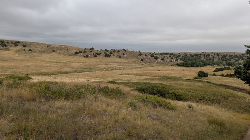
Wind tends to greet you at the top. Then the land opens up in every direction, and the climb suddenly makes sense.
The view from this hilltop ranks as the single biggest payoff of the stop.
Below stretches the valley that emigrants followed for weeks. The Platte River country unrolls in shades of green or gold depending on the season, with bluffs rising along the edges.
From Windlass Hill nearby, the view reaches across Ash Hollow and the broad river valley beyond.
Standing up there, it’s easy to imagine a line of white wagon covers creeping across the distance. Pioneers would have seen roughly the same sweep of sky and grass, minus the highways and fence lines that mark the land today.
Bring a camera, but also give yourself a few quiet minutes without one. The scale of western Nebraska is hard to capture in a photo, and the silence plays a big part in the experience.
On a clear day, the summit offers one of the most rewarding short-walk views in the Panhandle, and it costs nothing more than a bit of effort.
Trail Markers Along the Route
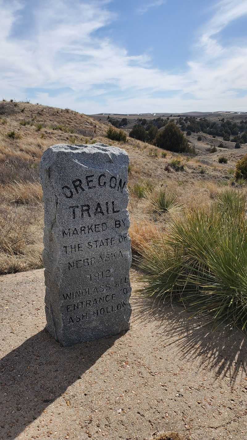
Did you know the markers dotting historic trails were often placed by groups determined to keep the route from fading into memory? Here, those markers serve as guideposts along the climb.
They help confirm you’re walking the actual corridor wagons once used.
Each one acts as a small pause button. Stop, read, look around, and connect the marker with the ruts nearby.
The combination turns a plain hillside into a readable story about the trail.
Both the Oregon and California trails shared this stretch. Travelers bound for the Willamette Valley and those chasing gold in California rolled side by side through western Nebraska before their paths split farther west.
Anyone who stood here in the trail years might have been headed toward very different futures.
For kids who like a goal, counting markers on the way up can make the walk feel like a scavenger hunt. Adults may find themselves doing the same thing quietly.
It’s a simple feature, yet it gives structure to the hike and keeps the history front and center rather than letting the scenery steal the whole show.
Who Will Love This Stop Most
History lovers come first on the list. If old diaries, trail maps, or westward expansion stories light you up, standing beside real wagon grooves will feel like meeting a character from a favorite book.
Road trippers crossing Nebraska make another natural fit. The stop works as an interesting break in a long drive, a chance to stretch your legs while soaking up something meaningful.
International travelers passing through the region find it a fascinating window into American frontier history, too.
Curious kids with good walking legs can enjoy it, especially if you share a few pioneer facts on the way up. Ask them how they’d get a wagon down a hill this steep.
The answers tend to be creative.
Photographers have plenty to work with as well. Long shadows across the ruts, wide valley views, and big skies all make strong images, particularly around sunrise or sunset.
Quiet seekers round out the group. With few crowds and little noise beyond the wind, the hilltop offers a calm place to sit and think about what it took to cross this land on foot.
Accessibility and the Steep Grade
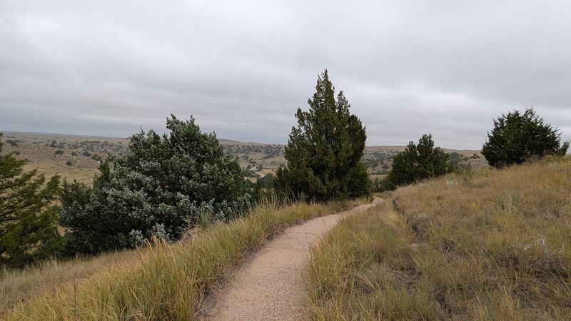
Strollers and wheelchairs will struggle here. The path may be paved, but its steepness makes it a poor match for anyone with limited mobility or anyone pushing a little one on wheels.
Good news, though: you don’t have to reach the top to see the ruts. From the bottom of the trail, the wagon wheel marks are visible on the hillside to the right, near the sign.
That means everyone in your group can share in the main attraction, even if only some make the climb.
Families with toddlers might bring a carrier instead of a stroller. Older adults can take the walk slowly, resting at markers along the way, and turn around whenever it feels right.
Weather plays a role too. Summer heat on open ground can be intense, and wind sometimes gusts hard across the hilltop.
Spring and fall mornings tend to be the most comfortable times for the walk. Plan ahead, set expectations, and the stop can still be meaningful for a wide range of visitors, whether they reach the summit or enjoy the view from below.
More Ruts Across Nebraska
Once the trail bug bites, more stops are waiting. California Hill near Brule marks the first big climb of the Oregon Trail after the South Platte crossing, rising about 240 feet in just over a mile and a half.
Its ruts are among the best preserved anywhere.
Head west and Scotts Bluff National Monument shows wagon ruts along a trail from its visitor center. East near Fairbury, Rock Creek Station State Historical Park holds about 1,600 feet of pristine ruts near a former Pony Express stop.
Closer to the middle of the state, the Murdock Wagon Ruts near Alda appear as grassy swales on a small site saved because it stayed in pasture. At the eastbound Interstate 80 rest area near Sutherland, O’Fallon’s Bluff shows where bluffs squeezed wagons onto a narrow path by the river.
Mormon Trail ruts survive as well, including deep grooves north of Sutherland on Prairie Trace Road. Linking several sites together makes a satisfying weekend route that follows the emigrants across Nebraska, one preserved groove at a time.
Getting There and Planning Your Visit
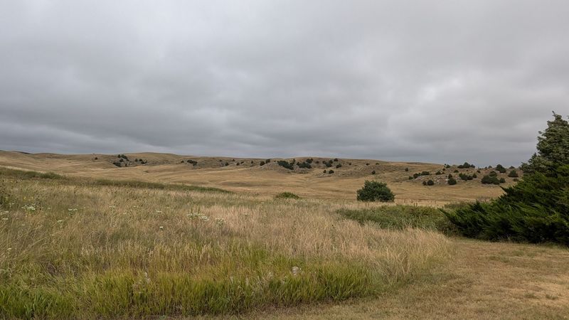
Oshkosh sits in Garden County in the western part of the state, along the North Platte River. The landmark lies near Lewellen and the entrance to Ash Hollow State Historical Park, so following signs for Ash Hollow and Windlass Hill will get you into the right area.
Services are limited out here. Fill up the gas tank and pack snacks and water before leaving a larger town, since the drive through this stretch of Nebraska includes long gaps between stops.
No hours or fees are posted for the trail landmark itself in available information. If you plan to spend time at Ash Hollow State Historical Park, check current park entry requirements and seasonal schedules before you go, since state parks may require a permit.
Allow around an hour for the walk, the view, and some reading at the markers. Add more time if you want to explore Ash Hollow or nearby Lake McConaughy, which makes an easy pairing for a summer day trip.
Early morning or late afternoon light shows the ruts best and keeps you away from the strongest midday heat.
A Short Climb With a Long Story
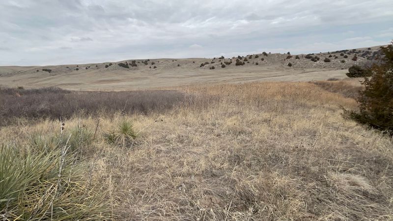
Some places need fanfare to make an impression. Here, a grassy slope, a paved path, and a few faint grooves manage it all on their own.
The power comes from knowing exactly what made those lines.
This isn’t a polished attraction with exhibits at every turn. The walk is steep, the trail ends at a hilltop rather than a building, and the ruts show best in the right light.
Those simple facts are part of the appeal.
What you leave with is perspective. A few minutes of uphill effort, with nothing to carry but a water bottle, offers a small taste of what emigrants endured for months.
The panoramic view at the top rewards that effort generously.
For Nebraskans, it’s a reminder that some of the country’s biggest stories ran straight through home ground. For travelers passing through, it’s a memorable pause on a long drive.
Pair it with Windlass Hill and Ash Hollow, choose a cool morning or golden evening, and let the prairie tell its story at its own unhurried pace.