This 32-Mile North Carolina Bike Trail Winds Through Deep Forests, Mountain Valleys And Hidden Waterfalls
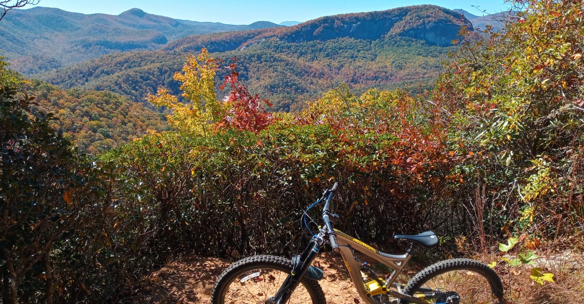
Thirty-two miles sounds perfectly reasonable until the mountain starts negotiating.
This North Carolina ride wastes very little time reminding cyclists who is actually in charge.
The trail keeps climbing, twisting, and throwing just enough wild terrain into the day to make every easy-looking mile suspicious.
By the time the views open up, tired legs suddenly discover a second opinion.
That is the magic of this Blue Ridge challenge.
It feels less like a casual bike ride and more like earning bragging rights one pedal stroke at a time.
Skilled riders keep returning for the punishment, which says plenty.
Apparently, sore legs come with excellent scenery.
Thirty-Two Miles Turn One Ride Into An All-Day Mountain Epic
Sunrise is the smartest start time for this ride, because the clock becomes your toughest opponent long before your legs give out.
The South Pisgah All Day Epic covers 32 miles by stitching together nine trails and forest roads into one big loop of effort.
Most riders plan for six to ten hours in the saddle, depending on fitness, stops, and trail conditions.
Everything begins in Pisgah National Forest near the Pisgah Ranger District, where you can grab maps and check on trail closures before rolling out. Cell service fades fast once you leave the area, so a downloaded route is a real lifesaver.
Packing matters as much as pedaling.
Bring plenty of water, a filter for creek refills, salty snacks, a real lunch, spare tubes, a chain tool, and a light jacket for cool ridge air. There are no shops along the route, so whatever you carry is what you get.
Gravel road stretches give your hands a short break between rugged singletrack sections.
That steady mix of fast and slow keeps the day interesting from the first mile to the last.
The ranger station sits at 1600 Pisgah Hwy, Pisgah Forest, NC 28768.
Nearly 6,900 Feet Of Climbing Make Riders Earn Every Descent
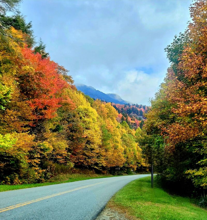
That climb adds up fast: nearly five Empire State Buildings, tackled on a bike loaded with snacks and tools.
That is roughly what 6,873 feet of elevation gain feels like on this route.
Your legs will remember it for days. Long forest road grinds make up some of the climbing, and they reward a slow, steady rhythm.
Find a gear you can spin for an hour, sip water often, and eat a little every 30 to 45 minutes before hunger hits.
Racing up the first big hill is a classic mistake that leaves riders empty by the halfway point.
Singletrack climbs are a different story.
Roots crisscross the path like tangled ropes, and loose rocks can spin a tire without warning.
Keep your weight centered, look a few feet ahead, and pick a clean line instead of muscling through. Then comes the payoff.
Descents in this part of the forest drop quickly through rocky chutes and twisting turns, and every foot you climbed turns into speed and grins.
Check your brakes before each downhill, since long descents heat them up fast and worn pads can fade when you need them most.
Deep Hardwood Forest Swallows Up Huge Sections Of The Route
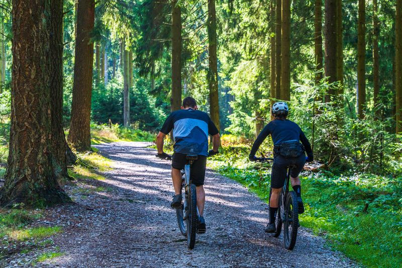
Under the leaves, the light turns soft and green, almost like riding through a giant aquarium.
Tall oaks, tulip poplars, maples, and hickories crowd both sides of the trail, and their branches knit together overhead. On a warm summer afternoon, the shade can feel several degrees cooler than the open roads.
Western North Carolina holds one of the richest hardwood forests in the country, and this route shows it off.
Rhododendron and mountain laurel form thick tunnels in damp hollows, blooming pink and white in late spring and early summer.
The smell of wet soil and crushed leaves drifts up as tires roll by.
Here is a fun bit of history.
Pisgah is often called the birthplace of American forestry, since the first forestry school in the nation opened nearby in 1898.
Today, the Cradle of Forestry in America shares that story just up the road from the trails. That thick canopy has a practical side too.
Fallen leaves hide rocks and roots in autumn, so slow down when the ground turns gold and orange.
Wet leaves also get slick after rain, and careful braking helps keep the ride smooth and safe.
Avery Creek Brings Cascades, Pools And Water Crossings Into The Adventure
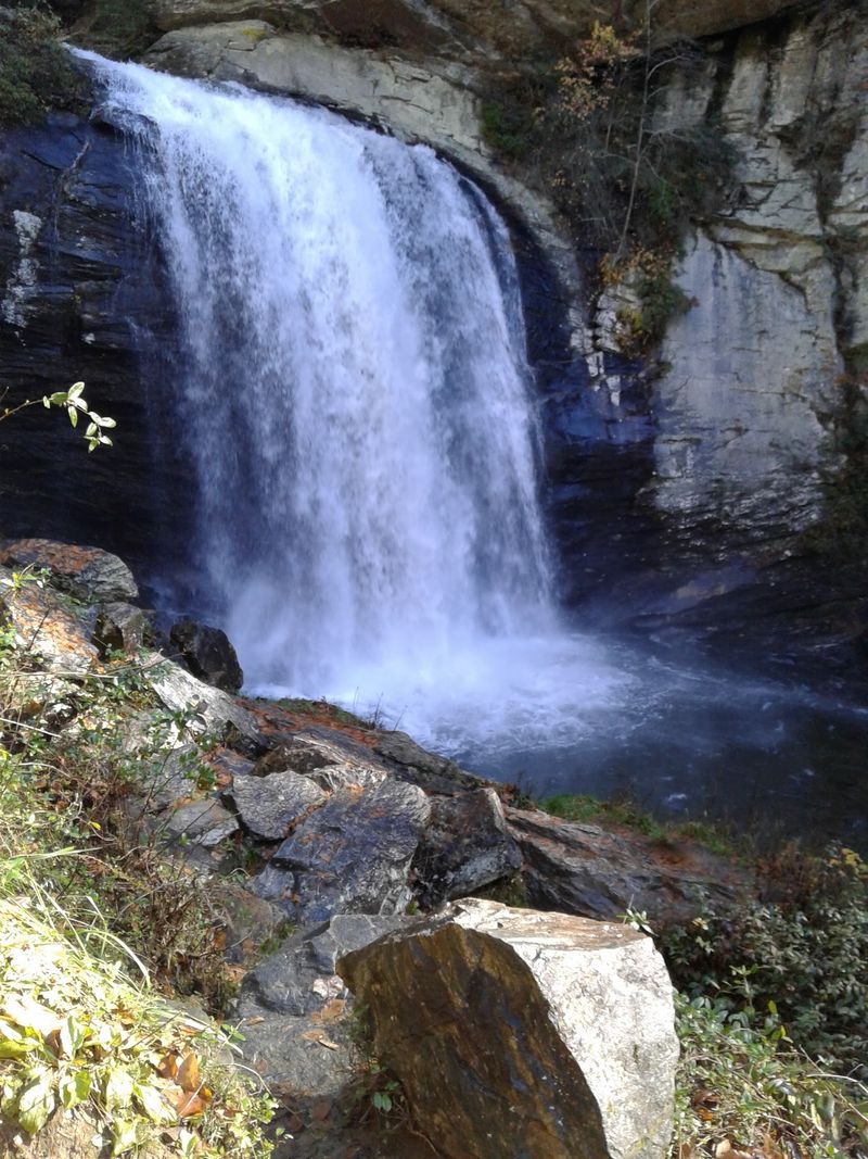
Splash. That cold shock on your ankles is your welcome to Avery Creek, one of the most refreshing parts of the whole day.
The trail follows the creek for several miles, crossing it again and again as clear water rushes over smooth stones.
Avery Creek Falls is the star here.
It stands about 10 feet tall and spreads roughly 30 feet wide, pouring into shallow pools that invite tired riders to wade in warm months.
The steady rumble of falling water makes it a lovely place to stop, rest your legs, and enjoy a snack.
Crossings deserve respect. Rocks beneath the surface are often mossy and slippery, so walking your bike through is usually the smartest choice.
After heavy rain, water levels can rise quickly, and waiting or turning back is wise if the current looks strong.
Good news arrived in summer and fall of 2025.
Crews built a new 35-foot trail bridge and stabilized eroding creek banks, making the trail stronger and kinder to the stream.
Avery Creek Trail carries a black diamond rating, so expect technical moves between those peaceful pools.
One Ridgeline Opens Up To Unexpected Views Across The Mountain Valleys
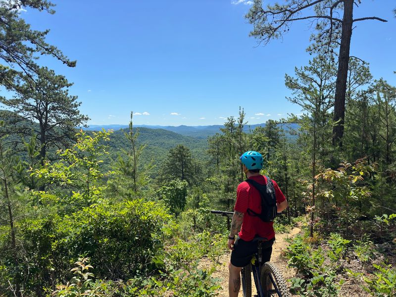
After hours of riding inside the trees, the forest suddenly thins and the sky opens wide.
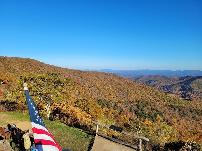
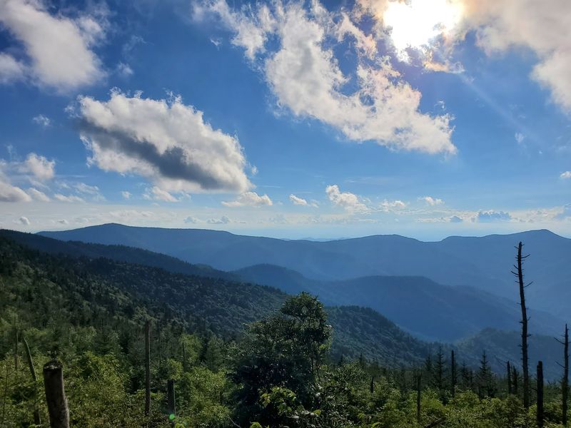
One ridgeline along the route offers a rare break from the canopy, and the view hits like a surprise gift. Layers of blue mountains roll away toward the horizon, each one paler than the last.
That hazy blue color gives the Blue Ridge Mountains their name.
Trees release a natural vapor into the air, and sunlight scatters through it to create the soft, smoky look.
On clear fall mornings, the valleys below can fill with fog that resembles a quiet white lake. Take a moment here.
Snap a photo, refill on snacks, and let your heart rate settle before the next push.
These few minutes often become the moment that sticks, long after sore muscles fade.
Timing changes the scene.
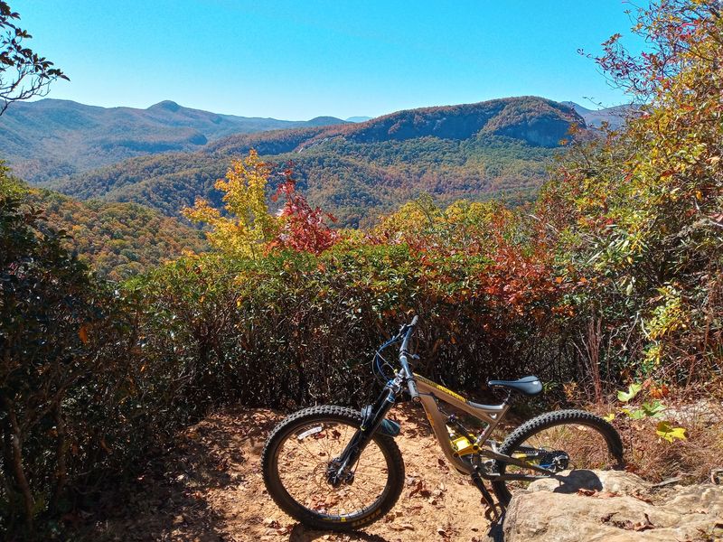
Autumn paints the slopes in red, orange, and gold, usually peaking in mid to late October in this part of North Carolina. Spring brings fresh green, while winter strips the trees and reveals far more of the landscape.
Wind can blow hard up high, so keep a warm layer handy.
Black Mountain Delivers Some Of The Wildest Miles Of The Entire Ride
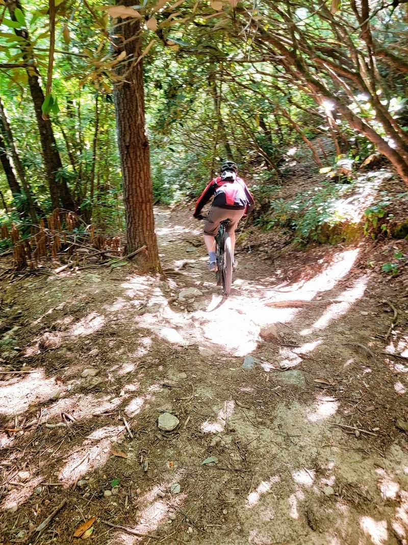
Rocks the size of footballs, roots like knotted fingers, and drops that appear without warning give Black Mountain Trail its fierce reputation.
Among mountain bike routes in North Carolina, this name carries plenty of weight.
It is officially rated difficult, and it earns that label quickly. Upper Black Mountain remains a demanding black-diamond segment.
Major portions were rehabilitated or rerouted for sustainability, while rock gardens, drops, and steep terrain still demand sharp focus.
Chunky rock gardens test balance, and one bad line can stop a bike cold. Descending here feels like a puzzle solved at speed.
Keep your pedals level, elbows bent, and eyes scanning ahead for the next safe path.
A dropper post helps a lot, letting you lower your seat and shift weight back on steep pitches.
This trail is classic Pisgah riding: raw, rugged, and mostly left in its natural state. That wildness is exactly what draws skilled riders from far away.
Black Mountain also mixes in climbs between descents, so save some energy.
Walking a tricky feature is always smarter than crashing on it, especially far from help.
Expect Plenty Of Hike-A-Bike When The Terrain Gets Seriously Steep
Sometimes the smartest gear on the mountain is a pair of good shoes.
On steep pitches, especially along upper Black Mountain Trail, the ground tilts so sharply that pedaling stops working.
Hopping off and pushing, which riders call hike-a-bike, becomes the only way forward. Nobody should feel embarrassed about walking.
Even strong, experienced riders push through these sections, because spinning tires on loose rock wastes energy and can tear up the trail.
Walking also gives your riding muscles a break while different muscles take over. A few tricks make pushing easier.
Stand beside the bike, hold the handlebar and the seat, and roll it ahead of you in short steps.
On very steep spots, some riders lift the bike onto a shoulder and carry it like a backpack.
Footwear matters more than many people expect.
Stiff racing shoes with hard plastic soles slip badly on wet rock, while flat pedal shoes or trail shoes with grippy rubber hold much better.
Gloves protect your hands when you grab roots or rocks for balance. Expect your average speed to drop during these stretches, and plan your daylight hours with that slowdown in mind.
Why This 32-Mile Challenge Is Definitely Not A Beginner Bike Ride
Ambition is wonderful, but this loop asks for more than enthusiasm.
Pisgah trails are known for being burly, with roots, rocks, and steep grades that were never smoothed out for bikes. Many paths began as old logging routes or hiking trails, long before mountain biking existed.
Put the numbers together and the challenge becomes clear.
Thirty-two miles, nearly 6,900 feet of climbing, black diamond sections on Avery Creek, and difficult ratings on Black Mountain add up to an expert-level day.
One mistake far from the trailhead can turn into a long, painful walk out.
New riders still have great options.
Bent Creek, near Asheville, offers gentler trails that build skills and confidence. Guided rides and local skills clinics are another smart way to learn before tackling bigger routes.
Ready riders should still prepare carefully.
Tell someone your plan, carry a paper map, and pack first aid supplies and a headlamp in case the day runs long. Ride with a partner whenever possible.
This corner of North Carolina rewards patience, and every season of practice makes that big loop feel a little closer and a lot more fun when you finally roll out from the start.