This Idaho Lookout Sits At The End Of A Gravel Road Where You See Into Three States
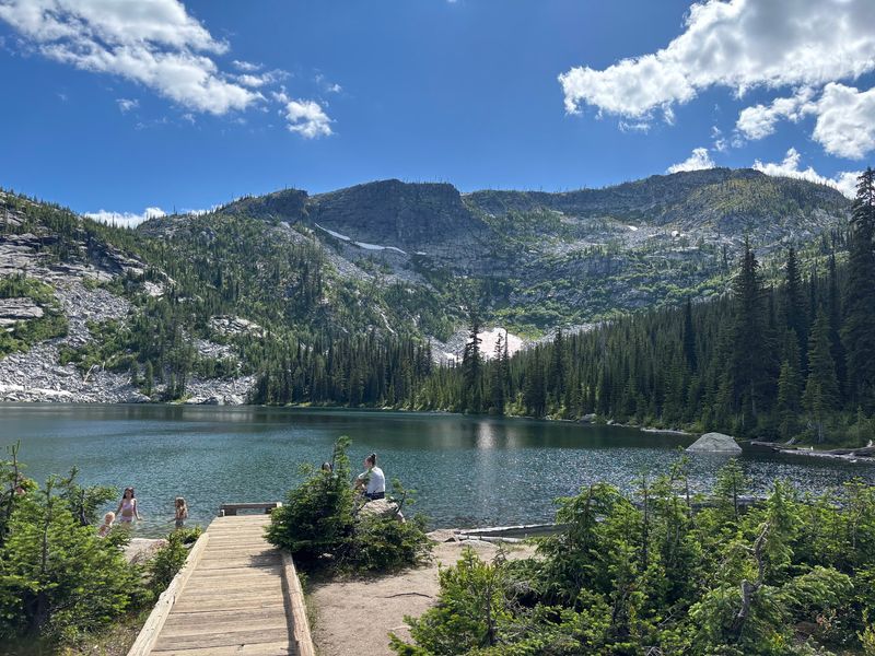
Dust coats your windshield for miles, the road keeps climbing, and then three clear mountain lakes appear in a granite bowl high in North Idaho. Above them rises a peak with one of the widest views in the Panhandle.
Nearby, an old fire lookout on a neighboring summit looks out over Idaho, Montana, and British Columbia, all in one turn of your head. For a day trip or a slow weekend, this corner of Boundary County pays you back for every bumpy mile.
A Granite Bowl In Boundary County
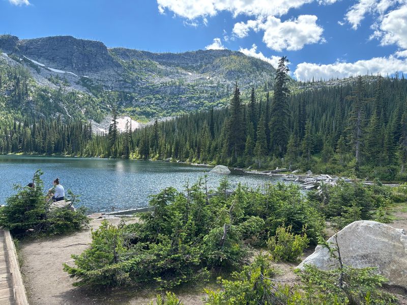
Granite walls, steep cliffs, and cold water fed by mountain runoff set the scene at Roman Nose Lakes. The group sits high in the Selkirk Mountains of the Idaho Panhandle, inside the Idaho Panhandle National Forest in Boundary County.
Three lakes make up the cluster: a lower lake that almost anyone can reach and two upper lakes that reward a short day hike. Rising above them all is Roman Nose peak, the summit that gives the area its name and its long-distance view.
Visitors describe the place as a bucket list spot, and it is easy to see why once you step out of the car. The water is clear enough to spot rocks on the bottom near shore, and the forest around it smells of fir and warm granite on summer afternoons.
Few places in North Idaho pack so much variety into one parking area. Families can stroll to a lakeshore, hikers can link all three lakes, and the strongest walkers can push on to the peak.
Each option starts from the same trailhead, which keeps planning simple even when the drive in is anything but.
Finding Idaho 83847 On The Map
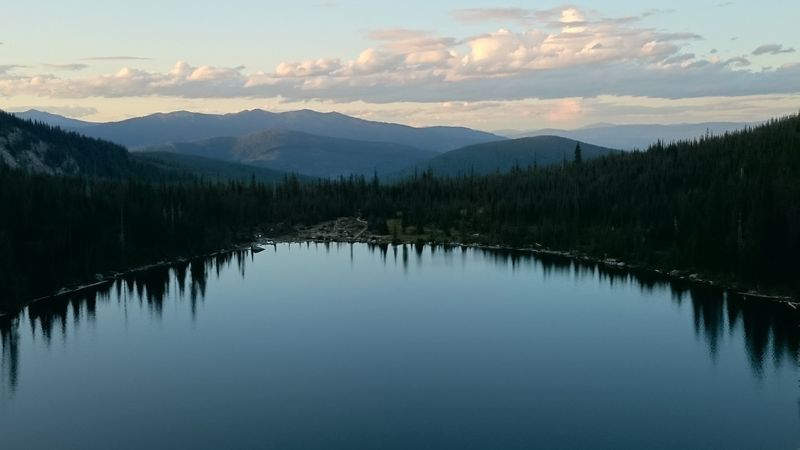
Officially, the lakes sit under the simple address of Idaho 83847, which tells you almost nothing about how remote they really are. That postal code covers a stretch of quiet Boundary County country in far northern Idaho, close to the Canadian line.
Bonners Ferry is the nearest real town for groceries and fuel, so plan on topping off the tank and the cooler before heading into the hills. Once you leave pavement, services disappear quickly, and cell coverage gets unreliable.
The approach follows Forest Service roads that climb into the Selkirks. Expect gravel, dust, washboard stretches, and plenty of curves as you gain elevation through thick timber.
A printed Forest Service map or a downloaded offline route is a smart companion here. Several visitors point out that phone navigation does not always recognize the correct way to the lakes, which is a story worth its own section.
Give yourself a generous time cushion for the drive. Rushing a rough mountain road rarely ends well, and the slower pace lets you notice side spots along the way that make good picnic stops.
Miles Of Washboard And Dust
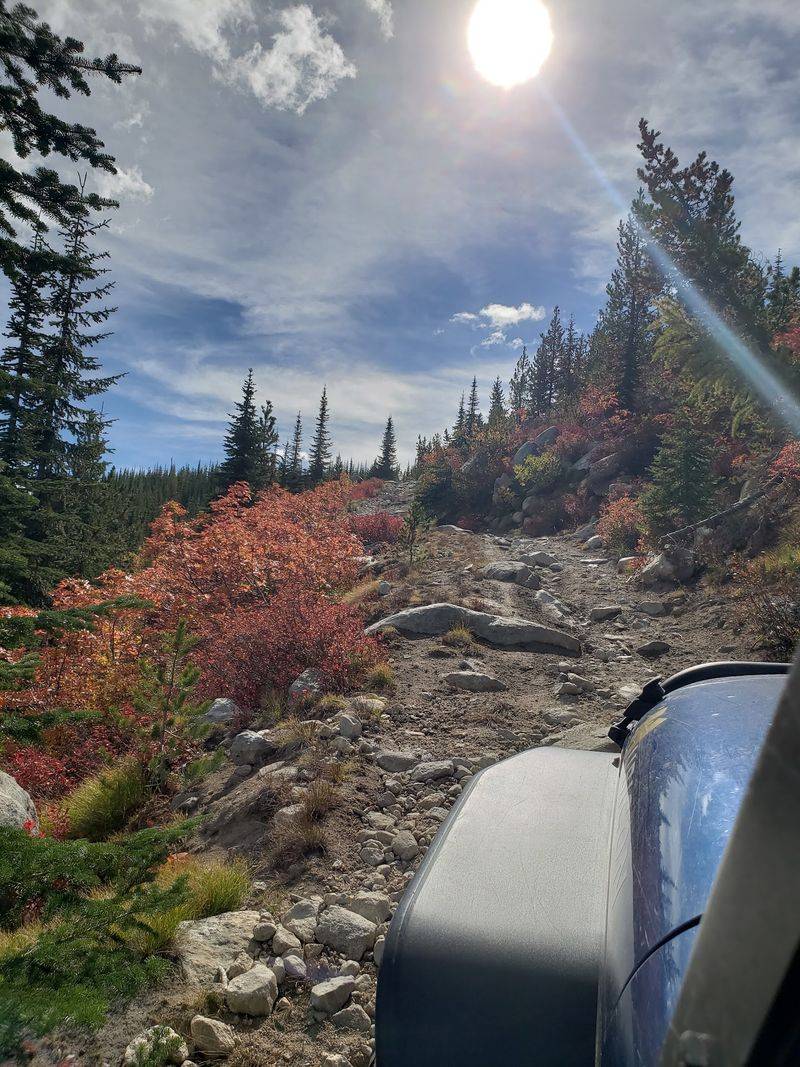
Long, windy, dusty, rough, and rocky. Those words come up again and again when visitors describe the road to Roman Nose Lakes, and nobody seems to regret making the trip anyway.
The drive is a big part of the experience. You wind upward through forest, catch glimpses of ridgelines between the trees, and pass pullouts that tempt you to stop for a sandwich and a look around.
Vehicle choice matters. One visitor strongly recommends a full size four-wheel-drive vehicle, and the rocky sections make high clearance a real comfort.
A low sedan may struggle, especially later in summer when ruts deepen.
Dust is part of the deal in dry months. Keep windows up when another rig passes, pack a rag for wiping off headlights, and leave extra room between vehicles so you can actually see the road ahead.
Patience pays off. The climb that feels endless on the way up becomes a pleasant, scenic cruise on the way down, when you already have lake water on your boots and a camera full of granite and sky.
When The Phone Gets It Wrong
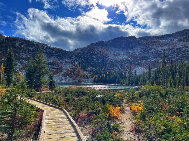
Here is the most repeated warning about this trip: do not trust your phone’s suggested route blindly. Several visitors over the years have found that popular map apps steer drivers the wrong way.
One account describes following suggested directions up the south side of Roman Nose peak. The road became impassable, and there was no place to turn around, which is a genuinely stressful spot on a narrow mountain track.
Another visitor discovered that the app route simply did not work for reaching the lake. A third noted the app sometimes fails to recognize the way at all.
The fix is old-fashioned and reliable. Grab a current Idaho Panhandle National Forest map, call the Bonners Ferry Ranger District before you go for road conditions, and note the main access route ahead of time.
Download offline maps as a backup, but cross-check them against official sources. If a road suddenly narrows, steepens, or looks rarely used, stopping to reconsider is far easier than backing a truck down a cliffside for half a mile.
Boardwalk To The Lower Lake
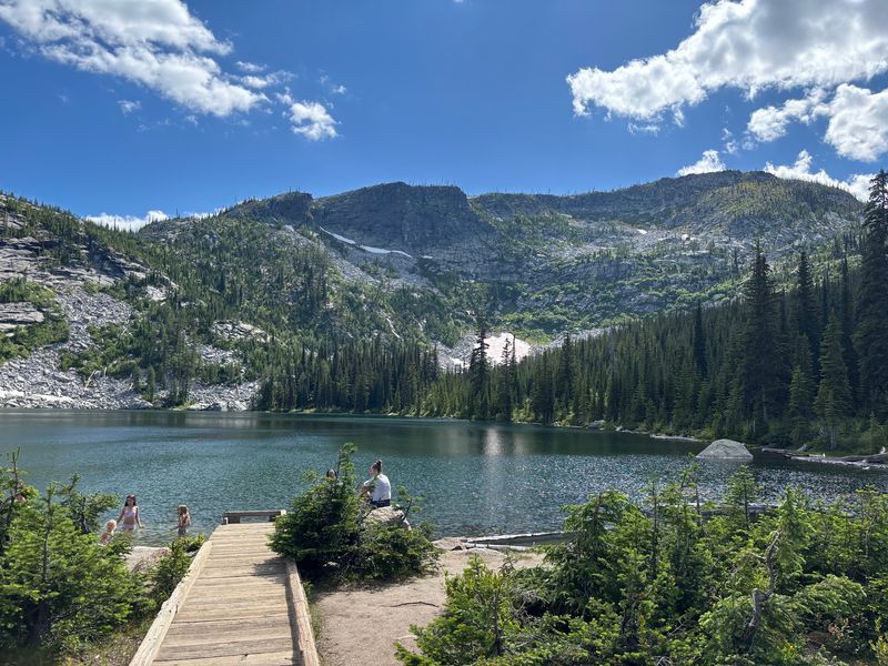
About 500 feet of wooden boardwalk is all that separates the parking area from the lower lake. For a high mountain lake in North Idaho, that is an unusually easy reach.
Visitors with health challenges or limited mobility single out this feature. One reviewer specifically recommends the lower lake for anyone who usually cannot get to alpine water because of physical limits.
Grandparents, toddlers, and anyone who just wants a quiet lakeside lunch can enjoy the same clear water and granite backdrop that hikers earn with sweat. The short walk also makes hauling a camp chair or fishing gear simple.
Fishing gets decent marks from those who have tried it. Bring a valid Idaho fishing license and check current regulations before casting.
Swimming is possible, though the water is cold. Some visitors call it refreshing on a hot day, while others found it too chilly to stay in long.
Either way, dipping your feet off the shore after the dusty drive feels like a small reward of its own.
Two Higher Lakes, One Short Hike
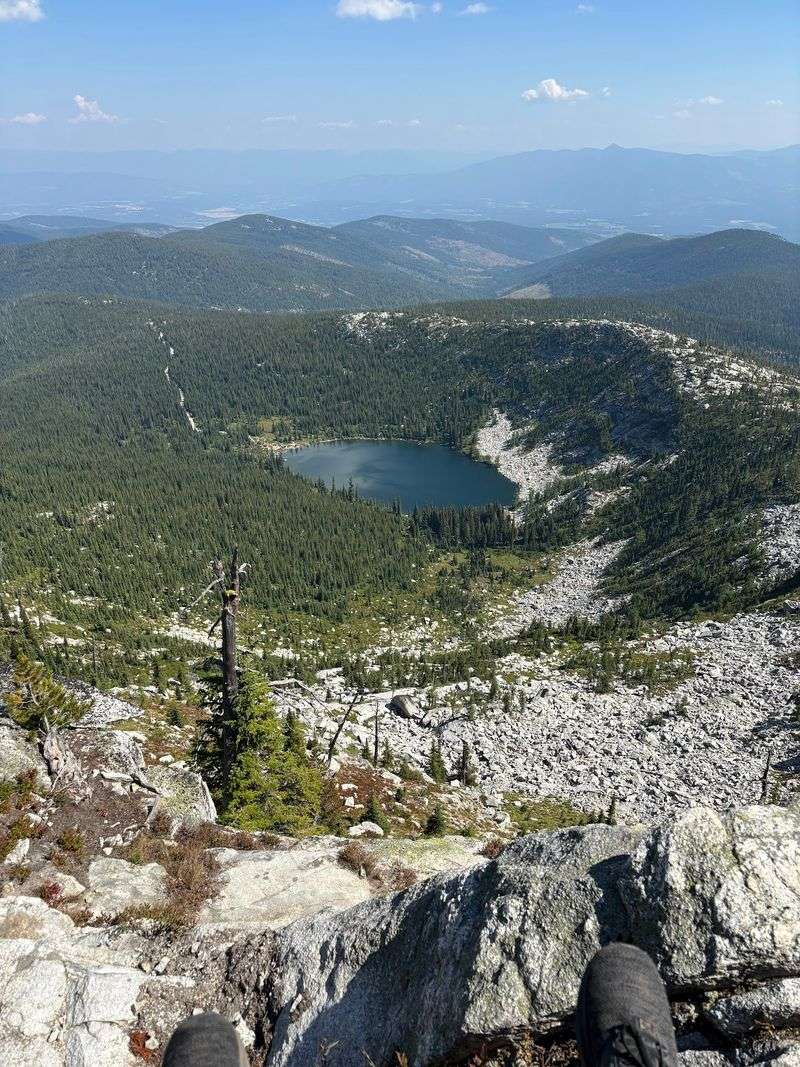
Beyond the lower lake, the trail climbs toward two more lakes tucked higher in the granite. Physically capable visitors describe reaching them as a quick day hike rather than a major expedition.
The trails earn compliments for being well kept and nicely groomed, which helps on the rockier stretches. Granite slabs, steep cliffs, and scattered fir trees line the way, so the scenery shifts every few minutes.
Opinions vary on which lake is best, but the upper lake wins over plenty of hikers. One visitor in mid-July called it their clear favorite, even with some lingering snow on the surrounding slopes.
Snow can hang around into early summer at this elevation in the Idaho Selkirks. In that July visit, the trail itself was clear, but the white patches nearby were a reminder that the season up here starts late.
Bring layers, sturdy shoes, and more water than you think you need. A lightweight water filter makes topping off at the lakes easy, and a few snacks turn each shoreline into a natural rest stop.
Summit Views From Roman Nose Peak
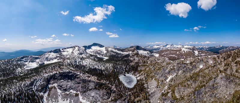
Ask anyone who made it to the top of Roman Nose, and the view comes up first. One hiker described it as among the most beautiful sights they had ever seen.
The climb is no stroll, though. Doing the lakes and the peak all in one day is rough, according to those who tried, so many visitors split it up.
A popular plan is to camp at the lakes, then tackle the summit the next morning with fresh legs. Two-day trips let you explore different lakes and peaks without feeling rushed.
From high points in this part of the Panhandle, ridges of the Selkirks roll away in every direction. Valleys drop toward the Kootenai country, and the northern horizon sits close to the Canadian border.
Plan your summit push for early in the day, when air is cooler and light is softer. Pack plenty of water or a filter, since the steeper sections dry you out fast.
Even on a slightly smoky September day, one visitor found the mountain air cleaner than down in the valley.
A Fire Lookout Watching Three Borders
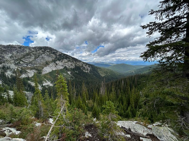
Roughly 45 miles northwest of Bonners Ferry, another summit in Boundary County delivers the view in this article’s title. Shorty Peak Lookout stands at about 6,500 feet, with a 360-degree panorama of Idaho, Montana, and British Columbia.
The first cabin, topped with a cupola, went up in 1927 to watch for wildfires. Today’s structure, an R-6 flat cab on a five-foot foundation, was built in 1964 and refurbished in 2005.
Reaching it takes a 2.5-mile hike with about 1,300 feet of elevation gain after the forest roads end. The trail climbs through fir forest thick with beargrass and huckleberries, and it is open to horseback riders too.
From the top, the Selkirk and Purcell ranges fill the skyline. Clear days reveal the Kootenai Valley, Red Top Mountain, and Lone Tree Peak.
The 15-by-15-foot cabin rents in summer through the recreation program, with reservations opening six months ahead. Inside are two twin beds, tables, chairs, and a historic fire finder.
Bring your own water, food, and bedding.
Huckleberries, Chipmunks, And A Few Bugs

Purple fingers are a fair sign of a good visit. Berries along the trails get high praise, and in late summer the huckleberry patches in this part of Idaho can slow a hike to a happy crawl.
Small entertainers greet you before the trail even starts. One visitor said the chipmunks put on quite a show in the parking lot, scampering over rocks and checking every car for crumbs.
Resist the urge to feed them. Human food is hard on wildlife and teaches animals bad habits that cause trouble for the next group.
Now the less cheerful neighbors. Bugs show up in more than one visitor account, with one person summing up the trip as lots of bugs but amazing scenery and berries.
Mosquitoes and biting flies tend to thrive near wet meadows and shorelines in early and mid summer. Pack repellent, a light long-sleeve shirt, and maybe a head net if you plan to sit by the water at dusk.
A little preparation keeps the buzzing from stealing attention away from the granite and the berries.
Bear Country Camping Basics
Grizzly bear country. That reminder appears in several visitor notes, along with clear advice to carry bear spray and stay bear aware the whole time.
The Selkirks of far North Idaho are home to both black bears and grizzlies. Store food properly, keep a clean camp, make noise on blind corners, and keep bear spray on your hip, not buried in a pack.
Camping options are modest. One visitor counted five camp spots, so on busy summer weekends, an early arrival improves your odds of grabbing one.
Toilets are available, which is a welcome surprise this far up a Forest Service road. Beyond that, plan to be self-reliant.
Pack a reliable water filter, warm layers for cold mountain nights, and a basic first aid kit. Nights at elevation can feel much cooler than the valley floor, even in July.
One visitor’s checklist says it best: bugs, bears, cold, and be prepared. Those who arrive ready tend to leave talking about sunsets over granite, not about what they forgot.
Autumn Color And A Gentle Verdict
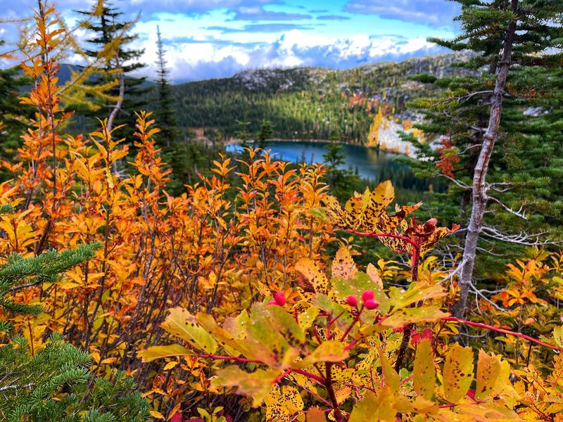
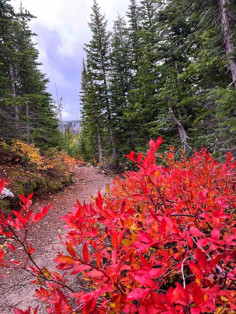
Fall might be the sweetest season up here. One repeat visitor hiked in both summer and fall and gave autumn the edge, describing new colors popping against the terrain at every bend.
Summer brings swimming, berries, and long daylight. September and early autumn can trade some warmth for crisp air, fewer bugs, and slopes splashed with red and gold, though wildfire smoke sometimes drifts through the region.
Timing depends on snow and road conditions, so check with the Bonners Ferry Ranger District before driving. Access generally fits the warmer months, roughly early summer through fall.
So who belongs at Roman Nose Lakes? Families wanting an easy lakeside walk, anglers, backpackers chasing a two-day loop, and anyone curious about the far northern edge of Idaho.
The road is long, the bugs are real, and bears roam these hills. Even so, visitors keep calling it a place worth every bumpy mile, and pairing it with a stay at nearby Shorty Peak Lookout turns a weekend into a true Panhandle adventure with three borders in view.