9 Idaho Mountain Drives
Galena Summit sits at 8,701 feet, and the first time you crest it, the whole Sawtooth Valley drops open below your windshield like a pop-up book. Idaho is full of roads like that, where a plain two-lane highway suddenly turns into the best seat in the state.
These nine drives take you past waterfalls, river canyons, granite towers, and mountain lakes, from the Panhandle down to the Utah line. Pack snacks, fill the tank, and pick one for your next free Saturday.
1. Galena Summit Overlook
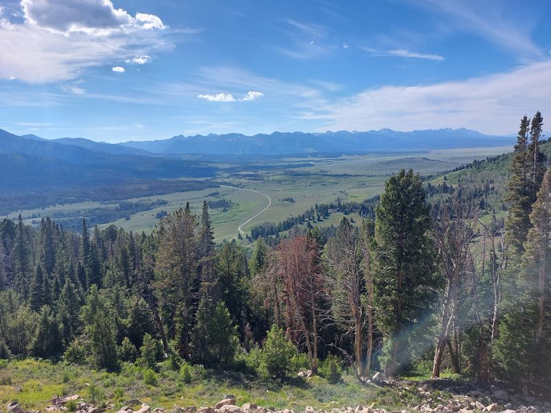
Few pullouts in Idaho deliver this much payoff for so little effort. You park, walk a few steps, and the Sawtooth Valley spreads out below with the jagged Sawtooth Range lined up across the horizon.
The overlook sits along the Sawtooth Scenic Byway on Highway 75, between Ketchum and Stanley, near Sawtooth City, ID 83340. Below you, the headwaters of the Salmon River begin as a thin ribbon winding through meadows before it grows into one of the West’s great rivers.
Informational displays explain the geology and history of the valley, so kids get a quick lesson while parents snap photos. There is no restaurant or store up here, which keeps the spot simple and quiet.
After dark, things get even better. The area belongs to the Central Idaho Dark Sky Reserve, and on clear nights the stars stack up thick enough to make the Milky Way look like spilled flour across the sky.
Plan for snow on the pass outside summer, and watch for deer and elk near the road at dawn and dusk. The highway climbs with sharp curves, so take it slow and use the turnouts.
Few roadside stops in the Sawtooths reward a ten-minute break this generously.
2. Teton Scenic Byway, Tetonia, ID
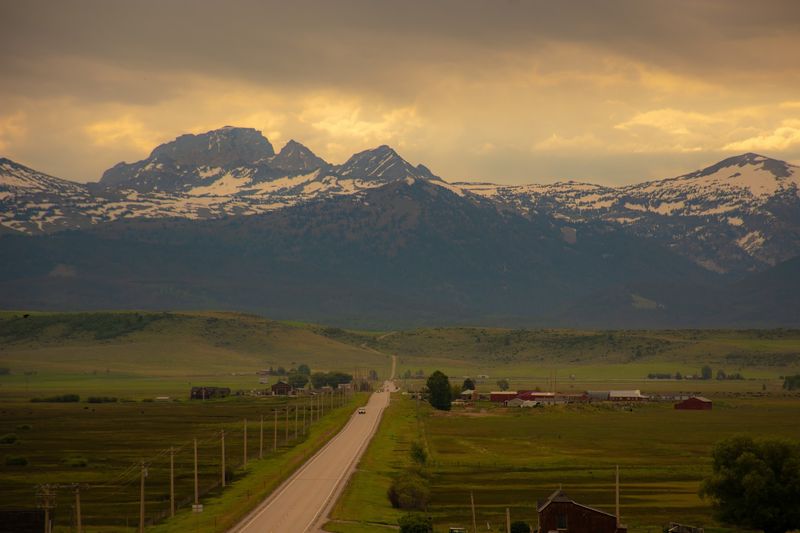
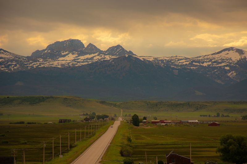
Wyoming gets the postcards, but Idahoans know the better angle on the Tetons. From the west side, the peaks rise straight up behind rolling farmland, and nobody has to fight a national park crowd to see them.
The Teton Scenic Byway runs about 69 miles through eastern Idaho on Highways 31, 33, and 32, linking Swan Valley, Victor, Driggs, Tetonia, and Ashton. A good reference point sits at 6535 ID-33, Tetonia, ID 83452.
Expect a patchwork of potato fields, barns, and grain, with the Snake River curling nearby and the Big Hole Mountains framing one side. The climb over Pine Creek Pass tops out at 6,764 feet, bringing steep grades and tight curves along with wide valley views.
Early mornings and evenings bring out elk, moose, and deer, and birds work the fields all day. Saturday mornings tend to draw the most traffic, while weekday afternoons stay calmer.
The road stays open year-round, though winter driving here demands patience and good tires. In summer, pull over in Driggs or Victor for a stretch and a snack, then keep rolling toward Tetonia as the light turns gold on those famous granite faces.
3. Mesa Falls Scenic Byway, Ashton, ID
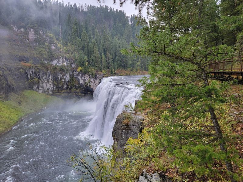
Two waterfalls on one short drive is a pretty good trade for a tank of gas. Starting at U.S. 20 and ID-47 near Ashton, ID 83420, this byway loops through forested caldera country toward Upper and Lower Mesa Falls.
Upper Mesa Falls is the showstopper. A short, easy trail and boardwalk lead to a vantage point above the roaring water, close enough to feel the mist on a warm afternoon.
Lower Mesa Falls has its own overlook a few miles down the road, giving a wider view of the canyon below. Kids handle both walks without complaint, which makes this a solid family outing.
Moose sightings happen often enough that it pays to scan the willows and meadows as you drive. The road itself bends and rolls through thick pine forest, making it a fun stretch behind the wheel with plenty of turnouts.
Fall paints the aspens yellow, and summer brings the busiest weekends, especially Friday and Saturday evenings. Weekday afternoons tend to feel almost private.
Pair this drive with the Teton Scenic Byway, since both connect near Ashton. Together they make a full eastern Idaho day of mountains, waterfalls, and wide farm country.
4. Payette River Scenic Byway
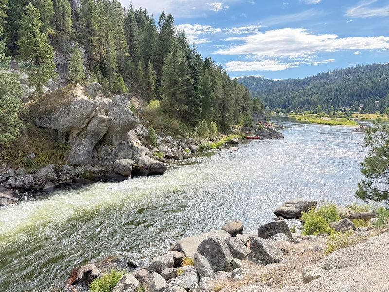
Ask anyone in the Treasure Valley about a summer escape and Highway 55 comes up fast. The Payette River Scenic Byway follows the river north from Eagle for roughly 112 miles to New Meadows, with Cascade, ID 83611 sitting right in the middle.
The first stretch hugs a canyon where whitewater rushes beside the road and rafters bounce through rapids. Then the land opens up into mountain valleys, and Lake Cascade appears, wide and blue against the forest.
Farther north, McCall wraps around Payette Lake. Ponderosa State Park sits on a peninsula there, and Osprey Point gives one of the best lake views in western Idaho.
History buffs should make time for Historic Roseberry near Donnelly, where a late 1800s Finnish homestead settlement still stands. It shows how early families carved out a life in this high valley.
Wildlife is everywhere if you look: deer, fox, moose, pileated woodpeckers, and red-tailed hawks. The byway is open year-round, but spring and fall bring milder weather and fewer cars.
Summer weekends can get crowded, so leave early and enjoy the river before the traffic catches up.
5. Ponderosa Pine Scenic Byway Sign, Stanley, ID
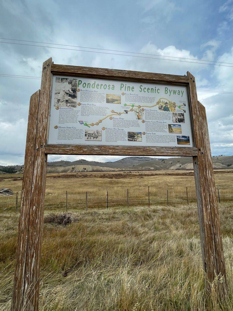
Turn left in Stanley and the adventure starts all over again. Highway 21 heads west out of town toward Lowman and Boise, and the Ponderosa Pine Scenic Byway sign at 1060-1270 ID-21, Stanley, ID 83278 marks the beginning.
Right away, the Sawtooths loom over your shoulder. The road climbs through high meadows and thick forest, and pullouts pop up often, giving you plenty of chances to stop and stare at the peaks.
Most travelers reach this point by driving about an hour north from Ketchum on Highway 75, then turning at the junction in Stanley. A gas station sits on that corner, handy for clean restrooms and a final fill-up before the long, quiet miles ahead.
Services thin out quickly once you leave town, so pack water and snacks. Cell signal comes and goes, which honestly adds to the charm.
The route rolls past rivers and burn areas slowly turning green again, then drops toward Lowman through dense ponderosa stands. Winter can bring closures and avalanche concerns on parts of Highway 21, so check road conditions before heading out.
In summer, this makes a fine loop back to Boise after a Sawtooth weekend.
6. Salmon River Scenic Byway Sign, Stanley, ID
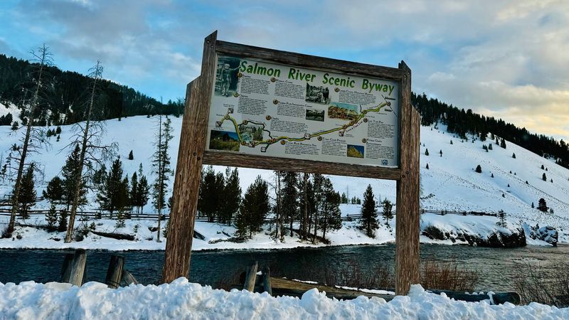
They call it the River of No Return, and after a few miles on this road you may not want to return either. The Salmon River Scenic Byway sign at 48 Gateway, Stanley, ID 83278 marks one end of a 162-mile route that follows the river nearly the whole way.
From Stanley, Highway 75 runs east through a canyon to Challis, then U.S. 93 carries you north through Salmon and up to Lost Trail Pass on the Montana line. That pass sits at 7,014 feet in the Bitterroot Mountains.
Plenty of Idahoans rank this as the most scenic road in the state. Clear water tumbles beside the pavement, and steep mountains rise on both sides.
Stops worth your time include the Land of the Yankee Fork State Park and the Bayhorse Historic District, where old mining history comes alive. Near Salmon, the Sacajawea Interpretive Center tells the story of the Lewis and Clark Expedition, which crossed a nearby divide in 1805.
Rafters and fly anglers flock here in summer. The byway also borders the Frank Church-River of No Return Wilderness, one of the wildest places left in the Lower 48.
Winter snow and ice can slow things down, so plan accordingly.
7. Trail Creek Road
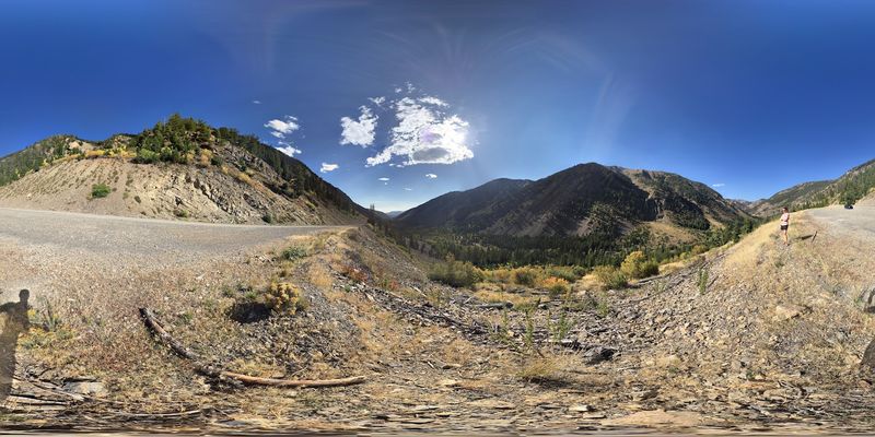
Gravel crunches under the tires, the pavement disappears, and suddenly Sun Valley feels a world away. Trail Creek Road climbs northeast out of the Ketchum and Sun Valley area, crossing a high pass on its way toward Mackay.
This is the rugged option on the list. The road is mostly dirt, narrow in spots, and carved into steep hillsides with drops that will keep both hands on the wheel.
Your reward comes in big helpings of quiet. Sagebrush slopes give way to forest, and the Pioneer Mountains and surrounding ranges unfold in every direction without a resort or shopping center in sight.
On the far side, the land opens into the Big Lost River Valley, wide and ranch-dotted, with the Lost River Range rising beyond it. Mackay makes a fine turnaround point or a stop before heading home on paved highways.
Trail Creek Road is seasonal and closes to regular vehicles in winter, usually reopening once snow melts in late spring or early summer. A high-clearance vehicle helps, and slow driving is a must.
Check current conditions before leaving town, and bring water, since there are no services along the way. Brave it once and you will have a story to tell.
8. International Selkirk Loop, Bonners Ferry, ID
Passport optional, but only if you stick to the Idaho side. The International Selkirk Loop is North America’s only multinational scenic drive, a 280-mile circle through Idaho, Washington, and British Columbia.
Up in the Panhandle, the loop strings together three byways: the Wild Horse Trail, the Panhandle Historic Rivers Passage, and the Pend Oreille Scenic Byway. Together they wrap around Lake Pend Oreille, the largest and deepest lake in Idaho.
Small towns break up the drive nicely. Bonners Ferry, Sandpoint, and Priest River each offer a main street worth a stroll, and the loop’s office at 6373 Bonner St, Bonners Ferry, ID 83805 has maps and restrooms on weekdays.
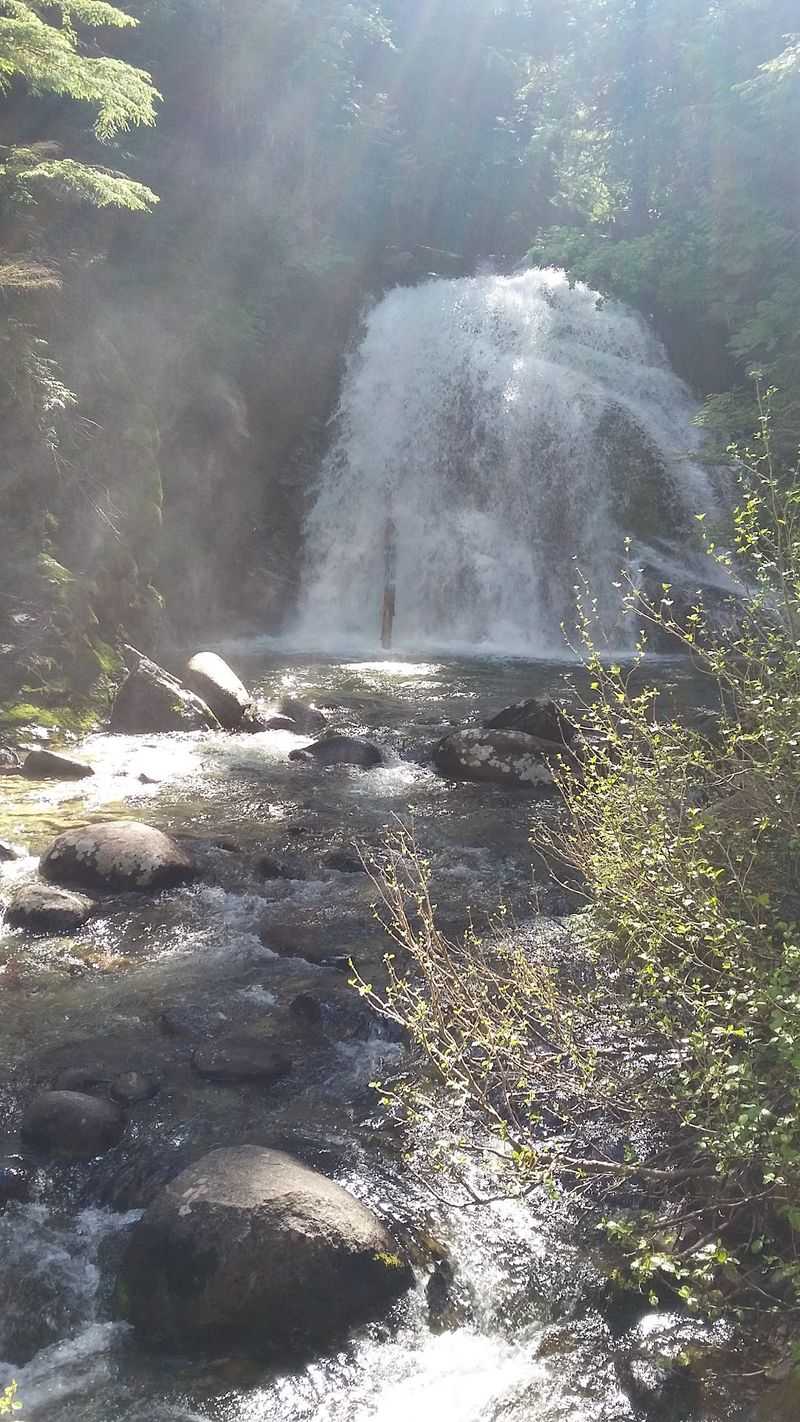
Nature stops come thick and fast. The Kootenai National Wildlife Refuge draws birds and bird watchers, Copper Falls tumbles through the forest, and Albeni Falls Dam sits along the Pend Oreille River.
Each season changes the mood. Summer brings boats and kayaks onto the water, fall sets the larch trees glowing gold, and winter sends skiers up to Schweitzer Mountain Resort.
Anyone who grew up in North Idaho has likely driven parts of this loop dozens of times, and it never seems to get old.
9. City of Rocks National Reserve
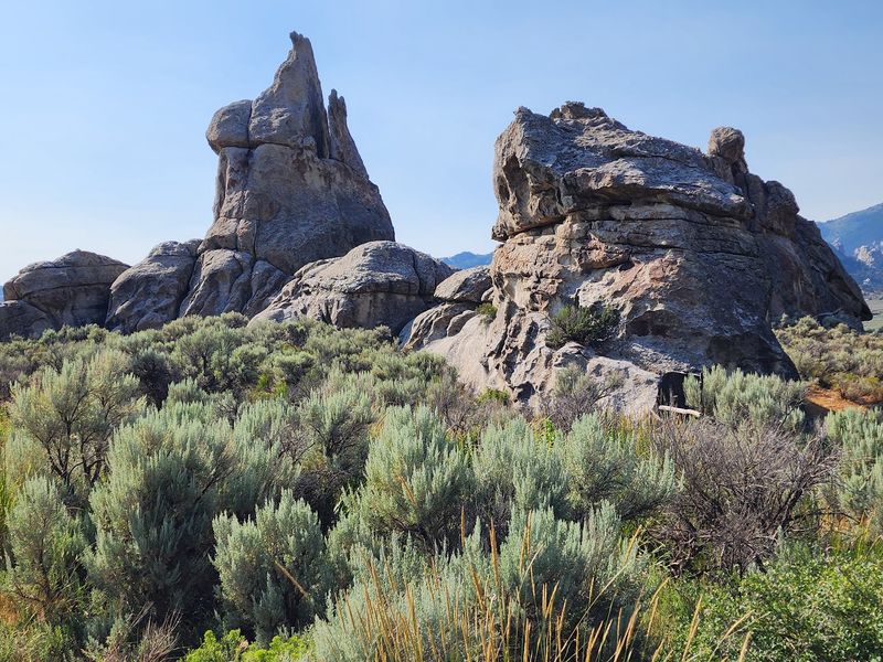
Granite towers shoot up from the sagebrush like a city skyline built by giants. City of Rocks National Reserve near Almo, ID 83312 sits close to the Albion Mountains in south-central Idaho, and the drive in is where jaws start dropping.
Some of these rock formations date back around 2 billion years. Wind and water shaped them into spires, domes, and fins with names like Finger Rock, a favorite spot to catch the sunset.
Pioneers on the California Trail passed through here, and some wrote their names on the rocks in axle grease. Many of those signatures can still be found today.
Rock climbers treat the reserve like a playground, but you do not need ropes to enjoy it. Short, kid-friendly hikes wind between the formations, and picnic tables make lunch easy.
The visitor center has helpful staff and exhibits that explain the geology. Campers can choose from 63 sites, and the remote ones at the far end offer quiet sunsets and dazzling stargazing.
Leashed dogs are welcome. Weekends get busier, especially Saturdays, so a weekday trip feels more peaceful.
Spring and fall bring the most comfortable temperatures for exploring this unusual corner of Idaho.