This Massive California Forest Hides Volcanic Cliffs, Alpine Lakes And A Highway With Jaw-Dropping Views
Some forests are so enormous that a quick afternoon visit barely scratches the surface.
You can spend hours driving through the scenery and still feel like you have only discovered a tiny corner.
One sprawling mountain wilderness offers exactly that kind of adventure, with landscapes that seem to change around every bend.
The deeper you explore, the more reasons you find to pull over, stretch your legs, and forget about the clock. And the scenery has a few surprises that ordinary forest drives rarely deliver.
California’s mountain forests can make a simple road trip feel like an expedition through several completely different landscapes.
There is something exciting about a destination where the journey matters just as much as the stops.
You might set out looking for a peaceful place to relax and end up planning an entirely different adventure.
The best part is knowing there is always another stretch of road worth exploring.
Nearly 900,000 Acres Of Sierra Nevada Wilderness
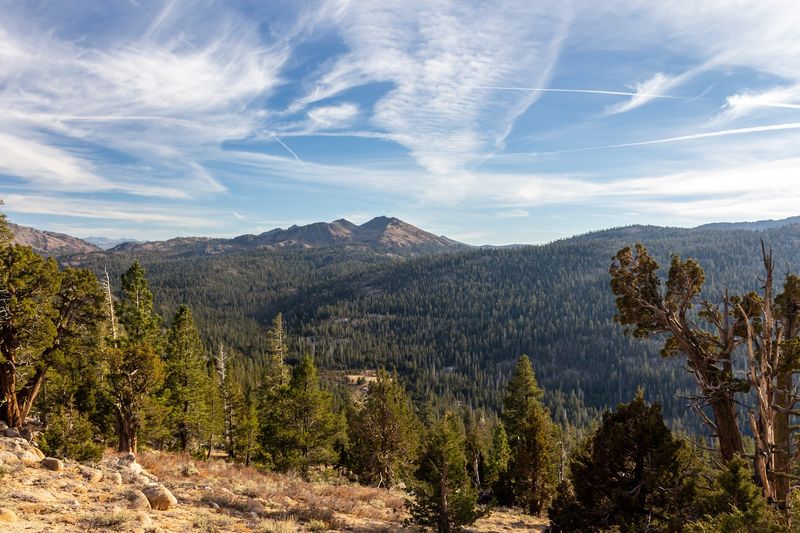
Size is the first thing that catches many visitors off guard. The forest covers roughly 898,000 acres, which is larger than some entire counties. Elevation changes the scenery as you move through it.
Lower areas hold oak woodlands and mixed conifer forests that feel warm and open in summer. Higher up, red fir and lodgepole pine take over, and the air turns cooler and thinner.
Open subalpine meadows appear in the high country, often dotted with wildflowers early in the season.
Rugged volcanic terrain sits beside smooth granite slopes in many spots. The highest point climbs past 11,000 feet at Sonora Peak.
Planning matters more in a forest this large. Cell service can be spotty or missing in many areas, so downloading maps ahead of time is a smart move.
Gas stations and stores are spread far apart, which makes filling the tank before heading up a good habit.
Choosing one region per trip often works better than trying to see everything at once. The forest rewards slow travel, and repeat visits can uncover something new each time.
The Spectacular Sonora Pass Highway
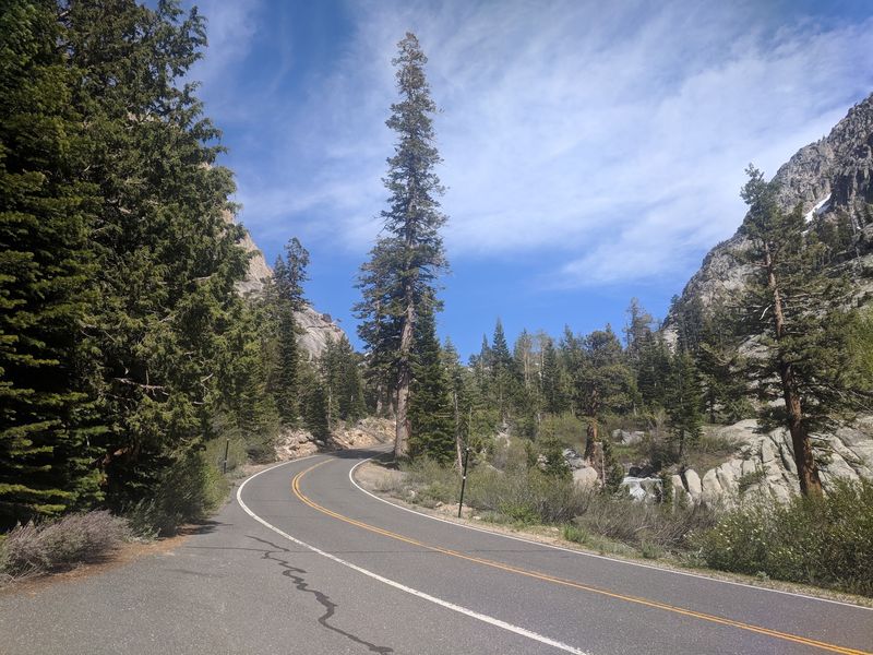
Few roads in the state feel quite as thrilling as State Route 108. Known as the Sonora Pass Highway, it climbs steadily through the forest toward one of the highest crossings in the Sierra Nevada.
Views open up again and again along the way. Granite walls, deep valleys, and tall pines slide past the windows as the road twists upward. Small reservoirs and rocky ridges appear around many corners.
Drivers should know what to expect before starting the climb. Sections of the road are steep, narrow, and winding, with grades that can exceed 8 percent.
Some spots reach grades as steep as 26 percent, which ranks among the sharpest in the region.
Large vehicles may struggle on this route. Travel trailers, long RVs, and heavy trucks can find the tight curves and steep grades challenging.
Comfort tips can make the trip more pleasant. Passengers who get carsick might feel better sitting up front and taking breaks at pullouts.
Taking it slow brings its own reward. Using pullouts lets faster traffic pass and gives everyone a chance to stretch, snap photos, and enjoy the fresh mountain air.
A Mountain Pass More Than 9,600 Feet High
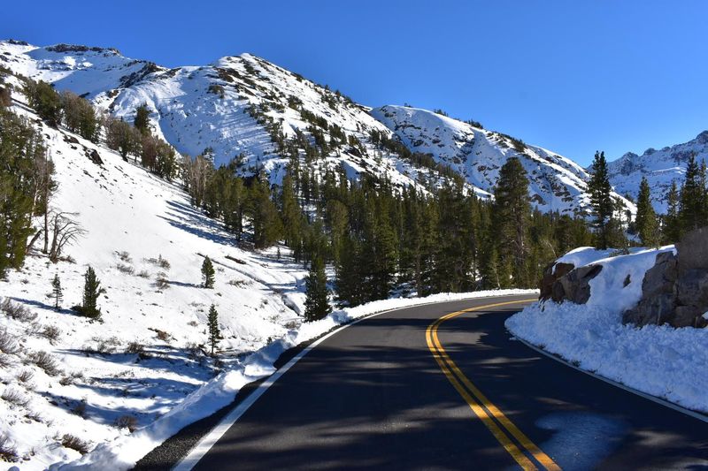
Standing at the top of Sonora Pass feels a bit like reaching the roof of the range. The summit sits at about 9,624 feet above sea level.
That makes it one of the highest paved mountain crossings in California.
Only one paved pass in the Sierra Nevada climbs higher. Tioga Pass, to the south in Yosemite, is about 321 feet taller. Sonora Pass holds second place, which is an impressive spot to be.
Scenery near the top looks different from the forests below. Trees grow shorter and thinner, while rocky slopes and volcanic peaks take center stage.
Thin air at this height can affect some visitors. Walking slowly, drinking plenty of water, and resting when needed can help the body adjust.
Sunlight also feels stronger up high, so sunscreen and sunglasses are worth packing.
Seasons control access to the summit. The pass usually closes in winter because of heavy snow, often from around November until May.
Opening and closing dates change each year, so checking with Caltrans before a trip is important.
Temperatures at the top can feel much cooler than in the foothills. A light jacket often comes in handy, even on a sunny afternoon.
Pinecrest Lake’s Beautiful Mountain Setting
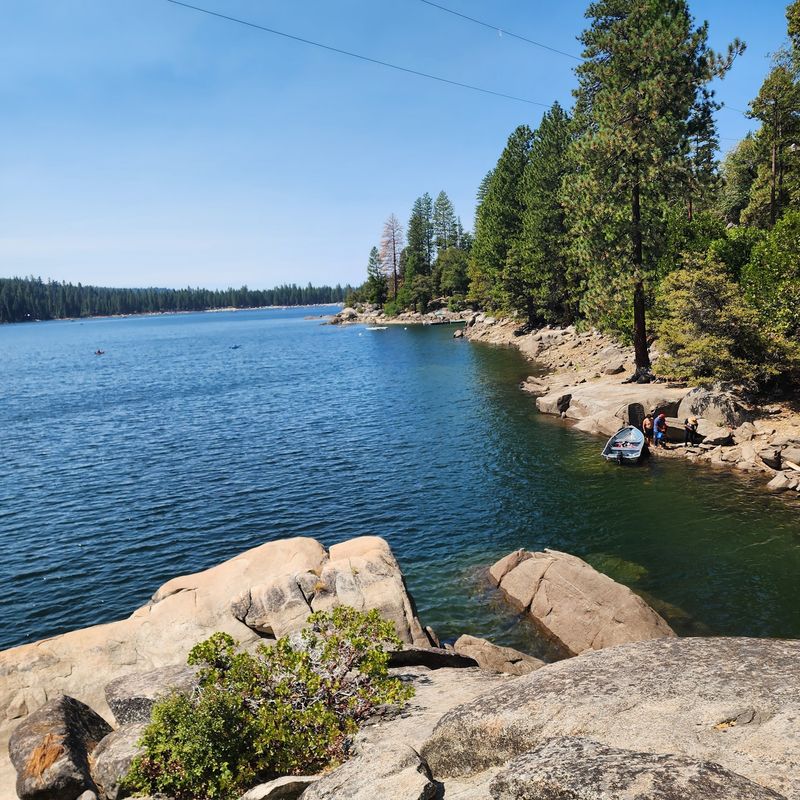
Summer days seem made for a lake ringed by tall pines. California’s Pinecrest Lake is a roughly 300-acre reservoir set in a timbered mountain landscape.
Soft sand, cool water, and shady trees give it a relaxed, family-friendly feel.
Plenty of activities keep the day moving. Swimmers can wade in from a sandy beach, while paddlers glide across in kayaks and canoes.
Anglers often find this lake rewarding. Rainbow trout are stocked regularly, making them a common catch. An accessible fishing pier near the beach offers an easy spot to cast a line.
Picnic areas sit close to the water for lunch breaks. A marina and a small shopping center nearby help with forgotten supplies or boat rentals.
That setup makes it easier to plan a full day without much fuss.
Pet owners should note a few rules. Dogs are generally allowed in the recreation area on a leash.
The Day Use Area has specific pet restrictions between May 15 and September 15, so checking signs on arrival helps.
Arriving early in the morning may help with finding a shady picnic table. Weekday visits might offer a calmer shoreline and quieter water.
A Scenic Trail Around Pinecrest Lake
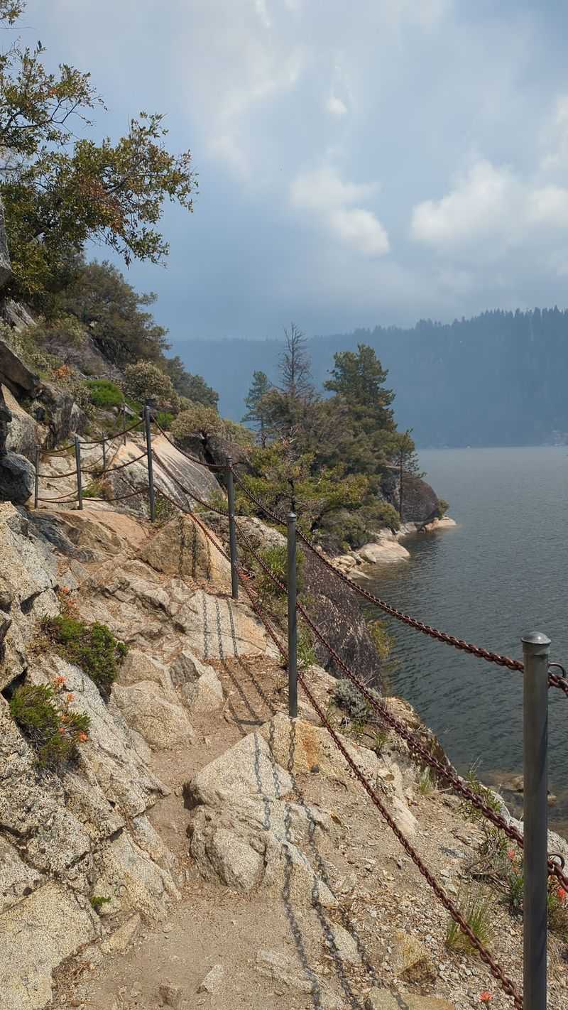
Walking all the way around a mountain lake gives a fresh view with every step. The Pinecrest Lake Trail is a loop of about four miles.
Most hikers rate it easy to moderate, which suits many ages and fitness levels.
Variety keeps the walk interesting. Some stretches hug the shoreline, while others wind through shady forest. Rocky sections ask for careful footing but rarely feel too difficult.
Two features stand out along the loop. The path crosses Strawberry Dam, offering wide views across the water.
A footbridge also spans the South Fork of the Stanislaus River, a nice spot to pause and listen to the current.
Parts of the trail may be paved, especially near the busier areas. Other sections are dirt and rock, so sturdy shoes make the hike more comfortable.
Dogs are welcome on the trail if they stay on a leash. Parking, restrooms, and drinking water are available near the trailhead and day use area.
Morning walks may bring cooler air and calmer water. Soft light on the lake can make photos look especially nice early in the day.
Volcanic Columns That Look Almost Man-Made
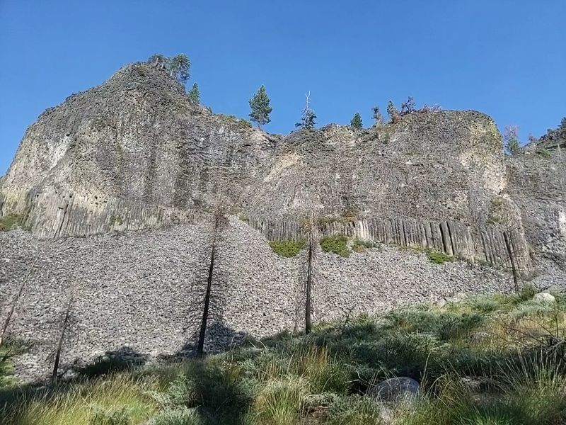
Nature sometimes builds shapes so neat they look carved by hand.
Columns of the Giants shows off tall basalt pillars with six-sided edges. Many visitors stop and stare, wondering how rock could form such tidy patterns.
Ancient lava created these formations. Molten rock flowed into the old Stanislaus riverbed more than 100,000 years ago.
As it cooled, it shrank and cracked into multi-sided vertical columns.
Glaciers later finished the job. Moving ice carved through the area and exposed the columns for people to see today. Broken pieces scattered at the base show just how blocky the rock can be.
Getting there is easy. The site sits along the Middle Fork of the Stanislaus River canyon on Highway 108, near Dardanelle.
Accessibility is a big plus here. The trail is wheelchair accessible, and signs along the way explain the geology in simple terms. Vault toilets are available near the parking area.
Timing matters for this stop. The best window to visit runs from early May to late October, before snow returns.
A Scenic Overlook Above Donnell Reservoir
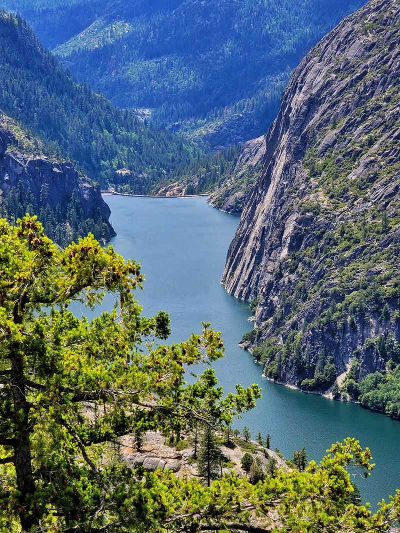
Big views do not always require big effort. Donnell Vista proves that with a short walk and a dramatic payoff.
The overlook looks down into a deep Sierra Nevada canyon with Donnell Reservoir far below.
Granite walls drop sharply toward the water. Surrounding mountains frame the scene on all sides. The scale can feel surprising, especially after the twists of the highway.
The trail is about half a mile long. Most people can finish it in around 15 minutes at a relaxed pace. Interpretive signs along the path add helpful background about the landscape.
Families with young children may find this stop especially easy. The short distance makes it a good leg stretch during a long drive on Highway 108.
Light changes the look of the canyon throughout the day. Afternoon sun can brighten the granite and make the water shine. Cloudy days may bring softer colors and a moodier feel.
Bringing binoculars could add to the experience. Distant ridges and rock details become easier to see up close.
A camera with a wide view helps capture the full depth of the canyon.
Comfortable shoes are enough for this walk. A water bottle and a light layer round out the short trip nicely.
The Remote Beauty Of Emigrant Wilderness
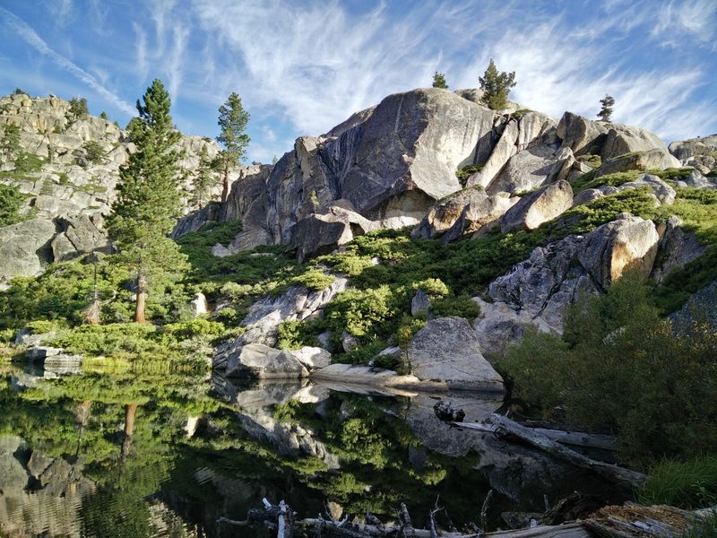
Quiet backcountry still exists for those willing to walk a little farther. California’s Emigrant Wilderness covers more than 113,000 acres inside the forest.
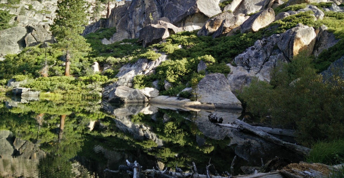
Glaciers shaped much of the land, leaving polished granite and sparkling lakes behind.
Scenery here feels wide and open. Granite peaks and volcanic ridges rise above meadows and pristine alpine lakes. Elevations range from below 5,000 feet to over 11,500 feet at Leavitt Peak.
Trails reach deep into the area. About 185 miles of developed paths support both day hikes and longer backpacking trips.
Many visitors enjoy the calmer atmosphere. Crowds are often lighter than in major national parks, though popular trailheads can still fill on summer weekends.
Fishing for trout, swimming in chilly lakes, and hunting in season are common activities.
Rules help keep the area wild. Wilderness permits are required for all overnight camping. Packing out trash and following Leave No Trace habits protects the fragile landscape.
Afternoon thunderstorms may roll in quickly, so starting early and leaving exposed ridges by midday is a smart plan.
More Than 1,000 Miles Of Hiking Trails
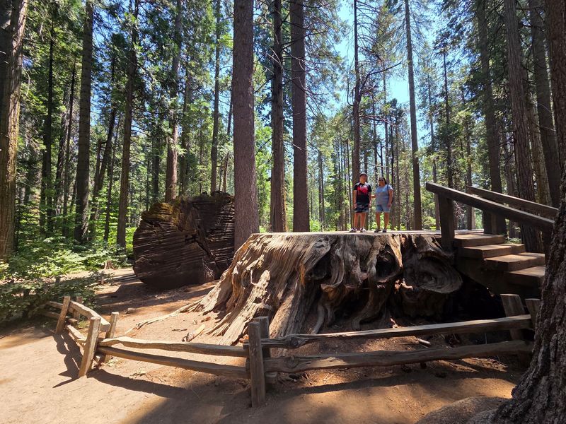
Trail lovers could spend years exploring and still find new paths. The forest offers more than 1,000 miles of non-motorized trails. Some sources even place the total above 1,100 miles.
Options range widely in difficulty. Short, accessible walks work well for families with small children. Challenging high routes and multi-day backpacking trips suit experienced hikers.
Choosing the right trail starts with honest planning. Thinking about distance, elevation gain, and the group’s energy level helps avoid a tough day.
Not every path is perfectly groomed. Many trails are well maintained, while some sections may be rough, faint, or less developed. A paper map and basic navigation skills offer peace of mind in remote areas.
Comfort on the trail comes down to a few basics. Sturdy shoes, plenty of water, snacks, and sun protection make a big difference. A light rain jacket helps when mountain weather shifts.
Sharing the trail kindly keeps the experience pleasant. Hikers often meet horses and pack animals in some areas, and stepping aside for them is common courtesy.
Starting small can build confidence. An easy lakeside loop might lead to bigger adventures on later trips.