7 Trails In Upstate New York With Ruins Hiding In The Woods
A grand mountain hotel in New York was started in the 1920s and never finished. Its concrete shell still stands on a Catskills slope.
Trees now grow where guests were supposed to sleep, and hikers wander through the empty arches on their way to a fire tower.
That one got me hooked. Then I learned about a blast furnace in an Adirondack ghost town.
A vine-wrapped greenhouse and Revolutionary War fort ruins also sit quietly beside popular footpaths.
Drumroll, please! I rounded up multiple trails where crumbling chimneys, stone walls, and abandoned buildings wait just off the path.
Most are easier to reach than you’d think. Ready to go ruin hunting?
1. Cornish Estate Trail
Some ruins demand a brutal climb, but this one asks for about a mile of easy walking. That’s a sweet deal for a mansion, a greenhouse, and river views.
The blue-marked Cornish Trail follows a former estate road in Hudson Highlands State Park Preserve.
From the Washburn Trailhead parking area along Route 9D near Cold Spring, the main ruins are about 0.9 mile away, making the return walk roughly 1.8 miles.
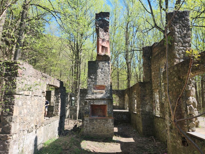
The stone arches and chimney stacks belonged to Northgate, an estate developed in the early twentieth century.
Diamond merchant Sigmund Stern built its principal buildings before the Cornish family acquired the property in 1917. The grounds eventually included gardens, a greenhouse, a swimming pool, and agricultural buildings.
Rather than appearing all at once, the estate’s remains emerge gradually as the path bends through the woods.
Today the mansion’s remaining stonework frames open sky and mature trees. A few other structures can be found along longer routes, but the main house is the simplest destination for a short outing.
From certain angles, the surviving arches resemble doorways into rooms that now have trees growing where the walls once stood.
Look for the greenhouse remains and the open lawn, which offers glimpses toward Storm King Mountain across the Hudson.
The greenhouse and mansion offer two different kinds of ruins, one shaped by spreading vegetation and the other by exposed stonework.
Visit after the leaves have fallen, and the outlines of the old buildings become easier to make out through the surrounding trees.
The route is generally gentle, although roots and uneven ground still require attention. Keep to established paths and appreciate fragile masonry without climbing it.
For a taste of New York estate history, this forest walk delivers an unusually atmospheric reward without requiring a summit hike or hours of uphill effort.
2. Overlook Mountain Trailhead
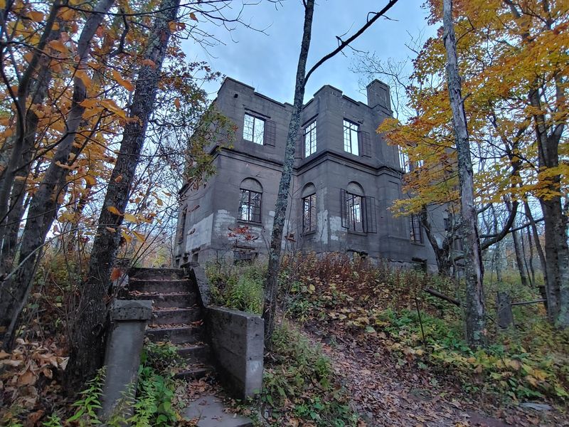
Hotels usually open before they fall apart. The Overlook Mountain House skipped that step, and its enormous concrete shell now waits beside a Catskills hiking trail.
Several earlier hotels stood on this mountain. Construction of the final version began in the 1920s, but the ambitious project was never completed.
What remains looks almost like an unfinished castle, with tall openings and weathered walls surrounded by forest. Those enormous window openings give you a sense of how imposing the completed mountain hotel was supposed to be.
The approach starts from the Overlook Mountain Trailhead at 353 Meads Mountain Rd in Woodstock.
Follow the wide, steadily climbing former carriage road for approximately 1.6 miles to reach the hotel remains. It’s easy to follow but physically demanding because much of the way is uphill.
Admire the structure from outside. Entering the ruins is prohibited for visitor safety, even though the arches seem inviting from the path.
Continue climbing to reach Overlook Mountain’s 60-foot fire tower. When conditions allow tower access, its elevated platform offers sweeping views, while a nearby lookout provides another panorama over the Hudson Valley and Ashokan Reservoir.
On a clear day, the transition from enclosed woodland to wide-open mountain scenery makes the final stretch especially memorable.
The complete outing to the summit and back is commonly around five miles. Wear sturdy footwear and carry water; timber rattlesnakes live in this mountain habitat and should be given space.
A remarkable historic building and an expansive summit make the steady climb worthwhile, especially when clear skies reveal the surrounding ridgelines.
3. Upper Works Trailhead
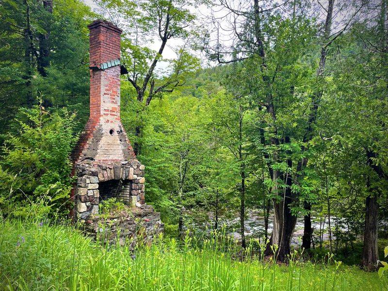
Ghost towns aren’t just a Wild West thing. Deep in the Adirondacks, Upper Works puts a remarkable ironmaking landmark beside a route into the High Peaks.
Near Newcomb, the former village of Adirondac once supported iron production and a small industrial community.
The imposing McIntyre Blast Furnace survives as a stone reminder of those operations, with its towering masonry standing among trees near the road.
Its remarkable size hints at the scale of industrial activity that once brought workers and machinery into this remote mountain valley.
Visitors following Upper Works Road pass the furnace before reaching the modern trailhead parking area. Interpretive paths and signs connect the old village landscape, industrial remains, and the preserved MacNaughton Cottage.
The cottage is associated with Theodore Roosevelt’s historic journey through the Adirondacks in 1901.
That modest wooden building provides an interesting contrast to the massive stone furnace, bringing a more personal side of the area’s history into focus.
Preservation work has stabilized the furnace and cottage, while a renewed walking route helps visitors understand how the settlement once functioned.
This isn’t a place for wandering into buildings; stay with the marked historical route and use the viewing areas.
Serious hikers can continue from Upper Works toward Henderson Lake, Flowed Lands, and the High Peaks. Mount Marcy is accessible from this southern approach, but it requires a lengthy mountain hike rather than a casual excursion.
For a shorter introduction, explore the interpretive areas and enjoy the surrounding forest.
Remote New York history feels particularly vivid when an old industrial tower rises beside a wilderness trail with mountain peaks rising in the distance.
4. Franny Reese State Park
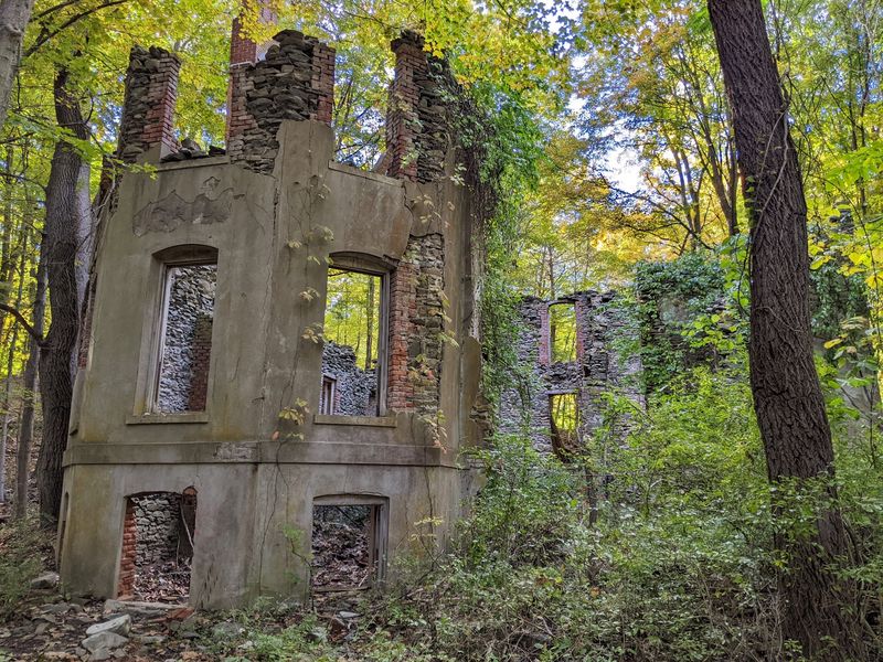
Brick chimneys standing alone in the forest make a pretty good conversation starter. You’ll find them at Franny Reese State Park, just across the Hudson from Poughkeepsie.
This 251-acre park preserves the remains of Cedar Glen, a nineteenth-century estate once owned by dentist Charles H. Roberts.
Stone walls, stairways, and masonry openings survive among the trees, recalling a property that once included elaborate buildings and landscaped grounds.
The scattered pieces invite you to imagine where the estate’s rooms, entrances, and outdoor gathering spaces once stood.
The park’s trails trace old carriage roads. Beginning from the Macks Lane entrance in Highland, the yellow-marked route passes the estate ruins before continuing downhill toward the Hudson.
A short blue-marked branch offers an overlook, while the longer white Ridgeline Trail explores wooded bluffs.
Altogether, the park has more than 2.5 miles of walking and biking paths. Elevated viewpoints take in the Mid-Hudson Bridge, Poughkeepsie, and the Walkway Over the Hudson.
A connecting route also joins the larger Walkway Loop Trail for anyone wanting to extend the outing.
The contrast between the quiet estate grounds and the enormous bridges crossing the river gives this walk two very different kinds of scenery.
Scenic Hudson protected the property in 2003, and the state park opened in 2009. It honors environmental advocate Frances “Franny” Reese, whose work helped preserve the Hudson Valley landscape.
The grounds are open daily from dawn to dusk. Leashed dogs are welcome, and the trails also accommodate snowshoeing in suitable winter conditions. Between the estate remains and the river overlooks, it’s a rewarding half-day walk.
5. Doodletown Trailhead
Yes, Doodletown is a real place, and its name is the least surprising thing about it.
This former hamlet sits within Bear Mountain State Park, where forest paths still trace the streets of a vanished community.
Families lived here for generations, building houses, a school, and a church along the mountain roads.
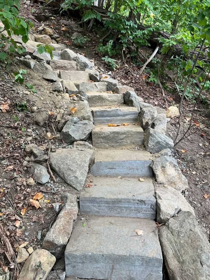
The final residents left in the 1960s when the land became part of the park. Old foundations, stone steps, and historical markers now recall individual homes and neighborhood landmarks.
Some markers identify the families who once occupied particular properties, giving the quiet foundations a surprisingly personal connection to the past.
The traditional approach begins near Route 9W and Iona Island in the Tomkins Cove area.
The Cornell Mine Trail reopened in October 2025, restoring an important connection toward Doodletown, but other nearby trails are still undergoing repairs after major storm damage.
That makes route planning essential. Consult the park’s latest closure map before leaving, use an approved parking area, and follow only open trails.
Access may differ from older trail descriptions, so an advertised short walk to the hamlet should not be taken for granted.
Where access is permitted, the surviving roadbeds help reveal how the village’s houses and community buildings once connected to one another.
The surrounding woods are also part of a significant bird habitat, adding another reason to move slowly. Respect the historic markers and leave stones and artifacts where they belong.
Doodletown tells an unusual New York story through the simple traces of everyday life. When the permitted route is open, the forest feels like an outdoor history book.
6. Madam Brett Park
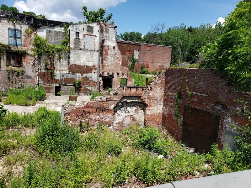
A waterfall just a short walk from your car sounds almost too easy. At Madam Brett Park in Beacon, rushing water and industrial ruins sit within the same compact outing.
Fishkill Creek powered mills for generations. Catheryna Brett operated a gristmill here in the early eighteenth century, and the waterway later supported the Tioronda Hat Works.
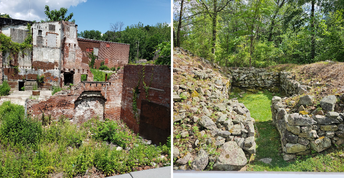
Brick industrial remains beside the park recall Beacon’s era as a major hatmaking center. The old masonry standing beside the creek makes it easy to imagine the sound of machinery once mixing with the rushing water.
Start near 560 South Avenue and follow the gentle paths along the creek.
One direction leads toward the waterfall overlook, where flowing water is especially impressive after rainfall. Another follows a boardwalk past the former factory area toward Fishkill Marsh.
The marsh provides habitat for birds, amphibians, and aquatic mammals. Look for the wildlife viewing platform and allow time to watch the reeds and water rather than concentrating only on the brickwork.
Within a short walk, the scenery shifts from historic brickwork and moving water to a peaceful wetland filled with reeds and wildlife.
Scenic Hudson manages this twelve-acre property, which is open year-round from dawn to dusk. Leashed dogs are allowed, and features of the paths and boardwalk provide an accessible way to experience the creekside setting.
Longer walking connections lead toward Dennings Point and Long Dock Park, linking three very different Beacon landscapes.
For a quick outing, though, the pairing of a waterfall and historic hat factory remnants is already a distinctive reward, with very little climbing required and plenty of waterside scenery.
7. Fort Montgomery State Historic Site
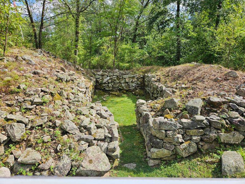
In October 1777, British forces approached this hilltop fort above the Hudson. Its surviving foundations still trace an important chapter of the American Revolution.
Fort Montgomery occupied a commanding position overlooking the river.
Archaeological remains include sections of stone walls, foundations of buildings used by the fort’s occupants, and parts of its defensive earthworks.
The Hudson Highlands setting helps explain why controlling this stretch of water mattered.
Nearby Fort Clinton formed part of the same defensive system, with both forts positioned to protect this strategically important Hudson River passage.
The historic site at 690 Route 9W in Fort Montgomery includes a museum with artifacts, detailed models, and an introductory film. Exhibits provide context for the landscape and the events of 1777, making it worthwhile to begin indoors.
There is an important access restriction in 2026: the main portion of the outdoor ruins is closed until further notice for pathway and accessibility improvements.
The museum remains open during its normal season, but visitors should follow the posted closure boundaries instead of attempting to reach the foundations.
The museum’s detailed models are particularly useful during the closure, helping visitors understand how the fort’s buildings and defenses once fit together.
Regular opening hours run Wednesday through Saturday, 10 a.m. to 5 p.m., and Sunday, 1 to 5 p.m., from mid-April through October. Off-season group visits require advance arrangements.
The location remains an absorbing stop for New York history enthusiasts, even while the main archaeological area is being improved.
Once paths reopen, the historic grounds will again complement the museum’s detailed account of the fort.