The Nebraska Spot Where You Stand At The Point Where Two States And Four Counties Meet
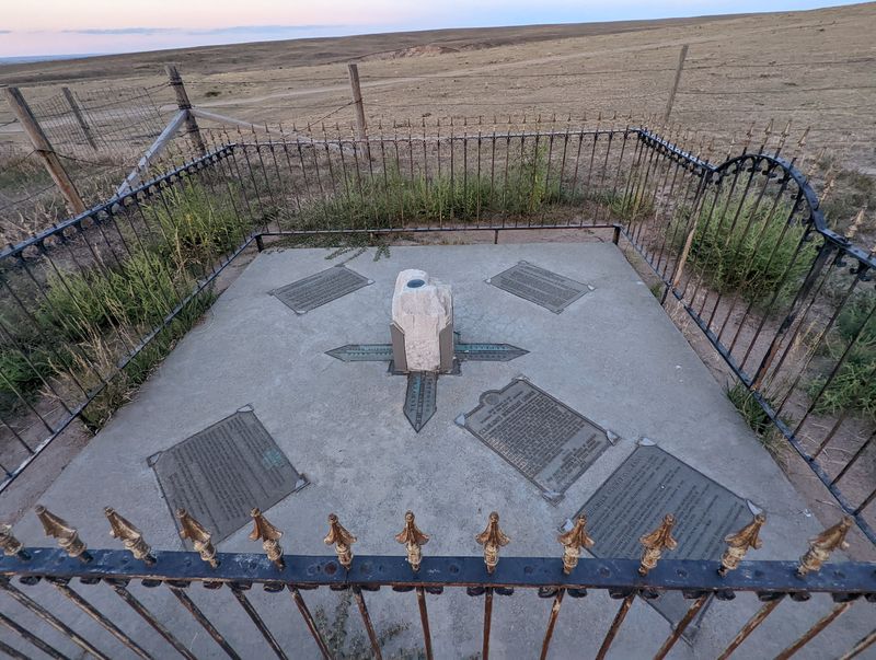
One step at the end of a dirt road puts your left foot in Colorado and your right foot in Nebraska. Four counties come together under your sneakers at the same moment.
The spot sits just a few miles off Interstate 80. Most drivers zoom right past it without a clue.
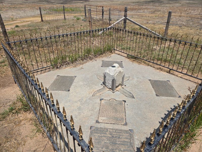
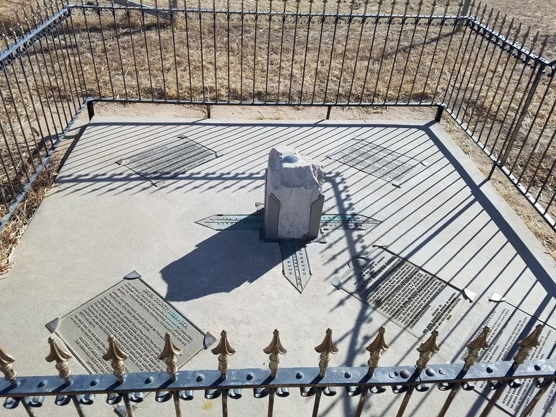
A small fence circles the monument, and a few informational markers explain what you are standing on.
I like how something this odd hides in plain farm country. There are no ticket booths or gift shops, just open fields, a big sky, and a line on a map made real.
It feels like a secret the surveyors left behind.
I can’t imagine a cheaper way to visit two states before lunch. So how did Colorado end up with a corner poking into the prairie here?
A Corner Of Colorado Sitting Right Off Nebraska’s Interstate
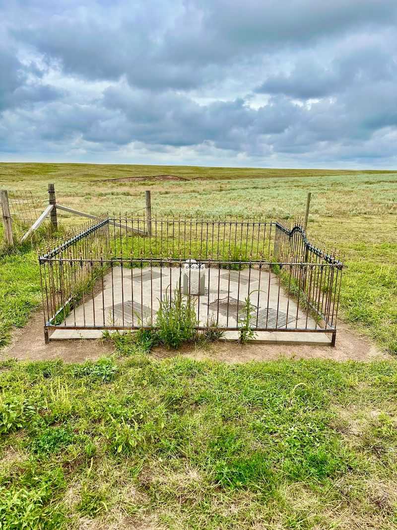
Few landmarks let you hop between states with a single stride. The Colorado – Nebraska Corner Border Marker does exactly that, out in the fields near Big Springs.
It marks the northeast corner of Colorado, where the state’s straight lines meet Nebraska’s panhandle. On a map, Colorado looks like a near-perfect rectangle.
This is one of the spots where that rectangle actually touches the ground.
Google lists it as a historical landmark, and that label fits. The site is small, simple, and refreshingly unfussy.
You get a monument, some markers, and a whole lot of sky.
Nebraska has plenty of famous stops along Interstate 80. Most of them involve parking lots and souvenir shelves.
Here, the souvenir is a photo of your feet in two places at once.
What makes it fun is how close it sits to everyday travel. Plenty of folks pass within a few miles every single day.
They just never know a state corner waits down a gravel road.
Once you learn it exists, ignoring it gets harder. The Colorado – Nebraska Corner Border Marker turns a routine highway drive into a quick geography lesson with a payoff.
Why Colorado Ends Up With A Corner In The Middle Of Farm Country
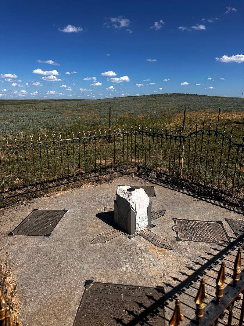
Blame the mapmakers in Washington for this one. When Colorado Territory was created in 1861, its borders followed lines of latitude and longitude instead of rivers or mountains.
That choice gave Colorado its famous boxy shape. Nebraska, meanwhile, wrapped around the top with its long panhandle stretching west.
Where the two shapes meet, a sharp corner appears.
Look closely at a Nebraska map and you’ll see a notch carved out of the southwest. That notch is Colorado’s top-right corner pressing in.
The marker sits right at the point of that notch.
It’s a quirk most Nebraskans have seen a thousand times on a road atlas. Few have stood on the actual spot, though.
Seeing it in person makes the shape on the map suddenly feel real.
There’s no mountain range or river to explain the line. It exists because people agreed it should be there.
Surveyors then had to go out and find it with chains, instruments, and plenty of patience.
So the corner is part history, part math, and part stubborn fieldwork. Standing there, you’re on top of a decision made long before this land held fields and fences.
The Invisible Lines You Can Finally Put Your Boots On
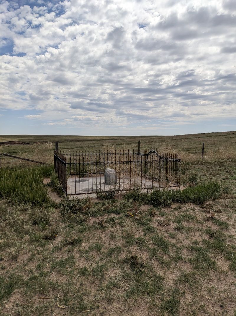
Two imaginary lines cross at this spot, and only one of them is easy to explain. Colorado’s northern border follows the 41st parallel north, a line of latitude circling the globe.
The eastern border is trickier. It was tied to a meridian measured from Washington, D.C., which was common for American surveys at the time.
That’s why the coordinates here don’t land on a tidy round number.
The map pin for the marker reads roughly 41.002 north and 102.051 west. Close to round, but not quite.
Old surveying tools and real-world ground explain those tiny differences.
Surveyors in the 1800s worked without satellites or phones. They relied on stars, careful measurements, and long days in the open.
Every corner they set became the official line, even when modern tools disagree slightly.
That’s the cool part for anyone who loves maps. The border isn’t where the math says it should be.
It’s where the original marker says it is.
Benchmarks at the site hint at that careful work. Take a second to look at them before snapping photos, because they tell the real story of this corner.
A Little Fence, Some Benchmarks, And Plenty To Read
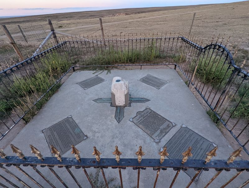
Don’t expect a towering statue or a flashy visitor center. The setup here is modest and tidy, which suits a corner in the middle of farm country.
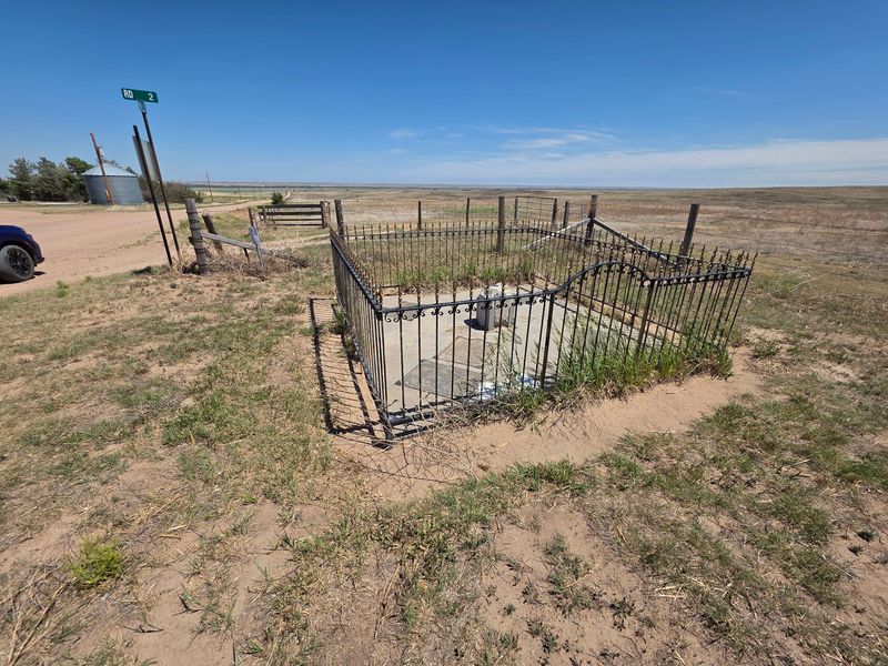
A small fence surrounds the main monument. It protects the marker but makes close-up photos a little tricky.
You’ll want to frame your shot carefully instead of climbing over.
Nearby, informational markers explain the history of the boundary. They’re worth reading before you start posing.
Context makes the whole stop more satisfying.
Survey benchmarks also sit at the site. These small markers are the working tools of surveyors, used as fixed reference points.
They’re less dramatic than a monument but arguably more important.
Respect goes a long way here. Someone maintains these markers, and the fence exists for a reason.
Leaving everything as you found it keeps the corner looking good for the next traveler.
That balance of simple and meaningful is what makes the Colorado – Nebraska Corner Border Marker work. It doesn’t try too hard.
It just quietly marks a real place where two states agreed to meet.
Two States And Four Counties Under One Pair Of Shoes
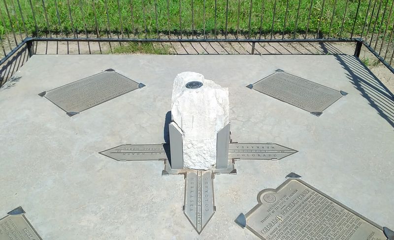
Here’s a party trick for your next family photo. Stand in the right place and you’re technically in two states and four counties at once.
County lines follow the state borders out here, so the corner becomes a meeting point for several of them. It’s the kind of fact that sounds made up until you’re standing on it.
Kids tend to love this stuff. Jumping from Colorado to Nebraska and back again never gets old.
Neither does announcing it to everyone in the car.
Adults aren’t immune either. There’s something oddly thrilling about a place where paperwork, taxes, and laws all shift within a few feet.
Your shoes don’t notice, but your brain does.
The little fence means the photo takes a bit of creativity. Try angles that show the monument and your feet on different sides.
A wide shot with the open fields behind it works well too.
Nebraska has its own famous spots for bragging rights. This one might be the easiest to explain at dinner.
You stood in two states before lunch, and you have the pictures to prove it.
Getting There Takes About Five Miles Of Gravel And Good Directions
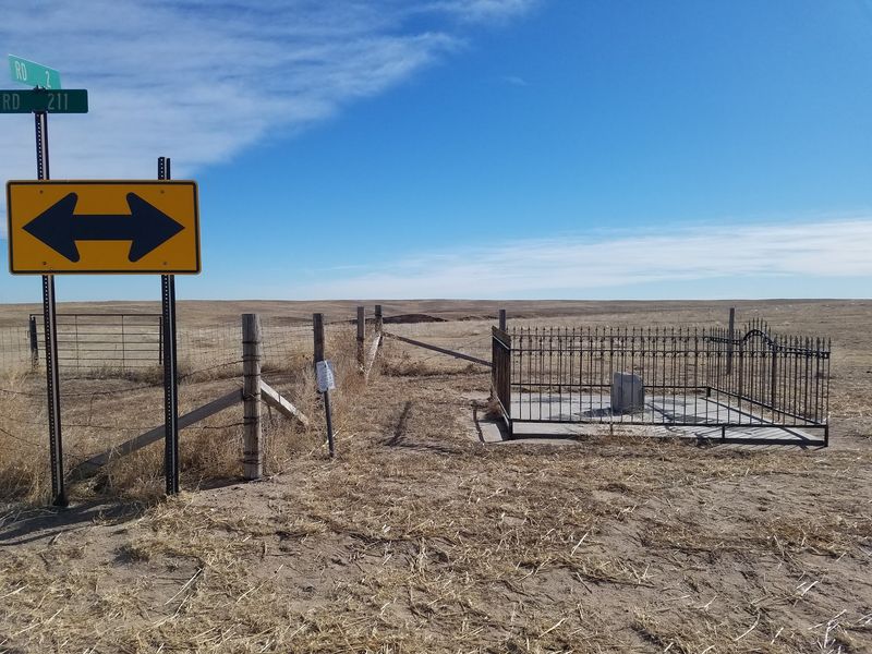
Good news for anyone who hates long detours. The marker sits only about five miles off Interstate 80, near the town of Big Springs.
Plug in Big Springs, NE 69122, or better yet, use the map pin for the marker itself. The final stretch runs on dirt roads, so pavement ends well before you arrive.
The monument sits at a T-intersection on one of those dirt roads. Once you spot it, there’s no mistaking it.
It’s about the only structure standing in the fields.
Julesburg, Colorado, is close by as well. That means travelers heading either direction on the interstate can reach it without much backtracking.
It makes a handy break during a long cross-state drive.
A regular car can handle the trip in dry weather. Just drive slowly and watch for ruts.
Farm traffic uses these roads too, so give tractors and trucks plenty of room.
Cell coverage and GPS help a lot out here. Download your route ahead of time if you can.
Those last few turns are easier when you’re not squinting at a spinning loading icon.
Dry Skies Make The Drive A Whole Lot Easier
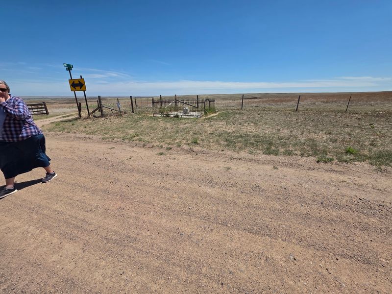
Weather matters more than you’d think on this trip. Those dirt roads behave nicely when they’re dry and turn far less friendly after a heavy rain.
A sudden downpour can soften the road surface quickly. Mud and ruts don’t mix well with low-clearance cars.
Checking the forecast before you turn off the interstate is smart.
Sunny days bring another bonus. The open landscape looks best under a clear sky, and photos come out sharper.
Even a breezy afternoon feels pleasant with all that space around you.
Western Nebraska weather can change fast, especially in spring and summer. Clouds roll in over the plains with little warning.
Keep an eye on the horizon while you explore.
Winter visits are possible since the site never closes. Snow and ice, however, can make rural roads slick.
Waiting for a mild day keeps the trip relaxed instead of stressful.
Plan around the weather and the stop stays easy. Pick a dry day, roll down the windows, and enjoy the slow gravel crawl.
The corner will be waiting, rain or shine, but your tires will thank you.
Nothing But Farm Fields And A Very Big Sky
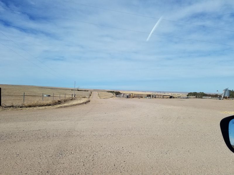
Silence is the main soundtrack here. Farm fields stretch out in every direction, and the horizon feels miles away.
There’s no town square, no restaurant, and no crowd at the corner. Just open land and the occasional sound of wind moving across the ground.
For a lot of folks, that’s exactly the appeal.
The scenery shows off the high plains at their simplest. Flat ground, wide skies, and changing light make the landscape feel huge.
Sunrise and sunset can paint the whole area in warm colors.
It’s also a reminder of what early surveyors faced. They had to find this exact spot in country with few landmarks to guide them.
Standing in all that openness, their work suddenly seems even more impressive.
Bring a jacket on breezy days. There’s nothing out here to block the wind.
A little shade or water in the car helps during hot summer afternoons too.
Many travelers rush through western Nebraska on the interstate. This stop lets you actually notice the land you’ve been driving across.
Five quiet minutes here might be the most peaceful part of the whole trip.
Geocachers And State Line Hunters Have This One Circled
Some people collect stamps or postcards. Others collect state corners, and this one belongs on that list.
Border and corner hunters travel to spots where states meet just to stand on them. The Colorado – Nebraska Corner Border Marker gives them an easy check mark thanks to its interstate access.
Geocachers have reason to stop too. A geocache is associated with the area, adding a small treasure hunt to the visit.
Bring your app and a pen for the logbook.
The corner also holds a fun bit of digital history. A traveler searching GPS for Colorado’s corner in 2016 added it to Google Maps.
Since then, plenty of others have followed that pin.
Surveying fans get extra value from the benchmarks on site. They’re real reference points, not decorations.
Snapping a photo of them makes a fine addition to any collection.
Whatever you’re hunting, the reward is the same. You get a story, a photo, and a spot most people never think to find.
That’s a pretty good return for a short detour from the highway.
Road-Trippers, History Buffs, And Restless Kids All Fit Here
Long drives across Nebraska can make everyone in the car a little cranky. A quick stop to stretch, jump between states, and read some history might fix that.
Families get an easy win here. Kids can burn off energy while learning how borders work.
Parents get a short break without a big detour.
History and surveying buffs find plenty to appreciate. The markers and benchmarks reflect real fieldwork from long ago.
It’s a hands-on look at how the map got drawn.
Cyclists might enjoy the area as well. The quiet roads and flat terrain make for an easy ride.
Just remember the surface is gravel, not smooth pavement.
Travelers staying overnight nearby have a perfect evening or morning outing. Hotels along the interstate sit only minutes away.
It’s a simple way to see something unusual before getting back on the road.
Thrill seekers might want to adjust expectations, though. This isn’t a big adventure or a full-day destination.
It’s a fun, quirky stop that works best paired with a larger trip across the state.
Open Around The Clock With A Few Simple Ground Rules
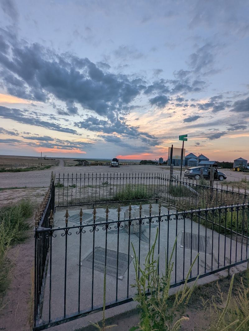
Forget checking business hours before you go. The marker is listed as open 24 hours, seven days a week.
That flexibility makes planning easy. You can swing by early in the morning, during midday, or on the way to an evening stop.
Daylight is still your best friend for finding the road and reading the signs.
There’s no ticket booth or staff on site. It’s simply a landmark in the countryside.
Pack whatever you need, like water, snacks, or sunscreen, before leaving the interstate.
The surrounding land is rural, so stay on the road and around the monument area. Respect fences and nearby property.
Keeping things tidy helps the site stay welcoming.
Leave no trash behind, and don’t take pieces of the markers home. They’re part of the official boundary, not souvenirs.
Photos make much better keepsakes anyway.
Plan for a short visit, usually enough time for pictures and some reading. Pair it with a meal or fuel stop in Big Springs or Julesburg.
That way the detour feels like part of the adventure instead of an extra errand.
A Small Detour Worth A Spot On Your Next Westbound Drive
Not every great stop needs a gift shop. Sometimes a fence, a few markers, and a dusty road deliver plenty.
The Colorado – Nebraska Corner Border Marker won’t fill an entire afternoon. It will, however, give you a story you’ll probably tell for years.
Standing in two states and four counties tends to stick with people.
Its strength is how easy it is to reach. A few miles off Interstate 80 and a short gravel crawl get you there.
For travelers already heading through western Nebraska, that’s hard to beat.
Expect quiet, open land and a spot that rewards curiosity. Read the markers, take your photos, and maybe log the geocache.
Then get back on the road feeling a little smarter about the map.
I believe stops like this make road trips memorable. They break up the miles and spark questions in the car.
Who drew this line, and how did they ever find it out here?
So next time you pass Big Springs, glance south toward the fields. A corner of Colorado is waiting just down the road.
It would be a shame to keep driving.