This Virginia Trail Feels Like A Journey Into Narnia With Ancient Sandstone Passageways
A 20-acre maze of sandstone crevices sits near the top of a mountain, and it was carved during the last ice age. Wait, what?
A slot-canyon-style labyrinth in the Appalachians sounds like something a fantasy author would dream up.
The rock itself is roughly 400 million years old. Ice and permafrost likely pried its cracks wider, turning one solid caprock into a puzzle of narrow passageways.
And it gets better. This Virginia oddity sits near a 4,208-foot summit with 360-degree views waiting nearby.
The air inside the channels can even feel cooler, a bit like a cave. How do you actually get there? Let me tell you!
A Stone Maze On A Mountaintop Sounds Made Up, But It Isn’t
Most mountain hikes end with a view. The Channels Natural Area Preserve ends with a view and a full-on stone labyrinth, which feels a little greedy in the best way.
Often called the Great Channels, the maze spreads across approximately 20 acres of sandstone blocks and deep crevices near Middle Knob on Clinch Mountain. The summit rises to 4,208 feet in Southwest Virginia, above miles of wooded ridges.
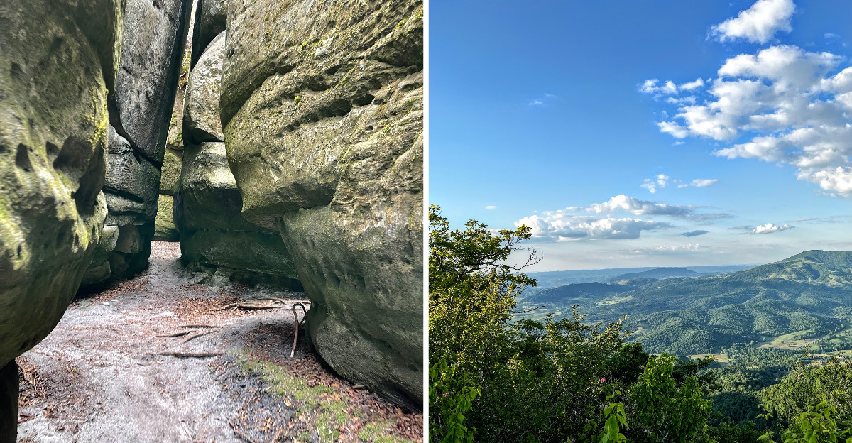
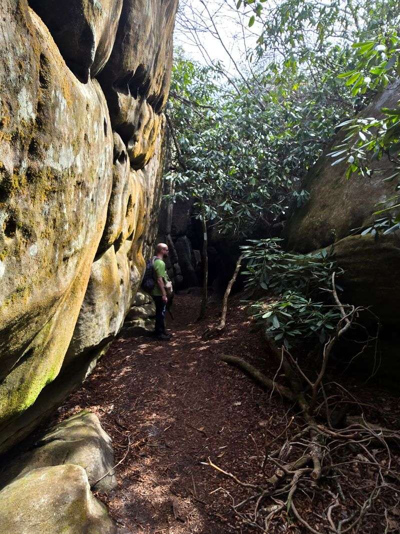
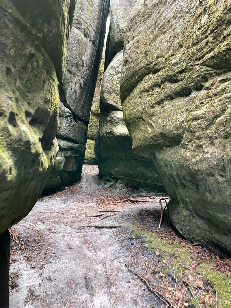
Walk down into the formations and the landscape changes. Massive walls rise beside narrow corridors, with passages that bend around corners or open into surprisingly spacious pockets. Tree roots stretch over some of the walls.
It resembles a desert slot canyon, except moss and ferns grow beneath leafy trees. Patchy sunlight reveals brown sandstone and green growth.
The interconnected corridors can become confusing. Some feel almost like miniature courtyards, while others are barely wide enough for one person to pass.
Notice the entrance and remember the route back rather than treating every passage like a shortcut. The hike gets you here, but the maze makes the day memorable.
Blame The Ice Age For These Wonderfully Weird Cracks
Roughly 400 million years ago, the sandstone that forms this maze began taking shape.
That’s older than the dinosaurs, which makes your oldest hiking boots look brand new.
The famous channels came much later, though. Geologists believe prolonged freezing conditions during the last ice age helped widen fractures in the exposed sandstone caprock.
The rock already contained natural joints. Water could enter those openings, freeze, and expand, gradually forcing neighboring sections farther apart.
Permafrost and repeated weathering likely contributed to the enormous blocks and long, straight-sided passages visible today.
Erosion played a role as well, wearing away material along the joints and helping shape the surfaces visitors see. The resulting maze wasn’t carved in a single event. Its formation involved ancient geology and later freezing conditions.
Look closely at the walls. Some surfaces are straight, while others curve or show shallow grooves. They reveal how sandstone responds to water and changing temperatures.
Those deliberately arranged-looking blocks belong to the same rock formation. Nature simply did an extraordinarily convincing job of building corridors without blueprints.
Your Calves Will Earn Every Inch Of This Climb
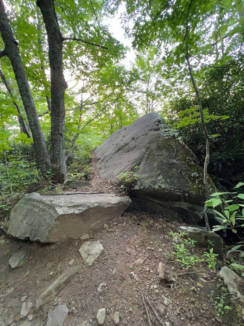
Nobody drives up to these rocks. Getting there means hiking, and the mountain makes you work for the reward.
The popular approach starts from Hayters Gap on Route 80. Follow the Brumley Mountain Trail about three to three and a half miles each way, roughly six to seven miles round trip.
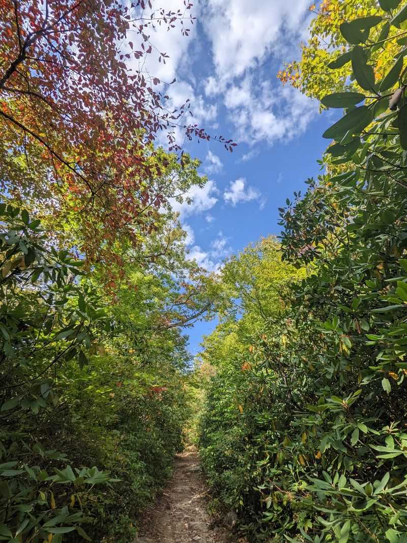
A gated old road leads into forest on a steadily rising trail. Expect about 1,200 feet of climbing, with rocky sections and switchbacks toward Middle Knob.
White diamond markers help identify the route. Near the summit, a spur passes an old lookout tower and descends into the channels. The final descent into the formations requires careful footing.
A longer alternative begins from Brumley Gap Road on Route 689. The Channels Trail can take eleven miles round trip from its lower parking area. Plan a full day for that route.
The Brumley Mountain Trail is currently open, though forest managers advise staying on the marked path and avoiding sections affected by earlier storms.
Ten Parking Spots Means Timing Is Everything
Ten. That’s the number of designated parking spaces at the popular Hayters Gap trailhead, and it can shape your whole visit.
The gravel lot sits on Route 80 near the county line. Parking on the highway shoulder is prohibited, so return later if it is full.
Weekdays and early mornings may offer better chances. Carpooling helps, too. If every space is occupied, spend time elsewhere in the area and return when a spot becomes available.
Keep the nearby private access road clear.
Navigate to the trailhead at 4250 Hayters Gap Road, Saltville, VA 24370. Other forest entrances lead to different hikes.
The preserve welcomes visitors from dawn until dusk, so plan enough daylight for the climb, exploring the maze, and returning to your vehicle.
Daylight hours vary seasonally. This Virginia preserve is a natural area rather than a staffed attraction, so visitors need to plan independently.
Trail access is available throughout the year, but changing mountain weather can affect conditions. A little flexibility goes a long way when the parking area is this compact.
Bring Everything, Because The Mountain Offers Nothing But Scenery
Bring Everything, Because The Mountain Offers Nothing But Scenery
Packing light sounds nice until you realize what’s missing. The preserve has no restrooms, no trash cans, and no drinking water.
That matters on a sustained uphill walk. Bring enough water for the entire round trip and something easy to eat when you reach the top. Use facilities before reaching the trailhead.
Cell reception can be inconsistent, so save an offline map. A downloaded forestry map works without a signal.
Comfortable footwear with reliable traction helps on the gravel approach, rocky upper trail, and uneven floors of the channels.
Carry a small first-aid kit and an extra layer. Mountain conditions can change between the parking lot and summit, even on an otherwise sunny day.
Carry out every scrap of packaging. Leave the moss, ferns, and sandstone surfaces exactly as you find them.
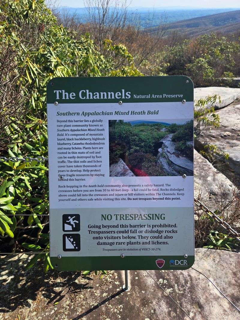
Rare plants here are sensitive to disturbance. Their sheltered habitat is part of the reason this mountain landscape receives special protection.
There are no developed picnic facilities, so keep the trail clear when taking a snack break. Preparation leaves more time to explore the maze.
Cave-Cool Air Lives Between The Rock Walls
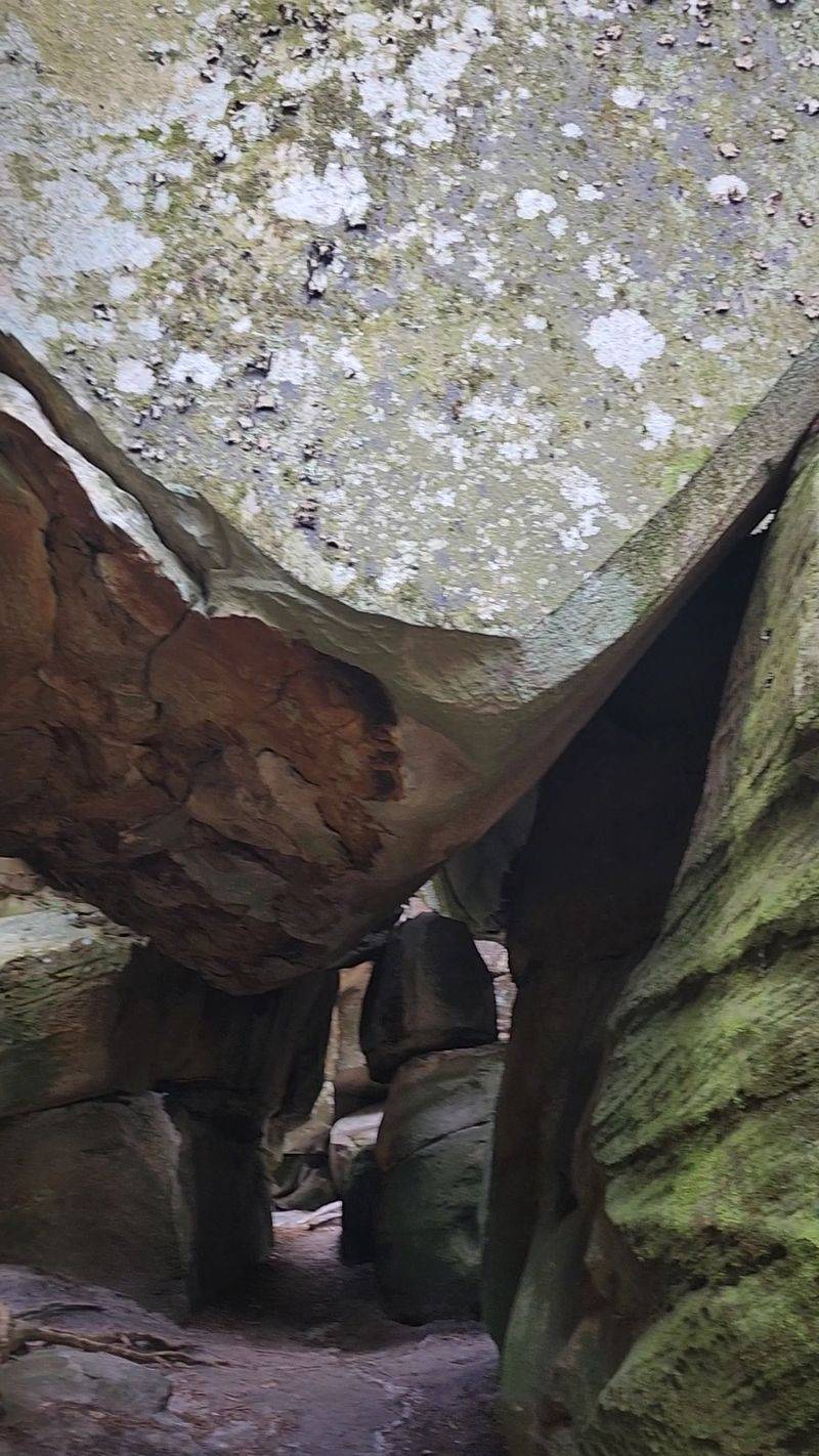
Step down into a shady crevice, and the air may suddenly change. Inside the channels, temperatures can feel cooler, much like inside an underground cave.
On a warm afternoon, that’s a welcome surprise after the climb.
High sandstone walls limit direct sunlight, while the sheltered spaces hold a different atmosphere from the open trail above.
Some corridors offer comfortable walking room. Others bend sharply, narrow between boulders, or pass beneath overhanging rock. There is plenty to explore without entering every opening.
Roots, damp patches, and sandstone steps make slow movement worthwhile. Watch for deep openings between blocks.
Moss and ferns give several walls a soft green covering. The plants thrive in sheltered, moist conditions and contribute to the almost storybook appearance of the passages. Leave the delicate greenery undisturbed.
Look up through the narrow strip of sky above. It can feel surprisingly far away.
The contrast is the memorable part: bright forest above, shadowy sandstone corridors below, and a cool breath of air between them.
Stand On Middle Knob And Watch Ridges Roll Forever
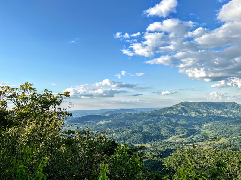
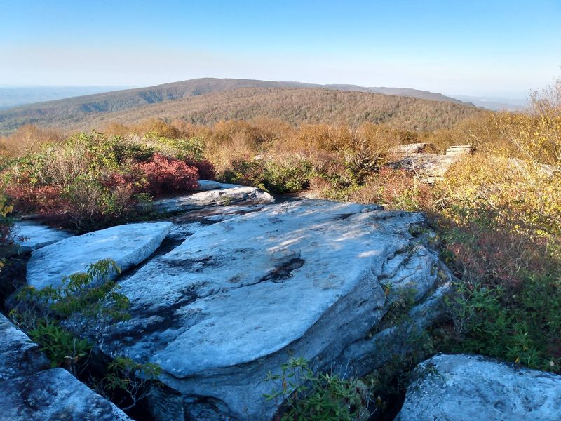
Ridge after ridge stretches toward the horizon around Middle Knob. The summit rises to approximately 4,208 feet, placing the Great Channels high above the surrounding valleys.
Before entering the labyrinth, the trail passes the remains of a lookout shelter and an old fire tower.
The tower is closed to climbing; enjoy nearby ground-level views. The aging structure is a reminder that these mountain ridges once served as an important lookout point across the forest.
Clear conditions reveal long views over the folds of Clinch Mountain and neighboring ridges. Trees and the summit terrain limit views from some spots.
It feels like two adventures together. First, forest hiking with occasional mountain views. Then comes the descent among sandstone blocks.
Autumn gives the ridges vivid colors, while spring brings fresh foliage along the slopes. In winter, leafless branches reveal more distant terrain.
Pause at a suitable spot before entering the maze. Wide mountain views give way to intimate stone corridors. It’s not every Virginia hike that manages to make the sky and the ground equally fascinating.
A Young Preserve Guarding Some Very Old Rocks
April 2008 marks the official start date. That’s when the Channels Natural Area Preserve became Virginia’s 53rd state natural area preserve.
The Nature Conservancy bought the property in 2004, helping protect the forest and formations.
The state acquired the property in 2008 and dedicated 721 acres as a preserve. Much of the surrounding land had previously been used for timber production, giving the acquisition a broader conservation purpose.
Today the preserve sits within Channels State Forest, which encompasses 4,836 acres across Washington and Russell counties.
Two state conservation agencies share management. The surrounding forest remains a place for carefully managed natural resources as well as low-impact recreation.
Protection extends beyond the maze. Hardwood forests change with elevation. Rare Carolina saxifrage grows among moist rocks.
Camping isn’t permitted within the state forest or the preserve. Daytime hiking and wildlife watching are the main attractions.
Protected status helps future generations discover the passages. Respect trails and delicate plants. After all, a rock labyrinth millions of years in the making deserves visitors with good manners.