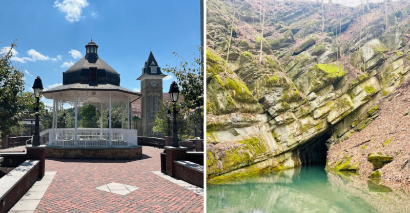
Pennsylvania’s Grand Canyon Drops About 800 Feet Along A 47-Mile Gorge You Bike Through
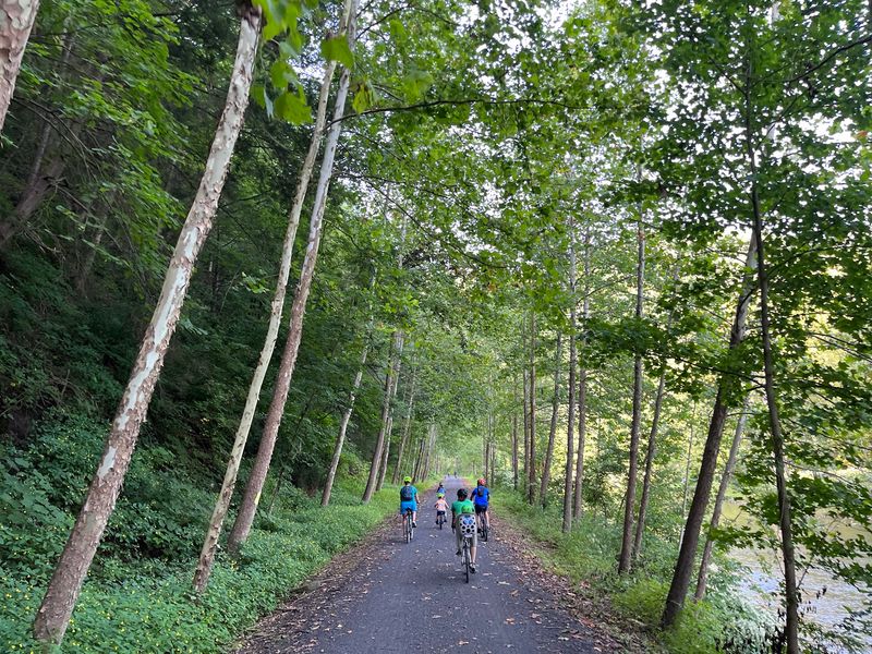
A canyon wall rises more than 800 feet above the bike path, and you get to pedal along the very bottom of it.
The gorge runs about 47 miles, and its deepest point near Waterville reaches roughly 1,450 feet. A creek rolls right beside the trail.
Bald eagles sometimes drift overhead like they own the place, which they kind of do.
I like how this whole adventure sits on an old railroad bed in Pennsylvania. That means the grade stays gentle, and the scenery does all the heavy lifting.
Your legs get a break while your eyes work overtime.
I can’t imagine a better way to see a canyon than rolling through it on two wheels. So how does a trail this dramatic stay this easy to ride?
A Canyon Floor Made For Two Wheels
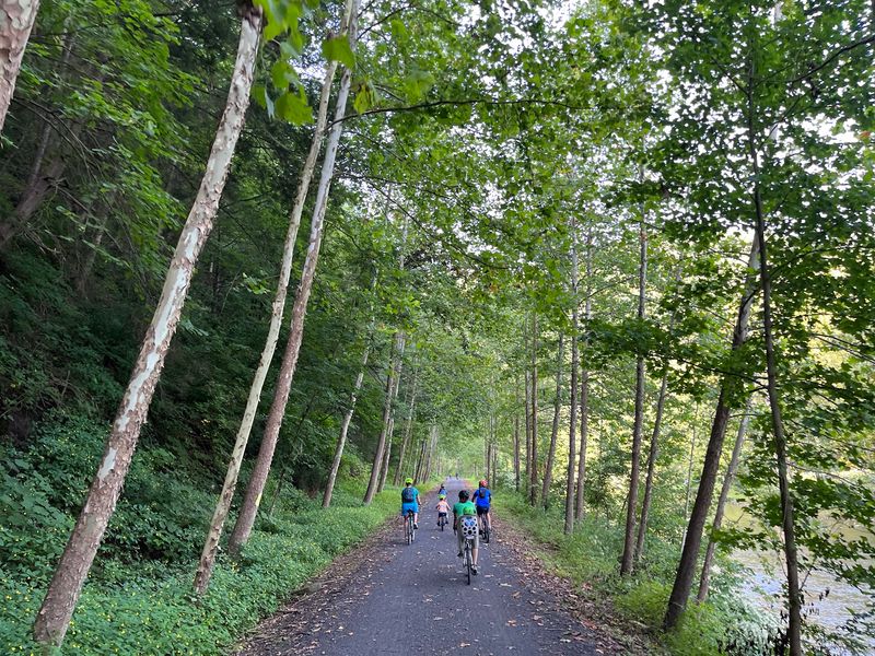
Most canyons make you hike down and sweat back up. The Pine Creek Rail Trail lets you skip the drama and ride the bottom instead.
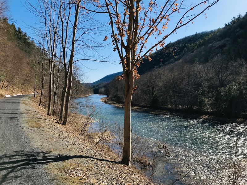
The trail follows Pine Creek through Pine Creek Gorge, nicknamed the Grand Canyon of Pennsylvania. The gorge stretches about 47 miles across the north-central part of the state.
Sources list the trail at roughly 62 miles, though some counts land closer to 60 or 65. Either way, that’s a lot of riding room.
It links Wellsboro Junction in the north with the Jersey Shore area in the south.
The path sits on a former railroad bed, so it stays wide and steady. You can bike it, walk it, ride horses on it, or cross-country ski it in winter.
Not many trails cover that many seasons with one surface.
Canyon walls tower above you for long stretches. In the deepest sections, the rim sits more than 800 feet overhead.
Meanwhile, you’re cruising beside clear water with barely a pedal stroke of effort.
USA Today once named it among 10 great places to take a bike tour. That’s a nice badge for a trail that started life hauling freight.
Honestly, the old trains never had it this good.
Ice Age Muscle Behind The Gorge
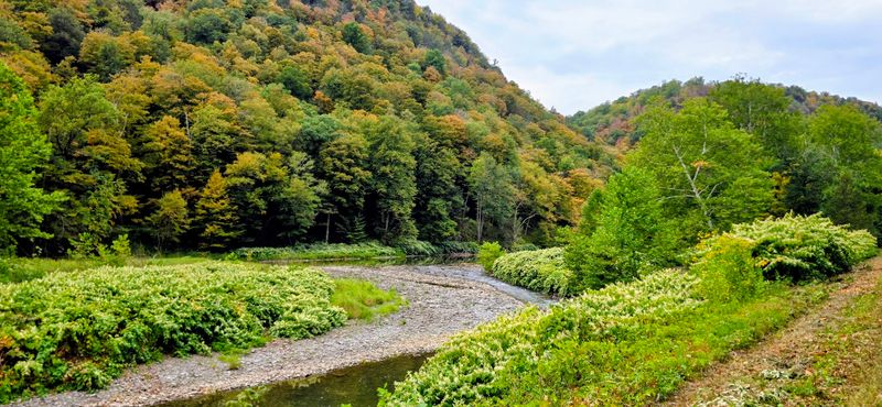
Glaciers deserve some credit here. About 20,000 years ago, ice blocked the creek’s old northward path and sent its water carving south.
That rerouted flow cut deep into the land, and Pine Creek kept chewing away for thousands of years. The result is a gorge that drops about 800 feet at its famous overlooks.
Near Waterville, the canyon gets even deeper. Its deepest point reaches around 1,450 feet, which is a serious number for Pennsylvania terrain.
The National Park Service took notice in 1968. That year, Pine Creek Gorge was designated a National Natural Landmark.
It joined a select list of places considered outstanding examples of the country’s natural history.
I believe that background makes the ride feel richer. You aren’t just rolling past pretty trees.
You’re traveling through a channel shaped by ancient ice and steady water.
Look up at the slopes as you pedal. Every layer of rock tells part of the story, even if nobody posted a sign explaining it.
Geology rarely gets this much screen time on a bike ride, and it earns every second of it.
Not bad for a creek that simply got redirected.
Trains, Timber And A Very Old Highway
Long before bikes showed up, people were already moving through this valley. For centuries, the gorge served as a major travel route for Native Americans.
Later, the lumber industry arrived in a big way. The region became a key timber area, and the hillsides you see now look very different from those busy logging years.
Railroads followed the creek because the valley offered a natural corridor. Trains rolled through here for decades.
Some longtime fans of the gorge remember seeing them as recently as around 1970.
Once the rails went quiet, the old bed found a second career. It became the Pine Creek Rail Trail, keeping the same smooth curves and easy grade the trains once needed.
The Civilian Conservation Corps also left a mark during the 1930s. Evidence of that era can still be seen at Colton Point State Park on the western rim.
I like how the layers stack up here. Ancient footpaths, timber booms, steam and steel, then quiet gravel and bike tires.
Every chapter used the same narrow passage.
That kind of continuity is rare. The trail feels new, yet it follows one of the oldest routes in this part of Pennsylvania.
The Downhill Secret Your Legs Will Love
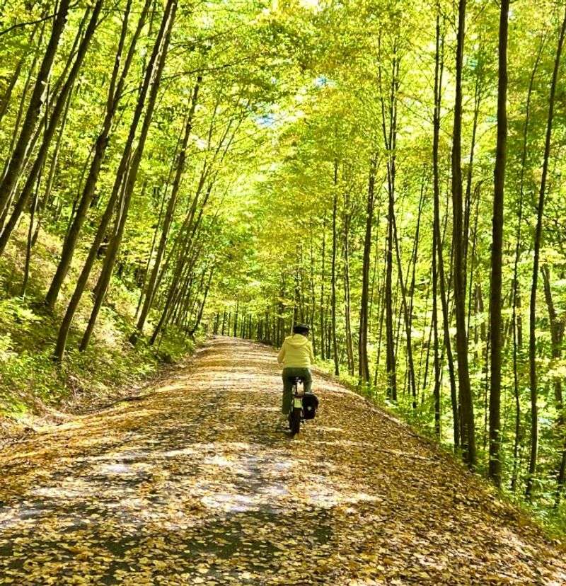
Here’s a happy little quirk. Ride from north to south, and you’ll be heading on a gentle, barely noticeable downhill grade.
Railroads needed mild slopes, and that engineering pays off today. The trail stays close to flat for most of its length, which makes long distances feel far more manageable.
Your effort mostly depends on wind, mileage, and how often you stop for photos. And you’ll stop a lot.
The scenery practically demands it every few minutes.
The surface is mostly hard-packed gravel, with fine, firm stone that bike tires handle well. Some stretches near the ends are paved.
Hybrid bikes and mountain bikes are easy fits here.
That gentle profile opens the trail to many riders. Families with kids, casual cyclists, and longtime riders easing back into the saddle can all find a comfortable pace.
Strollers and pull wagons roll along without much fuss too. Walking groups can cover a few miles and still enjoy the canyon without needing hiking boots.
Of course, a flat trail is still a long trail. Sixty-plus miles will humble any backside eventually.
Pick a section that fits your day, and let the slope do some quiet favors.
Where The Canyon Walls Rise Highest
Want the most canyon per mile? Aim for the stretch between Darling Run and Blackwell.
This section runs through the main part of the Grand Canyon of Pennsylvania. The walls climb steeply on both sides, and the creek bends right alongside the path.
Darling Run sits a few miles south of the northern end near Ansonia. Blackwell lies farther down the gorge to the south.
Between them, you’ll find Tiadaghton, a camping area that makes a natural halfway goal.
Riding from either end to Tiadaghton and back can make a solid outing of roughly 15 miles round trip. That’s a reasonable day for most casual riders.
Overhead, the rim sits far above you. The famous viewpoints at Leonard Harrison and Colton Point State Parks perch up there, roughly 800 feet higher.
From the trail, you get the opposite view, looking up instead of down.
Fall turns this part of the gorge into a color show. Gold, orange, and red leaves climb the slopes like someone spilled a paint set.
Spring brings fresh green and stronger creek flow. Either way, the Pine Creek Rail Trail makes this canyon section feel wonderfully close.
Eagles, Otters And The Occasional Porcupine
Bald eagles over a bike path. That alone should get your helmet buckled.
Pine Creek Gorge offers real chances to spot wildlife from the trail. Bald eagles show up along the creek, and they’re a highlight for plenty of riders.
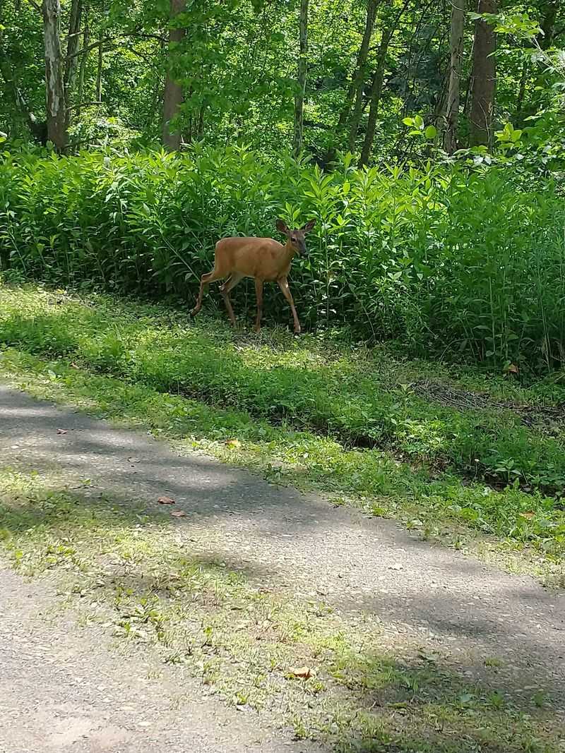
Black bears live in the area too, along with deer, river otters, and wild turkeys. Deer sometimes cross the path, so keep your eyes up and your speed reasonable.
Smaller surprises turn up as well. A porcupine climbing a tree isn’t out of the question.
Snakes may sun themselves near the trail in warm weather, so give them plenty of room.
Birds keep the soundtrack going in the woods. The creek adds its own steady background music, and the whole place can feel calm and lively at once.
Good habits help everyone here. Keep a respectful distance from animals, never feed them, and pack out what you bring in.
Binoculars are a smart addition to any bag. A quick pause at a bend in the creek may reward you with an eagle perched in a tall tree.
Patience pays off out here, even for riders who usually hate slowing down.
Old Rail Bridges And Creekside Breaks
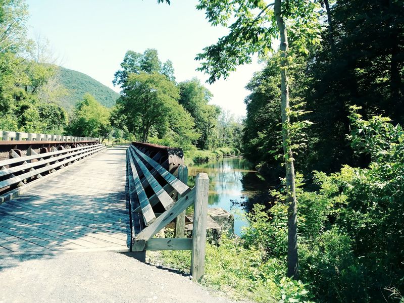
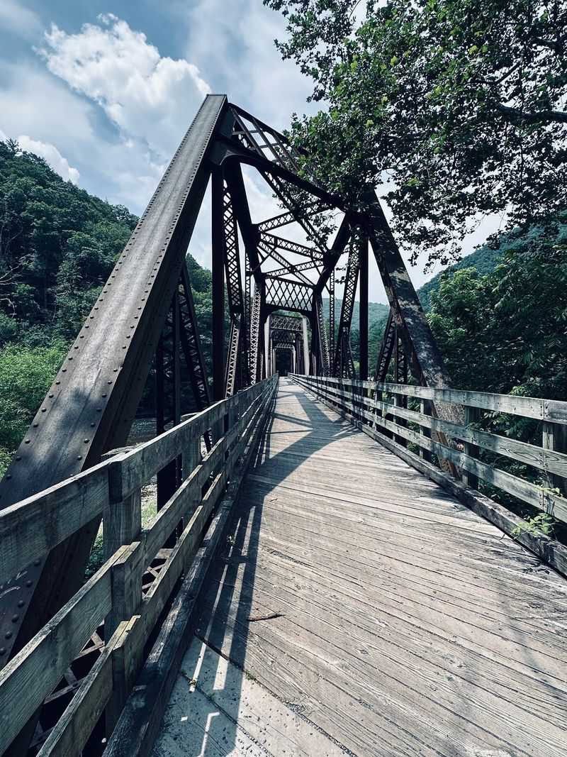
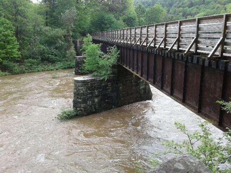
Crossing a creek on a former railroad bridge never really gets old. The Pine Creek Rail Trail has several of these crossings, and each one hands you a fresh angle on the water.
Bridge views rank among the best parts of the ride. You can pause mid-span, look up and down the valley, and watch the creek slide beneath you.
Those crossings also make great photo spots. The open sky over the water gives better light than the shaded wooded sections.
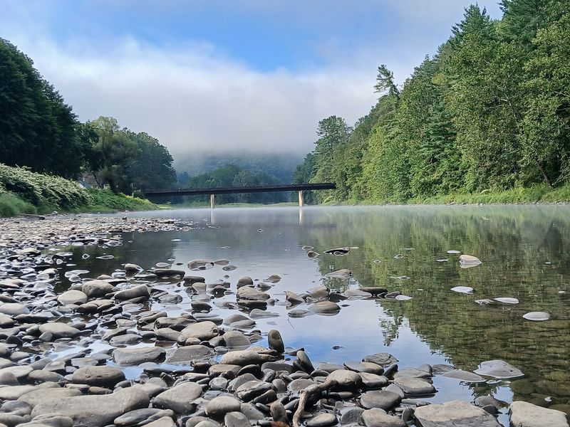
Along the banks, you’ll catch small waterfalls trickling down the hillsides. The creek itself runs clear in many places, with rocks visible below the surface.
Hot days invite a quick splash. Some riders set camp chairs right in the shallow water to cool off after a ride.
That’s a pretty brilliant use of a folding chair.
Benches and picnic tables appear along the way too. They make easy spots for a snack, a water refill, or just a few quiet minutes.
I like how the trail never rushes you. Bridges, benches, and bends in the creek all seem to suggest the same idea.
Slow down and look around.
Ice Cream Stops In Tiny Trail Towns
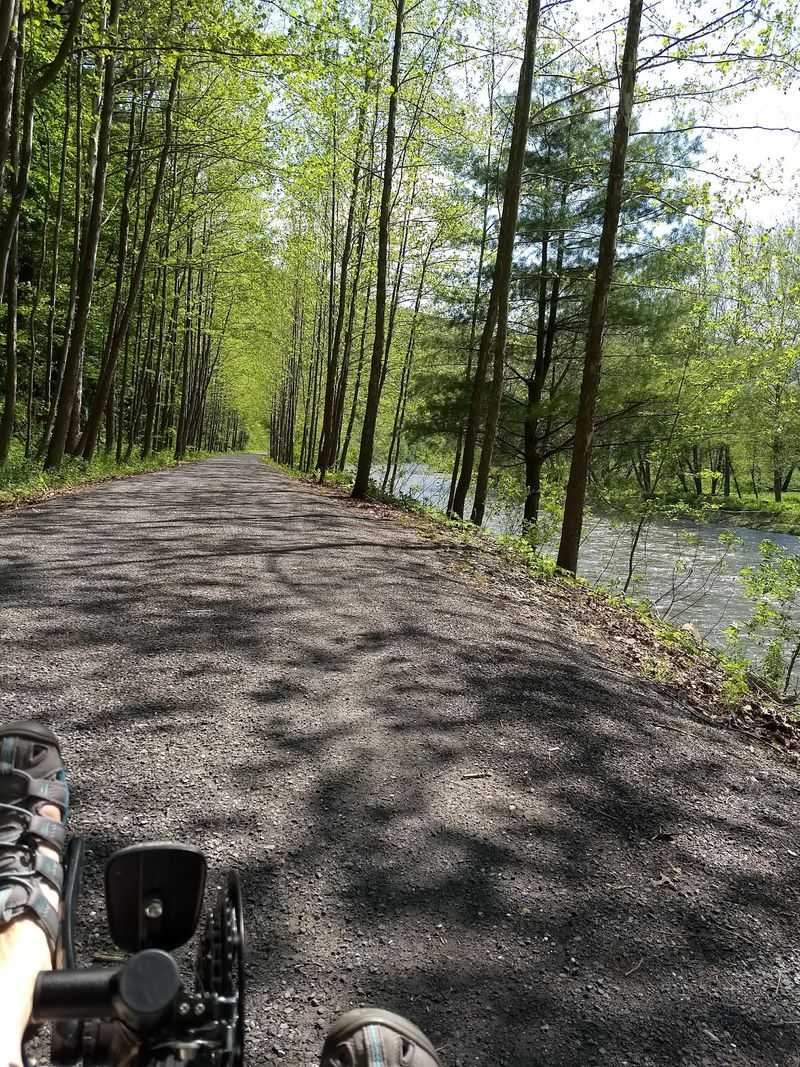
Few things motivate a bike ride like the promise of ice cream. Luckily, the southern stretch of the trail passes through small villages with friendly stops.
Slate Run, Cedar Run, and Blackwell sit along the route. Each one offers a break from pedaling and a peek at life in these quiet creekside communities.
Wolfe’s General Store has been a starting point for rides out of Slate Run. Farther north, Miller’s General Store at Blackwell sits a short distance off the trail.
Cedar Run, roughly midway between those two, has a shop with ice cream and sandwiches. That makes a ride from Slate Run to Blackwell feel well fueled.
Hours at these small stops can change with the seasons. Check ahead so you don’t arrive dreaming of a cone and find a locked door.
Restrooms and rest areas also appear along the trail. They’re handy, especially on longer rides between villages.
I believe these little towns add real personality. The canyon gives you scenery, but the villages give you a reason to stop, stretch, and celebrate the miles.
A cold treat beside Pine Creek just tastes like a small victory.
Paddles, Trout And Wagon Rides
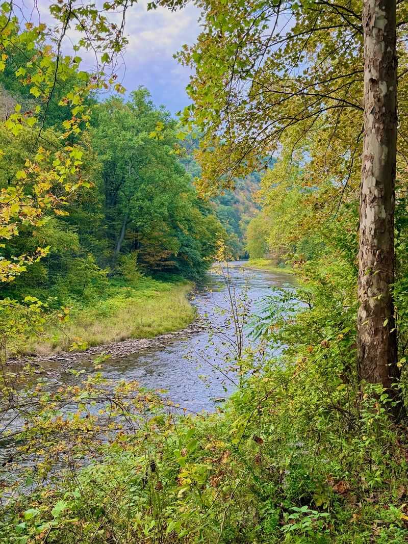
The bike might be the star, but the creek steals plenty of scenes. Pine Creek supports kayaking, canoeing, and rafting, with spring bringing the liveliest water.
Fly fishing for trout draws anglers to the creek too. Quiet pools and riffles run alongside the trail, so you’ll often pass someone casting a line.
Horseback riding is allowed on designated paths. Horse-drawn wagon rides are another option in the area, and covered wagons can appear along the trail.
Hikers have choices beyond the rail trail. The steep Turkey Path drops from the rims at Leonard Harrison and Colton Point State Parks down to the canyon floor.
The West Rim Trail offers a longer backpacking-style trek.
Winter changes the whole menu. Cross-country skiing takes over the trail when snow falls, giving the gorge a hushed, wintry feel.
Camping is available nearby, including Colton Point State Park from April through October. Campgrounds along the trail also make multi-day trips possible.
Pennsylvania doesn’t offer many spots where one valley handles this many activities. Bring a bike, a paddle, or a fishing rod.
You’ll probably wish you’d brought all three.
Who Feels Right At Home On This Trail
Families with young kids fit right in. The wide, mostly level path gives little riders room to wobble without much worry.
Retirees looking for a scenic, affordable outing will find plenty to love. Walking a few miles from any trailhead still delivers creek views and fresh forest air.
Serious cyclists have options too. Riding the full length is a big day, and plenty of riders split it into sections or stretch it over a weekend.
Big groups can manage it as well. The trail is wide enough to spread out, and it rarely feels packed.
Photographers and painters get endless material. Seasonal colors, low water revealing bright plants, and misty mornings make the gorge a favorite subject.
A few cautions help. Some sections cross roads without stop signs or traffic lights, so slow down and watch carefully.
Bring plenty of water on warm days. Summer heat in the valley can sneak up on you fast.
Anyone craving quiet will feel a sense of relief here. The creek, the trees, and the slow pace make the Pine Creek Rail Trail an easy place to unplug and simply enjoy the ride.
Getting There, Plus A Map Tip
Cell service mostly disappears in the gorge, so plan before you leave home. A printed trail map is a smart move, and a detailed regional map works even better.
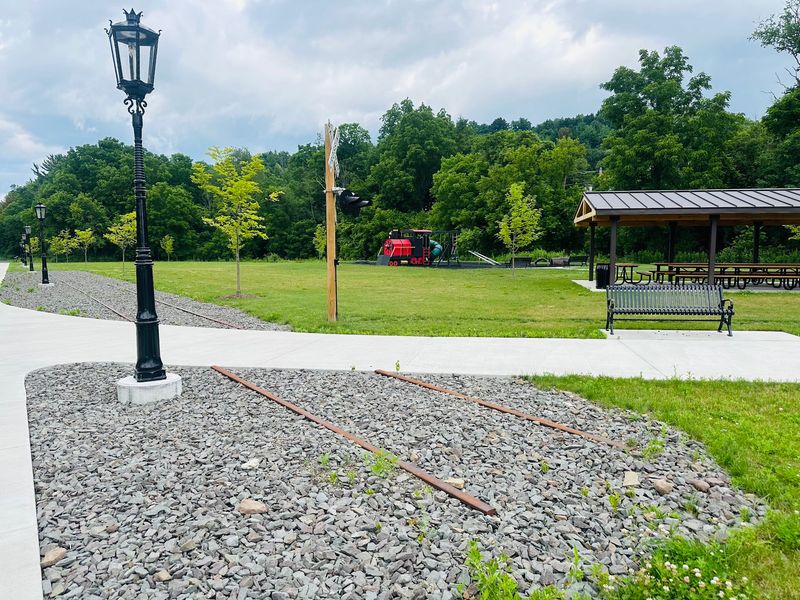
The northern end sits near Wellsboro. The Wellsboro Junction trailhead offers a train-themed playground, trail information, and a neat bridge to start things off.
Want to see the canyon from above first? Leonard Harrison State Park sits at 4797 Route 660, Wellsboro, PA 16901, about 12 miles west of town.
Its overlooks show the gorge from roughly 800 feet up.
Colton Point State Park sits on the opposite rim. Visiting both gives you a top-and-bottom look at the whole landscape.
Pine Creek Outfitters in Ansonia rents bikes and boats and offers shuttle services. A shuttle lets you ride one way, which is handy on a trail this long.
The area is open year-round, though some facilities and activities run seasonally. Hours and rental availability shift through the year, so check ahead before making the drive.
Trailheads spread along the route, giving you plenty of starting points. Pick one that matches the section and mileage you’re after.
A Ride That Earns A Return Trip
Some outings are nice once. The Pine Creek Rail Trail feels more like a place you’ll keep coming back to.
One visit might cover the canyon section near Darling Run. Another could take you through Slate Run and Cedar Run with ice cream breaks between villages.
Each season changes the mood. Spring brings rushing water and paddlers, summer invites creekside splashing, fall paints the walls, and winter hands the trail to skiers.
I can’t imagine a friendlier way to see a canyon of this size. The grade stays easy, the views stay big, and the eagles might even make an appearance.
For Pennsylvania residents, it’s also an easy sell. You don’t need a plane ticket to stand beneath walls 800 feet tall.
You just need a bike, some snacks, and a free day.
Bring a map, plenty of water, and patience for photo stops. Leave room in your schedule for lingering on bridges.
Fair warning, though. Once you’ve pedaled through this gorge, ordinary bike paths may start feeling a little flat.
That’s a small price for a ride this good.