A Single Idaho Highway Follows Two Wild Rivers For Nearly 100 Miles Without A Town
Nearly 100 miles of paved highway in Idaho pass without a single town along the way. No stoplights, no main street, and long stretches with no cell signal at all to distract you.
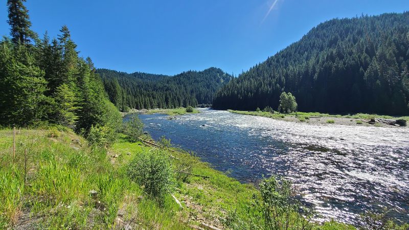
Instead, the road hugs a river whose Nez Perce name means rough water. Lewis and Clark crossed these same mountains in 1805, and they did not find it easy one bit.
I like how the whole trip nudges you to slow down and look around. Old-growth cedars, whitewater, forest hot springs, and wildlife all line the same two-lane road.
I can’t imagine a better excuse to top off the tank and forget about texting for a day. So what exactly waits out there along a road this empty, and why do so many Idahoans keep driving it?
Two Wild Rivers Share One Very Lonely Highway
Few highways get to brag about two federally protected rivers in one trip. U.S.
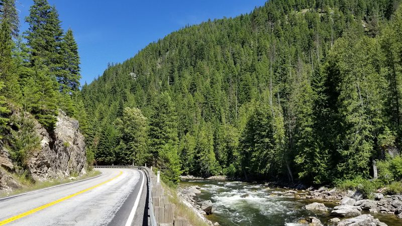
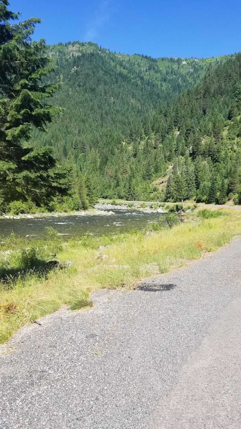
Highway 12, the Northwest Passage Scenic Byway, follows the Middle Fork of the Clearwater and then the Lochsa River.
The handoff between rivers happens at Lowell, a tiny spot on the map in north-central Idaho. There, the Lochsa and the Selway meet to form the Middle Fork of the Clearwater.
From Lowell, the road heads east along the Lochsa toward Lolo Pass on the Montana line. That stretch runs close to 100 miles with no town interrupting the view.
Both rivers carry the Wild and Scenic label, a federal designation meant to protect free-flowing water. The Lochsa runs undammed, so its moods change with every season.
The highway itself is a paved two-lane road squeezed between steep canyon walls. Pullouts appear often, which is handy when the scenery keeps demanding attention.
Most of the route passes through the Nez Perce-Clearwater National Forests. Expect forest, rock, and river, then more forest, rock, and river, in the best possible way.
Lewis And Clark Would Have Traded Anything For This Pavement
Long before asphalt, the Nez Perce people traveled these mountains on the Lolo Trail. They used the route for generations to cross the rugged Bitterroot Mountains.
Lewis and Clark followed that trail in 1805, then again on their return in 1806. Their crossing of these ridges ranks among the hardest stretches of the whole expedition.
Lewis and Clark leaned on Nez Perce help after that tough crossing. Without it, the expedition’s story might read very differently.
Today’s highway runs close to that historic path, though with far better footing. Construction took decades, and the road was finally completed in the early 1960s.
Historical markers pop up along the shoulder, so a quick stop turns into a short lesson. Reading them while the river rushes nearby makes the old stories feel close.
The Lochsa Historical Ranger Station sits roughly 48 miles east of Kooskia on Highway 12. It’s listed on the National Register of Historic Places and shows early forest management in remote country.
Consider rangers working out here with no paved road at all. Suddenly, a little missing cell signal seems like a very small complaint.
The Rough Water Name Is No Exaggeration
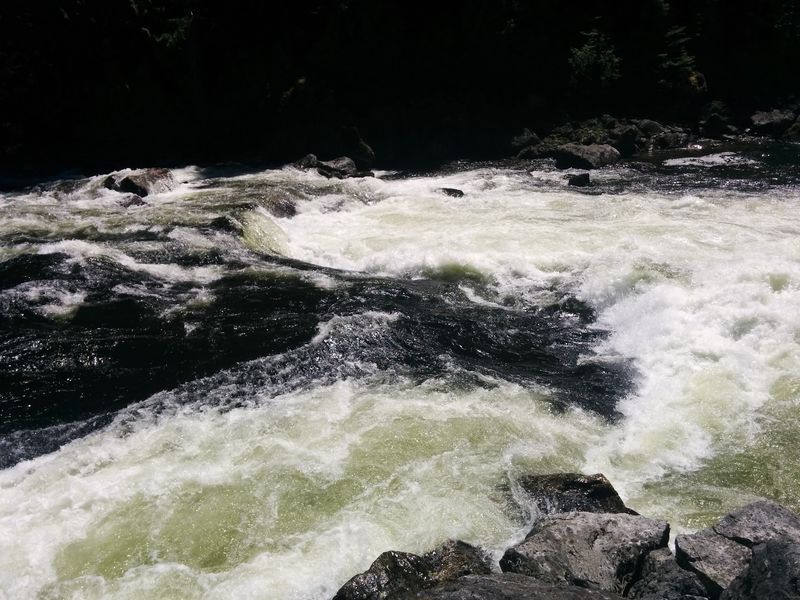
Lochsa comes from a Nez Perce word meaning rough water, and the river takes that seriously. Its rapids range from Class II to Class IV, with plenty of the bigger kind.
Spring brings the wildest ride, when snowmelt pushes the river high and fast. Rafters and kayakers time trips around that peak window, which carries into early summer.
Snowmelt timing shifts every year, so flows can change quickly from week to week. Checking current river levels before launching is simply smart planning.
Boat launches and access points sit right off Highway 12. That makes planning easier, whether the trip lasts one afternoon or several days.
Not every stretch roars, either. Calmer sections later in the season suit scenic floating and swimming when the weather warms up.
Still, the Lochsa runs cold and powerful, so beginners belong on guided trips. Licensed outfitters in the area know which rapids deserve respect.
Watching from a pullout counts as fun too. Seeing rafts vanish into a wave train and pop back out beats most roadside entertainment in Idaho.
Bring a jacket, since mornings in a deep canyon can run cool. Your passengers will thank you for the extra layer.
Pack The Fly Rod And Keep The Binoculars Handy
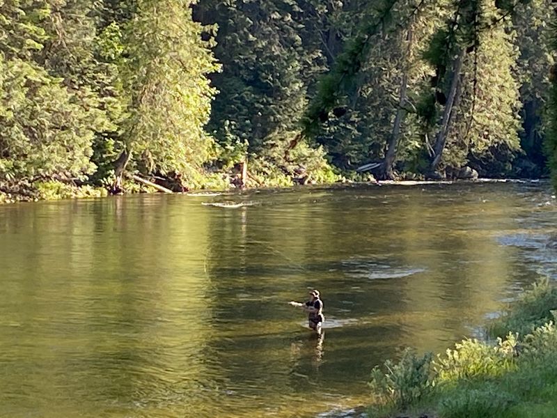
Clear, undammed water makes the Lochsa a magnet for anglers with fly rods. Cutthroat and rainbow trout live here, along with steelhead and salmon in their seasons.
Catch-and-release rules often apply, which helps keep the fishery healthy. Idaho Fish and Game regulations change, so read the current rules before casting.
Fly fishing gets plenty of love here, with long riffles and clear pools. Patience matters more than fancy gear on a river this wild.
Easy access from the highway means a fishing break can happen almost anywhere. Pull over, walk down, and the river handles the rest.
The wildlife list runs long too. Elk, deer, black bears, and moose all call the Lochsa watershed home.
Mountain goats sometimes appear on steep slopes, and harlequin ducks favor fast water. Eagles, ospreys, and great blue herons work the river from above.
Bear country rules apply, so store food properly and give every animal plenty of space. A moose in a meadow looks calm until it decides otherwise.
Keep binoculars on the dashboard for this drive. Spotting an osprey diving for a fish beats any radio playlist.
Cedars So Big They Make Your Car Look Tiny
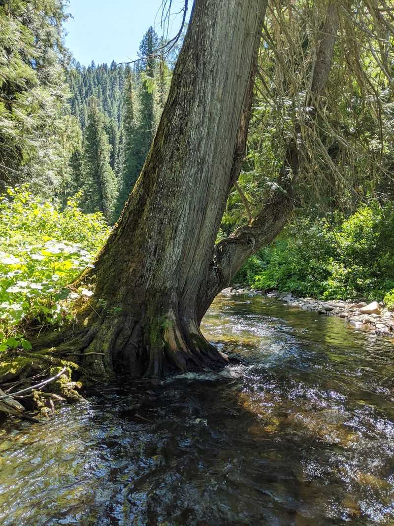
About 12 miles from the Montana border, the trees suddenly get serious. The DeVoto Memorial Cedar Grove holds western red cedars that tower over 100 feet tall.
Some trunks reach around six feet across. Standing next to one makes any car in the parking area look like a toy.
A gentle interpretive trail loops through the grove, so families with little hikers can manage it. The path keeps things easy without skipping the big trees.
The grove honors Bernard DeVoto, a historian and conservationist. He edited a well-known edition of the Lewis and Clark journals, which ties neatly back to the highway.
It’s a natural picnic stop on a long drive. Stretching your legs under ancient trees beats stretching them beside a gas pump.
Shade in the grove can feel welcome on a warm summer afternoon. Quiet comes easy here too, with the river close by.
Photographers should plan extra time, since the scale is hard to capture in one shot. Tilting the camera straight up usually does the trick.
For a road with no towns, it’s a fitting landmark. These cedars were here long before any highway sign.
Warm Pools Waiting At The End Of A Forest Trail
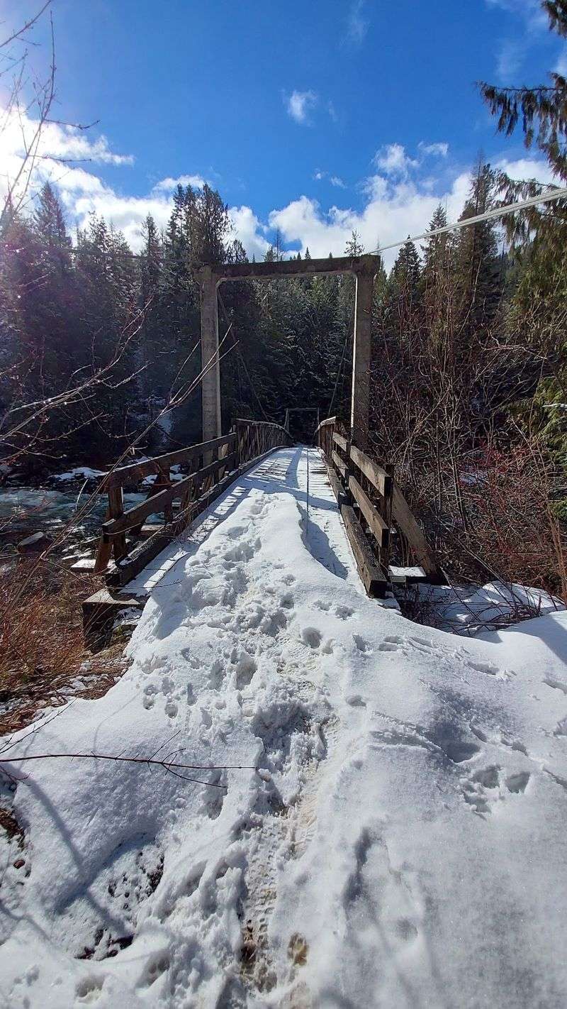
Warm water in a cold-river canyon sounds almost too good, yet two hot springs deliver. Jerry Johnson Hot Springs and Weir Creek Hot Springs both sit off Highway 12.
Neither one is a roadside soak. Each requires a hike through the forest, usually somewhere between 30 minutes and an hour and a half.
That effort is part of the appeal. The pools feel wild, surrounded by trees instead of concrete decks and snack bars.
Trail conditions vary, especially in winter when snow and ice can make footing tricky. Good boots and a headlamp make sense on shorter winter days.
Leave-no-trace habits matter a lot at popular springs like these. Pack out everything you bring, including any trash you find along the way.
Soaking spots like these are not developed resorts. There are no lifeguards, and natural pools can run hotter or cooler than expected.
Bring water to drink, because soaking and hiking together can be tiring. A small towel and dry layers make the hike back much happier.
After a day of rafting or driving, a warm soak feels like a reward. Just test the water first and keep an eye on the clock before dark.
Gas Up, Download Maps, And Pick A Riverside Campsite
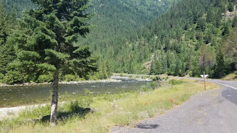
Planning matters here, because services are scarce between Lowell and Lolo Pass. Fill the tank in Kooskia on the Idaho side or Lolo on the Montana side before setting out.
Cell service is spotty or missing along much of the route. Download maps ahead of time, and tell someone your plans for the day.
Directions are simple: the Lochsa River follows U.S. Highway 12 in north-central Idaho.
There’s no street address, just mile after mile of roadside pullouts.
Campgrounds line the way, from developed sites to simpler riverside spots. Wilderness Gateway and Apgar offer picnic tables, fire rings, and vault toilets, with drinking water at some sites.
Wilderness Gateway is large and even handles horse trailers. RVs fit at many campgrounds, though full hookups are not part of the deal out here.
Opening seasons vary by campground, so check with the Nez Perce-Clearwater National Forests before driving. Arriving earlier in the day gives you a better shot at an open site.
Winter brings snow, so carry chains and an emergency kit. A slow, steady pace works best on the curves any time of year.
A Mountain Pass Finish Worth The Long Haul
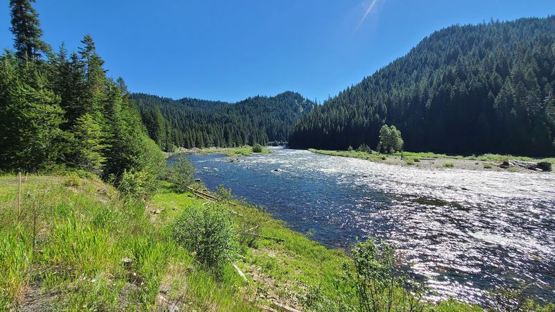
At the top of the drive, the highway climbs to Lolo Pass at 5,233 feet. The Lolo Pass Visitor Center sits right at the Idaho-Montana line.
Exhibits cover the Nez Perce people and the Lewis and Clark Expedition. A bookstore inside carries titles on local history and nature, plus a few souvenirs.
The Glade Creek Trail starts nearby and runs about a mile through mountain meadows. It’s an easy leg stretch after hours of curves along the Lochsa River.
The center makes a natural bookend to the drive. Start or finish here, and the history along the river clicks into place.
So who is this drive for? Motorcyclists, anglers, rafters, campers, and anyone who enjoys a long road with few interruptions.
It’s less ideal for travelers who need constant signal or a coffee shop every half hour. Fair warning: the nearest latte stays far behind you.
Driving the full stretch also earns bragging rights at any Idaho gathering. Not many highways cover nearly 100 miles without a single town.
The Lochsa rewards patience, curiosity, and a full gas tank. Bring all three, and this river road will likely earn a repeat trip.