An Eerie Ghost Town Is Lurking In Maryland And It Feels Straight Out Of A Nightmare
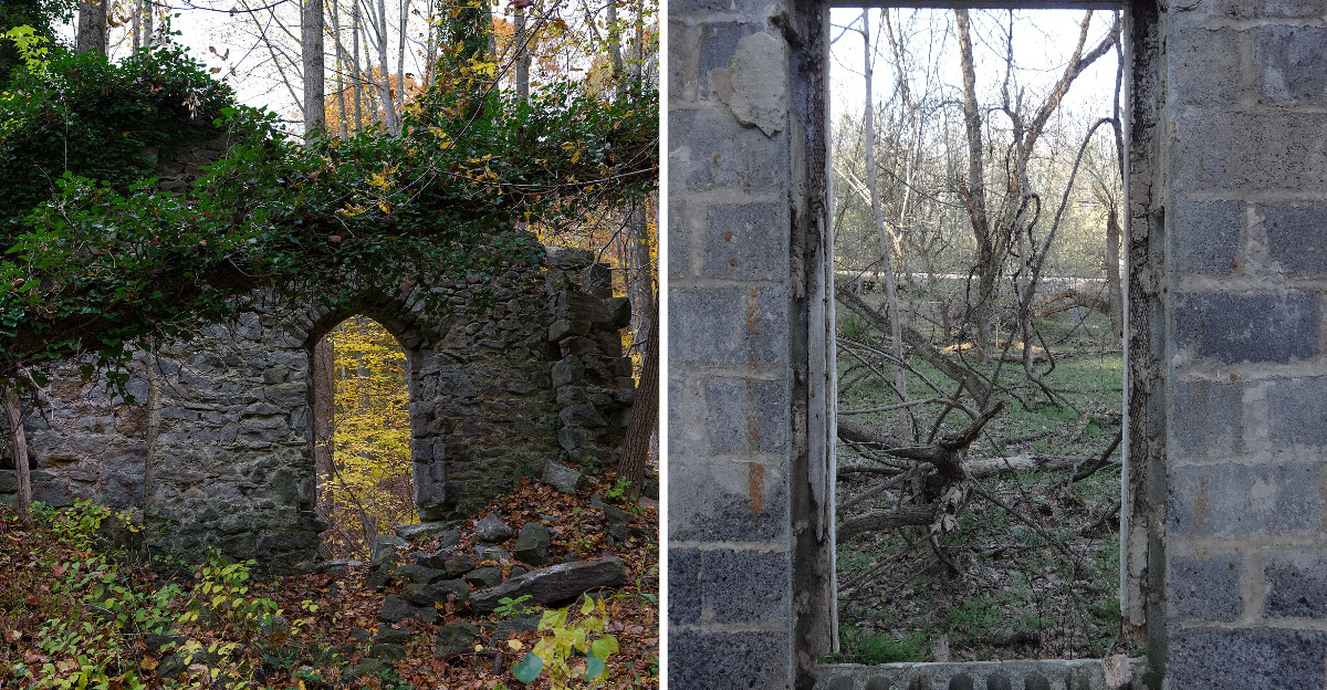
A wall with no roof. Rust in the weeds. A river rushing past like nothing ever happened.
Creepy enough?
Maryland hides the remains of an old mill town where nature has slowly taken back streets, foundations, and pieces of everyday life.
The silence feels strange because this place was once busy with families, work, shops, and routines.
Then everything changed. Now the ruins sit among trees and trails, giving the whole area a movie-set quality that is equal parts beautiful and unsettling.
You come for the ghost-town mood, but the real history is what makes the place linger in your mind.
A Mill Town Called Elysville
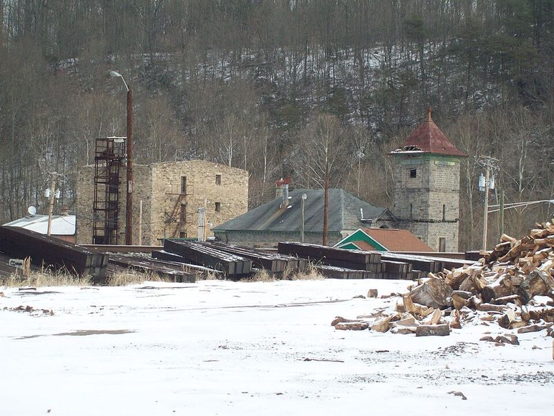
The industrial story here reaches back to the early nineteenth century. By the 1820s and 1830s, textile manufacturing was developing along this stretch of the Patapsco River.
The settlement became known as Elysville, a name connected to the family behind its early textile operation.
Ownership changed repeatedly during the following decades. By the mid-nineteenth century, the mill and surrounding community were known as Alberton.
The next major name change came in 1940, when the C.R. Daniels Company purchased the mill property and company village. Daniels is the name that eventually stuck.
The railroad played a huge role too. The B&O laid its original route through this section of the Patapsco Valley in 1831.
Parts of that early alignment proved too winding and were replaced over time, but hikers can still follow portions of the abandoned railroad grade today. Old bridge supports remain visible near the river.
By 1915, the mill employed about 400 workers and operated roughly 14,000 cotton spindles. Canvas and other cotton products became central to its business.
The complex eventually included workshops, power equipment, and facilities for several stages of textile production. It even generated electricity for the factory and surrounding town.
By 1940, company property included 118 homes, most with about five rooms. Nearly everything connected to daily life developed around the mill.
The Daniels Area is now part of Patapsco Valley State Park. The official Daniels trailhead is at 2090 Daniels Road in Ellicott City
Life Inside A Company Village
Imagine a town where the company owned not only the workplace but much of the community around it.
That was life in Daniels for decades.
The company controlled the houses and was the dominant employer in the immediate area. Workers rented homes on company property, creating a community closely tied to the mill.
A general store handled everyday supplies.
Two schools served children on opposite sides of the river, since Daniels stretched across both Howard and Baltimore counties.
Residents also had a library and bowling alley. A 20-member community emergency brigade was another part of town life. Three churches served the community at different points in its history.
The stone St. Stanislaus Kostka church stood on the Baltimore County side, while a Pentecostal congregation arrived later in the town’s history.
Gary Memorial stood on higher ground across the river and remained one of the last intact buildings associated with Daniels.
That congregation continued long after the company village disappeared, but it officially closed on October 1, 2026. The historic building remains on private property, so park visitors should not enter the site without permission.
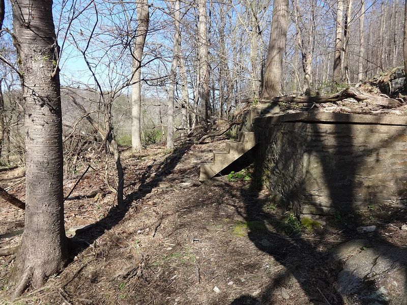
Foundations, road traces, church remains, and abandoned objects replace the rows of homes that once filled the valley.
When The Village Began To Disappear
The biggest change started before the river reshaped the site. By the late 1960s, roughly 90 families were still associated with Daniels.
Maintaining the aging company housing had become increasingly difficult, especially as modern infrastructure requirements grew.
In 1968, the company removed much of the village housing rather than make extensive upgrades.
Residents had to relocate, and many of the familiar streets and houses disappeared before the decade was over. Then Tropical Storm Agnes reached Maryland in June 1972.
Heavy rainfall sent the Patapsco far beyond its usual level and caused extensive damage throughout the valley.
The Daniels mill suffered heavily during the event and never resumed production at the river site.
Because much of the company housing had already been removed, the flood encountered a village that was far less populated than it had been only a few years earlier.
The company moved its manufacturing operation away from the old riverfront complex and eventually established a permanent location elsewhere in Ellicott City.
The original mill site and the surviving Gary Memorial property are private, and Maryland DNR specifically tells visitors not to trespass there.
Church Ruins On The Hillside
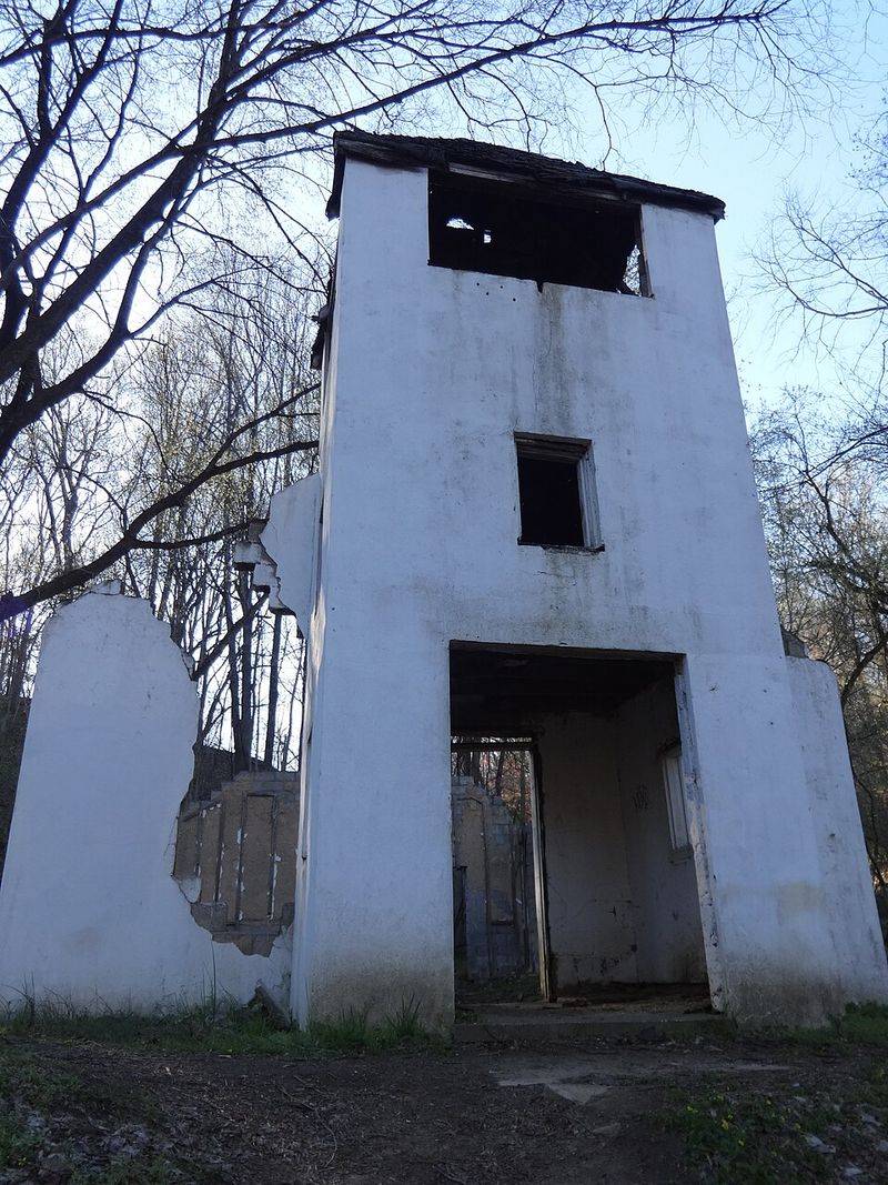
The stone remains of St. Stanislaus Kostka are among the most recognizable features on the official Alberton history route.
The congregation was founded in 1879, and the stone church was constructed soon afterward.
Its hillside location placed it well above many of the former homes closer to the river.
In the 1920s, lightning severely damaged the stone building. A wooden replacement was later constructed nearby and remained in use until the company village was removed decades later.
Today, sections of the original stone walls still rise among the trees.
The hillside setting and Gothic-style openings make the structure easy to recognize from the trail. Another set of church ruins appears farther along Alberton Road.
The Pentecostal congregation was established in 1940, relatively late in Daniels’ history. Its remaining structure now serves as another visible reminder of the community that once extended along this side of the river.
Both sites appear on Maryland DNR’s official 3.6-mile Alberton self-guided history hike.
The ruins are fragile, so visitors should remain on established routes, avoid climbing the walls, and leave stones and other materials where they are.
Old Vehicles And Stone Foundations
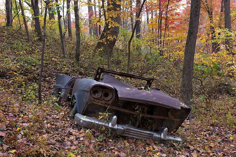
Several abandoned vehicles still sit among the woods around the former community.
They are real remnants of the Daniels landscape, but their exact histories are not always documented.
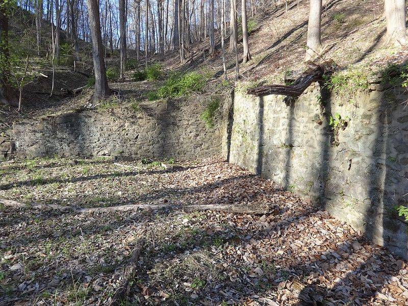
That makes it safer to view them as surviving objects from the abandoned town rather than assume the 1972 flood placed each one where it stands today. Stone foundations and partial walls also appear along the old routes.
Some mark former residential areas, while others belong to the larger network of structures that supported the mill community.
The official Alberton hike passes the former Guilford section of town before reaching viewpoints toward the old factory site. The mill itself should be viewed only from the public trail.
Maryland DNR notes that the factory property across the river is private, so crossing over to inspect the remaining industrial structures is not permitted.
Modern markings appear on some surviving surfaces, but adding to them only removes another layer of original material.
Loose masonry, old metal, uneven ground, and thick vegetation are better reasons to stay on the established route.
Riverside Views And Roaring Waters
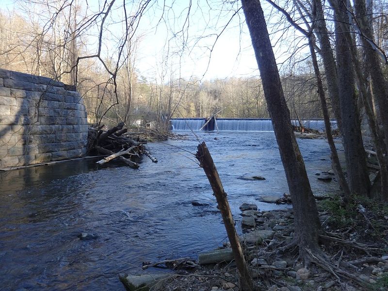
The Patapsco River is still the feature that ties the entire Daniels landscape together.
Daniels Dam stretches across the river near the main parking area and once supplied power to the textile operation.
At its industrial peak, the dam provided about 400 horsepower and also supported electricity generation.
A fish ladder and an interpretive display now explain another part of the river’s modern story.
The dam remains in place in 2026, although Maryland has completed a feasibility study examining its future.
Visitors should pay close attention to the safety restrictions here.
Maryland DNR prohibits activity within 300 feet of the dam, so this is a place for viewing from appropriate areas rather than approaching the structure closely.
Beyond the dam, the river corridor shifts between floodplain vegetation and steeper wooded slopes.
Sycamores and other river-bottom species occupy the lower ground, while oak, hickory, mountain laurel, and additional hardwoods appear higher on the ridges.
Hiking The Old Alberton Road
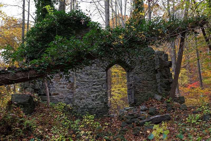
Exploring the most visible ghost-town remains is all about walking.
The official Alberton self-guided history route follows abandoned Alberton Road from the parking area.
The full history hike is about 3.6 miles and passes abandoned vehicles, two church ruins, remnants of the former communities, and viewpoints toward the old mill area.
Another option begins from the Daniels parking area.
The Camel’s Den and Abandoned B&O Loop covers about 2.5 miles and combines river-bottom terrain, a small natural cave, a steep ridge climb, and a return along an abandoned railroad alignment.
Much of the old B&O route west of Daniels follows an alignment first laid out in 1831.
The railroad changed course several times because the original route was too winding, leaving old grades, bridge supports, and other engineering traces behind.
Fall and winter can make historic features easier to see because the vegetation is thinner.
Summer creates a very different landscape, with heavy foliage covering many foundations and sightlines.
Pets are permitted throughout the Daniels Area but must remain leashed.
Downloading the current park map before leaving home is worthwhile, especially because numerous informal side paths connect with nearby private property.
Smart Tips Before You Go
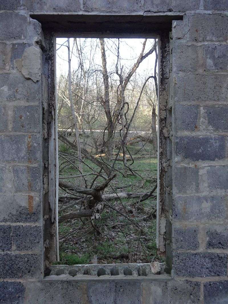
A little planning makes exploring Daniels much easier.
The Daniels Area is currently open from 9 a.m. until sunset.
Parking is available from Daniels Road, while Alberton Road provides a separate trail-access point for the historic self-guided route. Arriving earlier can help on busy weekends.
Maryland DNR warns that the Daniels Area can reach capacity during summer weekends and holidays.
Sturdy shoes are useful because surfaces change from old roadway to dirt, rock, roots, and occasionally muddy sections.
Rain can quickly change trail conditions and river levels, so current conditions should be checked before setting out. Most importantly, stay within public park areas.
The abandoned churches on the Alberton history route can be viewed from official access, but the old mill property and Gary Memorial site across the river are private.
Daniels is most interesting when treated less like an abandoned playground and more like an outdoor history site.