California’s November Hike Of The Month Is A Scenic Trail Worth Exploring Before Winter Arrives
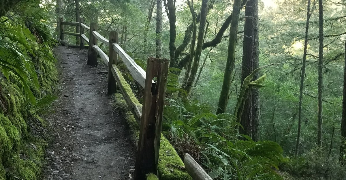
A wooden ladder bolted into a fern-filled canyon is the most famous feature of this hike. Beat poets Gary Snyder and Jack Kerouac reportedly climbed down an earlier version of it in the 1950s.
The ladder sits beside a creek that tumbles through redwoods on its way to the Pacific.
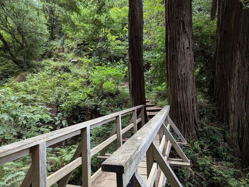
Wooden bridges cross the water again and again, like the trail can’t decide which bank it likes better.
I like how this route packs so much into a short stretch. You get ocean views, shady groves, mossy steps, and the steady roar of falling water.
It all happens on one mountainside in Northern California.
Late fall is when the rains begin and the cascades start waking up. I can’t imagine a better reason to lace up your boots this month. Are you ready to climb?
A Short Trail With A Seriously Big Personality
Only about 2 miles long, the Steep Ravine Trail still manages to feel like a full adventure. It drops or climbs roughly 1,000 feet through a canyon on Mount Tamalpais.
The trail lives inside Mount Tamalpais State Park, just above the coast in Marin County. Most hikers start near the Pantoll Ranger Station off Panoramic Highway.
Its name isn’t a joke, either. Expect stone steps, wooden steps, and plenty of switchbacks as you move between the ridge and the sea.
The scenery changes quickly as you go. One minute you’re under dark redwoods, and the next you’re in more open woodland with spruce nearby.
Steep Ravine Trail rates as moderate on its own. Pair it with nearby trails and the outing can turn strenuous fast.
That mix is part of the fun. It’s challenging enough to feel earned but short enough to fit into a weekend morning.
November is a smart month to go in California. The summer crowds fade, the air cools down, and early rains start filling the creek below.
Yes, There Really Is A Ladder In The Middle Of The Woods
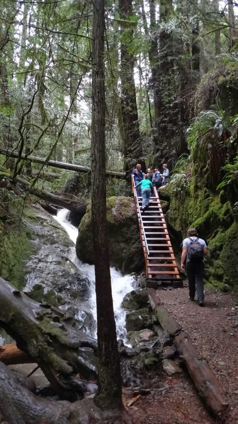
Most trails ask you to walk. Steep Ravine asks you to climb a ladder, which feels a bit like the forest is testing you.
The wooden ladder is the trail’s signature feature. Sources describe it as roughly 10 feet tall or about 14 rungs, set right into a steep section beside the creek.
Some history makes it even cooler. The Civilian Conservation Corps built trails and facilities on Mount Tamalpais between 1934 and 1940, and many believe they installed the ladder.
Literary fans have a reason to smile, too. Gary Snyder and Jack Kerouac reportedly descended an earlier version of it during the 1950s.
Going up is usually easier than going down. Face the rungs, take your time, and keep both hands free by using a backpack.
Wet weather changes things. Rain and creek spray can make the wood slick, so good grip on your shoes really matters.
Little ones may need a steady helper nearby. Older kids often treat it like the highlight of the whole day, and honestly, who could blame them?
Follow The Sound Of Falling Water All The Way Down
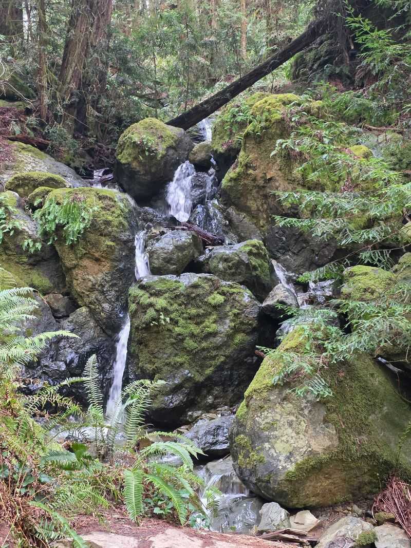
Webb Creek is the real tour guide here. The trail hugs it closely, so the sound of rushing water follows you through most of the canyon.
Along the way, the creek spills over rocks in a string of small waterfalls and cascades. The noise can drown out almost everything else, which feels wonderfully calm.
Timing makes a huge difference. The rainy months, usually late November through March, are when the cascades look their most lively.
That makes this month a sweet spot. Early storms start feeding the creek, and you still have a decent shot at clear, dry hiking days.
Several wooden bridges crisscross Webb Creek as you go. Each crossing gives you a fresh angle on the water and a good excuse to stop.
Bring a light rain jacket, even if the sky looks friendly. Mist and drips from the trees can leave you damp without a single raindrop falling.
Photographers, slow down on the bridges. The best shots usually come from looking upstream, where white water pours between dark rocks and bright green ferns.
Redwoods And Ferns Turn The Canyon Impossibly Green
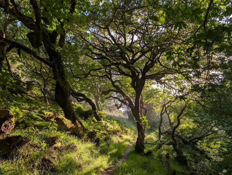
Green on green on green. That sums up the lower canyon, where ferns carpet the ground beneath tall redwood trunks.
Let’s be honest about the trees. These redwoods are generally smaller and less numerous than the giants at nearby Muir Woods.
Still, the woods here feel unusually lush. The thick fern groundcover gives the canyon a soft, almost storybook look that’s hard to find elsewhere.
The trail also passes through several small micro-environments. You’ll notice dense, dark redwood groves in some spots and spruce trees in others.
Shade is a big perk. Climbing back up through these cool groves feels much nicer than slogging up an open, sunny hillside.
Keep your eyes low as well as high. Banana slugs sometimes slide across the path, bright yellow and in absolutely no hurry.
Watch your step around roots and wet rocks, too. The same moisture that keeps everything so green can make the ground slippery.
For a California forest walk without huge crowds of tour buses, this canyon delivers. It feels wild, quiet, and refreshingly close to the coast.
The Ocean Views Up Top Are A Sneaky Bonus
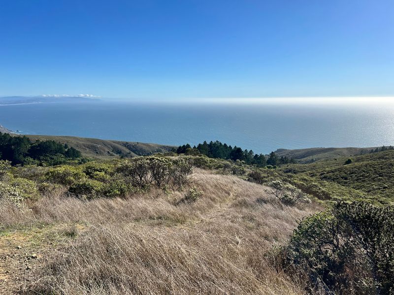
Forest hikes don’t usually come with ocean views. Steep Ravine breaks that rule by giving you both on the same outing.
Up near the ridge, the land opens up. On clear days, the views can reach Stinson Beach, San Francisco, and Point Reyes.
Clear fall and winter days are especially rewarding for these vistas. The air often looks crisper after a storm passes through.
Fog can be a gift, too. Sometimes the marine layer settles below, and hikers get that magical feeling of walking above the clouds.
Plan your loop with the views in mind. Many people head downhill on another trail, then climb back up through the shady ravine.
That way, the big open views come first while your energy is high. The cool canyon then becomes your reward on the way back.
Pack a snack and pick a spot to pause. Just remember that coastal weather changes fast, so a clear morning can turn misty by lunch.
Layers are your best friend here. Peel them off on sunny stretches and pull them back on when the fog rolls in.
Turn It Into A Loop With Some Famous Neighbors
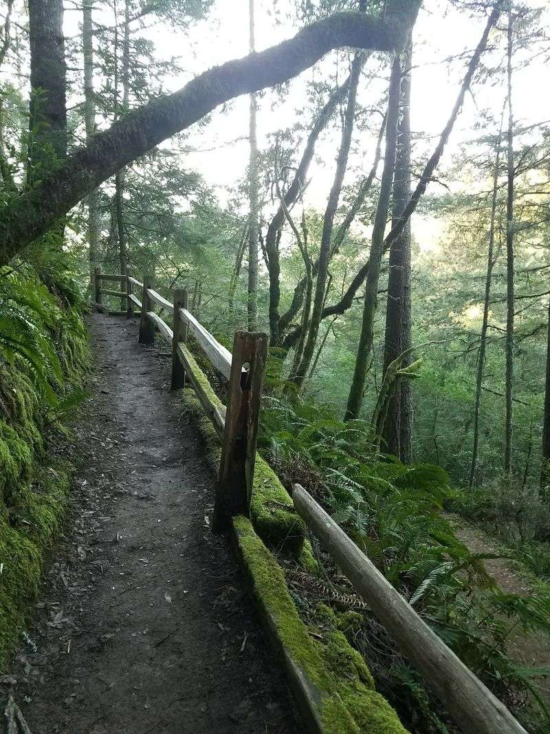
Why hike one trail when you can link three? Steep Ravine Trail is often paired with the Dipsea Trail and the Matt Davis Trail.
A popular plan starts near Pantoll and heads down toward Stinson Beach. Hikers then return uphill through the ravine for a shady climb back.
The Dipsea brings its own fame. It’s the route of a historic footrace and features plenty of stairs and open hillsides.
Matt Davis offers a different mood. It’s a strong pick when you want more sweeping views along the coastal slopes.
These combos usually push the hike into moderate-to-strenuous territory. Give yourself a full morning or afternoon, plus extra time for photos.
Bring more water than you think you need. Climbing back up from the coast can feel longer than the map suggests.
Good shoes matter on these loops. You’ll hit dirt, stone steps, roots, and possibly mud, all in one trip.
Start early if you can. You’ll beat some of the crowds and have more daylight, which shrinks fast in November.
Parking Fills Up Faster Than Your Water Bottle Empties
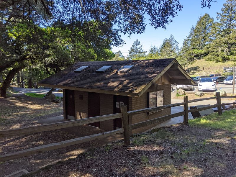
Early birds get the parking spots. On weekends, the lots near the trailhead often fill by about 8:00 to 9:30 in the morning.
Most hikers aim for the Pantoll area, near 3801 Panoramic Highway, Mill Valley, CA 94941. That’s where you’ll find the ranger station and a paid day-use lot.
The Pantoll Ranger Station offers restrooms and drinking water. Fill up there, since there aren’t many chances once you’re on the trail.
Free parking exists at the Whitegate Ranch Trailhead, but spaces are limited. Don’t count on it during busy weekends.
Weekdays are your best bet for a calmer trip. You’ll find easier parking and quieter stretches of trail.
Panoramic Highway is curvy, so drive slowly and watch for cyclists. The climb up the mountain is part of the adventure.
Arrive with a backup plan if the lot is full. Nearby trailheads can still connect you to the same loops with a little extra walking.
Check the weather before leaving home, too. Fog and wind on Mount Tam can feel very different from the valleys below.
Rustic Cabins By The Sea Make A Dreamy Finale
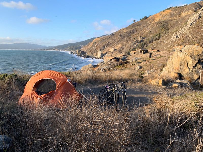
Down at the coast sits one of the most wished-for overnight spots in California. The Steep Ravine Environmental Campground perches on a marine terrace above the ocean.
It offers seven primitive campsites and nine rustic cabins. The cabins date back to the 1940s, which gives them plenty of old-school charm.
Each cabin includes a wood stove, a picnic table, and sleeping platforms. Don’t expect running water or electricity, though.
Primitive toilets and water faucets are available nearby. It’s simple living, but the setting more than makes up for it.
Getting a cabin is tough. As of 2024, reservations go through a lottery system because demand is so high.
The land itself carries deep meaning. This area sits on the ancestral and present lands of the Coast Miwok people.
Conservationist William Kent and his wife donated 200 acres here in 1928. That gift made Steep Ravine part of Mount Tamalpais State Park.
Even if you only hike, knowing that history adds something special. You’re walking through a place people worked hard to protect.