10 Gorgeous Wisconsin Fall Destinations That Most Locals Try To Keep Secret
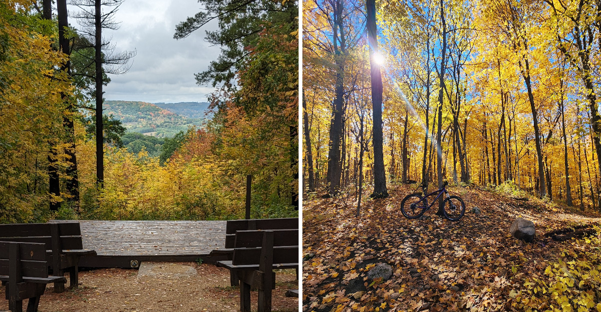
Would you tell everyone about your favorite fall spot if it still had beautiful color and surprisingly few crowds?
Wisconsin locals face that dilemma every October.
Quiet forests, waterfalls, bluffs, rock formations, and scenic overlooks can deliver all the autumn drama without turning every trail into a parade.
Better yet, the scenery changes constantly from place to place.
One hike follows ancient geology, while another leads toward a covered bridge or a waterfall framed by brilliant leaves. That variety keeps the road trip exciting!
After visiting a few of these quieter corners, you may understand exactly why locals sometimes become mysteriously vague when anyone asks for directions.
1. Copper Falls State Park, Mellen
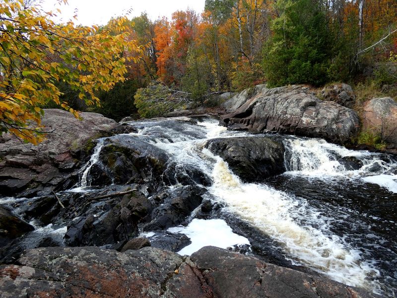
Imagine for a second a waterfall pouring through rock that once flowed as lava. Now add a wall of orange maples on both sides, and you get the idea.
Copper Falls State Park near Mellen brings ancient geology, rushing water, and northern Wisconsin color into one compact fall stop.
The Bad River and Tyler Forks cut through steep-walled gorges that rise roughly 60 to 100 feet above the water.
The 1.7-mile Doughboys Nature Trail is the classic route, passing overlooks for Copper Falls, Brownstone Falls, and the Tyler Forks cascades.
A half-mile portion has a firm crushed-granite surface leading toward a Copper Falls overlook and a historic bridge.
Seventeen miles of trails spread across the park, including more than four miles of the North Country National Scenic Trail. Red Granite Falls Trail adds a 2.5-mile option beginning near Loon Lake, where an accessible fishing pier is also available.
Log buildings and stonework from the Civilian Conservation Corps add another layer to the scenery. For fall 2026, one planning detail matters: the CCC 692 Trail is temporarily closed, although the observation tower itself has reopened.
Loon Lake beach and Red Granite Falls Trail remain accessible, but the seasonal flush-toilet building near the lake closed September 21 for construction.
The entrance is at 36764 Copper Falls Road. Sturdy footwear helps on damp leaves and rock steps, especially around the gorge.
2. Perrot State Park, Trempealeau
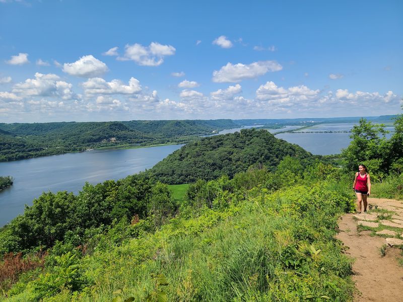
What if two big rivers met right beneath a bluff covered in fiery leaves?
Perrot State Park in Trempealeau sits where the Trempealeau River meets the Mississippi, with wooded bluffs rising roughly 500 feet above the valley.
The combination of water, prairie, and steep slopes makes autumn especially layered here.
Brady’s Bluff is one of the strongest viewpoints. The east trail runs 0.7 mile, while the west route is about 0.5 mile and includes stonework from the Civilian Conservation Corps. Both are narrow and steep, with stairs along the way.
Perrot Ridge Trail adds a 1.5-mile climb with views of Trempealeau Bay and surrounding farmland. For an easier option, the 2.5-mile Riverview Trail follows the water with no major climbs.
More than 200 bird species can be recorded here in a year, and fall migration adds extra movement above the river corridor. Trempealeau Mountain rises about 425 feet from the surrounding landscape and stands apart from the bluffs.
The park has 12.5 miles of hiking trails overall, so a visit can be as short or ambitious as the day allows. Bluff tops can feel noticeably breezier than the riverbank, making a light layer useful in October.
The entrance is at W26247 Sullivan Road. For the clearest fall experience, combine one bluff climb with Riverview Trail instead of trying to cover every route in a visit.
3. Governor Dodge State Park, Dodgeville
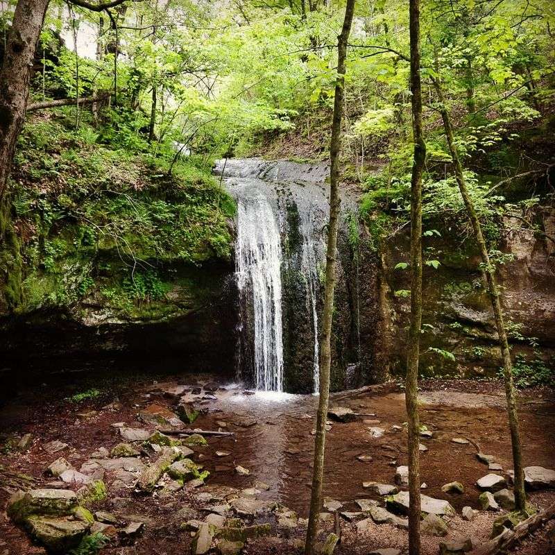
Governor Dodge State Park near Dodgeville covers more than 5,000 acres in the Driftless Area. Hills, sandstone bluffs, wooded valleys, two lakes, and Stephens Falls create several fall settings within the same property.
The half-mile Stephens’ Falls Trail is an easy place to start. A paved quarter-mile approach reaches an overlook above the falls, while stone steps and uneven ground continue toward the lower trail.
Hikers have nearly 40 miles of park trails. Lost Canyon Trail runs three miles through wooded terrain and reaches the canyon below Stephens Falls. Meadow Valley Trail stretches five miles across prairies, forests, ridges, and steeper grades.
Cox Hollow Lake and Twin Valley Lake add open water to the autumn scenery. Several routes also pass sandstone overhangs and rock formations shaped long before the park was established.
Fall 2026 requires extra planning. Road, retaining-wall, and water-system projects are continuing through the season, and some access points or facilities may be temporarily rerouted or unavailable.
Most of the park remains open. Checking current conditions before arrival is the simplest way to avoid a surprise detour.
The entrance is at 4175 Highway 23 North. A waterfall walk paired with one lake trail makes a balanced autumn day.
4. Rib Mountain State Park, Wausau
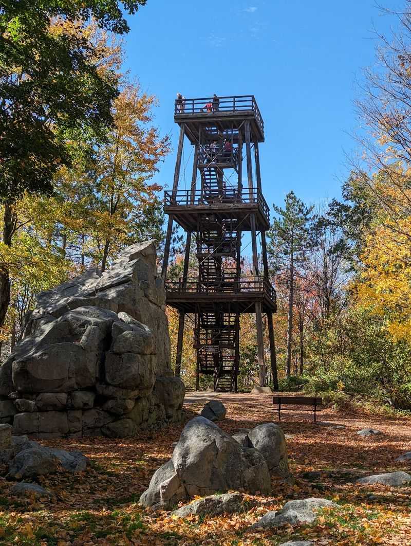
My jaw literally dropped the first time I climbed this tower. Miles of color stretched out like nature forgot where to stop.
Rib Mountain State Park in Wausau rises above the surrounding landscape on quartzite rock about 1.7 billion years old.
The ridge reaches 1,924 feet above sea level and stands roughly 670 feet higher than nearby terrain.
A 60-foot observation tower gives the broadest view of the Wausau area and surrounding river valley. The Gray Trail provides a relatively short route connecting several major park features, including the tower.
More than 13 miles of hiking trails cross the property, with over eight miles considered accessible. The Blue, Green, and Red trails pass quartzite formations and forested slopes, while Quarry Trail leads toward an old quarry.
Autumn color builds across maple, birch, hemlock, and mixed forest on the mountain. Clear days open long sightlines beyond the summit, while lower trails offer a more enclosed walk through the trees.
Granite Peak Ski Area occupies the north face, but fall visitors should check current notices rather than assume seasonal lift service is available.
The park is open year-round from 6 a.m. to 11 p.m. The entrance is at 149801 State Park Road.
A tower visit works well on its own, but adding one wooded loop gives the outing more variety than simply driving to the summit and leaving.
5. Interstate State Park, St. Croix Falls
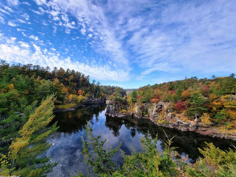
Let me look at it from this angle for a moment: one river gorge, two states, and a whole lot of autumn color.
Interstate State Park in St. Croix Falls became Wisconsin’s first state park in 1900.
Across the river, Minnesota has its own separate Interstate State Park, creating a paired landscape on both sides of the St. Croix.
The Dalles of the St. Croix is the geological centerpiece. Glacial meltwater cut the gorge through ancient basalt, leaving steep cliffs, rocky slopes, and cylindrical potholes carved by swirling sand and stone.
The 0.4-mile Pothole Trail is the quickest way to see that geology up close. It includes stone stairs, uneven ground, an observation deck, and views into the river gorge.
For more distance, there are over nine miles of hiking trails. Lake O’ the Dalles Trail makes a one-mile loop, while Silverbrook Trail reaches an 18-foot waterfall in a quieter part of the property.
Autumn works well here because evergreen trees remain mixed with changing hardwoods. That contrast keeps the cliffs and river edges sharp even after some leaves begin to fall.
Construction affects parts of the park in fall 2026. The Meadow Valley shelter is closed, and the River Bottoms Picnic Area has scheduled weekday access limits later in October.
The park address is 851 State Highway 35. Check current notices before choosing a picnic area or route.
6. Roche-A-Cri State Park, Friendship
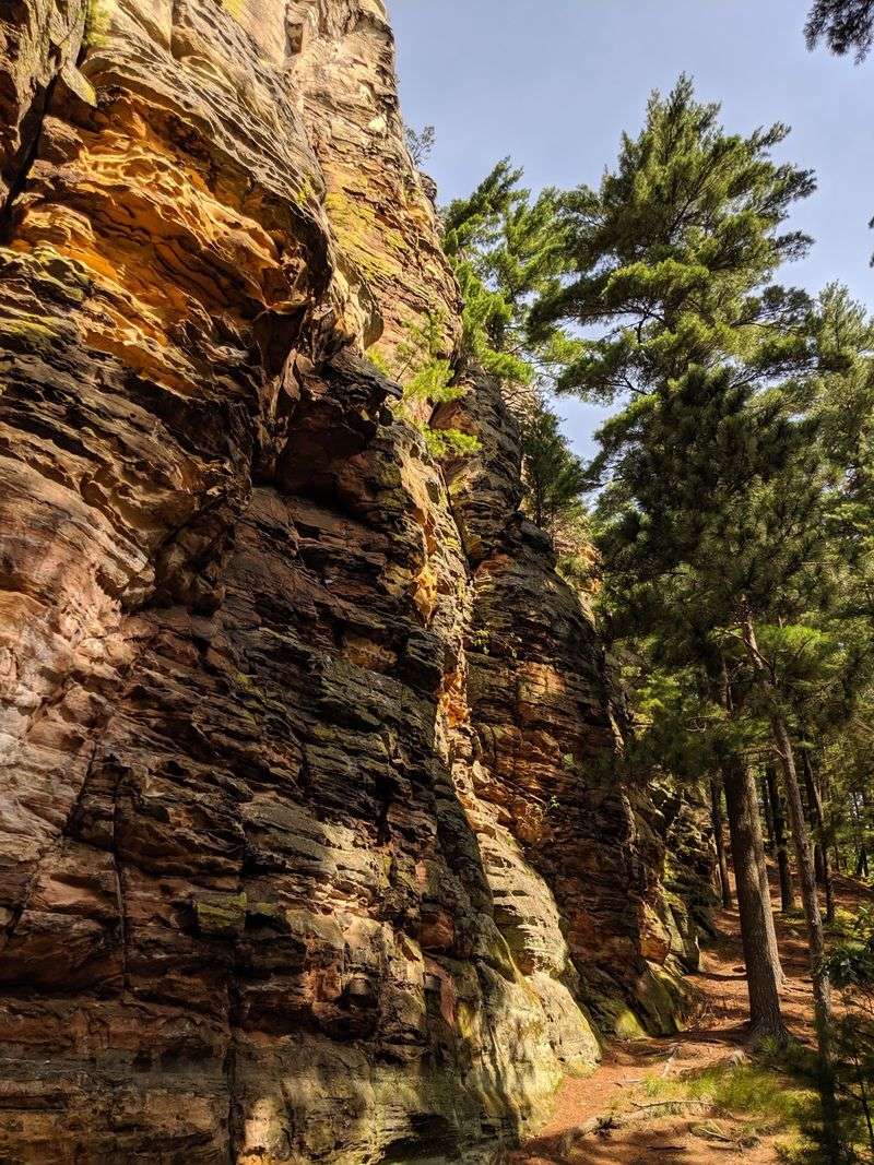
Some rocks hold stories far older than any book.
Roche-A-Cri State Park in Friendship protects a sandstone mound rising about 300 feet above the Central Sands plain.
Long ago, the formation stood as a rocky island in Glacial Lake Wisconsin, and erosion left its steep sides and broad summit above the surrounding landscape.
The park is also home to interpreted Native American petroglyphs and pictographs.
Some carvings are estimated to predate A.D. 900, while painted images appeared centuries later. An accessible viewing platform helps protect the rock art while keeping it visible to visitors.
Normally, a 303-step stairway leads toward the top of the mound. As of October 2026, however, that stairway and the trail around the base of the mound remain closed until further notice. Other hiking trails are open.
The 3.5-mile Acorn Trail circles through the wider property, while the 0.9-mile Turkey Vulture Trail passes pine, oak, maple, and restored prairie. Chickadee Rock Trail offers a shorter accessible route on a crushed-gravel surface.
The main gate closes for the season on October 13, 2026, but winter parking on Czech Avenue keeps walk-in access available afterward.
The park entrance is at 1767 State Highway 13. This fall, the strongest visit focuses on open woodland trails and the rock-art viewing area rather than planning around the summit stairway.
7. Kettle Moraine State Forest Northern Unit, Campbellsport
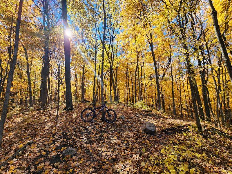
I always pictured this part of the state as flat farmland.
Kettle Moraine State Forest Northern Unit near Campbellsport changes that impression quickly.
Nearly 30,000 acres stretch across rolling glacial terrain shaped by kettles, kames, ridges, and other landforms left by ancient ice.
The 3.5-mile Parnell Tower Trail begins with a climb to the highest elevation in the forest. A 60-foot observation tower rises above the treetops, opening broad views across the surrounding glacial landscape.
About 31 miles of the Ice Age National Scenic Trail pass through the Northern Unit. Shorter trail systems at Greenbush, New Fane, Butler Lake, and other recreation areas make it easy to build a fall outing around the distance that suits the day.
Spruce Lake Bog offers a very different experience. Its quarter-mile boardwalk reaches a fragile open-lake bog community with pitcher plants, sundews, and other specialized vegetation.
The forest’s mix of hardwoods, prairies, lakes, and glacial hills gives Wisconsin fall color plenty of different backdrops. Water systems begin shutting down seasonally by October 19, 2026, although the forest remains open year-round.
The headquarters is at N1765 County Road G. Because the Northern Unit covers roughly 30 miles, choosing a specific trailhead before leaving home makes the day far smoother and simpler.
8. Amnicon Falls State Park, South Range
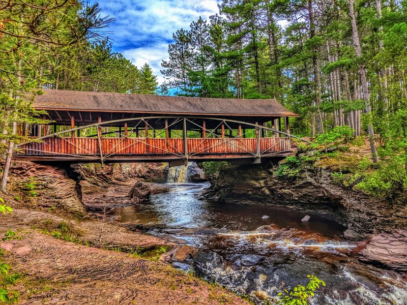
Rushing falls, a covered bridge, and golden leaves all fit in one frame.
Amnicon Falls State Park near South Range follows the Amnicon River through a compact landscape of rapids, pools, rocky ledges, and several waterfalls.
The river corridor is striking when autumn color settles into the surrounding forest.
Upper, Lower, and Snake Pit falls are the main named cascades. A quarter-mile island trail gives several close viewpoints, while another half-mile of riverside paths adds more angles on smaller drops and pools.
The covered bridge is one of the park’s signature features. Its steel bowstring structure was moved to the present site in 1930, and the roof was added by the Civilian Conservation Corps in 1939.
Geology adds another reason to slow down. Dark basalt at Upper Falls records ancient lava flows, while Lower Falls crosses younger sandstone. The Douglas Fault helps explain the sharp changes in rock layers and river shape.
The park has about 1.8 miles of trails overall, including the 0.8-mile Thimbleberry Nature Trail. Most river walks are short, but rock surfaces can become slick, especially after rain or beneath damp leaves.
A rustic campground extends the visit for anyone staying overnight.
The entrance is at 4279 South County Highway U. For a short fall stop, the bridge and island trail deliver the strongest mix of water, geology, and color without requiring a long hike.
9. Wildcat Mountain State Park, Ontario
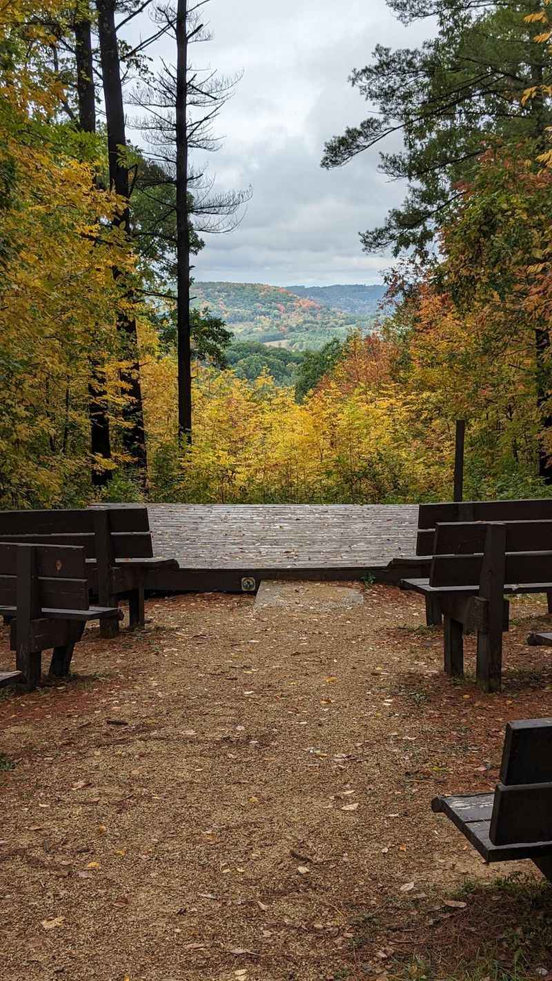
A whole valley of gold and scarlet rolls out below like a quilt.
Wildcat Mountain State Park near Ontario rises above the Kickapoo River Valley in the Driftless Area, where ridges and wooded slopes create strong autumn views. More than 20 miles of hiking, nature, and equestrian trails cross the property.
Old Settler’s Trail is a rugged 2.5-mile loop with about 390 feet of elevation change. For a shorter route with a major payoff, an accessible 0.4-mile segment reaches Taylor Hollow Overlook from the nature building.
The 1.3-mile Hemlock Nature Trail is not the easy stroll its name might suggest. It follows sandstone cliffs, climbs through switchbacks, and gains about 365 feet before reaching an observation point above the valley.
Ice Cave Trail offers a shorter 0.75-mile outing along Billings Creek to a shallow sandstone formation where a spring runs over the rock.
Paddlers can launch on the Kickapoo River from the lower picnic area, with canoe rentals and shuttle services available in Ontario.
After dark, the upper picnic area also offers excellent night-sky viewing, and astronomy programs appear on the seasonal calendar.
The park stays open year-round from 6 a.m. to 11 p.m. Its entrance is at E13660 State Highway 33.
For fall color, flexible timing works better than chasing one guaranteed peak date. Temperature, rain, and wind can shift the display quickly.
10. Blue Mound State Park, Blue Mounds
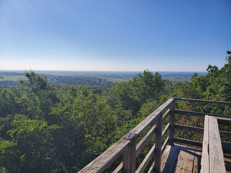
It takes a minute to wrap your head around this view. The countryside seems to roll on forever in red and gold.
Blue Mound State Park sits on the highest point in the southern part of the state, with broad views over the Driftless landscape.
The hill turns the surrounding farms, woods, and roads into a layered autumn panorama.
Two observation towers stand at opposite ends of the upper picnic area. Each tower is 40 feet tall and includes a landmark locator pointing toward distant cities and geological features.
More than 20 miles of hiking, biking, and seasonal ski trails cross the park. The 1.3-mile Flintrock Trail adds geology interpretation, while the one-mile John Minix Trail offers one of the gentler wooded loops.
Mountain bikers get more than 15 miles of challenging singletrack over hilly terrain. Hikers can also connect with routes that pass hardwood forest, prairie, springs, and rocky outcrops.
By early fall, maples and oaks bring strong yellow and crimson color to several trail corridors. The swimming pool and splash pad are closed for the 2026 season, so autumn attention shifts toward trails, towers, and picnic areas.
The park remains open year-round from 6 a.m. to 11 p.m.
The entrance is at 4350 Mounds Park Road. A tower climb followed by a short woodland loop makes a simple final stop for a fall road trip.