How Did Ten Inches Of Rain Turn One Idaho Dam Into The 1976 Teton Flood
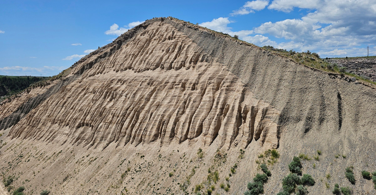
Eighty billion gallons of water escaped a brand-new dam in less than six hours.
It happened on a Saturday morning in June 1976, with the reservoir still filling for the very first time.
That dam sat above a river canyon in eastern Idaho, built to tame floods, not start one.
Workers spotted leaks early that morning, and by 11:57 a.m. the whole thing gave way.
I can’t imagine standing on that canyon rim as all that water roared loose below.
Towns downstream changed forever, and so did the national rules for keeping dams safe.
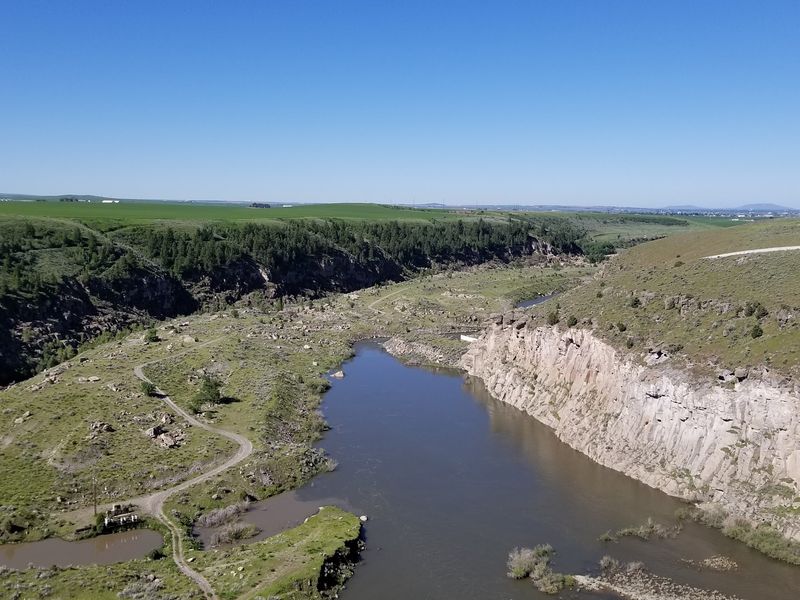
Today you can stand at the broken edge, gaze across the empty gap, and hike down to a cold, clear river.
So how did a spring of melting snow and rising water bring the whole thing down?
An Earthen Giant That Once Blocked A Quiet Eastern Idaho Canyon
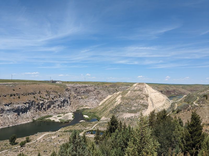
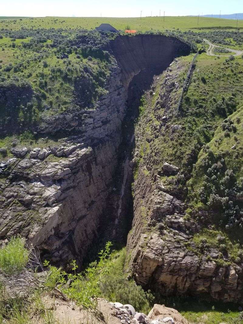
High above the Teton River, a chunk of dirt embankment ends suddenly in midair. That abrupt edge is all that remains of the Teton Dam, one of the most famous failures in American engineering.
The site sits in eastern Idaho, between Fremont and Madison counties, a short drive from Rexburg. Rolling farmland surrounds the canyon, so the drop into the gorge catches you a little off guard.
When it stood complete, the dam rose 305 feet high and stretched 3,100 feet across. That’s taller than most downtown buildings in Idaho and longer than ten football fields placed end to end.
The U.S. Bureau of Reclamation built it as an earthen dam, meaning packed soil and rock rather than poured concrete.
Its jobs were flood control, irrigation water for nearby farms, and hydroelectric power.
Here’s the twist that still makes people pause. The dam never finished its first fill, and the Bureau has never rebuilt it.
Debates about building a new dam at the site still pop up as water demands and drought worries grow. No concrete plans exist, so the canyon stays open, quiet, and wonderfully strange to stand beside.
Three Years Of Building And A Reservoir In A Hurry
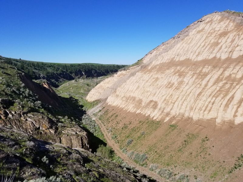
February 1972 marked the start of construction, and crews kept moving dirt for nearly four seasons. By November 1975, the dam was essentially complete.
Filling actually began a little earlier, on October 3, 1975. Regulations first limited the rise to one foot of water per day, a cautious pace for a brand-new structure.
That pace didn’t last long. By March 23, 1976, the approved rate doubled to two feet per day.
Then spring arrived in the mountains feeding the Teton River. After April 10, heavy snowmelt pushed the reservoir up an average of three feet per day.
On May 13, the water climbed a record 4.3 feet in a single day. The Bureau of Reclamation approved those higher rates, roughly three times the normal fill rate for dams.
Think about what that means for a giant pile of fresh soil. Every extra foot of water added fresh pressure against the embankment and the cracked rock beneath it.
Nobody watching the lake rise that spring saw an emergency coming. Underneath, though, water was already finding its way into places it never belonged.
So Where Does The Ten Inches Of Rain Fit In
Ten inches of rain makes a catchy headline, and the story deserves a straight answer. No reliable record pins the failure on a single ten-inch storm.
What the records do show is a wet, fast spring. Heavy snowmelt poured into the Teton River, and some accounts mention heavy rainfall in the weeks before the collapse.
All that water had one destination: the brand-new reservoir. Combine melting snow, spring showers, and approved fill rates, and the lake rose faster than anyone planned.
Still, water alone didn’t break the dam. Plenty of reservoirs across Idaho swell every spring without a hint of trouble.
The real problem hid inside the embankment and the canyon walls. The rapid rise simply exposed weaknesses that were already there, waiting for enough pressure.
So the honest version goes something like this. Rising water lit the fuse, but the soil, the rock, and the design supplied the trouble.
I like that the true story is more interesting than the myth. It turns a weather tale into a puzzle about dirt, stone, and decisions made on paper.
The Saturday Morning Bulldozers Raced A Leak
June 5, 1976, started as an ordinary Saturday in eastern Idaho. Then workers noticed muddy water seeping from the dam’s face.
Crews sent bulldozers to push material into the leaks and plug them. The effort looked brave and hopeful, but the leak kept growing.
Water carved deeper into the embankment as the minutes passed. The operators managed to get clear as the hole widened beneath them.
At 11:57 a.m., the dam breached. An estimated 80 billion gallons began pouring through the gap.
The flow topped one million cubic feet per second at its peak. For comparison, that’s far more water than many big rivers carry on their busiest days.
In less than six hours, the entire reservoir drained. A lake that took months to fill vanished before suppertime.
Photos from that morning still circulate, showing a brown torrent tearing through the canyon. Seeing the empty gap now, it’s hard to picture that much water moving that fast.
Warnings went out downstream as the breach widened. Those few hours of notice made an enormous difference for the families living in the flood’s path.
Floodwater That Reshaped Wilford, Sugar City, And Beyond
Wilford and Sugar City took the hardest hit. Both communities were nearly wiped off the map within hours.
Water spread across roughly 190,000 acres of farmland on the Snake River Plain. Fields, barns, fences, and irrigation canals disappeared under mud.
Eleven people lost their lives in the Teton Flood. Around 16,000 head of livestock were also lost, a staggering blow to farm families.
About 25,000 people found themselves without homes. Thousands of houses and businesses were destroyed, from Rexburg down toward Rigby and beyond.
Damage estimates range from 400 million to two billion dollars. The federal government eventually paid more than 300 million dollars in claims to victims.
Numbers like those can feel abstract until you drive these towns today. Rexburg and Sugar City rebuilt, and neighbors from across the region showed up to help shovel out.
If you grew up in the Upper Valley, you’ve probably heard flood stories from grandparents. Those memories still shape how the region talks about water, farming, and resilience.
Crumbly Soil, Cracked Rock, And A Lesson Engineers Still Teach
Engineers have a word for what happened inside the dam: piping. Water sneaks through tiny paths, carries soil away, and slowly hollows out a tunnel.
The Independent Panel that reviewed the failure found several culprits working together. Geology, design, and construction each played a role.
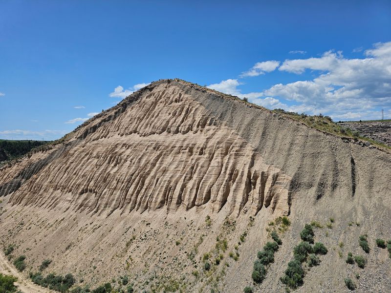
The dam’s core used loess, a fine, wind-blown soil that erodes easily. It packs well when dry but washes away quickly when water pushes through it.
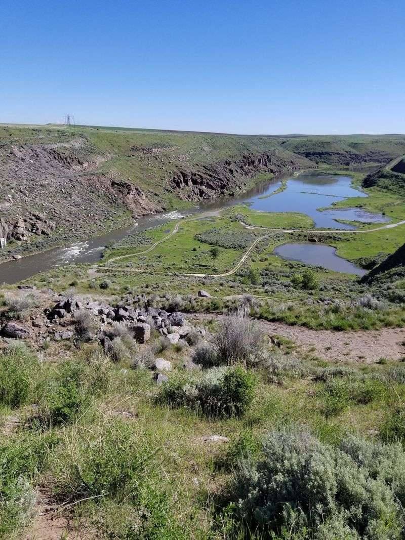
The canyon walls added more trouble. Fractured, highly permeable volcanic rock lined the foundation and abutments, full of joints and gaps.
Those rock joints weren’t sealed well enough. Water found the cracks, reached the soft core, and started carrying it off.
The fast fill rate turned up the pressure on every one of those weak spots. Each foot of water pushed harder against a system already losing ground.
Here’s the hopeful part. It was the first failure in Bureau of Reclamation history, and it sparked the Reclamation Safety of Dams Act of 1978 and the SEED program to check existing dams.
The New Overlook Puts The Whole Story At The Canyon Rim
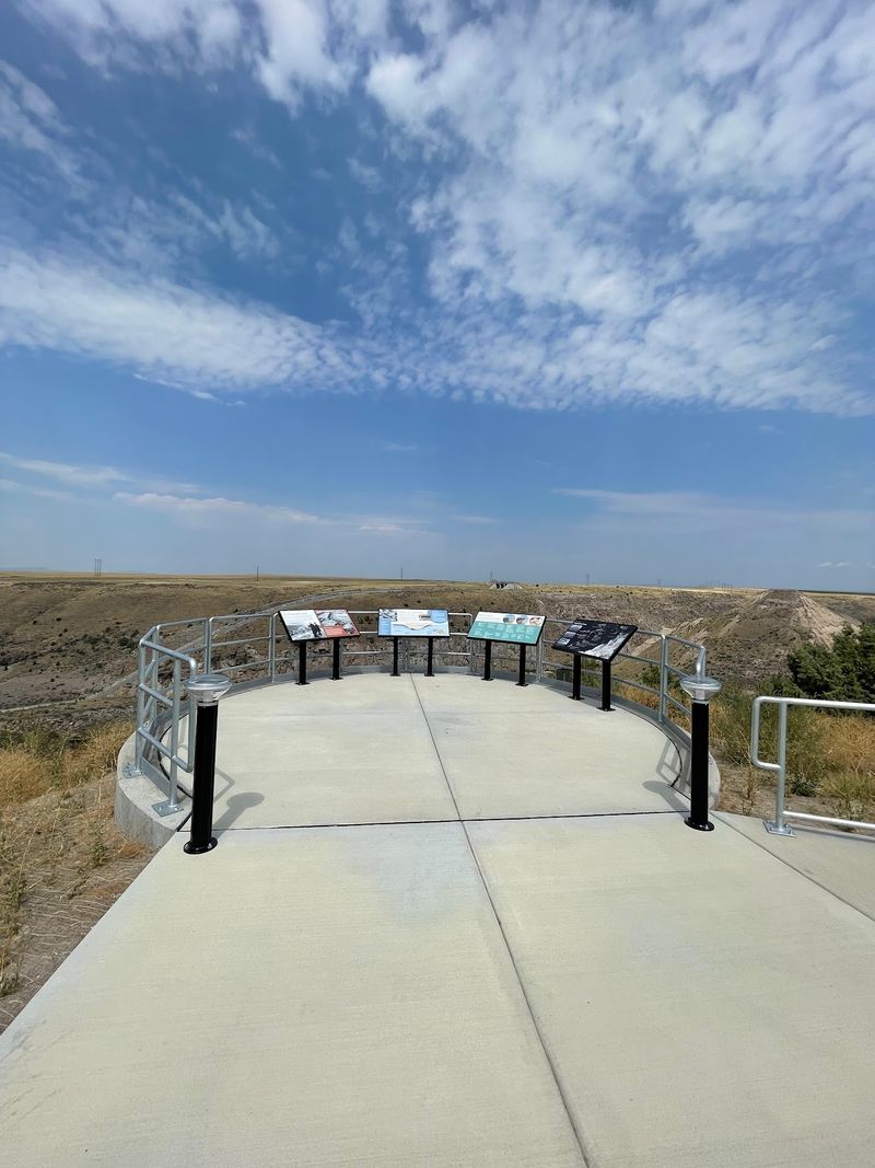
For years, visitors arrived and wondered what exactly they were looking at. That changed when a new overlook opened on the 50th anniversary of the failure.
Informational panels now walk you through the disaster and Idaho’s dam safety program. Pictures and plain-language text explain the timeline, so kids and adults can follow along.
The overlook area is paved up to the displays, with parking and a vault toilet. Don’t count on running water or shade, though.
From the rim, the view does most of the teaching. You can see the remaining embankment and the gap where the river broke through.
Look closely at the canyon walls. Exposed layers of basalt and rhyolite show the volcanic rock that caused so much trouble.
Fun detail: the left side of the dam washed out in the flood, and crews removed the right side later. The site also has two sides that don’t connect by road.
If you want a close look at the spillway, plan which side to visit first. Swapping sides means a longer drive around the canyon.
Directions, Dirt Roads, And A Few Honest Warnings
Getting there takes a little planning but no special skills. The site sits in Newdale, ID 83436, out in the farm country north of Rexburg.
From Rexburg, take Highway 20 north to Highway 33. About three miles east of Newdale, watch for the sign pointing toward the dam.
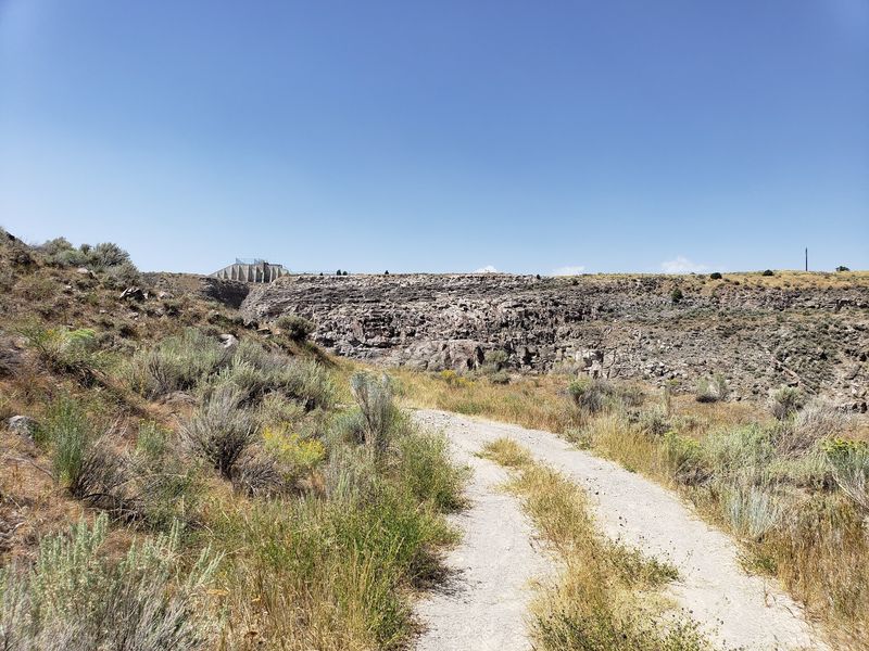
Turn and head roughly 1.5 miles north on 1200 East to the viewing area. A rough dirt road continues about a quarter mile east along the gorge rim to the dam itself.
Switchbacks lead down toward the river, and some stretches get steep. Vehicles with decent clearance handle the gravel best, while low sedans may struggle.
The road down to the water typically closes over winter and reopens in spring. Check before driving, though you can usually park near the top and walk in.
That walk is a workout, even on the dirt road. Rain or snow can turn the surface to mud quickly.
Pack water and sun protection for the trip. Admission isn’t something to budget for, but your shoes might need a good cleaning afterward.