11 Idaho Places That Look Completely Different From The Rest Of The State
Idaho has a habit of changing the scenery before your brain has caught up.
A drive that begins looking perfectly familiar can suddenly feel like somebody swapped states while you were not paying attention. The ground changes shape, the colors shift, and ordinary road-trip expectations start becoming useless.
That is what makes exploring the state so addictive.
Its strangest landscapes are not variations on the same mountain view. They feel genuinely unrelated, as if geology kept testing new ideas and never bothered choosing a favorite.
Some are easy to reach. Others depend on seasonal roads or conditions that can change quickly, so checking access before heading out matters.
The reward is a version of Idaho that feels much less predictable than the postcards suggest.
Apparently, the Gem State has been hiding a serious identity crisis in plain sight.
11. Black Magic Canyon – Near Shoshone
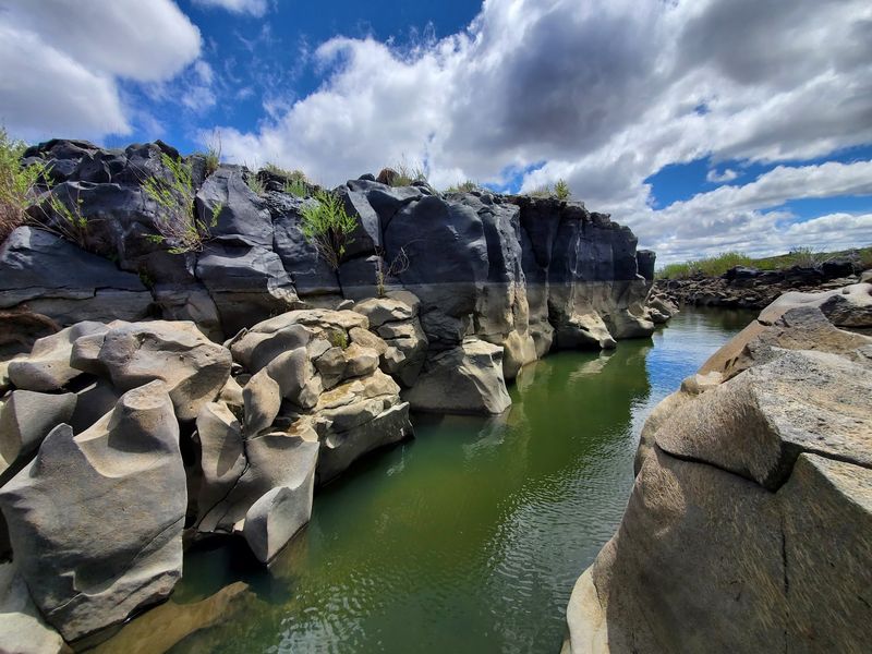
Walk across a stretch of flat farmland north of Shoshone and the ground simply opens up. The Big Wood River spent thousands of years grinding through black basalt here, leaving polished walls, deep pockets, and swirling shapes that belong in a science fiction film.
Black Magic Canyon narrows as you move deeper, and sunlight slips down the dark rock in thin ribbons. Some passages squeeze tight enough that you can touch both sides, while smooth bowls in the stone show exactly where water once spun in circles.
Timing matters more than anything. Access depends on irrigation releases upstream, so the channel may hold rushing water in spring and early summer, then drain to a walkable floor later in the year.
Late summer and early fall usually offer the safest window, but conditions change quickly.
Wear shoes with solid grip, since wet basalt turns slick, and carry plenty of water because shade is almost nonexistent. Checking current conditions before you drive out is the smartest move you can make.
Few places in Idaho reward curiosity like Black Magic Canyon.
10. Earl M. Hardy Box Canyon Springs Nature Preserve – Near Wendell
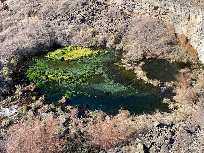
Farm fields roll on for miles outside Wendell, dry and dusty and unremarkable, and then the earth drops away without warning. Below sits a basalt gorge filled with water so clear and blue-green that it looks tinted.
Earl M. Hardy Box Canyon Springs Nature Preserve protects one of the biggest cold-water springs in North America, where millions of gallons rise from the canyon walls each day.
Cottonwoods, willows, and thick green growth crowd the creek, humming with birds and insects.
A rim trail gives you the wide view first, showing the ribbon of turquoise cutting through gray rock. A steeper route drops toward the water, where the air feels several degrees cooler and smells damp and mossy.
Look for herons stalking the shallows and trout holding steady in the cold current.
The preserve belongs to Thousand Springs State Park and stays open for day use, with no camping on site. Bring sturdy shoes, sun protection, and a picnic, because the climb back up takes more effort than the walk down.
Box Canyon Springs rewards every step.
9. Little City Of Rocks – North Of Gooding
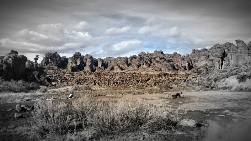
Rows of pale stone towers rise out of the sagebrush north of Gooding, looking uncannily like the skyline of a tiny abandoned village. Wind and weather carved the soft rhyolite into fins, pillars, and mushroom-capped columns over countless centuries.
The Bureau of Land Management describes the formations as resembling rows of little buildings, and the comparison sticks once you see them. Narrow passages wind between the towers, opening into quiet pockets where sound seems to drop away.
Little City of Rocks stays far quieter than its famous cousin near Almo, so you may have the whole maze to yourself on a weekday morning. Hoodoo shapes shift as you walk, first a chimney, then a face.
Photographers love the low light of early evening, when the rock glows warm gold.
Getting there requires a dirt road that turns greasy and impassable after rain or snowmelt, so plan your trip for dry weather and drive a vehicle with decent clearance. Pack water, since there are no services, and give yourself a couple of hours to wander the Little City of Rocks properly.
8. Blue Heart Springs – Near Hagerman And Buhl
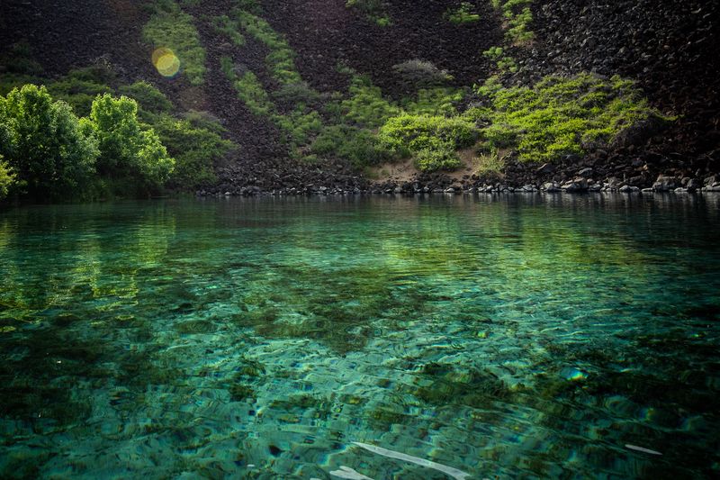
Paddle a mile or so downstream from Banbury Springs, round a bend in the Snake River, and a pocket of impossibly blue water appears against the canyon wall. Spring water bubbles up through pale sand, giving the cove a color closer to the tropics than a high desert river.
The cove’s outline traces a rough heart, which explains the name.
No road reaches Blue Heart Springs, and no hiking trail does either. Kayak, paddleboard, or a small boat is the only way in, which keeps the cove peaceful and helps protect its fragile bottom.
Outfitters near Hagerman and Buhl rent boats and run guided trips, so beginners can make the paddle without owning gear. Mornings on the river are glassy and calm.
Plan roughly two to three hours round trip and start early, since afternoon wind can make the return leg a workout.
The water stays cold year round, so a quick float is more realistic than a long swim. Southern Idaho holds few sights this unexpected.
Blue Heart Springs photographs beautifully under midday sun.
7. Camas Prairie Centennial Marsh Wildlife Management Area – Near Fairfield
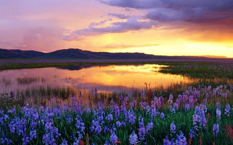
Show up in the right two weeks and this ordinary-looking prairie turns into a sea of blue-purple. Camas lilies bloom across the seasonally flooded flats near Fairfield, usually from late May into early June, painting thousands of acres in a color that reads almost like water from a distance.
The marsh matters for more than its looks. Camas bulbs were a vital food for the Shoshone-Bannock people, who gathered here for generations, and the wetland still draws sandhill cranes, ibis, avocets, and clouds of ducks.
Fish and Game manages the area and keeps gravel roads maintained for public access, so a regular car handles the route in dry conditions. Bring binoculars, because the bird activity often outshines the flowers.
Early morning light makes the purple glow, and the Soldier Mountains rise on the northern horizon as a backdrop.
Mosquitoes arrive with the standing water, so long sleeves and repellent belong in your bag. Stay on established roads and pullouts to protect the fragile bulbs.
Bloom timing shifts each year with snowmelt, and calling ahead saves a wasted drive to Camas Prairie Centennial Marsh.
6. Jump Creek Falls – Near Marsing
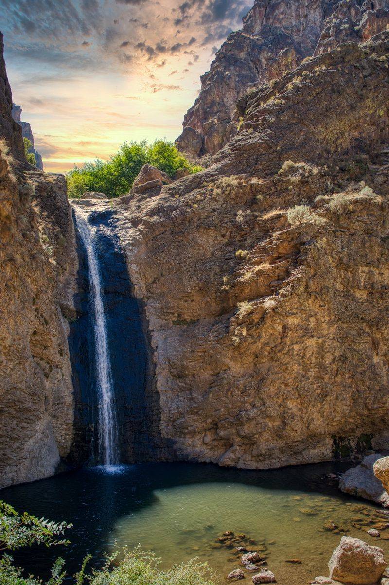
Owyhee country looks parched and stony in every direction, all rimrock and sagebrush, until a short walk between canyon walls delivers a waterfall. Jump Creek Falls pours roughly 50 to 60 feet into a clear pool ringed by boulders, and the temperature drops noticeably as you approach.
Water birch and dogwood line the creek, filling the narrow gorge with green that seems borrowed from another part of the country. Ferns cling to damp cracks, and the spray keeps moss alive on rock that would otherwise bake.
Birdsong bounces off the walls.
The hike from the parking area is short, mostly flat, and friendly for families, though the final stretch involves scrambling over rounded stones. Picnic spots sit near the pool, shaded by the canyon wall through much of the afternoon.
Sturdy shoes beat sandals here.
The Bureau of Land Management lists the recreation site as open daily from 6 a.m. to 9 p.m., and the access road southwest of Marsing includes a rough gravel section. Arrive early on summer weekends, since parking at Jump Creek Falls fills fast.
5. Bruneau Dunes State Park – Near Bruneau
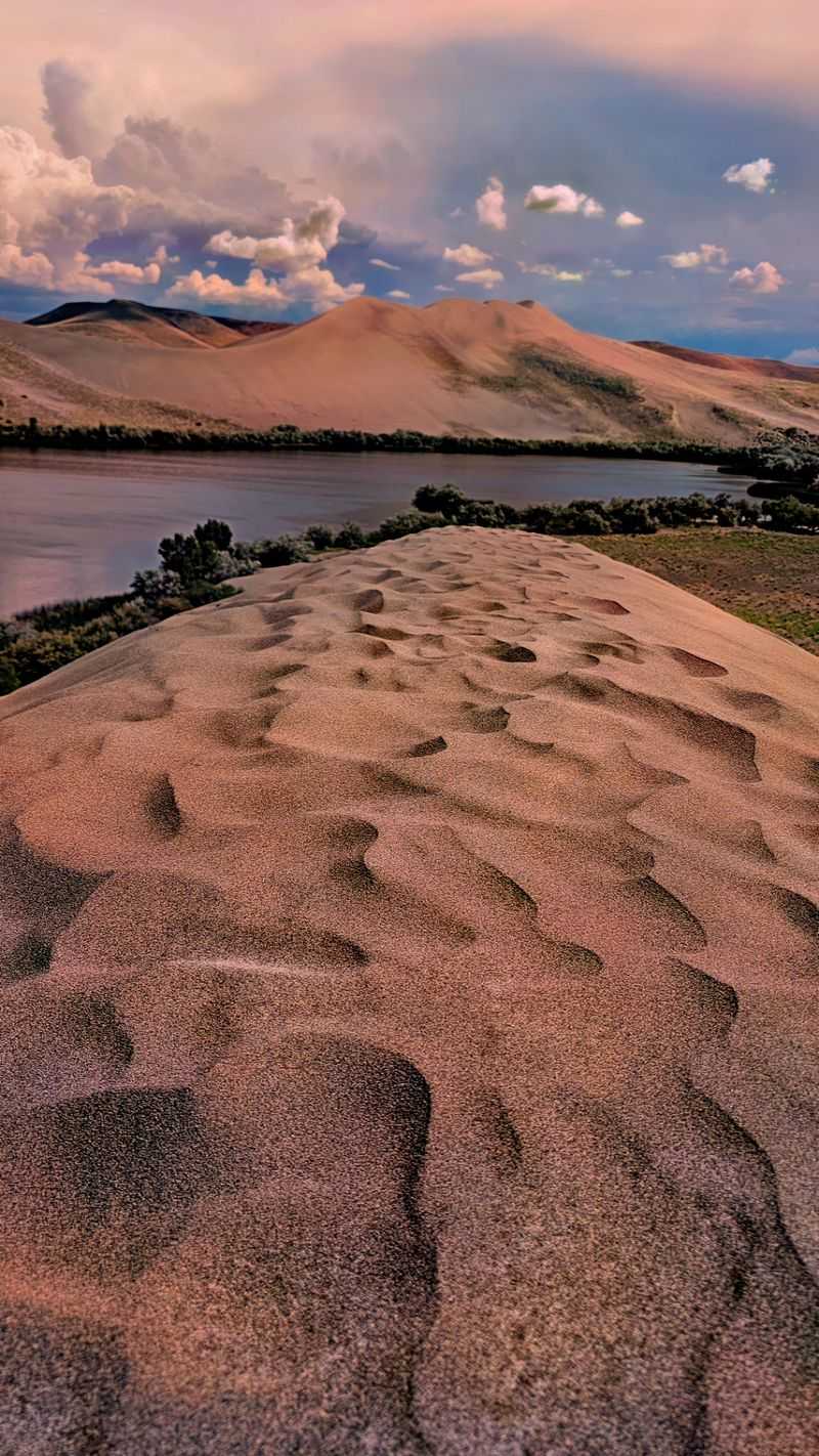
Sand mountains do not belong in the mental picture most people carry of this region, yet there they stand south of Mountain Home. Bruneau Dunes State Park holds the tallest single-structure sand dune in North America, rising about 470 feet above the desert floor.
Two small lakes sit at the base, which makes the scene stranger still: water, cattails, and shorebirds directly below a wall of shifting sand. Climbing the big dune takes real effort, roughly an hour of two-steps-forward, one-step-back progress, and the view from the crest stretches for miles.
Sandboarding is the main event on the way down, and boards can be rented at the visitor center. Sand gets hot by midday, so early morning or evening climbs feel far more pleasant.
Fishing, paddling, and camping round out the day.
After dark, the park becomes one of the best stargazing spots around, with a public observatory offering telescope viewing on scheduled evenings. Bring warm layers, because desert nights cool off quickly.
4. North Menan Butte – Near Menan
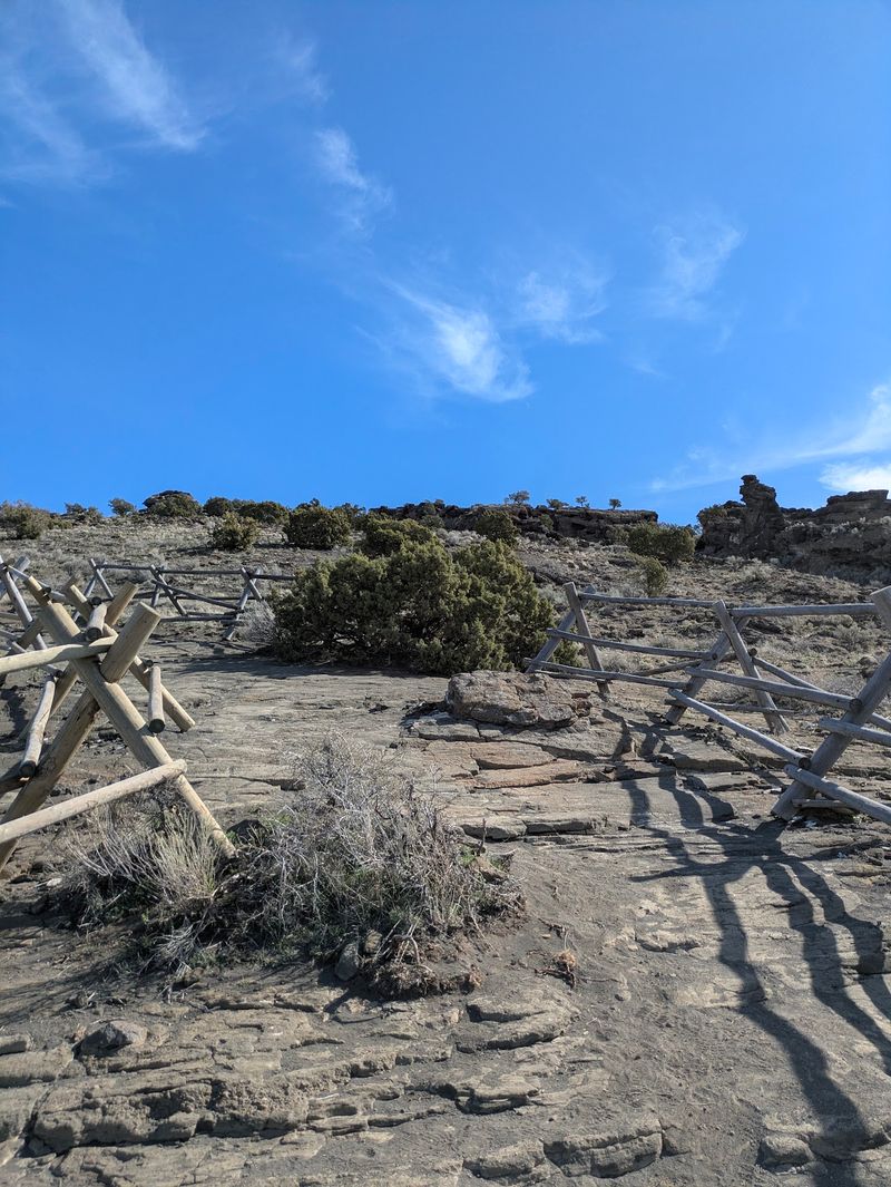
Climbing the rim of an extinct volcano sounds like a trip abroad, yet it happens on a short hike outside Menan. North Menan Butte is one of the largest volcanic tuff cones on Earth, formed roughly 10,000 years ago when magma pushed up through wet ground and exploded into ash and glassy fragments.
The trail gains about 800 feet in under a mile, steep enough to get your attention but manageable for most walkers. At the top, a wide crater drops away and a path circles the whole rim, roughly three miles around.
Views stretch across the Snake River Plain, with the Tetons visible to the east on clear mornings. The crater floor, green with grass in spring, feels oddly peaceful for a place born in an explosive eruption.
Sagebrush, wildflowers, and the occasional hawk keep the walk interesting.
Wind whips across the exposed summit, so a jacket helps even in July, and there is no water anywhere on the route. Start early on summer days to beat the heat.
Sunrise and sunset turn North Menan Butte into a photographer’s favorite.
3. Hell’s Half Acre – Between Blackfoot And Idaho Falls
Black lava stretches to the horizon here, cracked, twisted, and frozen mid-flow, which makes for a landscape that feels lifted from another world. The flow spread across the plain about 5,200 years ago, leaving pressure ridges, collapsed tubes, and jagged folds of rock.
Sound carries strangely across the empty flow.
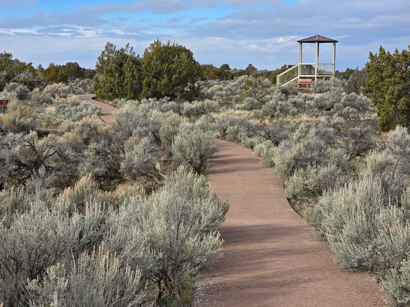
Hell’s Half Acre spreads across the plain along the interstate corridor north of Blackfoot, easy to reach yet startlingly empty once you step off the pavement. Hikers can pick up trails from the rest area, following markers across the rough surface.
Small pockets of soil support juniper, sagebrush, and stubborn wildflowers, tiny bursts of green against endless dark stone. Lichens crust the older rock in pale orange and gray.
Wildlife is sparse but present, and tracks in dust-filled hollows hint at who passed through overnight.
Footing demands attention, since the lava is sharp enough to shred soft shoes and ankles turn easily in the cracks. Carry water, wear boots, and stay on marked routes, because losing your bearings at Hell’s Half Acre comes easily.
2. Paris Ice Cave – Near Paris
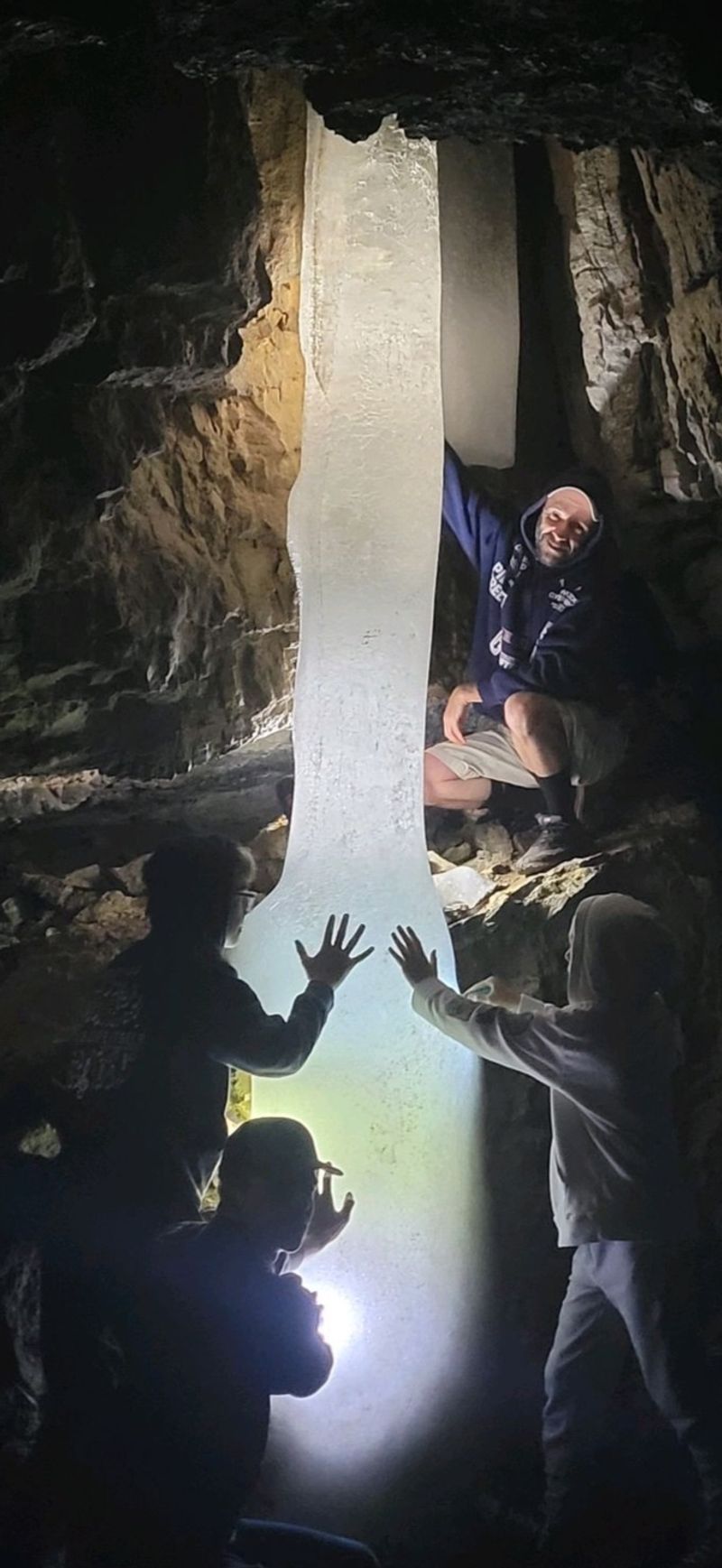
Summer heat bakes the valley floor in Bear Lake County, yet a short scramble into a small solution cave above the town of Paris leads to ice that refuses to melt. Cold air settles in the cave and stays, coating the floor and walls in slick sheets well into the warm months.
Nothing about Paris Ice Cave is polished. No lights, no railings, no guided tour, just a rough opening in the rock and whatever gear you carry.
That rawness is exactly the appeal for travelers who like their discoveries unvarnished.
Bring two light sources, a helmet if you have one, and shoes with serious grip, because ice plus uneven basalt makes for tricky footing. A jacket matters too, since the temperature inside drops sharply within a few steps.
Forest roads climb from Paris toward the site and stay snowbound into late spring, so summer and early fall offer the best access. Recreation.gov still lists the cave as an attraction near Paris Springs.
Go slowly, tread lightly, and leave the formations at Paris Ice Cave exactly as you found them.
1. Bayhorse Ghost Town – Near Challis
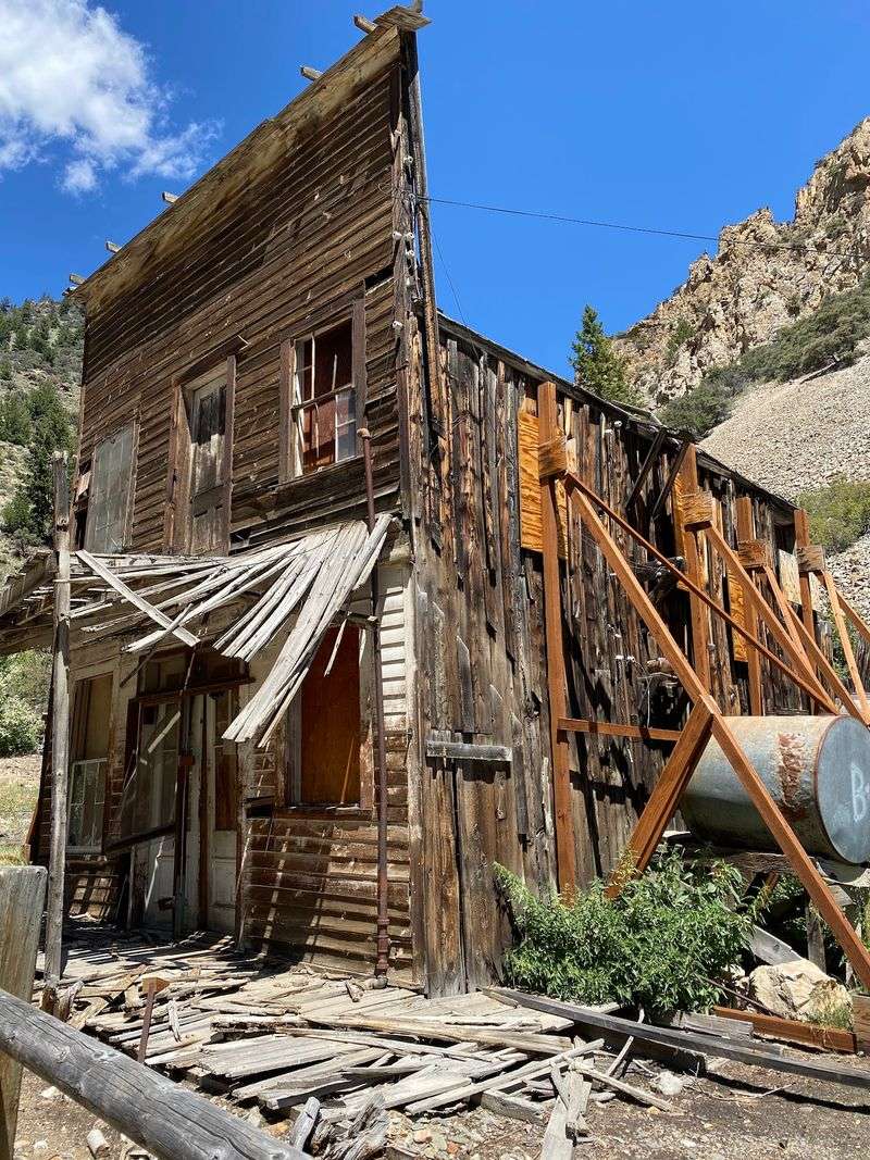
Weathered timber buildings lean against a steep canyon wall above the Salmon River, silent except for wind and the creek below. Bayhorse boomed in the 1870s and 1880s as a silver mining camp, then emptied out, leaving cabins, a mill, charcoal kilns, and stone foundations behind.
The state parks system stabilized the structures rather than rebuilding them, so the town looks worn and honest rather than staged. Interpretive signs explain what each building did, and you can peer inside several from marked walkways.
Beehive-shaped charcoal kilns stand near the road, blackened inside and surprisingly large up close. Above them, mine tailings streak the hillside in pale gray.
Rusted machinery still sits where crews left it more than a century ago.
Getting there means a narrow gravel road climbing from the Salmon River, roughly eight miles of slow driving with limited turnouts, so a smaller vehicle works best. The site opened for its 2026 season on May 1 and closes when snow returns.
Give yourself two hours to explore Bayhorse Ghost Town and the canyon around it.