Know Before You Drive Up That Nebraska’s Famous Bluff Road Tunnels Straight Through The Rock
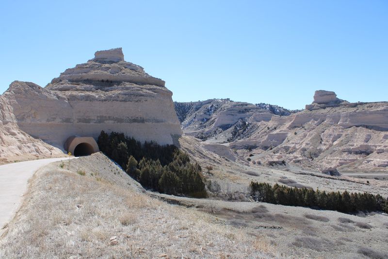
Three times on one short drive, the road ahead disappears straight into solid rock. Those are the only vehicle tunnels of their kind in Nebraska, and they sit on the oldest concrete road in the state.
Depression-era work crews built the route in the 1930s. It climbs about 1.6 miles up a bluff that once guided covered wagons heading west.
I love that a pioneer landmark now comes with headlights and a tunnel echo. I also like that the reward at the top is a view stretching for miles across the North Platte River Valley.
On clear days, you can even spot Wyoming mountains on the horizon.
There’s a catch, though. Not every vehicle fits, the gates don’t stay open late, and the weather gets a vote.
So what should you know before you turn the key?
A Summit Road That Climbs Right Through The Rock
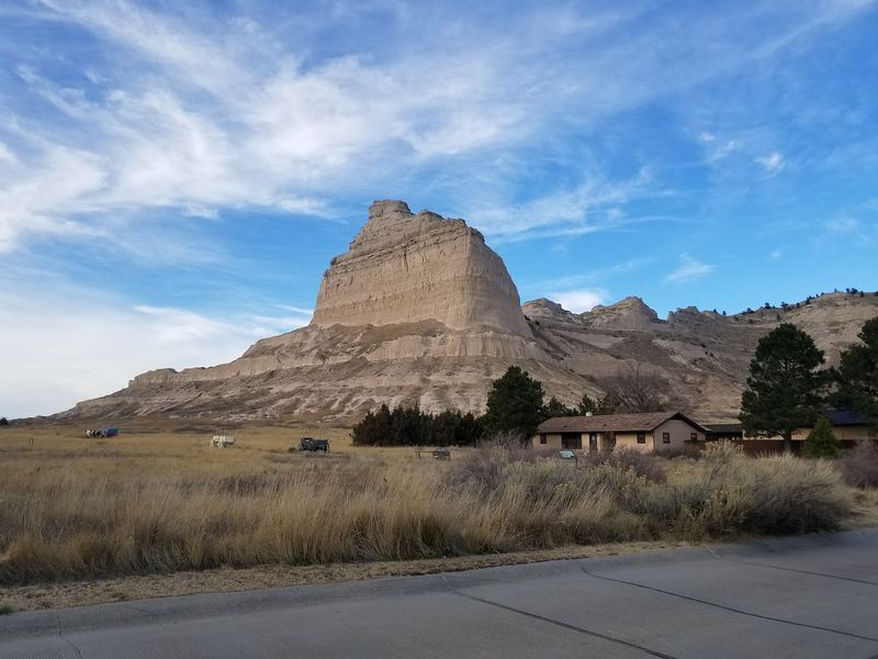
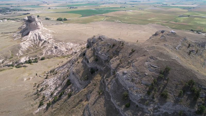
Out in the Panhandle, a sandstone giant rises about 800 feet above the North Platte River. Scotts Bluff National Monument protects roughly 3,000 acres of it, and the Summit Road is the star attraction for drivers.
The road starts at the visitor center parking lot and winds about 1.6 miles to the top. Along the way, it passes through three vehicle tunnels carved directly into the rock.
Nobody else in Nebraska can claim that. These are the only tunnels of their kind in the entire state, which makes the drive a true local oddity.
The monument sits just outside Gering, with Scottsbluff right next door. Folks in the western end of the state have watched that skyline their whole lives.
Still, plenty of Nebraskans have never actually driven to the top. That feels like leaving the best slice of pie on the plate.
The trip is short, but it packs history, engineering, and a wide-open view into one compact outing. Each piece of it deserves a closer look before you go.
So consider this your friendly briefing. Seatbelts on, and let’s start with why this bluff mattered long before cars showed up.
A Landmark That Guided Wagons Long Before Tunnels
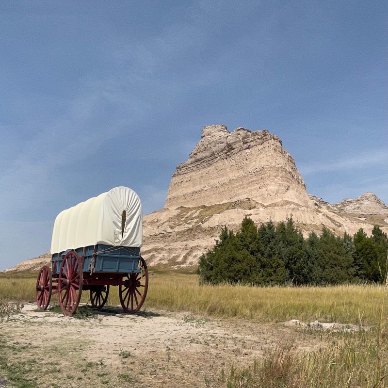
Long before anyone poured concrete here, travelers used this bluff as a giant road sign. Native Americans and later emigrants relied on it for direction for centuries.
In the mid-1800s, more than 350,000 people passed by over roughly three decades. They followed the Oregon, California, and Mormon Pioneer Trails right past its base.
Pony Express riders came through too. That’s a lot of traffic for a spot that still feels wonderfully quiet today.
Early fur traders in the 1820s often used Robidoux Pass, about nine miles west of Gering. From 1841 through 1850, that pass served as the main route of the Oregon and California Trail.
Members of the Robidoux family even ran a trading post and blacksmith shop there in the 1840s. Then Mitchell Pass, closer to the North Platte River, took over as the main route after 1851.
Mitchell Pass sits inside the monument today. Robidoux Pass is marked by an unpaved road and holds National Historic Landmark status.
Those wagon ruts are still visible near the base, too. More on that a little later.
Knowing all that changes the drive. Every curve up the bluff follows a skyline that pioneers once used to find their way west.
Depression-Era Crews And The Big 1937 Opening
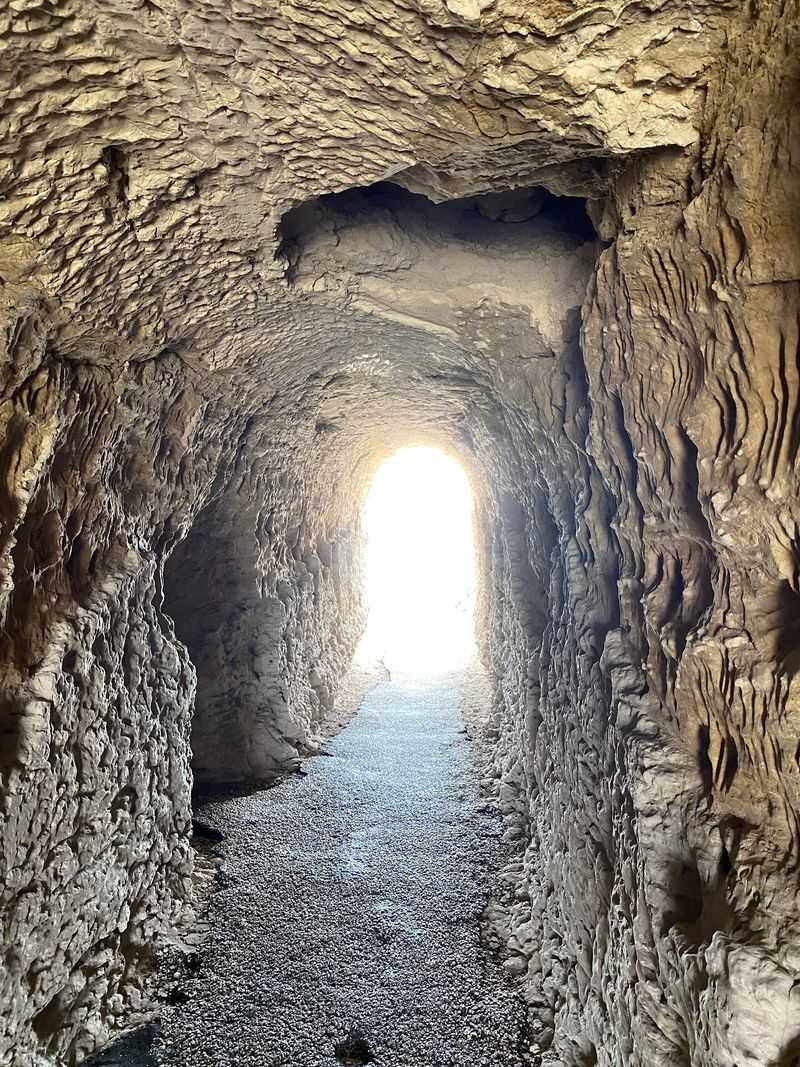
Timing shaped this road’s whole story. Depression-era work crews built the Summit Road during the 1930s, when steady jobs were hard to find.
Their project took on a bluff of layered rock rather than flat prairie. Carving three tunnels into it was no small assignment.
The road opened to the public on September 19, 1937. That means it has been carrying curious drivers upward for well over 80 years.
That’s a lot of family cars over the decades. Station wagons, pickups, and minivans have all taken their turn on the curves.
The workmanship still shows in the tunnels and the winding grade. You’re driving on a piece of Nebraska’s Depression-era history every time you go up.
Of course, a road that old needs care. The park has been working through major rehabilitation, so conditions can change from one visit to the next.
Checking with the visitor center before your trip is a smart move. A quick call can save you a wasted drive across the Panhandle.
Respect the old road, and it will reward you. Few drives in the state come with this much backstory per mile.
Bragging Rights For The Oldest Concrete Road In Nebraska
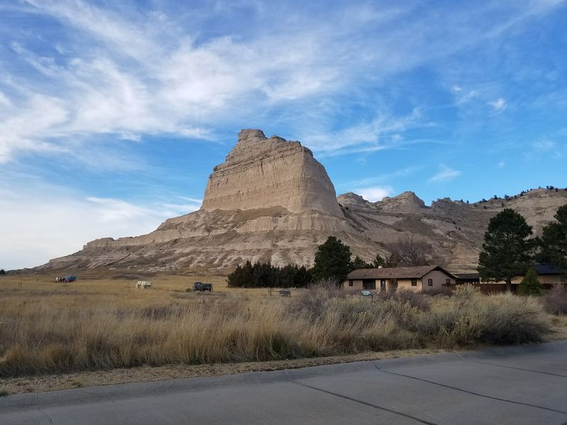
Pavement rarely earns a trivia title, but this one does. The Summit Road holds the honor of being the oldest concrete-paved road in Nebraska.
That’s a big claim in a state crisscrossed by highways and county roads. Yet this short climb up a Panhandle bluff got there first.
The concrete works as a quiet time capsule. It ties directly back to those 1930s crews who built it.
It also makes a great question for the next family road trip. Ask the kids where Nebraska’s oldest concrete road is and watch the guessing begin.
Plenty of folks might guess Omaha or Lincoln. Very few would point to a bluff out near Gering.
The road winds and curves, so it was never built for speed. Slow and steady is the whole point here.
Give the engine a gentle push and let the grade do the storytelling. Each turn reveals a bit more of the valley below.
Old concrete, fresh views, and three tunnels on the way. Not bad for a road that started as a Depression-era project.
Nebraska history doesn’t always come with a steering wheel. Here, it does.
Three Tunnels That Swallow Your Car Whole
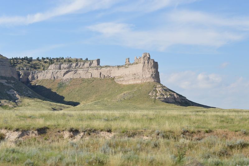
Darkness, then daylight, then darkness again. Driving the Summit Road means passing through three separate tunnels cut straight into the bluff.
They are the only ones of their kind in Nebraska. No other road in the state offers this particular party trick.
Each tunnel arrives fairly quickly on the short climb. Keep your headlights handy and your speed easy.
The tunnels are a big reason the park sets strict size limits. Oversized rigs simply won’t fit through safely, so not every vehicle is allowed up.
For everyone else, the tunnels are pure fun. It’s rare to drive through solid rock on the prairie.
Between tunnels, the views open up toward the valley and the badlands below. The contrast keeps the short drive surprisingly lively.
Drivers should keep eyes on the road, though. Passengers get the best seats for gazing out the window.
Rockfall can also close the road, especially after rough weather. Crews sometimes need time to clear debris before cars can head up.
A little patience pays off. Once you pop out of the last tunnel, the summit parking area is close.
Measure Your Ride Before You Head For The Top
Big rigs, listen up. Vehicles longer than 25 feet or taller than 11 feet 7 inches are not allowed on the Summit Road.
Trailers of any kind are prohibited too. That includes campers, boat trailers, and the little utility trailer you borrowed from your brother-in-law.
The reason is simple. Those three rock tunnels have fixed dimensions, and the bluff isn’t about to make room.
Road-tripping in a motorhome? Plan to park at the visitor center lot first.
From there, you still have options. The Saddle Rock Trail heads to the summit on foot, so the top isn’t off-limits.
Pickups with tall toppers deserve a quick measurement too. Guessing is not a great strategy when a tunnel ceiling is involved.
Standard cars, SUVs, and most minivans fall well within the limits. Still, rangers can confirm current restrictions if you’re unsure.
Road rehabilitation work can add its own temporary rules. Checking conditions before you arrive keeps surprises to a minimum.
Size limits might sound fussy at first. Once you remember the road runs through solid rock three times, they make perfect sense.
The Foot Tunnel Hikers Get To Themselves
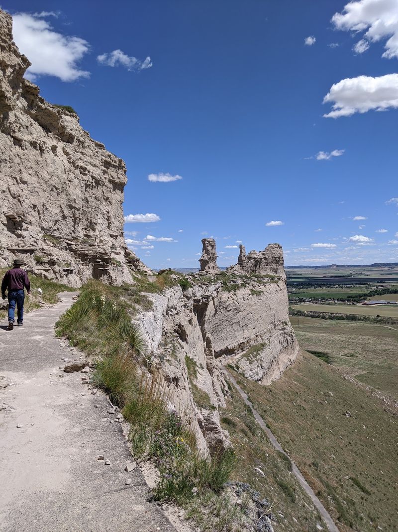
Drivers get three tunnels, but hikers get a secret one. The Saddle Rock Trail climbs from the visitor center to the summit, covering about 1.6 miles one way.
Along the route sits a short, hand-carved foot tunnel. Visible finger marks from its creation remain in the rock.
That detail gives the hike a personal touch. Real hands shaped that passage, and you can still see the evidence.
The trail also offers an audio tour you access with a cell phone. It shares historical tidbits as you climb, so the miles pass with a little storytelling.
Pace yourself on the way up. The trail climbs from the valley floor all the way to the summit, so bring water.
Hiking also solves the gate problem. The trail stays open to foot traffic even after the road closes to cars.
You could even split the difference. One person drives up while the hikers climb, and everyone meets at the top.
Keep an eye on the trail edges, since cliff drops are part of the scenery. Stay on the path and watch where little ones wander.
Earn the view on foot, and it somehow looks even better. Your legs may disagree.
Two Overlooks Waiting At The Summit
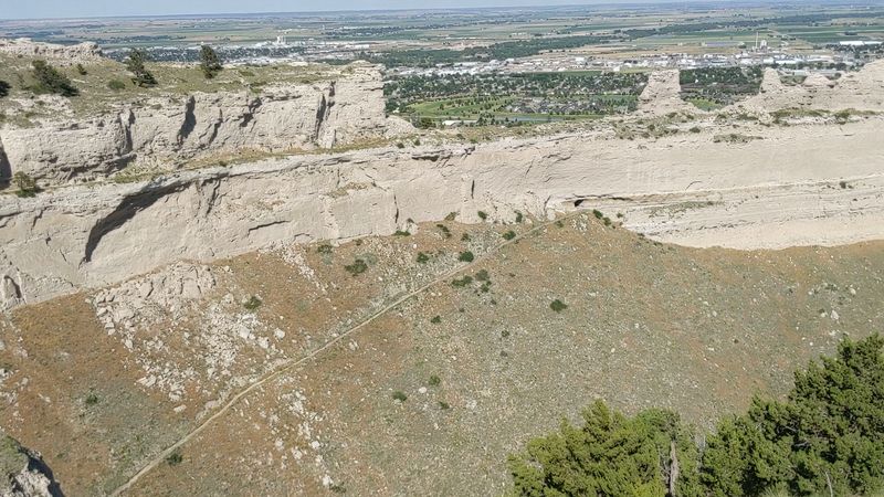
Parking at the top is only halftime. From the summit lot, paved trails lead out to two overlooks, each with its own personality.
The South Overlook sits about 300 yards away. It’s an easy stroll, which makes it a great warm-up for the bigger loop.
The North Overlook starts with a 60-yard uphill path. That leads into a looping trail system of roughly 150 yards.
Neither trail demands hiking boots or a backpack full of gear. They’re short enough for grandparents, kids, and anyone who just finished a long drive.
Paved paths keep footing simple. Still, the 60-yard climb on the north side will get your heart pumping a bit.
Wind can pick up on top of the bluff. A light jacket in the car is never a bad idea, even on a warm day.
Cliff edges are real up here. Stay on the paved route, and keep a hand on any small adventurers who like to explore.
Doing both overlooks gives you views in multiple directions. Each one frames the valley, the badlands, and the twin towns from a fresh angle.
Save a few minutes for simply standing still. The scenery rewards anyone who isn’t rushing.
Spot Chimney Rock And Maybe Wyoming From Up Here
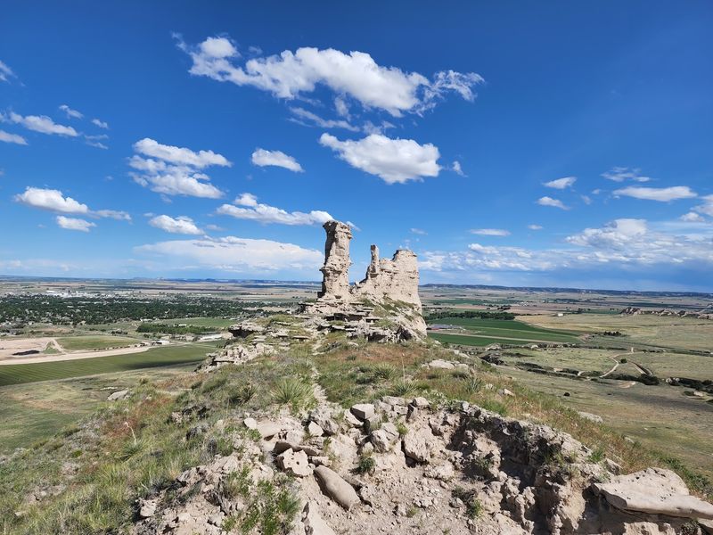
Bring your best squinting skills. From the summit, the North Platte River Valley spreads out in every direction.
The surrounding badlands add rugged texture to the scene. Scottsbluff and Gering sit right below, looking like toy towns on a train set.
On clear days, distant Wyoming mountains come into view. That’s right, you can peek into another state from a Nebraska bluff.
Chimney Rock is visible too, about 20 miles to the east. Spotting that famous spire from here is a fun little scavenger hunt.
Pioneers used both landmarks as guideposts on their way west. Seeing them together from above connects the dots in a way a map never could.
Cloudy or foggy weather can shrink the view, of course. Even then, the drive and the overlooks still make the trip worthwhile.
Binoculars can make the far-off details easier to pick out. A zoom lens on your phone works in a pinch too.
Car access to the top ends in the afternoon, so sunset photos by car aren’t an option. Plan your viewing time with that in mind.
Wide skies, far horizons, and a whole valley at your feet. Nebraska rarely shows off quite like this.
Wagon Ruts You Can Still See Today
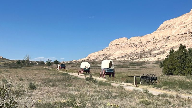
Some history lives in museums, and some is pressed right into the dirt. At Scotts Bluff National Monument, wagon ruts from the 1800s are still visible.
Those grooves came from wheels rolling toward Oregon, California, and beyond. Thousands upon thousands of wagons made the journey through this area.
Mitchell Pass is the key spot to know. It became the main route through the area after 1851, and it sits inside the monument.
Standing near those ruts puts the scale of the trip in perspective. Families walked beside their wagons for months to cross the continent.
Replica wagons set beneath the bluff help fill in the picture. Seeing a Conestoga-style wagon up close makes the old stories feel more real.
Rangers sometimes offer talks about the wagons and trail history. Catching one can turn a quick look into a real lesson.
Kids who’ve played Oregon Trail games may especially enjoy this part. Now they get to see the real route instead of pixels.
Bring a curious mind and comfortable shoes for walking the grounds. The ruts reward anyone willing to slow down and look closely.
Nebraska’s pioneer past is right there under your feet. That’s a field trip no classroom can match.
Start Inside With The Film And Museum
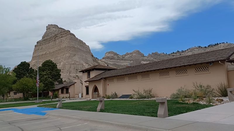
A short film at the visitor center makes a smart first stop. It runs about 10 minutes and sets up the whole story of the bluff.
The attached museum explains why this landmark mattered so much during westward expansion. Displays cover the Oregon, California, and Mormon Pioneer Trails.
Kids can get a hands-on look at local wildlife too. Items like a wolf fur and a jaw cast have been part of the learning experience.
Live history reenactments add another layer at times. Watching history acted out beats reading a plaque any day.
Friendly rangers staff the visitor center and can answer trail and road questions. They can also suggest other spots worth seeing nearby.
A gift shop rounds out the building. National park passport fans can pick up a passport here and start collecting stamps.
Clean restrooms make this a welcome pit stop after a long drive. Western Nebraska distances are no joke, after all.
Even when snow or ice closes the summit road, the visitor center still offers plenty. A winter stop can still deliver a solid dose of history.
Give yourself time here before heading uphill. The view means more once you know the story.
Rattlesnakes, Cactus, And Other Prairie Neighbors
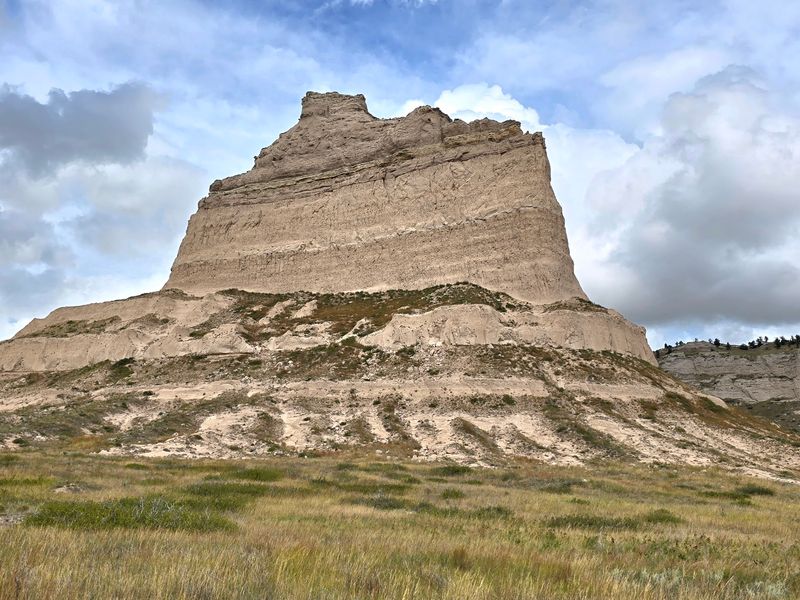
Yes, Nebraska has cactus. Out here on the bluff, prickly plants share the rugged landscape with layered sandstone.
Rattlesnakes live in the area too, and the park posts warnings about them. Stay on paved trails and watch where you step.
Birds are part of the show as well. A pair of binoculars makes it easier to enjoy them without disturbing anyone.
Cliff drops deserve real respect here. Some edges fall away sharply, so keep kids close and skip the daredevil selfies.
Weather adds its own wildcard. Wind, fog, rain, snow, and ice can all affect your visit.
Rockslides occasionally happen overnight, and crews may need to clear the road before it opens. A short delay beats an unsafe drive every time.
Pack water, sunscreen, and a layer for wind. Sturdy shoes help on the longer Saddle Rock Trail.
None of this should scare you off. A little awareness just keeps the focus on the views where it belongs.
The wild side of the monument is part of its appeal. Few places in the state mix pioneer history and prairie wildlife quite like this.
Respect the residents, and they’ll mostly ignore you. That’s a fair trade for a front-row seat to the Panhandle.
Timing Your Visit Around The Gates
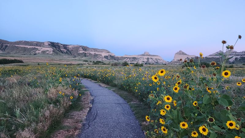
Good news first. There’s no entrance fee, so a full afternoon here won’t touch your wallet.
Head for 190276 Old Oregon Trail in Gering. The visitor center and the Summit Road both start from that main parking area.
The visitor center opens in the morning and closes in the afternoon every day. Car access to the summit also wraps up well before sunset.
Arrive early if you want time for the film, the drive, and both overlooks. About two hours makes for a comfortable, unhurried visit.
Hikers can still reach the top on foot after the road closes. That’s handy for anyone chasing late light.
Winter brings the biggest changes. Snow and ice can close the road to the top entirely.
Ongoing rehabilitation work can also cause closures. Calling ahead or checking park updates before you leave home is the smart play.
Pair the visit with Chimney Rock, about a half-hour drive away. Together they make a classic western Nebraska day out.
Pack snacks, water, and a full tank. Then let the bluff set the pace for the rest of the day.
A Short Climb With A Very Long Memory
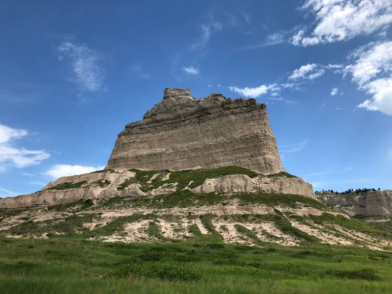
Few 1.6-mile drives pack in this much. Scotts Bluff National Monument manages tunnels, trails, pioneer history, and a sweeping view in a single outing.
The Summit Road alone would earn a spot on any Nebraska bucket list. Add the oldest concrete pavement in the state, and the trivia value climbs fast.
Families get a hands-on history lesson without a ticket price. Road-trippers get a legit break from long stretches of highway.
Hikers get the Saddle Rock Trail and its hand-carved foot tunnel. History fans get wagon ruts, replica wagons, and knowledgeable rangers.
Just remember the rules of the road. Measure your vehicle, watch the closing time, and check conditions before leaving home.
Weather may change your plans, and that’s okay. Even a visit that stays at the bottom delivers plenty to see.
I believe this is one of the best ways to understand the Panhandle. You see the land the way pioneers did, only from much higher up.
So grab the family, fuel the car, and point it west. Those three tunnels are waiting, and the rock isn’t going anywhere.