Mesa Falls Isn’t The Only Roar Here Because Idaho’s Lower Falls Overlook Drops 65 Feet Too
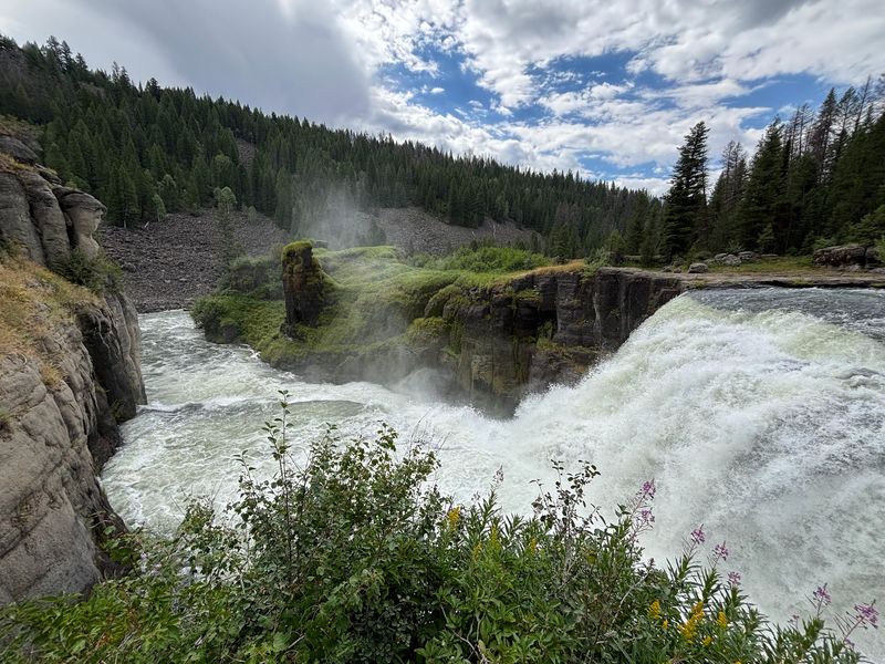
Most drivers on the byway north of town rush past a small pullout, never guessing that a 65-foot waterfall is roaring just beyond the pines. This quieter stop in eastern Idaho sits on the Henrys Fork, one of the last big undammed rivers in the Snake River system.
It costs nothing to visit, and the walk to the view is shorter than a trip across a grocery store parking lot. Once you see the river pour over that wide lip of old volcanic rock, the upper falls might have some real competition.
A Second Waterfall On Highway 47
Along the Mesa Falls Scenic Byway, a 28-mile loop of Idaho Highway 47 linking Ashton and Island Park, two waterfalls share one river. The famous one grabs the brochures, but the Lower Mesa Falls Observation Site waits just down the road inside the Caribou-Targhee National Forest.
Here the Henrys Fork of the Snake River tumbles 65 feet over a wide ledge. The overlook sits high on the canyon rim, so you take in the whole scene at once rather than standing beside the spray.
The site lies a short drive north of Ashton in Fremont County, in the high country of eastern Idaho. Many travelers treat it as a quick bonus after the upper falls, yet it holds its own as a destination.
There is a paved path, a wooden viewing platform, picnic tables, and a restroom near the lot.
For families making a day of it from Idaho Falls or Rexburg, it slots neatly into a loop drive. You can stop, stretch, and look for as long as you like, then keep rolling toward Island Park or back down toward the farm fields around Ashton.
Rock Born From A Supervolcano
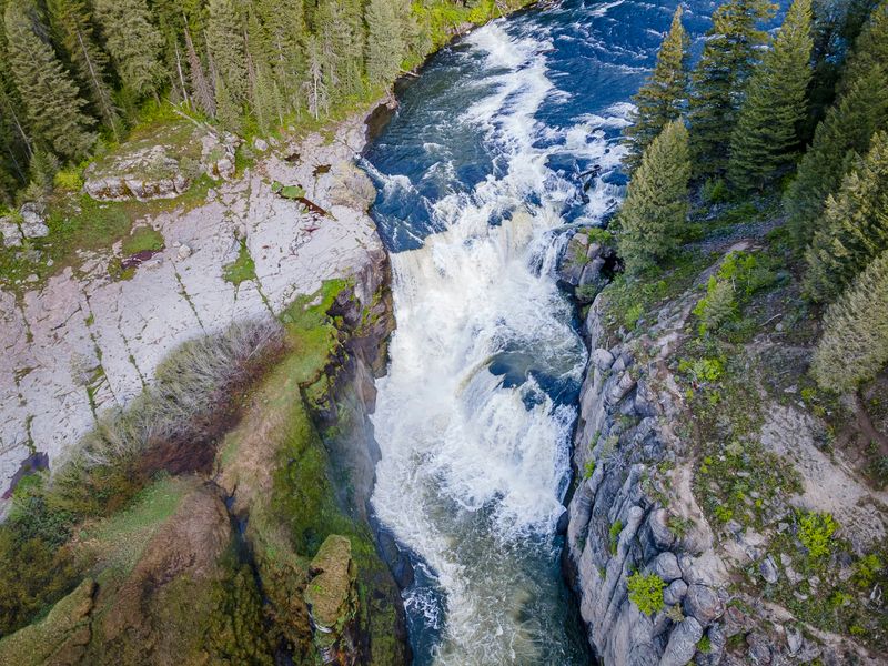
Over a million years ago, a massive eruption in the Yellowstone region blanketed this corner of Idaho in hot ash. That ash hardened into a tough rock called volcanic tuff, and today the Henrys Fork spills right over it.
Because tuff resists erosion better than the softer layers around it, the river carved a ledge instead of a smooth slope. The result is the wide, stepped drop you see from the overlook, with water fanning across the width of the canyon.
Interpretive signs at the platform explain the geology in plain terms, which makes the stop feel like a mini lesson for curious kids. Visitors often comment on how amazing it is to think about the way the falls formed.
Another fun detail sets these falls apart. Mesa Falls, upper and lower, are among the last major waterfalls in the Snake River system without a dam holding them back.
Almost every other big drop on the Snake has been harnessed for power or irrigation.
So the sound echoing through the canyon is the river doing exactly what it has done for ages, untouched by concrete.
Where The Platform Hangs Over The Canyon
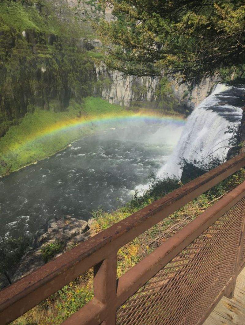
Less than a hundred yards separates the farthest parking spot from the railing. That short, paved stroll makes this one of the easiest waterfall views in eastern Idaho for anyone with tired legs, a stroller, or a grandparent along.
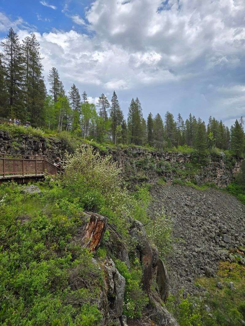
The sturdy wooden platform works like a balcony above the gorge. Some visitors mention catching a rainbow in the mist on sunny days, and more than one has joked that anyone nervous about heights should skip looking straight down.
Here is the honest trade-off. The falls sit a fair distance away from this viewpoint, so you will not feel spray on your face the way you might upstream.
A few trees also block parts of the view, which has frustrated some guests over the years.
Still, the broad perspective has its own reward. You see the full canyon, the curve of the river, and the forest rolling off in every direction.
Visitors who cannot manage a steep hike say this overlook is a fine way to enjoy the scene without any strain.
Binoculars, Zoom Lenses, And A Tripod
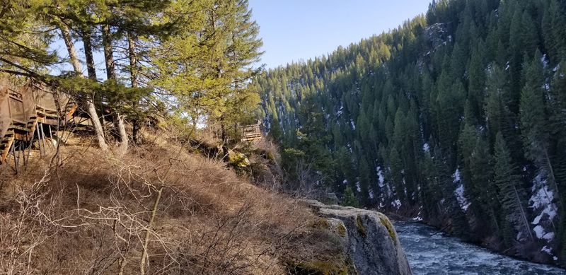
Pack the binoculars. That tip shows up again and again from people who stood at the railing wishing they could pull the falls a little closer or scan the canyon for wildlife.
Photographers have similar advice. A good zoom lens lets you frame the waterfall tightly from the platform, capturing details of the white water and dark rock you would otherwise need a long hike to reach.
A tripod helps too, especially if you want those silky, slow shutter shots of moving water.
Timing matters for pictures. Late spring gets high marks for fresh green foliage, lively clouds, lighter crowds, and easy parking.
Snowmelt also swells the Henrys Fork around then, so the falls tend to look fuller.
Kids can join the fun with a simple pair of binoculars and a mission: spot a bird, a squirrel, or maybe something bigger moving along the far slope. It turns a quick look into a small scavenger hunt.
Even a phone camera can grab a nice wide shot of the canyon here. Just bring a little patience and wait for the light to hit the water.
The Steep Route Down To The Water
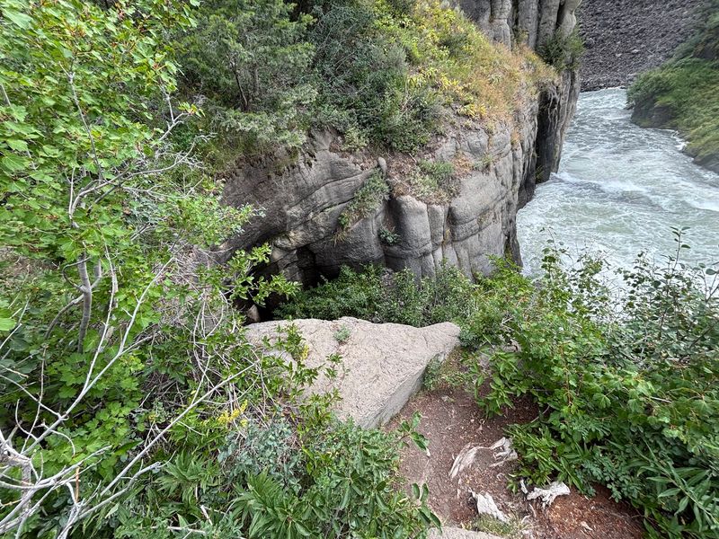
Hikers hungry for a closer look have a different option, and it starts somewhere else. No trail links the lower parking lot to the upper falls, so anyone wanting to hike between the two needs to begin at Upper Mesa Falls.
From there, an easy nature trail of less than two and a half miles round trip leads to a closer overlook of the lower falls. Families say it is gentle enough for young children around five or six.
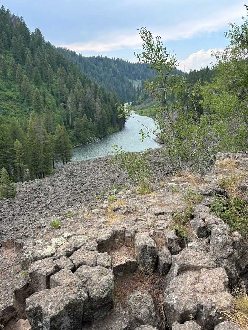
The real adventure comes after that. A rougher spur drops over the canyon edge, heads down a steep grade, and crosses a jumble of lava boulders before reaching the river near the top of the falls.
Visitors describe it as tough but completely worth the payoff.
Wear shoes with solid grip and take your time on the rocks. Several hikers warn that this section is not a good fit for small children.
One more tip from experience: the canyon gets very dark after sunset. Carry a flashlight if there is any chance your outing runs late, because the climb back up is no place to fumble around.
Wildflowers And Picnic Tables Among Lodgepoles
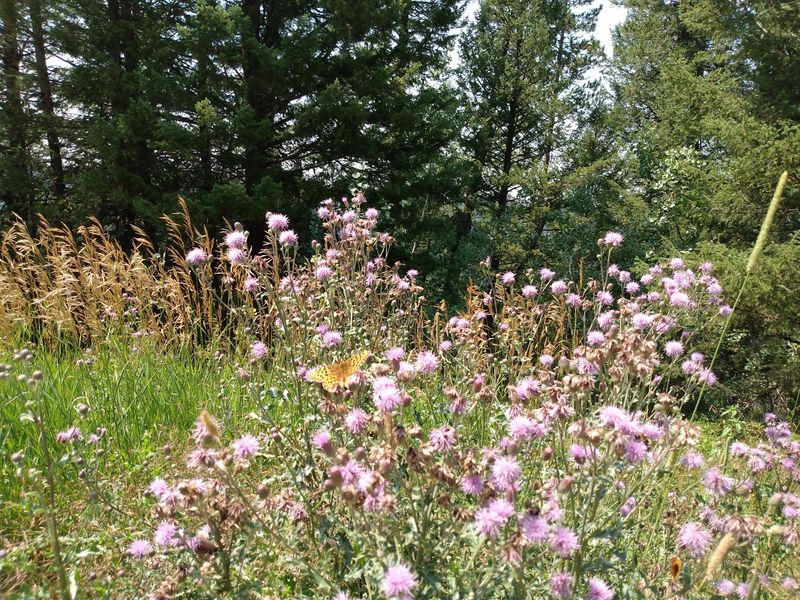
Sandwiches taste better with a waterfall rumbling nearby. A small picnic area near the lot offers a couple of tables framed by flowers, making it an easy lunch stop on a byway drive.
Lodgepole pines crowd the rim, and in summer the ground between them brightens with wildflowers. Nature lovers often mention the mix of blooms, shrubs, and trees as a big part of the appeal, not just the falls themselves.
The mood tends to run peaceful. Many people describe the site as serene, a spot to breathe slow mountain air and listen to the river instead of fighting crowds.
It feels more like a neighborhood park tucked into the forest than a busy tourist attraction.
Four-legged travelers are welcome too, since the site is pet friendly. Keep dogs close near the railing and along the rim, where the drop is sudden.
A campground sits right in the same area, and visitors say it does not interfere with enjoying the overlook. For some Idaho families, this corner of Fremont County carries deep personal meaning, the kind of place tied to birthdays, first trips, and years of memories.
Getting There And What It Costs
Good news for budget trips: there is no admission fee here, and parking is free. That makes the lower overlook one of the easiest free outings in eastern Idaho.
To find it, follow Idaho Highway 47 north out of Ashton along the Mesa Falls Scenic Byway. The loop reconnects with US 20 near Island Park, so you can make a full circle without backtracking.
The observation site sits inside the Caribou-Targhee National Forest.
Facilities stay simple. Expect an outhouse-style restroom near the parking lot, a few picnic tables, and the paved walk to the platform.
Plenty of travelers stop just to use the bathroom and end up lingering at the railing.
Parking is usually manageable, though the lot is smaller than the one at the upper falls. Arriving earlier in the day on summer weekends can help.
The byway is at its best from roughly late May through October. Winter snow changes road conditions in this high country, so check with the Caribou-Targhee National Forest before driving outside the main season.
Bring water, layers, and snacks, since services are limited between towns.
Worth The Extra Stop
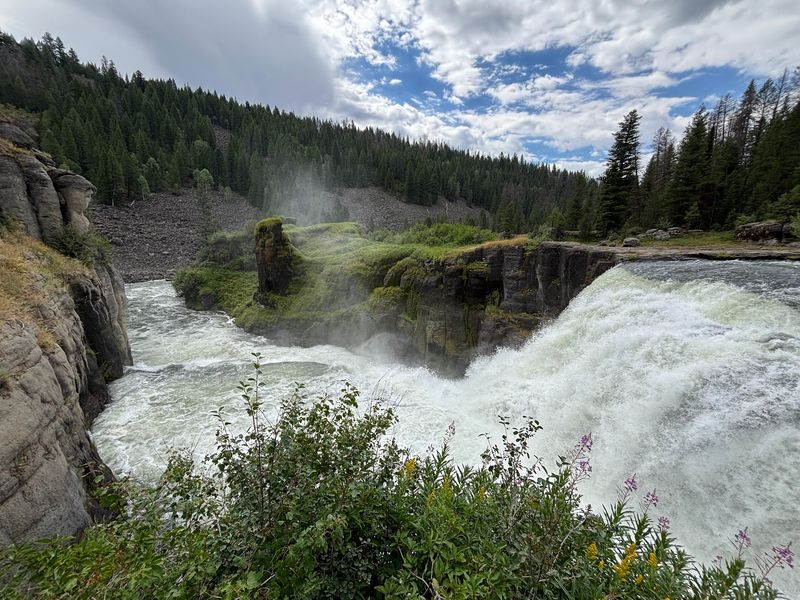
Skipping the lower overlook would mean missing half the story of the Henrys Fork. The upper falls deliver a thundering 114-foot plunge up close, while the lower site offers a wide, calm view of the whole canyon.
Together they make a satisfying afternoon in Fremont County. Many visitors say both stops are worth the time whenever you pass through the area.
Who will enjoy it most? Families with little ones, travelers who prefer short walks, and anyone who wants a scenic pause on the drive to Island Park or Yellowstone.
Photographers with long lenses and hikers ready for the steep route below will find plenty to love, too.
Keep expectations grounded. You are watching from a distance, and trees frame part of the scene.
Bring binoculars, give yourself a few quiet minutes, and the details start to reveal themselves.
For a free stop with a restroom, a picnic table, and a 65-foot waterfall, it is hard to ask for more. Eastern Idaho has a way of hiding its best moments just down the road from the famous ones.