9 Nebraska Panhandle Rockhounding Spots Where Colorful Stones Hide In Plain Sight
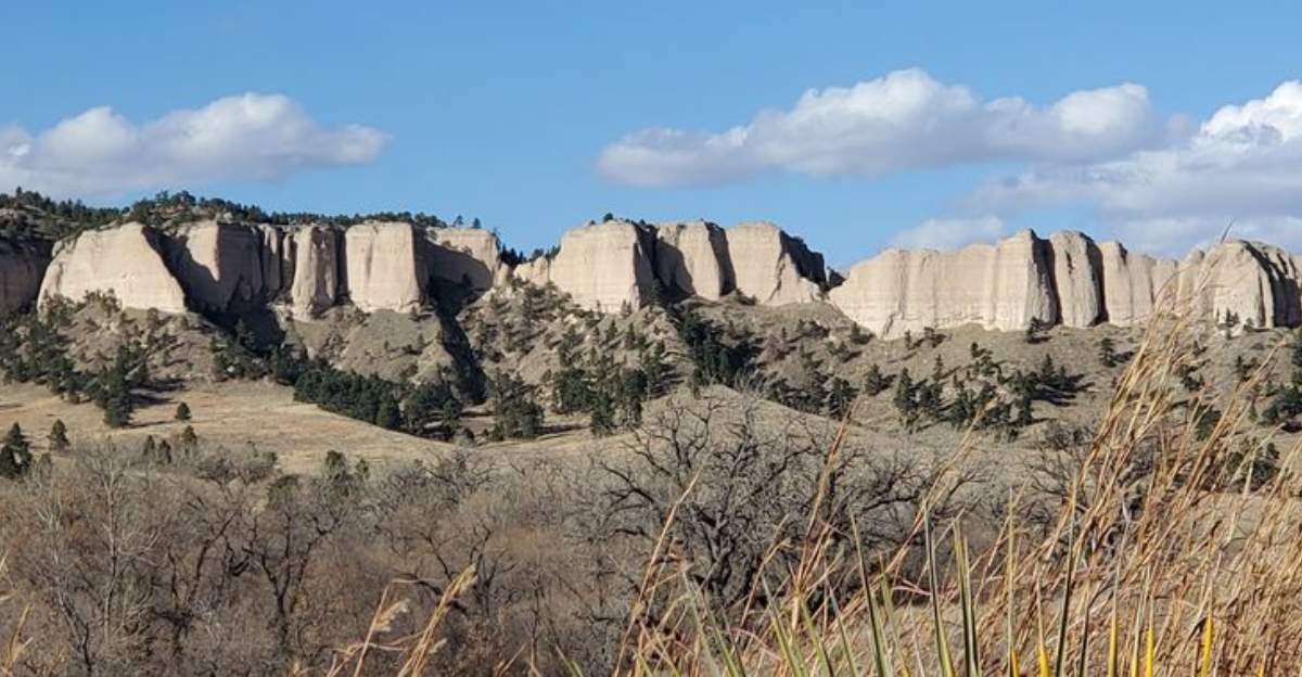
A patch of ordinary-looking ground can become remarkably interesting once you start paying attention to what is under your boots.
Across the Panhandle, riverbanks, gravel beds, public collecting areas, and weathered outcrops can hold agates, petrified wood, quartz, and other stones polished by time.
The best pieces are not always large or immediately impressive. Some reveal their color only after dust is wiped away or sunlight hits the surface at the right angle.
Western Nebraska rewards people willing to crouch beside a pile of rocks while everyone else keeps walking.
That patience is part of the appeal. Rockhounding turns an outdoor stop into a slow search where every unusual stripe or unexpected flash deserves another look.
Access rules vary, and collecting is not allowed everywhere, so checking land ownership and local regulations before filling a pocket is essential.
Most finds will not fund an early retirement. They may, however, end up displayed on a desk for years while you tell anyone nearby exactly where you spotted them.
1. Oglala National Grassland Near Crawford, Dawes County
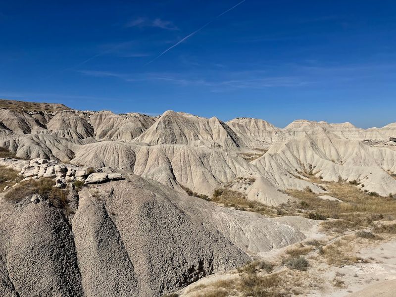
Stretching across more than 94,000 acres of eroded badland terrain in Dawes County, the Oglala National Grassland near Crawford stands as one of the most accessible and productive rockhounding areas.
The White River Group sediments exposed here weather out a stunning variety of collectible materials including blue chalcedony, prairie agate, jasper, petrified wood, common opal, and calcite crystals.
After a rainfall, the ground practically comes alive with finds.
Chalcedony develops a waxy sheen that catches the light against the pale gray-tan earth, making freshly washed specimens surprisingly easy to spot even from a standing position.
Rolling badland topography alternates between exposed clay, sandstone, and volcanic ash beds, each layer offering its own mix of colorful nodules.
A high-clearance vehicle is recommended for reaching the more remote collecting areas, particularly on unpaved dirt roads that can turn slick and muddy after wet weather.
Casual collecting for personal and hobby use is generally permitted on public lands here without a permit, though selling collected materials is not allowed.
Keeping a respectful distance from fragile formations ensures these incredible landscapes remain productive for future collectors.
2. Oglala National Grassland North of Toadstool Road, Near Crawford
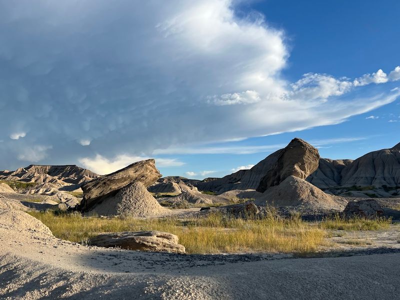
Just north of Crawford, the grasslands surrounding Toadstool Geologic Park carry a bit of a twist for collectors.
Mineral collecting is not permitted within the designated interpretive area of Toadstool Geologic Park itself, but the surrounding Oglala National Grassland land opens up collecting opportunities for chalcedony, common opal, jasper, and petrified wood.
The geology here belongs to the White River Group, a sequence of ancient sediments laid down tens of millions of years ago during a time when this region looked nothing like it does today.
Understanding those formations helps collectors zero in on the most productive slopes and eroded gullies rather than randomly wandering the landscape.
Exposed ash beds and clay-rich horizons tend to be especially productive after the freeze-thaw cycles of late winter and early spring loosen material from the hillsides.
Roads in this portion of the Oglala National Grassland are typically gravel and can be navigated by a standard car during dry conditions, though washouts and soft spots can develop quickly after rain.
Arriving with sturdy footwear, a hand lens, and a small collection bag makes the experience much more practical and enjoyable. Patience tends to be the most valuable tool brought along on any visit here.
3. Oglala National Grassland Near Whitney, Dawes County
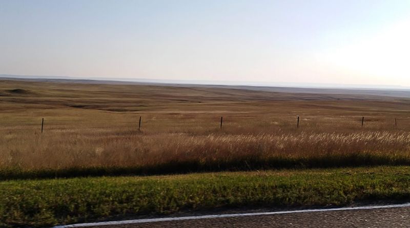
Not every productive rockhounding area in the Nebraska Panhandle announces itself with dramatic scenery, and the Oglala National Grassland sections near Whitney in Dawes County prove that point well.
Quiet and often overlooked compared to better-known spots, this stretch of public land sits within the same geological system that makes the broader Oglala Grassland so rewarding for collectors.
Prairie agate, chalcedony, and jasper fragments turn up across eroded slopes and gravel washes throughout this area.
The terrain here tends to be gentler than the deeper badland cuts found closer to Crawford, which can make walking and searching more comfortable for families or beginners.
That gentler topography also means collectors spend less time scrambling and more time scanning the ground at a comfortable pace.
Visiting during the shoulder seasons of spring and fall tends to offer cooler temperatures and better light conditions for spotting translucent stones against the pale soil.
Summer heat can make long walks uncomfortable, and midday glare sometimes flattens the visual contrast that makes agate and chalcedony easier to identify.
Bringing plenty of water and wearing sun protection remains important regardless of the season, since shade is nearly nonexistent across most of this open grassland terrain.
4. Agate Reservoir Area, Oglala National Grassland
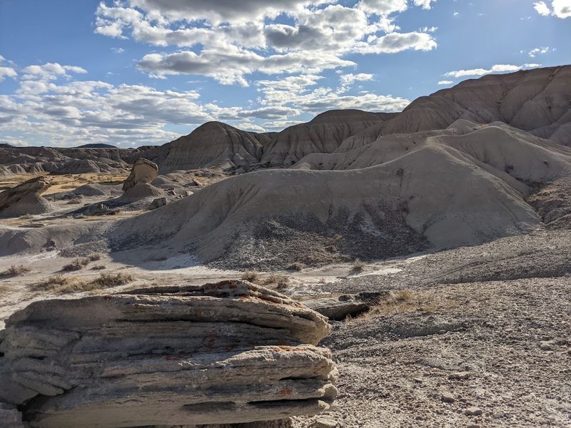
Few spots in the Nebraska Panhandle pack as much geological variety into a single drive as the roads leading toward Agate Reservoir within the Oglala National Grassland.
The surrounding public grassland contains exposures of White River Group sediments where collectors may encounter common surface materials such as chalcedony, jasper, and prairie agate on eligible public land.
Rather than one concentrated collecting area, the roads around the reservoir pass through changing terrain that includes gravelly slopes, weathered sediment, and open prairie.
Carefully checking land ownership before leaving established roads is important because public and private parcels occur throughout this portion of the grassland.
Changing elevations across this area expose different sedimentary layers, each with their own distinctive appearance and weathering patterns.
Walking slowly and scanning a wide arc ahead rather than just straight down tends to reveal more interesting surface material.
The reservoir itself adds a pleasant visual backdrop and can provide a comfortable resting spot between searching sessions during longer visits.
Road conditions can change quickly after rain, so checking the forecast before traveling is a sensible precaution.
5. Bordgate Reservoir Area, Oglala National Grassland
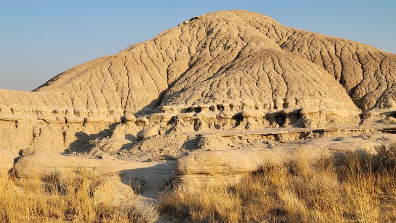
Within the broader expanse of the Oglala National Grassland, the Bordgate Reservoir area offers a quieter and less-traveled corner of the grassland for visitors exploring northwestern Nebraska.
Reservoir edges and surrounding hills provide a good opportunity to observe the weathered sedimentary landscape that characterizes this portion of the grassland.
The geology here belongs to the White River Group, whose ancient volcanic ash deposits and stream sediments shaped much of the surrounding terrain.
Recognizing pale ash beds and weathered slopes helps visitors better understand the geological history of the region.
Remote roads leading to the reservoir are generally unpaved and may become soft or deeply rutted after precipitation.
Checking current road conditions and carrying offline navigation is a good idea because cellular service can be limited.
The quiet setting makes this area especially appealing for those who enjoy wide-open prairie scenery.
Patience and preparation usually contribute more to an enjoyable visit than covering a large amount of ground.
6. Rock Bass Reservoir Area, Oglala National Grassland
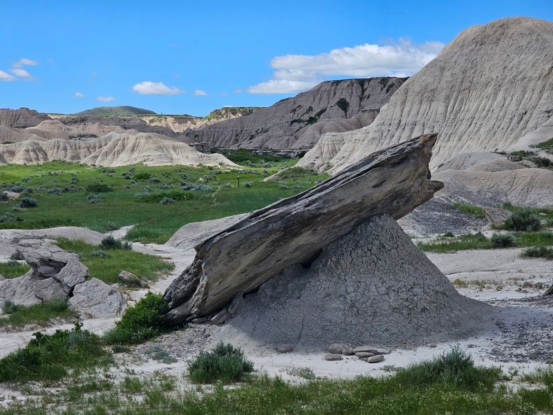
Rock Bass Reservoir sits within the Oglala National Grassland and shares the same broad geological setting found throughout much of the surrounding landscape.
The reservoir and nearby hillsides provide opportunities to observe the weathered sedimentary formations that define this portion of Dawes County.
Visitors may notice colorful jasper, chalcedony, and other common rocks naturally scattered across portions of the landscape where collecting is permitted.
The area has changed in recent years following the failure of the reservoir dam, so current conditions may differ from older photographs and guidebooks.
Roads remain primitive in places, making sturdy footwear and a high-clearance vehicle helpful under some conditions.
Weather can change quickly across the open prairie, and shade is limited throughout most of the area.
As with other eligible National Forest System lands, only modest amounts of common surface rocks may be collected for personal use where permitted under Forest Service regulations.
Checking current access conditions before visiting helps ensure a smoother trip.
7. Public Grassland Along Montrose Road Near Montrose
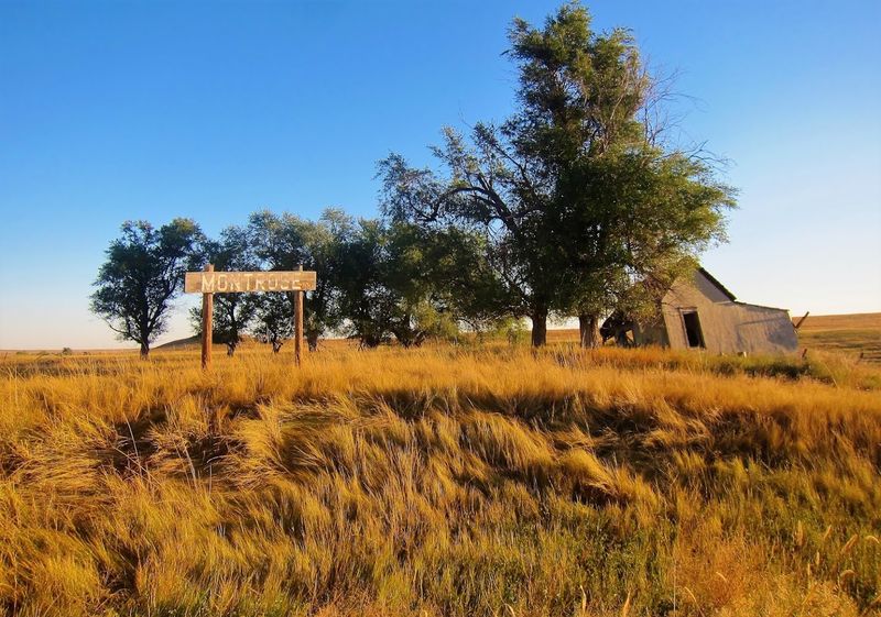
Remote and genuinely off the beaten path, the public-land sections around Montrose Road in Sioux County attract collectors who enjoy the combination of solitude and geological reward.
Agate, chalcedony, and jasper specimens scatter across open grassland and eroded badland formations throughout this area, weathering steadily out of ancient silica-rich deposits left behind by volcanic activity millions of years ago.
Sioux County sits within a geological transition zone where the chemistry and layering of exposed sediments shifts noticeably across short distances, meaning the character of collectible material can change from one ridge to the next.
Blue chalcedony nodules, banded prairie agates, and deeply colored jasper pieces are all realistic finds for a patient searcher willing to cover ground methodically.
Unimproved two-track access roads weave through sections of the area, and these can become challenging after rain, so dry-weather visits tend to be far more practical.
Confirming land status before heading out matters more here than at some other locations, since public and private parcels can alternate in this part of Sioux County without obvious visual markers at the ground level.
Downloading a current public land layer to a GPS app or picking up a BLM surface management map beforehand saves considerable frustration in the field.
The reward for doing that homework is a searching experience that feels genuinely exploratory and unhurried.
8. Crawford Rock Swap Field Trips, Crawford
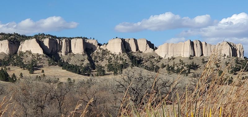
A reliable way to search Nebraska’s agate country without guessing about property boundaries begins at the Crawford Rock Swap.
The long-running event takes place at Crawford City Park over Labor Day weekend and includes scheduled field trips to nearby agate gravel beds.
Participants meet at the information booth before heading out with people familiar with local collecting areas.
That guided format matters in a region where Forest Service parcels, county roads, and private ranchland can sit close together.
The field trips give beginners a better chance of recognizing prairie agate, chalcedony, jasper, and other regional material in its natural condition.
Experienced collectors also benefit from visiting ground selected by local rock enthusiasts rather than relying on vague online coordinates.
Exact destinations can vary, which allows organizers to account for current access arrangements and site conditions.
Back at the park, vendors display polished agates, minerals, fossils, jewelry, and rough specimens.
The annual gathering also traditionally includes demonstrations, an auction, and a meeting for Fairburn agate collectors.
9. Prairie Agate Rock Shop And Fossil Museum, Crawford
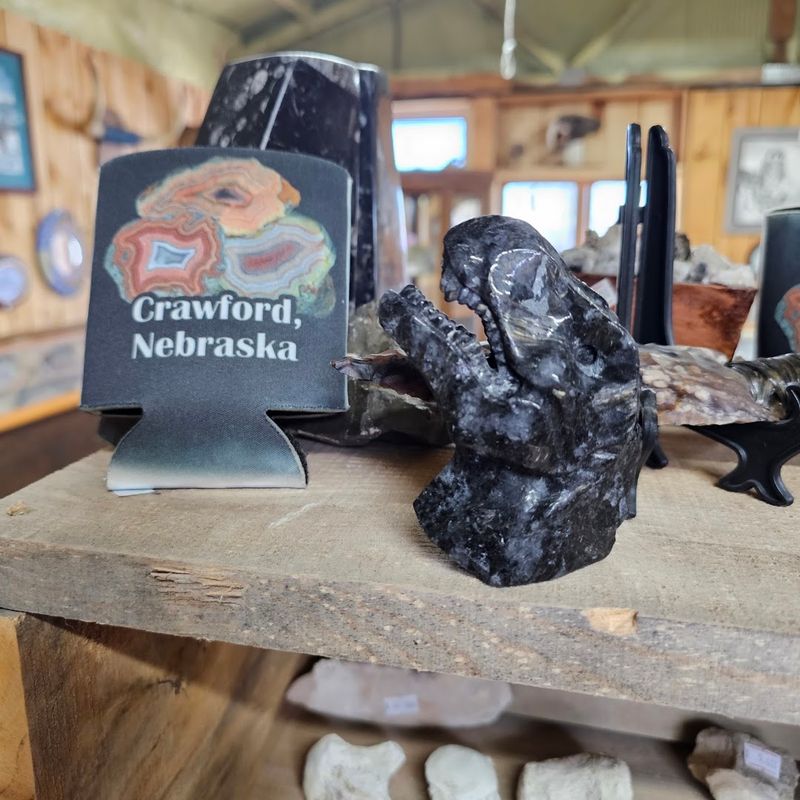
Prairie Agate Rock Shop and Fossil Museum gives visitors a close look at the stones found around northwestern Nebraska before they begin searching outdoors.
Located along U.S. Highway 20 in Crawford, the family-run shop displays local agates, minerals, petrified material, and fossils alongside specimens gathered farther afield.
One particularly useful feature is the display of local material in both rough and finished form.
Beginners can learn how weathered chalcedony or agate may appear on the ground before cutting and polishing reveal its color and pattern.
The owners have also traditionally helped visitors understand regional collecting rules and identify appropriate places to search.
That local guidance is valuable because legal access can change across the patchwork of public and private land surrounding Crawford.
This is not a free outdoor collecting field, so the heading should make that distinction clear.
It still belongs in a broader rockhounding article as a practical orientation stop where readers can study examples, ask informed questions, and purchase specimens without removing anything from protected ground.