10 New Mexico Picnic Spots With Views That Almost Don’t Look Real
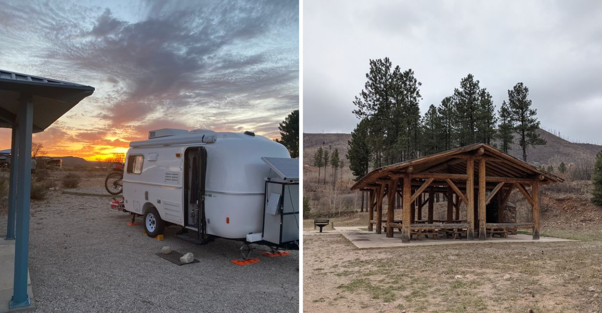
A sandwich improves dramatically when the table comes with red cliffs, blue water, or a mountain horizon.
Across New Mexico, picnic spots turn ordinary lunches into scenic pauses surrounded by desert light, forests, lakes, and volcanic landscapes.
The food can stay simple. The view is doing plenty!
Some places work for an easy roadside break, while others add short trails or water nearby.
Families can spread out under pines, and solo travelers can claim a quiet bench with more sky than they know what to do with.
Pack a cooler and choose the scenery first. Lunch tastes perfectly fine at home. Out here, the setting is what earns the extra drive.
1. Elena Gallegos Open Space, Albuquerque
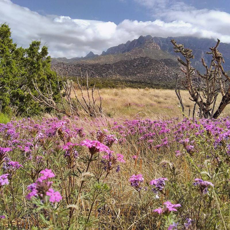
A quiet open-space escape sits minutes from a major city. Elena Gallegos Open Space covers 640 acres at the base of the Sandia Mountains.
Piñon and juniper grow in loose clusters across tawny grassland waves. Traffic noise fades quickly once wind starts moving through the bunchgrass.
Covered tables come with barbecue grills and welcome shade during warm months. Elevation sits near 6,500 feet, which keeps afternoons a touch cooler than the valley.
Views stretch west toward Mount Taylor and north across the Jemez Mountains. Looking south, the wide Tijeras Arroyo cuts through the land below.
Trails suit almost every ability level, including hikers, cyclists, and horseback riders. The Cottonwood Springs Trail is accessible and features small artistic rest stops along the way.
Mountain bikers and hikers can explore the open space’s multi-use trail network, while other routes connect toward the broader Sandia Mountain trail system.
Summer rains can bring seasonal vegetation changes, while the surrounding Sandia foothills provide habitat for a variety of wildlife, including coyotes and larger mammals.
Golden hour, roughly sixty minutes after sunrise or before sunset, delivers the best colors. Cacti and shrubs catch that warm glow beautifully.
You can reach the trailheads and shaded tables along 7100 Tramway Blvd NE in Albuquerque. Bring water, since desert air dries you out faster than expected.
2. Cerrillos Hills State Park, Cerrillos
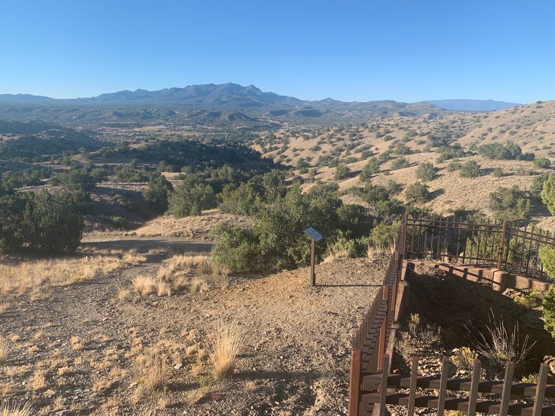
Correct me if I’m wrong, but eating lunch above 1,100 years of mining history sounds unusual. Cerrillos Hills State Park protects 1,116 acres of rolling high-desert terrain.
The park sits just off the Turquoise Trail National Scenic Byway. Day use runs year-round, sunrise until sunset, with no overnight camping allowed.
Widely spaced trees earned this ecosystem the nickname Pygmy Forest. Grassland dominates between the scattered piñon and juniper.
Five miles of paths wander past safeguarded mine shafts and old prospect pits. Interpretive signs explain digging that happened in the late 1800s and early 1900s.
Four mountain ranges appear on clear days: the Sandia, Ortiz, Jemez, and Sangre de Cristo. That panorama alone justifies unpacking the cooler slowly.
Picnic tables provide places to pause around the park and visitor-center area, while seasonal wildflowers add color beneath the wide New Mexico sky.
Hikers, mountain bikers, and riders on horseback share the marked routes. Spring and autumn bring the most comfortable walking temperatures.
More than thirty bird species live here, including great horned owls and golden eagles. Porcupines, mule deer, coyotes, and bobcats also roam the slopes.
A newly installed interpretive museum sits inside the small welcome building at 37 Main St in Cerrillos. Stop there first, then climb toward the ridges with your basket.
3. City Of Rocks State Park, Faywood
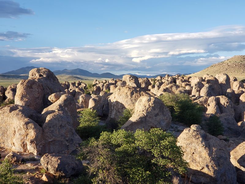
The volcanic columns make an immediate impression beside the road. City of Rocks State Park spreads its sculpted pinnacles across roughly one square mile.
Some formations rise close to 40 feet above the desert floor. Erosion carved narrow passages that resemble streets between buildings.
A massive eruption around 34.9 million years ago created the original rock. Wind and water handled the sculpting over the following ages.
Elevation reaches about 5,200 feet within the Chihuahuan Desert. Yuccas, cacti, ocotillo, juniper, and evergreen oak fill the gaps between boulders.
Picnic areas and developed sites sit among the rock formations, giving visitors an unusually dramatic setting for lunch.
Stargazing is one of the park’s major attractions, and the Star Observatory supports astronomy programs beneath the southern New Mexico sky.
Hikers choose easy or moderate routes, while cyclists ride designated tracks. A desert botanical garden showcases regional plants worth a slow walk.
Wildlife includes javelinas, jackrabbits, antelope, deer, and over 35 bird species. Golden eagles and small finches share the same airspace.
October through April brings cool weather ideal for walking and stargazing. Summer heat can be intense, so plan accordingly.
Follow 327 Highway 61 in Faywood to find the entrance and camping loops. Stay after dark if you can, since the stars steal the evening.
4. Bottomless Lakes State Park, Roswell
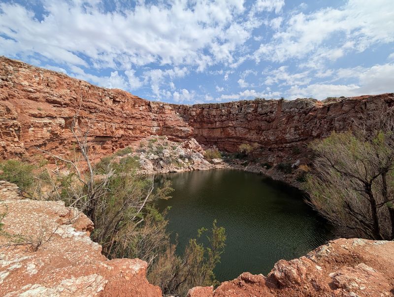
Sounds too good to be true, but eight deep lakes really do sit in this desert. Bottomless Lakes State Park guards a chain of spring-fed sinkholes east of Roswell.
Depths range between 17 and 90 feet across the different pools. Blue-green water creates an illusion of endless depth, which explains the name.
Red gypsum bluffs rise almost vertically above the shoreline. Vegetation stays sparse along those steep walls.
New Mexico’s very first state park opened here back in 1933. That history adds weight to an already strange landscape.
Lea Lake welcomes swimmers and nonmotorized paddlers during warmer months, but fishing is not permitted there. Fishing within the park is currently limited to Devil’s Ink Well and Pasture Lake, with Pasture Lake stocked seasonally.
Lea Lake’s day-use area includes 24 picnic shelters, a group shelter, and the historic pavilion, though current Stage II fire restrictions limit the use of fire and charcoal.
Short day hikes suit families and casual walkers looking for overlooks. Trails stay easy to moderate without long climbs.
Wetlands attract waterfowl throughout the year. Quails, hawks, and roadrunners appear along the drier margins.
Spring and autumn bring mild air ideal for camping and swimming. Summer stays busy despite the heat, so arrive early for shade.
The main road through the park runs to 545 A Bottomless Lakes Rd in Roswell. Bring towels, because that water tempts almost everyone eventually.
5. Hyde Memorial State Park, Santa Fe
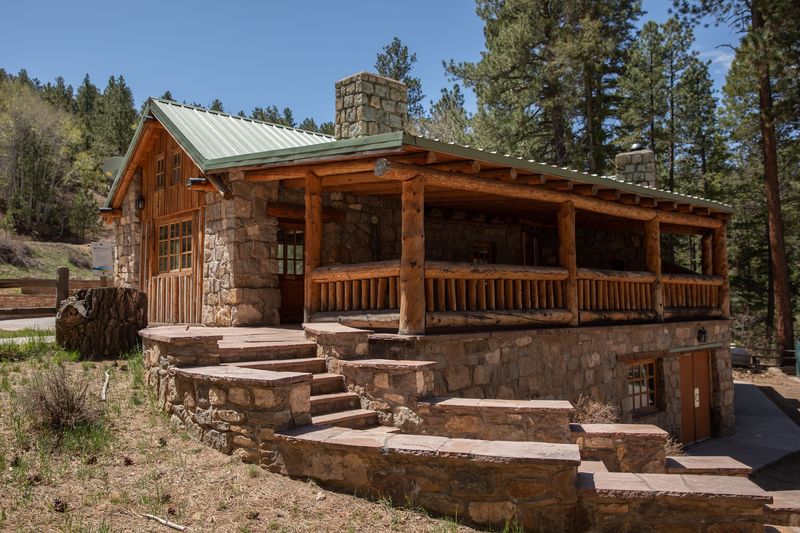
Swap desert heat for pine shade in twenty minutes. Hyde Memorial State Park climbs into the Sangre de Cristo Mountains above Santa Fe.
Elevations run between 8,300 and 9,400 feet, making this the highest state park in New Mexico. Air stays crisp even during midsummer afternoons.
Ponderosa pine and aspen crowd the slopes on either side of the road. A small stream slips past the campgrounds, adding steady background sound.
Picnic shelters provide shaded places beneath the forest, while autumn color in the aspens adds another reason to visit as the season changes.
Roughly 4.2 miles of trails cross the forest here. Waterfall Trail follows a small creek through a narrow canyon, while the Piggyback Trail follows Little Tesuque Creek and West Circle climbs steeply toward broader views.
Winter converts the grounds into a snow playground. Sledding, snowshoeing, and cross-country skiing keep the season busy.
The Civilian Conservation Corps built the historic lodge and several structures between 1938 and 1942. Those stone and timber details still stand today.
Birding and wildlife watching are among the park’s official activities, adding another reason to slow down beneath the pines and aspens.
Cell service ranges from poor to nonexistent, which most people count as a bonus. Head up 740 Hyde Park Rd in Santa Fe and let the phone rest quietly.
6. Villanueva State Park, Villanueva
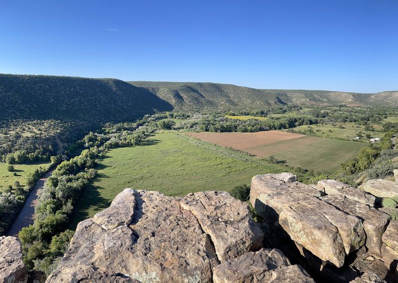
Ever eaten beside a river while sandstone cliffs glow red above you? Villanueva State Park tucks itself into a canyon along the Pecos River.
Elevation sits at 6,110 feet in a quiet stretch of northern New Mexico. The land marks a transition between the Rocky Mountains and the Great Plains.
Cottonwoods line the water and shade much of the corridor. Red and yellow sandstone bluffs rise sharply on both sides.
Picnic shelters and campground facilities sit beneath cottonwoods along the Pecos River, complementing the nearby historic village of Villanueva.
The park offers about 2.9 miles of hiking trails, including routes that climb along the canyon walls above the Pecos River.
Anglers cast into the Pecos while birders scan the cottonwood branches. Camping, swimming, canoeing, kayaking, and hiking round out the current activity list.
Families favor this canyon because everything stays walkable and manageable. You get grand scenery without a strenuous approach.
Spring and autumn bring mild temperatures perfect for day use. Summer afternoons cool off nicely beside the moving water.
Morning light hits the cliffs at an angle that flatters every photograph. Evening turns the stone a deeper rust color.
Follow the signs toward 135 Dodge Rd in Villanueva to reach the entrance. Pack simple food, since the canyon supplies all the atmosphere you need.
7. Sandstone Bluffs At El Malpais National Monument, Grants
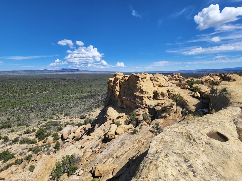
Sandstone Bluffs delivers one of the few elevated viewpoints inside El Malpais National Monument.
Dark lava flows spread across the basin below in every direction. The McCarty’s Lava Flow ranks among the youngest in the continental United States, roughly 2,500 to 3,900 years old.
Beneath your shoes lies Dakota Sandstone, rock that formed while dinosaurs walked the region. That contrast between pale stone and black basalt is startling.
Mount Taylor dominates the northern horizon. The ancient Zuni Mountains rise to the west, with the Chain of Craters cinder cones marking the southwest.
Tables and pit toilets sit near the parking area, making meals easy. Nothing blocks the panorama while you eat.
No established trails cross the bluffs, so walking here means free exploration. Watch your footing near the drop-offs.
Ravens and birds of prey ride thermal currents overhead. Tinajas, small water-filled hollows in the sandstone, appear after rain.
Photographers should target sunset or a clear afternoon. Low light exaggerates every ridge and crack in the lava.
Access comes from New Mexico Highway 117 south of Interstate 40, followed by a 1.5-mile gravel road to the overlook. Bring layers, because wind can sweep across the exposed rim.
8. Dripping Springs Natural Area, Las Cruces
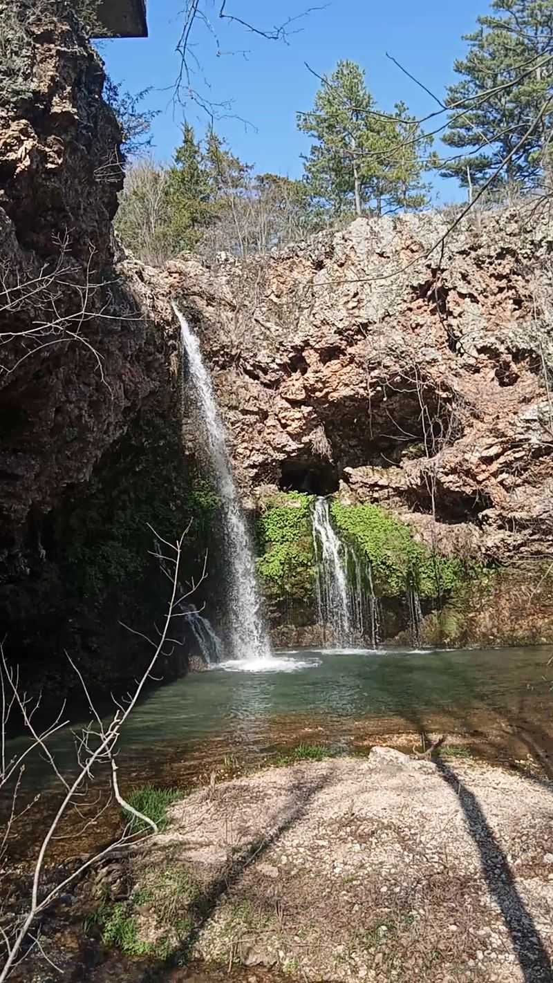
Ruins and mountain peaks make lunch far more interesting. Dripping Springs Natural Area rests at the base of the sharply fractured Organ Mountains.
Desert scrub blends into piñon-juniper and oak woodland as elevation increases. Solitude comes easily on weekday mornings.
Stone remains of the Van Patten Mountain Camp and Boyd health resort still stand along the trail. Van Patten’s resort developed in the 1890s, while Boyd’s health resort opened in 1904.
More than four miles of easy trails cross the area, with the Dripping Springs Trail drawing the most foot traffic. Grades stay gentle enough for kids.
Twelve picnic sites are available, plus a reservable group area for larger gatherings. Handicapped-accessible restrooms sit near the parking lot.
Wildlife watching stays productive throughout the year. Golden eagles, red-tailed hawks, Gambel’s quail, desert mule deer, and coyotes all appear regularly.
Warmer months bring black-throated sparrows, ladder-backed woodpeckers, and plenty of lizards. Binoculars earn their keep here.
Interpretive displays inside the welcome building explain the geology of the Organ Mountains. Reading them first improves the walk considerably.
Late-day light can bring strong color to the Chihuahuan Desert floor, but visitors should plan around the natural area’s sunset closing time.
The entry road leads to 15000 Dripping Springs Rd in Las Cruces, climbing steadily toward the peaks. Check closing hours before settling in for sunset.
9. Brantley Lake State Park, Carlsbad
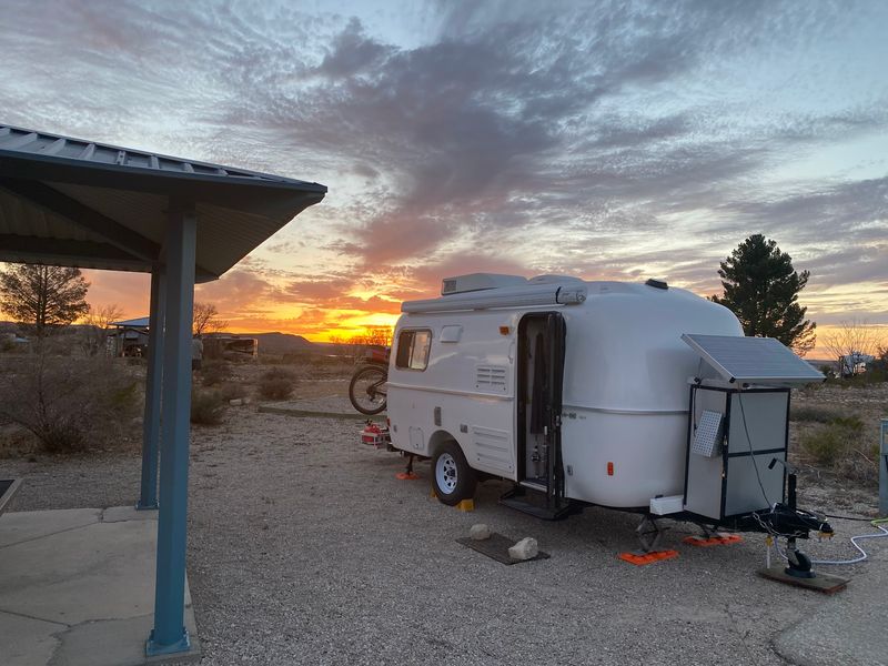
Let’s be real for a second, big water in the southern desert surprises everyone. Brantley Lake State Park spreads along the Pecos River as the southernmost lake in New Mexico.
Brantley Dam created the reservoir, and the surrounding habitat supports migrating waterfowl, pelicans, bald eagles, osprey, hawks, and other desert birds.
Mesas, cottonwoods, and open ground frame the water. Skies here run enormous, especially near dusk.
Roadrunners scurry near the brush while pelicans and bald eagles work the lake. Birders bring long lenses for good reason.
Picnic areas and group shelters give visitors places to eat near the lake, though current Stage II fire restrictions prohibit campfires, charcoal, and wood-burning stoves.
Boating covers both motorized and paddle-powered craft. Fishing, swimming, kayaking, and horseback riding keep the calendar full.
About 2.6 miles of hiking trails provide another way to explore the park, while its open desert setting also makes night-sky viewing appealing.
Historical exhibits inside the welcome building cover Seven Rivers, a Wild West settlement from the region’s past. Local heritage runs deep around this reservoir.
Spring and autumn deliver milder air and busier wildlife. Early mornings and evenings remain the sweetest hours in any season.
Turn toward 33 East Brantley Lake Rd in Carlsbad to reach the campgrounds and day-use zones. Bring a hat, since shade grows scarce by midday.
10. Fenton Lake State Park, Jemez Springs
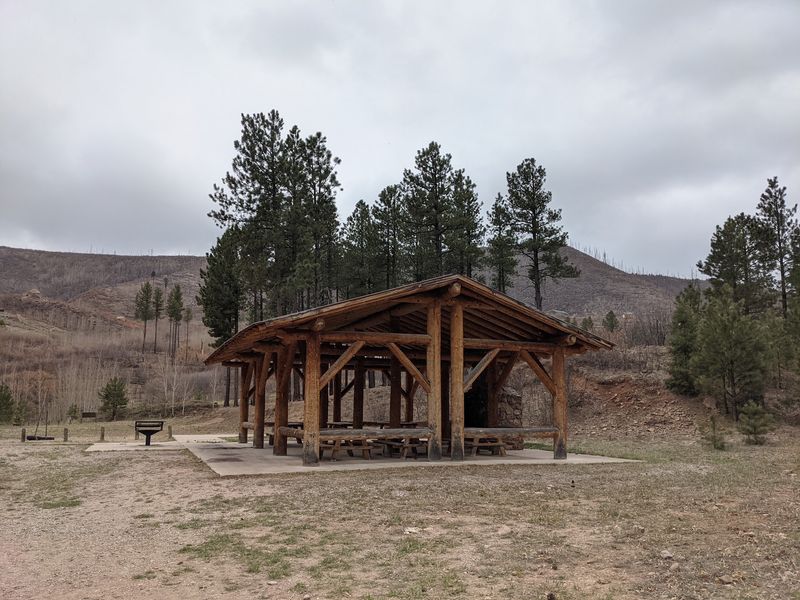
A mountain lake beats a crowded park any day. Fenton Lake State Park centers on a calm 37-acre lake inside the Jemez Mountains.
Ponderosa pine and aspen ring the shoreline at high altitude. Summer temperatures stay noticeably cooler than the valleys below.
The Rio Cebolla feeds the lake with clear, cold water. Trout thrive in those conditions year after year.
Anglers fly fish, spin cast, and even drill through ice during winter. Few small lakes stay this productive across all four seasons.
Canoes, kayaks, and other paddle craft share the lake with boats using electric trolling motors, while gasoline-powered boats are prohibited.
Tables sit among the trees within easy reach of the water. Autumn foliage makes October meals especially memorable.
Elk and deer wander the meadows near dawn and dusk. Bird activity picks up along the forest edges.
Winter transforms everything into a snowy playground for snowshoers and cross-country skiers. Camping continues for hardier travelers.
Here’s a fun detail: the 1976 film The Man Who Fell to Earth used this lake as a shooting location. Movie history hides in the pines.
Late spring through early fall brings the mildest weather and full lake access. Drive to 455 Fenton Lake Rd in Jemez Springs and settle in beside the water.