9 New Mexico Trails Under 2 Miles For Stunning Fall Colors Without The Tough Hike
No medal will be awarded for suffering uphill for six hours. Good news: New Mexico does not require it.
These short fall trails keep the mileage low while aspens, cottonwoods, lakes, waterfalls, and historic landscapes do all the dramatic work.
Under two miles can still mean a ridiculous amount of gold! That makes the routes especially appealing for families, beginners, casual walkers, or anyone whose favorite part of hiking is stopping to look at things.
Each trail brings a different setting, so the experience never becomes ten versions of the same walk.
Big scenery, manageable effort, and plenty of excuses to pause? Excellent arrangement.
1. Pueblo Loop Trail, Los Alamos
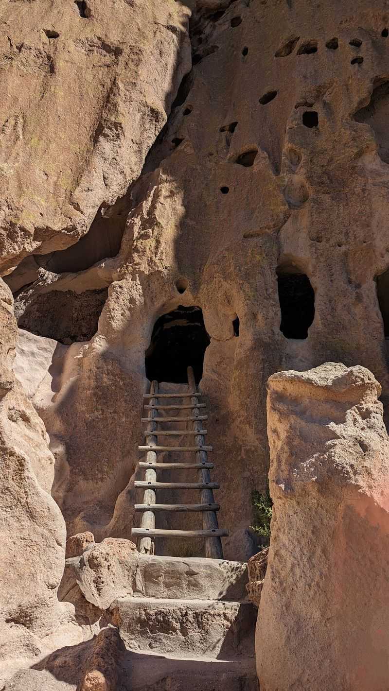
Are you seeing what I am seeing right now? Ancient homes peek out from cliffs wrapped in gold.
The Pueblo Loop Trail begins behind the visitor center in Bandelier National Monument near Los Alamos and covers 1.4 miles round trip.
It passes several major Ancestral Pueblo sites, including Tyuonyi, Long House, Talus House, and the Big Kiva, without requiring a long backcountry hike.
Soft volcanic cliffs rise beside the route, and human-carved cavates appear along the canyon walls. Optional wooden ladders lead into several of those alcoves, while petroglyphs and masonry remains add detail throughout the walk.
Autumn gives Frijoles Canyon a different look. Cottonwoods and box elders turn gold after higher-elevation aspens begin changing elsewhere in northern New Mexico, creating bright color against pale rock and dark evergreens.
Much of the early section is paved and relatively level, although stairs, drop-offs, narrow areas, and optional ladders make the entire loop less accessible than the opening stretch. Benches provide places to pause along the way.
Fall can also be one of Bandelier’s busiest seasons. In 2026, the seasonal shuttle operates intermittently through October 14, and parking in Frijoles Canyon can fill during popular hours.
Bring water, layers, and shoes with reliable traction. The trail starts at 15 Entrance Rd near Los Alamos and delivers archaeology, canyon scenery, and fall color in one compact route.
2. Jemez Falls Trail, Jemez Springs
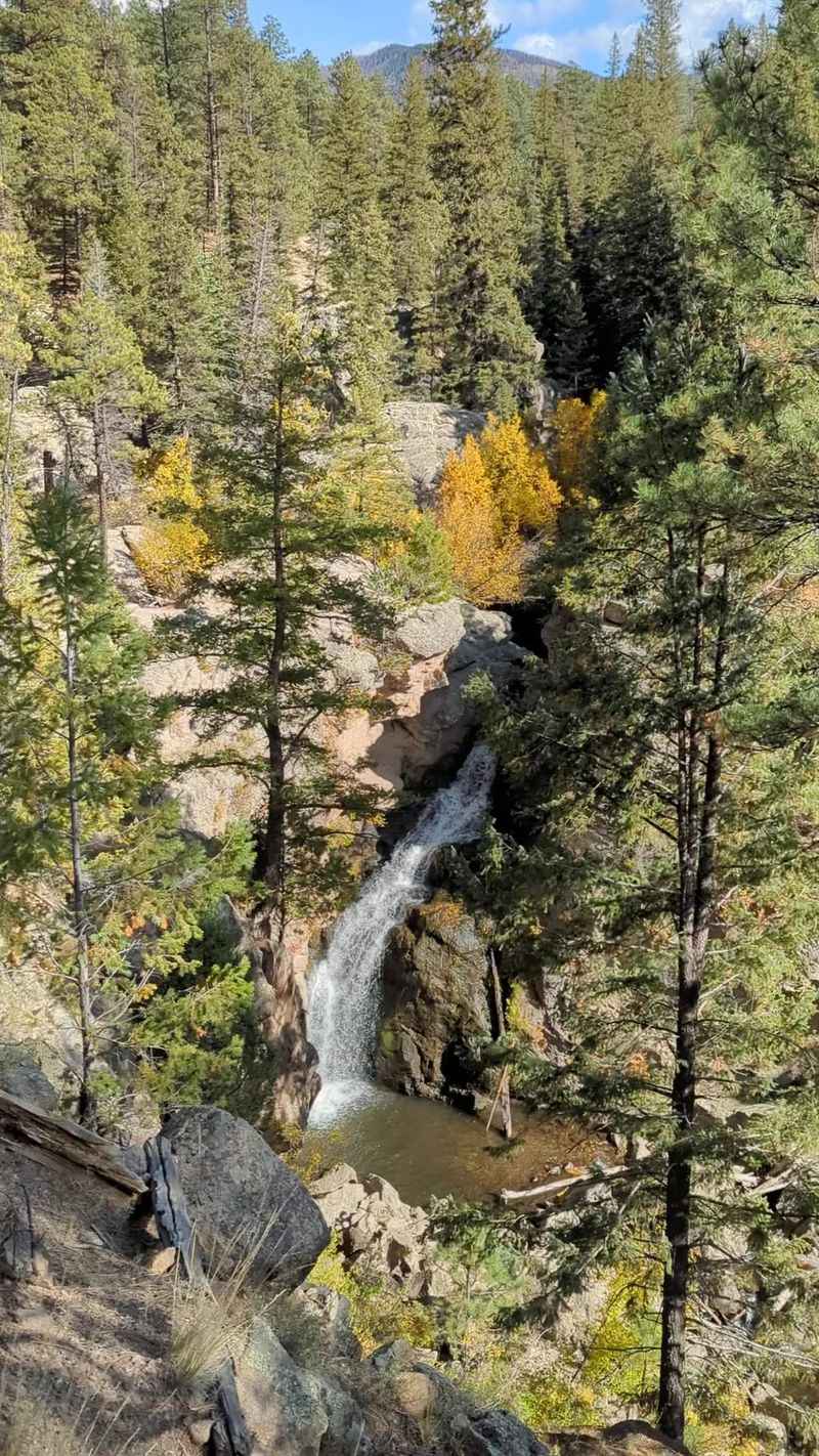
Just imagine for a second a 70-foot waterfall after a quick stroll. Sounds like a cheat code, right?
Jemez Falls sits in Santa Fe National Forest northeast of Jemez Springs, surrounded by boulders, ponderosa pine, and the East Fork of the Jemez River.
From the day-use area, the hardened trail to the overlook runs about 1,500 feet each way, keeping the outing well below two miles.
The main viewpoint looks across the rocky gorge toward the cascade. Staying on the overlook route avoids rougher approaches closer to the water, so the short hike works well for visitors who want scenery without a demanding climb.
The picnic area sits around 7,880 feet in elevation. Even a brief walk can feel different at that height, especially for anyone arriving from lower country, so an unhurried pace and water breaks make sense.
Fall color is part of the wider Jemez Mountains experience rather than a guarantee of dense aspens beside every step. Ponderosa forest dominates around the falls, while pockets of changing vegetation brighten nearby slopes and the scenic drive.
Mountain conditions can shift quickly late in the season. A light layer, sturdy shoes, and a weather check are useful before leaving the highway.
The day-use area lies about 15 miles northeast of Jemez Springs. Short distance, forest air, and a tall cascade make the stop feel much bigger than the mileage suggests.
3. East Circle Trail, Santa Fe
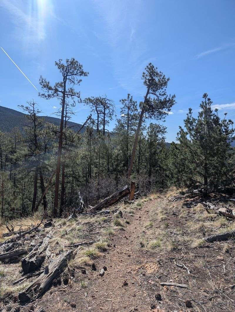
It makes you wonder, doesn’t it, how much beauty fits into one mile? Prepare to be pleasantly surprised.
The East Circle Trail covers about one mile on the east side of Hyde Memorial State Park outside Santa Fe.
It is rated easy and climbs above the campground through pine forest without the steep elevation gain found on the park’s western route.
The path works well as a short mountain walk on its own. It can also connect with the half-mile Piggyback Trail for visitors who want more time beside Little Tesuque Creek without a long hike.
Fall color begins before the first step. Hyde Park Road climbs through the Sangre de Cristo Mountains toward Ski Santa Fe, and the corridor is known for bright aspen displays during late September and October.
Elevation ranges from roughly 8,300 to 9,400 feet across Hyde Memorial, so shaded areas can feel cooler than the city below. Layers, water, and steady pacing are more useful than heavy hiking gear here.
One current detail matters in 2026: vault-toilet replacement work is scheduled through November, so visitors may notice construction activity and temporary facilities.
The park entrance is at 740 Hyde Park Rd in Santa Fe. For a quick autumn outing, the East Circle keeps the distance modest while the mountain setting supplies the scale.
4. Mallette Park Nature Trail, Red River
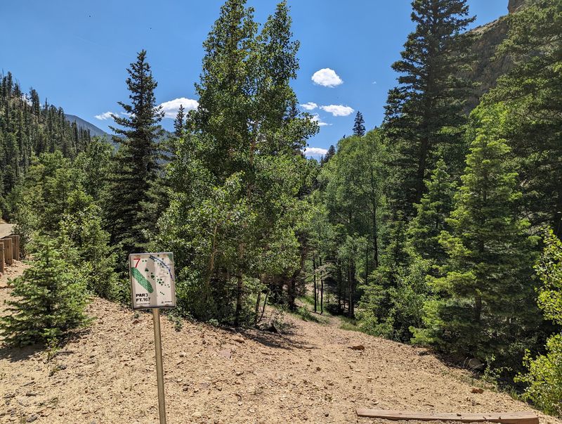
A quarter-mile trail that still packs a punch? Small but mighty describes it perfectly.
Mallette Park Nature Trail sits close to Main Street in Red River and covers about a quarter mile.
The route begins near the tennis court and follows Mallette Creek toward a dirt road, making it one of the shortest walks in town.
The terrain is very easy, but the surface is natural rather than paved. A small bridge, trees, and the creek keep the route feeling like a trail instead of a sidewalk.
A small cave adds an unusual feature. It is better treated as something to view from the established route than as a reason to wander beyond marked areas.
Fall is the real attraction around Red River. Aspen groves spread across the surrounding slopes, and seasonal guidance generally points to mid- and late October for strong color, depending on weather and elevation.
The trail places walkers near that display without a long climb.
Mallette Park also has picnic areas, recreation facilities, and a nine-hole disc golf course, so the walk can fit easily into a longer stop without moving.
High elevation can bring cold mornings even when afternoons feel comfortable. A light layer and shoes with grip are enough for most visits.
Find the trail from Mallette Rd in Red River. It is brief, scenic, and easy to combine with the rest of town.
5. La Pasada Encantada Trail, Cloudcroft
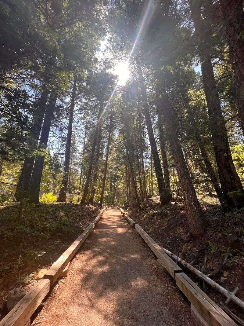
My jaw literally dropped when I learned how this trail was built. Thoughtful design rarely looks this lovely.
La Pasada Encantada Trail, or The Enchanted Path, is a 0.4-mile loop in Lincoln National Forest near Cloudcroft.
It was developed to make a forest experience more usable for blind and visually impaired visitors, and that purpose shapes the route.
Interpretive signs include Braille and invite attention to bark, rocks, tree rings, and other natural textures.
Six-by-six guide posts line the trail edge, providing a tactile cue for cane users. The surface is compact gravel, and the grade is generally gentle.
At roughly 9,000 feet, this is a high-elevation walk despite its short distance. Cool air can arrive quickly in autumn, and an early cold spell may change road or trail conditions faster than expected.
The Sacramento Mountains bring a different fall palette to southern New Mexico. Ponderosa pine, fir, and aspen share the broader forest, while deciduous vegetation adds yellow, orange, and rust around Cloudcroft.
This route rewards slowing down. The interpretive stops are designed around touch, sound, scent, and observation rather than speed.
Bring a layer, water, and shoes comfortable on gravel. Access begins from Forest Road 24B near Cloudcroft, where seasonal conditions should be checked before the drive.
At less than half a mile, the trail keeps effort low while making the forest itself the main attraction.
6. Aldo Leopold Forest Trail, Albuquerque
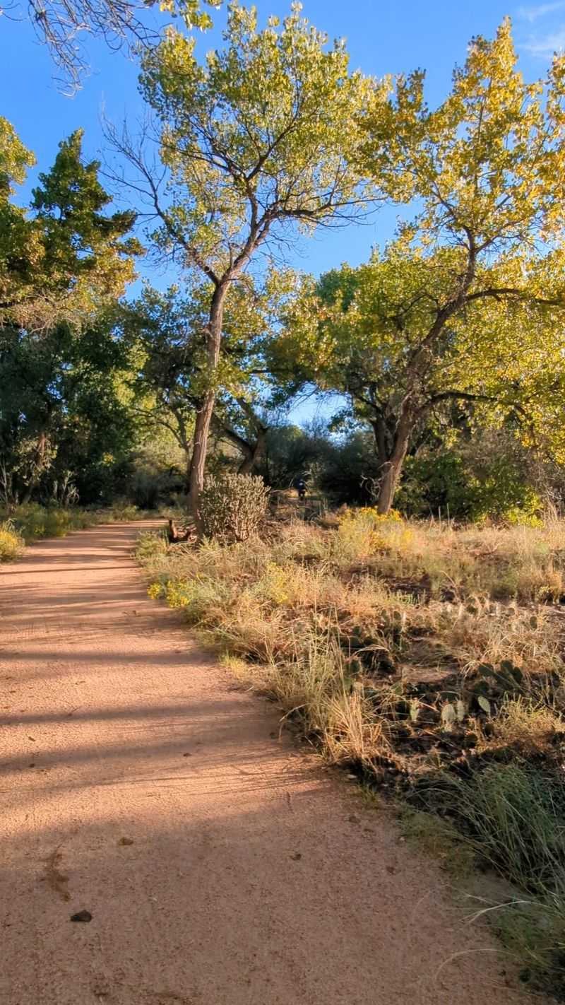
Golden cottonwoods in the middle of a city sound unlikely until you enter the bosque.
The Aldo Leopold Trail is reached through Rio Grande Nature Center State Park in Albuquerque and is listed by the city at 1.25 miles.
The route begins near the Nature Center’s west side, crosses toward the levee, and connects with the city-managed trail network beside the Rio Grande.
This is easier walking than the original draft suggested. The city classifies the named trail as Grade 1 and lists a broad asphalt surface, while nearby bosque routes provide additional options for visitors who prefer a more natural setting.
The surrounding Aldo Leopold Forest covers about 53 acres. Cottonwoods dominate the seasonal show, turning vivid yellow later in fall than many high-mountain aspens.
In New Mexico’s Rio Grande corridor, the strongest color often arrives in late October or November.
Birding is another reason to slow down. The adjacent Nature Center includes wildlife-viewing areas, ponds, native plant gardens, and access to additional riverside paths.
Current 2026 hours are straightforward: park grounds are open daily from 8 a.m. to 5 p.m., while the visitor center operates from 9 a.m. to 4 p.m. Only service animals are allowed on trails inside the Nature Center itself.
Start at 2901 Candelaria Rd NW in Albuquerque. This route proves that fall color does not require a mountain highway or a strenuous climb.
7. Carlito Springs Loop, Cedar Crest
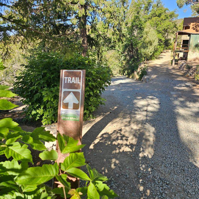
I am still trying to wrap my head around this hidden oasis. Water gardens in dry country always feel like a secret.
Carlito Springs Open Space sits near Tijeras, not Cedar Crest, and its main loop is about 1.8 miles.
That keeps the distance under two miles, but the route deserves a moderate rating because of loose gravel, uneven footing, and elevation changes.
The property centers on a spring that feeds ponds, ornamental gardens, an orchard, and a riparian pocket on the southeast side of the Sandia Mountains.
Historic buildings and landscape features add another layer without turning the walk into a museum route.
The loop climbs from the parking area toward the spring system before returning through the lower property. Shade appears in sections, but carrying water still matters in the dry surrounding hills.
Autumn changes the mood around the spring-fed gardens and deciduous plantings. Yellow and copper tones stand against evergreen vegetation, while ponds and stonework add texture to the landscape.
The springs are not a drinking-water source for hikers, so visitors should carry their own supply. Trekking poles can help anyone who prefers extra stability on loose sections.
Parking is limited, so quieter weekday periods can help. Access is from 82 Carlito Springs Rd in Tijeras.
This is the most demanding route on the list, but water, gardens, history, and mountain scenery make the extra effort worthwhile.
8. Monte Verde Lake Trail, Angel Fire
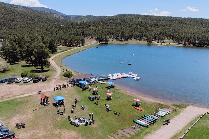
That makes two of us who adore a calm lakeside stroll. Water and gold leaves make a dreamy pair.
Monte Verde Lake Trail circles a spring-fed, mountain lake in Angel Fire for about one mile.
The loop has minimal elevation gain and is one of the easiest ways to add a real walk to a fall day without committing to a longer forest route.
Water stays beside the path for most of the circuit, while mountain views open beyond the shoreline. Ducks, geese, and other waterbirds are common there, and the broad setting leaves room to pause.
Autumn brings the strongest visual payoff. Aspens on the surrounding slopes turn gold, and calm mornings can place that color directly on the lake surface. The effect is strongest before afternoon breezes disturb the reflections.
Angel Fire sits high in the Moreno Valley, so even a flat route can feel cooler than expected. A fleece or light jacket is useful during fall mornings, and shoes should handle occasional muddy sections after wet weather.
The lake remains open to the public through November 1 in the 2026 season. The Lake House also operates then, with shorter hours after early September.
Trail access begins from the Monte Verde Lake parking area off Mountain View Boulevard. For families, casual walkers, or anyone saving energy for later, this loop delivers mountain color with very little climbing.
9. Coal Camp Interpretive Trail, Raton
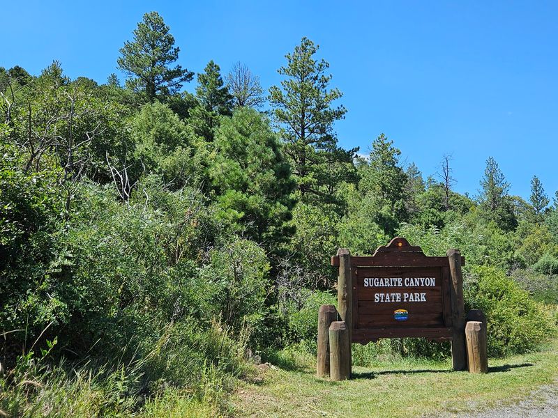
Louder for the people in the back: history does not need a long trek. Some stories fit comfortably into a short loop.
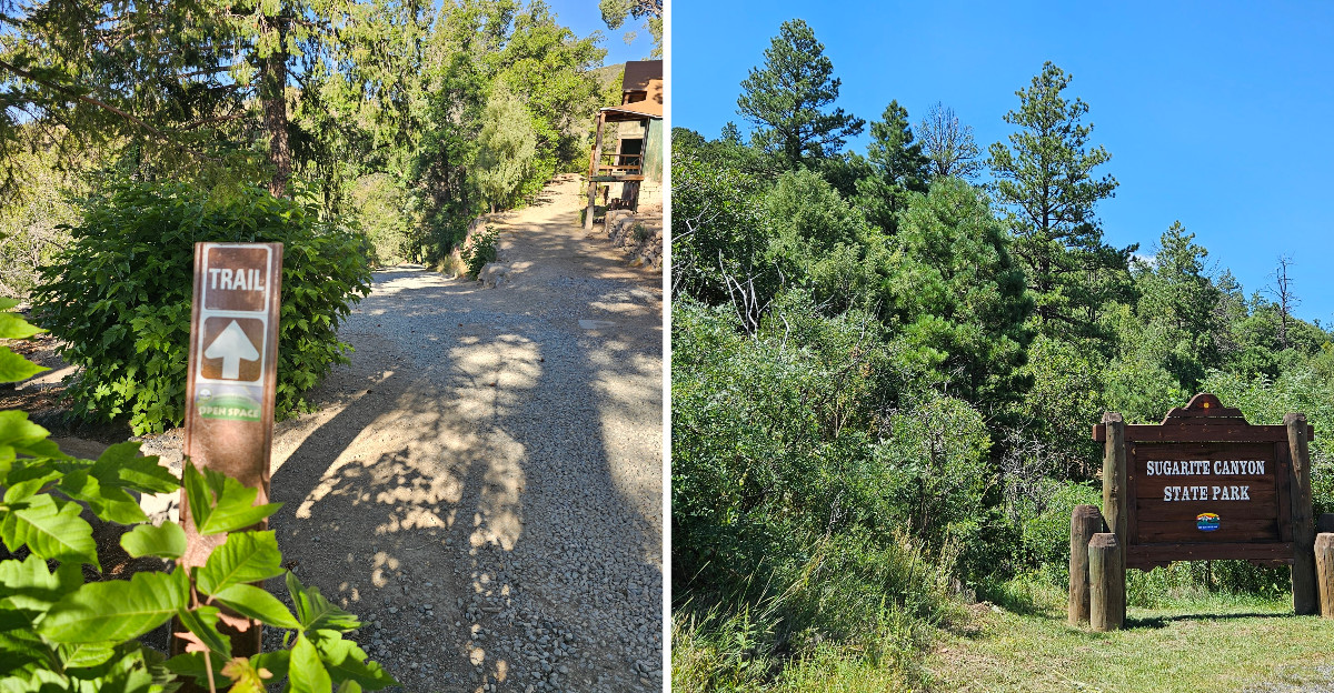
The Coal Camp Interpretive Trail begins near the visitor center at Sugarite Canyon State Park outside Raton.
The historic town loop covers about three-quarters of a mile, while longer extensions climb toward former mine levels. The shorter loop keeps the outing below two miles.
A gravel path moves through the remains of the Sugarite coal camp, where interpretive material explains the community that once occupied the canyon.
Foundations and surviving features make the landscape part of the lesson, so staying on the route protects them.
The walk is more substantial than the original 266-foot claim suggested. Park materials rate the historic trail as moderate, and the canyon setting includes changing grades rather than a completely level stroll.
Autumn adds color around the ruins. Gambel oak grows in Sugarite Canyon, and nearby higher trails reach aspen groves, giving the park a mix of warm foliage against conifers and rocky slopes.
Current 2026 conditions matter. Construction is affecting parts of the park, and no potable water is presently available, so visitors should bring their own supply and review posted notices.
The park address is 211 Highway 526 in Raton. Even without the longer extensions, this compact loop combines industrial history, canyon scenery, and seasonal color in a manageable walk.