Pedal 25 Scenic Miles Through Northern California On This Forgotten Railroad Trail Through A River Canyon
The railroad is gone, but the route still knows exactly where it is going.
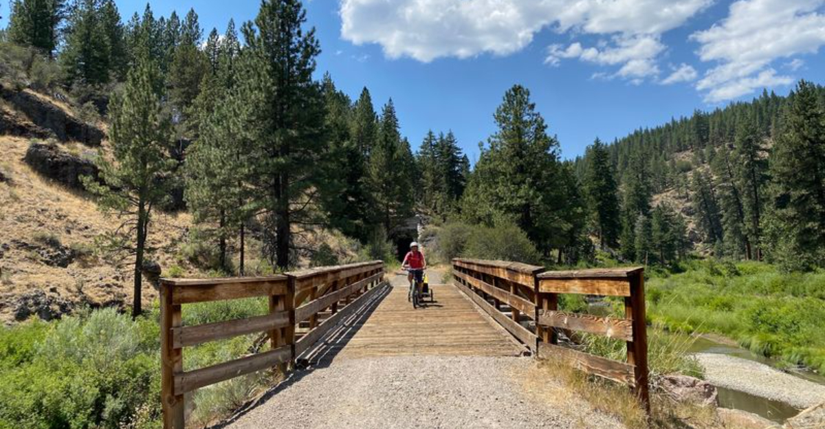
You pedal into a canyon where old grades cut through rock, bridges carry you over the river, and tunnels suddenly swallow the daylight for a few seconds at a time.
The scenery keeps changing just enough to make 25 miles feel more like exploration than exercise.
Northern California cyclists can follow this former rail corridor through one of the region’s quieter canyon landscapes.
Pick a section if the full distance sounds ambitious. Stop at the overlooks. Coast when the trail gives you permission.
And when an old railroad feature appears around the bend, slow down long enough to imagine what once traveled through here before bicycles took over.
The best rides give you more than mileage. This one gives you a river, a canyon, a vanished railway, and enough history under your tires to make every mile feel connected to something older.
Begin At The Historic Susanville Railroad Depot
Few trailheads come with their own train station, but the eastern end of this route does exactly that.
The restored depot sits at 601 Richmond Road in Susanville, California, and it marks the official eastern terminus of the Bizz Johnson National Recreation Trail.
Starting here gives the ride a railroad theme from the very first pedal stroke, since the building itself is a surviving piece of the corridor’s working past.
Wooden siding, the old platform area, and interpretive information help set the stage before anyone rolls out.
Riders who arrive early often take a few minutes to walk around the grounds, adjust gear, and check tire pressure before heading west into the canyon.
Parking is available near the depot, which makes it a practical launching point for both short out-and-back rides and full-length trips toward Mason Station.
Hours for the building can vary by season, so calling ahead is a reasonable step for anyone hoping to go inside.
Because the trail climbs gradually heading west from town, leaving from the depot means the return trip runs slightly downhill. That small detail matters more than expected after several hours in the saddle.
Starting from a depot rather than a plain gravel lot simply makes the whole outing feel connected to the history underfoot.
Follow 25.4 Miles Of Former Southern Pacific Railroad
Railroads shaped this part of Northern California long before recreation did, and the evidence runs the entire length of the route.
The corridor occupies the old Fernley and Lassen Branch Line of the Southern Pacific Railroad, stretching 25.4 miles from Susanville west to Mason Station near Westwood.
Trains once hauled lumber and freight along this exact alignment, which explains the steady, unhurried feel of the surface underneath.
Riding a converted rail line is a different experience from riding a typical singletrack path. Curves are broad and predictable, sightlines stay long, and the route rarely throws surprises at anyone paying reasonable attention.
Cut banks, fill slopes, and old ballast still frame long stretches of the grade. Recognizing those engineering details adds a layer of interest to what might otherwise look like an ordinary gravel path.
The full one-way distance suits strong riders comfortably, while casual cyclists often choose shorter segments and turn around when energy runs low. Both approaches work well, since access points break the corridor into manageable chunks.
Knowing the total length ahead of time helps with water planning, snack timing, and setting realistic expectations for the day.
Twenty-five miles of railroad history is a lot of ground, and it rewards a patient pace far more than a rushed one.
Ride Beside The Susan River For Miles
Water makes good company on a bike ride, and here it sticks around far longer than usual.
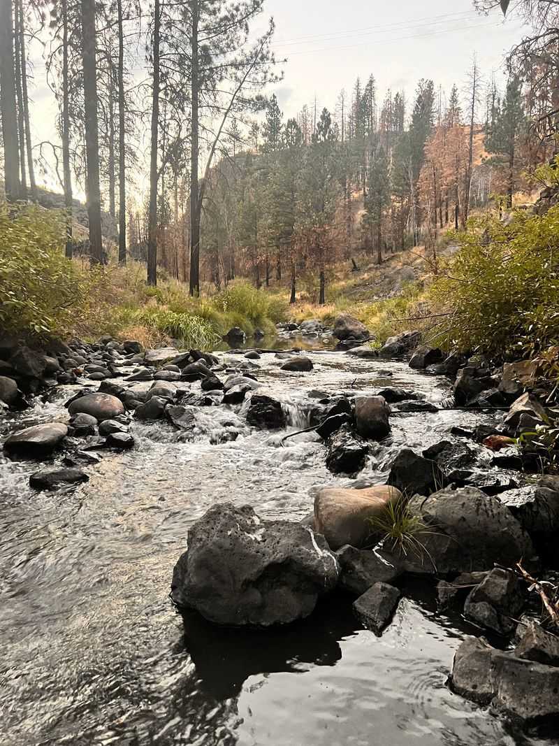
For the first 16 miles heading west out of Susanville, the trail closely follows the Susan River. Much of that stretch puts the water within easy view, sometimes just a few steps from the edge of the grade.
The sound of moving water fills quieter sections, softening the crunch of gravel under tires. Flow levels shift with the season, running fuller in spring and settling lower by late summer.
River-adjacent riding also affects temperature in a noticeable way. Shaded pockets near the water often feel several degrees cooler than open stretches, which helps on warm afternoons.
Places to pause show up regularly along the way. Sitting near the bank for a snack break turns a straightforward ride into something closer to a relaxed outing.
Wildlife activity tends to cluster near water too, so birds and small animals appear more often along these miles than on drier upper sections.
Anyone with limited time can simply ride out along the river and turn back whenever it feels right, since the best scenery arrives early rather than at the far end.
Sixteen miles of river views is a generous stretch by any standard.
Wind Deep Into The Susan River Canyon
Canyon riding changes the whole character of a trail, and that shift becomes obvious a few miles in.
Rocky walls close in as the route pushes deeper into the Susan River Canyon, with forested slopes rising above the old railroad grade. Mountain views open up between bends, then disappear again behind timber and stone.
Light behaves differently down here. Morning shadows linger longer against the canyon walls, and late afternoon sun angles across the rock in a way that makes the whole corridor feel enclosed and quiet.
Sound carries oddly too, with the river echoing off stone in narrower sections. Conversation between riders often gets easier or harder depending on where the canyon tightens.
Temperatures inside the canyon can run cooler than in town, which is worth remembering when packing layers. A light jacket takes up little space and solves a lot of discomfort.
The terrain looks rugged, yet the railroad alignment keeps the actual riding smooth and steady. That contrast between dramatic surroundings and easy pedaling is a big part of the appeal.
Photographers tend to slow down here, since the mix of rock, water, and conifers gives plenty to work with.
Rugged scenery paired with a forgiving grade is a rare combination worth savoring.
Cross The River A Remarkable 12 Times
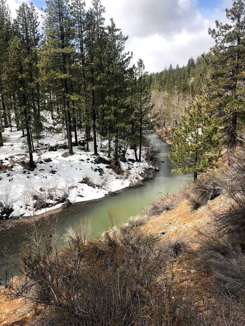
Twelve river crossings sounds like an exaggeration until the bridges start stacking up.
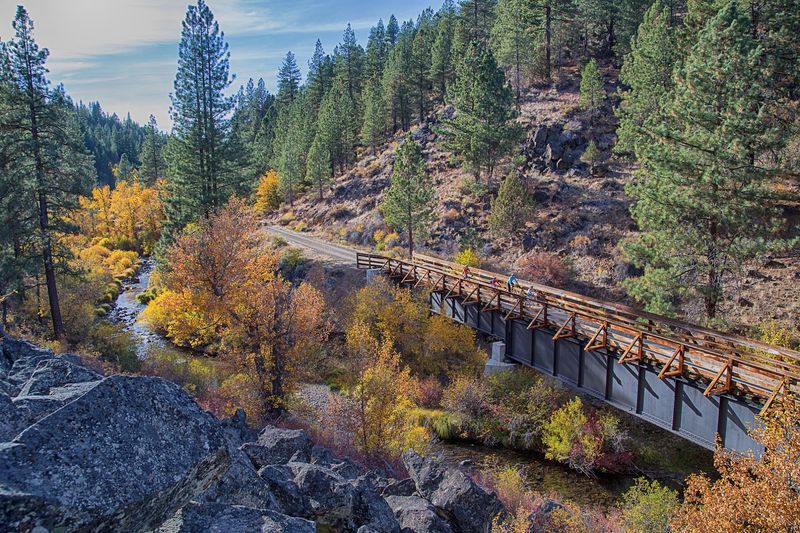
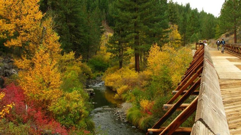
The Bureau of Land Management notes that the trail crosses the Susan River twelve times using bridges and trestles along the corridor. Each one puts the water directly underfoot rather than off in the distance.
Trestle decks feel different from packed gravel, so slowing down before each crossing makes sense.
Boards can be damp in cool morning conditions, and a steady speed handles that better than sudden braking.
Bridges also serve as natural landmarks for tracking progress. Counting them gives riders a simple sense of how far along the route they have traveled.
Views from mid-span are often the best of the entire ride, looking straight up or down the river channel with canyon walls framing both sides.
Stepping off to the side for a photo works fine when no one else is approaching.
Families with younger riders sometimes walk the bikes across, which keeps things calm and unhurried.
Repeated crossings turn the river into an active part of the journey instead of background scenery.
Twelve chances to stand above moving water is a genuinely memorable feature of this old railroad line.
Pedal Straight Through Two Old Railroad Tunnels
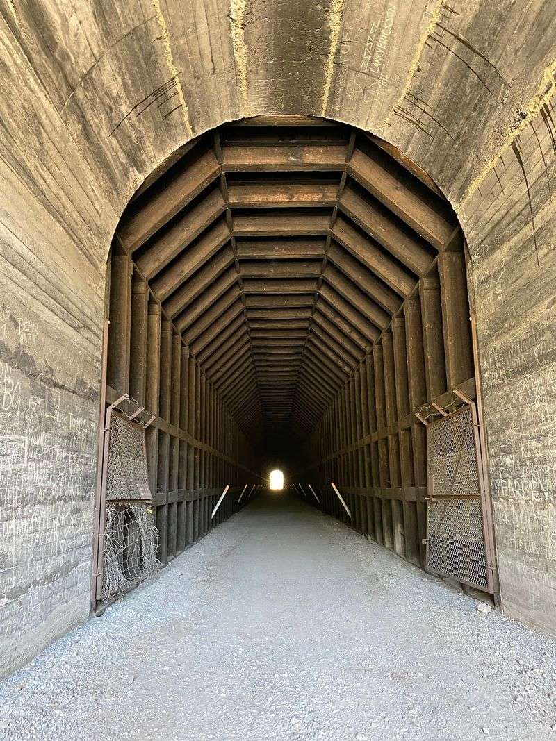
Nothing wakes a rider up quite like riding into total darkness on a sunny afternoon.
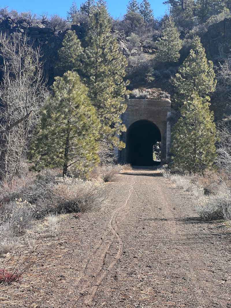
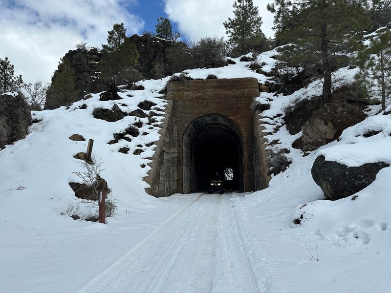
Two unlighted tunnels remain along the route, measuring roughly 800 feet and 450 feet in length. Both are open to travelers, and both cut straight through solid rock left over from the railroad era.
Bringing a bike light or a flashlight is genuinely useful here, not just a nice extra. Eyes need a moment to adjust after bright daylight, and a small beam keeps the surface visible.
Air inside feels noticeably cooler and damper than outside, which is a pleasant surprise on warm days. Sound changes too, with tire noise bouncing off the walls.
Walking through is a reasonable choice for anyone who feels uneasy about riding in low light. There is no rule requiring speed, and the surface stays manageable on foot.
The longer tunnel takes a bit more time to cross, so pacing matters. Keeping a straight line and watching for the light at the far end helps with orientation.
Emerging back into daylight on the other side is one of the most satisfying moments of the whole ride.
Old rail tunnels rarely stay accessible, which makes these two worth appreciating.
Bring A Bike Made For Gravel Rather Than Skinny Tires
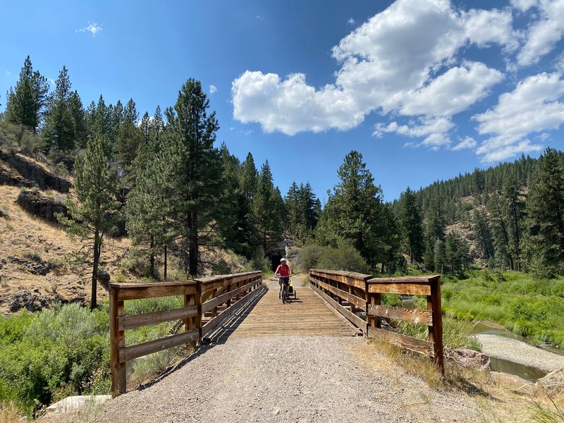
Tire choice can make or break a day on this particular corridor.
The surface consists primarily of aggregate and gravel rather than pavement, and the Bureau of Land Management specifically recommends wide-tire bicycles.
Mountain bikes suit the route especially well, and gravel bikes with generous clearance also work.
Narrow road tires struggle on loose sections and transmit far more vibration into hands and wrists. Over 20-plus miles, that fatigue adds up quickly.
Lower tire pressure than usual helps smooth out the ride and improves grip on loose patches. A small hand pump and a spare tube belong in every bag heading out here.
Rental options are limited in the area, so bringing a suitable bike from home is the safer plan. Checking brakes and drivetrain before departure prevents avoidable trouble far from the trailhead.
Padded gloves make a noticeable difference on gravel, and so does a comfortable saddle broken in ahead of time.
Conditions vary with weather and recent maintenance, meaning some segments feel firm while others stay looser.
Matching equipment to the surface keeps attention on canyon views instead of on every rattle and slide.
Wide rubber is the single easiest upgrade for enjoying this trail comfortably.
Ride The Entire Trail Without Paying An Entrance Fee
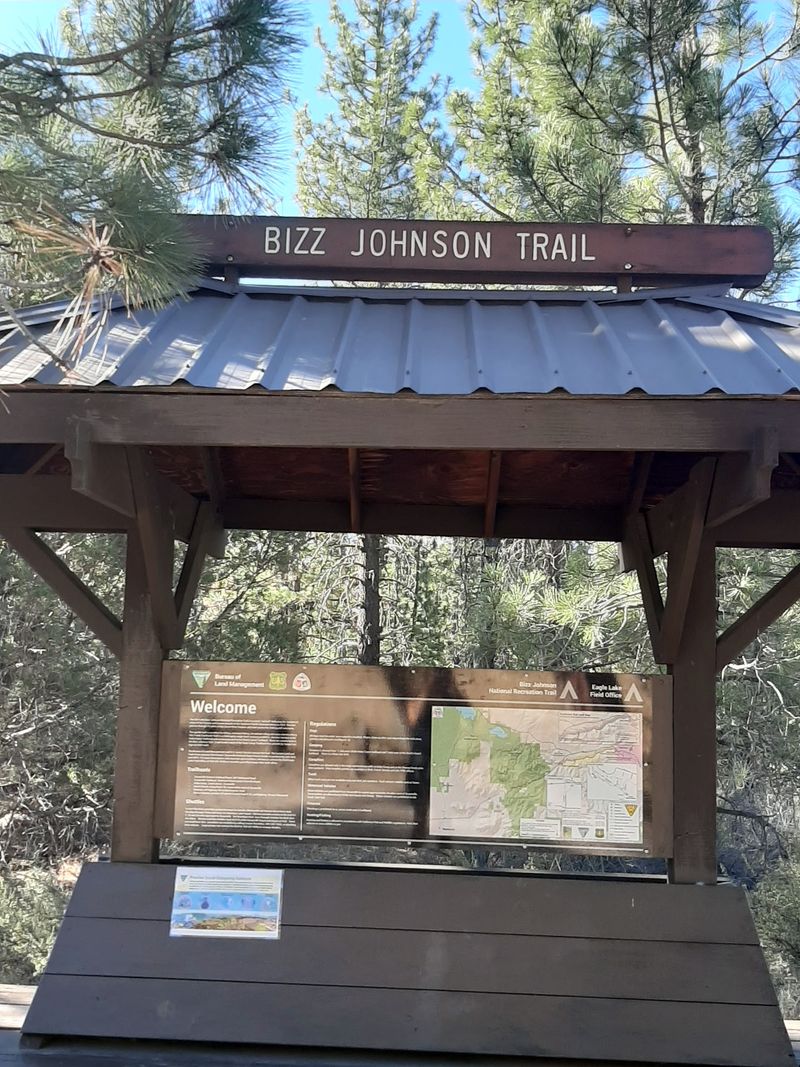
Free access is increasingly rare at destination-worthy outdoor spots, which makes this one easy to appreciate.
No entrance fee is currently required for access to the Bizz Johnson National Recreation Trail, according to the Bureau of Land Management.
That means the main costs come down to travel, food, and gear rather than admission.
Budget-friendly access makes spontaneous trips more realistic. Families can test a few miles without committing money upfront, then return for longer rides later.
Fee policies at public lands can change over time, so a quick check with the managing agency before a trip is a sensible habit.
Shuttle services, lodging, and camping in the area may carry their own charges, which should be factored into planning separately.
Respecting the corridor helps keep it in good shape, meaning packing out trash and staying on the established grade.
Restrooms and services are limited along the route, so preparing before leaving town avoids unnecessary detours.
Free public access to 25.4 miles of railroad history, canyon views, and river crossings represents remarkable value for a day outdoors.
Showing up prepared and treating the place well ensures it stays open and enjoyable for future riders.
Plan For Mountain Weather And Limited Services
Preparation separates a great day on this trail from a long, uncomfortable one.
Conditions in the Lassen County mountains shift quickly, with warm afternoons following chilly mornings even in summer. Packing a light layer and sun protection covers most of that range.
Water deserves special attention, since reliable drinking sources do not exist along the corridor. Carrying more than seems necessary is the safer approach on a 25-mile route.
Cell coverage can drop inside the canyon, making a downloaded map or printed guide genuinely useful. Telling someone the planned route and return time adds a simple safety margin.
Basic repair supplies matter here more than on urban paths, because help may be miles away. A tube, tire levers, a pump, and a multi-tool handle most common issues.
Snacks keep energy steady across the long, gradual miles. Nothing along the route sells food between the endpoints.
Winter brings snow to the area, which changes access and turns portions into a different kind of outing entirely.
Checking current trail conditions with the managing agency before heading out avoids surprises related to closures or maintenance.
Thoughtful packing lets the canyon scenery stay the main focus from start to finish.