14 Spots In California Where One Short Walk Leads To A View That Feels Wildly Dramatic
A short walk should not be allowed to show off this much. Ten minutes in, the day starts acting expensive.
Shoes barely get dirty. Breathing stays normal. Then the view appears like it has been waiting to embarrass every overcomplicated hiking plan.
California has a talent for putting big drama at the end of very little effort.
You do not need a brutal climb to get cliffs, ocean, or a lookout that makes everyone go quiet for a second. A few steps can change the whole mood.
One bend in the path can make the parking lot feel much farther away than it really is.
Spots like these are perfect for people who want the reward without turning the outing into a personal endurance documentary.
1. Glacier Point Overlook, Yosemite National Park
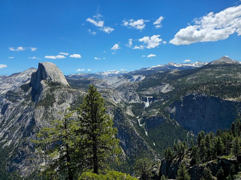
Standing at the edge of Glacier Point feels like the entire world has suddenly dropped away beneath your feet.
The overlook sits roughly 3,200 feet above the valley floor, and after just a 300-yard paved walk from the parking area, the full sweep of Yosemite Valley opens up in front of you.
Half Dome rises directly across the canyon, and on clear days the High Sierra stretches far into the distance.
Yosemite Falls is visible from here too, tumbling down the opposite wall of the valley in a long white ribbon.
The paved path makes this spot accessible to a wide range of visitors, including those who prefer not to tackle steep or uneven terrain.
Morning light tends to bring softer colors across the granite, while late afternoon can turn the whole scene golden.
Glacier Point Road is typically open from late spring through early fall, depending on snowpack, so checking the National Park Service website before visiting is a smart move.
Crowds can build quickly during summer weekends, so arriving early in the day usually means a calmer experience at the railing.
2. Taft Point, Yosemite National Park
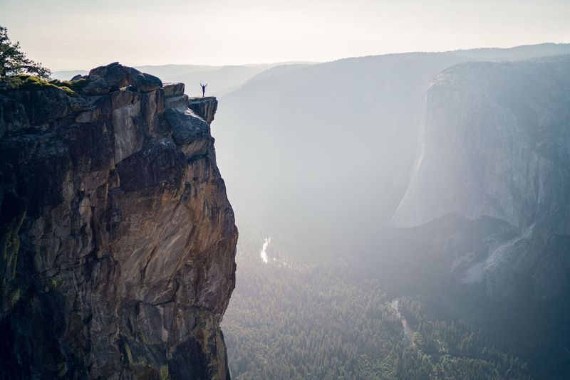
Few spots in Yosemite deliver a genuine sense of vertigo quite like Taft Point, where the ground simply ends and a sheer drop of over 2,500 feet begins.
The round-trip walk covers about 2.2 miles along a mostly flat forested trail before the trees give way to open granite slabs near the edge.
Deep fissures cut through the rock right at your feet, offering a glimpse straight down into the valley with nothing between you and the air below.
El Capitan dominates the view across the valley, and Yosemite Falls appears in the distance to the right on clear days.
The lack of guardrails along most of the edge is part of what makes this place feel so raw and honest.
Staying aware of footing near the fissures and the cliff edge is important, especially with younger visitors along.
The trailhead shares a parking lot with the Sentinel Dome trail off Glacier Point Road, which is typically open late spring through early fall.
Sunset visits are popular here because the light hits El Capitan directly, turning the granite face a deep amber.
3. Zabriskie Point, Death Valley National Park
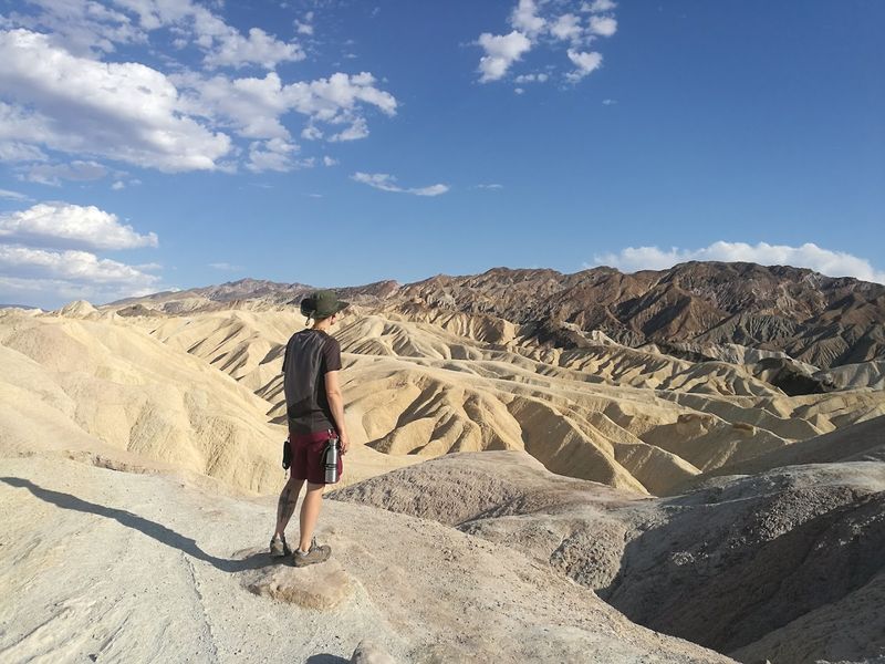
The walk to Zabriskie Point is short enough that it almost feels like cheating, yet the view waiting at the top is genuinely one of the most striking in all of California.
A paved quarter-mile path climbs gently from the parking area to a railed overlook where the badlands of Death Valley spread out in every direction.
Layers of eroded golden and brown hills ripple away toward the valley floor in a pattern that looks almost sculptural.
The formations are made from ancient lake sediments compressed over millions of years, which gives them that distinctive banded appearance.
Sunrise is widely considered the best time to visit because the low light rakes across the ridges and brings out every shadow and texture.
Temperatures in Death Valley can be extreme, particularly from late spring through early fall, so early morning visits are not just scenic but also far more comfortable.
The paved path and railed viewpoint make this accessible to most visitors without requiring specialized gear.
4. Keys View, Joshua Tree National Park
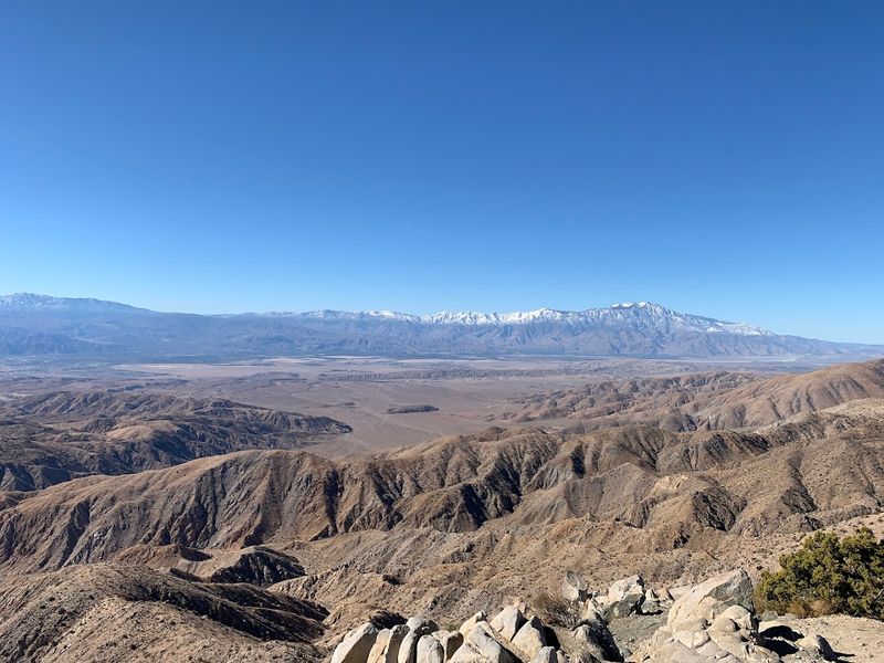
Sitting at an elevation of about 5,185 feet, the viewpoint at Keys View offers one of the broadest single-frame panoramas in Southern California.
A quarter-mile paved nature trail leads from the parking area to the overlook, where the Coachella Valley spreads out far below in a hazy, sun-bleached sweep.
On the clearest days the Salton Sea appears as a silver glimmer in the far distance, and the jagged outline of the San Jacinto Mountains rises sharply to the west.
The trace of the San Andreas Fault is actually visible from here, running as a subtle linear depression through the valley floor below.
Interpretive signs along the short trail help explain the geology and give context to the scale of what you are looking at.
Winter and early spring tend to offer the clearest air and the most dramatic mountain snow coverage on the peaks across the valley.
Keys View Road winds up from the main park road and is paved the entire way, making the drive itself a pleasant lead-up to the overlook.
Sunset visits are popular because the western-facing orientation catches the last light beautifully over the mountains.
5. Moro Rock, Sequoia National Park
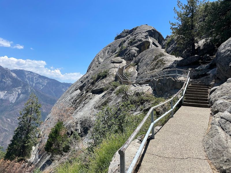
Climbing Moro Rock is a genuine physical experience, with more than 350 stone-and-concrete steps carved directly into the granite dome leading visitors upward through tight switchbacks and past sheer drop-offs.
The ascent covers a short distance but involves real elevation gain, and the effort builds anticipation in a way that flat overlooks simply cannot match.
Once at the top, the Great Western Divide unfolds across the eastern horizon in a serrated line of snow-capped peaks.
The San Joaquin Valley stretches away to the west on clear days, offering a striking contrast between the flat agricultural lowlands and the dramatic mountain terrain surrounding the summit.
Handrails line most of the route, which helps with confidence on the steeper sections, though the open-air nature of the climb can feel intense for those uncomfortable with heights.
The rounded granite surface of the rock itself adds to the sense of exposure at the top.
Arriving before mid-morning usually means shorter waits and cooler temperatures on the exposed steps.
6. Condor Gulch Viewpoint, Pinnacles National Park
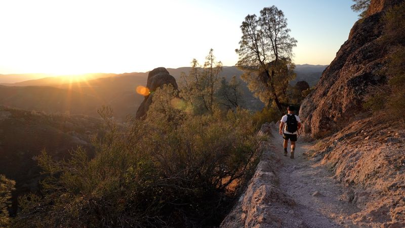
Pinnacles National Park does not always get the same attention as California’s more famous parks, but the Condor Gulch Viewpoint earns its place on any list of dramatic short walks in the state.
The climb covers about one mile from the trailhead near the visitor center on the east side of the park, gaining elevation steadily through chaparral before the High Peaks come into full view overhead.
The volcanic rock formations rise in jagged columns and towers that feel genuinely imposing when seen up close from the viewpoint.
California condors are sometimes spotted soaring on thermals above the peaks, which adds an element of wildlife watching to the hike that feels special given how rare these birds were just a few decades ago.
The trail surface is well-maintained but involves some rocky sections, so footwear with solid grip is worth wearing.
Morning visits tend to offer better light on the rock faces and cooler temperatures before the chaparral heats up.
The east entrance to Pinnacles is the more accessible side of the park for this trail, with a visitor center and parking available nearby.
7. Muir Beach Overlook, Golden Gate National Recreation Area
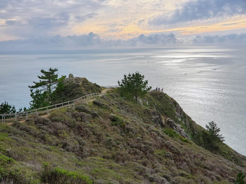
Perched above the Pacific on a narrow coastal ridge, the Muir Beach Overlook delivers a sweeping ocean view that stretches far beyond what most short walks in California can offer.
The path from the small parking area is brief, covering just a few hundred yards to the railed viewpoint at the edge of the cliff.
On clear days the view extends northward toward Point Reyes and out to sea toward the Farallon Islands, which appear as faint shapes on the horizon.
The overlook sits within the Golden Gate National Recreation Area and is free to access, making it an easy addition to a day spent exploring the Marin Headlands or the coast south of Muir Beach.
The wind at the viewpoint can be strong, especially in the afternoon, so a light jacket tends to come in handy even on otherwise warm days.
Fog is a regular presence along this stretch of coast, which can either obscure the view or create a moody, atmospheric scene depending on the conditions.
The parking area is located along Muir Beach Road off Highway 1, and it fills quickly on weekends during summer.
8. Battery Spencer Overlook, Marin Headlands
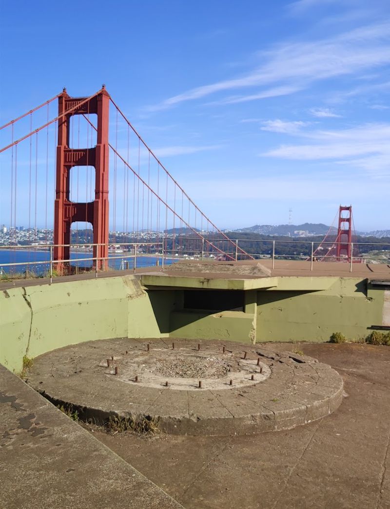
Very few spots in the Bay Area put you this close to the Golden Gate Bridge from above, and Battery Spencer delivers that experience after almost no walking at all.
The overlook is just a short scramble or walk from the pullout along Conzelman Road in the Marin Headlands, and the view from the concrete gun battery is one of the most photographed perspectives of the bridge.
The towers rise just below eye level from here, which gives the structure a scale that is hard to fully appreciate from ground level.
San Francisco spreads across the hills on the other side of the strait, and on clear days the Bay Bridge is visible in the distance behind the city.
The concrete remnants of the former military battery add a textured foreground to the scene and give the overlook an interesting historical dimension beyond the view itself.
Fog rolling in through the Golden Gate in the afternoon can create a dramatic layered effect with the bridge towers poking above the mist.
Conzelman Road is a one-way road heading west from the Marin Headlands entrance, and parking along the pullouts can fill up quickly on weekends and holidays.
9. Hawk Hill, Marin Headlands
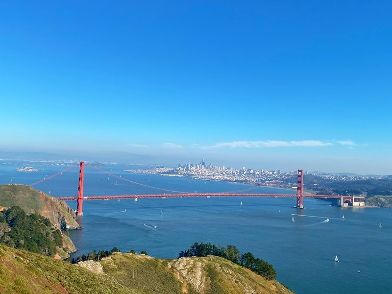
Hawk Hill sits at about 920 feet above sea level in the Marin Headlands, and the panorama from the top includes the Golden Gate Bridge, San Francisco Bay, the city skyline, and on clear days stretches all the way to Mount Tamalpais.
The walk from the nearest pullout along Conzelman Road is short but involves a noticeable uphill grade, rewarding the effort with a broader and higher perspective than Battery Spencer just below.
The open grassy summit gives a full 360-degree sense of the surrounding geography.
From mid-August through mid-December, Hawk Hill is one of the best raptor migration observation points on the West Coast, with thousands of hawks, falcons, and other birds of prey.
Volunteer counters are often present during peak migration season and can point out species and explain the patterns of the migration.
Outside of migration season the hill is simply a scenic overlook with consistent wind and consistently excellent views.
Conzelman Road provides access from the Marin Headlands area, and the road becomes one-way heading west past the main intersection.
Weekend parking fills up fast, particularly during clear weather when the bridge views are at their best.
10. Sea Lion Point Trail, Point Lobos State Natural Reserve
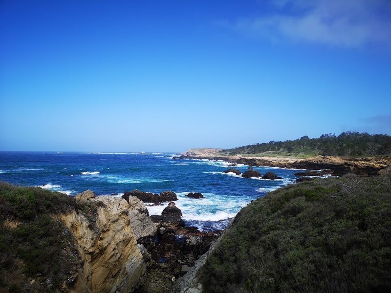
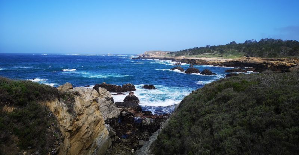
Point Lobos is often described as one of the most beautiful meeting points of land and sea on the California coast, and the Sea Lion Point Trail gives access to some of its most dramatic scenery in under half a mile.
The paved loop of about 0.4 miles winds along the edge of a rocky headland above a series of coves where the Pacific crashes against jagged offshore rocks with considerable force.
Sea lions are frequently visible hauled out on the rocks below, and sea otters occasionally float in the kelp beds just offshore.
The sound of the surf here is a constant presence, sometimes thundering loud enough to feel it underfoot when the swells are large.
The trail surface is paved and relatively level, making it one of the more accessible routes within the reserve.
Views extend along the coastline in both directions, with the rugged cliffs of the reserve’s southern shore visible to one side and the open Pacific stretching to the horizon on the other.
Point Lobos State Natural Reserve charges a day-use fee and has limited parking, so arriving early is strongly recommended on weekends and holidays.
Reservations for parking are available through the California State Parks reservation system and are worth booking in advance during busy seasons.
11. Guy Fleming Trail, Torrey Pines State Natural Reserve
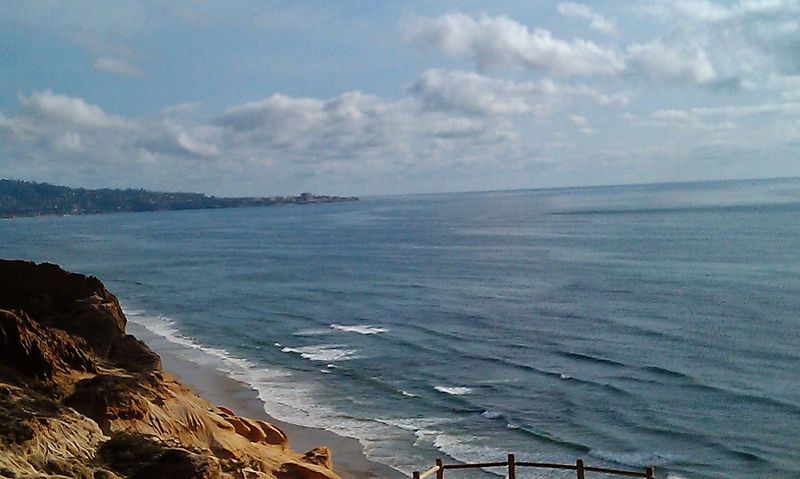
The Guy Fleming Trail at Torrey Pines State Natural Reserve covers just under a mile as a loop and manages to pack in two separate ocean-bluff overlooks along the way.
The trail winds through groves of Torrey pines, one of the rarest pine species in the world, growing in twisted shapes shaped by the coastal wind.
Both overlooks offer wide views across the Pacific and down the sandstone bluffs that define this stretch of the San Diego County coast.
The North Grove Overlook and South Grove Overlook each provide slightly different perspectives on the coastline, with the beach far below and the ocean extending unobstructed to the west.
The trail surface is mostly packed dirt and sandstone, with some uneven sections that benefit from shoes with decent grip.
Mornings tend to bring clearer air and better visibility before the marine layer builds in the afternoon.
Torrey Pines State Natural Reserve requires a day-use parking fee and has a capacity limit, so arriving early or visiting on a weekday significantly improves the chances of finding a spot.
The reserve is located along North Torrey Pines Road in La Jolla, and the main entrance and parking area are clearly marked from the road.
12. Devil’s Slide Trail, San Mateo County Coast
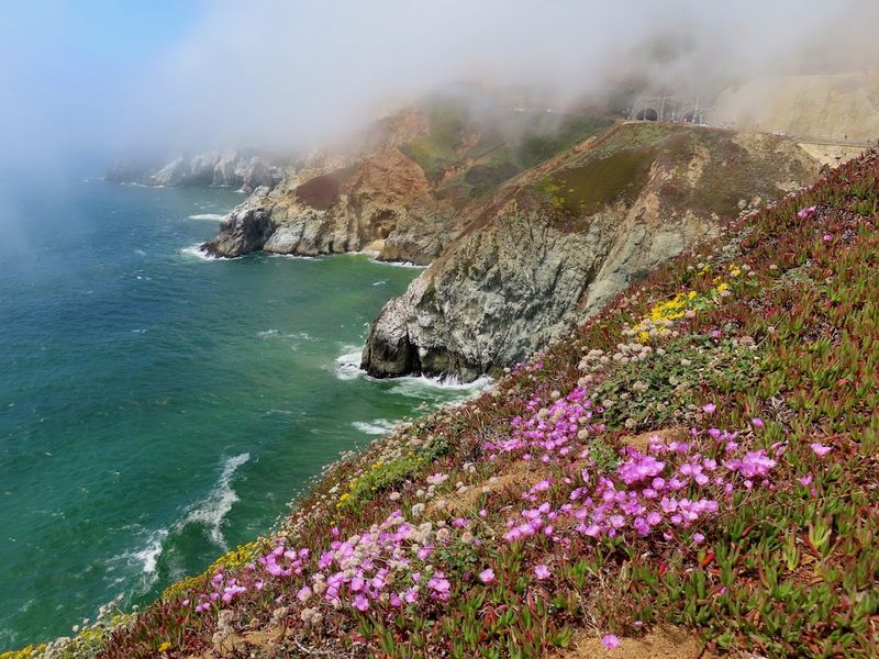
Built along a former section of Highway 1 that was prone to landslides, the Devil’s Slide Trail follows a paved 1.3-mile route perched on rocky heights above the Pacific between Pacifica and Montara.
The path sits right at the edge of steep coastal cliffs, with the ocean churning far below and the rugged San Mateo County coastline stretching in both directions.
The combination of the narrow coastal shelf and the dramatic drop to the water creates a view that feels much more exposed and wild than the paved surface might suggest.
Harbor seals are sometimes visible on the rocks below, and brown pelicans and cormorants regularly fly past at close range along the cliffside.
The trail is open to both pedestrians and cyclists, and the smooth surface makes it accessible to a wider range of visitors than many coastal trails in the area.
Fog is common along this stretch of coast, and a misty day can make the cliffs feel particularly atmospheric and dramatic.
Parking is available at both ends of the trail, with access from the north near the Pacifica side and from the south near Montara.
The trail is free to use and open year-round, though conditions can be windy and cool even in summer.
13. Bluff Trail, Montana de Oro State Park
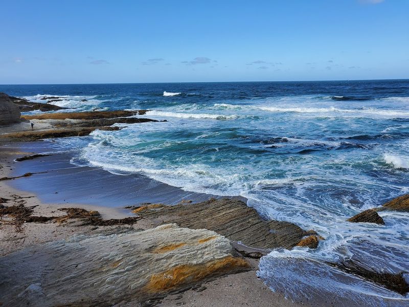
Montana de Oro State Park sits on a wild stretch of the Central Coast south of Morro Bay, and the Bluff Trail puts visitors directly above some of the most rugged shoreline in the region.
The trail hugs the edge of coastal bluffs for about 1.5 miles one way, passing above sea caves, blowholes, and rocky outcroppings where the surf hits with real force on days with any swell.
The views are wide and unobstructed, with the open Pacific to the west and the rolling hills of the park behind you.
The path is mostly gentle with only minor undulations, making it manageable for most fitness levels, though the uneven ground near the bluff edge calls for some attention.
Spring visits bring wildflowers to the hillsides and tend to offer clearer skies than the summer fog season.
The park name itself translates to mountain of gold, a reference to the golden poppies and other wildflowers that cover the hills in spring.
Montana de Oro is a day-use park with a small fee, and the main parking area near the bluff trailhead can fill on weekends.
The lack of development along this stretch of coast gives the Bluff Trail a genuinely remote feel despite being accessible by a paved park road.
14. Klamath River Overlook, Redwood National and State Parks
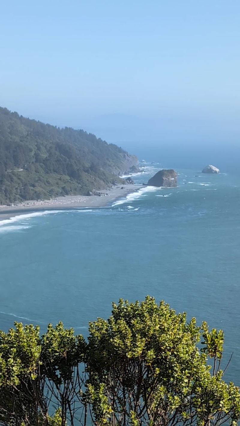
The Klamath River Overlook offers one of the most geographically interesting views in Northern California, sitting at the point where the Klamath River flows out of the Coast Range and meets the Pacific Ocean.
A short steep trail descends from the main overlook area to an even more exposed vantage point, covering roughly a quarter mile with a noticeable elevation drop.
From the lower viewpoint the scale of the river mouth and the width of the Pacific become much more apparent than from the parking area above.
Gray whales are sometimes spotted offshore during their migration seasons in spring and fall, and the broad open ocean view makes this one of the better land-based whale-watching spots in the region.
The surrounding landscape is dominated by tall coastal grasses and wind-sculpted shrubs, with the dark forested ridges of the redwood country visible inland.
The contrast between the wide river, the crashing surf, and the dense green hills creates a scene that feels genuinely remote and impressive.
The overlook is located along Requa Road off Highway 101, north of the town of Klamath in Del Norte County.
Parking is available in a small lot at the top of the overlook, and the area is free to access as part of Redwood National and State Parks.