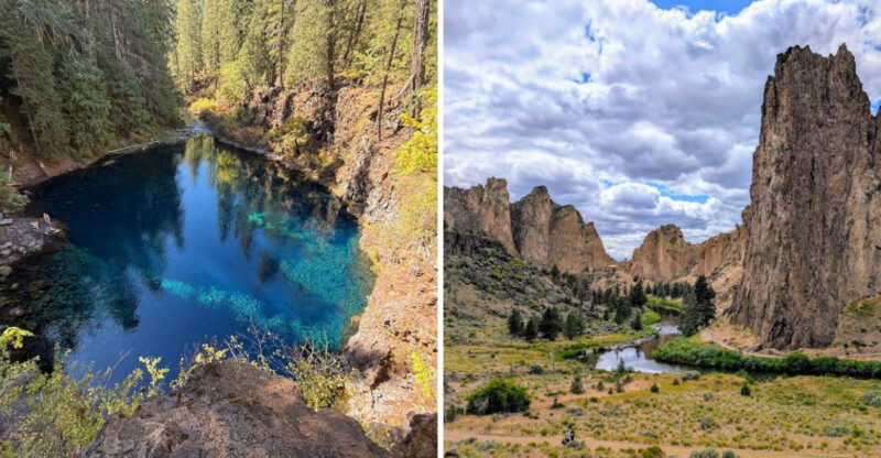
10 Stunning Places In Oregon Where Nature Steals The Show
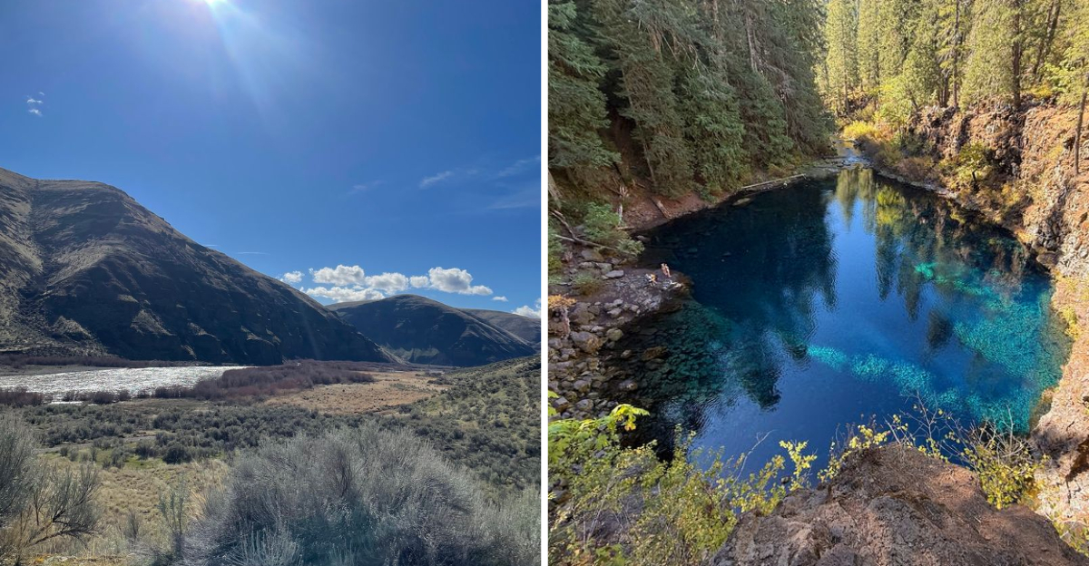
I once tried making a short list of Oregon scenery worth driving for. The list immediately became ridiculous.
How do you choose between waterfalls, volcanoes, dunes, canyons, deep-blue water, and the Pacific coast?
Oregon can change the entire mood of a road trip before you have even finished the day. That variety is what makes exploring here so addictive.
One stop can involve a forest hike, while the next feels like somebody quietly swapped the landscape while you were driving.
I narrowed this list to places that genuinely make the journey feel worthwhile.
Do not rush through them. Pick a few, stay longer, and save the rest as an excuse to return.
1. Crater Lake National Park
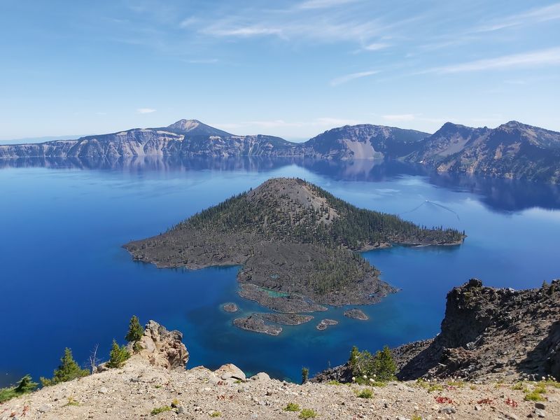
Sounds too good to be true, but yes, water really can be that shade of blue.
No rivers or streams flow into or out of Crater Lake. Rain and snow supply its water, while evaporation and underground seepage keep the level remarkably stable.
Crater Lake National Park in the southern part of the state holds the deepest lake in the country.
The caldera formed roughly 7,700 years ago when a volcano collapsed in on itself. Wizard Island and Phantom Ship rise from the surface like leftovers of that ancient blast.
Rim Drive circles the whole basin and stops at overlook after overlook. Pull over often, because the color shifts as the sun moves across the sky. Short paths suit families, while steeper trails drop toward the shoreline itself.
Summer opens up boat tours that carry you close to Wizard Island. Guides share stories about the eruption and the wildlife living here. Bring layers, since mornings at this elevation stay chilly even in July.
Winter turns the rim into a hushed white world. Cross-country skiers and snowshoers get the views nearly to themselves. Snow piles deep here, among the heaviest anywhere in the Cascades.
Photographers should aim for early light, when the caldera walls glow warm. Wildflowers appear along roadside meadows once the snow finally retreats.
Pack water, snacks and patience for the drive, then let that impossible blue do the rest.
2. Columbia River Gorge
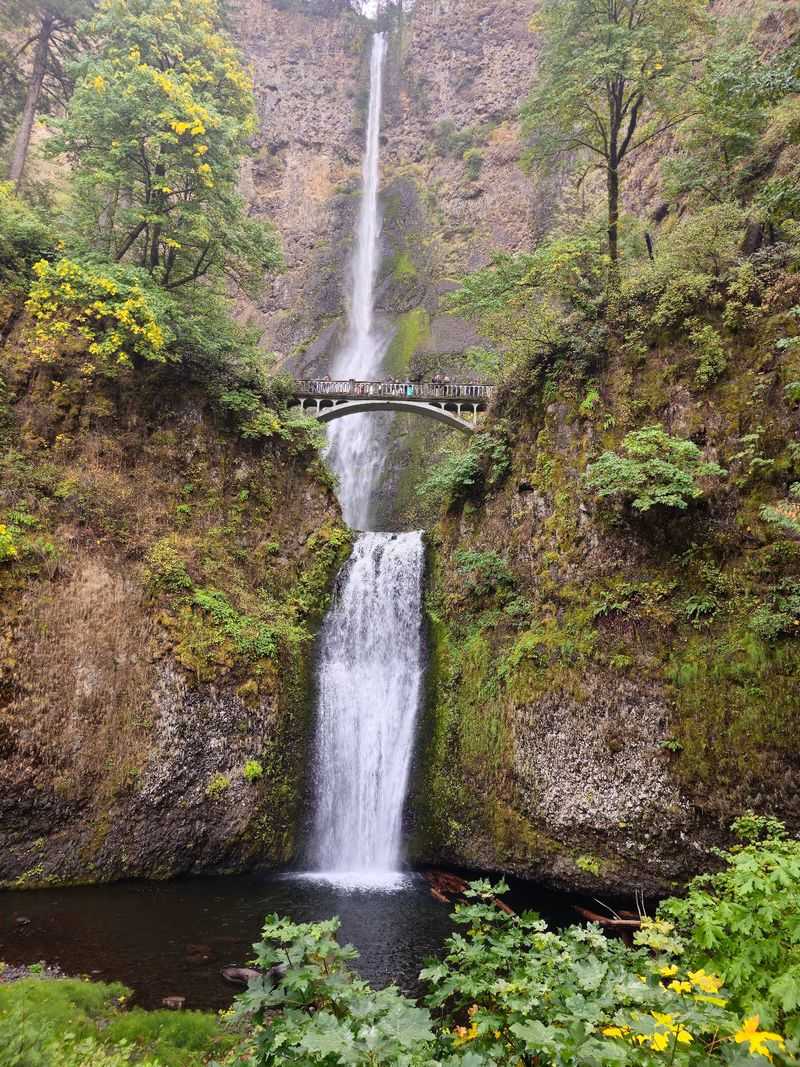
Few road-trip regions pack this many waterfalls into such a short distance. Roughly 80 miles of basalt cliffs line the river here, dripping with moss and ferns.
The Columbia River Gorge in northern Oregon delivers scenery at highway speed. Multnomah Falls drops 620 feet in two tiers, and a stone footbridge crosses right between them. Arrive early, since parking fills fast on warm weekends.
Trails climb to viewpoints above the treetops for wide river panoramas. Others tuck behind curtains of water where the air turns cool and misty. Wear shoes with grip, because wet rock gets slick.
Wind funnels through the corridor almost daily, which windsurfers and kiteboarders absolutely love.
Cyclists take the Historic Columbia River Highway, a road built with stone railings and graceful curves. Sections of it are now closed to cars, making pedaling peaceful.
Spring runs strongest for waterfall flow, fed by melting mountain snow. Autumn brings golden bigleaf maples against dark basalt. Winter sometimes coats the whole gorge in ice, a rare and startling sight.
Check trail conditions before heading out, as some paths still recover from past wildfires. Bring a rain shell no matter the forecast. Few drives anywhere pack this much drama into a single afternoon of wandering.
3. Samuel H. Boardman State Scenic Corridor
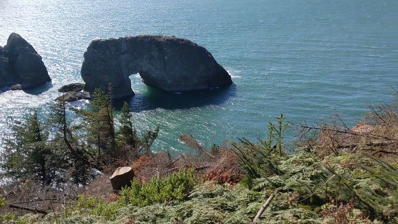
Correct me if I’m wrong, but this might be the most photogenic coastline in the West. Sea stacks jut from the surf, arches frame the horizon, and tiny coves hide below the road.
Samuel H. Boardman State Scenic Corridor runs along Oregon’s southern coast for about twelve miles. Pullouts appear every few minutes, each one opening onto something new.
Secret Beach lives up to its name, reached by a short and slightly steep path.
Natural Bridges is the showstopper, where collapsed sea caves left stone arches spanning turquoise water. A viewing platform sits just steps from the parking area. Photographers love the low light of early morning and late evening.
Sitka spruce lean inland, permanently bent by ocean wind. Fog rolls in and out, changing the mood hour by hour. Bring a windproof jacket, since breezes here rarely take a break.
Beachcombers find agates and driftwood along the smaller coves. Experienced paddlers launch kayaks on calm days to see the stacks from sea level. Whales pass offshore during their spring and winter migrations.
Trail segments of the Oregon Coast Trail connect many viewpoints for longer walks. Watch your footing near cliff edges, which crumble easily. Come with a full memory card and zero schedule.
4. Haystack Rock, Cannon Beach
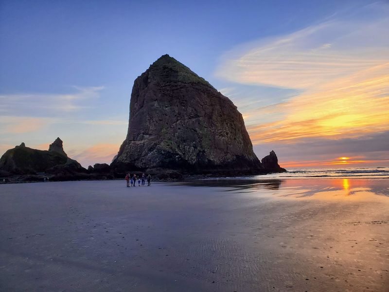
Movie fans will recognize this silhouette instantly, thanks to a certain 1980s treasure-hunting adventure. Rising 235 feet straight out of the sand, the monolith anchors one of the coast’s most famous shorelines.
Haystack Rock sits at Cannon Beach on Oregon’s northern coast. Basalt from ancient lava flows built it, and centuries of waves shaped the rest. It carries protection as one of Oregon’s seven Marine Gardens.
Low tide is the magic window. Water pulls back to reveal pools packed with orange and purple sea stars, green anemones and scurrying hermit crabs. Aim to arrive an hour or more before the lowest point.
Tufted puffins nest on the rock through spring and into summer. Bring binoculars and look for their bright orange bills against the grassy slopes. Gulls and cormorants share the ledges year-round.
The Haystack Rock Awareness Program stations interpretive guides on the sand during daytime low tides, mid-February through late October.
They explain what lives where and how to avoid harming it. Never climb the rock, and step only on bare sand between pools.
Sunsets here turn the whole beach copper. Kite flyers, dog walkers and sandcastle builders share the wide flats. Few coastal walks feel this rewarding with so little effort required.
5. Cape Kiwanda, Pacific City
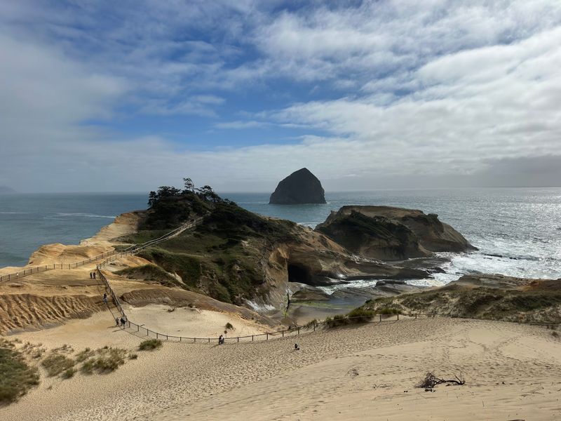
Climbing a giant sand dune before breakfast sounds strange until you try it. Legs burn on the way up, then the Pacific spreads out in every direction.
Cape Kiwanda in Pacific City breaks the mold along this shoreline. Most northern headlands here are hard basalt, but Kiwanda is sandstone. Wind, rain and surf have carved it into smooth, swirling shapes stained gold and rust.
Chief Kiawanda Rock sits offshore, a hulking mass that catches every incoming swell. Waves smash against the cape’s base and send spray high into the air. Photographers chase that moment endlessly.
From the top, views stretch south toward Nestucca Bay and north to Cape Lookout. Surfers ride the break below, and dory boats launch straight off the sand, a tradition unique to this stretch.
Stay behind safety fencing, because the soft rock breaks away without warning.
Two sinkholes appeared in January 2023 above sea caves at the lower northwest corner of the dune. Sneaker waves also catch people off guard on the lower beach.
Sunrise paints the sandstone in warm tones, while sunset lights the water. Kids love rolling down the dune, though sand ends up everywhere. Shake out your shoes, then wander the beach until the tide nudges you back.
6. Tamolitch Blue Pool, McKenzie River Trail
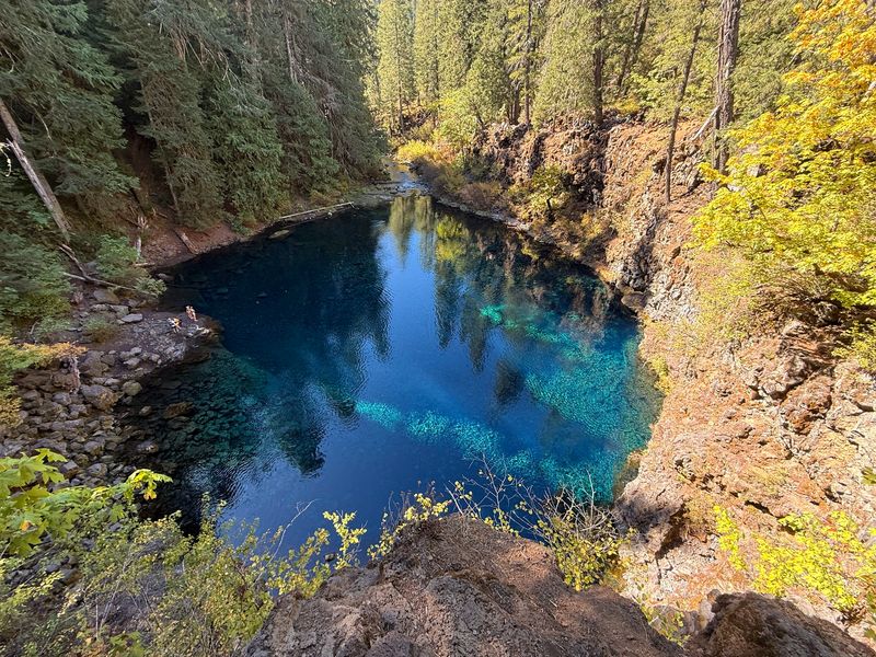
Call me crazy, but water this color usually shows up in tropical brochures. Instead it sits deep in an Oregon forest, ringed by black lava rock and towering evergreens.
Tamolitch Blue Pool waits along the McKenzie River Trail in the central Cascades. An underground spring feeds it after the river vanishes beneath a lava flow upstream. The water resurfaces here, filtered and startlingly clear.
That glowing turquoise comes from clarity and depth rather than minerals. Sunlight sinks in, scatters, and bounces back as blue. On cloudy days the color mutes, so plan for sun if you can.
The hike runs roughly two miles each way from the Trailbridge area, gaining modest elevation. Roots and loose rock make sturdy shoes a smart call. Old-growth Douglas fir shades most of the route.
Swimming is prohibited at Tamolitch Blue Pool, and the Forest Service has specifically moved to close the pool to swimming because of safety and resource concerns.
Cliff jumping has caused serious injuries here. Admire from the rim instead, and keep dogs leashed near the edge.
Autumn thins the crowds and adds vine maple color to the trail. Early mornings on weekdays are quietest. Pack out everything you carry in, then let that unreal blue stay with you the whole drive home.
7. Hells Canyon
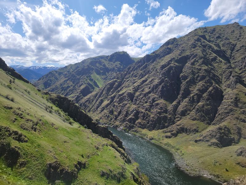
Deeper than the Grand Canyon, and hardly anybody talks about it. That statistic alone should push this one onto your list.
Hells Canyon carves through remote eastern Oregon along the Snake River. Ranked as America’s deepest river gorge, it plunges thousands of feet between rugged rims. Roads are few, cell service is spotty and solitude comes standard.
Jet boat tours and rafting trips remain the classic way to experience it. Guides run stretches of whitewater while pointing out ancient petroglyphs on canyon walls. Multi-day float trips reach sections no vehicle can touch.
Rim viewpoints reward drivers willing to tackle gravel roads. Hat Point and similar overlooks reveal the full scale of the drop. Binoculars help you trace the river as a thin silver ribbon far below.
Bighorn sheep scramble across the slopes, elk graze in draws and eagles ride the thermals. Rattlesnakes live here too, so watch where you step. Trails tend to be steep and exposed.
Spring and fall bring milder temperatures and green or golden hillsides. Summer heat in the canyon bottom gets intense. Carry far more water than you think you need, and enjoy having all that wild country nearly to yourself.
8. Leslie Gulch
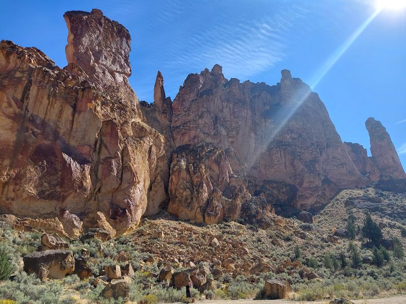
Red rock towers riddled with holes look almost hand-carved, yet nature did all the work. Sunlight shifts across them through the day, changing orange to gold to deep rust.
Leslie Gulch hides in southeastern Oregon’s high desert, far from any crowd. Cliffs of rhyolite tuff have eroded into honeycombed spires, terraced ledges and narrow side canyons. Volcanic ash laid the groundwork millions of years ago.
Side canyons invite short hikes with big payoffs. Juniper Gulch is the most popular, following a sandy wash between soaring walls. Timber Gulch and Dago Gulch offer quieter routes for those with time.
Bighorn sheep pick their way along impossible ledges. Mule deer browse in the shade, and chukar burst from the sagebrush without warning. California bighorn were reintroduced to this area decades ago.
Late spring and early summer bring wildflowers, including rare species found almost nowhere else. Fall delivers crisp air and long shadows. Summer afternoons can be brutally hot with no shade at all.
The access road is gravel and washboarded, so drive slowly. Slocum Creek Campground sits near the end, close to Owyhee Reservoir. Bring all your water and supplies, then settle in for a night under staggering desert stars.
9. Mt. Hood
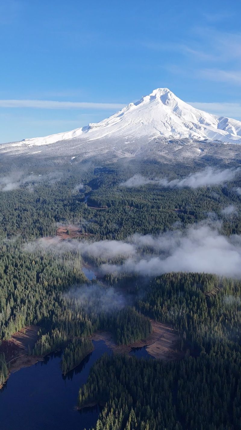
On clear days, drivers heading east out of Portland get a jolt of white against blue sky. The peak dominates the horizon and never really lets go of your attention.
Mt. Hood rises 11,240 feet as Oregon’s tallest summit and the fourth-highest in the Cascade Range. An active stratovolcano, it feeds streams and reservoirs across the region.
Glaciers still cling to its upper flanks.
Winter turns the slopes into a playground for skiers, snowboarders, snowshoers and snowmobilers. One area on the mountain keeps lifts running through summer. Snow lingers here longer than almost anywhere nearby.
Warm months open up Mt. Hood National Forest, which spreads across more than a million acres. Trails circle alpine lakes, cross wildflower meadows and pass tumbling creeks.
Trillium Lake serves up the classic reflection photo.
Spring adds roaring waterfalls and blooming beargrass. Autumn thins the crowds while huckleberries ripen along forest paths. Fewer cars means easier parking at popular trailheads.
Roughly 10,000 climbers attempt the summit each year, mostly between April and mid-June. That route demands ice axes, crampons and real experience.
Everyone else can simply grab a warm drink, find a viewpoint and watch clouds drift past that snowy crown.
10. Cottonwood Canyon State Park
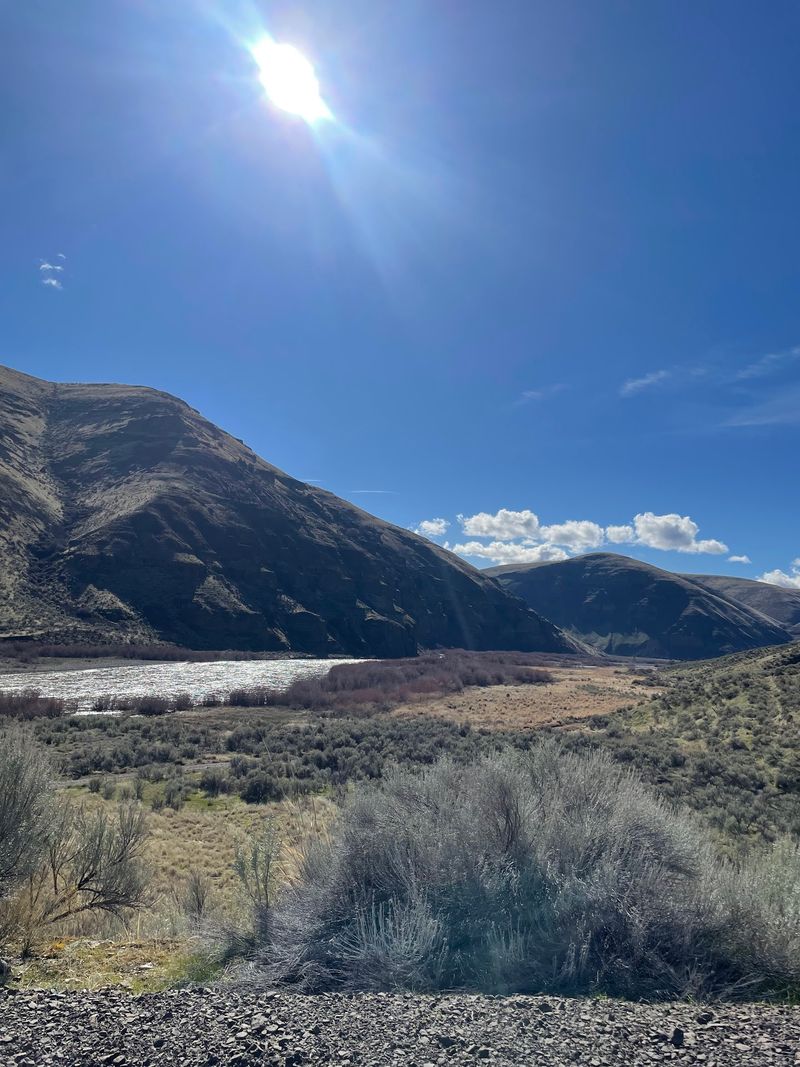
Silence out here has weight to it. No highway hum, no crowds, just wind moving through dry grass above a river.
Cottonwood Canyon State Park sits in north central Oregon and covers more than 8,000 acres.
Ranked second-largest among the state’s parks, it follows steep canyon walls carved by the John Day River. The John Day River includes 252 free-flowing miles through this remote landscape.
Two main trails hug the water. The Pinnacles Trail heads upstream beneath towering rock columns, while the Lost Corral Trail runs the opposite direction. Both stay fairly flat, making them friendly for casual walkers.
Anglers cast for smallmouth bass, catfish and steelhead depending on the season. Paddlers bring rafts, kayaks and canoes for mellow float trips. Water levels drop noticeably by late summer.
Rocky Mountain elk, mule deer, pronghorn and bighorn sheep all roam the surrounding slopes. Early morning gives the best odds of seeing them. Bring binoculars and move quietly.
Certified as an International Dark Sky Park in 2024, the canyon shines after sunset. The Milky Way appears with almost no effort. Find the park on Highway 206 between Condon and Wasco, then stay late enough for the stars.