Take A Journey Along A South Carolina Trail With 14 Wooden Bridges And Leafy Tree Tunnels
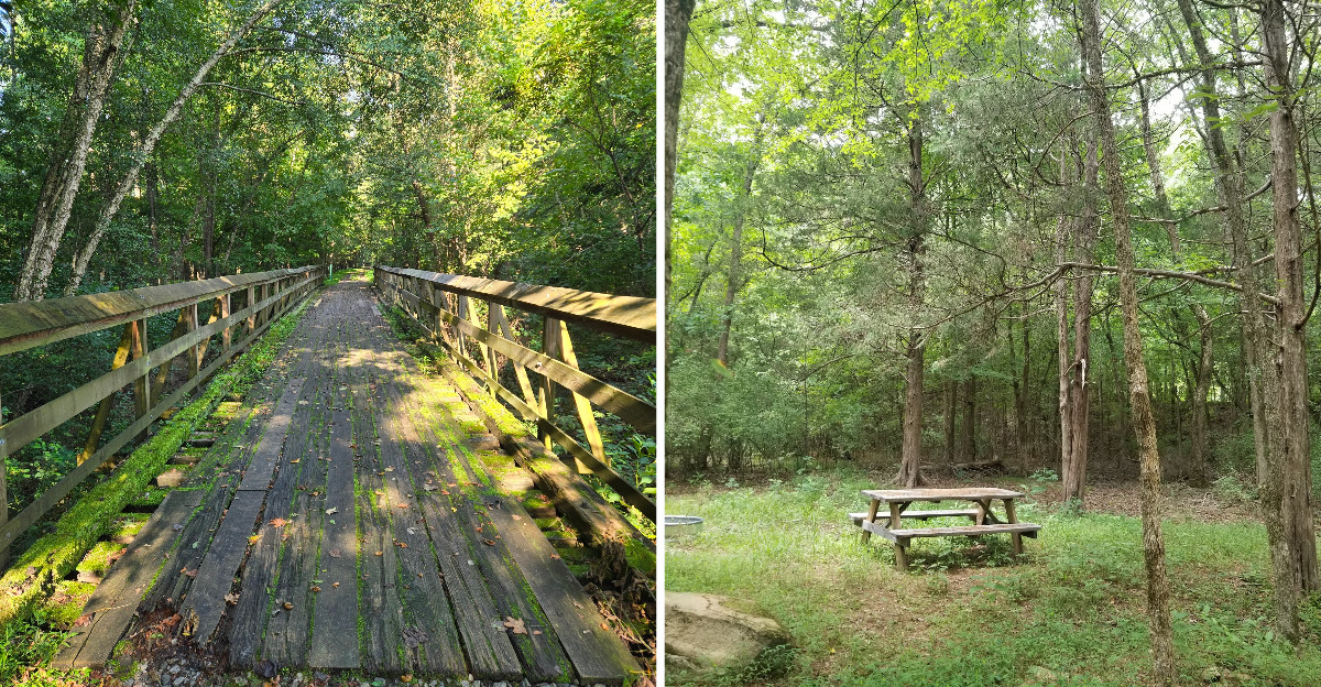
Fourteen wooden trestles cross one wandering creek on a single trail.
That is a lot of bridges for one stream, and it makes you wonder how a path ends up so tangled with water.
There’s a good reason to wonder about that.
The route follows an old railroad corridor, and trains needed steady, flat ground. So the builders kept bridging the creek instead of going around it.
And that leads to something else worth knowing. The biggest crossing stretches 1,100 feet over a river in South Carolina, with views wide enough to spot bald eagles.
Between the bridges, tree branches meet overhead to form leafy tunnels. Which part would you want to see first?
The Old Railroad Gave This Trail Its Easygoing Personality
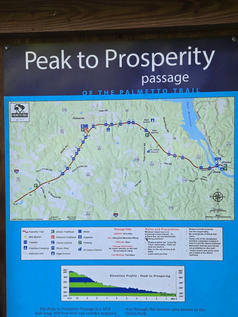
Trains hate hills, and hikers get to enjoy the payoff. The Peak to Prosperity Passage of the Palmetto Trail follows the former Norfolk Southern Railroad corridor through the South Carolina Midlands.
That history explains why the route stays remarkably flat. It stretches approximately 10.7 miles through Fairfield and Newberry counties, connecting the Alston area with woodland near Peak, Pomaria, and Prosperity.
The railroad once transported freight and passengers through this countryside. Today, the same corridor welcomes walkers, cyclists, birdwatchers, and families exploring the outdoors.
The surface is natural rather than paved. Expect a mixture of crushed stone, dirt, sand, and occasional grassy patches beneath your feet.
Some stretches contain loose rocks, making sturdy walking shoes a sensible choice. Mountain bikes generally handle the uneven sections better than road bicycles.
The former railroad alignment also explains the trail’s unusual collection of bridges. Rather than following every bend of the landscape, the route continues across streams on elevated trestles. Four main access points make shorter adventures possible.
The full passage measures more than ten miles, although maintenance closures currently affect sections at either end.
The 1,100-Foot Broad River Trestle Is The Star Attraction
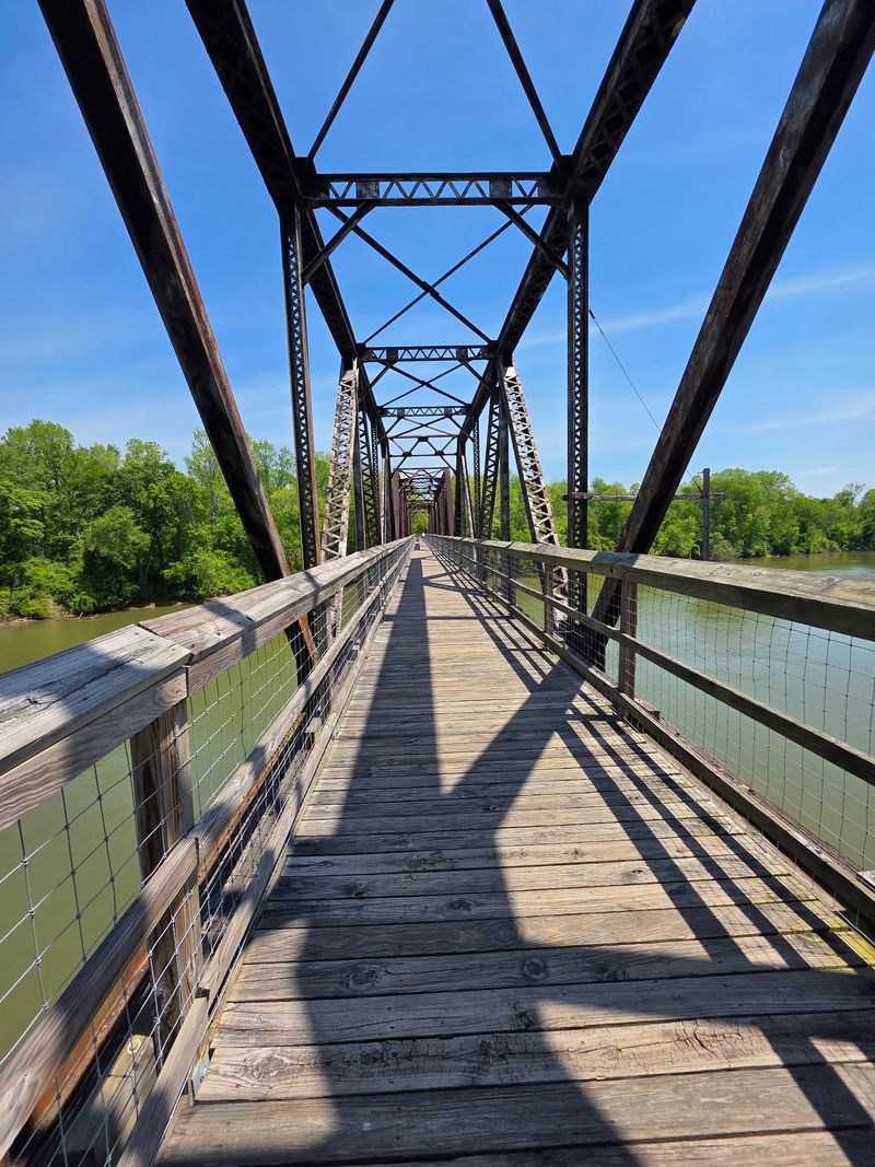
Some trails save the best for last. This one puts its crown jewel right near the beginning.
The Broad River Trestle stretches approximately 1,100 feet across the water, making it the most impressive crossing on the entire passage. Its elevated position offers wide views across the river and surrounding woodland.
Bald eagles are among the birds that may be spotted above the water. Turtles and other river wildlife also inhabit this scenic stretch. The bridge is reached from the Alston Trailhead, which provides parking and access to the river.
A section of trail beside the Broad River Trestle closed for extensive maintenance in October 2026. The restriction affects the usual connection between Alston and the trail farther west.
Visitors should follow posted barriers and confirm access before expecting to cross. The Alston area still offers opportunities to enjoy the riverside setting, including picnic spaces and a kayak launch.
When the full crossing is available, the enormous steel structure provides a memorable perspective on the surrounding countryside.
That Big Bridge Has A History Stretching Back To 1848
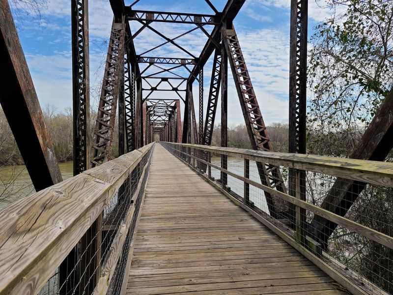
The Broad River crossing has quite a history. Its story stretches back more than 170 years.
The first railroad bridge at this location was constructed in 1848, with trains beginning to use the crossing in 1851.
Over the following decades, the structure underwent several major changes as the railroad developed. The steel trestle standing today dates to 1904.
That’s more than a century of history supporting a structure now associated with hiking, cycling, and outdoor recreation. When the railroad corridor became part of the Palmetto Trail, the trestle was adapted for pedestrian and bicycle access.
The transformation preserved an important piece of the area’s transportation history while giving the crossing a new purpose. The surrounding countryside has an equally interesting background.
German immigrants established communities in this region during the 1730s, contributing to the settlement of the area known as the Dutch Fork. The name comes from the German settlers who called themselves Deutsche.
Interpretive materials along the trail introduce aspects of the region’s history and natural surroundings.
Crims Creek Keeps Popping Up Along The Way
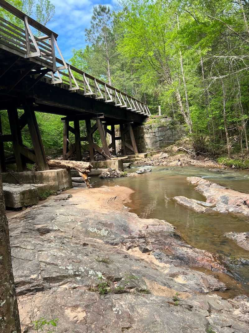
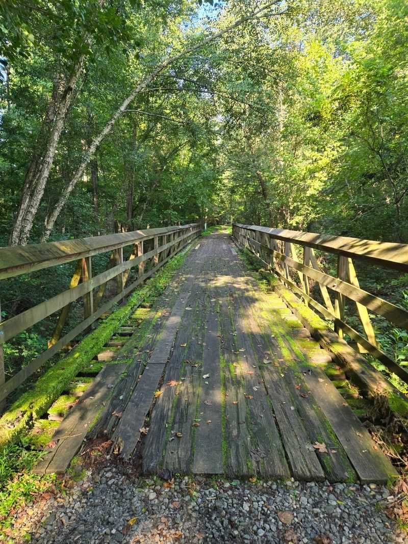
Count the crossings and you’ll run out of fingers fast. The passage includes fourteen wooden trestles spanning the twisting Crims Creek.
The creek meanders across the former rail corridor, appearing beneath the path again and again. Each crossing provides another view of the water, wooded banks, and surrounding vegetation.
Some bridges are relatively short, while others carry the trail across wider areas of low ground. Wooden stairs near certain trestles provide access to lower areas and designated stopping points.
One particularly useful landmark is Koon Trestle, near Koon Trestle Road. A primitive campsite and picnic area stand approximately 500 feet beyond this crossing, offering a convenient place to rest during a longer outing.
The trestles also provide opportunities to observe the small details of the creek environment. Look for turtles near the water, birds among the branches, and reflections beneath the wooden structures.
Careful footing is important because sections of the decking and surrounding paths can become uneven. Trail maintenance is ongoing, so posted restrictions should always guide your route.
Walk Under Leafy Ceilings That Change With Every Season
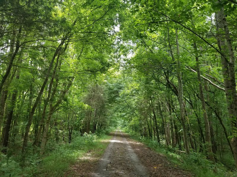
Nature built the roof here, and it did a lovely job. Long sections of the passage pass beneath trees whose branches create a leafy tunnel overhead.
Pines, oaks, maples, and other woodland species line the former railroad corridor.
Where branches extend toward one another, the trail seems to disappear into a green passageway.
The shade is particularly welcome during South Carolina’s warmer months, when exposed paths can feel considerably hotter. Each season creates a different atmosphere.
Spring brings fresh foliage and bright green leaves, while summer fills the corridor with dense vegetation.
Autumn introduces changing colors, especially where hardwood trees grow beside the route. Winter reveals more of the surrounding landscape as the leaves thin.
The relatively straight railroad alignment creates an interesting visual effect. Trees appear to frame the path far into the distance.
The wooded sections also provide opportunities for birdwatching, with species moving among the branches throughout the day.
The Alston Trailhead Is Basically Your Home Base
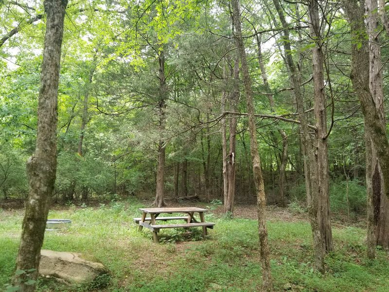
Parking, river access, and picnic facilities. The Alston Trailhead offers plenty of reasons to stop before beginning a walk.
It’s the largest trailhead on the Peak to Prosperity Passage, standing near State Road S-20-35 in the Little Mountain area. The site includes a picnic shelter, tables, and camping facilities.
An accessible campsite is among the designated overnight areas, and the riverfront provides opportunities for fishing, canoeing, and kayaking. The Broad River is the centerpiece of the setting.
A kayak launch makes it possible for paddlers to access the water without searching for another river entrance. The trailhead also became home to a new educational paddling experience in August 2026.
Alston is particularly useful for travelers interested in combining outdoor activities with a riverside picnic. There are designated camping spaces, although overnight visitors should bring their own drinking water and necessary supplies.
The maintenance restriction near the Broad River Trestle currently limits the usual westbound trail connection.
Kids Can Turn Their Hike Into A Prize-Winning Adventure
A brochure and a little curiosity can turn a walk into a mission. Young hikers have their own outdoor activity program associated with the Alston Trailhead.
In 2020, Alston became the first location on the Palmetto Trail to participate in the Kids in Parks TRACK Trail program.
The project encourages families to explore nature through self-guided activities.
Children can use educational brochures to identify birds, learn about animals, and discover the history of the former railroad.
Completed adventures can be recorded through the program, allowing participants to earn rewards. The original TRACK Trail experience includes a short out-and-back route featuring historic trestles.
Its accessibility currently depends on the maintenance restrictions near the Broad River crossing. Families interested in a different experience can explore the Broad River–Alston Access Paddle TRACK Trail.
This South Carolina addition officially opened in August 2026 as the nation’s first standalone Paddle TRACK Trail. The activity encourages families to explore the river by kayak, canoe, or paddleboard while learning about aquatic habitats.
A Country Store Waits Near The Middle Of The Route
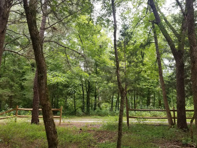
Forgot a drink? Good news, because a country store sits close to the middle of the passage.
Wilson’s Grocery operates at 5941 US Highway 176 in Pomaria, near the trail’s mile 6.5 access point.
The store offers snacks, refreshments, and everyday essentials, making it a practical stop before or after a walk. The nearby Pomaria Trailhead includes parking and a trail information kiosk.
From there, hikers and cyclists can travel in either direction along accessible portions of the former railroad corridor.
The entrance is reached from Angella Street, beside the grocery store. This central access point works particularly well for shorter outings.
Rather than completing the entire passage, visitors can choose a manageable distance and return to their starting point.
Hope Station provides another useful trailhead farther east. Its day-use parking area stands near 1317 Hope Station Road in Pomaria.
The different access points make the route flexible for families, casual walkers, and cyclists. Keep in mind that the Broad River Trestle is several miles east of Pomaria, near Alston.
Know These Tips Before You Lace Up And Head Out
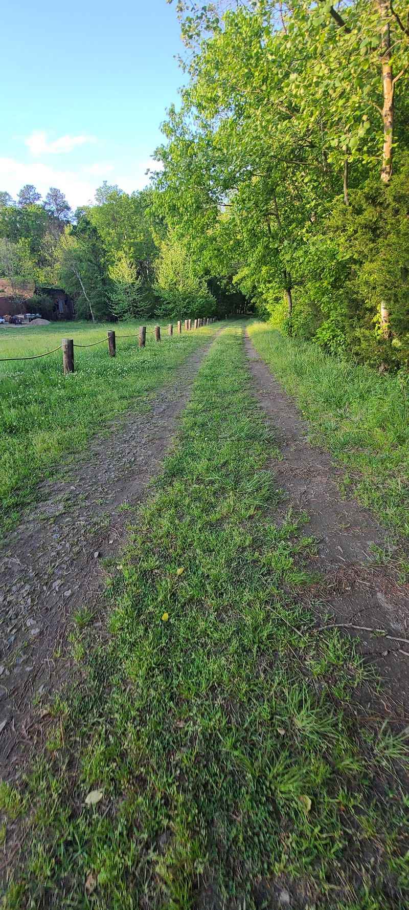
A little planning goes a long way on a trail this long. Choosing the right access point can make the difference between a short woodland walk and a much bigger outing.
The Peak to Prosperity Passage is rated easy, but its natural surface includes rocky patches, wooden decking, and occasional stairs. Sturdy footwear is useful, particularly after rain.
Cyclists will generally find the route more comfortable on mountain bikes than on narrow-tired road bicycles.
The trail also welcomes leashed dogs, and designated camping is permitted. Current access restrictions deserve special attention.
Maintenance began near the Broad River Trestle in October 2026, affecting the connection from the Alston end. A separate section west of the Kibler’s Bridge Trailhead remains closed until further notice.
That trailhead is near 3593 Kibler Bridge Road in Prosperity. Visitors should plan walks within accessible sections rather than assuming the full passage is continuously open.
The larger Palmetto Trail is an ambitious project stretching across South Carolina, with approximately 416 miles completed toward its planned 500-mile route.
Peak to Prosperity is one scenic part of that statewide network. For now, enjoy the bridges, tree tunnels, creek views, and woodland paths that are available. There’s plenty here to make a shorter adventure memorable.