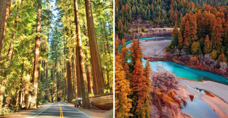
The Quiet California Mountain Town Most Visitors Completely Miss
The road narrows, the mountains crowd closer, and somewhere along the way the trip stops feeling like a normal weekend drive.
Then the town appears, small enough to pass through almost before you realize you have arrived.
This California mountain community sits beneath dramatic Sierra scenery without the noise or polish of a major resort destination. That is exactly what gives it character.
The streets stay quiet and the day can unfold without much pressure to chase attractions.
You might wander for a while, stop for something simple to eat, or let the landscape pull you toward a trail or a scenic road nearby.
Nothing here seems interested in competing for attention. That may be why so many visitors miss it.
This place does not demand a place on your itinerary. It quietly rewards the people who notice it anyway.
Walk Through Tiny Downtown Sierra City
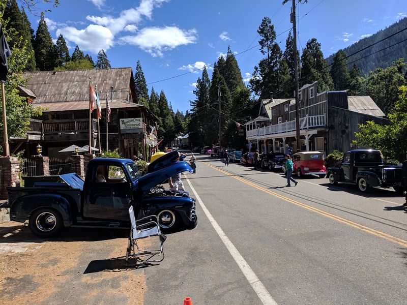
Few main streets in California can be walked end to end in the time it takes a coffee to cool.
The heart of this community stretches along Highway 49, lined with preserved storefronts and wooden buildings that date back to the town’s Gold Rush prosperity.
Fewer than 300 residents live here, so the pace stays slow and the sidewalks stay quiet. There is no resort district, no chain signage, and no crowd noise competing with the sound of wind through the pines.
The whole settlement sits inside Tahoe National Forest, a protected area covering more than 850,000 acres across the northern Sierra Nevada.
Granite walls climb steeply on both sides of the canyon, which means the light shifts noticeably through the day and shade arrives earlier than expected in the afternoon.
Walking is easy since the developed stretch is short and mostly flat, though the highway carries traffic and shoulders are narrow in places. Comfortable shoes and a bit of awareness go a long way.
Services are limited compared with larger towns, so filling the gas tank and picking up supplies before arriving is a practical move that saves backtracking later in the trip.
Climb Toward The Sierra Buttes Fire Lookout
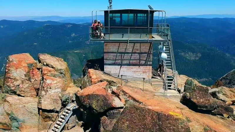
Nothing else in the area draws serious hikers quite like the rocky crown of the Sierra Buttes.
The fire lookout sitting on top is the showstopper, and reaching it can be done several different ways depending on how much effort feels reasonable.
Starting from the Pacific Crest Trail access near Highway 49 makes for a long day, with the full round trip measuring roughly 17 miles.
Most visitors instead drive to a higher trailhead, where a common route runs about 5 to 6 miles round trip with somewhere between 1,500 and 1,800 feet of climbing.
Even the shorter version is real work. The path gains elevation steadily, footing turns rocky and loose in sections, and shade disappears as the trees thin out near the ridge.
Carrying more water than expected is smart, since there are no reliable sources along the upper stretch. Sun protection matters too, because exposure increases the higher the trail goes.
Weather in the high country can change quickly, and snow may linger into early summer at these elevations. Checking current conditions before driving up the forest roads helps avoid a wasted trip.
Starting early rewards hikers with cooler air, calmer wind, and a much better chance of having stretches of trail entirely to themselves.
Climb The Lookout’s Famous Final Staircase
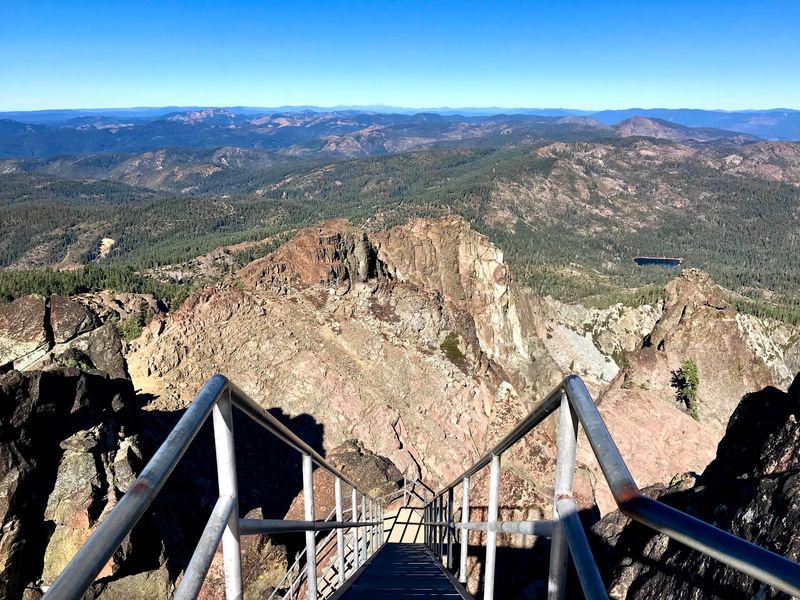
Here is the part of the hike people talk about for years afterward. The final approach to the lookout involves a steep stairway of roughly 178 to 180 steps bolted onto the summit rock.
Forest Service employees built the stairs in 1964 so visitors could reach the structure safely. Even with handrails, the experience is memorable because several sections are fully exposed above steep drops.
An open-grate catwalk wraps around the lookout itself, and portions of it hang high above a glacial cirque.
Seeing straight through the metal grating to the rocks far below is unsettling for many people, and anyone uneasy with heights should think carefully before committing.
Wind can pick up sharply at the top, so a jacket is worth carrying even on warm days. Gloves help too, since the metal railings heat up in direct sun and chill fast in shade.
Small children and dogs generally struggle with the open steps, and turning back partway is a perfectly reasonable decision. The views from the base of the staircase are already extraordinary.
Space at the top is limited, which means groups sometimes take turns during busy summer weekends. Patience and a short wait are usually all that stand between a hiker and the payoff.
Spend A Morning At Lower Sardine Lake
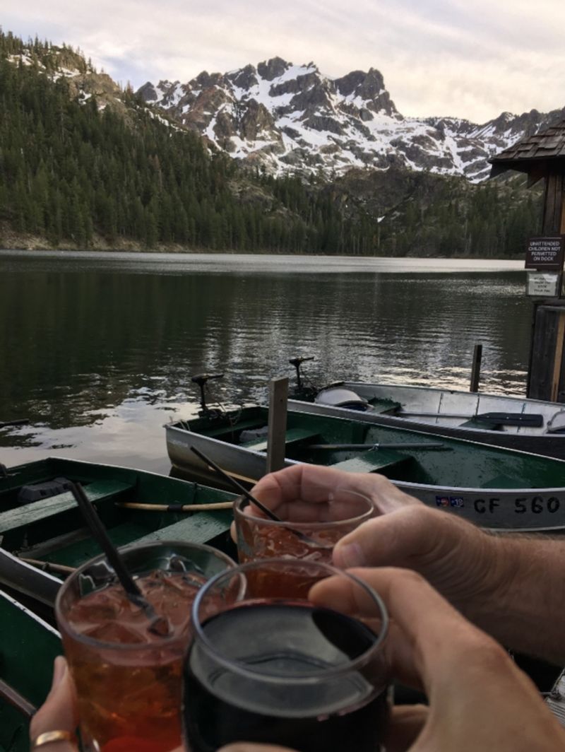
Postcards from this corner of the northern Sierra almost always show the same scene.
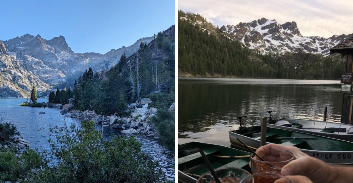
Deep blue-green water sits directly beneath the jagged Sierra Buttes, creating one of the most recognizable views in the region.
The lake rests within Tahoe National Forest and is reached by a short drive on forest roads north of town.
Mornings are usually the calmest, when the surface goes glassy and the peaks reflect clearly before afternoon wind arrives.
Fishing is a major draw, and Sierra County designates the lake as a premium fishing spot.
Kayaking, canoeing, and paddleboarding are also popular, and Sardine Lake Resort on the shoreline offers boat rentals during its operating season.
Swimming is not permitted here, since the lake is managed to protect the fishery. Anyone hoping to get in the water should plan on a nearby alternative instead.
Parking near the shoreline is limited and fills faster on summer weekends than most visitors expect. Arriving early or choosing a weekday makes the whole visit more relaxed.
Bringing a folding chair and a thermos turns a quick photo stop into a genuinely restful morning. The combination of still water, cool air, and that wall of rock overhead tends to slow everyone down.
Continue Up To Upper Sardine Lake
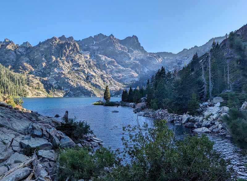
Most people stop at the lower lake and never realize there is a second one waiting above it. Continuing upward leads to a smaller, quieter basin tucked even closer beneath the mountain walls.
Reaching it means walking roughly half a mile to just over a mile on a dirt and gravel road that climbs gradually from the lower lake.
The route is generally rated easy to moderate, with modest elevation gain and a rocky surface in spots.
Sitting at an elevation near 1,823 meters, the upper lake feels noticeably more remote. Sound carries differently up here, and the stillness is often the first thing visitors notice after leaving the busier shoreline below.
Swimming is allowed in the upper lake, which makes it appealing on hot afternoons. Water temperatures stay cold well into summer at this elevation, so expect a bracing first few seconds.
Sturdy shoes handle the loose gravel better than sandals, and there is little shade along parts of the walk. A hat and water are worth packing even for a short outing.
Late afternoon light hits the rock faces beautifully, though the return walk should be timed so the drive down the forest road happens before dark.
Cool Off At Sand Pond
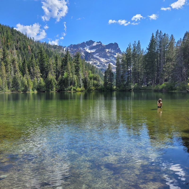
Not every mountain water stop requires boots and a topographic map. About 15 driving minutes north of town sits a small pond that has become a favorite for families looking to swim without a long approach.
Positioned roughly 1,600 feet above the town, it is the lowest and smallest in the chain of waters that includes the Sardine Lakes.
Shallow depth means the water warms far more than the alpine lakes nearby, which makes wading comfortable on summer afternoons.
An interpretive trail of about 0.8 to 1 mile loops around the pond and the marshy ground beside it. Signs along the way explain the transition zone between forest and marsh along with the wildlife that lives there.
The walk is flat and short enough for young children and older visitors, and views of the Sierra Buttes appear from several points. Birds are active in the marshy sections, especially in the early hours.
Mosquitoes can be noticeable near the wetland during early summer, so repellent is a sensible addition to the day bag. Bringing a towel and water shoes helps too, since the bottom is soft in places.
Find Love Falls
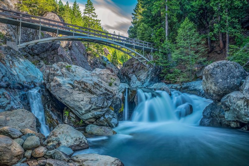
A heart-shaped boulder is responsible for the name of this waterfall. When flows run high, the rock splits the water at the upper cascade, and the shape gave the falls their nickname.
Three distinct drops make up the sequence on the North Yuba River, described as upper, middle, and lower sections.
Water has carved the granite into a narrow gorge here, and a large bridge spanning the river offers views of the cascades below.
Getting there does not require a long trek. The shortest route begins where the Pacific Crest Trail meets Highway 49, roughly 0.2 miles northeast of town, followed by about a quarter mile of walking southeast on the PCT.
Spring and early summer bring the strongest flows, fed by snowmelt from the surrounding high country. By late summer the volume drops considerably, changing the character of the falls entirely.
Rocks near moving water stay slick, and the gorge walls are steep in places. Staying well back from the edge and keeping children close is simple common sense here.
Because the waterfall sits so close to the road, it fits neatly into an afternoon that also includes a walk through the small downtown or a stop along the river.
Hike The Wild Plum Loop
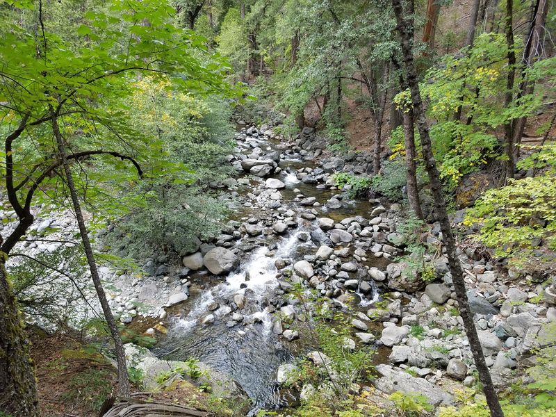
Anyone wanting mountain scenery without a punishing climb should look at this trail first.
Running about 2.5 miles as a loop, it starts and finishes near town and connects to the Wild Plum Campground roughly a mile east of the settlement.
The path follows Haypress Creek through riparian hardwood stands, which means shade, moving water, and cooler air for much of the way. Birding is good along the creek corridor, particularly in the morning hours.
Difficulty is generally described as moderate rather than easy, so there is some climbing involved.
Compared with the effort required for the Sierra Buttes, though, the loop feels manageable for most reasonably fit walkers.
Horseback riders share the trail, and connections lead onward to the Pacific Crest Trail and the Haypress Trail for those who want a longer outing.
Signs at junctions help, but carrying a downloaded map is still wise since cell service is unreliable throughout the canyon.
Creek crossings can run high after snowmelt, changing how straightforward the loop feels in spring. Later in the season the route settles down considerably.
Two hours is a realistic window for the full loop at a relaxed pace, leaving plenty of daylight for other stops.
Spend Time Along The North Yuba River
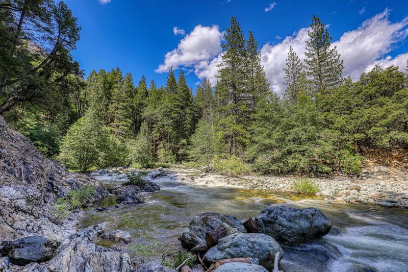
The sound of moving water follows visitors almost everywhere in this canyon.
The town rises above the North Fork of the Yuba River, and the current is audible from the streets and visible from bridges within the community.
Deep, clear pools form between granite boulders along the river, and some are suitable for swimming when conditions allow. Water stays cold through much of the year, which is refreshing in August and shocking in June.
Fishing draws steady interest along accessible stretches, and riverside exploring works well for anyone who prefers wandering to following a marked route.
Smooth rocks make good spots to sit and read while the water rushes past.
Currents strengthen considerably during spring runoff, and what looks calm from a bridge can be powerful up close. Checking conditions and choosing shallow, slow sections is the sensible approach.
Riverbanks are rocky and uneven, so footing deserves attention, particularly where wet stone stays slippery. Water shoes handle the terrain far better than flip-flops.
Because the canyon walls are steep, direct sunlight arrives late and leaves early along the water. Midday tends to be the warmest window for anyone planning to swim rather than simply watch the river go by.