These 9 Breathtaking Idaho Day Hikes Will Make You Forget Your Phone Exists
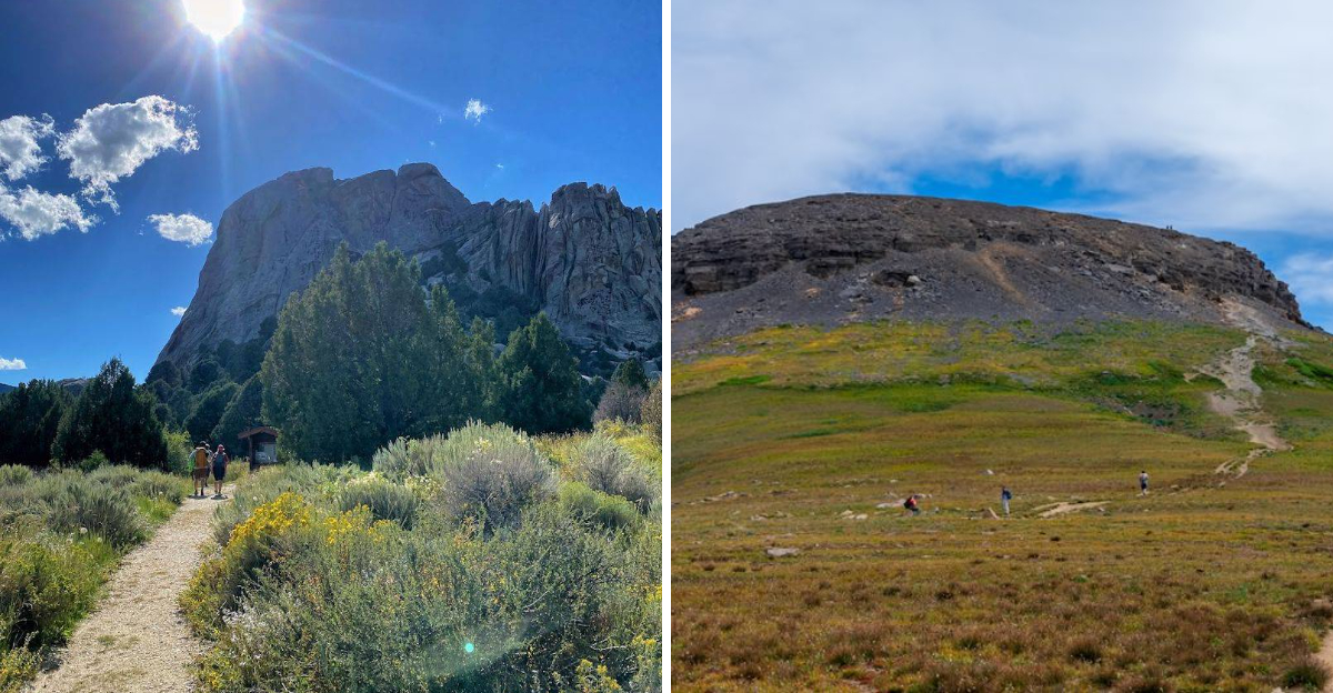
Phones get very clingy until a trail makes them feel completely unnecessary.
That is the funny thing about a truly good hike.
Somewhere along the path, the noise drops away, the air starts feeling sharper, and the whole day begins acting like it had a better plan all along.
Boots hit the dirt, the first climb wakes everyone up, and suddenly the reward starts feeling bigger than the effort.
Not every trail needs to be brutal to feel unforgettable.
A short route can still make the world feel wider when the scenery knows how to show up at exactly the right moment.
Curiosity does most of the pulling here.
One bend makes hikers wonder what waits beyond the next one, then another stretch quietly convinces them to keep going.
That is how a simple day hike turns into the kind of memory people bring up later with a little too much excitement.
Idaho has a talent for making outdoor plans feel larger than expected.
Pack the water, trust the trail, and let the state remind everyone why staying inside was never the better idea.
1. Sawtooth Lake Trail
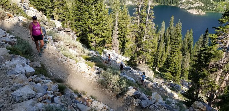
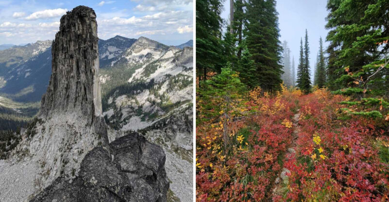
Jagged alpine scenery makes Sawtooth Lake Trail near Stanley one of Idaho’s classic big-reward day hikes, but this route deserves more respect than a casual morning stroll.
Most hikers start from the Iron Creek area southwest of Stanley. The Sawtooth National Forest notes that Iron Creek Trailhead provides access to Alpine Lake, Sawtooth Lake, Goat Lake, Trail Creek Lakes, and other Sawtooth Wilderness destinations.
The hike is commonly treated as a long out-and-back day, so arrive early and give yourself more time than the mileage may suggest.
Pine forest, creek crossings, open slopes, and rising granite views build slowly before the trail reaches the lake’s dramatic basin.
Sawtooth Wilderness users also need a free wilderness permit, which the Forest Service says can be self-issued at the trailhead or wilderness boundary for smaller groups.
Layers belong in the pack because mountain temperatures can swing quickly even in summer.
Once Sawtooth Lake appears below the peaks, the effort starts making sense. Cold blue water, rugged walls, and wide silence turn the final view into one of those Idaho moments that makes checking a phone feel almost rude.
2. Mineral Ridge National Recreation Trail
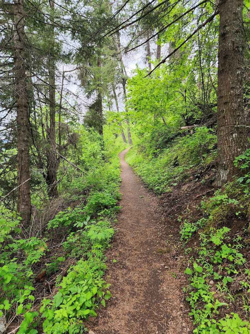
Lake views arrive without an all-day commitment on Mineral Ridge National Recreation Trail, about 11 miles east of Coeur d’Alene near Wolf Lodge Bay.
Bureau of Land Management information lists this route as a 3.3-mile trail with sweeping views of Lake Coeur d’Alene, a paved parking area, picnic space, and an interpretive guide tied to 22 marked stations.
That balance makes it one of the easiest hikes on this list to recommend for mixed groups. The climb still feels like exercise, but it does not turn into a full mountain mission.
Forest shade, seasonal wildflowers, lake glimpses, and open overlooks keep the loop moving with enough variety to prevent the “are we there yet” feeling.
Mineral Ridge also carries real recreation history, since BLM says it was the first recreation site the agency developed in Idaho in 1963 and became a National Recreation Trail in 1982.
Beauty Bay and Wolf Lodge Bay look especially good from the higher points, where the lake curves below in deep blue sections. Bring water, take the interpretive stops seriously, and give yourself enough time at the overlook.
Short hikes can still leave a long memory.
3. North Crater Trail
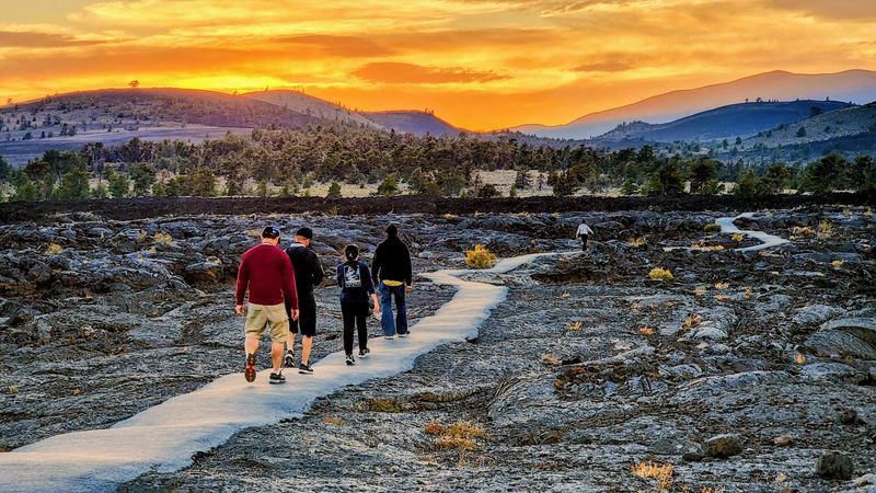
Otherworldly scenery takes over on North Crater Trail at Craters of the Moon National Monument, where black lava, cinder, sagebrush, and crater rims make Idaho feel briefly borrowed from another planet.
National Park Service information lists the trail as a 3.5-mile round trip with 758 feet of elevation gain. It crosses North Crater, drops into the crater, continues toward Big Craters, and finishes at the Spatter Cones.
Craters of the Moon sits near Arco, and the monument’s mailing address is 1266 Craters Loop Road, which gives visitors a practical point for planning. Sturdy footwear matters here because lava rock is sharp, uneven, and not forgiving when someone steps carelessly.
Shade is limited, so water and sun protection are not optional. NPS also warns that off-trail travel is prohibited in areas such as Big Craters, Spatter Cones, and North Crater Flow to protect fragile volcanic formations.
No waterfall, forest canopy, or alpine lake softens this hike. Raw geology does the work.
Every step feels shaped by fire, pressure, and time.
4. Hidden Lake Loop Trail
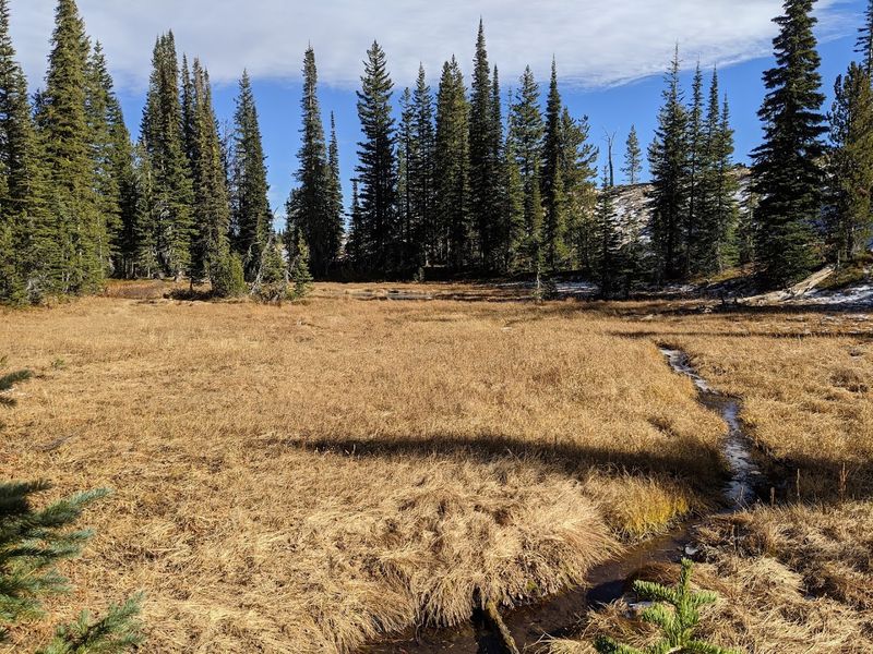
Quiet lake country gives Hidden Lake Loop Trail near McCall a more relaxed kind of payoff, especially for hikers who want scenery without committing to a punishing climb.
Payette National Forest lists Hidden Lake Loop Trail #511 as a 2.8-mile route south of the Hazard Lake area. The trail branches from Upper Hazard/Hard Creek Basin Trail #169, passes Hidden Lake, and reconnects with the main trail near Hard Creek Lake.
That layout keeps the route from feeling repetitive, since hikers get forest, meadow, water, and connecting trail sections in a compact outing. The area is not a polished city-park walk, so road conditions, seasonal snow, and trail access deserve a check before leaving McCall.
Creek outlets, open meadows, and quiet forest pockets give the hike its personality. Because some nearby routes allow other trail users, hikers should stay aware around corners and narrow spots.
Sun protection helps on exposed stretches, while bug spray can make lake and meadow areas more pleasant in warm months. Hidden Lake works best for families with older kids, casual hikers, or anyone wanting a half-day route that still feels secluded away from normal noise.
5. Table Mountain Trail
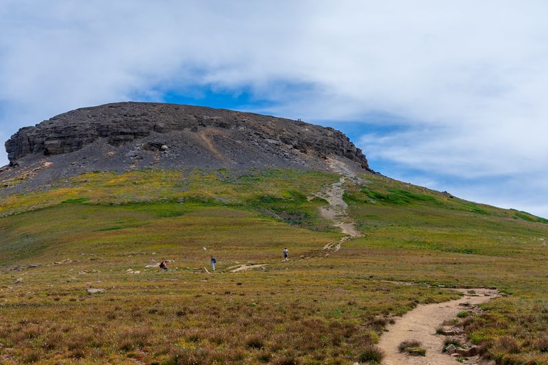
Serious elevation turns Table Mountain Trail near Driggs into one of Idaho’s most demanding day hikes, and the reward is one of the region’s most unforgettable Teton views.
Caribou-Targhee National Forest information for North Teton Trailhead says the trail reaches Table Mountain after 6.4 miles, with more than 4,000 feet of elevation change and noted views of the Tetons and Cascade Canyon.
Since that distance describes the climb to the summit, hikers should treat the full outing as a long, strenuous round trip from the Teton Canyon side.
The Forest Service also warns that north-facing slopes can hold snow until mid-July, so early-season plans may be trickier than they look.
Starting early is smart, especially when afternoon weather threatens high routes. Meadows, forested sections, steep climbs, and open ridges all lead toward the summit reveal, where the Tetons rise with jaw-dropping closeness across the skyline.
Plenty of hikers use this trail, but popularity does not make it easy. Pack food, water, layers, and humility.
Table Mountain does not hand out its view cheaply, which is exactly why the final panorama feels so earned.
6. Bruneau Dunes 6-Mile Hiking Trail
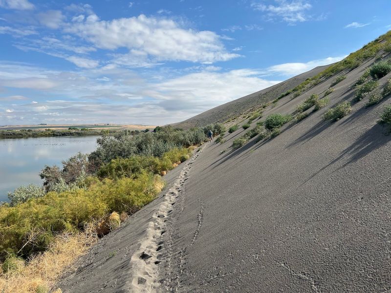
Sand changes every hiking rule at Bruneau Dunes State Park, where the 6-mile self-guided route can make strong legs feel suddenly confused.
Idaho Parks notes the park contains North America’s tallest single-structured sand dune, rising about 470 feet above the surrounding desert floor. The official trail brochure describes the route as a 6-mile moderately strenuous hike across the dunes.
The park sits near Mountain Home at 27608 Sand Dunes Road, giving travelers a clear destination before they start chasing dune lines.
Hiking through sand requires more effort than the mileage suggests, so the brochure’s advice is important to follow. It recommends bringing 1 to 2 quarts of water per person, sturdy shoes, snacks, bug spray, sunscreen, a compass, and a camera.
Morning or evening makes far more sense than midday during hot weather. Desert lakes, marsh edges, open sky, and dune ridges create more variety than many first-timers expect.
A little sliding may happen. Calves may complain.
Still, watching light shift across those massive sand slopes makes every slow, sinking step feel weirdly worth it.
7. City Of Rocks Hiking Trails
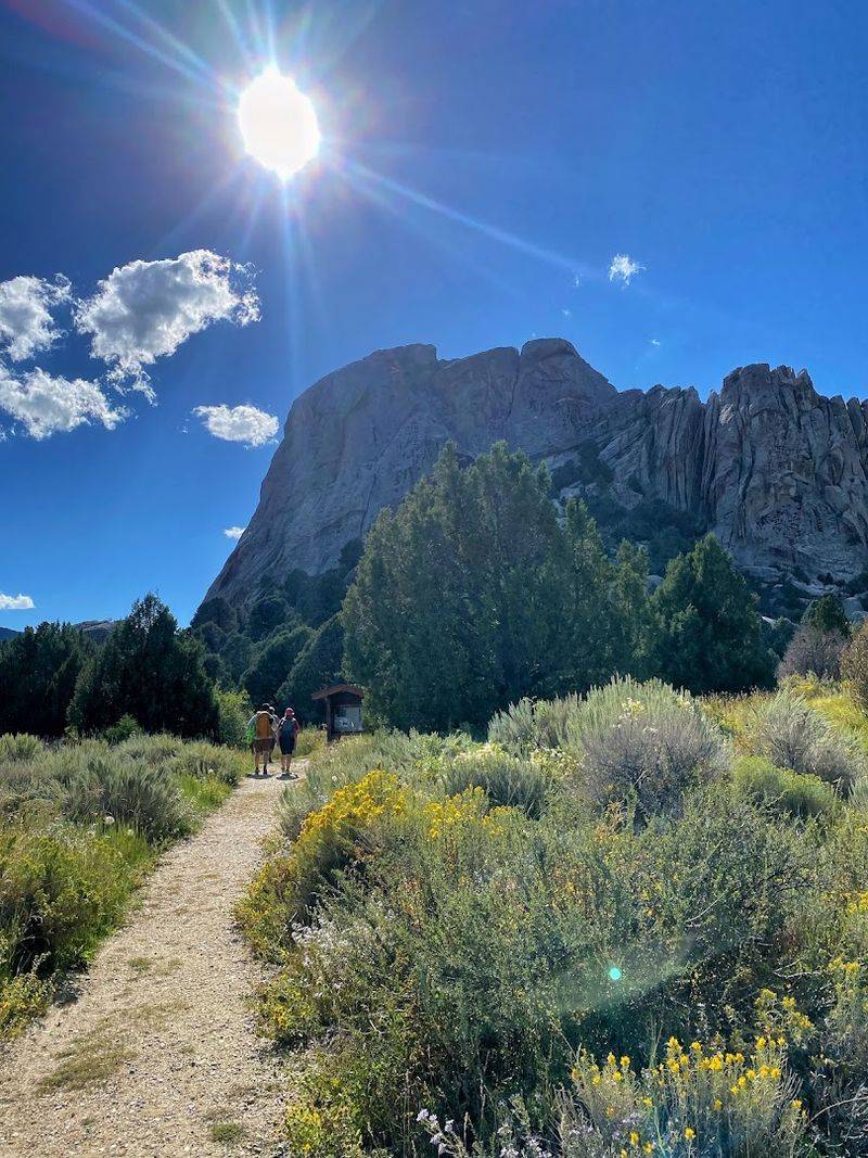
Granite spires turn City of Rocks National Reserve near Almo into a natural maze of stone, sky, and trail options.
National Park Service information describes the reserve as a dramatic landscape shaped by geology, Old West history, and outdoor recreation like camping, climbing, hiking, and exploration. Idaho Parks also notes that roughly 700 climbing routes have been developed there.
Hikers do not need ropes to enjoy the place. NPS hiking guidance points visitors toward scenic trails that wind through rugged landscapes, natural arches, rock windows, and overlooks for a range of ability levels.
A park archive notes more than 22 miles of hiking trails, with advice to carry water, monitor weather, stay on trails, and watch landmarks because elevation ranges from 5,720 to 8,867 feet. Almo’s quiet setting adds to the feeling that this is not a typical day hike stop.
Granite towers keep shifting shape as the light changes, and climbers on the walls add a little suspense to the views below. Choose a shorter route for a sampler or link trails for a longer day.
Either way, City of Rocks proves mileage is only one piece of a hike’s impact.
8. Shadow Falls Trail
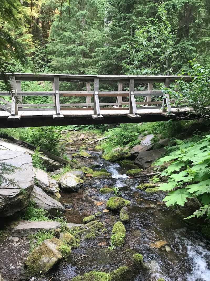
Cool forest air takes over quickly on Shadow Falls Trail #513 in the Idaho Panhandle National Forests, where water, ferns, moss, and shade give this hike a completely different Idaho mood.
Forest Service information describes a scenic 25-foot waterfall dropping over a moss-covered rock face, with a split log footbridge and rustic rails crossing the creek below the falls.
That same trail page notes that hikers can access the area under and behind the waterfall, which gives the short route a memorable payoff without needing a huge climb.
Fern Falls appears about 0.2 miles from the parking area, offering a smaller preview before Shadow Falls takes over.
Damp surfaces can be slick, so sturdy shoes still matter even when the distance sounds friendly. Forest roads in this region can also feel more remote than expected, so directions and road conditions are worth checking before leaving the Coeur d’Alene or Wallace area.
Photographers will want extra time near both falls because soft light, green growth, and moving water do most of the composing for them. Compared with desert dunes or alpine climbs, this trail feels intimate, shaded, and refreshingly cool.
9. Castle Rocks Trail
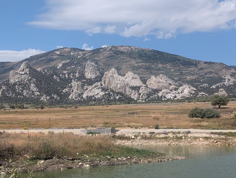
High-desert stone gives Castle Rocks State Park near Almo a quieter, more spacious personality than its famous neighbor, City of Rocks.
Idaho Parks notes that the visitor center operates seasonally from mid-April through late October in 2026 and warns that traveling to Castle Rocks via Oakley involves a dirt road, while the Almo route is paved.
That detail matters when planning a day hike, especially for visitors unfamiliar with rural southern Idaho roads. NPS hiking guidance groups Castle Rocks with City of Rocks as a scenic trail area full of rugged landscapes, arches, rock windows, and overlooks.
Granite formations, open sky, sagebrush, and pinyon pine give this park a sculptural feel without requiring huge mileage to enjoy it.
Morning light brings out the texture in the rocks, while evening makes the whole place feel softer and more remote.
Hikers should still bring water, sunscreen, and a hat because shade can be limited and high-desert weather can change quickly.
Pairing Castle Rocks with City of Rocks makes sense for a full Almo-area adventure, but this park can stand on its own.
Quiet trails, stone shapes, and big views do not need crowds to feel impressive.
Disclaimer: Before heading out, check the latest trail conditions, road access, parking information, permit requirements, weather alerts, fire restrictions, and seasonal closures with the park, forest, or land agency that manages each route.
Idaho’s terrain can change quickly, especially in mountain, desert, and backcountry areas, so bring more water than you think you need, pack layers, wear sturdy footwear, and stay on marked trails to protect both yourself and fragile landscapes.
Mileage, difficulty, and access can feel different depending on heat, snow, elevation, recent storms, or personal hiking experience, so choose a route that fits your group’s comfort level and turn around when conditions stop feeling safe.