This 62-Mile Connecticut Trail Is The Ultimate Test For Serious Hikers
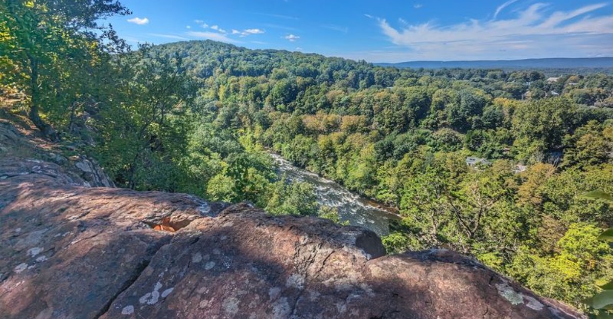
Sixty-two miles has a way of separating the casual walkers from the people who genuinely enjoy seeing what their legs are made of.
This trail is not a quick afternoon loop pretending to be an adventure.
It keeps going through ridgelines, forest, rocky stretches, and the kind of terrain that makes every completed section feel earned. Serious hikers know the appeal immediately.
The Connecticut route is officially listed at 62 miles, giving anyone tackling major sections plenty of distance to plan for.
There is plenty of scenery along the way, but nobody is handing it over without effort.
That is what makes finishing a major section so satisfying.
You are not just collecting views. You are testing pace, endurance, and patience mile after mile.
For people who like hiking to feel like an actual challenge instead of a pleasant stroll, this trail has more than enough distance to make the entire day memorable.
1. Long-Distance Hiking Gets Rugged On This Blue-Blazed Route
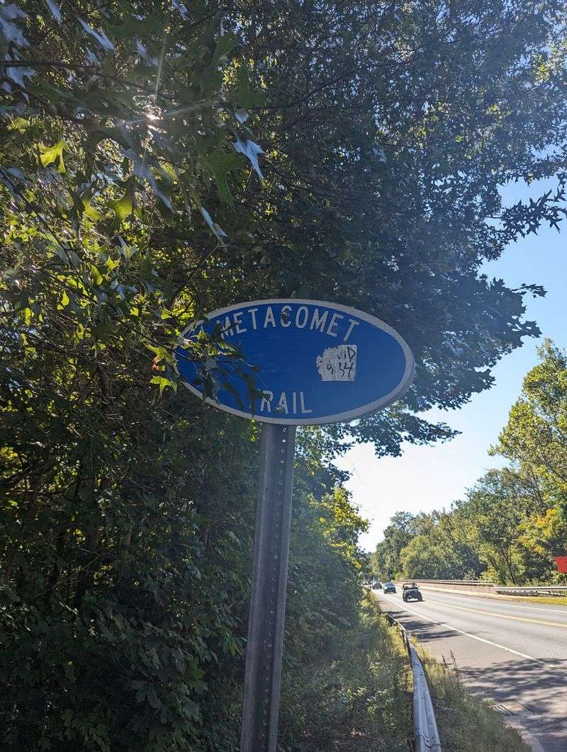
Blue marks matter here. Along the Metacomet Trail, those small painted rectangles keep the route easy to follow even when the ridge starts twisting through rock and woods.
The system is simple once you know what to watch for.
CFPA volunteers maintain this section as part of the state’s Blue-Blazed Hiking Trail network. A single light-blue blaze means continue ahead, while paired blazes signal that the route is about to change direction.
Keeping an eye out for the next mark makes the hike feel much smoother throughout the walk.
Near East Granby, the trail climbs quickly from the Route 20 area toward Peak Mountain. The opening stretch is steep and rocky, but the ridge soon settles into easier walking with broad views appearing farther along.
Much of the Metacomet Trail crosses a mix of protected land and private property where public passage is allowed, so staying on the marked route is important. The East Granby trailhead is near 74 Turkey Hills Road, East Granby, CT 06026, close to the Newgate Road intersection.
Those blue blazes do more than point the way. They also help hikers respect the land while moving confidently through one of the state’s most memorable ridge trails.
2. Traprock Ridges Carry The Trail Through Central Hills
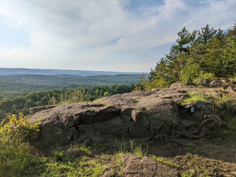
Roughly 200 million years ago, lava spread across what is now central Connecticut, cooled, and hardened into basalt. Erosion and shifting land later tilted those layers upward, leaving the long, uneven wall known as the Metacomet Ridge.
The Metacomet Trail rides that wall for most of its length.
Basalt is often called traprock around here, and it behaves differently from the granite and schist found elsewhere in New England.
Iron inside the rock weathers to a rusty reddish brown, which gives many of the ledges a warm color that stands out against green summer leaves or bare winter branches.
The ridge runs from near Long Island Sound north into Massachusetts, rising hundreds of feet above the surrounding river valleys. That vertical relief is why a 62-mile path in a small state can feel genuinely mountainous.
Walking here means hopping between blocky shelves, edging along cliff tops, and dropping into shaded hollows where the rock breaks apart into rubble.
Understanding the geology changes how the hike feels. Every ledge you scramble is a piece of an ancient lava flow, and the valley spread out below marks where softer rock wore away long ago.
3. Sixty-Two Miles Put Endurance To The Test
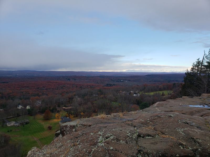
Sixty-two miles sounds manageable until you factor in the constant climbing and descending. Published lengths for the Metacomet Trail run right around 62 to 62.7 miles, and almost none of it is flat.
Some hikers tackle it as a multi-day trek, while many others break it into day trips over a season, using road crossings as natural start and finish points. Both approaches work, and the second one suits people who want to sample the best overlooks without carrying overnight gear.
Water is a real planning issue. Reliable sources are limited on a dry ridge, so carrying more than you think you need is the safer choice, especially in summer heat when the exposed rock radiates warmth.
Footwear makes an enormous difference too. Sturdy shoes with grippy soles handle the rock far better than soft sneakers, and trekking poles help on the steeper descents.
Pace expectations should shift as well. A mile of rolling ridge with rocky footing takes noticeably longer than a mile of smooth woods path, so build extra time into your plan.
Finish the whole thing and you have earned a legitimate long-distance accomplishment.
4. The Route Forms Part Of A National Scenic Trail
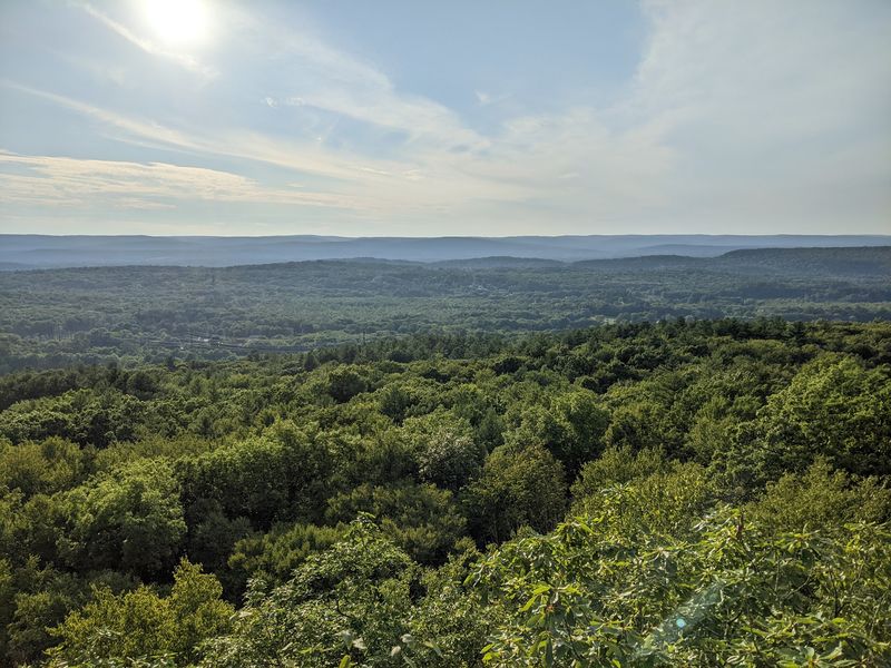
Congress gave this footpath national standing in 2009, when the New England National Scenic Trail was designated. The Metacomet Trail became one of its core segments, sharing the honor with a small number of national scenic trails across the country.
The larger NET stretches roughly 220 to 235 miles, running from Long Island Sound north toward the Massachusetts and New Hampshire border.
It links the Menunkatuck, Mattabesett, Metacomet, and Metacomet-Monadnock trails, a combination hikers sometimes shorten to the 3-M or MMM system.
Within that chain, the Metacomet portion covers ground from the Hanging Hills of Meriden north to the Massachusetts line in Suffield, which means the East Granby section sits in the upper stretch of the route.
National designation brought better signage, coordinated maintenance, and more attention from hikers outside the region.
It also puts the trail in interesting company. Walking a few miles here means walking part of the same protected system that includes far more famous routes, which adds a satisfying sense of scale to an afternoon outing.
For thru-hikers chasing the full NET, the Metacomet is the long middle chapter, and many describe it as the most demanding one.
5. Steep Climbs Lead To Dramatic Ridge Views
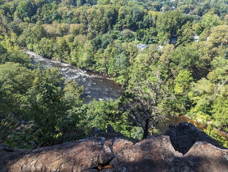
The reward system on this trail is simple: work hard, then look out. Openings in the trees appear along the cliff edges, and the drop-off does the rest.
West-facing overlooks are especially common, stretching from West Suffield Mountain in the north down through Ragged Mountain in the south. What you see is a mix of farm fields, quiet neighborhoods, small town centers, and river corridors folded between low hills.
Farther north, the outlook can reach west toward the Barndoor Hills and north toward Manituck Mountain, giving a good sense of how the ridge keeps rolling on past the state line.
Timing shapes the experience. Late fall through early spring opens up sightlines that leaves hide in summer, and one frequent piece of advice from local hikers is that cooler months bring the sharpest, farthest views.
The East Granby overlooks have a small local claim to fame as well, since the historic Old New-Gate prison site can be picked out from higher ground.
Bring a snack, find a flat piece of warm rock, and give yourself time to sit. Rushing past these viewpoints wastes the climb that earned them.
6. Castle Craig And Heublein Tower Mark The Journey
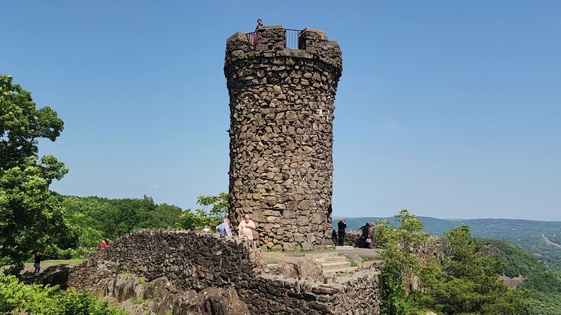
The towers change everything. After miles of woods and rocky ridge, two striking landmarks suddenly rise above the trees.
That surprise is part of what makes the Metacomet Trail so memorable.
Castle Craig stands on East Peak in Meriden’s Hubbard Park. Dedicated in 1900, the stone tower overlooks the city and surrounding ridges, with clear-day views stretching toward Sleeping Giant, New Haven, Long Island Sound, and the southern Berkshires.
Hikers reach it directly from the Metacomet Trail, though a seasonal park road also brings visitors to the summit.
Farther north, Heublein Tower crowns Talcott Mountain in Simsbury. Built in 1914, the 165-foot structure now serves as a historic house museum.
Its upper levels open to sweeping scenery, while the surrounding grounds feel surprisingly peaceful after the climb.
Access works differently at each landmark. Castle Craig’s summit road operates seasonally when conditions allow, while Heublein Tower can only be reached on foot by a 1.25-mile trail.
The museum also keeps seasonal hours.
That contrast adds to the fun. Reaching either tower after a ridge walk feels like discovering a landmark exactly when the trail needs a dramatic finish.
Both turn a rugged hike into something with a memorable sense of arrival.
7. Basalt Spires Add Strange Beauty Up North
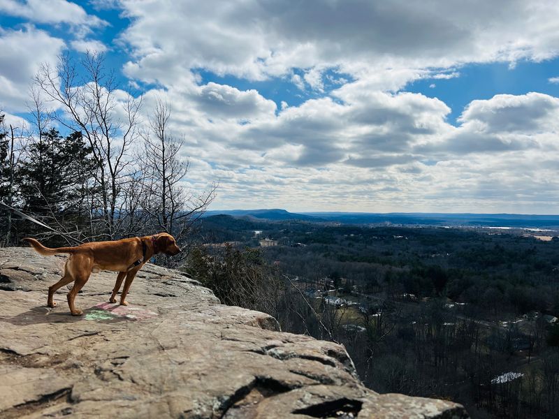
Head toward the northern end and the rock starts doing odd things. Along certain cliff edges, the basalt has eroded into narrow, chimney-like spires that stand apart from the main ledge like stone pillars left behind.
Columns form because cooling lava cracks in a roughly hexagonal pattern. Centuries of freezing, thawing, and rain have picked at those cracks until individual blocks separated, leaving shapes that feel almost sculpted.
Scattered nearby are glacial erratics, boulders carried and dropped by ice sheets thousands of years ago. Some rest in spots where they look impossibly out of place, perched on flat rock or wedged between trees.
Photographers tend to love this stretch because the textures are so unusual, especially in soft morning light when moss and lichen show their color.
Common sense applies around the formations. The edges can be crumbly, and standing too close to a spire top is not worth the picture.
Hikers who move slowly through this area usually notice more, from small ferns growing in rock seams to the hollow sound of loose stone underfoot.
It is the part of the trail that most clearly reveals its fiery origins, quietly and without any signs explaining it.
8. Serious Hikers Get Plenty To Conquer Here
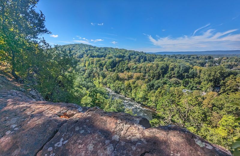
The trail gets serious fast. In East Granby, the Metacomet Trail climbs sharply from the road and reaches rocky ground almost immediately.
That steep opening gives hikers a quick sense of what some sections can demand.
Ragged Mountain turns up the challenge again. Here, the route crosses broken traprock and steep ridge terrain, with short climbs arriving often enough to keep the pace measured.
Careful footing matters most where loose stone gathers below the ledges.
Then the character changes completely. Near Reservoir Number 6 in West Hartford, the trail follows a wide, flat graveled path for an easy stretch beside the water.
It is one of the gentlest pieces of the entire 62-mile route and a welcome contrast to the rougher ridge sections.
Cooler days can make exposed climbs more comfortable, especially where shade thins out. Carrying enough water and keeping an offline map handy also makes longer sections easier to manage.
That variety is part of the appeal. One stretch can feel rugged and demanding, while the next settles into easy walking without making every mile feel like a challenge.
Finish a harder ridge section and the scale of the full Metacomet Trail starts to feel much more impressive.